Inventory Search Results
2,011 suspension bridges were found for search criteria: "(footbridge)" .
All 2,011 bridges from the search results appear below. Click the Bridgemeister ID number to isolate the bridge on its own page.
If you don't see what you were looking for, try an image search with the same criteria: "(footbridge)"
Related:
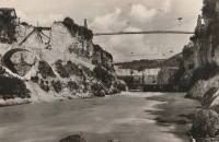
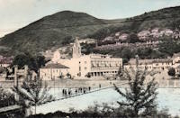
Bridgemeister ID: 375 (added before 2003)Year Completed: 1822 Name: (footbridge) Location: Annonay, Ardèche , France Crossing: Cance River Principals: Marc Seguin, Camille Seguin, Jules Seguin, Paul Seguin, Charles Seguin References: AAJ , BBR , GHD , LAB , TTSB Use: Footbridge Status: Removed Main Cables: Wire (iron) Suspended Spans: 1 Main Span: 1 x 18 meters (59.1 feet)
Bridgemeister ID: 3551 (added 2019-12-26)Year Completed: 1835 Name: (footbridge) Location: Alipore, Kolkata, West Bengal , India Crossing: Tolly's Nullah (Adi Ganga) Principals: Captain John Thomson References: ISB Use: Footbridge Status: Removed Main Cables: Chain (iron)
Described in ISB as located: "at the north side of the Great Jail of Alipoor, opposite the road leading from the General Hospital to the European Burying Ground." Bridgemeister ID: 5088 (added 2020-09-04)Year Completed: 1842 Name: (footbridge) Location: London, England , United Kingdom Crossing: Regent's Canal At or Near Feature: Regent's Park Principals: James Dredge References: AAJ Use: Footbridge Status: Removed Main Cables: Rod (iron) Suspended Spans: 1 Main Span: 1 x 22.9 meters (75 feet)
Bridgemeister ID: 5089 (added 2020-09-04)Year Completed: 1842 Name: (footbridge) Location: London, England , United Kingdom Crossing: Regent's Canal At or Near Feature: Regent's Park Principals: James Dredge References: AAJ Use: Footbridge Status: Removed Main Cables: Rod (iron) Suspended Spans: 1 Main Span: 1 x 22.9 meters (75 feet)
Bridgemeister ID: 5090 (added 2020-09-04)Year Completed: 1842 Name: (footbridge) Location: London, England , United Kingdom At or Near Feature: Regent's Park Principals: James Dredge References: AAJ Use: Footbridge Status: Removed Main Cables: Rod (iron) Main Span: 1 x 45.7 meters (150 feet)
Bridgemeister ID: 5091 (added 2020-09-04)Year Completed: 1842 Name: (footbridge) Location: London, England , United Kingdom At or Near Feature: Regent's Park Principals: James Dredge References: AAJ Use: Footbridge Status: Removed Main Cables: Rod (iron)
Bridgemeister ID: 5092 (added 2020-09-04)Year Completed: 1842 Name: (footbridge) Location: London, England , United Kingdom At or Near Feature: Regent's Park Principals: James Dredge References: AAJ Use: Footbridge Status: Removed Main Cables: Rod (iron)
This distinctly Dredge bridge is currently sitting atop modern concrete piers. Bridgemeister ID: 1487 (added 2004-09-11)Year Completed: 1850 Name: (footbridge) Location: Brahesborg Estate, Assens, Denmark Coordinates: 55.279684 N 9.950276 E Maps: Acme , GeoHack , Google , OpenStreetMap References: BC3 Use: Footbridge Status: Extant (last checked: 2019) Main Cables: Chain (iron) Suspended Spans: 1
Bridges on the Tyne . "Built to connect with Thorneyburn station on the Border Counties Railway."Bridgemeister ID: 920 (added 2003-10-18)Year Completed: 1869 Name: (footbridge) Location: Salado, Texas , USA Crossing: Salado Creek At or Near Feature: Salado College Use: Footbridge Status: Destroyed, 1913 Main Cables: Wire (iron)
Destroyed by flood, 1913. Bridgemeister ID: 594 (added 2003-01-11)Year Completed: 1870 Name: (footbridge) Location: Rockford, Illinois , USA Crossing: Kent Creek At or Near Feature: Tinker Swiss Cottage Museum Principals: Robert Tinker Use: Footbridge Status: Removed, 1976
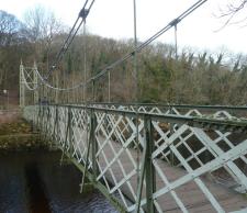
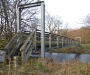
Bridgemeister ID: 417 (added before 2003)Year Completed: 1886 Name: (footbridge) Location: Huttons Ambo, North Yorkshire, England , United Kingdom Crossing: River Derwent Coordinates: 54.09975 N 0.8311 W Maps: Acme , GeoHack , Google , OpenStreetMap References: NTB Use: Footbridge Status: In use (last checked: 2014) Main Cables: Wire Suspended Spans: 1 Main Span: 1 x 29 meters (95 feet)
Bridgemeister ID: 1168 (added 2004-01-21)Year Completed: 1890 Name: (footbridge) Location: Hittisau, Austria Crossing: Bolgenach River Coordinates: 47.461957 N 9.970007 E Maps: Acme , GeoHack , Google , OpenStreetMap Use: Footbridge Status: In use (last checked: 2019) Main Cables: Wire Suspended Spans: 1
HARPER: Likely located at Pelham Street, just east of the present-day (2020) Lincoln train station. Bridgemeister ID: 264 (added before 2003)Year Completed: 1891 Name: (footbridge) Location: Lewiston, Maine , USA At or Near Feature: Island Garden Amusement Park Use: Footbridge Status: Dismantled, 1903 Main Cables: Wire Suspended Spans: 1
Nancy Fraser writes: "The pedestrian suspension bridge [was] located at Island Garden Amusement Park in Lewiston, Maine. It started at the water gate house that you can see and led to an island over the water falls where they had entertainment. It was in existence in Lewiston from 1891 to 1903. It was later sold to Amos Gerald of Fairfield, Maine to be used for the trolley line leading to Casco Castle and Amusement Park in South Freeport, Maine." Moved to (footbridge) - South Freeport, Maine, USA . Bridgemeister ID: 6467 (added 2021-08-13)Year Completed: 1892 Name: (footbridge) Location: Anderson, Indiana , USA Crossing: White River Use: Footbridge Status: Destroyed, March 27, 1921 Main Cables: Wire (steel) Suspended Spans: 3 Main Span: 1 Side Spans: 2
Bridgemeister ID: 5079 (added 2020-08-30)Year Completed: 1894 Name: (footbridge) Location: Grimsby, England , United Kingdom Crossing: River Freshney Coordinates: 53.570454 N 0.095989 W Maps: Acme , GeoHack , Google , OpenStreetMap Principals: Harper & Co. References: HARPER Use: Footbridge Status: Only towers remain (last checked: 2014) Main Cables: Wire Suspended Spans: 1 Main Span: 1 x 10.7 meters (35 feet)
Bridgemeister ID: 1207 (added 2004-02-07)Year Completed: 1897 Name: (footbridge) Location: Addingham, England , United Kingdom Crossing: River Wharfe Use: Footbridge Status: Destroyed, 1936 Main Cables: Wire
Bridgemeister ID: 312 (added before 2003)Year Completed: 1898 Name: (footbridge) Location: Pontiac, Illinois , USA Crossing: Vermilion River At or Near Feature: Chautauqua Park Coordinates: 40.87696 N 88.62358 W Maps: Acme , GeoHack , Google , OpenStreetMap Principals: Joliet Bridge and Iron Co. Use: Footbridge Status: In use (last checked: 2005) Main Cables: Wire Suspended Spans: 2 Main Span: 1 Side Span: 1
Bridgemeister ID: 1862 (added 2005-07-31)Year Completed: 1898 Name: (footbridge) Location: Pontiac, Illinois , USA Crossing: Vermilion River At or Near Feature: Chautauqua Park Coordinates: 40.87554 N 88.62279 W Maps: Acme , GeoHack , Google , OpenStreetMap Principals: Joliet Bridge and Iron Co. Use: Footbridge Status: In use (last checked: 2005) Main Cables: Wire Main Span: 1 Side Span: 1
Bridge over Mandakini near Bhiri a risk to lives - The Tribune India . Residents of Bhiri town in Rudprayag district are irked over the dilapidated condition of a footbridge over the Mandakini, which is on the verge of collapse. "The British constructed the bridge in1889 on the old Kedaranth trek route, near Bhiri, in Rudraprayag district."Bridgemeister ID: 2917 (added 2019-09-15)Year Completed: 1902 Name: (footbridge) Location: Littleton, New Hampshire , USA Crossing: Ammonoosuc River Status: Destroyed, 1938 Main Cables: Wire Suspended Spans: 1
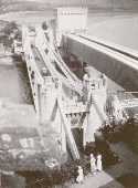
This entry refers to the steel suspension footbridge nestled between Telford's suspension bridge and Stephenson's rail bridge. Click the photo to get a better view of this bridge. According to Susan Ellis, Senior Archivist of the Conwy County Borough Council, the bridge was built on the recommendation of John J. Webster who was hired to inspect Telford's suspension bridge in 1902 "following fears about the safety of its condition. He reported back making various recommendation for strengthening the bridge, including that a separate footbridge be constructed." This footbridge was in existence until at least 1957. Next to 1826 Conwy (Conway) - Conwy, Wales, United Kingdom . "Conway Suspension Bridge." The Engineer , 20 May 1904.This detailed account of the 1904 reinforcement of Telford's adjacent bridge does not mention the existence of, or building of, an additional footbridge. It does describe adding a cantilevered walkway to one side of Telford's bridge. This walkway was, indeed, built, and can be seen in the linked image on the left side of the older bridge. Thus, it is not entirely clear whether this bridge was actually constructed in 1904 and the work of Alfred Thorne (who was very much associated with the Telford bridge reinforcement project)
Bridgemeister ID: 2446 (added 2008-04-23)Year Completed: 1905 Name: (footbridge) Location: Peradeniya, Sri Lanka Crossing: Mahaweli Ganga At or Near Feature: Royal Botanical Gardens Coordinates: 7.276585 N 80.593782 E Maps: Acme , GeoHack , Google , OpenStreetMap Use: Footbridge Status: In use (last checked: 2022) Main Cables: Wire (steel) Suspended Spans: 3 Main Span: 1 Side Spans: 2
Bridgemeister ID: 260 (added before 2003)Year Completed: 1913 Name: (footbridge) Location: Ithaca, New York , USA Crossing: Fall Creek Gorge At or Near Feature: Cornell University campus Use: Footbridge Status: Removed
Bridgemeister ID: 1424 (added 2004-07-18)Year Completed: 1915 Name: (footbridge) Location: Chiwaukum vicinity, Washington , USA Crossing: Wenatchee River Principals: National Forest Service References: AAJ , PTS2 Use: Footbridge Main Cables: Wire (steel) Suspended Spans: 1 Main Span: 1 x 57.9 meters (190 feet)
Bridgemeister ID: 700 (added 2003-03-08)Year Completed: 1918 Name: (footbridge) Location: Wakefield vicinity, New Zealand Crossing: Dove River References: GAP Use: Footbridge
Bridgemeister ID: 1564 (added 2004-11-27)Year Completed: 1920 Name: (footbridge) Location: Follebu, Innlandet, Norway Coordinates: 61.2153 N 10.269267 E Maps: Acme , GeoHack , Google , kart.1881.no , OpenStreetMap Use: Footbridge Status: In use (last checked: 2004) Main Cables: Wire
Bridgemeister ID: 4954 (added 2020-08-08)Year Completed: 1921 Name: (footbridge) Location: Oregon City and West Linn, Oregon , USA Crossing: Willamette River Use: Footbridge Status: Removed, 1922 Main Cables: Wire (steel)
Bridgemeister ID: 819 (added 2003-05-31)Year Completed: 1922 Name: (footbridge) Location: Bexley, Ohio , USA Crossing: Alum Creek At or Near Feature: Wolfe Park Coordinates: 39.963831 N 82.947491 W Maps: Acme , GeoHack , Google , OpenStreetMap References: AAJ , PTS2 Use: Footbridge Status: In use (last checked: 2016) Main Cables: Wire (steel) Suspended Spans: 1 Deck width: 6.25 feet
Closed 2013 for major refurbishment including a new deck. Reopened March. 2014. April 2015: Two main cables snap, causing a partial collapse of the bridge deck. Repaired and reopened August 5, 2016. Failure speculated to have been caused by the weight of the new deck installed 2013-2014. Bridgemeister ID: 1882 (added 2005-09-24)Year Completed: 1923 Name: (footbridge) Location: Kirschbaumwasen, Germany Crossing: Murg River Coordinates: 48.6233 N 8.354967 E Maps: Acme , GeoHack , Google , OpenStreetMap Use: Footbridge Status: In use (last checked: 2005) Suspended Spans: 1
Bridgemeister ID: 1804 (added 2005-05-18)Year Completed: 1924 Name: (footbridge) Location: Oklahoma , USA Crossing: Baron Fork Creek Use: Footbridge Main Cables: Wire (steel) Main Span: 1 x 48.8 meters (160 feet)
Bridgemeister ID: 5562 (added 2020-12-19)Year Completed: 1927 Name: (footbridge) Location: Forst, Germany Crossing: Lusatian Neisse River Coordinates: 51.748356 N 14.659815 E Maps: Acme , GeoHack , Google , OpenStreetMap References: AAJ Use: Footbridge Status: Removed Main Cables: Eyebar (steel) Suspended Spans: 3 Main Span: 1 x 39.6 meters (129.89 feet) Side Spans: 2 x 19.8 meters (64.94 feet)
Coordinates are for likely alignment of this former bridge, with at least one pier remaining (as of 2020). Bridgemeister ID: 2301 (added 2007-04-26)Year Completed: 1927 Name: (footbridge) Location: Töpeln and Wöllsdorf, Saxony, Germany Crossing: Zschopau River Use: Footbridge Status: Destroyed, 2002, by flood Main Cables: Wire (steel) Suspended Spans: 1
Replaced by a cable-stayed bridge April, 2004. Bridgemeister ID: 734 (added 2003-03-08)Year Completed: 1930 Name: (footbridge) Location: Grey Valley, Slaty Creek vicinity, New Zealand Crossing: Big River References: GAP Use: Footbridge
Bridgemeister ID: 5544 (added 2020-12-13)Year Completed: 1930 Name: (footbridge) Location: Hartola, Finland Crossing: Tainionvirta Coordinates: 61.568078 N 26.019536 E Maps: Acme , GeoHack , Google , OpenStreetMap Use: Footbridge Status: In use (last checked: 2020) Main Cables: Wire (steel) Suspended Spans: 1
Bridgemeister ID: 4392 (added 2020-04-18)Year Completed: 1933 Name: (footbridge) Location: Buhølen, Lindesnes, Agder, Norway Crossing: Skarpesvingen Coordinates: 58.118716 N 7.341573 E Maps: Acme , GeoHack , Google , kart.1881.no , OpenStreetMap Use: Footbridge Status: Removed Main Cables: Wire (steel) Suspended Spans: 1 Main Span: 1 x 40 meters (131.2 feet) estimated
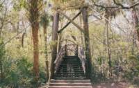
Likely completed in 1933 or soon after. The bridge was built to provide access to a school built in 1933. Based on historic aerial images, removed at some point in time frame 1968-2004. Bridgemeister ID: 178 (added before 2003)Year Completed: 1933 Name: (footbridge) Location: Palatka, Florida , USA At or Near Feature: Ravine Gardens State Park Coordinates: 29.63481 N 81.64594 W Maps: Acme , GeoHack , Google , OpenStreetMap Use: Footbridge Status: In use (last checked: 2021) Main Cables: Wire (steel) Suspended Spans: 1 Main Span: 1
Bridgemeister ID: 2425 (added before 2003)Year Completed: 1933 Name: (footbridge) Location: Palatka, Florida , USA At or Near Feature: Ravine Gardens State Park Coordinates: 29.63343 N 81.64323 W Maps: Acme , GeoHack , Google , OpenStreetMap Use: Footbridge Status: In use (last checked: 2018) Main Cables: Wire (steel) Suspended Spans: 1
Bridgemeister ID: 1890 (added 2005-10-01)Year Completed: 1934 Name: (footbridge) Location: Green Valley vicinity, California , USA Crossing: Bouquet Reservoir References: CE193408 Use: Footbridge Status: Removed Main Cables: Wire (steel) Main Span: 1 x 61 meters (200 feet)
CE193408: "A bridge 276 ft long, consisting of a 200-ft suspension span and two equal shore spans, connects the [gate control] tower with the shore. The suspended span is supported by two prestressed cable strands and by arc-welded structural steel stiffening trusses." Article includes photo of the bridge and tower. Access bridge for the Bouquet Reservoir gate control tower. Likely completed 1933 or 1934. Bridgemeister ID: 750 (added 2003-03-08)Year Completed: 1934 Name: (footbridge) Location: Grey Valley, New Zealand Crossing: Slaty Creek Use: Footbridge
Bridgemeister ID: 4099 (added 2020-04-05)Year Completed: 1934 Name: (footbridge) Location: Rollag, Viken, Norway Crossing: Numedalslågen Coordinates: 60.017909 N 9.276293 E Maps: Acme , GeoHack , Google , kart.1881.no , OpenStreetMap Use: Footbridge Status: In use (last checked: 2019) Main Cables: Wire (steel) Suspended Spans: 1 Main Span: 1 x 88 meters (288.7 feet) estimated Deck width: 1.5 meters
Bridgemeister ID: 752 (added 2003-03-08)Year Completed: 1936 Name: (footbridge) Location: Gisborne vicinity, New Zealand Crossing: Waimata River References: GAP Use: Footbridge
Bridgemeister ID: 285 (added before 2003)Year Completed: 1936 Name: (footbridge) Location: Hillsborough River State Park, Florida , USA Crossing: Hillsborough River Coordinates: 28.1499 N 82.23203 W Maps: Acme , GeoHack , Google , OpenStreetMap Principals: CCC Use: Footbridge Status: In use (last checked: 2004) Main Cables: Wire (steel) Main Span: 1
Bridgemeister ID: 754 (added 2003-03-08)Year Completed: 1936 Name: (footbridge) Location: Motumote, Southland, New Zealand Crossing: Waiau River References: GAP Use: Footbridge
Bridgemeister ID: 1306 (added 2004-04-10)Year Completed: 1936 Name: (footbridge) Location: Tower Lakes, Illinois , USA Crossing: Tower Lake Coordinates: 42.230815 N 88.154552 W Maps: Acme , GeoHack , Google , OpenStreetMap Use: Footbridge Status: Extant (last checked: 2019) Suspended Spans: 3 Main Spans: 3
There is at least one other suspension footbridge in the Tower Lakes area, but this 1936 3-span bridge appears to be the largest and the only one with a level deck. Bridgemeister ID: 755 (added 2003-03-08)Year Completed: 1936 Name: (footbridge) Location: Waikino, New Zealand Crossing: Ohinemuri River Principals: L.E. Shaw References: GAP Use: Footbridge Status: Destroyed, 1981 Main Cables: Wire Main Span: 1 x 42.1 meters (138.1 feet)
GAP: Damaged by flood, 1964. Repaired. Destroyed by flood, 1981. Bridgemeister ID: 757 (added 2003-03-08)Year Completed: 1937 Name: (footbridge) Location: Bruce property, New Zealand Crossing: Maruia River References: GAP Use: Footbridge
Bridgemeister ID: 766 (added 2003-03-08)Year Completed: 1939 Name: (footbridge) Location: Dannevirke vicinity, New Zealand Crossing: Mangatoro Stream References: GAP Use: Footbridge
Bridgemeister ID: 742 (added 2003-03-08)Year Completed: 1939 Name: (footbridge) Location: Masterton, Wairarapa District, New Zealand Crossing: Waipoua River At or Near Feature: Queen Elizabeth Park Coordinates: 40.947982 S 175.669994 E Maps: Acme , GeoHack , Google , OpenStreetMap References: GAP Use: Footbridge Status: In use (last checked: 2023) Main Cables: Wire (steel) Suspended Spans: 3 Main Span: 1 Side Spans: 2
Appears to have replaced a suspension bridge of similar design, but slightly narrower towers. Bridgemeister ID: 768 (added 2003-03-08)Year Completed: 1939 Name: (footbridge) Location: West Bank, New Zealand Crossing: Maruia River References: GAP Use: Footbridge
Bridgemeister ID: 6106 (added 2021-07-04)Year Completed: 1947 Name: (footbridge) Location: Krzyżanowice, Proszówki vicinity, Poland Crossing: Raba Coordinates: 50.008323 N 20.434253 E Maps: Acme , GeoHack , Google , OpenStreetMap Use: Footbridge Status: In use (last checked: 2021) Main Cables: Wire (steel) Suspended Spans: 1
Crossed Kinderhook Creek just a few feet north of the confluence of Kinderhook, Claverack, and Stockport Creeks. Said to have replaced multiple prior suspension bridges built in the 1914, the 1920s, and 1938. 1983: Closed. 2010, February: Collapsed due to snow and ice accumulation. Bridgemeister ID: 2087 (added 2006-06-24)Year Completed: 1949 Name: (footbridge) Location: Minneapolis, Minnesota , USA At or Near Feature: University of Minnesota Principals: Joseph A. Wise, Mid-West Engineering Inc. Use: Footbridge Status: Dismantled Main Cables: Wire Suspended Spans: 1
Bridgemeister ID: 803 (added 2003-03-30)Year Completed: 1950 Name: (footbridge) Location: New Hamburg vicinity, Ontario , Canada Crossing: Nith River Coordinates: 43.398709 N 80.707671 W Maps: Acme , GeoHack , Google , OpenStreetMap Use: Footbridge Status: Extant (last checked: 2020) Main Cables: Wire Suspended Spans: 3 Main Span: 1 Side Spans: 2
Bridgemeister ID: 5180 (added 2020-10-04)Year Completed: 1953 Name: (footbridge) Location: Forgaria nel Friuli, Udine, Italy Crossing: Torrente Arzino Coordinates: 46.225500 N 12.958499 E Maps: Acme , GeoHack , Google , OpenStreetMap Use: Footbridge Status: In use (last checked: 2020) Main Cables: Wire (steel) Suspended Spans: 1
Bridgemeister ID: 5823 (added 2021-04-14)Year Completed: 1953 Name: (footbridge) Location: Ivanovo (Иваново), Ivanovo Oblast, Russia Crossing: Reka Uvod Coordinates: 57.003389 N 40.980845 E Maps: Acme , GeoHack , Google , OpenStreetMap Use: Footbridge Status: In use (last checked: 2021) Main Cables: Wire (steel) Suspended Spans: 1
Bridgemeister ID: 263 (added before 2003)Year Completed: 1953 Name: (footbridge) Location: Richland Center, Wisconsin , USA Crossing: Pine Creek Coordinates: 43.33931 N 90.39205 W Maps: Acme , GeoHack , Google , OpenStreetMap Use: Footbridge Status: In use (last checked: 2020) Main Cables: Wire (steel) Suspended Spans: 10 Main Spans: 8 x 22.9 meters (75 feet) estimated Side Spans: 1 x 9.8 meters (32 feet),
Long low-level footbridge across marshy Pine Creek. Larry Beranek writes: "A flood in Spring 1951, just after I was born, washed out the original bridge. The [current bridge pictured here] was built in 1953. The dam [mentioned here ] is gone now so the river remains a trickle til heavy rains or snow melt beef it up as happened in September of [2007]. The water was up to the stringer which supports the walking surface and the police had it taped off so no one would go on it." Bridgemeister ID: 1132 (added 2004-01-16)Year Completed: 1954 Name: (footbridge) Location: Bad Kreuznach, Rheinland-Pfalz, Germany Crossing: Nahe River Coordinates: 49.838188 N 7.851235 E Maps: Acme , GeoHack , Google , OpenStreetMap Use: Footbridge Status: In use (last checked: 2019) Main Cables: Wire (steel) Suspended Spans: 1 Main Span: 1 x 56 meters (183.7 feet) Deck width: 1.8 meters
Bridgemeister ID: 591 (added 2003-01-05)Year Completed: 1955 Name: (footbridge) Location: Jersey Shore vicinity, Pennsylvania , USA Crossing: Pine Creek At or Near Feature: Boy Scouts Camp Kline Coordinates: 41.273683 N 77.323883 W Maps: Acme , GeoHack , Google , OpenStreetMap Principals: Williamsport Technical Institute students Use: Footbridge Status: Destroyed, 1972 Main Cables: Wire
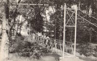
The postcard (postmarked 1961) showing the bridge says, "The largest foot-suspension bridge in the East crosses Pine Creek at the Boy Scouts' Camp Kline, north of Jersey Shore, Pa. Built in 1955 by Williamsport Technical Institute students with materials donated by area industries. Valued over $25,000, the 409-foot span has concrete anchors and a 14-ton capacity. For 35 years previous, boats were used to reach the popular 360-acre camp-site, donated to the Scouts in 1920 by James N. Kline, a Williamsport merchant." It's doubtful this was anywhere close to being a 409-foot bridge. The message written on the postcard is amusing (though unrelated to the bridge): "Hi Mom and Dad, I had a fine time up here. I went on a boat trip Monday around the island. We got half way around and Tiny tiped [sic] his boat then we tiped ours. I didn't get to sleep until 2:00 Monday night. I am going to try to swim a mile today. I don't do nothing but lay in my bunk and listen to records. Ken." Patrick O'Donnell is familiar with this area and notes that the bridge is gone, but the concrete footings are still visible. He suspects 1972's Hurricane Agnes brought down this bridge. Denny Keller confirms Patrick's suspicion with a firsthand account of Hurricane Agnes' impact on this bridge: "21 June 1972 is a date that I will never forget. I along with 340+ kids and adults were at Camp Kline during our yearly 4-H camp. I was the very last (along with the National Guard that performed the rescue) to leave and walk across the bridge that once stood at 11PM on the evening of June 21st. I along with two other senior 4-H counselors. I can remember the last trip across the bridge while mobile homes, trees, and all type of debris were floating down the creek and hitting the bridge underneath." Bridgemeister ID: 2205 (added 2007-02-11)Year Completed: 1956 Name: (footbridge) Location: Waldbreitbach, Rheinland-Pfalz, Germany Crossing: Wied River Coordinates: 50.553032 N 7.426243 E Maps: Acme , GeoHack , Google , OpenStreetMap Use: Footbridge Status: Demolished, 1987 Main Cables: Wire (steel) Suspended Spans: 1
Bridgemeister ID: 1398 (added 2004-07-04)Year Completed: 1958 Name: (footbridge) Location: Glanamman, Ammanford, Wales , United Kingdom Crossing: Amman River Coordinates: 51.8007 N 3.95425 W Maps: Acme , GeoHack , Google , OpenStreetMap Principals: David Rowell & Co. Use: Footbridge Status: In use (last checked: 2013) Main Cables: Wire (steel) Suspended Spans: 1
Allan Agate writes: "I was the Project Engineer for this footbridge and can therefore confirm it was designed and built by David Rowell Ltd and almost certainly the last suspension bridge they built. It was a hybrid of earlier bridges making use of new bolted hot rolled sections instead of riveted composite tower construction. The date was about 1962/3." I am not sure of the provenance of the 1958 date associated with this bridge and I don't have reason to question Mr. Agate's recollection of the bridge completed a few years later. Bridgemeister ID: 1211 (added 2004-02-07)Year Completed: 1958 Name: (footbridge) Location: Santa Rosa del Valle de Calamuchita, Cordoba, Argentina Crossing: Rio Santa Rosa Coordinates: 32.068913 S 64.541461 W Maps: Acme , GeoHack , Google , OpenStreetMap Use: Footbridge Status: In use (last checked: 2022) Main Cables: Wire (steel) Suspended Spans: 2 Main Span: 1 Side Span: 1
Bridgemeister ID: 5239 (added 2020-10-25)Year Completed: 1959 Name: (footbridge) Location: Gornye Kliuchi (Горные Ключи), Primorsky Krai, Russia Crossing: Ussuri River Coordinates: 45.243029 N 133.510776 E Maps: Acme , GeoHack , Google , OpenStreetMap Use: Footbridge Status: In use (last checked: 2023) Main Cables: Wire (steel) Suspended Spans: 1
Bridgemeister ID: 3087 (added 2019-10-27)Year Completed: 1960 Name: (footbridge) Location: Hrabusice vicinity, Slovakia Crossing: Hornád River At or Near Feature: Slovakian Paradise National Park Coordinates: 48.953117 N 20.422883 E Maps: Acme , GeoHack , Google , OpenStreetMap Use: Footbridge Status: In use (last checked: 2018) Main Cables: Wire (steel)
Bridgemeister ID: 2390 (added 2007-11-19)Year Completed: 1960 Name: (footbridge) Location: Palazzolo dello Stella, Italy Coordinates: 45.80366 N 13.07428 E Maps: Acme , GeoHack , Google , OpenStreetMap Use: Footbridge Status: In use (last checked: 2007) Main Cables: Wire (steel) Suspended Spans: 1
Bridgemeister ID: 1740 (added 2005-04-20)Year Completed: 1962 Name: (footbridge) Location: Henningsmoen, Dalsbygda vicinity, Os, Innlandet, Norway Crossing: Vangrøfta Coordinates: 62.514033 N 11.12585 E Maps: Acme , GeoHack , Google , kart.1881.no , OpenStreetMap Use: Footbridge Status: In use (last checked: 2005) Main Cables: Wire Suspended Spans: 1 Main Span: 1 x 38 meters (124.7 feet) estimated Deck width: 2.4 meters (estimated)
Bridgemeister ID: 218 (added before 2003)Year Completed: 1964 Name: (footbridge) Location: Wilmot vicinity and Dillsboro vicinity, North Carolina , USA Crossing: Tuckaseigee River Coordinates: 35.40421 N 83.29348 W Maps: Acme , GeoHack , Google , OpenStreetMap Principals: Roanoke Bridge Co. Use: Footbridge Status: In use (last checked: 2002) Main Cables: Wire (steel) Suspended Spans: 2 Main Spans: 1 x 42.4 meters (139 feet),
A 4/4/2002 article in The Sylva Herald And Ruralite ("Repairing Last Swinging Bridge") notes this bridge was completed 1964, but Patrick S. O'Donnell sent me a photo of a 1906 Roanoke Bridge Co. builder's plate attached to one of the towers. Bridgemeister ID: 879 (added 2003-09-01)Year Completed: 1966 Name: (footbridge) Location: Indiana Beach, Indiana , USA Crossing: Lake Shafer Coordinates: 40.787346 N 86.770724 W Maps: Acme , GeoHack , Google , OpenStreetMap Use: Footbridge Status: Extant (last checked: 2019) Main Cables: Wire (steel)
Large multi-span footbridge that serves as entrance to Indiana Beach amusement park. Bridgemeister ID: 4601 (added 2020-06-06)Year Completed: 1968 Name: (footbridge) Location: Kriznica, Pitomaca vicinity, Croatia Crossing: Drava River Coordinates: 45.959868 N 17.311073 E Maps: Acme , GeoHack , Google , OpenStreetMap Use: Footbridge Status: In use (last checked: 2019) Main Cables: Wire (steel) Suspended Spans: 1 Main Span: 1 x 164 meters (538.1 feet)
Bridgemeister ID: 4693 (added 2020-06-20)Year Completed: 1968 Name: (footbridge) Location: Zagórze Śląskie, Poland Crossing: Bystrzyca Coordinates: 50.752005 N 16.418261 E Maps: Acme , GeoHack , Google , OpenStreetMap Use: Footbridge Status: Demolished, 2017-2019 Main Cables: Wire (steel) Suspended Spans: 1
Replaced in time frame 2017-2019. Bridgemeister ID: 4642 (added 2020-06-16)Year Completed: 1969 Name: (footbridge) Location: Mošnov, Czechia Crossing: Lubina River Coordinates: 49.681695 N 18.128000 E Maps: Acme , GeoHack , Google , OpenStreetMap Use: Footbridge Status: In use (last checked: 2015) Main Cables: Wire (steel) Suspended Spans: 1
Bridgemeister ID: 909 (added 2003-10-11)Year Completed: 1973 Name: (footbridge) Location: Lincoln, Illinois , USA Crossing: Kickapoo Creek At or Near Feature: Kickapoo Creek County Park Coordinates: 40.17338 N 89.37623 W Maps: Acme , GeoHack , Google , OpenStreetMap Use: Footbridge Status: In use (last checked: 2005) Main Cables: Wire Suspended Spans: 1 Main Span: 1
Bridgemeister ID: 4616 (added 2020-06-07)Year Completed: 1973 Name: (footbridge) Location: Newtown, Wales , United Kingdom Crossing: River Severn At or Near Feature: Dolerw Park Coordinates: 52.514964 N 3.319958 W Maps: Acme , GeoHack , Google , OpenStreetMap Use: Footbridge Status: In use (last checked: 2018) Main Cables: Wire (steel) Suspended Spans: 1
Bridgemeister ID: 6707 (added 2021-10-05)Year Completed: 1974 Name: (footbridge) Location: Hayfork, California , USA Crossing: Hayfork Creek At or Near Feature: Bar 717 Ranch Coordinates: 40.628631 N 123.371112 W Maps: Acme , GeoHack , Google , OpenStreetMap Principals: Paul Wills, Willy Wills, Ed Clark Use: Footbridge Status: In use (last checked: 2021) Main Cables: Wire (steel) Main Span: 1
Bridgemeister ID: 6960 (added 2022-02-19)Year Completed: 1976 Name: (footbridge) Location: Alexeyevka, Belgorod Oblast, Russia Crossing: Reka Tikhaya Sosna Coordinates: 50.629171 N 38.684831 E Maps: Acme , GeoHack , Google , OpenStreetMap Use: Footbridge Status: In use (last checked: 2022) Suspended Spans: 1 Main Span: 1 x 80 meters (262.5 feet) estimated
Bridgemeister ID: 6207 (added 2021-07-16)Year Completed: 1976 Name: (footbridge) Location: Brest, Belarus Crossing: Mukhovets River Coordinates: 52.084229 N 23.668432 E Maps: Acme , GeoHack , Google , OpenStreetMap Use: Footbridge Status: In use (last checked: 2021) Main Cables: Wire (steel) Suspended Spans: 1 Main Span: 1 x 86 meters (282.2 feet) estimated
Bridgemeister ID: 1258 (added 2004-03-06)Year Completed: 1976 Name: (footbridge) Location: Lampasas, Texas , USA Crossing: Sulphur Creek Coordinates: 31.05598 N 98.18108 W Maps: Acme , GeoHack , Google , OpenStreetMap Use: Footbridge Status: In use (last checked: 2004) Main Cables: Rod Suspended Spans: 1 Main Span: 1 x 19.8 meters (65 feet)
It is doubtful that this is a true suspension bridge. Follow the picture for more on this observation. Bridgemeister ID: 1796 (added 2005-05-17)Year Completed: 1978 Name: (footbridge) Location: Avegno vicinity, Ticino, Switzerland Crossing: Maggia River At or Near Feature: Valle Maggia Coordinates: 46.215524 N 8.744706 E Maps: Acme , GeoHack , Google , OpenStreetMap Use: Footbridge Status: In use (last checked: 2014) Main Cables: Wire (steel) Suspended Spans: 2 Main Span: 1 x 100 meters (328.1 feet) Side Span: 1 x 24 meters (78.7 feet) Deck width: 1.3 meters
The side without a side span is anchored directly into rock. Bridgemeister ID: 2211 (added 2007-02-11)Year Completed: 1978 Name: (footbridge) Location: Kloster Ehrenstein vicinity, Rheinland-Pfalz, Germany Crossing: Wied River Coordinates: 50.61750 N 7.45082 E Maps: Acme , GeoHack , Google , OpenStreetMap Use: Footbridge Status: In use (last checked: 2006) Main Cables: Wire (steel) Suspended Spans: 1 Main Span: 1 x 30.1 meters (98.8 feet) Deck width: 0.9 meters between side rails, 1.4 meters total
Bridgemeister ID: 1710 (added 2005-04-02)Year Completed: 1978 Name: (footbridge) Location: Pontiac, Illinois , USA Crossing: Vermilion River At or Near Feature: Humiston Riverside Park Coordinates: 40.876867 N 88.63325 W Maps: Acme , GeoHack , Google , OpenStreetMap Use: Footbridge Status: In use (last checked: 2005) Main Cables: Wire (steel) Suspended Spans: 3 Main Span: 1 Side Spans: 2
Bridgemeister ID: 1458 (added 2004-08-21)Year Completed: 1982 Name: (footbridge) Location: Glen Nevis vicinity, Scotland , United Kingdom Crossing: River Nevis Coordinates: 56.811717 N 5.076033 W Maps: Acme , GeoHack , Google , OpenStreetMap Use: Footbridge Status: In use (last checked: 2009) Main Cables: Wire (steel) Suspended Spans: 1 Main Span: 1 x 32.6 meters (107 feet)
This is not the popular wire rope crossing at Glen Nevis which is literally three ropes -- two to hold onto and one to walk on. Instead, this listing is a traditional suspension footbridge just north of Glen Nevis. Don McGillivray worked on this bridge and sent information about its construction."The Suspension bridge was principally built by five Royal Engineers from 15 Field Support Squadron Royal Engineers in the summer of 1982. They were Sapper Terry Bradley (Metal workworker) Sapper Paul Brookes (Draughtsman), Sapper Ian Duggan (Surveyor), Sapper Taff Green (Draughtsman) Sapper Don McGillivray (Blacksmith). "The pier footings and anchorages were excavated by hand as the plant machines were being used on another project at Caol and upriver at the priority bridge opposite the YMCA.The Accrow shuttering and Re-bar was humped and Concrete was pumped across the river over a series of aluminium Mk4 assualt boats. Once the concrete cured, the steel work, provided by Highland Engineering was manhandled across the river using the same boats. The steel uprights and main cable were raised and positioned using a block and tackle from a wooden Gyn. The main cables were anchored on the east bank and were tensioned on the west bank using two tirfor winches. The hangers and stringers were strung out from the west bank in a series like stepping stones until the decking could be positioned. "The Bridge took five weeks start to finish the best part of the build was the weather which was hot and as we were constantly dropping tools etc. in the river, you had to jump in after it. We later moved up to finish the two span through deck bridge at the YMCA. This bridge replaced an old narrow bridge that used to be a part of a WW2 Mulberry Harbour section." Bridgemeister ID: 7793 (added 2023-08-21)Year Completed: 1982 Name: (footbridge) Location: Zhytomyr (Житомир), Zhytomyr Oblast, Ukraine Crossing: Teteriv At or Near Feature: Gagarin Park Coordinates: 50.243169 N 28.662776 E Maps: Acme , GeoHack , Google , OpenStreetMap Use: Footbridge Status: In use (last checked: 2021) Main Cables: Wire (steel) Suspended Spans: 1 Main Span: 1 x 159 meters (521.7 feet) estimated
Bridgemeister ID: 2638 (added 2019-03-02)Year Completed: 1983 Name: (footbridge) Location: Glenlivet, Scotland , United Kingdom Crossing: River Livet At or Near Feature: Speyside Way - Tomintoul Spur Coordinates: 57.347297 N 3.331187 W Maps: Acme , GeoHack , Google , OpenStreetMap Use: Footbridge Status: In use (last checked: 2014) Main Cables: Wire (steel) Suspended Spans: 1
Bridgemeister ID: 1866 (added 2005-08-02)Year Completed: 1984 Name: (footbridge) Location: Martensdale vicinity, Iowa , USA At or Near Feature: Zo-El Annett Woods Coordinates: 41.395367 N 93.698733 W Maps: Acme , GeoHack , Google , OpenStreetMap Principals: Iowa Youth Conservation Corp Use: Footbridge Status: In use (last checked: 2007) Main Cables: Wire (steel) Suspended Spans: 1 Main Span: 1 x 36.6 meters (120 feet) estimated
Lisa Youngblut writes: "My husband and his summer crew, the Iowa Youth Conservation Corp, built this bridge in the summer 1984. They used spades, shovels, hammers and nails, a handsaw and a brace and bit. Half of the materials, including 4 yards of concrete, were shipped to the other side of the ravine on a zip line. The cement was bucket brigaded from the zip line to the piling and the anchors." Bridgemeister ID: 1847 (added 2005-07-16)Year Completed: 1985 Name: (footbridge) Location: Salina, Kansas , USA Crossing: Smoky Hill River At or Near Feature: Oakdale Park Coordinates: 38.833167 N 97.6041 W Maps: Acme , GeoHack , Google , OpenStreetMap Principals: Frank R. Weinhold Use: Footbridge Status: In use (last checked: 2010) Main Cables: Wire Suspended Spans: 3 Main Span: 1 x 27.4 meters (90 feet) estimated Side Spans: 2 x 13.7 meters (45 feet) estimated
Bridgemeister ID: 1331 (added 2004-04-30)Year Completed: 1987 Name: (footbridge) Location: Criglersville, Virginia , USA Crossing: Robinson River Coordinates: 38.4633 N 78.309933 W Maps: Acme , GeoHack , Google , OpenStreetMap Principals: VDOT Use: Footbridge Status: In use (last checked: 2021) Main Cables: Wire (steel) Suspended Spans: 1 Main Span: 1 x 36.6 meters (120 feet) estimated
Bridgemeister ID: 955 (added 2003-11-01)Year Completed: 1987 Name: (footbridge) Location: Kelheim, Germany Crossing: Rhine-Main-Danube Channel Coordinates: 48.920467 N 11.8731 E Maps: Acme , GeoHack , Google , OpenStreetMap Principals: Schlaich Bergermann Partner Use: Footbridge Status: In use (last checked: 2005) Main Cables: Wire (steel) Suspended Spans: 1
Bridgemeister ID: 2206 (added 2007-02-11)Year Completed: 1987 Name: (footbridge) Location: Waldbreitbach, Rheinland-Pfalz, Germany Crossing: Wied River Coordinates: 50.552841 N 7.426353 E Maps: Acme , GeoHack , Google , OpenStreetMap Principals: Lermer GmbH Use: Footbridge Status: In use (last checked: 2006) Main Cables: Wire (steel) Suspended Spans: 1 Main Span: 1 x 29.7 meters (97.4 feet) Deck width: 1.2 meters between side rails, 1.5 meters total
Bridgemeister ID: 905 (added 2003-10-11)Year Completed: 1988 Name: (footbridge) Location: Inverness, Scotland , United Kingdom Crossing: River Ness At or Near Feature: Ness Islands Coordinates: 57.462946 N 4.233579 W Maps: Acme , GeoHack , Google , OpenStreetMap Principals: Cruden and Tough References: HBR Use: Footbridge Status: In use (last checked: 2019) Main Cables: Wire (steel) Suspended Spans: 3 Main Span: 1 Side Spans: 2
Bridgemeister ID: 906 (added 2003-10-11)Year Completed: 1988 Name: (footbridge) Location: Inverness, Scotland , United Kingdom Crossing: River Ness At or Near Feature: Ness Islands Coordinates: 57.465699 N 4.228247 W Maps: Acme , GeoHack , Google , OpenStreetMap References: HBR Use: Footbridge Status: In use (last checked: 2019) Main Cables: Wire (steel) Suspended Spans: 1
Bridgemeister ID: 2307 (added 2007-04-30)Year Completed: 1988 Name: (footbridge) Location: Richmond, Indiana , USA Crossing: Whitewater River At or Near Feature: Whitewater Gorge Coordinates: 39.83331 N 84.89902 W Maps: Acme , GeoHack , Google , OpenStreetMap Use: Footbridge Status: In use (last checked: 2007) Main Cables: Wire (steel)
Bridgemeister ID: 1319 (added 2004-04-25)Year Completed: 1988 Name: (footbridge) Location: Sanger vicinity, North Dakota , USA At or Near Feature: Cross Ranch State Park Coordinates: 47.198983 N 100.99675 W Maps: Acme , GeoHack , Google , OpenStreetMap Principals: North Dakota National Guard Use: Footbridge Status: In use (last checked: 2004) Main Cables: Wire Suspended Spans: 1
Short footbridge with simple tubular metal towers. Crosses a small river just upstream of where the river flows into the Missouri. Bridgemeister ID: 7056 (added 2022-05-27)Year Completed: 1992 Name: (footbridge) Location: Bohuslav, Kyiv Oblast, Ukraine Crossing: Ros River Coordinates: 49.539549 N 30.882699 E Maps: Acme , GeoHack , Google , OpenStreetMap Use: Footbridge Status: In use (last checked: 2020) Main Span: 1
Bridgemeister ID: 1020 (added 2003-11-22)Year Completed: 1992 Name: (footbridge) Location: Chauffard, Haiti Principals: Michael Baker International Use: Footbridge Status: In use Main Span: 1 x 27.4 meters (90 feet)
Bridgemeister ID: 924 (added 2003-10-18)Year Completed: 1992 Name: (footbridge) Location: Pforzheim, Germany Crossing: Enz River Coordinates: 48.895202 N 8.724250 E Maps: Acme , GeoHack , Google , OpenStreetMap Principals: Schlaich Bergermann Partner Use: Footbridge Status: Extant (last checked: 2018) Main Cables: Wire (steel) Suspended Spans: 2 Main Spans: 2
Bridgemeister ID: 925 (added 2003-10-18)Year Completed: 1992 Name: (footbridge) Location: Pforzheim, Germany Crossing: Enz River Coordinates: 48.897727 N 8.730578 E Maps: Acme , GeoHack , Google , OpenStreetMap Principals: Schlaich Bergermann Partner Use: Footbridge Status: In use (last checked: 2019) Main Cables: Wire (steel) Suspended Spans: 1 Main Span: 1 x 82 meters (269 feet) estimated
Bridgemeister ID: 1837 (added 2005-07-02)Year Completed: 1995 Name: (footbridge) Location: Gundelfingen and Vörstetten, Germany Crossing: Vörstetter Strasse Coordinates: 48.050217 N 7.859667 E Maps: Acme , GeoHack , Google , OpenStreetMap Use: Footbridge Status: In use (last checked: 2005) Main Cables: Wire (steel) Suspended Spans: 1
Bridgemeister ID: 2533 (added 2011-12-25)Year Completed: 1995 Name: (footbridge) Location: Pittsburgh, Pennsylvania , USA At or Near Feature: Pittsburgh Zoo Coordinates: 40.481856 N 79.919181 W Maps: Acme , GeoHack , Google , OpenStreetMap Principals: American Bridge Co. Use: Footbridge Status: In use (last checked: 2010) Suspended Spans: 1 Main Span: 1
Bridgemeister ID: 1302 (added 2004-04-03)Year Completed: 1996 Name: (footbridge) Location: Hooversville, Pennsylvania , USA Crossing: Stony Creek Coordinates: 40.147959 N 78.914295 W Maps: Acme , GeoHack , Google , OpenStreetMap Use: Footbridge Status: Closed, July 2024 Main Cables: Wire (steel) Suspended Spans: 1 Main Span: 1 x 42.1 meters (138 feet) estimated
Bridgemeister ID: 1798 (added 2005-05-17)Year Completed: 1996 Name: (footbridge) Location: Tegna and Losone, Ticino, Switzerland Crossing: Melezza River Coordinates: 46.180795 N 8.748574 E Maps: Acme , GeoHack , Google , OpenStreetMap Use: Footbridge Status: In use (last checked: 2023) Main Cables: Wire (steel) Suspended Spans: 1 Main Span: 1 x 120 meters (393.7 feet) Deck width: 2.7 meters
Bridgemeister ID: 1794 (added 2005-05-17)Year Completed: 1997 Name: (footbridge) Location: Giumaglio vicinity, Ticino, Switzerland Crossing: Maggia River At or Near Feature: Valle Maggia Coordinates: 46.271237 N 8.676774 E Maps: Acme , GeoHack , Google , OpenStreetMap Use: Footbridge Status: In use (last checked: 2018) Main Cables: Wire (steel) Suspended Spans: 3 Main Spans: 3 x 83 meters (272.3 feet) Deck width: 0.6 meters (path), 0.9 meters (between side rails)
Deck rests on secondary cables instead of deck stringers. Bridgemeister ID: 1109 (added 2004-01-03)Year Completed: 1997 Name: (footbridge) Location: Motta vicinity, Brione and Lavertezzo vicinity, Ticino, Switzerland Crossing: Verzasca River At or Near Feature: Val Verzasca Coordinates: 46.271641 N 8.812424 E Maps: Acme , GeoHack , Google , OpenStreetMap Principals: Passera and Pedretti Use: Footbridge Status: In use (last checked: 2014) Main Cables: Wire (steel) Suspended Spans: 1 Main Span: 1 x 60 meters (196.9 feet) Deck width: 1 meter
Narrow modern footbridge with unconventional H-shaped towers. Bridgemeister ID: 2370 (added 2007-09-29)Year Completed: 1998 Name: (footbridge) Location: Munich, Bavaria, Germany At or Near Feature: Deutsches Museum Coordinates: 48.129894 N 11.582539 E Maps: Acme , GeoHack , Google , OpenStreetMap Use: Footbridge Status: In use (last checked: 2007) Main Cables: Wire (steel) Characteristics: Monocable
This appears to be a real mast-style suspension bridge inside the "Bridge Room" at the Deutsches Museum. Bridgemeister ID: 1676 (added 2005-03-25)Year Completed: 1998 Name: (footbridge) Location: Tumut vicinity, New South Wales , Australia Coordinates: 35.389083 S 148.248133 E Maps: Acme , GeoHack , Google , OpenStreetMap Principals: Waldren Bridges, Australian Army 21 Construction Regiment Royal Australian Engineers Use: Footbridge Status: In use (last checked: 2005) Main Cables: Wire (steel) Suspended Spans: 1 Main Span: 1 x 60.2 meters (197.5 feet)
A sign at the bridge reads, "The construction of the pedestrian suspension bridge has allowed The Hume and Hovell Walking Track to be re-routed off the Snowy Mountains Highway and Blowering Dam access road onto a now disused section of the old hightway. The bridge was designed by Waldren Bridges Pty Ltd of Yackandandah Victoria and has a span of 60.2 metres. Ironbark timber decking which is supported from two 30mm steel cables. End supports are made from 4 ironbark timber poles 9.3 meters in height. The bridge was constructed by the Australian Army 21 Construction Regiment Royal Australian Engineers as a training program in 7 days." Bridgemeister ID: 1434 (added 2004-07-30)Year Completed: 1999 Name: (footbridge) Location: Monteviot, Ancrum vicinity, Scotland , United Kingdom Crossing: River Teviot Coordinates: 55.512985 N 2.555607 W Maps: Acme , GeoHack , Google , OpenStreetMap Use: Footbridge Status: In use (last checked: 2009) Main Cables: Wire (steel) Suspended Spans: 1 Main Span: 1 x 69.8 meters (229 feet) Deck width: 3 feet
Bridgemeister ID: 2518 (added 2009-12-30)Year Completed: 2000 Name: (footbridge) Location: Bramwell, West Virginia , USA Crossing: Bluestone River Coordinates: 37.32488 N 81.31427 W Maps: Acme , GeoHack , Google , OpenStreetMap Use: Footbridge Status: In use (last checked: 2008) Main Cables: Wire (steel) Suspended Spans: 1 Main Span: 1 x 20.4 meters (67 feet)
Bridgemeister ID: 930 (added 2003-10-25)Year Completed: 2000 Name: (footbridge) Location: Langenargen, Germany Crossing: Argen River Coordinates: 47.59018 N 9.55693 E Maps: Acme , GeoHack , Google , OpenStreetMap Use: Footbridge Status: In use (last checked: 2013) Main Cables: Wire (steel) Suspended Spans: 1 Main Span: 1 x 40 meters (131.2 feet)
Modern footbridge distinct from 1898 Langenargen bridge. Bridgemeister ID: 855 (added 2003-08-07)Year Completed: 2000 Name: (footbridge) Location: Lázně Toušeň, Prague vicinity, Czechia Crossing: Elbe River Coordinates: 50.173496 N 14.722408 E Maps: Acme , GeoHack , Google , OpenStreetMap Use: Footbridge Status: In use (last checked: 2018) Main Cables: Wire (steel) Suspended Spans: 1 Main Span: 1 x 10⁴ meters (341.2 feet)
Bridgemeister ID: 3199 (added 2019-11-10)Year Completed: 2001 Name: (footbridge) Location: Battambang vicinity, Cambodia Crossing: Sangker River Coordinates: 13.048928 N 103.196297 E Maps: Acme , GeoHack , Google , OpenStreetMap Use: Footbridge Status: In use (last checked: 2014) Main Cables: Wire (steel) Suspended Spans: 1
Bridgemeister ID: 8033 (added 2023-12-23)Year Completed: 2001 Name: (footbridge) Location: Botung, Mandailing Natal Regency, North Sumatra , Indonesia Coordinates: 0.646139 N 99.817083 E Maps: Acme , GeoHack , Google , OpenStreetMap Use: Footbridge Status: In use (last checked: 2023) Main Cables: Wire (iron) Suspended Spans: 1
Bridgemeister ID: 2513 (added 2009-12-30)Year Completed: 2001 Name: (footbridge) Location: Chattanooga, Tennessee , USA Crossing: South Chickamauga Creek At or Near Feature: Elise Chapin Sanctuary at Audobon Acres Coordinates: 34.996926 N 85.184675 W Maps: Acme , GeoHack , Google , OpenStreetMap Principals: S & R Construction Use: Footbridge Status: In use (last checked: 2019) Main Cables: Wire (steel) Suspended Spans: 1 Main Span: 1 x 38.1 meters (125 feet)
Bridgemeister ID: 967 (added 2003-11-01)Year Completed: 2001 Name: (footbridge) Location: Houston, Texas , USA Crossing: ravine along Lake Carter Coordinates: 29.77431 N 95.47557 W Maps: Acme , GeoHack , Google , OpenStreetMap Principals: Sahale, LLC. Use: Footbridge Status: In use Main Cables: Wire (steel) Suspended Spans: 1 Main Span: 1 x 20.1 meters (66 feet) Deck width: 4 feet
This bridge is located on private property. Bridgemeister ID: 6468 (added 2021-08-14)Year Completed: 2001 Name: (footbridge) Location: Sanghiang Tanjung, Lebak and Pasirtanjung, Lebak, Banten , Indonesia Crossing: Ciberang River Coordinates: 6.393431 S 106.254467 E Maps: Acme , GeoHack , Google , OpenStreetMap Use: Footbridge Status: Replaced, 2012 Main Cables: Wire (steel) Main Span: 1
Bridgemeister ID: 1889 (added 2005-10-01)Year Completed: 2001 Name: (footbridge) Location: Sarreguemines, Moselle , France Crossing: Sarre River Coordinates: 49.110183 N 7.072017 E Maps: Acme , GeoHack , Google , OpenStreetMap Use: Footbridge Status: In use (last checked: 2017) Main Cables: Wire (steel) Suspended Spans: 2 Side Spans: 2 Characteristics: Self-anchored
Self-anchored. Inclined suspenders. Bridgemeister ID: 1019 (added 2003-11-22)Year Completed: 2001 Name: (footbridge) Location: Tours, Indre-et-Loire , France Crossing: Cher River Coordinates: 47.37155 N 0.682467 E Maps: Acme , GeoHack , Google , OpenStreetMap Principals: Alain Spielmann Use: Footbridge Status: In use (last checked: 2005) Main Cables: Wire (steel) Suspended Spans: 1 Characteristics: Monocable
Monocable from A-shaped towers. Bridgemeister ID: 2253 (added 2007-04-08)Year Completed: 2002 Name: (footbridge) Location: Pliezhausen vicinity, Baden-Württemberg, Germany Crossing: Neckar River Coordinates: 48.558365 N 9.219604 E Maps: Acme , GeoHack , Google , OpenStreetMap Principals: Holzbau Amann GmbH Use: Footbridge Status: In use (last checked: 2019) Main Cables: Rod Suspended Spans: 1
Unconventional design. The main cable ends are anchored to the tops of posts that are inclined away from the bridge. Bridgemeister ID: 916 (added 2003-10-12)Year Completed: 2003 Name: (footbridge) Location: Collingwood, Ontario , Canada Coordinates: 44.48883 N 80.31083 W Maps: Acme , GeoHack , Google , OpenStreetMap Use: Footbridge Status: In use (last checked: 2005) Main Cables: Wire (steel) Suspended Spans: 1 Main Span: 1 x 126 meters (413.4 feet)
Located at the Scenic Caves attraction, the owners claim this large (126-meter main span) footbridge is the longest footbridge in Ontario. Bridgemeister ID: 1516 (added 2004-10-10)Year Completed: 2004 Name: (footbridge) Location: Conner vicinity and Darby vicinity, Montana , USA Crossing: Bitterroot River Coordinates: 45.95001 N 114.13475 W Maps: Acme , GeoHack , Google , OpenStreetMap Principals: Sahale, LLC Use: Footbridge Status: In use (last checked: 2007) Main Cables: Wire (steel) Suspended Spans: 1 Main Span: 1 x 61 meters (200 feet) Deck width: 5 feet
Bridgemeister ID: 2163 (added 2007-01-12)Year Completed: 2004 Name: (footbridge) Location: Frankenberg, Sachsenburg vicinity, Saxony, Germany Crossing: Zschopau River Coordinates: 50.931877 N 13.025694 E Maps: Acme , GeoHack , Google , OpenStreetMap Principals: Montage & Stahlbau Standke Use: Footbridge Status: In use (last checked: 2006) Main Cables: Wire (steel) Suspended Spans: 1 Main Span: 1 x 52 meters (170.6 feet) Deck width: 1.1 meters between side rails, 1.4 meters total
Bridgemeister ID: 2306 (added 2007-04-30)Year Completed: 2005 Name: (footbridge) Location: Cambridge City, Indiana , USA Crossing: Whitewater River At or Near Feature: Creitz Park Coordinates: 39.81527 N 85.16978 W Maps: Acme , GeoHack , Google , OpenStreetMap Principals: Milestone Construction Co., Jim Sweet Use: Footbridge Status: In use (last checked: 2008) Main Cables: Wire (steel) Suspended Spans: 1
Replaced a 1928 suspension bridge at the same location which had been destroyed by heavy snow and debris, December 2004. This predecessor appears to have been a drooping bridge. Bridgemeister ID: 2462 (added 2008-09-27)Year Completed: 2005 Name: (footbridge) Location: Gainesville, Georgia , USA Crossing: Walnut Creek At or Near Feature: Elachee Nature Center Coordinates: 34.233920 N 83.831655 W Maps: Acme , GeoHack , Google , OpenStreetMap Use: Footbridge Status: In use (last checked: 2018) Main Cables: Wire (steel) Main Span: 1
Bridgemeister ID: 1966 (added 2005-11-26)Year Completed: 2005 Name: (footbridge) Location: Ithiel Falls, Vermont , USA Crossing: Lamoille River At or Near Feature: Long Trail Coordinates: 44.651508 N 72.728753 W Maps: Acme , GeoHack , Google , OpenStreetMap Use: Footbridge Status: In use (last checked: 2015) Main Cables: Wire (steel) Main Span: 1 x 41.5 meters (136 feet)
Bridgemeister ID: 4614 (added 2020-06-07)Year Completed: 2005 Name: (footbridge) Location: Kolin, Czechia Crossing: Elbe River Coordinates: 50.031968 N 15.196795 E Maps: Acme , GeoHack , Google , OpenStreetMap Use: Footbridge Status: In use (last checked: 2019) Main Cables: Wire (steel) Suspended Spans: 3 Main Span: 1 x 99.5 meters (326.4 feet) estimated Side Spans: 2
Bridgemeister ID: 1839 (added 2005-07-03)Year Completed: 2005 Name: (footbridge) Location: Rockford, Illinois , USA Crossing: Kent Creek At or Near Feature: Tinker Swiss Cottage Museum Coordinates: 42.2645 N 89.101667 W Maps: Acme , GeoHack , Google , OpenStreetMap Use: Footbridge Status: In use (last checked: 2014) Main Cables: Wire (steel) Suspended Spans: 2 Main Span: 1 Side Span: 1
Bridgemeister ID: 2247 (added 2007-03-28)Year Completed: 2006 Name: (footbridge) Location: Esslingen and Mettingen, Baden-Württemberg, Germany Crossing: Neckar River Coordinates: 48.744594 N 9.271616 E Maps: Acme , GeoHack , Google , OpenStreetMap Principals: Schlaich Bergermann Partner, Ed. Züblin AG Use: Footbridge Status: In use (last checked: 2013) Main Cables: Wire (steel) Suspended Spans: 1 Main Span: 1 x 10⁵ meters (344.5 feet) Deck width: 3.1 meters
Bridgemeister ID: 4831 (added 2020-07-05)Year Completed: 2006 Name: (footbridge) Location: Green Lane, Pennsylvania , USA Crossing: Unami Creek Coordinates: 40.340001 N 75.438839 W Maps: Acme , GeoHack , Google , OpenStreetMap Principals: Frank Neeld, Hart Mechanical Use: Footbridge Status: In use (last checked: 2023) Main Cables: Wire (steel) Suspended Spans: 1
Bridgemeister ID: 2222 (added 2007-03-15)Year Completed: 2006 Name: (footbridge) Location: Mount Hermon, California , USA Crossing: Zayante Creek At or Near Feature: Mount Hermon Christian Conference Center Coordinates: 37.05149 N 122.06182 W Maps: Acme , GeoHack , Google , OpenStreetMap Principals: Sahale, LLC Use: Footbridge Status: In use (last checked: 2007) Main Cables: Wire (steel) Suspended Spans: 1
Bridgemeister ID: 3235 (added 2019-11-16)Year Completed: 2006 Name: (footbridge) Location: Plauen, Germany Crossing: White Elster River Coordinates: 50.491470 N 12.139265 E Maps: Acme , GeoHack , Google , OpenStreetMap Use: Footbridge Status: In use (last checked: 2017) Main Cables: Wire (steel) Suspended Spans: 1 Main Span: 1 x 34 meters (111.5 feet)
Bridgemeister ID: 8036 (added 2023-12-23)Year Completed: 2006 Name: (footbridge) Location: Tamiang, Mandailing Natal Regency, North Sumatra , Indonesia Coordinates: 0.651111 N 99.767167 E Maps: Acme , GeoHack , Google , OpenStreetMap Use: Footbridge Status: In use (last checked: 2023) Main Cables: Wire (steel) Suspended Spans: 1
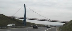
Bridgemeister ID: 5086 (added 2020-09-04)Year Completed: 2007 Name: (footbridge) Location: Madrid, Spain Crossing: R-3 Motorway At or Near Feature: Parque de la Maceta and Parque de la Cuña Verde de Vicalvaro Coordinates: 40.413714 N 3.615467 W Maps: Acme , GeoHack , Google , OpenStreetMap Principals: Carlos Fernández Casado S.L. Use: Footbridge Status: In use (last checked: 2020) Main Cables: Wire (steel) Suspended Spans: 3 Main Span: 1 x 110 meters (360.9 feet) Side Spans: 2
Bridgemeister ID: 5087 (added 2020-09-04)Year Completed: 2007 Name: (footbridge) Location: Madrid, Spain Crossing: M-40 Motorway At or Near Feature: Parque de la Cuña Verde de Vicalvaro Coordinates: 40.416779 N 3.614191 W Maps: Acme , GeoHack , Google , OpenStreetMap Principals: Carlos Fernández Casado S.L. Use: Footbridge Status: In use (last checked: 2007) Main Cables: Wire (steel) Suspended Spans: 1
Bridgemeister ID: 4760 (added 2020-06-28)Year Completed: 2007 Name: (footbridge) Location: Solothurn, Switzerland Crossing: Aare River Coordinates: 47.200455 N 7.530966 E Maps: Acme , GeoHack , Google , OpenStreetMap Use: Footbridge Status: In use (last checked: 2019) Main Cables: Wire (steel) Suspended Spans: 1 Main Span: 1 x 72 meters (236.2 feet)
Bridgemeister ID: 4734 (added 2020-06-27)Year Completed: 2008 Name: (footbridge) Location: Guadalajara, Spain Crossing: Autovía A-2 Coordinates: 40.622582 N 3.164038 W Maps: Acme , GeoHack , Google , OpenStreetMap Use: Footbridge Status: In use (last checked: 2020) Suspended Spans: 2
Bridgemeister ID: 5687 (added 2021-03-28)Year Completed: 2008 Name: (footbridge) Location: Sondrio and Albosaggia, Italy Crossing: Adda River Coordinates: 46.158386 N 9.860458 E Maps: Acme , GeoHack , Google , OpenStreetMap Use: Footbridge Status: In use (last checked: 2019) Main Cables: Wire (steel) Suspended Spans: 1
Bridgemeister ID: 7189 (added 2022-07-04)Year Completed: 2009 Name: (footbridge) Location: Ba'ba Tapua, Matangnga, Polewali Mandar Regency, West Sulawesi , Indonesia Coordinates: 3.273312 S 119.219228 E Maps: Acme , GeoHack , Google , OpenStreetMap Use: Footbridge Status: Extant (last checked: 2021) Main Cables: Wire (steel) Main Span: 1 x 30 meters (98.4 feet)
Bridgemeister ID: 4107 (added 2020-04-05)Year Completed: 2009 Name: (footbridge) Location: Dalen, Tokke, Vestfold Og Telemark, Norway Crossing: Tokke Coordinates: 59.451213 N 7.951819 E Maps: Acme , GeoHack , Google , kart.1881.no , OpenStreetMap Use: Footbridge Status: In use (last checked: 2019) Main Cables: Wire (steel) Suspended Spans: 1 Main Span: 1 x 36.25 meters (118.9 feet) estimated
Bridgemeister ID: 8031 (added 2023-12-23)Year Completed: 2009 Name: (footbridge) Location: Tobang, Mandailing Natal Regency, North Sumatra , Indonesia Coordinates: 0.641111 N 99.833944 E Maps: Acme , GeoHack , Google , OpenStreetMap Use: Footbridge Status: In use (last checked: 2023) Main Cables: Wire (steel) Suspended Spans: 1
Bridgemeister ID: 2612 (added 2014-04-15)Year Completed: 2010 Name: (footbridge) Location: Lake City, Colorado , USA Crossing: Lake San Cristobal Coordinates: 37.96624 N 107.29273 W Maps: Acme , GeoHack , Google , OpenStreetMap Principals: Chris Haaland Use: Footbridge Status: In use (last checked: 2010) Main Cables: Wire (steel) Suspended Spans: 1 Main Span: 1 x 67.1 meters (220 feet)
Bridgemeister ID: 4719 (added 2020-06-26)Year Completed: 2010 Name: (footbridge) Location: Padua, Italy Crossing: Via Venezia Coordinates: 45.409987 N 11.898991 E Maps: Acme , GeoHack , Google , OpenStreetMap Use: Footbridge Status: In use (last checked: 2019) Main Cables: Wire (steel)
Bridgemeister ID: 4605 (added 2020-06-07)Year Completed: 2010 Name: (footbridge) Location: Witryrów and Ulucz, Poland Crossing: San River Coordinates: 49.668268 N 22.256491 E Maps: Acme , GeoHack , Google , OpenStreetMap Use: Footbridge Status: In use (last checked: 2020) Main Cables: Wire (steel) Suspended Spans: 1 Main Span: 1 x 150 meters (492.1 feet) Deck width: 1.5 meters
Bridgemeister ID: 5551 (added 2020-12-14)Year Completed: 2011 Name: (footbridge) Location: Sigmaringen, Germany Crossing: Danube River Coordinates: 48.085564 N 9.208066 E Maps: Acme , GeoHack , Google , OpenStreetMap Use: Footbridge Status: In use (last checked: 2020) Main Cables: Wire (steel) Suspended Spans: 1
Bridgemeister ID: 6610 (added 2021-09-05)Year Completed: 2012 Name: (footbridge) Location: Bau Selatan, Bonggakaradeng, Tana Toraja Regency, South Sulawesi , Indonesia Crossing: Sadang River Coordinates: 3.349188 S 119.694813 E Maps: Acme , GeoHack , Google , OpenStreetMap Use: Footbridge Status: In use (last checked: 2021) Main Cables: Wire (steel) Main Span: 1 x 66.4 meters (218 feet) estimated
Bridgemeister ID: 4487 (added 2020-04-28)Year Completed: 2012 Name: (footbridge) Location: Bøen, Rjukan, Tinn, Vestfold og Telemark, Norway Crossing: Måna Coordinates: 59.878079 N 8.596104 E Maps: Acme , GeoHack , Google , kart.1881.no , OpenStreetMap Use: Footbridge Status: In use (last checked: 2019) Main Cables: Wire (steel) Main Span: 1 x 40 meters (131.2 feet) estimated
Bridgemeister ID: 3227 (added 2019-11-11)Year Completed: 2012 Name: (footbridge) Location: Chekaguda, Rayagada and Mariguda, Odisha , India Crossing: Nagavali River Coordinates: 19.167376 N 83.432883 E Maps: Acme , GeoHack , Google , OpenStreetMap Use: Footbridge Status: In use (last checked: 2022) Main Cables: Wire (steel) Suspended Spans: 1 Main Span: 1 x 150 meters (492.1 feet)
New Indian Express - Mishap-prone hanging bridge will not be closed in Odisha . "Residents of more than 30 villages in Rayagada district heaved a sigh of relief after the administration revoked its decision to close the mishap-prone hanging bridge over Nagavali river. The district administration had decided to close the bridge for public till its renovation following a spate of fatal mishaps involving tourists at the site… the bridge became a major attraction for tourists. With the rise in tourist footfall, the number of mishaps near the bridge too increased."Bridgemeister ID: 4250 (added 2020-04-09)Year Completed: 2012 Name: (footbridge) Location: Jucuapa Abajo, Nicaragua Principals: Bridges to Prosperity, Flatiron Construction, E.E. Cruz, Turner Construction Use: Footbridge Status: In use (last checked: 2012) Main Cables: Wire (steel) Suspended Spans: 1 Main Span: 1 x 57 meters (187 feet)
Bridgemeister ID: 4774 (added 2020-07-03)Year Completed: 2012 Name: (footbridge) Location: Nájera, La Rioja, Spain Crossing: Río Najerilla Coordinates: 42.419783 N 2.732036 W Maps: Acme , GeoHack , Google , OpenStreetMap Use: Footbridge Status: In use (last checked: 2020) Main Cables: Wire (steel) Suspended Spans: 1
Bridgemeister ID: 6884 (added 2022-01-15)Year Completed: 2012 Name: (footbridge) Location: Ralle Anak, Aralle, Mamasa Regency, West Sulawesi , Indonesia Coordinates: 2.912302 S 119.127848 E Maps: Acme , GeoHack , Google , OpenStreetMap Use: Footbridge Status: In use (last checked: 2018) Main Cables: Wire (steel) Main Span: 1 x 64 meters (210 feet) estimated
Facebook . Image of the bridge, posted 2018.Bridgemeister ID: 6469 (added 2021-08-14)Year Completed: 2012 Name: (footbridge) Location: Sanghiang Tanjung, Lebak and Pasirtanjung, Lebak, Banten , Indonesia Crossing: Ciberang River Coordinates: 6.393086 S 106.254386 E Maps: Acme , GeoHack , Google , OpenStreetMap Use: Footbridge Status: Replaced, 2021 Main Cables: Wire (steel) Main Span: 1
Bridgemeister ID: 3901 (added 2020-03-14)Year Completed: 2013 Name: (footbridge) Location: Driva, Oppdal, Trøndelag, Norway Crossing: Driva River Coordinates: 62.53801 N 9.61389 E Maps: Acme , GeoHack , Google , kart.1881.no , OpenStreetMap Use: Footbridge Status: In use (last checked: 2019) Main Cables: Wire (steel) Suspended Spans: 1 Main Span: 1 x 52.5 meters (172.2 feet) estimated
Bridgemeister ID: 4121 (added 2020-04-06)Year Completed: 2013 Name: (footbridge) Location: Ducuale Grande, Estelí, Nicaragua Crossing: Rio Pueblo Nuevo Coordinates: 13.384222 N 86.410598 W Maps: Acme , GeoHack , Google , OpenStreetMap Principals: Flatiron Construction, Bridges to Prosperity Use: Footbridge Status: In use (last checked: 2013) Main Cables: Wire (steel) Main Span: 1 x 67 meters (219.8 feet)
Bridgemeister ID: 7163 (added 2022-06-26)Year Completed: 2013 Name: (footbridge) Location: Rangoan, Matangnga, Polewali Mandar Regency, West Sulawesi , Indonesia Coordinates: 3.124789 S 119.201523 E Maps: Acme , GeoHack , Google , OpenStreetMap Use: Footbridge Status: In use (last checked: 2020) Main Cables: Wire (steel) Main Span: 1 x 41.1 meters (135 feet) estimated
Bridgemeister ID: 3693 (added 2020-02-08)Year Completed: 2014 Name: (footbridge) Location: Fort Belvoir, Virginia , USA Crossing: Accotink Creek At or Near Feature: Accotink Bay Wildlife Refuge Coordinates: 38.700000 N 77.161667 W Maps: Acme , GeoHack , Google , OpenStreetMap Principals: Western Wood Structures Use: Footbridge Status: In use (last checked: 2020) Main Cables: Wire (steel)
Bridgemeister ID: 4753 (added 2020-06-27)Year Completed: 2014 Name: (footbridge) Location: Gießen, Germany Crossing: Lahn River Coordinates: 50.596327 N 8.671094 E Maps: Acme , GeoHack , Google , OpenStreetMap Use: Footbridge Status: In use (last checked: 2019) Main Cables: Wire (steel) Suspended Spans: 1 Main Span: 1 x 49 meters (160.8 feet)
Bridgemeister ID: 8195 (added 2024-02-05)Year Completed: 2014 Name: (footbridge) Location: Jauljibi (जौलजीबी), Uttarakhand , India and Jadani, Uku, Nepal Crossing: Sharda River Coordinates: 29.749853 N 80.379217 E Maps: Acme , GeoHack , Google , OpenStreetMap Use: Footbridge Status: Removed, c. 2015 Main Cables: Wire Suspended Spans: 1 Main Span: 1 x 30 meters (98.4 feet) estimated
Facebook . Image of the bridge posted November 15, 2014: "People waiting at Nepal side to get fixed the temporary suspense bridge constructed by Nepalese people for Jauljibi Mela at Jauljibi, Uttrakhanda. India."Facebook . Image of the bridge posted December 9, 2014.Bridgemeister ID: 7016 (added 2022-05-14)Year Completed: 2015 Name: (footbridge) Location: Kedungsari, Kebumen Regency and Wanatawang, Rantewringin, Kebumen Regency, Central Java , Indonesia Coordinates: 7.740013 S 109.653594 E Maps: Acme , GeoHack , Google , OpenStreetMap Use: Footbridge Status: In use (last checked: 2018) Main Cables: Wire (steel) Suspended Spans: 1 Main Span: 1
Bridgemeister ID: 6966 (added 2022-03-13)Year Completed: 2016 Name: (footbridge) Location: Khati (खाती) vicinity and Wachham (वाछाम) vicinity, Uttarakhand , India Coordinates: 30.106814 N 79.938394 E Maps: Acme , GeoHack , Google , OpenStreetMap Use: Footbridge Status: In use (last checked: 2020) Main Cables: Wire (steel) Suspended Spans: 1 Main Span: 1 x 41.1 meters (135 feet) estimated
Bridgemeister ID: 7456 (added 2022-12-24)Year Completed: 2016 Name: (footbridge) Location: San Pablo Tacachico, El Salvador Crossing: Rio Copinula Coordinates: 13.956942 N 89.364483 W Maps: Acme , GeoHack , Google , OpenStreetMap Use: Footbridge Status: In use (last checked: 2016) Main Cables: Wire (steel) Suspended Spans: 1
Facebook . Image of the bridge, posted January 25, 2016.Facebook . Image of the bridge, posted January 25, 2016.Facebook . Image of the bridge, posted January 25, 2016.2020, February: Destroyed by flood. 2020, July: Grant funds received for replacement. Bridgemeister ID: 7439 (added 2022-12-17)Year Completed: 2016 Name: (footbridge) Location: Yopal and Aguazul, Casanare, Colombia Crossing: Rio Charte Coordinates: 5.256656 N 72.485903 W Maps: Acme , GeoHack , Google , OpenStreetMap Use: Footbridge Status: Replaced, September 2020 Main Cables: Wire (steel) Suspended Spans: 1
Bridgemeister ID: 4768 (added 2020-07-03)Year Completed: 2017 Name: (footbridge) Location: Johannesburg, South Africa Crossing: N17 highway Coordinates: 26.236267 S 28.070071 E Maps: Acme , GeoHack , Google , OpenStreetMap Use: Footbridge Status: In use (last checked: 2020) Main Cables: Wire (steel) Suspended Spans: 3 Main Span: 1 Side Spans: 2
Bridgemeister ID: 7181 (added 2022-07-02)Year Completed: 2017 Name: (footbridge) Location: Tapua, Matangnga, Polewali Mandar Regency, West Sulawesi , Indonesia Coordinates: 3.240719 S 119.215733 E Maps: Acme , GeoHack , Google , OpenStreetMap Use: Footbridge Status: In use (last checked: 2018) Main Cables: Wire (steel) Suspended Spans: 1 Main Span: 1 x 30.5 meters (100 feet) estimated
Facebook . Image of the bridge, posted January 2018.Twitter . Image of the bridge, posted December 2017.Bridgemeister ID: 3317 (added 2019-11-30)Year Completed: 2018 Name: (footbridge) Location: Gadsden, Alabama , USA Crossing: Black Creek At or Near Feature: Noccalula Falls Park Use: Footbridge Status: In use (last checked: 2019) Main Cables: Wire (steel)
2018, October 18: Damaged while still under construction, possibly due to one of the main cables slipping. Construction was targeted to be completed in October before the damage. Likely was still completed within 2018. Syahrullah, Hery. "Belum Rampung, Jembatan Gantung di Perbatasan Paleleng-Caku Pinrang Sudah Rusak." TribunPinrang.com , 18 Oct. 2018, https://makassar.tribunnews.com/2018/10/19/belum-rampung-jembatan-gantung-di-perbatasan-paleleng-caku-pinrang-sudah-rusak .Translated: "Not Completed, The Suspension Bridge on the Paleng-Caku Pinrang Border Has Been Damaged - The suspension bridge built right on the border of Paleleng-Caku Hamlet, Kaseralau Village , Batu Lappa District , Pinrang Regency, was damaged, Thursday (18/10/2018). In fact, the infrastructure that takes up a budget of Rp 700 million is still under construction and must be completed in October 2018."
Bridgemeister ID: 6967 (added 2022-03-13)Year Completed: 2018 Name: (footbridge) Location: Khati (खाती) vicinity and Khaljhuni (खल्झुनी) vicinity, Uttarakhand , India Crossing: Pindar River Coordinates: 30.124539 N 79.951836 E Maps: Acme , GeoHack , Google , OpenStreetMap Use: Footbridge Status: In use (last checked: 2021) Main Cables: Wire (steel) Suspended Spans: 1 Main Span: 1 x 75.3 meters (247 feet) estimated
Completed in early 2018 but the bridge was passable and in use as of late 2017. Bridgemeister ID: 8012 (added 2023-12-10)Year Completed: 2018 Name: (footbridge) Location: Rawada (रवाडा), Uttron and Kuflon, Uttarakhand , India Crossing: Assi Ganga Use: Footbridge Status: In use (last checked: 2018) Main Cables: Wire (steel) Suspended Spans: 1 Main Span: 1 x 108.2 meters (355 feet) estimated
Bridgemeister ID: 6851 (added 2022-01-01)Year Completed: 2019 Name: (footbridge) Location: Aralle, Mamasa Regency, West Sulawesi , Indonesia Coordinates: 2.881632 S 119.148872 E Maps: Acme , GeoHack , Google , OpenStreetMap Use: Footbridge Status: In use (last checked: 2019) Main Cables: Wire (steel) Main Span: 1
Bridgemeister ID: 6811 (added 2021-12-04)Year Completed: 2019 Name: (footbridge) Location: Hasis, Gilgit-Baltistan, Pakistan Crossing: Karambar River Coordinates: 36.298774 N 73.791845 E Maps: Acme , GeoHack , Google , OpenStreetMap Use: Footbridge Status: In use (last checked: 2019) Main Cables: Wire (steel) Main Span: 1 x 40.5 meters (133 feet) estimated
Facebook . Bridge under construction in 2019.Facebook . Bridge recently opened, June 2019.Bridgemeister ID: 6905 (added 2022-01-21)Year Completed: 2019 Name: (footbridge) Location: Pollewani, Tubbi Taramanu, Polewali Mandar Regency, West Sulawesi , Indonesia Coordinates: 3.219983 S 119.030886 E Maps: Acme , GeoHack , Google , OpenStreetMap Use: Footbridge Status: In use (last checked: 2021) Main Cables: Wire (steel) Main Span: 1 x 66.8 meters (219 feet) estimated
Facebook . Image of people on the bridge, posted in 2021.Facebook . Image of the builder's plate at the bridge, posted in 2021.Bridgemeister ID: 8401 (added 2024-03-03)Year Completed: 2019 Name: (footbridge) Location: Pulau, Kampar Regency and Sipungguk, Salo, Kampar Regency, Riau , Indonesia Coordinates: 0.346070 N 100.982817 E Maps: Acme , GeoHack , Google , OpenStreetMap Use: Footbridge Status: In use (last checked: 2023) Main Cables: Wire (steel) Suspended Spans: 3 Main Span: 1 x 72.5 meters (237.9 feet) estimated Side Spans: 2 x 16 meters (52.5 feet) estimated
Near (suspension bridge) - Pulau, Kampar Regency, Riau, Indonesia . Near Ganting - Ganting, Salo, Kampar Regency, Riau, Indonesia . Near Red - Pulau, Kampar Regency, Riau, Indonesia . Bridgemeister ID: 7187 (added 2022-07-04)Year Completed: 2019 Name: (footbridge) Location: Tapua, Matangnga, Polewali Mandar Regency, West Sulawesi , Indonesia Coordinates: 3.253676 S 119.206241 E Maps: Acme , GeoHack , Google , OpenStreetMap Use: Footbridge Status: In use (last checked: 2019) Main Cables: Wire (steel) Main Span: 1
Bridgemeister ID: 7451 (added 2022-12-24)Year Completed: 2020 Name: (footbridge) Location: El Zope, El Salvador Crossing: Rio Suquiapa Coordinates: 13.985964 N 89.383506 W Maps: Acme , GeoHack , Google , OpenStreetMap Use: Footbridge Status: In use (last checked: 2020) Main Cables: Wire (steel) Main Span: 1
Twitter . Image taken on the bridge during its inauguration ceremony, posted October 4, 2020.Bridgemeister ID: 6293 (added 2021-07-23)Year Completed: 2020 Name: (footbridge) Location: Kattan Payeen, Darora vicinity and Landi Shah, Darora vicinity, Khyber Pakhtunkhwa, Pakistan Crossing: Ushiri River Coordinates: 35.118663 N 71.996236 E Maps: Acme , GeoHack , Google , OpenStreetMap Use: Footbridge Status: In use (last checked: 2020) Main Cables: Wire (steel) Suspended Spans: 1 Main Span: 1 x 32.6 meters (107 feet)
Bridgemeister ID: 8240 (added 2024-02-07)Year Completed: 2020 Name: (footbridge) Location: Koto Panjang Ikua Koto, Koto Tangah, Padang City, West Sumatra , Indonesia Crossing: Sungai Lubuk Menturun Coordinates: 0.840611 S 100.367583 E Maps: Acme , GeoHack , Google , OpenStreetMap Use: Footbridge Status: In use (last checked: 2024) Main Cables: Wire (steel) Suspended Spans: 1 Main Span: 1 x 61 meters (200.1 feet) estimated
Bridgemeister ID: 5110 (added 2020-09-05)Year Completed: 2020 Name: (footbridge) Location: Spanish Fork, Utah , USA Crossing: Spanish Fork At or Near Feature: Dripping Rock Trail Coordinates: 40.084505 N 111.596595 W Maps: Acme , GeoHack , Google , OpenStreetMap Use: Footbridge Status: In use (last checked: 2020) Main Cables: Wire (steel) Suspended Spans: 1
Bridgemeister ID: 5987 (added 2021-07-01)Year Completed: 2021 Name: (footbridge) Location: Antechamber Bay, Kangaroo Island, South Australia , Australia Crossing: Chapman River At or Near Feature: Lashmar Conservation Park Coordinates: 35.784974 S 138.066628 E Maps: Acme , GeoHack , Google , OpenStreetMap Use: Footbridge Status: In use (last checked: 2021) Main Cables: Wire (steel) Main Span: 1
Bridgemeister ID: 5924 (added 2021-06-16)Year Completed: 2021 Name: (footbridge) Location: Guthega vicinity, New South Wales , Australia Crossing: Spencer Creek At or Near Feature: Snowies Alpine Walk, Kosciuszko National Park Coordinates: 36.399539 S 148.348952 E Maps: Acme , GeoHack , Google , OpenStreetMap Use: Footbridge Status: In use (last checked: 2021) Main Cables: Wire (steel) Suspended Spans: 1
Bridgemeister ID: 5923 (added 2021-06-15)Year Completed: 2021 Name: (footbridge) Location: Pueblo, Colorado , USA Crossing: Arkansas River Coordinates: 38.267861 N 104.623417 W Maps: Acme , GeoHack , Google , OpenStreetMap Use: Footbridge Status: In use (last checked: 2021) Main Cables: Wire (steel) Suspended Spans: 1 Main Span: 1
Opened for one weekend in early June 2021 as part of ceremonies commemorating those that lost their lives during the flood that devasted Pueblo 100 years ago, on June 3, 1921. Bridge is expected to be fully open to the public in July 2021. Bridgemeister ID: 8858 (added 2024-09-30)Year Completed: 2021 Name: (footbridge) Location: Ōmokoroa and Pahoia, New Zealand Crossing: Waipapa River Coordinates: 37.645944 S 176.013694 E Maps: Acme , GeoHack , Google , OpenStreetMap Use: Footbridge Status: In use (last checked: 2021) Main Cables: Wire (steel) Main Span: 1 x 62 meters (203.4 feet) estimated
Bridgemeister ID: 8808 (added 2024-09-27)Year Completed: 2022 Name: (footbridge) Location: Chapimarca, Peru Crossing: Rio Pachachaca Coordinates: 13.924944 S 73.066833 W Maps: Acme , GeoHack , Google , OpenStreetMap Use: Footbridge Status: In use (last checked: 2022) Main Cables: Wire (steel) Suspended Spans: 1 Main Span: 1 x 44 meters (144.4 feet) estimated
Bridgemeister ID: 7366 (added 2022-11-04)Year Completed: 2022 Name: (footbridge) Location: Emiliano Zapata, Tamaulipas, Mexico Crossing: Guayalejo River Coordinates: 23.021991 N 98.888132 W Maps: Acme , GeoHack , Google , OpenStreetMap Use: Footbridge Status: In use (last checked: 2022) Main Cables: Wire (steel) Suspended Spans: 3 Main Span: 1 x 140 meters (459.3 feet) estimated Side Spans: 2
Bridgemeister ID: 7454 (added 2022-12-24)Year Completed: 2022 Name: (footbridge) Location: Puerto Vallarta, Jalisco, Mexico Crossing: Rio Cuale Coordinates: 20.605843 N 105.235450 W Maps: Acme , GeoHack , Google , OpenStreetMap Use: Footbridge Status: In use (last checked: 2022) Main Cables: Wire (steel)
Bridgemeister ID: 7161 (added 2022-06-26)Year Completed: 2022 Name: (footbridge) Location: Shepparton, Victoria , Australia Crossing: Broken River At or Near Feature: Australian Botanic Gardens Shepparton Coordinates: 36.398024 S 145.381404 E Maps: Acme , GeoHack , Google , OpenStreetMap Use: Footbridge Status: In use (last checked: 2022) Main Cables: Wire (steel) Main Span: 1
Bridgemeister ID: 7866 (added 2023-09-17)Year Completed: 2023 Name: (footbridge) Location: Umdalong, Lalong, West Jaintia Hills, Meghalaya , India Crossing: Myntdu River At or Near Feature: Lalong Park Coordinates: 25.448260 N 92.256463 E Maps: Acme , GeoHack , Google , OpenStreetMap Use: Footbridge Status: In use (last checked: 2023) Main Cables: Wire (steel) Main Span: 1 x 78 meters (255.9 feet) estimated
Bridgemeister ID: 4860 (added 2020-07-12)Name: (footbridge) Also Known As: きしべはし Location: Kinokawa, Wakayama , Japan Crossing: Kishi River Coordinates: 34.203697 N 135.311855 E Maps: Acme , GeoHack , Google , OpenStreetMap Use: Footbridge Status: In use (last checked: 2019) Main Cables: Wire (steel) Suspended Spans: 1
Bridgemeister ID: 6267 (added 2021-07-18)Name: (footbridge) Location: Abadzekhskaya (Абадзехская), Adygea Republic, Russia Crossing: Reka Belaya Coordinates: 44.389362 N 40.212834 E Maps: Acme , GeoHack , Google , OpenStreetMap Use: Footbridge Status: In use (last checked: 2018) Main Cables: Wire (steel) Main Span: 1 x 105.2 meters (345 feet) estimated Side Span: 1 x 44.2 meters (145 feet) estimated
Bridgemeister ID: 1246 (added 2004-02-16)Name: (footbridge) Location: Abisko vicinity, Abisko National Park, Sweden Coordinates: 68.28423 N 18.59086 E Maps: Acme , GeoHack , Google , OpenStreetMap Use: Footbridge Status: In use Main Cables: Wire (steel)
Narrow metal footbridge. Has link chains for suspenders. Bridgemeister ID: 6172 (added 2021-07-08)Name: (footbridge) Location: Acharisaghmarti, Georgia Coordinates: 41.519608 N 41.792892 E Maps: Acme , GeoHack , Google , OpenStreetMap Use: Footbridge Status: In use (last checked: 2021) Main Cables: Wire (steel) Suspended Spans: 1
Bridgemeister ID: 7885 (added 2023-10-07)Name: (footbridge) Location: Aco, Peru Crossing: Rio Santa Coordinates: 9.644386 S 77.488165 W Maps: Acme , GeoHack , Google , OpenStreetMap Use: Footbridge Status: In use (last checked: 2022) Main Cables: Wire (iron) Suspended Spans: 1 Main Span: 1 x 57 meters (187 feet) estimated
Completed at some point in the 2014-2016 time frame. Bridgemeister ID: 2558 (added 2012-01-15)Name: (footbridge) Location: Adana, Türkiye Crossing: Seyhan River Coordinates: 37.00017 N 35.33750 E Maps: Acme , GeoHack , Google , OpenStreetMap Use: Footbridge Status: In use (last checked: 2011) Main Cables: Wire (steel) Suspended Spans: 3 Main Span: 1 Side Spans: 2
Bridgemeister ID: 2559 (added 2012-01-15)Name: (footbridge) Location: Adana, Türkiye Crossing: Seyhan River Coordinates: 36.99724 N 35.33793 E Maps: Acme , GeoHack , Google , OpenStreetMap Use: Footbridge Status: In use (last checked: 2011) Main Cables: Wire (steel) Suspended Spans: 3 Main Span: 1 Side Spans: 2
Bridgemeister ID: 6909 (added 2022-01-21)Name: (footbridge) Location: Agoyán, Ecuador Crossing: Rio Pastaza At or Near Feature: Cascada Manto de la Novia Coordinates: 1.403847 S 78.334456 W Maps: Acme , GeoHack , Google , OpenStreetMap Use: Footbridge Status: In use (last checked: 2018) Main Cables: Wire (steel) Main Span: 1
Bridgemeister ID: 8282 (added 2024-02-08)Name: (footbridge) Location: Agua Caliente, Padilla, Bolivia Coordinates: 19.563972 S 64.104250 W Maps: Acme , GeoHack , Google , OpenStreetMap Use: Footbridge Status: Extant (last checked: 2024) Main Span: 1
Bridgemeister ID: 3438 (added 2019-12-22)Name: (footbridge) Location: Aguas Calientes, Machu Picchu, Peru Crossing: Urubamba River Coordinates: 13.187022 S 72.529714 W Maps: Acme , GeoHack , Google , OpenStreetMap Use: Footbridge Status: Extant (last checked: 2015) Main Cables: Wire (steel)
Bridgemeister ID: 3439 (added 2019-12-22)Name: (footbridge) Location: Aguas Calientes, Machu Picchu, Peru Crossing: Urubamba River At or Near Feature: Inca Trail 104 Km Checkpoint Coordinates: 13.186273 S 72.508611 W Maps: Acme , GeoHack , Google , OpenStreetMap Use: Footbridge Status: In use (last checked: 2019) Main Cables: Wire (steel) Suspended Spans: 1
Bridgemeister ID: 6500 (added 2021-08-22)Name: (footbridge) Location: Ajmeer, Khyber Pakhtunkhwa, Pakistan Coordinates: 35.078937 N 72.757762 E Maps: Acme , GeoHack , Google , OpenStreetMap Use: Footbridge Status: In use (last checked: 2021) Main Cables: Wire (steel) Suspended Spans: 1 Main Span: 1 x 22.9 meters (75 feet) estimated
Built at some point in 2011-2013 time frame. Appears to have been damaged by flood in the 2018-2019 time frame. Bridgemeister ID: 1151 (added 2004-01-18)Name: (footbridge) Location: Akron, Ohio , USA Crossing: Cuyahoga River At or Near Feature: High Bridge Glens Park, now Gorge Metro Park Use: Footbridge Status: Removed Main Cables: Wire
This bridge is visible in the foreground of a popular late 19th century stereoview showing the "high bridge" and falls. No longer in existence. Bridgemeister ID: 1784 (added 2005-05-16)Name: (footbridge) Location: Akron, Ohio , USA At or Near Feature: F.A. Seiberling Nature Realm, Sand Run Metro Park Coordinates: 41.135883 N 81.5735 W Maps: Acme , GeoHack , Google , OpenStreetMap Use: Footbridge Status: In use (last checked: 2012) Main Cables: Wire Suspended Spans: 1
Adjacent to Ranighat Palace (Rani Mahal). Bridgemeister ID: 6758 (added 2021-10-24)Name: (footbridge) Location: Alatyr (Алатырь), Chuvashia Republic, Russia Crossing: Reka Alatyr Coordinates: 54.870633 N 46.584543 E Maps: Acme , GeoHack , Google , OpenStreetMap Use: Footbridge Status: In use (last checked: 2021) Main Cables: Wire (steel) Suspended Spans: 1 Main Span: 1
Bridgemeister ID: 3223 (added 2019-11-11)Name: (footbridge) Location: Alijosiskes, Lithuania Coordinates: 55.390022 N 22.233411 E Maps: Acme , GeoHack , Google , OpenStreetMap Use: Footbridge Status: In use (last checked: 2019) Main Cables: Wire (steel) Main Span: 1
There are several small bridges in the park at this location. A small level deck suspension bridge was observed at the coordinates indicated in the late 2010s. There is at least one other droopy suspension bridge in the park. Bridgemeister ID: 5810 (added 2021-04-10)Name: (footbridge) Location: Alishan Township, Chiayi County, Taiwan At or Near Feature: Shipangu Falls - 石盤谷瀑布 Coordinates: 23.599119 N 120.745541 E Maps: Acme , GeoHack , Google , OpenStreetMap Use: Footbridge Status: In use (last checked: 2020) Main Cables: Wire (steel) Main Span: 1
Bridgemeister ID: 5811 (added 2021-04-11)Name: (footbridge) Location: Alishan Township, Chiayi County, Taiwan Coordinates: 23.592602 N 120.746110 E Maps: Acme , GeoHack , Google , OpenStreetMap Use: Footbridge Status: In use (last checked: 2017) Main Cables: Wire (steel) Main Span: 1
Bridgemeister ID: 2744 (added 2019-06-23)Name: (footbridge) Location: Alishan Township, Taiwan At or Near Feature: Danaiku Nature Ecological Park Coordinates: 23.381680 N 120.682677 E Maps: Acme , GeoHack , Google , OpenStreetMap Use: Footbridge Status: In use (last checked: 2019) Main Cables: Wire (steel)
Bridgemeister ID: 1792 (added 2005-05-17)Name: (footbridge) Location: Alnasca, Brione, Ticino, Switzerland Crossing: Verzasca River At or Near Feature: Val Verzasca Coordinates: 46.304296 N 8.795310 E Maps: Acme , GeoHack , Google , OpenStreetMap Use: Footbridge Status: In use (last checked: 2014) Main Cables: Wire (steel) Suspended Spans: 1 Main Span: 1 x 79 meters (259.2 feet) Deck width: 1.1 meters
Only one tower. On one side the cables are anchored directly into rock. Bridgemeister ID: 3027 (added 2019-10-13)Name: (footbridge) Location: Altja, Lääne-Viru County, Estonia At or Near Feature: Lahemaa National Park Coordinates: 59.585815 N 26.117792 E Maps: Acme , GeoHack , Google , OpenStreetMap Use: Footbridge Status: In use (last checked: 2020) Main Cables: Wire (steel) Suspended Spans: 1
Bridgemeister ID: 1342 (added 2004-05-08)Name: (footbridge) Location: Alum Wells vicinity and Craigs Mill vicinity, Virginia , USA Crossing: North Fork Holston River At or Near Feature: Buffalo Ford Coordinates: 36.74740 N 82.18636 W Maps: Acme , GeoHack , Google , OpenStreetMap Principals: VDOT Use: Footbridge Status: In use (last checked: 2004) Main Cables: Wire (steel) Suspended Spans: 2 Main Span: 1 x 58.2 meters (191 feet) estimated Side Span: 1 x 18.3 meters (60 feet) estimated
Bridgemeister ID: 1926 (added 2005-10-23)Name: (footbridge) Location: Amden vicinity, Switzerland Coordinates: 47.141933 N 9.14025 E Maps: Acme , GeoHack , Google , OpenStreetMap Use: Footbridge Status: In use (last checked: 2005) Main Cables: Wire Suspended Spans: 1
Narrow footbridge with A-shaped towers. Bridgemeister ID: 3885 (added 2020-03-13)Name: (footbridge) Location: Anikovo (Аниково) and Karinskoye (Каринское), Moscow Oblast, Russia Crossing: Moskva River Coordinates: 55.705680 N 36.688922 E Maps: Acme , GeoHack , Google , OpenStreetMap Use: Footbridge Status: In use (last checked: 2022) Main Cables: Wire (steel)
Bridgemeister ID: 1689 (added 2005-03-27)Name: (footbridge) Location: Antes Fort vicinity, Pennsylvania , USA Crossing: Antes Creek Coordinates: 41.179603 N 77.226050 W Maps: Acme , GeoHack , Google , OpenStreetMap Use: Footbridge Status: In use (last checked: 2020) Main Cables: Wire (steel) Suspended Spans: 1 Main Span: 1 x 30.8 meters (101 feet) estimated
Bridgemeister ID: 7248 (added 2022-07-16)Name: (footbridge) Location: Antonio Stomayor, Los Rios, Ecuador Crossing: Rio Vinces Coordinates: 1.639569 S 79.802726 W Maps: Acme , GeoHack , Google , OpenStreetMap Use: Footbridge Status: In use (last checked: 2017) Main Cables: Wire (steel) Main Span: 1 x 159 meters (521.7 feet) estimated
Bridgemeister ID: 5839 (added 2021-05-09)Name: (footbridge) Location: Aoba Ward, Yokohama, Kanagawa , Japan At or Near Feature: Kodomo no Kuni Coordinates: 35.562558 N 139.490068 E Maps: Acme , GeoHack , Google , OpenStreetMap Use: Footbridge Status: In use (last checked: 2021) Main Cables: Wire (steel) Suspended Spans: 1
Bridgemeister ID: 7404 (added 2022-12-04)Name: (footbridge) Location: Apartadó, Antioquia, Colombia Crossing: Rio Apartadó Coordinates: 7.881961 N 76.627881 W Maps: Acme , GeoHack , Google , OpenStreetMap Use: Footbridge Status: Removed, c. 2017-2018 Main Cables: Wire (steel) Suspended Spans: 1 Main Span: 1 x 56.4 meters (185 feet) estimated
Twitter . March 19, 2015: Photos of the inauguration of a nearby replacement bridge and one image of the suspension bridge.Bridgemeister ID: 1629 (added 2005-03-11)Name: (footbridge) Location: Apertin, Sweden Coordinates: 59.51675 N 13.36985 E Maps: Acme , GeoHack , Google , OpenStreetMap Use: Footbridge Status: In use (last checked: 2021)
apopaonline.com - Video: Apopa El Puente Se Esta Cayendo, Esta Tarde Se Cayo Una Señora Y La Alcaldia No Hace Nada . Images and video of the poor condition of the bridge.Facebook . Image of repairs being made to the bridge's suspenders, posted April 23, 2013.Facebook . Image of repairs being made to the bridge's suspenders, posted April 23, 2013.Facebook - Los angeles apopa puente de amaca . Video of a flood at the bridge, posted May 31, 2020.Facebook - Puente en colonia Los Angeles Apopa . Image of the bridge, posted February 19, 2012.Twitter - Apopa, Puente De Colonia Los Angeles Se Esta Cayendo, Pasan Niños, Ancianos Y Se Pueden Caer . Video of the poor condition of the bridge, posted January 7, 2022.Facebook . Image of the bridge posted in 2019.Facebook . Image of the bridge posted in 2017.Bridgemeister ID: 7335 (added 2022-09-03)Name: (footbridge) Location: Arando, Gilgit-Baltistan, Pakistan Crossing: Shigar River Coordinates: 35.868625 N 75.334283 E Maps: Acme , GeoHack , Google , OpenStreetMap Use: Footbridge Status: In use (last checked: 2021) Main Cables: Wire (steel) Suspended Spans: 1 Main Span: 1 x 49.4 meters (162 feet) estimated
Bridgemeister ID: 7475 (added 2022-12-25)Name: (footbridge) Location: Arashiyama Kitamatsuoyama, Nishikyo Ward, Kyoto , Japan Crossing: Katsura River At or Near Feature: Hozukyō Gorge - 保津峡 Coordinates: 35.026157 N 135.645702 E Maps: Acme , GeoHack , Google , OpenStreetMap Use: Footbridge Status: In use Main Cables: Wire (steel) Suspended Spans: 1 Main Span: 1 x 50 meters (164 feet) estimated
Bridgemeister ID: 3339 (added 2019-12-14)Name: (footbridge) Location: Arden, Manitoba , Canada At or Near Feature: Lansdowne Centennial Park and Campground Coordinates: 50.277673 N 99.271874 W Maps: Acme , GeoHack , Google , OpenStreetMap Use: Footbridge Status: In use (last checked: 2019) Main Cables: Wire (steel)
Bridgemeister ID: 4230 (added 2020-04-09)Name: (footbridge) Location: Aridagawa, Wakayama , Japan Crossing: Arita River Coordinates: 34.051282 N 135.337517 E Maps: Acme , GeoHack , Google , OpenStreetMap Use: Footbridge Status: In use (last checked: 2018) Main Cables: Wire (steel) Suspended Spans: 3 Main Span: 1 Side Spans: 2
Bridgemeister ID: 5573 (added 2020-12-20)Name: (footbridge) Location: Arkhangelsk, Arkhangelsk Oblast, Russia Crossing: Reka Solombalka Coordinates: 64.587903 N 40.532004 E Maps: Acme , GeoHack , Google , OpenStreetMap Use: Footbridge Status: In use (last checked: 2020) Main Cables: Wire (steel) Suspended Spans: 1
Bridgemeister ID: 5574 (added 2020-12-20)Name: (footbridge) Location: Arkhangelsk, Arkhangelsk Oblast, Russia Coordinates: 64.574199 N 40.529797 E Maps: Acme , GeoHack , Google , OpenStreetMap Use: Footbridge Status: In use (last checked: 2020) Main Cables: Wire (steel) Suspended Spans: 1
Bridgemeister ID: 6762 (added 2021-10-24)Name: (footbridge) Location: Arkhipo-Osipovka (Архипо-Осиповка), Krasnodar Krai, Russia Crossing: Reka Vulan Coordinates: 44.365995 N 38.521985 E Maps: Acme , GeoHack , Google , OpenStreetMap Use: Footbridge Status: In use (last checked: 2021) Main Cables: Wire Main Span: 1
Bridgemeister ID: 4236 (added 2020-04-09)Name: (footbridge) Location: Arnhem, Netherlands At or Near Feature: Stadsblokken-Meinerswijk Coordinates: 51.977847 N 5.878371 E Maps: Acme , GeoHack , Google , OpenStreetMap Use: Footbridge Status: In use (last checked: 2020) Main Cables: Wire (steel)
Damaged by flood, February 2016. Appears to have since been repaired. Bridgemeister ID: 2367 (added 2007-09-08)Name: (footbridge) Location: Artrip, Virginia , USA Crossing: Clinch River Coordinates: 36.96490 N 82.11193 W Maps: Acme , GeoHack , Google , OpenStreetMap Principals: VDOT Status: Closed (last checked: 2004) Main Cables: Wire Suspended Spans: 3 Main Span: 1 Side Spans: 2
Bridgemeister ID: 2913 (added 2019-09-15)Name: (footbridge) Location: Ashino Lake, Goshogawara, Aomori , Japan At or Near Feature: Ashinochishogun Prefectural Natural Park Coordinates: 40.914930 N 140.452633 E Maps: Acme , GeoHack , Google , OpenStreetMap Use: Footbridge Status: In use (last checked: 2019) Main Cables: Wire (steel)
Bridgemeister ID: 6367 (added 2021-07-26)Name: (footbridge) Location: Asrang (अस्रंग) and Manthali (मन्थली), Nepal Crossing: Bagmati River Coordinates: 27.438371 N 85.325775 E Maps: Acme , GeoHack , Google , OpenStreetMap Use: Footbridge Status: Extant (last checked: 2021) Main Cables: Wire (steel) Main Span: 1 x 75 meters (246.1 feet) estimated
Bridgemeister ID: 2169 (added 2007-01-12)Name: (footbridge) Location: Auburn, Washington , USA Crossing: Green River At or Near Feature: Isaac Evans Park Coordinates: 47.32745 N 122.21021 W Maps: Acme , GeoHack , Google , OpenStreetMap Use: Footbridge Status: In use (last checked: 2007) Main Cables: Wire (steel) Suspended Spans: 1 Main Span: 1 x 50 meters (164 feet) estimated
Bridgemeister ID: 8749 (added 2024-07-04)Name: (footbridge) Location: Aucará, Lucanas, Peru Coordinates: 14.247056 S 74.042944 W Maps: Acme , GeoHack , Google , OpenStreetMap Use: Footbridge Status: In use (last checked: 2023) Main Cables: Wire (steel) Suspended Spans: 1 Main Span: 1 x 30 meters (98.4 feet) estimated
Bridgemeister ID: 5576 (added 2020-12-20)Name: (footbridge) Location: Aulnay, Châtenay-Malabry, Hauts-de-Seine , France At or Near Feature: Arboretum de la Vallée aux Loups Coordinates: 48.771694 N 2.271225 E Maps: Acme , GeoHack , Google , OpenStreetMap Use: Footbridge Status: In use (last checked: 2020) Suspended Spans: 1
This small garden footbridge appears to currently (2020) be aided by a substantial steel beam supporting the deck. Bridgemeister ID: 1795 (added 2005-05-17)Name: (footbridge) Location: Aurigeno vicinity, Ticino, Switzerland Crossing: Maggia River At or Near Feature: Valle Maggia Coordinates: 46.231664 N 8.721555 E Maps: Acme , GeoHack , Google , OpenStreetMap Use: Footbridge Status: In use (last checked: 2014) Main Cables: Wire (steel) Suspended Spans: 3 Main Span: 1 x 96 meters (315 feet) Side Spans: 2 x 12 meters (39.4 feet) Deck width: 1.2 meters (path), 1.6 meters (between side rails)
Side rails are secondary main cables. Bridgemeister ID: 1559 (added 2004-11-26)Name: (footbridge) Location: Aurora, Illinois , USA Crossing: Blackberry Creek At or Near Feature: Virgil L. Gilman Trail Coordinates: 41.760533 N 88.388141 W Maps: Acme , GeoHack , Google , OpenStreetMap Use: Footbridge Status: In use (last checked: 2020) Main Cables: Wire (steel) Suspended Spans: 1 Main Span: 1 x 33 meters (108.3 feet) estimated Deck width: 2.7 meters
On the Virgil L. Gilman Trail near the intersection of Orchard Rd. and Prairie St. At mile marker 6.5 on the trail. Bridgemeister ID: 7538 (added 2023-01-22)Name: (footbridge) Location: Auzat-la-Combelle, Puy-de-Dôme , France Use: Footbridge Status: Removed Main Cables: Wire (steel) Suspended Spans: 1
Location known as Auzat-sur-Allier at the time the bridge was completed. Bridgemeister ID: 8220 (added 2024-02-06)Name: (footbridge) Location: Avignonet, Isère , France Crossing: Drac River At or Near Feature: Avignonet Hydroelectric Plant Use: Footbridge Main Span: 1
Exact location of this bridge is unclear, but likely in close proximity to the current (as of 2023) Drac River dam at Avignonet. Bridgemeister ID: 5587 (added 2020-12-22)Name: (footbridge) Location: Avoca vicinity, Oklahoma , USA Coordinates: 35.002361 N 96.970450 W Maps: Acme , GeoHack , Google , OpenStreetMap Use: Footbridge Status: In use (last checked: 2011) Main Cables: Wire (steel) Suspended Spans: 1
Bridgemeister ID: 5975 (added 2021-07-01)Name: (footbridge) Location: Ayacucho, Peru Coordinates: 13.095281 S 74.212794 W Maps: Acme , GeoHack , Google , OpenStreetMap Use: Footbridge Status: In use (last checked: 2014) Main Cables: Wire Suspended Spans: 1 Main Span: 1
Bridgemeister ID: 5978 (added 2021-07-01)Name: (footbridge) Location: Ayacucho, Peru Coordinates: 13.077508 S 74.235558 W Maps: Acme , GeoHack , Google , OpenStreetMap Use: Footbridge Status: Extant (last checked: 2021) Main Cables: Wire
Facebook . Image of the bridge, posted April 2019.Facebook . Image of the bridge, posted April 2019.Bridgemeister ID: 7192 (added 2022-07-04)Name: (footbridge) Location: Ayun, Khyber Pakhtunkhwa, Pakistan Crossing: Kunar/Chitral/Mastuj River Coordinates: 35.706519 N 71.773531 E Maps: Acme , GeoHack , Google , OpenStreetMap Use: Footbridge and Pipeline Status: Extant (last checked: 2021) Main Cables: Wire (steel) Main Span: 1 x 80.5 meters (264 feet) estimated
Bridgemeister ID: 4460 (added 2020-04-25)Name: (footbridge) Location: Ålefjær, Kristiansand, Agder, Norway Coordinates: 58.224771 N 7.994212 E Maps: Acme , GeoHack , Google , kart.1881.no , OpenStreetMap Use: Footbridge Status: In use (last checked: 2019) Main Cables: Wire (steel) Suspended Spans: 1 Main Span: 1 x 35 meters (114.8 feet) estimated
Completed at some point between 1978 and 2002. Bridgemeister ID: 4204 (added 2020-04-08)Name: (footbridge) Location: Årlifoss, Notodden, Vestfold Og Telemark, Norway Crossing: Tinne Coordinates: 59.684278 N 9.147484 E Maps: Acme , GeoHack , Google , kart.1881.no , OpenStreetMap Use: Footbridge Status: Removed Main Cables: Wire Main Span: 1 x 56.5 meters (185.4 feet)
Based on historic aerial images, removed at some point between 1971 and 1991. Bridgemeister ID: 3466 (added 2019-12-23)Name: (footbridge) Location: Çirali, Türkiye Coordinates: 36.390158 N 30.465431 E Maps: Acme , GeoHack , Google , OpenStreetMap Use: Footbridge Status: In use (last checked: 2017) Main Cables: Wire (steel)
Bridgemeister ID: 7904 (added 2023-10-15)Name: (footbridge) Location: Île de Bercy and Île de Reuilly, Paris , France Crossing: Lac Daumesnil Coordinates: 48.831052 N 2.412569 E Maps: Acme , GeoHack , Google , OpenStreetMap Use: Footbridge Status: In use (last checked: 2023) Main Cables: Wire Suspended Spans: 1
Bridgemeister ID: 7188 (added 2022-07-04)Name: (footbridge) Location: Ba'ba Tapua, Matangnga, Polewali Mandar Regency, West Sulawesi , Indonesia Coordinates: 3.275485 S 119.225259 E Maps: Acme , GeoHack , Google , OpenStreetMap Use: Footbridge Status: In use (last checked: 2015) Main Cables: Wire (steel) Main Span: 1 x 30.5 meters (100 feet) estimated
Completed at some point in 2013 or 2014. Facebook . Several images of the bridge, posted May 25, 2015. One image clearly shows the year "2013" painted on a tower, but in this area that sometimes designates the year the tower was erected not the year the bridge was completed.Bridgemeister ID: 6888 (added 2022-01-15)Name: (footbridge) Location: Baños de Agua Santa, Ecuador Crossing: Rio Pastaza Coordinates: 1.387133 S 78.413061 W Maps: Acme , GeoHack , Google , OpenStreetMap Use: Footbridge Status: In use (last checked: 2020) Main Cables: Wire (steel) Suspended Spans: 1
Bridgemeister ID: 2024 (added 2006-02-11)Name: (footbridge) Location: Baños vicinity, Ecuador Crossing: Pastaza River At or Near Feature: on the road to Puyo Use: Footbridge Status: In use (last checked: 2005) Main Cables: Wire Suspended Spans: 1
Bridgemeister ID: 3118 (added 2019-10-29)Name: (footbridge) Location: Baños, Ecuador Crossing: Rio Pastaza Coordinates: 1.394176 S 78.424923 W Maps: Acme , GeoHack , Google , OpenStreetMap Use: Footbridge Status: In use (last checked: 2017) Main Cables: Wire (steel) Suspended Spans: 1
Bridgemeister ID: 7148 (added 2022-06-25)Name: (footbridge) Location: Baños, Ecuador At or Near Feature: Agoyan Waterfall Coordinates: 1.402204 S 78.368902 W Maps: Acme , GeoHack , Google , OpenStreetMap Use: Footbridge Status: In use (last checked: 2018) Main Cables: Wire (steel) Suspended Spans: 1 Main Span: 1
Bridgemeister ID: 7225 (added 2022-07-10)Name: (footbridge) Location: Babahoyo, Los Rios, Ecuador Crossing: Rio San Pablo Coordinates: 1.796872 S 79.528713 W Maps: Acme , GeoHack , Google , OpenStreetMap Use: Footbridge Status: In use (last checked: 2015) Main Cables: Wire (steel) Suspended Spans: 1 Main Span: 1
Bridgemeister ID: 2484 (added 2008-12-22)Name: (footbridge) Location: Bad Axe vicinity, Michigan , USA Coordinates: 43.78363 N 82.94364 W Maps: Acme , GeoHack , Google , OpenStreetMap Use: Footbridge Status: Extant (last checked: 2008) Main Span: 1
Bridgemeister ID: 2244 (added 2007-03-28)Name: (footbridge) Location: Bad Hütten and Unterlangnau, Baden-Württemberg, Germany Crossing: Argen River Coordinates: 47.630887 N 9.649808 E Maps: Acme , GeoHack , Google , OpenStreetMap Use: Footbridge Status: Extant (last checked: 2009) Main Cables: Wire Suspended Spans: 1
This cables, suspenders, and deck of this bridge are entirely hemp rope. At first quick glance, it has the appearance of any ordinary short-span suspension footbridge, but except for the towers, it's all rope. Bridgemeister ID: 2160 (added 2006-12-11)Name: (footbridge) Location: Bad Windsheim, Bavaria, Germany Coordinates: 49.506743 N 10.413097 E Maps: Acme , GeoHack , Google , OpenStreetMap Principals: Schlaich Bergermann Partner Use: Footbridge Status: In use (last checked: 2019) Main Cables: Eyebar (steel) Suspended Spans: 2 Main Span: 1 x 19.5 meters (64 feet) Side Span: 1 x 12.9 meters (42.3 feet) Deck width: 2.2 meters
Appears to have been largely destroyed at some point in the 2019-2021 time frame. Bridgemeister ID: 5684 (added 2021-03-26)Name: (footbridge) Location: Bagope, Peña Blanca vicinity, Honduras At or Near Feature: Lake Yojoa Coordinates: 14.935128 N 88.007859 W Maps: Acme , GeoHack , Google , OpenStreetMap Use: Footbridge Status: In use (last checked: 2018) Main Cables: Wire (steel) Suspended Spans: 1
Bridgemeister ID: 7656 (added 2023-06-10)Name: (footbridge) Location: Bajo Laguna, San Luis, San José Province, Costa Rica Crossing: Rio Turrobares Coordinates: 9.855294 N 84.512401 W Maps: Acme , GeoHack , Google , OpenStreetMap Use: Footbridge Status: Extant (last checked: 2022) Main Span: 1 x 122 meters (400.3 feet) estimated
Bridgemeister ID: 2060 (added 2006-06-03)Name: (footbridge) Location: Bakertown vicinity, New York , USA Coordinates: 43.402783 N 74.127383 W Maps: Acme , GeoHack , Google , OpenStreetMap Use: Footbridge Status: In use (last checked: 2006) Suspended Spans: 1
Bridgemeister ID: 7013 (added 2022-05-14)Name: (footbridge) Location: Bakola (बकोला), Uttarakhand , India Crossing: Lan Gad Coordinates: 30.432333 N 79.020581 E Maps: Acme , GeoHack , Google , OpenStreetMap Use: Footbridge Status: In use (last checked: 2018) Main Cables: Wire (steel) Suspended Spans: 1 Main Span: 1 x 70 meters (229.7 feet) estimated
Bridgemeister ID: 8525 (added 2024-03-24)Name: (footbridge) Location: Balakhu (बलखु) and Solpathana (सोल्पाठाना), Nepal Crossing: Sunkoshi Coordinates: 27.230956 N 86.330011 E Maps: Acme , GeoHack , Google , OpenStreetMap Use: Footbridge Status: Extant (last checked: 2023) Main Span: 1 x 180.7 meters (593 feet) estimated
Completed at some point in 2013 or 2014. Bridgemeister ID: 8526 (added 2024-03-24)Name: (footbridge) Location: Balakhu (बलखु) and Solpathana (सोल्पाठाना), Nepal Crossing: Sunkoshi Coordinates: 27.201181 N 86.356200 E Maps: Acme , GeoHack , Google , OpenStreetMap Use: Footbridge Status: Extant (last checked: 2023) Main Span: 1 x 184.1 meters (604 feet) estimated
Completed at some point in the 2008-2020 time frame. Bridgemeister ID: 1875 (added 2005-09-22)Name: (footbridge) Location: Baldwin vicinity, Iowa , USA Crossing: Bear Creek At or Near Feature: Eden Valley County Refuge Coordinates: 42.04455 N 90.86093 W Maps: Acme , GeoHack , Google , OpenStreetMap Use: Footbridge Status: In use (last checked: 2007) Suspended Spans: 1 Main Span: 1 x 27.4 meters (90 feet)
Bridgemeister ID: 2530 (added 2010-05-19)Name: (footbridge) Location: Ballindalloch vicinity, Scotland , United Kingdom Crossing: Allt a'Gheallaidh At or Near Feature: Speyside Way Coordinates: 57.4225 N 3.3745 W Maps: Acme , GeoHack , Google , OpenStreetMap Use: Footbridge Status: In use (last checked: 2009) Main Cables: Wire (steel) Suspended Spans: 1 Main Span: 1 x 24.8 meters (81.5 feet)
Bridgemeister ID: 1864 (added 2005-08-01)Name: (footbridge) Location: Baltimore, Maryland , USA At or Near Feature: Druid Hill Park Coordinates: 39.326730 N 76.646482 W Maps: Acme , GeoHack , Google , OpenStreetMap Use: Footbridge Status: In use (last checked: 2021) Main Cables: Wire (steel) Suspended Spans: 1
Bridgemeister ID: 4369 (added 2020-04-12)Name: (footbridge) Location: Bame, Nepal Crossing: Bheri River Coordinates: 28.586629 N 82.000248 E Maps: Acme , GeoHack , Google , OpenStreetMap Use: Footbridge Status: Extant (last checked: 2019) Main Span: 1 x 180.5 meters (592.2 feet) estimated
Bridgemeister ID: 5040 (added 2020-08-23)Name: (footbridge) Location: Ban Na, Si Samrong District, Sukhothai, Thailand Crossing: Yom River Coordinates: 17.164695 N 99.835829 E Maps: Acme , GeoHack , Google , OpenStreetMap Use: Footbridge Status: Closed (last checked: 2014) Main Cables: Wire (steel) Suspended Spans: 1
Bridgemeister ID: 7077 (added 2022-05-27)Name: (footbridge) Location: Banaue, Ifugao, Philippines Coordinates: 16.933529 N 121.141050 E Maps: Acme , GeoHack , Google , OpenStreetMap Use: Footbridge Status: In use (last checked: 2018) Main Cables: Wire (steel) Suspended Spans: 1
Bridgemeister ID: 7078 (added 2022-05-27)Name: (footbridge) Location: Banaue, Ifugao, Philippines Coordinates: 16.912427 N 121.061670 E Maps: Acme , GeoHack , Google , OpenStreetMap Use: Footbridge Status: In use (last checked: 2022) Main Cables: Wire (steel)
There are two closely adjacent suspension bridges at this location as of the late 2010s. This entry represents the older of the two, which is derelict. The other bridge is newer, in use, but is of the "drooping" style typically omitted from the inventory. Bridgemeister ID: 8160 (added 2024-02-03)Name: (footbridge) Location: Bangapani (बुन्गापनी), Uttarakhand , India Crossing: Goriganga Coordinates: 29.95926 N 80.30458 E Maps: Acme , GeoHack , Google , OpenStreetMap Use: Footbridge Status: In use (last checked: 2022) Main Cables: Wire (steel) Main Span: 1 x 45 meters (147.6 feet) estimated
Bangapani's suspension bridge is in a dilapidated condition - amurajala.com . Article about the poor condition of the bridge. Dated January 19, 2016. Translated from the article: "The condition of the suspension bridge built on Gori in Bangapani has become very bad. The asphalt on the bridge has started falling apart. There are holes on the bridge at many places. The feet of pedestrians and animals are getting stuck in these holes…"Facebook . Image of the bridge after recent flooding. June 28, 2013.Google Maps . Image of three men posing on the bridge. October 2022.Google Maps - Bangapani Guest House . Image with the bridge visible. January 2022.Bridgemeister ID: 6368 (added 2021-07-26)Name: (footbridge) Location: Banjh (बाँझ), Nepal Coordinates: 29.564439 N 80.862567 E Maps: Acme , GeoHack , Google , OpenStreetMap Use: Footbridge Status: Extant (last checked: 2021) Main Span: 1
Bridgemeister ID: 2830 (added 2019-07-04)Name: (footbridge) Location: Baoshan, Hsinchu County, Taiwan Crossing: Pao-shan Reservoir Coordinates: 24.747207 N 121.052170 E Maps: Acme , GeoHack , Google , OpenStreetMap Use: Footbridge Status: In use (last checked: 2016) Main Cables: Wire (steel) Suspended Spans: 3 Main Span: 1 Side Spans: 2
Facebook . Image of a person on the bridge. Posted May 12, 2015.Facebook . Image of the bridge. Posted December 2, 2015.Bridgemeister ID: 6269 (added 2021-07-19)Name: (footbridge) Location: Barawal Bandi, Khyber Pakhtunkhwa, Pakistan Coordinates: 35.088809 N 71.767442 E Maps: Acme , GeoHack , Google , OpenStreetMap Use: Footbridge Status: In use (last checked: 2018) Main Cables: Wire (steel) Main Spans: 1 x 74.1 meters (243 feet) estimated,
Bridgemeister ID: 6289 (added 2021-07-22)Name: (footbridge) Location: Barawal Bandi, Upper Dir District, Khyber Pakhtunkhwa, Pakistan Crossing: Baraul Khwar Coordinates: 35.103265 N 71.778643 E Maps: Acme , GeoHack , Google , OpenStreetMap Use: Footbridge Status: Extant (last checked: 2020) Main Cables: Wire Main Span: 1 x 50.6 meters (166 feet) estimated
Bridgemeister ID: 1375 (added 2004-07-03)Name: (footbridge) Location: Barbours Creek vicinity, Virginia , USA Crossing: Craig Creek Coordinates: 37.54998 N 80.01515 W Maps: Acme , GeoHack , Google , OpenStreetMap Principals: VDOT Use: Footbridge Status: In use (last checked: 2004) Main Cables: Wire (steel) Suspended Spans: 1 Main Span: 1 x 61.3 meters (201 feet) estimated
Bridgemeister ID: 5181 (added 2020-10-04)Name: (footbridge) Location: Barcis, Pordenone, Italy Crossing: Torrente Pentina Coordinates: 46.188938 N 12.542967 E Maps: Acme , GeoHack , Google , OpenStreetMap Use: Footbridge Status: In use (last checked: 2011) Main Cables: Wire (steel) Suspended Spans: 1
Bridgemeister ID: 4996 (added 2020-08-16)Name: (footbridge) Location: Barra do Itapocu, Araquari, Santa Catarina, Brazil Crossing: Lagoa da Cruz Coordinates: 26.552829 S 48.654915 W Maps: Acme , GeoHack , Google , OpenStreetMap Use: Footbridge Status: In use (last checked: 2020) Main Cables: Wire (steel) Suspended Spans: 1
Bridgemeister ID: 4997 (added 2020-08-16)Name: (footbridge) Location: Barra Velha, Santa Catarina, Brazil Crossing: Lagoa de Barra Velha Coordinates: 26.599758 S 48.674018 W Maps: Acme , GeoHack , Google , OpenStreetMap Use: Footbridge Status: In use (last checked: 2022) Main Cables: Wire (steel) Suspended Spans: 4 Main Spans: 2 Side Spans: 2
Bridgemeister ID: 7779 (added 2023-08-18)Name: (footbridge) Location: Barrio Flaminia, Sarapiquí, Heredia Province, Costa Rica Crossing: Río Puerto Viejo At or Near Feature: Estación Biológica La Selva Coordinates: 10.431271 N 84.005016 W Maps: Acme , GeoHack , Google , OpenStreetMap Use: Footbridge Status: In use (last checked: 2021) Main Cables: Wire (steel) Main Span: 1
Bridgemeister ID: 8553 (added 2024-04-06)Name: (footbridge) Location: Barruera, Vall de Boí, Lleida, Spain Crossing: Noguera de Tor Coordinates: 42.502111 N 0.799333 E Maps: Acme , GeoHack , Google , OpenStreetMap Use: Footbridge Status: In use (last checked: 2023) Main Cables: Wire (steel) Suspended Spans: 1 Main Span: 1 x 34 meters (111.5 feet) estimated
Bridgemeister ID: 2445 (added 2008-04-23)Name: (footbridge) Location: Barwick, Breathitt County, Kentucky , USA Crossing: North Fork Kentucky River Coordinates: 37.37142 N 83.35669 W Maps: Acme , GeoHack , Google , OpenStreetMap Use: Footbridge Status: In use (last checked: 2008) Main Cables: Wire Suspended Spans: 4 Main Spans: 1 x 39.6 meters (130 feet), Side Spans: 1 x 36.6 meters (120 feet),
Bridgemeister ID: 6521 (added 2021-08-28)Name: (footbridge) Location: Basi, Alpurai vicinity, Khyber Pakhtunkhwa, Pakistan Crossing: Ghorband Khwar Coordinates: 34.899041 N 72.665587 E Maps: Acme , GeoHack , Google , OpenStreetMap Principals: Sarhad Rural Support Programme (SRSP) Use: Footbridge Status: In use (last checked: 2021) Main Cables: Wire (steel) Suspended Spans: 1 Main Span: 1 x 31.1 meters (102 feet) estimated
Completed at some point in 2011-2013 time frame. Replaced a bridge slightly to the west that may have been a suspension bridge. Bridgemeister ID: 808 (added 2003-05-28)Name: (footbridge) Location: Batavia, Illinois , USA Crossing: Fox River At or Near Feature: Clark Park Coordinates: 41.846869 N 88.307962 W Maps: Acme , GeoHack , Google , OpenStreetMap Use: Footbridge Status: Removed, c. 2005-2007 Main Cables: Wire (steel) Suspended Spans: 1 Main Span: 1 x 25 meters (82 feet) estimated Deck width: 1.5 meters
There were two small footbridges at this location. This record represents the bridge that connected from the Batavia side (west) of the Fox River to a small island. The other bridge is about 200 feet away and connects the first island to another island. Removed at some point between 2005 and 2007. Connects to (footbridge) - Batavia, Illinois, USA . Bridgemeister ID: 1840 (added 2005-07-09)Name: (footbridge) Location: Batavia, Illinois , USA Crossing: Fox River At or Near Feature: Clark Park Coordinates: 41.846270 N 88.307685 W Maps: Acme , GeoHack , Google , OpenStreetMap Use: Footbridge Status: Closed (last checked: 2021) Main Cables: Wire (steel) Suspended Spans: 1 Main Span: 1 x 25 meters (82 feet) estimated Deck width: 1.5 meters
Bridgemeister ID: 3356 (added 2019-12-15)Name: (footbridge) Location: Batopilas, Chihuahua, Mexico Coordinates: 27.026366 N 107.738538 W Maps: Acme , GeoHack , Google , OpenStreetMap Use: Footbridge Status: In use (last checked: 2019) Main Cables: Wire (steel)
Bridgemeister ID: 2229 (added 2007-03-19)Name: (footbridge) Location: Baturaden, Banyumas District, Central Java , Indonesia Use: Footbridge Status: Collapsed, October, 2006 Main Cables: Wire
Collapsed October, 2006 under weight of sightseers, reportedly killing 5 and injuring 24. Bridgemeister ID: 6587 (added 2021-09-04)Name: (footbridge) Location: Bau, Tana Toraja Regency, South Sulawesi , Indonesia Crossing: Sadang River Coordinates: 3.284866 S 119.694045 E Maps: Acme , GeoHack , Google , OpenStreetMap Use: Footbridge Status: In use (last checked: 2021) Main Cables: Wire (steel) Suspended Spans: 1 Main Span: 1 x 59.1 meters (194 feet) estimated
Bridgemeister ID: 3082 (added 2019-10-26)Name: (footbridge) Location: Bauska, Latvia Crossing: Musa River Coordinates: 56.400216 N 24.197436 E Maps: Acme , GeoHack , Google , OpenStreetMap Use: Footbridge Status: In use (last checked: 2017) Main Cables: Wire (steel) Suspended Spans: 1
Bridgemeister ID: 4207 (added 2020-04-08)Name: (footbridge) Location: Bø, Vestfold Og Telemark, Norway Crossing: Bøelva Coordinates: 59.410216 N 8.927449 E Maps: Acme , GeoHack , Google , kart.1881.no , OpenStreetMap Use: Footbridge Status: In use (last checked: 2019) Main Cables: Wire (steel) Main Span: 1 x 59.25 meters (194.4 feet) estimated
Bridgemeister ID: 4208 (added 2020-04-08)Name: (footbridge) Location: Bø, Vestfold Og Telemark, Norway Crossing: Bøelva Coordinates: 59.408759 N 8.959738 E Maps: Acme , GeoHack , Google , kart.1881.no , OpenStreetMap Use: Footbridge Status: Removed Main Cables: Wire Main Span: 1 x 62 meters (203.4 feet) estimated Deck width: ~1 meter
Bridgemeister ID: 4516 (added 2020-05-02)Name: (footbridge) Location: Bøen, Rjukan, Tinn, Vestfold og Telemark, Norway Crossing: Måna Coordinates: 59.877932 N 8.596171 E Maps: Acme , GeoHack , Google , kart.1881.no , OpenStreetMap Use: Footbridge Status: Replaced Main Cables: Wire (steel) Suspended Spans: 1 Main Span: 1 x 40 meters (131.2 feet) estimated
Bridgemeister ID: 2267 (added 2007-04-21)Name: (footbridge) Location: Beatrice vicinity, Nebraska , USA Crossing: Cub Creek At or Near Feature: Homestead National Monument Coordinates: 40.29049 N 96.83587 W Maps: Acme , GeoHack , Google , OpenStreetMap Use: Footbridge Status: In use (last checked: 2006) Main Cables: Wire (steel) Suspended Spans: 1 Main Span: 1 x 24.4 meters (80 feet)
Bridgemeister ID: 2457 (added 2008-09-20)Name: (footbridge) Location: Beatrice vicinity, Ritchie County, West Virginia , USA Crossing: South Fork Hughes River Use: Footbridge Status: In use (last checked: 2008) Main Cables: Wire Suspended Spans: 1 Main Span: 1
Coordinates and photos of this private bridge have been withheld at the request of the owner. Bridgemeister ID: 4702 (added 2020-06-20)Name: (footbridge) Location: Belaya Kalitva, Rostov Oblast, Russia Crossing: Reka Kalitva Coordinates: 48.180509 N 40.793238 E Maps: Acme , GeoHack , Google , OpenStreetMap Use: Footbridge Status: In use (last checked: 2019) Main Cables: Wire (steel) Suspended Spans: 1
Bridgemeister ID: 5862 (added 2021-05-16)Name: (footbridge) Location: Beli Iskar, Bulgaria Crossing: Cherni Iskar At or Near Feature: Чакърови поляни Coordinates: 42.294807 N 23.541663 E Maps: Acme , GeoHack , Google , OpenStreetMap Use: Footbridge Status: In use (last checked: 2021) Main Cables: Wire (steel) Main Span: 1
Facebook . Image of the damaged bridge. Posted January 18, 2016.Facebook . Image of the damaged bridge. Posted January 17, 2016.Jembatan Gantung di Muaraenim Putus, Dua Warga Nyaris Tewas . Article dated January 19, 2016, translated: "Two residents of Belimbing Village almost died when they were swept away by the current after the suspension bridge they were crossing broke when they were hit by the overflowing waters of the Lematang River, in Belimbing Village, Belimbing District, Muaraenim Regency, Sunday (17/1) at around 17.30…"Facebook . Image of the approach to the new bridge. Posted October 17, 2017.Facebook . Image of the bridge. A tower for the bridge destroyed in January 2016 is visible to the left of the new bridge tower in the background. Posted July 28, 2018.Facebook . Several images of people on the bridge soon after it opened. Posted January 3, 2018.Bridgemeister ID: 1372 (added 2004-07-03)Name: (footbridge) Location: Bellamy vicinity, Virginia , USA Crossing: Copper Creek Coordinates: 36.66061 N 82.68509 W Maps: Acme , GeoHack , Google , OpenStreetMap Principals: VDOT Use: Footbridge Status: In use (last checked: 2004) Main Cables: Wire (steel) Suspended Spans: 3 Main Span: 1 x 26.5 meters (87 feet) estimated Side Spans: 1 x 6.1 meters (20 feet) estimated,
Bridgemeister ID: 1378 (added 2004-07-03)Name: (footbridge) Location: Bellamy vicinity, Virginia , USA Crossing: Copper Creek Coordinates: 36.66067 N 82.67929 W Maps: Acme , GeoHack , Google , OpenStreetMap Use: Footbridge Status: In use (last checked: 2004) Main Cables: Wire (steel) Suspended Spans: 2 Main Span: 1 x 27.4 meters (90 feet) estimated Side Span: 1 x 14 meters (46 feet) estimated
Carries a private pier that extends into the Long Island Sound. Bridgemeister ID: 1622 (added 2005-02-27)Name: (footbridge) Location: Bellefonte, Pennsylvania , USA Crossing: Spring Creek At or Near Feature: Talleyrand Park Coordinates: 40.910683 N 77.781517 W Maps: Acme , GeoHack , Google , OpenStreetMap Use: Footbridge Status: In use (last checked: 2007) Main Cables: Wire Suspended Spans: 1
Bridgemeister ID: 2220 (added 2007-03-11)Name: (footbridge) Location: Bellepoint vicinity, Ohio , USA Crossing: Mill Creek Coordinates: 40.248596 N 83.163559 W Maps: Acme , GeoHack , Google , OpenStreetMap Use: Footbridge Status: Derelict (last checked: 2007) Main Cables: Wire
Bridgemeister ID: 1056 (added 2003-12-13)Name: (footbridge) Location: Belton vicinity, Texas , USA Crossing: Lampasas River At or Near Feature: Chalk Ridge Falls Park Coordinates: 31.018 N 97.525 W Maps: Acme , GeoHack , Google , OpenStreetMap Use: Footbridge Status: In use (last checked: 2020) Main Cables: Wire (steel) Suspended Spans: 1
Short footbridge with wood towers near Stillhouse Hollow Lake Dam. Bridgemeister ID: 5002 (added 2020-08-16)Name: (footbridge) Location: Benedito Novo, Santa Catarina, Brazil Crossing: Rio Benedito Coordinates: 26.783978 S 49.365241 W Maps: Acme , GeoHack , Google , OpenStreetMap Use: Footbridge Status: In use (last checked: 2019) Main Cables: Wire (steel) Suspended Spans: 1
Bridgemeister ID: 4615 (added 2020-06-07)Name: (footbridge) Location: Benešov u Semil and Slaná, Czechia Crossing: Jizera River Coordinates: 50.595235 N 15.361863 E Maps: Acme , GeoHack , Google , OpenStreetMap Use: Footbridge Status: In use (last checked: 2014) Main Cables: Wire (steel) Suspended Spans: 1 Main Span: 1 x 50 meters (164 feet) estimated
Bridgemeister ID: 4900 (added 2020-07-18)Name: (footbridge) Location: Benighat and Ghyalchok, Nepal Crossing: Trishuli River Coordinates: 27.808944 N 84.756091 E Maps: Acme , GeoHack , Google , OpenStreetMap Use: Footbridge Status: In use (last checked: 2019) Main Cables: Wire (steel) Suspended Spans: 1
Bridgemeister ID: 4825 (added 2020-07-04)Name: (footbridge) Location: Benighat, Nepal Crossing: Trishuli River Coordinates: 27.817172 N 84.809304 E Maps: Acme , GeoHack , Google , OpenStreetMap Use: Footbridge Status: In use (last checked: 2017) Main Cables: Wire (steel) Suspended Spans: 1
Bridgemeister ID: 2411 (added 2007-12-25)Name: (footbridge) Location: Benton Harbor, Michigan , USA At or Near Feature: Eastman Springs Use: Footbridge
Bridgemeister ID: 4478 (added 2020-04-26)Name: (footbridge) Location: Berlevåg, Troms og Finnmark, Norway Crossing: Gentjejgohka Coordinates: 70.652143 N 29.174046 E Maps: Acme , GeoHack , Google , kart.1881.no , OpenStreetMap Use: Footbridge Status: In use (last checked: 2019) Main Cables: Wire (steel) Suspended Spans: 1 Main Span: 1 x 40 meters (131.2 feet) estimated
Built prior to 1970. Claimed to be Europe's northernmost suspension bridge. Bridgemeister ID: 7352 (added 2022-10-22)Name: (footbridge) Location: Beroun, Czechia Crossing: Berounka Coordinates: 49.977854 N 14.072694 E Maps: Acme , GeoHack , Google , OpenStreetMap Use: Footbridge Status: In use (last checked: 2022) Main Cables: Wire (steel) Suspended Spans: 3 Main Span: 1 x 62 meters (203.4 feet) estimated Side Spans: 2
Bridgemeister ID: 292 (added before 2003)Name: (footbridge) Location: Bethel, Marshfield vicinity, Wisconsin , USA Crossing: Dexter Lake At or Near Feature: North Wood County Park Coordinates: 44.5186 N 90.14035 W Maps: Acme , GeoHack , Google , OpenStreetMap Use: Footbridge Status: In use (last checked: 2021) Main Cables: Wire (steel) Suspended Spans: 1 Main Span: 1 x 45.7 meters (150 feet) estimated
Bridgemeister ID: 805 (added 2003-03-30)Name: (footbridge) Location: Bethlehem, Pennsylvania , USA Crossing: Monocacy Creek At or Near Feature: Monocacy Park Coordinates: 40.64248 N 75.38225 W Maps: Acme , GeoHack , Google , OpenStreetMap Use: Footbridge Status: In use (last checked: 2021) Main Cables: Wire (steel) Suspended Spans: 1
2004: Damaged by flooding during Hurricane Ivan. Remained closed through 2005. Built in 1920s. Bridgemeister ID: 1495 (added 2004-09-24)Name: (footbridge) Location: Bethlehem, Pennsylvania , USA Crossing: Saucon Creek At or Near Feature: Saucon Park Coordinates: 40.603255 N 75.346362 W Maps: Acme , GeoHack , Google , OpenStreetMap Use: Footbridge Status: In use (last checked: 2021) Main Cables: Wire (steel) Suspended Spans: 1
Bridgemeister ID: 5628 (added 2020-12-28)Name: (footbridge) Location: Bhagawati, Nepal Coordinates: 28.874432 N 82.490111 E Maps: Acme , GeoHack , Google , OpenStreetMap Use: Footbridge Status: In use (last checked: 2020) Main Cables: Wire (steel) Main Span: 1
Bridgemeister ID: 6438 (added 2021-08-12)Name: (footbridge) Location: Bhairabanath (भैरबनाथ), Nepal Crossing: Seti River Coordinates: 29.476622 N 81.008113 E Maps: Acme , GeoHack , Google , OpenStreetMap Use: Footbridge Status: Extant (last checked: 2021) Main Span: 1
Bridgemeister ID: 7133 (added 2022-06-19)Name: (footbridge) Location: Bhiman (भिमान), Kamalamai, Nepal Crossing: Kamla Nadi Coordinates: 27.104525 N 85.972935 E Maps: Acme , GeoHack , Google , OpenStreetMap Use: Footbridge Status: Extant (last checked: 2021) Main Cables: Wire (steel) Suspended Spans: 2 Main Spans: 1 x 203 meters (666 feet) estimated,
Completed at some point in 2019 or 2020. Bridgemeister ID: 6328 (added 2021-07-24)Name: (footbridge) Location: Bhorletar, Nepal Crossing: Madi Nadi Coordinates: 28.145796 N 84.223746 E Maps: Acme , GeoHack , Google , OpenStreetMap Use: Footbridge Status: Extant (last checked: 2021) Main Cables: Wire (steel) Main Span: 1
Bridgemeister ID: 6330 (added 2021-07-24)Name: (footbridge) Location: Bhorletar, Nepal Coordinates: 28.154870 N 84.226940 E Maps: Acme , GeoHack , Google , OpenStreetMap Use: Footbridge Status: Extant (last checked: 2021) Main Cables: Wire (steel) Main Span: 1
Bridgemeister ID: 6295 (added 2021-07-23)Name: (footbridge) Location: Bibyawar (ببیاوڑ), Khyber Pakhtunkhwa, Pakistan Crossing: Panjkora River Coordinates: 35.124261 N 71.940465 E Maps: Acme , GeoHack , Google , OpenStreetMap Use: Footbridge Status: Only towers remain (last checked: 2020) Main Span: 1
As of 2017 there are two suspension bridges at this location (very closely adjacent). One is a newer simple suspension bridge excluded from the inventory. The other is an older suspended deck footbridge represented by this record. Bridgemeister ID: 4341 (added 2020-04-11)Name: (footbridge) Location: Birkelid, Volleberg, Kristiansand, Agder, Norway Crossing: Songdalselva Coordinates: 58.125056 N 7.846654 E Maps: Acme , GeoHack , Google , kart.1881.no , OpenStreetMap Use: Footbridge Status: Removed Main Cables: Wire (steel) Suspended Spans: 1 Main Span: 1 x 34.25 meters (112.4 feet) estimated
Damaged by flood, 2017. Subsequently removed and scheduled to be replaced by a non-suspension bridge. Bridgemeister ID: 8527 (added 2024-03-24)Name: (footbridge) Location: Birta Besi, Ramechhap (रामेछाप) and Murki Besi (मुर्की बेसी), Nepal Crossing: Sunkoshi Coordinates: 27.275442 N 86.078578 E Maps: Acme , GeoHack , Google , OpenStreetMap Use: Footbridge Status: Extant (last checked: 2023) Main Span: 1 x 268 meters (879.3 feet) estimated
Completed in 2018 or 2019. Bridgemeister ID: 8528 (added 2024-03-24)Name: (footbridge) Location: Birtadeurali (बिर्तादेउराली) and Saramthali (सरमथली), Nepal Crossing: Sunkoshi Coordinates: 27.554000 N 85.749789 E Maps: Acme , GeoHack , Google , OpenStreetMap Use: Footbridge Status: Extant (last checked: 2022) Main Span: 1 x 115 meters (377.3 feet) estimated
Bridgemeister ID: 3345 (added 2019-12-14)Name: (footbridge) Location: Bishalgarh vicinity, Golaghati, Tripura , India Coordinates: 23.689034 N 91.350278 E Maps: Acme , GeoHack , Google , OpenStreetMap Use: Footbridge Status: In use (last checked: 2019) Main Cables: Wire
Bridgemeister ID: 911 (added 2003-10-11)Name: (footbridge) Location: Blackburn vicinity, Arkansas , USA Crossing: Lee Creek At or Near Feature: Devil's Den State Park Coordinates: 35.777113 N 94.253950 W Maps: Acme , GeoHack , Google , OpenStreetMap Use: Footbridge Status: Destroyed, April, 2004 Main Cables: Wire Suspended Spans: 1
An April 28, 2004 AP wire story mentions: "Weekend flooding did an estimated $3 million in damage at Devil's Den State Park... A suspension bridge at the park was taken down by the flood waters." It appears to have since been rebuilt. Replaced by (footbridge) - Blackburn vicinity, Arkansas, USA . Bridgemeister ID: 2495 (added 2003-10-11)Name: (footbridge) Location: Blackburn vicinity, Arkansas , USA Crossing: Lee Creek At or Near Feature: Devil's Den State Park Coordinates: 35.777184 N 94.254335 W Maps: Acme , GeoHack , Google , OpenStreetMap Use: Footbridge Status: In use (last checked: 2008) Main Cables: Wire (steel) Suspended Spans: 1
Bridgemeister ID: 1457 (added 2004-08-15)Name: (footbridge) Location: Blackford vicinity, Virginia , USA Crossing: Clinch River Coordinates: 37.00014 N 81.92902 W Maps: Acme , GeoHack , Google , OpenStreetMap Principals: VDOT Use: Footbridge Status: In use (last checked: 2004) Main Cables: Wire Suspended Spans: 1 Main Span: 1 x 59.1 meters (194 feet) estimated
Bridgemeister ID: 1466 (added 2004-08-28)Name: (footbridge) Location: Blankenloch vicinity, Baden-Württemberg, Germany Crossing: Pfinz-Entlastungskanal Coordinates: 49.063133 N 8.436317 E Maps: Acme , GeoHack , Google , OpenStreetMap Use: Footbridge Status: In use (last checked: 2006) Main Cables: Wire (steel) Suspended Spans: 1 Main Span: 1 x 22.6 meters (74.1 feet) Deck width: 1.3 meters between side rails, 1.6 meters total
Bridgemeister ID: 5863 (added 2021-05-16)Name: (footbridge) Location: Bochnia, Poland Crossing: Raba Coordinates: 49.985235 N 20.399971 E Maps: Acme , GeoHack , Google , OpenStreetMap Use: Footbridge Status: In use (last checked: 2021) Main Cables: Wire (steel) Suspended Spans: 3 Main Span: 1 x 101 meters (331.4 feet) estimated Side Spans: 2 x 50 meters (164 feet) estimated
Bridgemeister ID: 4495 (added 2020-05-01)Name: (footbridge) Location: Bogøya, Frøya and Smaløya, Frøya, Trøndelag, Norway Crossing: Bogøysund Coordinates: 63.871138 N 8.551365 E Maps: Acme , GeoHack , Google , kart.1881.no , OpenStreetMap Use: Footbridge and Golf cart Status: In use (last checked: 2019) Main Cables: Wire (steel) Main Span: 1 x 36 meters (118.1 feet) estimated Side Spans: 1 x 27.5 meters (90.2 feet) estimated,
Based on historic aerial images, completed prior to 1968. Bridgemeister ID: 5618 (added 2020-12-28)Name: (footbridge) Location: Bojongsawah, Buniwangi, Geger Bitung, Sukabumi Regency, West Java , Indonesia Coordinates: 6.956062 S 106.975570 E Maps: Acme , GeoHack , Google , OpenStreetMap Use: Footbridge Status: Removed, 2019-2020 Main Cables: Wire Suspended Spans: 1
Bridgemeister ID: 3370 (added 2019-12-21)Name: (footbridge) Location: Bongdeok-ri, Jangseong-eup, Jangseong-gun, South Korea Coordinates: 35.366823 N 126.823649 E Maps: Acme , GeoHack , Google , OpenStreetMap Use: Footbridge Status: In use (last checked: 2019) Main Cables: Wire (steel)
Bridgemeister ID: 1608 (added 2005-02-13)Name: (footbridge) Location: Bonneville vicinity, Oregon , USA Crossing: Eagle Creek Coordinates: 45.63995 N 121.92358 W Maps: Acme , GeoHack , Google , OpenStreetMap Use: Footbridge Status: In use (last checked: 2005) Main Cables: Wire Suspended Spans: 1
Bridgemeister ID: 8866 (added 2024-10-01)Name: (footbridge) Location: Boone, Iowa , USA At or Near Feature: Camp Hantesa Coordinates: 41.999361 N 93.894444 W Maps: Acme , GeoHack , Google , OpenStreetMap Use: Footbridge Status: In use (last checked: 2022) Main Cables: Wire (steel)
Bridgemeister ID: 7997 (added 2023-12-09)Name: (footbridge) Location: Borjomi (ბორჯომი) and Larebi (ლარები), Georgia Crossing: Kura River Coordinates: 41.809222 N 43.334306 E Maps: Acme , GeoHack , Google , OpenStreetMap Use: Footbridge Status: In use (last checked: 2023) Suspended Spans: 1
Bridgemeister ID: 7986 (added 2023-12-04)Name: (footbridge) Location: Borjomi (ბორჯომი), Georgia Crossing: Kura River Coordinates: 41.839989 N 43.379649 E Maps: Acme , GeoHack , Google , OpenStreetMap Use: Footbridge Status: In use (last checked: 2021) Main Cables: Wire (steel) Main Span: 1
Bridgemeister ID: 5990 (added 2021-07-02)Name: (footbridge) Location: Boulder, Utah , USA Crossing: Calf Creek At or Near Feature: Grand Escalante National Monument Coordinates: 37.794371 N 111.413965 W Maps: Acme , GeoHack , Google , OpenStreetMap Use: Footbridge Status: In use (last checked: 2021) Main Cables: Wire (steel) Suspended Spans: 1 Main Span: 1
Bridgemeister ID: 1318 (added 2004-04-25)Name: (footbridge) Location: Bout-du-Monde vicinity, Quebec , Canada Coordinates: 46.40765 N 73.07795 W Maps: Acme , GeoHack , Google , OpenStreetMap Use: Footbridge Status: In use (last checked: 2005) Main Cables: Wire Suspended Spans: 1
Tall timber towers, possibly made from telephone poles. Bridgemeister ID: 1842 (added 2005-07-15)Name: (footbridge) Location: Brandon, South Dakota , USA Crossing: Big Sioux River At or Near Feature: Big Sioux State Recreation Area Coordinates: 43.577467 N 96.6051 W Maps: Acme , GeoHack , Google , OpenStreetMap Use: Footbridge Status: In use (last checked: 2016) Main Cables: Wire Suspended Spans: 1 Main Span: 1 x 36.6 meters (120 feet) estimated
Bridgemeister ID: 5545 (added 2020-12-13)Name: (footbridge) Location: Brandon, South Dakota , USA At or Near Feature: Beaver Creek State Nature Area Coordinates: 43.551489 N 96.542894 W Maps: Acme , GeoHack , Google , OpenStreetMap Use: Footbridge Status: In use (last checked: 2011) Main Cables: Wire (steel) Suspended Spans: 1
Bridgemeister ID: 2338 (added 2007-08-11)Name: (footbridge) Location: Bridgewater, Virginia , USA Crossing: North River arm At or Near Feature: Wildwood Park Coordinates: 38.38494 N 78.98827 W Maps: Acme , GeoHack , Google , OpenStreetMap Use: Footbridge Status: In use (last checked: 2007) Main Cables: Wire Suspended Spans: 1 Main Span: 1 x 23.8 meters (78 feet)
Replaced a bridge destroyed by flood in 1996. Bridgemeister ID: 2672 (added 2019-03-23)Name: (footbridge) Location: Brightwater vicinity, New Zealand Crossing: Wairoa River Coordinates: 41.356351 S 173.116505 E Maps: Acme , GeoHack , Google , OpenStreetMap Use: Footbridge Status: In use (last checked: 2017) Main Cables: Wire (steel) Suspended Spans: 3 Main Span: 1 Side Spans: 2
Bridgemeister ID: 1125 (added 2004-01-11)Name: (footbridge) Location: Broken Arrow, Oklahoma , USA At or Near Feature: Ray Harral Nature Park Coordinates: 35.98443 N 95.78731 W Maps: Acme , GeoHack , Google , OpenStreetMap Use: Footbridge Status: In use (last checked: 2006) Main Cables: Wire (steel) Suspended Spans: 1
Bridgemeister ID: 2084 (added 2006-06-18)Name: (footbridge) Location: Brookville, Pennsylvania , USA Crossing: North Fork Creek At or Near Feature: Dr. Walter Dick Memorial Park Coordinates: 41.168117 N 79.074767 W Maps: Acme , GeoHack , Google , OpenStreetMap Use: Footbridge Status: Closed, February, 2021 (last checked: July, 2022) Main Cables: Wire (steel) Suspended Spans: 1 Main Span: 1 x 54.3 meters (178 feet) estimated
2021, February: Closed indefinitely after failing a safety inspection. 2023, October: Brookville awarded grant from the Pennsylvania Department of Conservation and Natural Resources for the replacement of the bridge. Work expected to commence in mid-2024. Nelson, Alex. "Good news for the swinging bridge." Jeffersonian Democrat , 14, Apr. 2021, http://www.thecourierexpress.com/jeffersonian_democrat/good-news-for-the-swinging-bridge/article_6a72a49c-7ed2-538d-a154-d719a7650c48.html"Borough Manager Dana Rooney provided a positive update to the swinging bridge at the Walter Dick Memorial Park, saying there is a way for council to repair the existing bridge during last Tuesday’s meeting." Article discusses the council's plan to repair the bridge, rather than replace it, and their progress engaging an engineer to approve the repairs.
This interesting bridge is suspended from the four towers of a larger highway viaduct. The footpath passes through the viaduct towers. Bridgemeister ID: 4104 (added 2020-04-05)Name: (footbridge) Location: Bruland, Førde, Vestland, Norway Crossing: Jølstra Coordinates: 61.434333 N 5.920401 E Maps: Acme , GeoHack , Google , kart.1881.no , OpenStreetMap Use: Footbridge Status: Closed Main Cables: Wire (steel) Suspended Spans: 1 Main Span: 1 x 28.5 meters (93.5 feet) estimated
Based on historic aerial images, built prior to 1957. Reported as closed, mid-to-late 2010s. Bridgemeister ID: 6077 (added 2021-07-04)Name: (footbridge) Location: Bryansk (Брянск), Bryansk Oblast, Russia Crossing: Desna River Coordinates: 53.273622 N 34.373667 E Maps: Acme , GeoHack , Google , OpenStreetMap Use: Footbridge Status: In use (last checked: 2021) Main Cables: Wire (steel) Suspended Spans: 1 Main Span: 1
Leads to island across a very narrow section of the river. Bridgemeister ID: 6970 (added 2022-03-26)Name: (footbridge) Location: Brzi Brod (Брзи Брод), Niš, Serbia Crossing: Nišava Coordinates: 43.315853 N 21.966607 E Maps: Acme , GeoHack , Google , OpenStreetMap Use: Footbridge Status: In use (last checked: 2021) Main Cables: Wire (steel) Suspended Spans: 1 Main Span: 1 x 60 meters (196.9 feet) estimated
Bridgemeister ID: 8183 (added 2024-02-05)Name: (footbridge) Location: Bucaramanga, Santander, Colombia Crossing: Rio de Oro Coordinates: 7.148028 N 73.151333 W Maps: Acme , GeoHack , Google , OpenStreetMap Use: Footbridge Status: In use (last checked: 2023) Main Cables: Wire Main Span: 1
Bridgemeister ID: 8184 (added 2024-02-05)Name: (footbridge) Location: Bucaramanga, Santander, Colombia Crossing: Rio de Oro Coordinates: 7.125361 N 73.160917 W Maps: Acme , GeoHack , Google , OpenStreetMap Status: Extant (last checked: 2023) Main Span: 1 x 74 meters (242.8 feet) estimated
Bridgemeister ID: 1661 (added 2005-03-20)Name: (footbridge) Location: Buckhannon, West Virginia , USA Use: Footbridge Main Cables: Wire Suspended Spans: 1
Long footbridge circa early 1900's, unsure of river. Likely removed. Bridgemeister ID: 5796 (added 2021-04-10)Name: (footbridge) Location: Budhimorang, Dhankuta District, Nepal Crossing: Tamor River Coordinates: 26.931118 N 87.331517 E Maps: Acme , GeoHack , Google , OpenStreetMap Use: Footbridge Status: In use (last checked: 2021) Main Cables: Wire (steel) Main Span: 1
Bridgemeister ID: 4391 (added 2020-04-18)Name: (footbridge) Location: Buhølen, Lindesnes, Agder, Norway Crossing: Skarpesvingen Coordinates: 58.114695 N 7.340361 E Maps: Acme , GeoHack , Google , kart.1881.no , OpenStreetMap Use: Footbridge Status: In use (last checked: 2019) Main Cables: Wire (steel) Suspended Spans: 2 Main Span: 1 x 50 meters (164 feet) estimated Side Span: 1 x 10 meters (32.8 feet) estimated
Bridgemeister ID: 6854 (added 2022-01-02)Name: (footbridge) Location: Buluagung, Karangan, Trenggalek Regency, East Java , Indonesia Coordinates: 8.055462 S 111.680326 E Maps: Acme , GeoHack , Google , OpenStreetMap Use: Footbridge Status: In use (last checked: 2016) Main Cables: Wire (steel) Suspended Spans: 1
Bridgemeister ID: 6646 (added 2021-09-11)Name: (footbridge) Location: Bungurmekar, Sajira, Lebak Regency, Banten , Indonesia Coordinates: 6.456537 S 106.326363 E Maps: Acme , GeoHack , Google , OpenStreetMap Use: Footbridge Status: In use (last checked: 2016) Main Cables: Wire (steel) Main Span: 1
Bridgemeister ID: 2625 (added 2018-12-31)Name: (footbridge) Location: Burlington, North Dakota , USA Crossing: Des Lacs River At or Near Feature: Old Settlers Park Coordinates: 48.282898 N 101.429323 W Maps: Acme , GeoHack , Google , OpenStreetMap Use: Footbridge Status: In use (last checked: 2018) Main Cables: Wire (steel) Suspended Spans: 1
Bridgemeister ID: 4381 (added 2020-04-12)Name: (footbridge) Location: Burnsville vicinity, North Carolina , USA Crossing: Cane River Use: Footbridge Status: In use (last checked: 2003) Main Cables: Wire Suspended Spans: 1
Bridgemeister ID: 4382 (added 2020-04-12)Name: (footbridge) Location: Burnsville vicinity, North Carolina , USA Crossing: Cane River Use: Footbridge Status: In use (last checked: 2003) Main Cables: Wire Suspended Spans: 1
Bridgemeister ID: 4383 (added 2020-04-12)Name: (footbridge) Location: Burnsville vicinity, North Carolina , USA Crossing: Cane River Use: Footbridge Status: In use (last checked: 2003) Main Cables: Wire Main Span: 1
Bridgemeister ID: 4384 (added 2020-04-12)Name: (footbridge) Location: Burnsville vicinity, North Carolina , USA Crossing: Cane River Use: Footbridge Status: In use (last checked: 2003) Main Cables: Wire Main Span: 1
Bridgemeister ID: 4385 (added 2020-04-12)Name: (footbridge) Location: Burnsville vicinity, North Carolina , USA Crossing: Cane River Use: Footbridge Status: In use (last checked: 2003) Main Cables: Wire Main Span: 1
Bridgemeister ID: 4386 (added 2020-04-12)Name: (footbridge) Location: Burnsville vicinity, North Carolina , USA Crossing: Cane River Use: Footbridge Status: In use (last checked: 2003) Main Cables: Wire Suspended Spans: 1
Bridgemeister ID: 4387 (added 2020-04-12)Name: (footbridge) Location: Burnsville vicinity, North Carolina , USA Crossing: Cane River Use: Footbridge Status: In use (last checked: 2003) Main Cables: Wire Suspended Spans: 1
Bridgemeister ID: 4388 (added 2020-04-12)Name: (footbridge) Location: Burnsville vicinity, North Carolina , USA Crossing: Cane River Use: Footbridge Status: In use (last checked: 2003) Main Cables: Wire Suspended Spans: 1
Bridgemeister ID: 2408 (added 2007-12-24)Name: (footbridge) Location: Burnt Ranch vicinity, California , USA Crossing: Trinity River At or Near Feature: Six Rivers National Forest Use: Footbridge Status: Removed Main Cables: Wire Suspended Spans: 1
Completed 1915-1917, likely removed, 1970s. An article in the October 29, 1971 edition of The Times-Standard (Eureka, California) describes this bridge as being located over the Trinity River at New River. USGS topographical maps show a footbridge a few hundred yards north of the intersection of the two rivers at Gray Falls. The article has a photograph of the bridge and describes its possible replacement. The bridge was already closed at the time of the article: "A 50 year-old picturesque footbridge across the Trinity River at New River will be replaced if special funds can be obtained by the Six Rivers Nalional Forest, the federal agency has decided. 'Strong supportive response from people throughout the area to the continued need for a bridge' was reported by Forest Supervisor Bob Allison. The responses came after the Forest Service solicited comments in August on the replacement need for the span. The new bridge would be nearly as possible a replica of the present bridge constructed sometime between 1915 - 1917 by Jim and John Larson. It served as the main link between Denny and the outside world." Bridgemeister ID: 3086 (added 2019-10-27)Name: (footbridge) Location: Burton, Michigan , USA Crossing: Kearsley Creek At or Near Feature: For-Mar Nature Preserve Coordinates: 43.039600 N 83.607800 W Maps: Acme , GeoHack , Google , OpenStreetMap Use: Footbridge Status: In use (last checked: 2020) Main Cables: Wire (steel) Suspended Spans: 1
Bridgemeister ID: 3156 (added 2019-11-03)Name: (footbridge) Location: Butwal (बुटवल), Nepal Crossing: Tinaau River Coordinates: 27.711999 N 83.462995 E Maps: Acme , GeoHack , Google , OpenStreetMap Use: Footbridge Status: In use (last checked: 2019) Main Cables: Wire (steel) Suspended Spans: 1
Bridgemeister ID: 6583 (added 2021-09-04)Name: (footbridge) Location: Butwal (बुटवल), Nepal Crossing: Tinaau River Coordinates: 27.707884 N 83.462227 E Maps: Acme , GeoHack , Google , OpenStreetMap Use: Footbridge Status: In use (last checked: 2020) Main Cables: Wire (steel) Main Span: 1
Bridgemeister ID: 6584 (added 2021-09-04)Name: (footbridge) Location: Butwal (बुटवल), Nepal Crossing: Dano River Coordinates: 27.686191 N 83.445957 E Maps: Acme , GeoHack , Google , OpenStreetMap Use: Footbridge Status: Extant (last checked: 2021) Main Cables: Wire (steel) Main Span: 1
Narrow footbridge with steel towers. Bridgemeister ID: 7950 (added 2023-11-18)Name: (footbridge) Location: Calabacito, Panama Crossing: Rio Santa Maria Coordinates: 8.258306 N 81.082306 W Maps: Acme , GeoHack , Google , OpenStreetMap Use: Footbridge Status: In use (last checked: 2023) Main Cables: Wire (steel) Suspended Spans: 1 Main Span: 1 x 10⁴ meters (341.2 feet) estimated
Bridgemeister ID: 3220 (added 2019-11-11)Name: (footbridge) Location: Caldera vicinity, Chiriqui, Panama Crossing: Rio Chiriqui Nuevo At or Near Feature: Caldera Hot Springs Coordinates: 8.667561 N 82.349550 W Maps: Acme , GeoHack , Google , OpenStreetMap Use: Footbridge Status: In use (last checked: 2004) Main Cables: Wire (steel) Suspended Spans: 1
Bridgemeister ID: 6016 (added 2021-07-02)Name: (footbridge) Location: Cali and Candelaria, Valle del Cauca, Colombia Crossing: Cauca River Coordinates: 3.446939 N 76.474629 W Maps: Acme , GeoHack , Google , OpenStreetMap Use: Footbridge Status: Extant (last checked: 2021) Main Cables: Wire (steel) Main Span: 1
Bridgemeister ID: 6649 (added 2021-09-11)Name: (footbridge) Location: Calungbungur, Lebak Regency, Banten , Indonesia Coordinates: 6.469384 S 106.324995 E Maps: Acme , GeoHack , Google , OpenStreetMap Use: Footbridge Status: In use (last checked: 2016) Main Cables: Wire (steel) Main Span: 1
Bridgemeister ID: 6650 (added 2021-09-11)Name: (footbridge) Location: Calungbungur, Sajira, Lebak Regency, Banten , Indonesia Coordinates: 6.470882 S 106.330237 E Maps: Acme , GeoHack , Google , OpenStreetMap Use: Footbridge Status: In use (last checked: 2016) Main Cables: Wire (steel) Main Span: 1 Side Span: 1
Bridgemeister ID: 6684 (added 2021-09-12)Name: (footbridge) Location: Cameron, Ohio , USA Crossing: Sunfish Creek Coordinates: 39.760249 N 80.934763 W Maps: Acme , GeoHack , Google , OpenStreetMap Use: Footbridge Status: In use (last checked: 2016) Main Cables: Wire (steel) Suspended Spans: 1
Bridgemeister ID: 8271 (added 2024-02-08)Name: (footbridge) Location: Camp 3 vicinity, Benguet, Philippines Crossing: Bued River Coordinates: 16.296028 N 120.598083 E Maps: Acme , GeoHack , Google , OpenStreetMap Use: Footbridge Status: In use (last checked: 2022) Main Span: 1 x 37 meters (121.4 feet) estimated
Bridgemeister ID: 8272 (added 2024-02-08)Name: (footbridge) Location: Camp 3 vicinity, Benguet, Philippines Crossing: Bued River Coordinates: 16.286944 N 120.583250 E Maps: Acme , GeoHack , Google , OpenStreetMap Use: Footbridge Status: In use (last checked: 2023) Main Cables: Wire (steel) Suspended Spans: 1 Main Span: 1 x 91 meters (298.6 feet) estimated
Bridgemeister ID: 2507 (added 2009-12-29)Name: (footbridge) Location: Camp Italiano vicinity, Torres del Paine, Chile Use: Footbridge Status: In use (last checked: 2020) Main Cables: Wire Suspended Spans: 1
Bridgemeister ID: 6231 (added 2021-07-17)Name: (footbridge) Location: Cancura, Osorno, Chile Crossing: Rahue River Coordinates: 40.760684 S 72.966358 W Maps: Acme , GeoHack , Google , OpenStreetMap Use: Footbridge Status: In use (last checked: 2021) Main Cables: Wire (steel) Main Span: 1
Bridgemeister ID: 1800 (added 2005-05-17)Name: (footbridge) Location: Cannobio, Italy Crossing: Cannobino River Coordinates: 46.062843 N 8.691344 E Maps: Acme , GeoHack , Google , OpenStreetMap Use: Footbridge Status: In use (last checked: 2020) Main Cables: Wire (steel) Suspended Spans: 2 Main Span: 1 x 63 meters (206.7 feet) Side Span: 1 x 19 meters (62.3 feet) Deck width: 1.3 meters
Appears to have been rebuilt in late 2000s or early 2010s. The height of the towers were extended and the suspended side span eliminated. Bridgemeister ID: 7498 (added 2023-01-01)Name: (footbridge) Location: Cantón El Gramal, La Palma, El Salvador Crossing: Rio Nunuapa Coordinates: 14.296743 N 89.175150 W Maps: Acme , GeoHack , Google , OpenStreetMap Use: Footbridge Status: In use (last checked: 2021) Main Cables: Wire (iron) Suspended Spans: 1
Bridgemeister ID: 7492 (added 2022-12-30)Name: (footbridge) Location: Canton La Ruda vicinity, Masahuat, El Salvador Crossing: Rio Lempa Coordinates: 14.154030 N 89.407071 W Maps: Acme , GeoHack , Google , OpenStreetMap Use: Footbridge Status: In use (last checked: 2013) Main Cables: Wire (steel) Main Span: 1 x 91.4 meters (300 feet) estimated
Bridgemeister ID: 2105 (added 2006-08-26)Name: (footbridge) Location: Canton vicinity, South Dakota , USA Crossing: Sargeant Creek At or Near Feature: Newton Hills State Park Coordinates: 43.2241 N 96.5803 W Maps: Acme , GeoHack , Google , OpenStreetMap Use: Footbridge Status: In use (last checked: 2006) Main Cables: Wire Suspended Spans: 1 Main Span: 1 x 16.2 meters (53 feet) estimated
Bridgemeister ID: 2106 (added 2006-08-26)Name: (footbridge) Location: Canton vicinity, South Dakota , USA Crossing: Sargeant Creek At or Near Feature: Newton Hills State Park Coordinates: 43.227333 N 96.57695 W Maps: Acme , GeoHack , Google , OpenStreetMap Use: Footbridge Status: In use (last checked: 2006) Main Cables: Wire Suspended Spans: 1 Main Span: 1 x 14.9 meters (49 feet) estimated
Bridgemeister ID: 1899 (added 2005-10-02)Name: (footbridge) Location: Cap-Rouge, Quebec City, Quebec , Canada Coordinates: 46.76315 N 71.355333 W Maps: Acme , GeoHack , Google , OpenStreetMap Use: Footbridge Status: In use (last checked: 2005) Main Cables: Wire (steel)
Bridgemeister ID: 773 (added 2003-03-14)Name: (footbridge) Location: Carnation, Washington , USA Crossing: Snoqualmie River At or Near Feature: Tolt-McDonald Park Coordinates: 47.64391 N 121.9251 W Maps: Acme , GeoHack , Google , OpenStreetMap Use: Footbridge Status: In use (last checked: 2015) Main Cables: Wire (steel) Suspended Spans: 1 Main Span: 1 x 90.5 meters (297 feet) estimated
Bridgemeister ID: 1356 (added 2004-05-15)Name: (footbridge) Location: Carrol Mill vicinity, Virginia , USA Crossing: Hardy Creek Coordinates: 36.66879 N 83.25842 W Maps: Acme , GeoHack , Google , OpenStreetMap Principals: VDOT Use: Footbridge Status: In use (last checked: 2004) Main Cables: Wire Suspended Spans: 1 Main Span: 1 x 18.3 meters (60 feet) estimated
Bridgemeister ID: 1355 (added 2004-05-15)Name: (footbridge) Location: Carrol Mill, Virginia , USA Crossing: Hardy Creek Coordinates: 36.67238 N 83.26071 W Maps: Acme , GeoHack , Google , OpenStreetMap Principals: VDOT Use: Footbridge Status: In use (last checked: 2004) Main Cables: Wire Suspended Spans: 1 Main Span: 1 x 12.2 meters (40 feet) estimated
Bridgemeister ID: 1381 (added 2004-07-03)Name: (footbridge) Location: Carter Ferry, Clinchport vicinity, Virginia , USA Crossing: Clinch River Coordinates: 36.69280 N 82.69012 W Maps: Acme , GeoHack , Google , OpenStreetMap Principals: VDOT Use: Footbridge Status: In use (last checked: 2004) Main Cables: Wire (steel) Suspended Spans: 3 Main Span: 1 x 68.6 meters (225 feet) estimated Side Spans: 1 x 29 meters (95 feet) estimated,
Bridgemeister ID: 3198 (added 2019-11-10)Name: (footbridge) Location: Castellar de Tost vicinity, Lleida, Spain Crossing: Segre River Coordinates: 42.264975 N 1.357872 E Maps: Acme , GeoHack , Google , OpenStreetMap Use: Footbridge Status: In use (last checked: 2018) Main Cables: Wire (steel)
Bridgemeister ID: 2594 (added 2014-04-14)Name: (footbridge) Location: Causapscal, Quebec , Canada Crossing: Matapédia River Coordinates: 48.352598 N 67.223151 W Maps: Acme , GeoHack , Google , OpenStreetMap Use: Footbridge Status: In use (last checked: 2018) Main Cables: Wire (steel) Suspended Spans: 3 Main Span: 1 x 48.8 meters (160 feet) estimated Side Spans: 1 x 6.1 meters (20 feet) estimated,
Bridgemeister ID: 7207 (added 2022-07-08)Name: (footbridge) Location: Cazones de Herrera, Veracruz, Mexico Crossing: Cazones River Coordinates: 20.706484 N 97.313810 W Maps: Acme , GeoHack , Google , OpenStreetMap Use: Footbridge Status: Closed, 2021 Main Cables: Wire (steel) Main Spans: 2
2021: Damaged by Hurricane Grace. Closed awaiting repairs or replacement. Bridgemeister ID: 1853 (added 2005-07-16)Name: (footbridge) Location: Cedar Rapids, Iowa , USA At or Near Feature: Ellis Park Use: Footbridge Suspended Spans: 1
Bridgemeister ID: 5917 (added 2021-05-29)Name: (footbridge) Location: Celje, Slovenia Crossing: Savinja Coordinates: 46.232912 N 15.219454 E Maps: Acme , GeoHack , Google , OpenStreetMap Use: Footbridge Status: In use (last checked: 2021) Main Cables: Wire (steel) Suspended Spans: 1
Bridgemeister ID: 2274 (added 2007-04-21)Name: (footbridge) Location: Celo vicinity, North Carolina , USA Crossing: South Toe River Coordinates: 35.86893 N 82.17425 W Maps: Acme , GeoHack , Google , OpenStreetMap Use: Footbridge Status: In use (last checked: 2007) Main Cables: Wire (steel) Suspended Spans: 1 Main Span: 1 x 36.6 meters (120 feet) estimated
Bridgemeister ID: 4134 (added 2020-04-06)Name: (footbridge) Location: Ceneya, Asturias, Spain Crossing: Sella River Coordinates: 43.235895 N 5.092046 W Maps: Acme , GeoHack , Google , OpenStreetMap Use: Footbridge Status: Extant (last checked: 2014) Main Cables: Wire (steel)
Bridgemeister ID: 8844 (added 2024-09-29)Name: (footbridge) Location: Chacaltianguis, Veracruz, Mexico Crossing: Rio Papaloapan Coordinates: 18.310917 N 95.844194 W Maps: Acme , GeoHack , Google , OpenStreetMap Use: Footbridge Status: In use (last checked: 2024) Main Cables: Wire (steel) Main Span: 1 x 149 meters (488.8 feet) estimated
Bridgemeister ID: 8600 (added 2024-05-24)Name: (footbridge) Location: Chamac, Moquegua, Peru Crossing: Rio Moquegua Coordinates: 17.300278 S 70.989806 W Maps: Acme , GeoHack , Google , OpenStreetMap Use: Footbridge Status: In use (last checked: 2022) Main Cables: Wire (steel) Suspended Spans: 1 Main Span: 1
Bridgemeister ID: 6380 (added 2021-07-27)Name: (footbridge) Location: Chame, Nepal Crossing: Marsyangdi River Coordinates: 28.552013 N 84.241436 E Maps: Acme , GeoHack , Google , OpenStreetMap Use: Footbridge Status: In use (last checked: 2018) Main Cables: Wire (steel) Suspended Spans: 1 Main Span: 1
Bridgemeister ID: 8882 (added 2024-10-27)Name: (footbridge) Location: Chamoson, Valais, Switzerland Crossing: Losentse River Coordinates: 46.200583 N 7.219361 E Maps: Acme , GeoHack , Google , OpenStreetMap Use: Footbridge Status: In use (last checked: 2021) Main Cables: Wire (steel) Suspended Spans: 1 Main Span: 1 x 36 meters (118.1 feet) estimated
Bridgemeister ID: 2481 (added 2008-12-21)Name: (footbridge) Location: Chancellorsville, Virginia , USA Crossing: Clear Lake Coordinates: 38.30128 N 77.65755 W Maps: Acme , GeoHack , Google , OpenStreetMap Use: Footbridge Status: In use (last checked: 2008) Main Cables: Wire (steel) Suspended Spans: 1
Bridgemeister ID: 1387 (added 2004-07-03)Name: (footbridge) Location: Charlton vicinity, Virginia , USA Crossing: Craig Creek Coordinates: 37.58205 N 79.99082 W Maps: Acme , GeoHack , Google , OpenStreetMap Principals: VDOT Use: Footbridge Status: In use (last checked: 2004) Main Cables: Wire (steel) Suspended Spans: 1 Main Span: 1 x 56.4 meters (185 feet) estimated
Bridgemeister ID: 1335 (added 2004-05-01)Name: (footbridge) Location: Chatham Hill vicinity, Virginia , USA Crossing: North Fork Holston River Coordinates: 36.95624 N 81.49294 W Maps: Acme , GeoHack , Google , OpenStreetMap Principals: VDOT Use: Footbridge Status: In use (last checked: 2004) Main Cables: Wire Suspended Spans: 1 Main Span: 1 x 22.6 meters (74 feet) estimated
Bridgemeister ID: 1339 (added 2004-05-02)Name: (footbridge) Location: Chatham Hill vicinity, Virginia , USA Crossing: North Fork Holston River Coordinates: 36.95690 N 81.49520 W Maps: Acme , GeoHack , Google , OpenStreetMap Principals: VDOT Use: Footbridge Status: In use (last checked: 2004) Main Cables: Wire Suspended Spans: 1 Main Span: 1 x 28.3 meters (93 feet) estimated
Bridgemeister ID: 7362 (added 2022-10-29)Name: (footbridge) Location: Chaucalla, Yanaquihua, Condesuyos, Peru Crossing: Rio Ocoña Coordinates: 15.593640 S 73.090480 W Maps: Acme , GeoHack , Google , OpenStreetMap Use: Footbridge Status: Only towers remain, since January, 2019 Main Cables: Wire (steel) Suspended Spans: 1
Bridgemeister ID: 1260 (added 2004-03-13)Name: (footbridge) Location: Chauga Heights vicinity, South Carolina , USA Crossing: Chauga River At or Near Feature: Chau Ram County Park Coordinates: 34.68241 N 83.1468 W Maps: Acme , GeoHack , Google , OpenStreetMap Use: Footbridge Status: In use (last checked: 2009) Main Cables: Wire (steel) Suspended Spans: 1 Main Span: 1 x 53.3 meters (175 feet)
Douglas E. McClure writes (in 2009): "This bridge span is 175 feet and was constructed a few years ago. The earlier bridge was also a swinging bridge at the same location and type, but was washed out during heavy rains. The new bridge was raised 5 feet." Bridgemeister ID: 4056 (added 2020-03-29)Name: (footbridge) Location: Chaughada, Nepal Crossing: Likhu River Coordinates: 27.895730 N 85.232686 E Maps: Acme , GeoHack , Google , OpenStreetMap Use: Footbridge Status: In use (last checked: 2017) Main Cables: Wire (steel)
Bridgemeister ID: 5821 (added 2021-04-14)Name: (footbridge) Location: Chayofa, Santa Cruz de Tenerife, Spain At or Near Feature: Jungle Park Coordinates: 28.078989 N 16.696127 W Maps: Acme , GeoHack , Google , OpenStreetMap Use: Footbridge Status: In use (last checked: 2021) Main Cables: Rope Suspended Spans: 1
Bridgemeister ID: 2562 (added 2012-02-04)Name: (footbridge) Location: Cheat Lake vicinity, West Virginia , USA Crossing: Cheat River At or Near Feature: Lake Lynn Power House and Dam Coordinates: 39.72056 N 79.85580 W Maps: Acme , GeoHack , Google , OpenStreetMap Use: Footbridge Status: Extant (last checked: 2011) Main Cables: Wire
Bridgemeister ID: 3886 (added 2020-03-13)Name: (footbridge) Location: Chemal (Чемал), Altai Republic, Russia Coordinates: 51.391291 N 86.003713 E Maps: Acme , GeoHack , Google , OpenStreetMap Use: Footbridge Status: In use (last checked: 2020) Main Cables: Wire Suspended Spans: 1
Bridgemeister ID: 6075 (added 2021-07-04)Name: (footbridge) Location: Chemal (Чемал), Altai Republic, Russia Crossing: Katun River At or Near Feature: Ostrov Patmos (Остров Патмос) Coordinates: 51.398186 N 86.000859 E Maps: Acme , GeoHack , Google , OpenStreetMap Use: Footbridge Status: In use (last checked: 2021) Main Cables: Wire (steel) Main Span: 1
Bridgemeister ID: 8415 (added 2024-03-03)Name: (footbridge) Location: Chemal (Чемал), Altai Republic, Russia Crossing: Katun River Coordinates: 51.390917 N 85.999167 E Maps: Acme , GeoHack , Google , OpenStreetMap Use: Footbridge Status: Derelict (last checked: 2023) Main Cables: Wire Suspended Spans: 1
Instagram . Image of the derelict bridge. Posted September 22, 2021.Bridgemeister ID: 5314 (added 2020-11-11)Name: (footbridge) Location: Chernyakhovsk, Kaliningrad Oblast, Russia Crossing: Angrapa River Coordinates: 54.640392 N 21.822244 E Maps: Acme , GeoHack , Google , OpenStreetMap Use: Footbridge Status: In use (last checked: 2020) Main Cables: Wire (steel) Suspended Spans: 1
Bridgemeister ID: 2604 (added 2014-04-14)Name: (footbridge) Location: Cherokee vicinity, North Carolina , USA Crossing: Oconaluftee River At or Near Feature: Chief Saunooke Trading Post Coordinates: 35.499332 N 83.304113 W Maps: Acme , GeoHack , Google , OpenStreetMap Use: Footbridge Status: Closed (last checked: 2016) Main Cables: Wire Suspended Spans: 2 Main Span: 1 x 36.6 meters (120 feet) estimated Side Span: 1 x 12.2 meters (40 feet) estimated
Bridgemeister ID: 2726 (added 2019-06-22)Name: (footbridge) Location: Cherry Grove vicinity, Pennsylvania , USA Crossing: Tionesta Creek At or Near Feature: Chapman State Park Coordinates: 41.744371 N 79.182978 W Maps: Acme , GeoHack , Google , OpenStreetMap Use: Footbridge Status: In use (last checked: 2018) Main Cables: Wire (steel) Suspended Spans: 1
Bridgemeister ID: 6281 (added 2021-07-19)Name: (footbridge) Location: Chhangchhangdi (छाङ्छाङ्दी) and Waling (वालिङ), Nepal Crossing: Aadhi Khola Coordinates: 28.005677 N 83.777517 E Maps: Acme , GeoHack , Google , OpenStreetMap Use: Footbridge Status: In use (last checked: 2019) Main Cables: Wire (steel) Suspended Spans: 1 Main Span: 1
Bridgemeister ID: 7584 (added 2023-04-30)Name: (footbridge) Location: Chhatanga (छतंगा), Uttarakhand , India Crossing: Yamuna River Coordinates: 30.824427 N 78.244032 E Maps: Acme , GeoHack , Google , OpenStreetMap Use: Footbridge Status: Extant (last checked: 2019) Main Cables: Wire (steel) Suspended Spans: 1 Main Span: 1 x 60 meters (196.9 feet) estimated
Southern approach appears to have been damaged by flooding around 2012. Bridgemeister ID: 8101 (added 2023-12-25)Name: (footbridge) Location: Chhepetar and Satdobato, Nepal Crossing: Daraudi Khola Coordinates: 27.996861 N 84.567194 E Maps: Acme , GeoHack , Google , OpenStreetMap Use: Footbridge Status: Extant (last checked: 2023) Main Cables: Wire Suspended Spans: 1
Google Maps . Image of the nearby road bridge with the suspension bridge visible in the distance. March 2020.Bridgemeister ID: 8154 (added 2024-02-03)Name: (footbridge) Location: Chhintang (छिन्ताङ) and Belaka, Nepal Crossing: Sunkoshi Coordinates: 26.913531 N 87.156328 E Maps: Acme , GeoHack , Google , OpenStreetMap Use: Footbridge Status: In use (last checked: 2021) Main Cables: Wire (steel) Suspended Spans: 1 Main Span: 1 x 243 meters (797.2 feet) estimated
Bridgemeister ID: 8100 (added 2023-12-25)Name: (footbridge) Location: Chhoprak (छोप्राक) and Gorkha (गोरखा), Nepal Crossing: Daraudi Khola Coordinates: 28.026333 N 84.591833 E Maps: Acme , GeoHack , Google , OpenStreetMap Use: Footbridge Status: Extant (last checked: 2023) Main Span: 1 x 300 meters (984.3 feet) estimated
Completed at some point in the 2021-2023 time frame. Bridgemeister ID: 2435 (added 2008-04-22)Name: (footbridge) Location: Chillca, Peru Crossing: Urubamba River At or Near Feature: Inca Trail 82 Km Checkpoint Coordinates: 13.215849 S 72.384193 W Maps: Acme , GeoHack , Google , OpenStreetMap Use: Footbridge Status: In use (last checked: 2015) Main Cables: Wire (steel) Suspended Spans: 1
Bridgemeister ID: 3210 (added 2019-11-10)Name: (footbridge) Location: Chisinau, Moldova At or Near Feature: La Izvor Park Coordinates: 47.046556 N 28.791656 E Maps: Acme , GeoHack , Google , OpenStreetMap Use: Footbridge Status: In use (last checked: 2017) Main Cables: Wire (steel) Suspended Spans: 1
Bridgemeister ID: 8634 (added 2024-06-16)Name: (footbridge) Location: Chisopani (चिसोपानी) and Singtam (सिंगतम), Sikkim , India Crossing: Ranikhola Coordinates: 27.235378 N 88.508053 E Maps: Acme , GeoHack , Google , OpenStreetMap Use: Footbridge Status: In use (last checked: 2021) Main Cables: Wire (steel) Main Span: 1 x 83.2 meters (273 feet) estimated
Facebook . Image of the bridge. Posted June 16, 2018.Google Maps . Image of the bridge. Dated January 2021.Bridgemeister ID: 7996 (added 2023-12-09)Name: (footbridge) Location: Chitakhevi (ჩითახევი), Georgia Crossing: Kura River Coordinates: 41.791493 N 43.303340 E Maps: Acme , GeoHack , Google , OpenStreetMap Use: Footbridge Status: In use (last checked: 2023) Main Cables: Wire (iron) Main Span: 1 x 64 meters (210 feet) estimated
Completed at some point in the 2013-2019 time frame. Bridgemeister ID: 4672 (added 2020-06-19)Name: (footbridge) Location: Chmyrivka, Kyiv Oblast, Ukraine Crossing: Ros' River Coordinates: 49.772093 N 30.021136 E Maps: Acme , GeoHack , Google , OpenStreetMap Use: Footbridge Status: In use (last checked: 2019) Main Cables: Wire (steel) Suspended Spans: 1
Bridgemeister ID: 6898 (added 2022-01-16)Name: (footbridge) Location: Chontabamba District, Oxapampa, Peru Crossing: Rio Chontabamba Coordinates: 10.599071 S 75.437196 W Maps: Acme , GeoHack , Google , OpenStreetMap Use: Footbridge Status: In use (last checked: 2013) Main Cables: Wire (steel) Suspended Spans: 1
Bridgemeister ID: 1854 (added 2005-07-16)Name: (footbridge) Location: Christchurch, New Zealand Crossing: Otukaikino Stream At or Near Feature: Waimairi Walkway, The Groynes Recreation Reserve Coordinates: 43.451467 S 172.606467 E Maps: Acme , GeoHack , Google , OpenStreetMap Use: Footbridge Status: In use (last checked: 2017) Main Cables: Wire (steel) Suspended Spans: 1
Bridgemeister ID: 5828 (added 2021-04-15)Name: (footbridge) Location: Chusovoy (Чусово́й), Perm Krai, Russia Crossing: Chusovaya River Coordinates: 58.282156 N 57.801246 E Maps: Acme , GeoHack , Google , OpenStreetMap Use: Footbridge Status: In use (last checked: 2019) Main Cables: Wire (steel) Suspended Spans: 2 Main Spans: 2 x 100 meters (328.1 feet) estimated
Bridgemeister ID: 7542 (added 2023-03-04)Name: (footbridge) Location: Cibadak, Sukabumi Regency, West Java , Indonesia Coordinates: 6.891043 S 106.775127 E Maps: Acme , GeoHack , Google , OpenStreetMap Use: Footbridge Status: In use (last checked: 2021) Main Cables: Wire Suspended Spans: 1
Bridgemeister ID: 7546 (added 2023-03-12)Name: (footbridge) Location: Cibadak, Sukabumi Regency, West Java , Indonesia Coordinates: 6.895111 S 106.778680 E Maps: Acme , GeoHack , Google , OpenStreetMap Use: Footbridge Status: In use (last checked: 2020) Main Cables: Wire (steel) Main Span: 1 x 29.9 meters (98 feet) estimated
Completed at some point in 2014 or 2015. Google Maps . Image with bridge barely visible behind buildings, October 2015.Bridgemeister ID: 6643 (added 2021-09-11)Name: (footbridge) Location: Cimarga, Lebak Regency, Banten , Indonesia Coordinates: 6.442054 S 106.223532 E Maps: Acme , GeoHack , Google , OpenStreetMap Use: Footbridge Status: In use Main Cables: Wire (steel) Main Span: 1
Bridgemeister ID: 2454 (added 2008-09-20)Name: (footbridge) Location: Cisco vicinity, Ritchie County, West Virginia , USA Crossing: North Fork Hughes River Coordinates: 39.15388 N 81.23820 W Maps: Acme , GeoHack , Google , OpenStreetMap Use: Footbridge Status: In use (last checked: 2021) Main Cables: Wire Suspended Spans: 2 Main Span: 1 x 38.1 meters (125 feet) estimated Side Span: 1 x 9.8 meters (32 feet) estimated
Bridgemeister ID: 5804 (added 2021-04-10)Name: (footbridge) Location: Clanezzo, Bergamo, Italy Crossing: Brembo Coordinates: 45.761153 N 9.603957 E Maps: Acme , GeoHack , Google , OpenStreetMap Use: Footbridge Status: In use (last checked: 2021) Main Cables: Wire Suspended Spans: 1
2007: Failed when one of the main cables snapped. Subsequently repaired. 2022: Destroyed by flood. Bridgemeister ID: 3824 (added 2020-03-01)Name: (footbridge) Location: Clayhole, Kentucky , USA Crossing: Troublesome Creek Coordinates: 37.474070 N 83.280920 W Maps: Acme , GeoHack , Google , OpenStreetMap Use: Footbridge Status: In use (last checked: 2007) Main Cables: Wire Main Span: 1 x 27.4 meters (90 feet) estimated Side Spans: 2
Bridgemeister ID: 1389 (added 2004-07-03)Name: (footbridge) Location: Clearwater Park vicinity, Virginia , USA Crossing: Jackson River Coordinates: 37.86373 N 79.98956 W Maps: Acme , GeoHack , Google , OpenStreetMap Principals: VDOT Use: Footbridge Status: In use (last checked: 2004) Main Cables: Wire (steel) Suspended Spans: 1 Main Span: 1 x 62.2 meters (204 feet) estimated
Bridgemeister ID: 873 (added 2003-08-31)Name: (footbridge) Location: Clifftop vicinity, West Virginia , USA Crossing: Glade Creek At or Near Feature: Babcock State Park Coordinates: 37.98300 N 80.94377 W Maps: Acme , GeoHack , Google , OpenStreetMap Use: Footbridge Status: In use (last checked: 2008) Main Cables: Wire Suspended Spans: 1 Main Span: 1 x 21.3 meters (70 feet) estimated
There is at least one 'droopy' swinging bridge in this park that is excluded from the Bridgemeister inventory. Bridgemeister ID: 1670 (added 2005-03-22)Name: (footbridge) Location: Clifton Ford vicinity and Webster Springs vicinity, West Virginia , USA Crossing: Elk River Coordinates: 38.57102 N 80.48879 W Maps: Acme , GeoHack , Google , OpenStreetMap Use: Footbridge Status: In use (last checked: 2005) Main Cables: Wire Suspended Spans: 1 Main Span: 1 x 70.1 meters (230 feet) estimated
Bridgemeister ID: 1671 (added 2005-03-22)Name: (footbridge) Location: Clifton Ford vicinity and Webster Springs vicinity, West Virginia , USA Crossing: Elk River Coordinates: 38.56377 N 80.48884 W Maps: Acme , GeoHack , Google , OpenStreetMap Use: Footbridge Status: In use (last checked: 2005) Main Cables: Wire Suspended Spans: 1 Main Span: 1 x 79.2 meters (260 feet) estimated
Bridgemeister ID: 1672 (added 2005-03-22)Name: (footbridge) Location: Clifton Ford vicinity and Webster Springs vicinity, West Virginia , USA Crossing: Elk River Coordinates: 38.55854 N 80.48617 W Maps: Acme , GeoHack , Google , OpenStreetMap Use: Footbridge Status: In use (last checked: 2005) Main Cables: Wire Suspended Spans: 1 Main Span: 1 x 63.4 meters (208 feet) estimated
Bridgemeister ID: 1673 (added 2005-03-22)Name: (footbridge) Location: Clifton Ford vicinity and Webster Springs vicinity, West Virginia , USA Crossing: Elk River Coordinates: 38.52709 N 80.47652 W Maps: Acme , GeoHack , Google , OpenStreetMap Use: Footbridge Status: In use (last checked: 2005) Main Cables: Wire Suspended Spans: 1 Main Span: 1 x 72.5 meters (238 feet) estimated
Bridgemeister ID: 1674 (added 2005-03-22)Name: (footbridge) Location: Clifton Ford vicinity and Webster Springs vicinity, West Virginia , USA Crossing: Elk River Coordinates: 38.52487 N 80.48331 W Maps: Acme , GeoHack , Google , OpenStreetMap Use: Footbridge Status: In use (last checked: 2005) Main Cables: Wire Suspended Spans: 1 Main Span: 1 x 55.8 meters (183 feet) estimated
Bridgemeister ID: 1675 (added 2005-03-22)Name: (footbridge) Location: Clifton Ford vicinity and Webster Springs vicinity, West Virginia , USA Crossing: Elk River Coordinates: 38.51794 N 80.48419 W Maps: Acme , GeoHack , Google , OpenStreetMap Use: Footbridge Status: In use (last checked: 2005) Main Cables: Wire Suspended Spans: 1 Main Span: 1 x 59.4 meters (195 feet) estimated
Bridgemeister ID: 1682 (added 2005-03-26)Name: (footbridge) Location: Clifton Ford vicinity and Webster Springs vicinity, West Virginia , USA Crossing: Elk River Coordinates: 38.59299 N 80.49238 W Maps: Acme , GeoHack , Google , OpenStreetMap Use: Footbridge Status: Derelict (last checked: 2005) Main Cables: Wire Suspended Spans: 1
Bridgemeister.com gives you the good, the bad, and the ugly. Bridgemeister ID: 1683 (added 2005-03-26)Name: (footbridge) Location: Clifton Ford vicinity and Webster Springs vicinity, West Virginia , USA Crossing: Elk River Coordinates: 38.50829 N 80.47778 W Maps: Acme , GeoHack , Google , OpenStreetMap Use: Footbridge Status: In use (last checked: 2005) Main Cables: Wire Suspended Spans: 1 Main Span: 1 x 77.1 meters (253 feet) estimated
Bridgemeister ID: 1391 (added 2004-07-03)Name: (footbridge) Location: Clinchport, Virginia , USA Crossing: Clinch River Coordinates: 36.673533 N 82.747483 W Maps: Acme , GeoHack , Google , OpenStreetMap Principals: VDOT Use: Footbridge Status: In use (last checked: 2020) Main Cables: Wire (steel) Suspended Spans: 1 Main Span: 1 x 86 meters (282 feet) estimated
Bridgemeister ID: 2384 (added 2007-11-08)Name: (footbridge) Location: Clintonville, Wisconsin , USA Crossing: Pigeon River At or Near Feature: Walter A. Olen Park Coordinates: 44.61846 N 88.75838 W Maps: Acme , GeoHack , Google , OpenStreetMap Use: Footbridge Status: In use (last checked: 2007) Main Cables: Wire (steel)
Bridgemeister ID: 2588 (added 2014-04-14)Name: (footbridge) Location: Coaticook, Quebec , Canada Crossing: Coaticook River At or Near Feature: Le Parc de la Gorge de Coaticook Use: Footbridge Status: In use (last checked: 2011) Main Cables: Wire Suspended Spans: 1 Main Span: 1 x 19.8 meters (65 feet) estimated
Bridgemeister ID: 4993 (added 2020-08-16)Name: (footbridge) Location: Colombo, Sri Lanka At or Near Feature: Viharamahadevi Park Coordinates: 6.914225 N 79.861322 E Maps: Acme , GeoHack , Google , OpenStreetMap Use: Footbridge Status: In use (last checked: 2020) Main Cables: Wire
Bridgemeister ID: 1884 (added 2005-09-24)Name: (footbridge) Location: Colville vicinity, Washington , USA Crossing: Mill Creek At or Near Feature: Douglas Falls Grange Park Coordinates: 48.6146 N 117.899917 W Maps: Acme , GeoHack , Google , OpenStreetMap Use: Footbridge Status: In use (last checked: 2005)
Bridgemeister ID: 7408 (added 2022-12-04)Name: (footbridge) Location: Condoto, Choco, Colombia Crossing: Rio Condoto Coordinates: 5.096590 N 76.694830 W Maps: Acme , GeoHack , Google , OpenStreetMap Use: Footbridge Status: In use (last checked: 2021) Main Cables: Wire (steel) Main Span: 1
Facebook . 2021, August 11: Image of the bridge.Facebook . 2021, November 3: Aerial image of the bridge.Bridgemeister ID: 8217 (added 2024-02-06)Name: (footbridge) Location: Constantine, Algeria At or Near Feature: Rhumel Gorge Use: Footbridge
Appears to have been located somewhere within the network of tunnels of the Rhumel Gorge. Bridgemeister ID: 2366 (added 2007-09-08)Name: (footbridge) Location: Cooksburg, Pennsylvania , USA Crossing: Toms Run At or Near Feature: Cook Forest State Park Coordinates: 41.34104 N 79.21433 W Maps: Acme , GeoHack , Google , OpenStreetMap Use: Footbridge Status: In use (last checked: 2002) Main Cables: Wire (steel) Suspended Spans: 1
Bridgemeister ID: 7204 (added 2022-07-07)Name: (footbridge) Location: Copake, New York , USA At or Near Feature: Camp Pontiac Coordinates: 42.082996 N 73.594446 W Maps: Acme , GeoHack , Google , OpenStreetMap Principals: Norman Horowitz Use: Footbridge Status: In use (last checked: 2017) Main Cables: Wire (steel) Suspended Spans: 1
Completed at some point in the 1960s. Bridgemeister ID: 1797 (added 2005-05-17)Name: (footbridge) Location: Corcapolo vicinity, Intragna, Ticino, Switzerland Crossing: Melezza River Coordinates: 46.166807 N 8.676307 E Maps: Acme , GeoHack , Google , OpenStreetMap Use: Footbridge Status: In use (last checked: 2005) Main Cables: Wire (steel) Suspended Spans: 1 Main Span: 1 x 48 meters (157.5 feet) Deck width: 1.2 meters
Bridgemeister ID: 7608 (added 2023-05-19)Name: (footbridge) Location: Corina, Limón, Costa Rica Crossing: Rio Zent Coordinates: 9.987867 N 83.298014 W Maps: Acme , GeoHack , Google , OpenStreetMap Use: Footbridge Status: Extant (last checked: 2023) Main Cables: Wire (steel) Suspended Spans: 1
Facebook . Images of a group of bicyclists on and around the bridge. Posted July 7, 2021.Facebook . Image of the bridge. Posted July 19, 2020.Facebook . Image of the bridge with the replacement bridge above it. Posted November 1, 2022.Facebook . Image of collapsed bridge. Posted January 1, 2022.Facebook . Image of the scene of the collapse. Posted January 1, 2022. Translated: "Limón, Zent, indigenous area, hammock bridge that communicates Chumico. They indicate that the bridge collapsed and there are about 30 people who rushed into the river. Multiple patients on scene. Red Cross and Firefighters en route."Twitter . Image of the new (2023) vehicular suspension bridge with the narrow footbridge visible in the foreground.Twitter . Video of a group of people shaking the bridge, reportedly just before it collapsed. Posted January 2, 2022.Bridgemeister ID: 7211 (added 2022-07-09)Name: (footbridge) Location: Cortes, Bohol, Philippines Coordinates: 9.741557 N 123.914636 E Maps: Acme , GeoHack , Google , OpenStreetMap Use: Footbridge Status: In use (last checked: 2021) Main Cables: Wire Main Span: 1
Bridgemeister ID: 1517 (added 2004-10-10)Name: (footbridge) Location: Coupvray, Seine-et-Marne , France Crossing: Chalifert Canal Coordinates: 48.896971 N 2.796701 E Maps: Acme , GeoHack , Google , OpenStreetMap Principals: Freyssinet International Use: Footbridge Status: Extant (last checked: 2019) Main Cables: Wire (steel) Suspended Spans: 1 Main Span: 1 x 34 meters (111.5 feet)
Bridgemeister ID: 4133 (added 2020-04-06)Name: (footbridge) Location: Cuevas, Spain Crossing: Sella River Coordinates: 43.426687 N 5.074758 W Maps: Acme , GeoHack , Google , OpenStreetMap Use: Footbridge Status: In use (last checked: 2019) Main Cables: Wire (steel) Suspended Spans: 1
Bridgemeister ID: 7401 (added 2022-12-03)Name: (footbridge) Location: Dachnoe (Дачное), Leningrad Oblast, Russia Crossing: Reka Mga Coordinates: 59.777232 N 30.969781 E Maps: Acme , GeoHack , Google , OpenStreetMap Use: Footbridge Status: In use (last checked: 2021) Main Cables: Wire (steel) Suspended Spans: 1 Main Span: 1 x 51 meters (167.3 feet) estimated
Bridgemeister ID: 2502 (added 2008-12-24)Name: (footbridge) Location: Daedunsan Provincial Park, South Korea Use: Footbridge Status: In use (last checked: 2008) Main Cables: Wire (steel)
Along a popular Daedun Mountain trail that includes this bridge and a long steel staircase. Bridgemeister ID: 3077 (added 2019-10-26)Name: (footbridge) Location: Daejeon, South Korea At or Near Feature: Ppuri Park Coordinates: 36.284627 N 127.385568 E Maps: Acme , GeoHack , Google , OpenStreetMap Use: Footbridge Status: In use (last checked: 2012) Main Cables: Wire (steel) Suspended Spans: 3 Main Span: 1 Side Spans: 2
Bridgemeister ID: 3147 (added 2019-11-03)Name: (footbridge) Location: Dagomys, Russia Crossing: Dagomys River Coordinates: 43.653888 N 39.653440 E Maps: Acme , GeoHack , Google , OpenStreetMap Use: Footbridge Status: In use (last checked: 2020) Main Cables: Wire (steel) Suspended Spans: 1
Bridgemeister ID: 7944 (added 2023-11-11)Name: (footbridge) Location: Dahlin (धलिन), Uttarakhand , India Crossing: Yamuna River Coordinates: 30.536672 N 77.908211 E Maps: Acme , GeoHack , Google , OpenStreetMap Use: Footbridge Status: In use (last checked: 2021) Main Cables: Wire (steel) Suspended Spans: 1 Main Span: 1 x 53 meters (174 feet) estimated
Cables and remnants of an earlier suspension appear to be adjacent to the current bridge. Bridgemeister ID: 6819 (added 2021-12-23)Name: (footbridge) Location: Dalnegorsk (Дальнегорск) vicinity, Primorsky Krai, Russia Crossing: Reka Rudnaya Coordinates: 44.548661 N 135.646399 E Maps: Acme , GeoHack , Google , OpenStreetMap Use: Footbridge Status: Extant (last checked: 2021)
Bridgemeister ID: 6752 (added 2021-10-23)Name: (footbridge) Location: Damas vicinity, Gilgit-Baltistan, Pakistan Crossing: Gilgit River Coordinates: 36.218906 N 73.715492 E Maps: Acme , GeoHack , Google , OpenStreetMap Use: Footbridge Status: In use (last checked: 2018) Main Cables: Wire (steel) Suspended Spans: 1 Main Span: 1 x 56.7 meters (186 feet) estimated
Likely replaced another suspension bridge damaged in 2010 floods. Bridgemeister ID: 6248 (added 2021-07-18)Name: (footbridge) Location: Danaglar Castle, Scotland , United Kingdom Crossing: Shee Water At or Near Feature: Danaglar Ford Use: Footbridge Main Cables: Wire Suspended Spans: 1
Likely removed. Exact location unknown but appears to have been in the vicinity of Danaglar Castle. Bridgemeister ID: 7466 (added 2022-12-25)Name: (footbridge) Location: Dasmariñas, Cavite, Philippines Crossing: Imus River Coordinates: 14.328394 N 120.956422 E Maps: Acme , GeoHack , Google , OpenStreetMap Use: Footbridge Status: Removed, c. 2014-2019 Main Cables: Wire (steel) Suspended Spans: 3 Main Span: 1 x 29 meters (95.1 feet) estimated Side Spans: 2
Bridgemeister ID: 7467 (added 2022-12-25)Name: (footbridge) Location: Dasmariñas, Cavite, Philippines Crossing: Imus River Coordinates: 14.328177 N 120.956527 E Maps: Acme , GeoHack , Google , OpenStreetMap Use: Footbridge Status: Removed, c. 2014-2019 Main Cables: Wire (steel) Suspended Spans: 3 Main Span: 1 x 30 meters (98.4 feet) estimated Side Spans: 2
Bridgemeister ID: 5135 (added 2020-09-06)Name: (footbridge) Location: Debelja, Serbia Coordinates: 43.471985 N 19.904907 E Maps: Acme , GeoHack , Google , OpenStreetMap Use: Footbridge Status: In use (last checked: 2020) Main Cables: Wire (steel) Suspended Spans: 1 Main Span: 1 x 110 meters (360.9 feet) estimated
Bridgemeister ID: 1834 (added 2005-07-02)Name: (footbridge) Location: Deer Park vicinity, Michigan , USA Crossing: Two Hearted River At or Near Feature: North Country Trail Coordinates: 46.69857 N 85.422817 W Maps: Acme , GeoHack , Google , OpenStreetMap Use: Footbridge Status: In use (last checked: 2005) Main Cables: Wire Suspended Spans: 1
Bridgemeister ID: 4573 (added 2020-06-03)Name: (footbridge) Location: Dego, Savona, Italy Crossing: Bormida di Spigno Coordinates: 44.449014 N 8.311554 E Maps: Acme , GeoHack , Google , OpenStreetMap Use: Footbridge Status: In use (last checked: 2019) Main Cables: Wire (steel) Suspended Spans: 1 Main Span: 1 x 56.5 meters (185.4 feet) estimated
Bridgemeister ID: 1352 (added 2004-05-14)Name: (footbridge) Location: Del Rio, Texas , USA Coordinates: 29.369034 N 100.884902 W Maps: Acme , GeoHack , Google , OpenStreetMap Use: Footbridge Status: In use (last checked: 2019) Main Cables: Wire (steel) Suspended Spans: 1 Main Span: 1 x 24.4 meters (80 feet)
Bridgemeister ID: 2404 (added 2007-12-22)Name: (footbridge) Location: Delray, West Virginia , USA Crossing: North River Coordinates: 39.20732 N 78.59352 W Maps: Acme , GeoHack , Google , OpenStreetMap Use: Footbridge Status: In use (last checked: 2007) Main Cables: Wire (steel) Suspended Spans: 2 Main Spans: 2 x 27.4 meters (90 feet)
Bridgemeister ID: 2322 (added 2007-05-06)Name: (footbridge) Location: DeSoto, Missouri , USA Crossing: Joachim Creek Use: Footbridge Status: Removed Main Cables: Wire
Crossed Joachim Creek at East Clement Street. Bridgemeister ID: 1483 (added 2004-09-04)Name: (footbridge) Location: Dexter vicinity, Michigan , USA Crossing: Mill Creek Use: Footbridge Status: In use (last checked: 2007) Main Cables: Wire
Bridgemeister ID: 7313 (added 2022-08-27)Name: (footbridge) Location: Dhaula, Uttarakhand , India Crossing: Rupin River Coordinates: 31.131267 N 78.077372 E Maps: Acme , GeoHack , Google , OpenStreetMap Use: Footbridge Status: In use (last checked: 2019) Main Cables: Wire (steel) Suspended Spans: 1 Main Span: 1 x 30.5 meters (100 feet) estimated
Bridgemeister ID: 1955 (added 2005-11-04)Name: (footbridge) Location: Diablo vicinity, Washington , USA Use: Footbridge Main Cables: Wire
Circa 1930's, distinct from other Diablo-area suspension bridges listed. Bridgemeister ID: 6287 (added 2021-07-22)Name: (footbridge) Location: Dir Upper, Upper Dir District, Khyber Pakhtunkhwa, Pakistan Crossing: Dir River Coordinates: 35.226595 N 71.870076 E Maps: Acme , GeoHack , Google , OpenStreetMap Status: Extant (last checked: 2020) Main Cables: Wire Suspended Spans: 1
Bridgemeister ID: 6581 (added 2021-09-04)Name: (footbridge) Location: Dobhan (दोभान), Nepal Crossing: Tinaau River At or Near Feature: Ramapithecus Park Coordinates: 27.736194 N 83.464768 E Maps: Acme , GeoHack , Google , OpenStreetMap Use: Footbridge Status: In use (last checked: 2021) Main Cables: Wire (steel) Suspended Spans: 1 Main Span: 1
Bridgemeister ID: 6582 (added 2021-09-04)Name: (footbridge) Location: Dobhan (दोभान), Nepal Crossing: Tinaau River At or Near Feature: Ramapithecus Park Coordinates: 27.735724 N 83.464170 E Maps: Acme , GeoHack , Google , OpenStreetMap Use: Footbridge Status: In use (last checked: 2021) Main Cables: Wire (steel) Suspended Spans: 1 Main Span: 1
Bridgemeister ID: 3363 (added 2019-12-20)Name: (footbridge) Location: Dolni Pasarel, Bulgaria Coordinates: 42.549048 N 23.480921 E Maps: Acme , GeoHack , Google , OpenStreetMap Use: Footbridge Status: In use (last checked: 2019) Main Cables: Wire (steel)
Bridgemeister ID: 1380 (added 2004-07-03)Name: (footbridge) Location: Dona vicinity, Virginia , USA Crossing: North Fork Clinch River Coordinates: 36.60260 N 82.96255 W Maps: Acme , GeoHack , Google , OpenStreetMap Principals: VDOT Use: Footbridge Status: In use (last checked: 2004) Main Cables: Wire Suspended Spans: 3 Main Span: 1 x 42.7 meters (140 feet) estimated Side Spans: 2
Bridgemeister ID: 7312 (added 2022-08-27)Name: (footbridge) Location: Doni (डोनी) and Bari, Uttarakhand , India Crossing: Rupin River Coordinates: 31.151414 N 78.092389 E Maps: Acme , GeoHack , Google , OpenStreetMap Use: Footbridge Status: Extant (last checked: 2022) Main Cables: Wire (steel) Suspended Spans: 1 Main Span: 1 x 120.7 meters (396 feet) estimated
Appears to have been under construction since 2004 or earlier, but not completed until some point between late 2011 and 2013. Google Maps . Image with the bridge in the background, March 2021.Bridgemeister ID: 3324 (added 2019-12-01)Name: (footbridge) Location: Dorrigo Mountain, New South Wales , Australia At or Near Feature: Crystal Shower Falls Coordinates: 30.380666 S 152.729510 E Maps: Acme , GeoHack , Google , OpenStreetMap Use: Footbridge Status: In use (last checked: 2019) Main Cables: Wire (steel)
Bridgemeister ID: 1350 (added 2004-05-08)Name: (footbridge) Location: Dorter Mill, Virginia , USA Crossing: North Fork Holston River Coordinates: 36.61721 N 82.51891 W Maps: Acme , GeoHack , Google , OpenStreetMap Principals: VDOT Use: Footbridge Status: In use (last checked: 2004) Main Cables: Wire (steel) Suspended Spans: 2 Main Span: 1 x 85.3 meters (280 feet) estimated Side Span: 1 x 5.2 meters (17 feet) estimated
Bridgemeister ID: 4775 (added 2020-07-03)Name: (footbridge) Location: Družiniće, Serbia Crossing: Uvac River At or Near Feature: Uvac Special Nature Reserve Coordinates: 43.338333 N 19.982355 E Maps: Acme , GeoHack , Google , OpenStreetMap Use: Footbridge Status: In use (last checked: 2020) Main Cables: Wire (steel)
Bridgemeister ID: 1403 (added 2004-07-04)Name: (footbridge) Location: Dryden vicinity, Virginia , USA Crossing: Powell River Coordinates: 36.76043 N 82.94509 W Maps: Acme , GeoHack , Google , OpenStreetMap Principals: VDOT Use: Footbridge Status: In use (last checked: 2004) Main Cables: Wire (steel) Suspended Spans: 1 Main Span: 1 x 45.1 meters (148 feet) estimated
Bridgemeister ID: 3095 (added 2019-10-27)Name: (footbridge) Location: Dubuque vicinity, Iowa , USA Crossing: Catfish Creek At or Near Feature: Swiss Valley Nature Preserve Coordinates: 42.414786 N 90.766344 W Maps: Acme , GeoHack , Google , OpenStreetMap Use: Footbridge Status: In use (last checked: 2021) Main Cables: Wire (steel) Suspended Spans: 1
Bridgemeister ID: 5727 (added 2021-04-03)Name: (footbridge) Location: Dubuque vicinity, Iowa , USA Crossing: Catfish Creek At or Near Feature: Swiss Valley Nature Preserve Coordinates: 42.420553 N 90.764417 W Maps: Acme , GeoHack , Google , OpenStreetMap Use: Footbridge Status: In use (last checked: 2018) Main Cables: Wire (steel) Suspended Spans: 1 Main Span: 1 x 18.3 meters (60 feet) estimated
Bridgemeister ID: 5728 (added 2021-04-03)Name: (footbridge) Location: Dubuque vicinity, Iowa , USA Crossing: Catfish Creek At or Near Feature: Swiss Valley Nature Preserve Coordinates: 42.422724 N 90.757699 W Maps: Acme , GeoHack , Google , OpenStreetMap Use: Footbridge Status: In use (last checked: 2018) Main Cables: Wire (steel) Suspended Spans: 1 Main Span: 1 x 20.4 meters (67 feet) estimated
August 2020: Damaged by flood, closed. Reopened at some point. Bridgemeister ID: 3727 (added 2020-02-15)Name: (footbridge) Location: Dunderland vicinity, Rana, Nordland, Norway Crossing: Ranelva Coordinates: 66.500741 N 14.897418 E Maps: Acme , GeoHack , Google , kart.1881.no , OpenStreetMap Use: Footbridge Status: In use (last checked: 2019) Main Cables: Wire (steel) Suspended Spans: 1 Main Span: 1 x 65 meters (213.3 feet) estimated
Bridgemeister ID: 7739 (added 2023-07-15)Name: (footbridge) Location: Durbil (दुर्बिल) and Banas, Uttarakhand , India Crossing: Yamuna River Coordinates: 30.951017 N 78.413197 E Maps: Acme , GeoHack , Google , OpenStreetMap Use: Footbridge Status: Derelict (last checked: 2020) Main Cables: Wire Suspended Spans: 1 Main Span: 1 x 50 meters (164 feet) estimated
Google Maps - Yamuna Bridge . Image with the bridge visible in the foreground next to a newer suspension bridge. Part of the suspension bridge deck is missing. October 2018.Bridgemeister ID: 806 (added 2003-03-30)Name: (footbridge) Location: Durham, North Carolina , USA Crossing: Eno River At or Near Feature: Eno River State Park Coordinates: 36.075453 N 79.007745 W Maps: Acme , GeoHack , Google , OpenStreetMap Use: Footbridge Status: In use (last checked: 2021) Main Cables: Wire (steel) Main Span: 1 x 38 meters (124.7 feet) estimated
Patrick S. O'Donnell provided a rough main span estimate of 300 feet. Bridgemeister ID: 4737 (added 2020-06-27)Name: (footbridge) Location: Новомлинськ (Novomlyns'k), Kharkiv Oblast, Ukraine Crossing: Oskil River Coordinates: 49.873590 N 37.731758 E Maps: Acme , GeoHack , Google , OpenStreetMap Use: Footbridge Status: In use (last checked: 2020) Main Cables: Wire (steel)
Bridgemeister ID: 1894 (added 2005-10-01)Name: (footbridge) Location: Eagle Lake vicinity, Minnesota , USA Crossing: LeSueur River At or Near Feature: Wildwood County Park Coordinates: 44.12445 N 93.864117 W Maps: Acme , GeoHack , Google , OpenStreetMap Use: Footbridge Status: In use (last checked: 2005) Main Cables: Wire (steel) Main Span: 1 x 42.7 meters (140 feet)
Bridgemeister ID: 1638 (added 2005-03-13)Name: (footbridge) Location: East End vicinity, Arkansas , USA Crossing: Mary Lake At or Near Feature: Carmelite Novitiate Coordinates: 34.538468 N 92.342199 W Maps: Acme , GeoHack , Google , OpenStreetMap Use: Footbridge Status: Extant (last checked: 2021) Main Cables: Wire Suspended Spans: 1 Main Span: 1 x 42 meters (137.8 feet) estimated
Coordinates given here are the likely location of the bridge, but it may be completely on private property. Damaged by flood, 2017, but remained open. Believed to have been built in the 1950s. May-June 2020: Declared unsafe and closed. Dunedin City Council announced plans to remove the bridge as "unsafe" causing complaints by local residents upset about the possible removal. Bridgemeister ID: 8530 (added 2024-03-29)Name: (footbridge) Location: Eden Township, Utica vicinity, Ohio , USA Crossing: Rocky Fork Stream At or Near Feature: Camp Ohio Use: Footbridge Main Span: 1
The bridge pictured here at "Camp Ohio" is usually attributed to Utica, Ohio (USA). The bridge was likely located within the 4-H "Camp Ohio" found about 10 miles east of Utica. However, historic photos of that Camp Ohio show a different short suspension bridge. 4-H Camp Ohio History - 1930s . The short suspension footbridge pictured on this page does not match the bridge in the postcard image linked here. Perhaps the bridge was rebuilt at some point or the postcard illustrator took liberties with the depiction.Bridgemeister ID: 1123 (added 2004-01-11)Name: (footbridge) Location: Egeskov Castle, Kværndrup, Egeskov, Denmark Crossing: castle moat Coordinates: 55.176203 N 10.490566 E Maps: Acme , GeoHack , Google , OpenStreetMap Use: Footbridge Status: Extant (last checked: 2019) Main Cables: Wire Suspended Spans: 1 Main Span: 1 x 45.7 meters (150 feet) estimated
Wide footbridge crossing the castle's moat. Bridgemeister ID: 7481 (added 2022-12-28)Name: (footbridge) Location: El Ahogado, El Salvador Crossing: Rio Lempa Coordinates: 14.220889 N 89.378592 W Maps: Acme , GeoHack , Google , OpenStreetMap Use: Footbridge Status: In use (last checked: 2016) Main Cables: Wire (steel) Main Span: 1 x 90.2 meters (296 feet) estimated
Facebook . Image of the bridge, posted January 19, 2016.Facebook . Image of the bridge, posted January 19, 2016.Facebook . Image of the bridge, posted January 19, 2016.Facebook . Image of the bridge, posted January 19, 2016.Bridgemeister ID: 7482 (added 2022-12-28)Name: (footbridge) Location: El Cañalon, Santa Rita Cimarrón and Santa Rosa Guachipilín, El Salvador Crossing: Rio Lempa Coordinates: 14.242597 N 89.317543 W Maps: Acme , GeoHack , Google , OpenStreetMap Use: Footbridge Status: In use (last checked: 2017) Main Cables: Wire (steel) Main Span: 1 x 81.7 meters (268 feet) estimated
Bridgemeister ID: 3134 (added 2019-11-02)Name: (footbridge) Location: El Dorado de Cascales vicinity, Ecuador Crossing: Rio Aguarico Coordinates: 0.071470 N 77.250980 W Maps: Acme , GeoHack , Google , OpenStreetMap Use: Footbridge Status: In use (last checked: 2017) Main Cables: Wire (steel)
Google Maps . Image of people on the bridge. Dated September 2019.Bridgemeister ID: 5683 (added 2021-03-26)Name: (footbridge) Location: El Jaral, Peña Blanca vicinity, Honduras At or Near Feature: Parque Arqueológico Los Naranjos Coordinates: 14.940485 N 88.032548 W Maps: Acme , GeoHack , Google , OpenStreetMap Use: Footbridge Status: In use (last checked: 2021) Main Cables: Wire (steel) Main Span: 1
Bridgemeister ID: 7465 (added 2022-12-25)Name: (footbridge) Location: El Jute, Guarnecia, El Salvador Crossing: Rio Amayo Coordinates: 14.098989 N 89.449964 W Maps: Acme , GeoHack , Google , OpenStreetMap Use: Footbridge Status: In use (last checked: 2019) Main Cables: Wire (steel) Suspended Spans: 1 Main Span: 1 x 52.1 meters (171 feet) estimated
Built at some point in the 2004-2012 time frame. Facebook . Image of the bridge, posted August 27, 2015.Facebook . Post encouraging the community to help repair the bridge, including several images of the bridge. Posted July 1, 2019.Facebook . Post with several images of repair work in progress. Posted August 31, 2019.Bridgemeister ID: 1562 (added 2004-11-27)Name: (footbridge) Location: El Paso, Texas , USA Crossing: Rio Grande Use: Footbridge Status: Removed Main Cables: Wire Suspended Spans: 1
Narrow long footbridge circa early 1900s. Bridgemeister ID: 4093 (added 2020-04-05)Name: (footbridge) Location: El Traum, Troyo vicinity, Lonquimay, Chile Crossing: Rio Biobío Coordinates: 38.211070 S 71.296577 W Maps: Acme , GeoHack , Google , OpenStreetMap Use: Footbridge Status: In use (last checked: 2012) Main Cables: Wire (steel)
Bridgemeister ID: 6073 (added 2021-07-04)Name: (footbridge) Location: Elekmonar (Элекмонар), Altai Republic, Russia Crossing: Katun River Coordinates: 51.475600 N 85.986399 E Maps: Acme , GeoHack , Google , OpenStreetMap Use: Footbridge Status: In use (last checked: 2021) Main Cables: Wire (steel) Suspended Spans: 2 Main Spans: 2
Bridgemeister ID: 2539 (added 2011-12-30)Name: (footbridge) Location: Eleutherian Mills, Wilmington vicinity, Delaware , USA Crossing: Brandywine Creek Use: Footbridge
In existence in early 1900s, likely at or near Hagley Yard area of du Pont Eleutherian Mills property. Bridgemeister ID: 7426 (added 2022-12-09)Name: (footbridge) Location: Elle Valle, Bahía Solano, Choco, Colombia Crossing: Río Valle Coordinates: 6.10064 N 77.42355 W Maps: Acme , GeoHack , Google , OpenStreetMap Use: Footbridge Status: In use (last checked: 2019) Main Cables: Wire (steel) Main Spans: 3
Bridgemeister ID: 2461 (added 2008-09-27)Name: (footbridge) Location: Ellijay, Georgia , USA Crossing: Coosawattee River At or Near Feature: Coosawattee River Resort Coordinates: 34.674655 N 84.529773 W Maps: Acme , GeoHack , Google , OpenStreetMap Use: Footbridge Status: In use (last checked: 2021) Main Cables: Wire (steel) Suspended Spans: 3 Main Span: 1 x 45 meters (147.6 feet) estimated Side Spans: 1,
Bridgemeister ID: 4074 (added 2020-04-04)Name: (footbridge) Location: Elnes vicinity, Verdal, Trøndelag, Norway Crossing: Skjækra Coordinates: 63.867094 N 12.073933 E Maps: Acme , GeoHack , Google , kart.1881.no , OpenStreetMap Use: Footbridge Status: In use (last checked: 2019) Main Cables: Wire (steel) Main Span: 1 x 27.5 meters (90.2 feet) estimated
Built at some point between 2010 and 2017. Two-span footbridge with an interesting bend in the middle (forming a shallow V-shaped bridge). Bridgemeister ID: 2464 (added 2008-09-28)Name: (footbridge) Location: Eskdale, England , United Kingdom Crossing: River Esk Use: Footbridge Status: In use (last checked: 2008) Main Cables: Wire (steel) Suspended Spans: 1
Bridgemeister ID: 251 (added before 2003)Name: (footbridge) Location: Esopus, New York , USA Crossing: Black Creek At or Near Feature: Black Creek Forest Preserve Coordinates: 41.8211 N 73.96285 W Maps: Acme , GeoHack , Google , OpenStreetMap Use: Footbridge Status: In use (last checked: 2021) Main Cables: Wire (steel) Suspended Spans: 3 Main Span: 1 x 24.4 meters (80 feet) Side Spans: 1 x 4 meters (13 feet),
Bridgemeister ID: 1397 (added 2004-07-04)Name: (footbridge) Location: Estacada vicinity, Oregon , USA Crossing: Clear Creek At or Near Feature: Metzler Park Coordinates: 45.228333 N 122.367333 W Maps: Acme , GeoHack , Google , OpenStreetMap Use: Footbridge Status: In use (last checked: 2018) Main Cables: Wire (steel) Suspended Spans: 1
Bridgemeister ID: 2221 (added 2007-03-11)Name: (footbridge) Location: Findlay vicinity, Ohio , USA Crossing: Eagle Creek At or Near Feature: Camp Berry Coordinates: 40.95892 N 83.65817 W Maps: Acme , GeoHack , Google , OpenStreetMap Use: Footbridge Status: In use (last checked: 2007) Suspended Spans: 1
Bridgemeister ID: 3973 (added 2020-03-22)Name: (footbridge) Location: Finnerud, Oslo, Norway Crossing: Langlielva Coordinates: 60.04544 N 10.60091 E Maps: Acme , GeoHack , Google , kart.1881.no , OpenStreetMap Use: Footbridge Status: In use (last checked: 2015) Main Cables: Wire (steel) Main Span: 1 x 17 meters (55.8 feet) estimated
Bridgemeister ID: 3283 (added 2019-11-23)Name: (footbridge) Location: Fiordland National Park, New Zealand Crossing: Arthur River At or Near Feature: Milford Track Coordinates: 44.736950 S 167.804401 E Maps: Acme , GeoHack , Google , OpenStreetMap Use: Footbridge Status: In use (last checked: 2015) Main Cables: Wire (steel)
Bridgemeister ID: 3284 (added 2019-11-23)Name: (footbridge) Location: Fiordland National Park, New Zealand At or Near Feature: Milford Track, Giant Gate Falls Coordinates: 44.706041 S 167.852262 E Maps: Acme , GeoHack , Google , OpenStreetMap Use: Footbridge Status: In use (last checked: 2015) Main Cables: Wire (steel)
Bridgemeister ID: 7568 (added 2023-04-16)Name: (footbridge) Location: Fjordland National Park, Southland, New Zealand At or Near Feature: Helena Falls Coordinates: 45.471122 S 167.166154 E Maps: Acme , GeoHack , Google , OpenStreetMap Use: Footbridge Status: In use (last checked: 2018) Main Cables: Wire (steel) Suspended Spans: 1 Main Span: 1 x 62 meters (203.4 feet) estimated
Bridgemeister ID: 1262 (added 2004-03-13)Name: (footbridge) Location: Fleish, Mystic vicinity, California , USA Crossing: Truckee River Coordinates: 39.452067 N 120.00555 W Maps: Acme , GeoHack , Google , OpenStreetMap Use: Footbridge Status: Replaced, 2013 Main Cables: Wire (steel) Suspended Spans: 1 Main Span: 1 x 61 meters (200 feet) estimated
Crosses some a spillway just east of I-80 just before I-80 crosses from California to Nevada. North of Mystic in Sierra County. Jan Claire sends observations about the structure the bridge crosses: "The dam is a diverter. Water from the Truckee river is diverted into a canal which runs over to Verdi, Nevada at which point it is pumped up and over a hill and down into another river. Because this dam does not appear on the California Department of Water Resources inventory, I assume it is a long-ago-grandfathered dam operated under treaty with the state of Nevada for irrigation purposes. Satellite photos show this diverter-canal runs through what may still be, or probably was, farmland west of Verdi." Replaced by 2013 Fleish - Fleish, Mystic vicinity, California, USA . Bridgemeister ID: 3941 (added 2020-03-21)Name: (footbridge) Location: Folldals Verk, Folldal, Innlandet, Norway Crossing: Folla Coordinates: 62.127484 N 10.018376 E Maps: Acme , GeoHack , Google , kart.1881.no , OpenStreetMap Use: Footbridge Status: Extant (last checked: 2018) Main Cables: Wire Main Span: 1 x 37 meters (121.4 feet) estimated
Patrick S. O'Donnell provided a rough main span estimate of 350 feet. Bridgemeister ID: 2541 (added 2011-12-31)Name: (footbridge) Location: Fort Belvoir, Virginia , USA Crossing: Accotink Creek At or Near Feature: Accotink Bay Wildlife Refuge Use: Footbridge Status: Replaced (last checked: 2014) Main Cables: Wire (steel)
Bridgemeister ID: 811 (added 2003-05-29)Name: (footbridge) Location: Fort Collins, Colorado , USA Crossing: Cache La Poudre River At or Near Feature: Environmental Learning Center Coordinates: 40.55705 N 105.019417 W Maps: Acme , GeoHack , Google , OpenStreetMap Use: Footbridge Status: In use (last checked: 2005) Main Cables: Wire Suspended Spans: 1
Bridgemeister ID: 5192 (added 2020-10-04)Name: (footbridge) Location: Fort Jennings, Ohio , USA Crossing: Auglaize River Coordinates: 40.904724 N 84.295338 W Maps: Acme , GeoHack , Google , OpenStreetMap Use: Footbridge Status: In use (last checked: 2020) Main Cables: Wire Suspended Spans: 3 Main Span: 1 Side Spans: 2
Bridgemeister ID: 2392 (added 2007-11-20)Name: (footbridge) Location: Fort Pillow Historic Park, Tennessee , USA Coordinates: 35.64206 N 89.83880 W Maps: Acme , GeoHack , Google , OpenStreetMap Use: Footbridge Status: In use (last checked: 2007) Main Cables: Wire (steel) Suspended Spans: 1
Bridgemeister ID: 644 (added 2003-02-16)Name: (footbridge) Location: Fort Wayne, Indiana , USA Crossing: St. Mary's River At or Near Feature: Foster Park Coordinates: 41.04716 N 85.16566 W Maps: Acme , GeoHack , Google , OpenStreetMap Use: Footbridge Status: In use (last checked: 2019) Main Cables: Wire (steel) Suspended Spans: 1
Bridgemeister ID: 2255 (added 2007-04-18)Name: (footbridge) Location: Frankenberg, Sachsenburg vicinity, Saxony, Germany Crossing: Zschopau River Coordinates: 50.931556 N 13.025557 E Maps: Acme , GeoHack , Google , OpenStreetMap Use: Footbridge Status: Destroyed, August 2002, by flood Suspended Spans: 1
Bridgemeister ID: 1790 (added 2005-05-17)Name: (footbridge) Location: Frasco, Ticino, Switzerland Crossing: Verzasca River At or Near Feature: Val Verzasca Coordinates: 46.339056 N 8.801326 E Maps: Acme , GeoHack , Google , OpenStreetMap Use: Footbridge Status: In use (last checked: 2014) Main Cables: Wire (steel) Suspended Spans: 1 Main Span: 1 x 90 meters (295.3 feet) Deck width: 1.1 meters
Bridgemeister ID: 778 (added 2003-03-16)Name: (footbridge) Location: Fredericksburg, Virginia , USA Crossing: Hazel Run At or Near Feature: Alum Springs Park Use: Footbridge Status: Removed Main Cables: Wire Suspended Spans: 1
Appears to have been removed in late 1990's or early 2000's. Bridgemeister ID: 824 (added 2003-05-31)Name: (footbridge) Location: Friendship, Virginia , USA Crossing: South Fork Holston River Coordinates: 36.71700 N 81.74703 W Maps: Acme , GeoHack , Google , OpenStreetMap Principals: VDOT Use: Footbridge Status: In use Main Cables: Wire Suspended Spans: 2 Main Span: 1 x 36.3 meters (119 feet) estimated Side Span: 1 x 7 meters (23 feet) estimated
Bridgemeister ID: 1330 (added 2004-04-30)Name: (footbridge) Location: Fulks Run vicinity, Virginia , USA Crossing: Little Dry River Coordinates: 38.65450 N 78.93848 W Maps: Acme , GeoHack , Google , OpenStreetMap Principals: VDOT Use: Footbridge Status: In use (last checked: 2004) Main Cables: Wire (steel) Suspended Spans: 1 Main Span: 1 x 52.4 meters (172 feet) estimated
Bridgemeister ID: 5895 (added 2021-05-21)Name: (footbridge) Location: Fuxing District, Taoyuan City, Taiwan Crossing: Shih-men Reservoir Coordinates: 24.801072 N 121.286394 E Maps: Acme , GeoHack , Google , OpenStreetMap Use: Footbridge Status: In use (last checked: 2018) Main Cables: Wire (steel) Suspended Spans: 1
Bridgemeister ID: 2000 (added 2005-12-25)Name: (footbridge) Location: Gardiner vicinity, Montana , USA Crossing: Yellowstone River At or Near Feature: Blacktail Deer Creek Trail, Yellowstone National Park Coordinates: 44.996583 N 110.578867 W Maps: Acme , GeoHack , Google , OpenStreetMap Use: Footbridge Status: In use (last checked: 2006) Main Cables: Wire (steel) Suspended Spans: 1 Main Span: 1 x 67.1 meters (220 feet) estimated
Bridgemeister ID: 6687 (added 2021-09-12)Name: (footbridge) Location: Gates Mills, Ohio , USA Crossing: Chagrin River Coordinates: 41.506583 N 81.399896 W Maps: Acme , GeoHack , Google , OpenStreetMap Use: Footbridge Status: Removed, c. 2018-2019 Main Cables: Wire Main Span: 1 x 46 meters (151 feet) estimated
Removed at some point in late 2018 or early 2019. Bridgemeister ID: 8119 (added 2024-01-07)Name: (footbridge) Location: Gawana Talla (गवाना तल्ला) and Kamargarh (कमार्गढ़), Uttarakhand , India Crossing: Purvi Nayar Ghati River Coordinates: 29.869972 N 78.83588 E Maps: Acme , GeoHack , Google , OpenStreetMap Use: Footbridge Status: In use (last checked: 2023) Main Cables: Wire (steel) Suspended Spans: 1 Main Span: 1 x 50.3 meters (165 feet) estimated
Bridgemeister ID: 7342 (added 2022-09-30)Name: (footbridge) Location: General Terán, Nuevo Leon, Mexico Crossing: Rio Pilón Coordinates: 25.254674 N 99.684713 W Maps: Acme , GeoHack , Google , OpenStreetMap Use: Footbridge Status: In use (last checked: 2022) Main Cables: Wire Suspended Spans: 2 Main Span: 1 Side Span: 1
Bridgemeister ID: 5777 (added 2021-04-08)Name: (footbridge) Location: Germantown, Queensland , Australia Crossing: Mena Creek At or Near Feature: Mena Creek Falls, Paronella Park Coordinates: 17.653107 S 145.956446 E Maps: Acme , GeoHack , Google , OpenStreetMap Use: Footbridge Status: In use (last checked: 2021) Main Cables: Wire (steel) Suspended Spans: 1
Bridgemeister ID: 1791 (added 2005-05-17)Name: (footbridge) Location: Gerra, Ticino, Switzerland Crossing: Verzasca River At or Near Feature: Val Verzasca Coordinates: 46.318696 N 8.804561 E Maps: Acme , GeoHack , Google , OpenStreetMap Use: Footbridge Status: In use (last checked: 2005) Main Cables: Wire (steel) Suspended Spans: 1 Main Span: 1 x 45 meters (147.6 feet) Deck width: 1.2 meters
Bridgemeister ID: 6615 (added 2021-09-06)Name: (footbridge) Location: Ghulmet, Gilgit-Baltistan, Pakistan Crossing: Rakaposhi Nala Coordinates: 36.240482 N 74.489085 E Maps: Acme , GeoHack , Google , OpenStreetMap Use: Footbridge Status: In use (last checked: 2021) Main Cables: Wire (steel) Main Span: 1 x 27.4 meters (90 feet) estimated
Built at some point in late 2015 or early 2016. Bridgemeister ID: 6338 (added 2021-07-25)Name: (footbridge) Location: Gimdi (गिम्दी) and Betini (बेतिनि), Nepal Crossing: Bagmati River Coordinates: 27.425569 N 85.363277 E Maps: Acme , GeoHack , Google , OpenStreetMap Use: Footbridge Status: In use (last checked: 2020) Main Cables: Wire (steel) Suspended Spans: 1 Main Span: 1
Bridgemeister ID: 8186 (added 2024-02-05)Name: (footbridge) Location: Girón, Santander, Colombia Crossing: Rio de Oro Coordinates: 7.065000 N 73.169889 W Maps: Acme , GeoHack , Google , OpenStreetMap Use: Footbridge Status: Derelict (last checked: 2023) Main Cables: Wire Suspended Spans: 1 Main Span: 1 x 60 meters (196.9 feet) estimated
Bridgemeister ID: 5851 (added 2021-05-14)Name: (footbridge) Location: Giseong-dong, Seo-gu, Daejeon, South Korea At or Near Feature: Daejeon Jangtaesan Recreational Forest - 대전 장태산 휴양림 Coordinates: 36.218208 N 127.338410 E Maps: Acme , GeoHack , Google , OpenStreetMap Use: Footbridge Status: In use (last checked: 2021) Main Cables: Wire (steel) Suspended Spans: 2 Main Span: 1 Side Span: 1
Bridgemeister ID: 3899 (added 2020-03-14)Name: (footbridge) Location: Gjøra, Sunndal, Møre og Romsdal, Norway Crossing: Driva River Coordinates: 62.561610 N 9.072330 E Maps: Acme , GeoHack , Google , kart.1881.no , OpenStreetMap Use: Footbridge Status: Extant (last checked: 2019) Main Cables: Wire Main Span: 1 x 62 meters (203.4 feet) estimated
Based on historical aerial images, built prior to 1971. Bridgemeister ID: 1633 (added 2005-03-12)Name: (footbridge) Location: Glade House vicinity and Lake Te Anau vicinity, New Zealand Crossing: Clinton River At or Near Feature: Milford Track Coordinates: 44.919363 S 167.930113 E Maps: Acme , GeoHack , Google , OpenStreetMap Use: Footbridge Status: In use Main Cables: Wire (steel)
Carries the Milford Track (a popular trail) across the Clinton River. Removed at some point in the 2011-2021 time frame and replaced with a non-suspension bridge. Bridgemeister ID: 6873 (added 2022-01-06)Name: (footbridge) Location: Gobardiya (गोबरडिहा), Dang Deukhuri District and Juluke (जुलुके), Arghakhanchi District, Nepal Crossing: Ransing River Coordinates: 27.797552 N 82.783320 E Maps: Acme , GeoHack , Google , OpenStreetMap Use: Footbridge Status: Extant (last checked: 2021) Main Cables: Wire (steel) Main Span: 1 x 148 meters (485.6 feet) estimated
Bridgemeister ID: 7992 (added 2023-12-08)Name: (footbridge) Location: Gomi (გომი) and Kaspi (კასპი), Georgia Crossing: Kura River Coordinates: 41.921975 N 44.393490 E Maps: Acme , GeoHack , Google , OpenStreetMap Use: Footbridge Status: In use (last checked: 2021) Main Cables: Wire (iron) Main Spans: 5 x 74 meters (242.8 feet) estimated
Bridgemeister ID: 6912 (added 2022-01-21)Name: (footbridge) Location: Gorki, Voronezh Oblast, Russia Crossing: Reka Usman Coordinates: 51.716947 N 39.595303 E Maps: Acme , GeoHack , Google , OpenStreetMap Use: Footbridge Status: In use (last checked: 2021) Main Cables: Wire (steel) Main Span: 1
Bridgemeister ID: 794 (added 2003-03-28)Name: (footbridge) Location: Goshen Pass Gorge, Virginia , USA Crossing: Maury River At or Near Feature: Little North Mountain Wildlife Management Area Coordinates: 37.94831 N 79.45969 W Maps: Acme , GeoHack , Google , OpenStreetMap Use: Footbridge Status: In use Main Cables: Wire Suspended Spans: 1 Main Span: 1 x 50.3 meters (165 feet) estimated
Bridgemeister ID: 7127 (added 2022-06-18)Name: (footbridge) Location: Govind Ghat (गोविंद घाट), Toli Naga Chiae (टोली नागा चिए), Uttarakhand , India Crossing: Alakananda River Coordinates: 30.624739 N 79.558053 E Maps: Acme , GeoHack , Google , OpenStreetMap Use: Footbridge Status: Destroyed, June 2013 Main Cables: Wire Suspended Spans: 1 Main Span: 1 x 48.2 meters (158 feet)
Destroyed by the catastrophic Uttarakhand flooding in June 2013. Bridgemeister ID: 1464 (added 2004-08-28)Name: (footbridge) Location: Graham, Texas , USA Crossing: Salt Creek At or Near Feature: Fireman's Park Coordinates: 33.113059 N 98.597555 W Maps: Acme , GeoHack , Google , OpenStreetMap Use: Footbridge Status: In use (last checked: 2008) Main Cables: Wire Suspended Spans: 1
Bridgemeister ID: 4507 (added 2020-05-02)Name: (footbridge) Location: Granvin, Vestland, Norway Crossing: Granvinelva Coordinates: 60.522217 N 6.721664 E Maps: Acme , GeoHack , Google , kart.1881.no , OpenStreetMap Use: Footbridge Status: In use (last checked: 2020) Main Cables: Wire (steel) Suspended Spans: 1 Main Span: 1 x 20.5 meters (67.3 feet) estimated
Built at some point before 1958. Bridgemeister ID: 1846 (added 2005-07-16)Name: (footbridge) Location: Gratsch, Italy Coordinates: 46.691467 N 11.1417 E Maps: Acme , GeoHack , Google , OpenStreetMap Use: Footbridge Status: In use (last checked: 2005) Suspended Spans: 1
Bridgemeister ID: 2111 (added 2006-09-03)Name: (footbridge) Location: Great Falls vicinity, Montana , USA Crossing: Missouri River At or Near Feature: Ryan Island Day Use Area Coordinates: 47.568717 N 111.119083 W Maps: Acme , GeoHack , Google , OpenStreetMap Use: Footbridge Status: In use (last checked: 2006) Main Cables: Wire (steel)
Located just below Ryan Dam. Bridgemeister ID: 257 (added before 2003)Name: (footbridge) Location: Green Bay, Wisconsin , USA Crossing: Duck Creek At or Near Feature: Pamperin Park Coordinates: 44.54537 N 88.10242 W Maps: Acme , GeoHack , Google , OpenStreetMap Use: Footbridge Status: In use (last checked: 2008) Main Cables: Wire Suspended Spans: 1 Main Span: 1 x 32.6 meters (107 feet) estimated
Bridgemeister ID: 798 (added 2003-03-28)Name: (footbridge) Location: Griffith, Virginia , USA Crossing: Cowpasture River Coordinates: 37.86683 N 79.73335 W Maps: Acme , GeoHack , Google , OpenStreetMap Principals: VDOT Use: Footbridge Status: In use (last checked: 2015) Main Cables: Wire Suspended Spans: 1 Main Span: 1 x 56.1 meters (184 feet) estimated
Bridgemeister ID: 1365 (added 2004-07-03)Name: (footbridge) Location: Griffith, Virginia , USA Crossing: Pads Creek Coordinates: 37.86571 N 79.73183 W Maps: Acme , GeoHack , Google , OpenStreetMap Principals: VDOT Use: Footbridge Status: In use (last checked: 2004) Main Cables: Wire (steel) Suspended Spans: 1 Main Span: 1 x 22.6 meters (74 feet) estimated
Bridgemeister ID: 4336 (added 2020-04-11)Name: (footbridge) Location: Grovane vicinity, Vennesla, Agder, Norway Crossing: Otra Coordinates: 58.314776 N 7.963524 E Maps: Acme , GeoHack , Google , kart.1881.no , OpenStreetMap Use: Footbridge Status: In use (last checked: 2019) Main Cables: Wire (steel) Suspended Spans: 1
Bridgemeister ID: 7697 (added 2023-07-04)Name: (footbridge) Location: Guadalupe, Ecuador Crossing: Rio Yacuambi Coordinates: 3.846337 S 78.890452 W Maps: Acme , GeoHack , Google , OpenStreetMap Use: Footbridge Status: Extant (last checked: 2020) Main Cables: Wire (steel) Main Span: 1 x 94 meters (308.4 feet) estimated
Bridgemeister ID: 7696 (added 2023-07-04)Name: (footbridge) Location: Guaguayme Bajo, La Saquea, Ecuador Crossing: Rio Yacuambi Coordinates: 3.906817 S 78.864694 W Maps: Acme , GeoHack , Google , OpenStreetMap Use: Footbridge Status: In use (last checked: 2020) Main Cables: Wire (steel) Main Span: 1
Bridgemeister ID: 7284 (added 2022-07-23)Name: (footbridge) Location: Gualaceo, Ecuador Crossing: Rio Paute Coordinates: 2.856600 S 78.801995 W Maps: Acme , GeoHack , Google , OpenStreetMap Use: Footbridge Status: Extant (last checked: 2020) Main Cables: Wire Main Span: 1
Bridgemeister ID: 7717 (added 2023-07-07)Name: (footbridge) Location: Gualaceo, Ecuador Crossing: Rio Santa Barbara Coordinates: 2.895440 S 78.775679 W Maps: Acme , GeoHack , Google , OpenStreetMap Use: Footbridge Status: In use (last checked: 2022) Main Cables: Wire (steel) Suspended Spans: 1 Main Span: 1 x 36 meters (118.1 feet) estimated
Bridgemeister ID: 1876 (added 2005-09-22)Name: (footbridge) Location: Guantian District, Tainan City, Taiwan At or Near Feature: Longtian Park Coordinates: 23.1973 N 120.295567 E Maps: Acme , GeoHack , Google , OpenStreetMap Use: Footbridge Status: In use (last checked: 2005)
Bridgemeister ID: 7464 (added 2022-12-25)Name: (footbridge) Location: Guarnecia, El Salvador Crossing: Rio Amayo Coordinates: 14.094208 N 89.42605 W Maps: Acme , GeoHack , Google , OpenStreetMap Use: Footbridge Status: In use (last checked: 2018) Main Cables: Wire (steel) Suspended Spans: 1 Main Span: 1 x 34.1 meters (112 feet) estimated
Built at some point in the 2002-2012 time frame. Bridgemeister ID: 8563 (added 2024-04-06)Name: (footbridge) Location: Guayabetal, Cundinamarca, Colombia Crossing: Rio Negro Coordinates: 4.216028 N 73.815750 W Maps: Acme , GeoHack , Google , OpenStreetMap Use: Footbridge Status: In use (last checked: 2014) Main Cables: Wire (steel) Suspended Spans: 1
Bridgemeister ID: 836 (added 2003-06-28)Name: (footbridge) Location: Guelph, Ontario , Canada Crossing: Speed River At or Near Feature: Riverside Park Use: Footbridge Status: Closed, 2003. Removed by 2004. Main Cables: Wire Suspended Spans: 1
This bridge was closed April 2003. Wayne Grodkiewicz reports that it has since been replaced by a truss bridge. Bridgemeister ID: 1632 (added 2005-03-12)Name: (footbridge) Location: Gukeng Township, Yunlin County, Taiwan At or Near Feature: Zhanghu Shell Fossil Zone Use: Footbridge Status: In use (last checked: 2004) Main Cables: Wire (steel) Suspended Spans: 1
Long footbridge crossing above a river and the "ZhangHu Shell Fossil Zone". Bridgemeister ID: 7540 (added 2023-03-04)Name: (footbridge) Location: Haapajärvi, Finland Crossing: Kortejärvi At or Near Feature: Siiponkosken Jokikeskus Coordinates: 63.778816 N 25.294072 E Maps: Acme , GeoHack , Google , OpenStreetMap Use: Footbridge Status: In use (last checked: 2022) Main Cables: Wire (steel) Suspended Spans: 1
Facebook . Image of the bridge, posted October 2021.Facebook . The nearby bridge that looks like a suspension bridge, but appears to be functioning as a girder bridge with a midspan pier.Siiponkosken Jokikeskus . Several images of the bridge and another nearby footbridge that has suspension cables but does not appear to be functioning as a suspension bridge.Bridgemeister ID: 2499 (added 2008-12-24)Name: (footbridge) Location: Hachioji, Tokyo , Japan At or Near Feature: Mount Takao trail Use: Footbridge Status: In use (last checked: 2008) Main Cables: Wire Suspended Spans: 1
Bridgemeister ID: 6101 (added 2021-07-04)Name: (footbridge) Location: Hachioji, Tokyo , Japan Coordinates: 35.628162 N 139.248918 E Maps: Acme , GeoHack , Google , OpenStreetMap Use: Footbridge Status: In use (last checked: 2016) Main Cables: Wire (steel) Suspended Spans: 1
Bridgemeister ID: 1085 (added 2004-01-01)Name: (footbridge) Location: Halstead, Kansas , USA Crossing: Little Arkansas River At or Near Feature: Riverside Park Coordinates: 38.00838 N 97.50696 W Maps: Acme , GeoHack , Google , OpenStreetMap Use: Footbridge Status: In use (last checked: 2010) Main Cables: Wire Suspended Spans: 3 Main Span: 1 x 35.4 meters (116 feet) estimated Side Spans: 2 x 9.1 meters (30 feet) estimated
Small footbridge with steel towers. Evidently located in the park where the 1956 William Holden movie "Picnic" was filmed. Based on historical aerial images, completed prior to 1955 and removed by 1993. Bridgemeister ID: 4302 (added 2020-04-10)Name: (footbridge) Location: Hamamatsu, Shizuoka , Japan Crossing: Keta River Coordinates: 34.969871 N 137.900579 E Maps: Acme , GeoHack , Google , OpenStreetMap Use: Footbridge Status: In use (last checked: 2018) Main Cables: Wire (steel) Suspended Spans: 1 Main Span: 1 x 115 meters (377.3 feet) estimated
Based on historic aerial images, built prior to 1972 and removed by 2007. Bridgemeister ID: 2275 (added 2007-04-21)Name: (footbridge) Location: Hamrick vicinity, North Carolina , USA Crossing: South Toe River Coordinates: 35.78000 N 82.20553 W Maps: Acme , GeoHack , Google , OpenStreetMap Use: Footbridge Status: In use (last checked: 2007) Main Cables: Wire (steel) Suspended Spans: 1 Main Span: 1 x 43 meters (141 feet) estimated
Bridgemeister ID: 2607 (added 2014-04-15)Name: (footbridge) Location: Hardenburgh vicinity, New York , USA Crossing: Beaverkill Creek At or Near Feature: Mongaup Hardenburgh Trail Use: Footbridge Status: In use (last checked: 2009) Main Cables: Wire
Bridgemeister ID: 3825 (added 2020-03-01)Name: (footbridge) Location: Hardshell, Kentucky , USA Crossing: Troublesome Creek Coordinates: 37.450200 N 83.228820 W Maps: Acme , GeoHack , Google , OpenStreetMap Use: Footbridge Status: In use (last checked: 2007) Main Cables: Wire (steel) Suspended Spans: 2 Main Span: 1 Side Span: 1 x 30.5 meters (100 feet) estimated
Bridgemeister ID: 6810 (added 2021-12-04)Name: (footbridge) Location: Hasis, Gilgit-Baltistan, Pakistan Crossing: Karambar River Coordinates: 36.298825 N 73.791733 E Maps: Acme , GeoHack , Google , OpenStreetMap Use: Footbridge Status: Destroyed, 2018 Main Cables: Wire (steel) Main Span: 1 x 40.5 meters (133 feet) estimated
Bridgemeister ID: 2540 (added 2011-12-30)Name: (footbridge) Location: Haskell, New Jersey , USA Use: Footbridge Main Cables: Wire
Was in existence in 1914, on site of du Pont "Haskell Works" munitions facility. Bridgemeister ID: 5141 (added 2020-09-06)Name: (footbridge) Location: Hayakawa, Yamanashi , Japan Crossing: Haya River At or Near Feature: Minami Alps Murayacho Park Coordinates: 35.471410 N 138.337956 E Maps: Acme , GeoHack , Google , OpenStreetMap Use: Footbridge Status: In use (last checked: 2016) Main Cables: Wire (steel) Suspended Spans: 1 Main Span: 1 x 97 meters (318.2 feet) estimated
Bridgemeister ID: 1480 (added 2004-09-04)Name: (footbridge) Location: Hayfork, California , USA Crossing: Hayfork Creek Coordinates: 40.552217 N 123.1815 W Maps: Acme , GeoHack , Google , OpenStreetMap Use: Footbridge Status: In use (last checked: 2005) Main Cables: Wire Suspended Spans: 1 Main Span: 1 x 91.4 meters (300 feet) estimated
Bridgemeister ID: 7615 (added 2023-05-26)Name: (footbridge) Location: Hector vicinity, Stockton, West Coast, New Zealand Crossing: Ngakawau River At or Near Feature: Mangatini Falls Coordinates: 41.607652 S 171.912838 E Maps: Acme , GeoHack , Google , OpenStreetMap Use: Footbridge Status: In use (last checked: 2022) Main Cables: Wire (steel) Suspended Spans: 1
Bridgemeister ID: 2243 (added 2007-03-28)Name: (footbridge) Location: Heggelbach, Baden-Württemberg, Germany Crossing: Argen River Coordinates: 47.634725 N 9.682643 E Maps: Acme , GeoHack , Google , OpenStreetMap Use: Footbridge Status: In use (last checked: 2019) Main Cables: Wire Suspended Spans: 1 Main Span: 1 x 39.1 meters (128.3 feet)
Bridgemeister ID: 1415 (added 2004-07-04)Name: (footbridge) Location: Helper, Utah , USA Crossing: Price River Coordinates: 39.688467 N 110.855617 W Maps: Acme , GeoHack , Google , OpenStreetMap Use: Footbridge Status: In use (last checked: 2022) Main Cables: Wire (steel) Suspended Spans: 1 Main Span: 1 x 37.8 meters (124 feet) estimated
Bridgemeister ID: 2216 (added 2007-02-13)Name: (footbridge) Location: Helper, Utah , USA Crossing: Price River Coordinates: 39.68397 N 110.85598 W Maps: Acme , GeoHack , Google , OpenStreetMap Use: Footbridge Status: In use (last checked: 2006) Main Cables: Wire (steel) Suspended Spans: 1 Main Span: 1 x 24.1 meters (79 feet) estimated
Bridgemeister ID: 2212 (added 2007-02-11)Name: (footbridge) Location: Hennef, North Rhine-Westphalia, Germany Crossing: Sieg River Coordinates: 50.78816 N 7.28245 E Maps: Acme , GeoHack , Google , OpenStreetMap Use: Footbridge Status: In use (last checked: 2006) Main Cables: Eyebar (steel) Suspended Spans: 1 Main Span: 1 x 70 meters (229.7 feet) Deck width: 2.5 meters between side rails, 3.0 meters total Characteristics: Self-anchored
Eckhard Bernstorff notes of this self-anchored bridge: "Two chains on each side of main span, only running from one tower to mid of main span. There, all four chains are fixed at the deck." Bridgemeister ID: 3243 (added 2019-11-16)Name: (footbridge) Location: Heping District, Taichung City, Taiwan At or Near Feature: Taoshan Falls Trail Coordinates: 24.397973 N 121.307851 E Maps: Acme , GeoHack , Google , OpenStreetMap Use: Footbridge Status: In use (last checked: 2018) Main Cables: Wire (steel) Suspended Spans: 1
Connected two castellated towers, one sitting on a tiny island in the Ruhr River, at Niedernhof Castle. Removed in 1926 (or soon after) during construction of nearby dam. Bridgemeister ID: 2516 (added 2009-12-30)Name: (footbridge) Location: Heron Lake State Park, New Mexico , USA Crossing: Rio Chama Coordinates: 36.66036 N 106.70000 W Maps: Acme , GeoHack , Google , OpenStreetMap Use: Footbridge Status: In use (last checked: 2009) Main Cables: Wire (steel) Suspended Spans: 1
Bridgemeister ID: 6511 (added 2021-08-22)Name: (footbridge) Location: Hetauda, Nepal Coordinates: 27.448106 N 85.035787 E Maps: Acme , GeoHack , Google , OpenStreetMap Use: Footbridge Status: In use (last checked: 2019) Main Cables: Wire (steel) Main Span: 1
Bridgemeister ID: 1461 (added 2004-08-21)Name: (footbridge) Location: High Springs vicinity, Florida , USA Crossing: Santa Fe River At or Near Feature: O'Leno State Park Coordinates: 29.914417 N 82.579472 W Maps: Acme , GeoHack , Google , OpenStreetMap Use: Footbridge Status: Closed, August 2022 (last checked: 2022) Main Cables: Wire Suspended Spans: 1
Bridgemeister ID: 1865 (added 2005-08-02)Name: (footbridge) Location: Hiji Falls, Okuma vicinity, Okinawa , Japan Coordinates: 26.711183 N 128.183183 E Maps: Acme , GeoHack , Google , OpenStreetMap Use: Footbridge Status: In use (last checked: 2005) Main Cables: Wire
Bridgemeister ID: 6988 (added 2022-04-03)Name: (footbridge) Location: Hilham, Tennessee , USA At or Near Feature: Standing Stone State Park Coordinates: 36.470954 N 85.418240 W Maps: Acme , GeoHack , Google , OpenStreetMap Use: Footbridge Status: In use (last checked: 2021) Main Cables: Wire (steel) Suspended Spans: 1
Bridgemeister ID: 2217 (added 2007-02-13)Name: (footbridge) Location: Hog Springs Rest Area, Utah , USA Crossing: North Wash At or Near Feature: Glen Canyon Nat. Rec. Area vicinity Coordinates: 37.96283 N 110.49188 W Maps: Acme , GeoHack , Google , OpenStreetMap Use: Footbridge Status: In use (last checked: 2006) Main Cables: Wire (steel) Suspended Spans: 1 Main Span: 1 x 21.6 meters (71 feet) estimated
HARPER: Likely constructed in 1870s. Coordinates indicate likely approximate former location of the bridge. Bridgemeister ID: 5284 (added 2020-11-08)Name: (footbridge) Location: Homtang, Nepal Coordinates: 27.044246 N 87.178389 E Maps: Acme , GeoHack , Google , OpenStreetMap Use: Footbridge Status: In use (last checked: 2018) Main Cables: Wire (steel)
Bridgemeister ID: 585 (added 2003-01-05)Name: (footbridge) Location: Horse Creek, California , USA Crossing: Klamath River Use: Footbridge Status: Replaced Main Cables: Wire
Bridgemeister ID: 2414 (added 2007-12-31)Name: (footbridge) Location: Hot Springs, Arkansas , USA At or Near Feature: Lake Catherine State Park Coordinates: 34.429010 N 92.910986 W Maps: Acme , GeoHack , Google , OpenStreetMap Use: Footbridge Status: In use (last checked: 2018) Main Cables: Chain Suspended Spans: 1
Bridgemeister ID: 4019 (added 2020-03-28)Name: (footbridge) Location: Hualaihué, Chile Crossing: Estero Pichicolo Coordinates: 41.985445 S 72.564372 W Maps: Acme , GeoHack , Google , OpenStreetMap Use: Footbridge Status: In use (last checked: 2014) Main Cables: Wire Suspended Spans: 1 Main Span: 1
Bridgemeister ID: 7896 (added 2023-10-14)Name: (footbridge) Location: Huallanca vicinity, Peru Crossing: Rio Santa Coordinates: 8.861868 S 77.828972 W Maps: Acme , GeoHack , Google , OpenStreetMap Use: Footbridge Status: Extant (last checked: 2013) Main Cables: Wire (steel) Suspended Spans: 1
Private bridge providing access to the energy company that operates a nearby hydroelectric dam. Bridgemeister ID: 6007 (added 2021-07-02)Name: (footbridge) Location: Huamancaca, Peru Crossing: Rio Cunas Coordinates: 12.059575 S 75.253866 W Maps: Acme , GeoHack , Google , OpenStreetMap Use: Footbridge Status: In use (last checked: 2019) Main Cables: Wire (steel) Main Span: 1
Bridgemeister ID: 3508 (added 2019-12-24)Name: (footbridge) Location: Huentemo, Chiloé, Chile Crossing: Rio Colecole Coordinates: 42.507064 S 74.183216 W Maps: Acme , GeoHack , Google , OpenStreetMap Use: Footbridge Status: In use (last checked: 2019) Main Cables: Wire (steel)
Bridgemeister ID: 7291 (added 2022-07-23)Name: (footbridge) Location: Ichar, Zanskar, Kargil District, Ladakh , India Crossing: Tsarap River Coordinates: 33.300105 N 77.000849 E Maps: Acme , GeoHack , Google , OpenStreetMap Use: Footbridge Status: Destroyed, May 2015 Main Cables: Wire (steel) Suspended Spans: 1 Main Span: 1 x 33.8 meters (111 feet) estimated
Bridgemeister ID: 7292 (added 2022-07-23)Name: (footbridge) Location: Ichar, Zanskar, Kargil District, Ladakh , India Crossing: Tsarap River Coordinates: 33.299825 N 77.000819 E Maps: Acme , GeoHack , Google , OpenStreetMap Use: Footbridge Status: In use (last checked: 2021) Main Cables: Wire (steel) Suspended Spans: 1 Main Span: 1 x 46.3 meters (152 feet) estimated
Bridgemeister ID: 7651 (added 2023-06-10)Name: (footbridge) Location: Igbaras, Iloilo, Philippines Coordinates: 10.740539 N 122.242926 E Maps: Acme , GeoHack , Google , OpenStreetMap Use: Footbridge Status: Removed, c. 2020 Main Cables: Wire (steel) Suspended Spans: 1
Was adjacent to a low-water vehicle crossing. Appears to have been removed in 2019 or 2020 upon completion of a higher-level automobile bridge. Bridgemeister ID: 7167 (added 2022-06-26)Name: (footbridge) Location: Iida, Nagano , Japan Crossing: Nosoko River At or Near Feature: Nosokoyama Forest Park (野底山森林公園) Coordinates: 35.541114 N 137.818050 E Maps: Acme , GeoHack , Google , OpenStreetMap Use: Footbridge Status: In use (last checked: 2022) Main Cables: Wire (steel) Suspended Spans: 1 Main Span: 1 x 44 meters (144.4 feet) estimated
Bridgemeister ID: 7168 (added 2022-06-26)Name: (footbridge) Location: Iida, Nagano , Japan Use: Footbridge Status: In use (last checked: 2022) Main Cables: Wire (steel) Suspended Spans: 1
Bridgemeister ID: 1307 (added 2004-04-10)Name: (footbridge) Location: Illano vicinity, Spain Use: Footbridge
Bridgemeister ID: 2876 (added 2019-09-13)Name: (footbridge) Location: Indianapolis, Indiana , USA Crossing: Indianapolis Motor Speedway Use: Footbridge Status: Removed Main Cables: Wire (steel) Suspended Spans: 3 Main Spans: 3
There have been at least two suspension bridges at the speedway. This was a larger three-span wide footbridge that was in existence in 1909. Patrick S. O'Donnell provided a rough main span estimate of 100 feet. Likely built around 1946-1947 during construction of the Génissiat dam. Bridgemeister ID: 7624 (added 2023-05-27)Name: (footbridge) Location: Iqaluit, Nunavut , Canada Coordinates: 63.720294 N 68.523049 W Maps: Acme , GeoHack , Google , OpenStreetMap Use: Footbridge Status: Extant (last checked: 2022) Main Cables: Wire Suspended Spans: 1
Google Maps . "Street view" image with bridge visible in the distance, to the right, taken while mushing across a frozen bay. Dated 2013.Twitter . Image of the bridge, posted October 4, 2022.Bridgemeister ID: 6029 (added 2021-07-03)Name: (footbridge) Location: Isumi, Chiba , Japan At or Near Feature: Tsubaki Park - 椿公園 Coordinates: 35.255293 N 140.382663 E Maps: Acme , GeoHack , Google , OpenStreetMap Use: Footbridge Status: In use (last checked: 2016) Main Cables: Wire (steel) Main Span: 1 x 46 meters (150.9 feet) estimated
Bridgemeister ID: 6030 (added 2021-07-03)Name: (footbridge) Location: Isumi, Chiba , Japan At or Near Feature: Tsubaki Park - 椿公園 Coordinates: 35.256046 N 140.382650 E Maps: Acme , GeoHack , Google , OpenStreetMap Use: Footbridge Status: In use (last checked: 2015) Main Cables: Wire (steel) Suspended Spans: 1 Main Span: 1 x 20 meters (65.6 feet) estimated
Bridgemeister ID: 3810 (added 2020-03-01)Name: (footbridge) Location: Jackson, Kentucky , USA Crossing: Quicksand Creek Coordinates: 37.563010 N 83.291030 W Maps: Acme , GeoHack , Google , OpenStreetMap Use: Footbridge Status: In use (last checked: 2009) Main Cables: Wire Suspended Spans: 3 Main Span: 1 x 27.4 meters (90 feet) estimated Side Spans: 2
Bridgemeister ID: 6485 (added 2021-08-14)Name: (footbridge) Location: Jagannath (जगन्नाथ), Nepal Crossing: Karnali River Coordinates: 29.470062 N 81.710523 E Maps: Acme , GeoHack , Google , OpenStreetMap Use: Footbridge Status: In use (last checked: 2020) Main Cables: Wire (steel) Main Span: 1
Bridgemeister ID: 7354 (added 2022-10-22)Name: (footbridge) Location: Jalbire (जल्बिरे), Sindhupalchok and Batase (बतासे), Sindhupalchok, Bagmati, Nepal Crossing: Bhotekoshi Coordinates: 27.811839 N 85.767932 E Maps: Acme , GeoHack , Google , OpenStreetMap Use: Footbridge Status: In use (last checked: 2021) Main Cables: Wire (steel) Suspended Spans: 1
Bridgemeister ID: 8856 (added 2024-09-30)Name: (footbridge) Location: Jalcomulco, Veracruz, Mexico Crossing: Rio La Antiqua Coordinates: 19.330658 N 96.763536 W Maps: Acme , GeoHack , Google , OpenStreetMap Use: Footbridge Status: In use (last checked: 2024) Main Cables: Wire (steel) Suspended Spans: 1 Main Span: 1 x 71 meters (232.9 feet) estimated
2023: Deck and cables replaced in extensive renovation project. Bridgemeister ID: 5617 (added 2020-12-28)Name: (footbridge) Location: Jambenenggang, Sukabumi, West Java , Indonesia Coordinates: 6.958416 S 106.966813 E Maps: Acme , GeoHack , Google , OpenStreetMap Use: Footbridge Status: In use (last checked: 2019) Main Cables: Wire (steel) Suspended Spans: 1
Bridgemeister ID: 2627 (added 2018-12-31)Name: (footbridge) Location: Jamestown vicinity, Tennessee , USA Crossing: Thompson Creek At or Near Feature: Pickett CCC Memorial State Park Coordinates: 36.55035 N 84.801530 W Maps: Acme , GeoHack , Google , OpenStreetMap Use: Footbridge Status: In use (last checked: 2015) Main Cables: Wire (steel)
Bridgemeister ID: 6746 (added 2021-10-23)Name: (footbridge) Location: Jandoli, Gilgit-Baltistan, Pakistan Crossing: Gilgit River Coordinates: 36.264508 N 73.643811 E Maps: Acme , GeoHack , Google , OpenStreetMap Use: Footbridge Status: In use (last checked: 2021) Main Cables: Wire (steel) Suspended Spans: 1 Main Span: 1 x 53 meters (174 feet) estimated
Built at some point in the 2007-2013 time frame. Bridgemeister ID: 2376 (added 2007-10-10)Name: (footbridge) Location: Jasper vicinity, Alberta , Canada Crossing: Maligne River At or Near Feature: Maligne Canyon Trailhead Coordinates: 52.921546 N 118.016911 W Maps: Acme , GeoHack , Google , OpenStreetMap Use: Footbridge Status: Replaced Main Cables: Wire (steel) Suspended Spans: 1
Replaced by a cable-stayed bridge at some point between 2007 and 2018. Bridgemeister ID: 8193 (added 2024-02-05)Name: (footbridge) Location: Jauljibi (जौलजीबी), Uttarakhand , India and Jadani, Uku, Nepal Crossing: Sharda River Coordinates: 29.749847 N 80.377489 E Maps: Acme , GeoHack , Google , OpenStreetMap Use: Footbridge Status: Only towers remain, since c. 2013 Main Cables: Wire (steel) Suspended Spans: 1 Main Span: 1 x 80 meters (262.5 feet) estimated
Facebook . Image with the one remaining tower visible across the river under the current (as of 2023) simple suspension bridge. Posted February 7, 2016.Facebook . Image of the temporary suspension bridge erected after the 2013 destruction of the two bridges here.Google Maps . Image with the one remaining tower visible across the river under the current (as of 2023) simple suspension bridge. Dated February 2018.TravelBlog.org - Bridge to Nepal. | Photo . Image of the bridge. Dated February 19, 2011. Adjacent older suspension bridge also visible to the right.Bridgemeister ID: 5230 (added 2020-10-12)Name: (footbridge) Location: Jayaram Ghat, Nepal Crossing: Dudh Koshi Coordinates: 27.177031 N 86.473944 E Maps: Acme , GeoHack , Google , OpenStreetMap Use: Footbridge Status: In use (last checked: 2020) Main Cables: Wire (steel) Suspended Spans: 1
Bridgemeister ID: 4834 (added 2020-07-07)Name: (footbridge) Location: Jüriküla, Estonia Crossing: Pedja River At or Near Feature: Alam-Pedja Nature Reserve Coordinates: 58.539049 N 26.197478 E Maps: Acme , GeoHack , Google , OpenStreetMap Use: Footbridge Status: In use (last checked: 2020) Main Cables: Wire (steel) Suspended Spans: 1
Bridgemeister ID: 2927 (added 2019-09-15)Name: (footbridge) Location: Jenison, Michigan , USA At or Near Feature: Grand Ravines Park Coordinates: 42.946855 N 85.879794 W Maps: Acme , GeoHack , Google , OpenStreetMap Use: Footbridge Status: In use (last checked: 2019) Main Cables: Wire (steel) Suspended Spans: 1
Bridgemeister ID: 2021 (added 2006-01-22)Name: (footbridge) Location: Jenkins Corner vicinity, Pennsylvania , USA Crossing: Octoraro Creek At or Near Feature: Camp Horseshoe and Camp Ware Coordinates: 39.7268 N 76.125 W Maps: Acme , GeoHack , Google , OpenStreetMap Use: Footbridge Status: In use Main Cables: Wire (steel) Suspended Spans: 1
Rush Wickes writes: "It collapsed once during the mid-1980s due to being overloaded by mischievous Scout campers. It was subsequently rebuilt, explaining the mismatched steel and wood tower combination. The "W" in the tower may very well refer to the phrase, 'Wimachtendienk, Wingolauchsik, Witahemui', or WWW, a motto of the Order of the Arrow honor group. The Octararo lodge of the honor group has its ceremonial fire pit just beyond the steel tower." Near (footbridge) - Jenkins Corner vicinity, Pennsylvania, USA . Bridgemeister ID: 7957 (added 2023-11-19)Name: (footbridge) Location: Jhal, Bheladi (भेलादी), Uttarakhand , India Coordinates: 29.845814 N 78.865650 E Maps: Acme , GeoHack , Google , OpenStreetMap Use: Footbridge Status: In use Main Cables: Wire (iron) Suspended Spans: 1 Main Span: 1 x 50.6 meters (166 feet) estimated
Completed at some point in the 2010-2012 time frame. Bridgemeister ID: 3766 (added 2020-02-29)Name: (footbridge) Location: Jianshi Township, Hsinchu County, Taiwan Coordinates: 24.738471 N 121.254994 E Maps: Acme , GeoHack , Google , OpenStreetMap Use: Footbridge Status: Derelict (last checked: 2013) Main Cables: Wire
Bridgemeister ID: 3767 (added 2020-02-29)Name: (footbridge) Location: Jianshi Township, Hsinchu County, Taiwan Coordinates: 24.704941 N 121.208162 E Maps: Acme , GeoHack , Google , OpenStreetMap Use: Footbridge Status: In use (last checked: 2019) Main Cables: Wire (steel) Suspended Spans: 1
Bridgemeister ID: 1829 (added 2005-05-30)Name: (footbridge) Location: Johannesburg, South Africa Coordinates: 26.231317 S 28.003033 E Maps: Acme , GeoHack , Google , OpenStreetMap Use: Footbridge Status: In use (last checked: 2005) Main Cables: Wire
Bridgemeister ID: 1412 (added 2004-07-04)Name: (footbridge) Location: Jonesville vicinity, Virginia , USA Crossing: Powell River Coordinates: 36.67621 N 83.05527 W Maps: Acme , GeoHack , Google , OpenStreetMap Principals: VDOT Use: Footbridge Status: In use (last checked: 2004) Main Cables: Wire (steel) Suspended Spans: 1 Main Span: 1 x 73.8 meters (242 feet) estimated
Bridgemeister ID: 1363 (added 2004-07-02)Name: (footbridge) Location: Jordan Mines, Virginia , USA Crossing: Potts Creek Coordinates: 37.66552 N 80.12227 W Maps: Acme , GeoHack , Google , OpenStreetMap Principals: VDOT Use: Footbridge Status: In use (last checked: 2004) Main Cables: Wire (steel) Suspended Spans: 1 Main Span: 1 x 25 meters (82 feet) estimated
Bridgemeister ID: 1385 (added 2004-07-03)Name: (footbridge) Location: Jordan Mines, Virginia , USA Crossing: Potts Creek Coordinates: 37.66542 N 80.11738 W Maps: Acme , GeoHack , Google , OpenStreetMap Principals: VDOT Use: Footbridge Status: In use (last checked: 2004) Main Cables: Wire (steel) Suspended Spans: 1 Main Span: 1 x 37.8 meters (124 feet) estimated
Coordinates provided appear to be the approximate vicinity of the bridge, crossing the north/south rail line. Bridgemeister ID: 7380 (added 2022-11-24)Name: (footbridge) Location: Joya de Ceren, El Salvador Crossing: Río Sucio Coordinates: 13.817269 N 89.358369 W Maps: Acme , GeoHack , Google , OpenStreetMap Use: Footbridge Status: In use (last checked: 2019) Main Cables: Wire (steel) Main Span: 1 x 44.2 meters (145 feet) estimated
Deck or entire bridge replaced at some point in the 2011-2013 time frame. Facebook . Images of the bridge, posted June 22, 2019.Built at some point in the 2007-2010 time frame. Bridgemeister ID: 7067 (added 2022-05-27)Name: (footbridge) Location: Kaga Laga Dronagiri (कागा लागा द्रोनागिरी), Uttarakhand , India Crossing: Dhauliganga River Coordinates: 30.611922 N 79.809406 E Maps: Acme , GeoHack , Google , OpenStreetMap Use: Footbridge Status: In use (last checked: 2017) Main Cables: Wire (steel) Suspended Spans: 1 Main Span: 1 x 51.8 meters (170 feet) estimated
May have been closed in the 2017-2019 time frame. Bridgemeister ID: 6336 (added 2021-07-24)Name: (footbridge) Location: Kakegawa, Shizuoka , Japan At or Near Feature: Sumiyakinomori Myo-gajima Camping Ground Coordinates: 34.901316 N 138.012529 E Maps: Acme , GeoHack , Google , OpenStreetMap Use: Footbridge Status: In use (last checked: 2020) Main Cables: Wire (steel) Suspended Spans: 1
Bridgemeister ID: 6225 (added 2021-07-17)Name: (footbridge) Location: Kalam viciinty, Pakistan Crossing: Swat River Coordinates: 35.435523 N 72.604925 E Maps: Acme , GeoHack , Google , OpenStreetMap Use: Footbridge Status: In use (last checked: 2020) Main Cables: Wire (steel) Suspended Spans: 1 Main Span: 1
Bridgemeister ID: 4368 (added 2020-04-12)Name: (footbridge) Location: Kalegaun, Nepal Crossing: Bheri River Coordinates: 28.688892 N 82.228925 E Maps: Acme , GeoHack , Google , OpenStreetMap Use: Footbridge Status: In use (last checked: 2018) Main Cables: Wire (steel) Suspended Spans: 1 Main Span: 1 x 283.5 meters (930.1 feet) estimated
Bridgemeister ID: 7217 (added 2022-07-10)Name: (footbridge) Location: Kalkatak, Drosh (دروش) vicinity, Khyber Pakhtunkhwa, Pakistan Crossing: Kunar/Chitral/Mastuj River Coordinates: 35.514001 N 71.747124 E Maps: Acme , GeoHack , Google , OpenStreetMap Use: Footbridge Status: In use (last checked: 2021) Main Cables: Wire (steel) Main Span: 1 x 66.8 meters (219 feet) estimated
Bridgemeister ID: 1895 (added 2005-10-01)Name: (footbridge) Location: Kam'yanytsya (Кам'яниця) Uzgorod vicinity, Zakarpattia Oblast, Ukraine Crossing: Uzh River Coordinates: 48.685333 N 22.4036 E Maps: Acme , GeoHack , Google , OpenStreetMap Use: Footbridge Status: In use (last checked: 2022) Main Cables: Wire (steel) Main Span: 1
Bridgemeister ID: 6068 (added 2021-07-04)Name: (footbridge) Location: Kamennomostsky (Каменномостский), Adygea Republic, Russia Crossing: Reka Belaya Coordinates: 44.298824 N 40.175779 E Maps: Acme , GeoHack , Google , OpenStreetMap Use: Footbridge Status: In use (last checked: 2022) Main Cables: Wire (steel) Main Span: 1
Bridgemeister ID: 4361 (added 2020-04-11)Name: (footbridge) Location: Kamganka, Wangdue Phodrang, Bhutan Coordinates: 27.285240 N 90.001476 E Maps: Acme , GeoHack , Google , OpenStreetMap Use: Footbridge Status: In use (last checked: 2013) Main Cables: Wire (steel) Suspended Spans: 1
Bridgemeister ID: 4888 (added 2020-07-18)Name: (footbridge) Location: Kamikitayama, Nara , Japan Crossing: Sakamoto Reservoir Coordinates: 34.095810 N 136.065848 E Maps: Acme , GeoHack , Google , OpenStreetMap Use: Footbridge Status: In use (last checked: 2019) Main Cables: Wire (steel) Suspended Spans: 1 Main Span: 1 x 190 meters (623.4 feet) estimated
Bridgemeister ID: 5069 (added 2020-08-30)Name: (footbridge) Location: Kamphaeng Din, Sam Ngam District, Phichit, Thailand Crossing: Yom River Coordinates: 16.637555 N 100.204962 E Maps: Acme , GeoHack , Google , OpenStreetMap Use: Footbridge Status: In use (last checked: 2014) Main Cables: Wire (steel) Suspended Spans: 1
Bridgemeister ID: 6726 (added 2021-10-17)Name: (footbridge) Location: Kandalaksha (Кандалакша), Murmansk Oblast, Russia Coordinates: 67.153788 N 32.430017 E Maps: Acme , GeoHack , Google , OpenStreetMap Use: Footbridge Status: In use (last checked: 2021) Main Cables: Wire (steel) Main Span: 1 x 142 meters (465.9 feet) estimated
Bridgemeister ID: 6736 (added 2021-10-17)Name: (footbridge) Location: Kandersteg, Gasterntal, Switzerland Crossing: Kander Coordinates: 46.444604 N 7.724130 E Maps: Acme , GeoHack , Google , OpenStreetMap Use: Footbridge Status: In use (last checked: 2021) Main Cables: Wire (steel) Suspended Spans: 1 Main Span: 1
Bridgemeister ID: 2854 (added 2019-09-08)Name: (footbridge) Location: Kaohsiung, Kaohsiung City, Taiwan At or Near Feature: Jhongdou (Zhongdu) Wetlands Park Coordinates: 22.646417 N 120.284415 E Maps: Acme , GeoHack , Google , OpenStreetMap Use: Footbridge Status: In use Main Cables: Wire (steel)
Bridgemeister ID: 2855 (added 2019-09-08)Name: (footbridge) Location: Kaohsiung, Kaohsiung City, Taiwan At or Near Feature: Jhongdou (Zhongdu) Wetlands Park Coordinates: 22.646915 N 120.284774 E Maps: Acme , GeoHack , Google , OpenStreetMap Use: Footbridge Status: In use Main Cables: Wire (steel)
Bridgemeister ID: 2856 (added 2019-09-08)Name: (footbridge) Location: Kaohsiung, Kaohsiung City, Taiwan At or Near Feature: Jhongdou (Zhongdu) Wetlands Park Coordinates: 22.647294 N 120.285589 E Maps: Acme , GeoHack , Google , OpenStreetMap Use: Footbridge Status: In use Main Cables: Wire (steel)
Bridgemeister ID: 3092 (added 2019-10-27)Name: (footbridge) Location: Karangahake viciinty, New Zealand Crossing: Waitawheta River At or Near Feature: Crown Tramway Track Coordinates: 37.427753 S 175.725183 E Maps: Acme , GeoHack , Google , OpenStreetMap Use: Footbridge Status: In use (last checked: 2019) Main Cables: Wire (steel) Suspended Spans: 1
Bridgemeister ID: 4790 (added 2020-07-04)Name: (footbridge) Location: Karangdapo, Paduraksa, Empat Lawang Regency, South Sumatra , Indonesia Coordinates: 3.768042 S 102.824642 E Maps: Acme , GeoHack , Google , OpenStreetMap Use: Footbridge Status: In use (last checked: 2019) Main Cables: Wire (steel)
Bridgemeister ID: 4791 (added 2020-07-04)Name: (footbridge) Location: Karangdapo, Paduraksa, Empat Lawang Regency, South Sumatra , Indonesia Coordinates: 3.768511 S 102.827946 E Maps: Acme , GeoHack , Google , OpenStreetMap Use: Footbridge Status: In use (last checked: 2019) Main Cables: Wire (steel) Suspended Spans: 1
Bridgemeister ID: 4792 (added 2020-07-04)Name: (footbridge) Location: Karangdapo, Paduraksa, Empat Lawang Regency, South Sumatra , Indonesia Coordinates: 3.768057 S 102.827123 E Maps: Acme , GeoHack , Google , OpenStreetMap Use: Footbridge Status: In use (last checked: 2019) Main Cables: Wire (steel) Suspended Spans: 1
Bridgemeister ID: 4794 (added 2020-07-04)Name: (footbridge) Location: Karangdapo, Paduraksa, Empat Lawang Regency, South Sumatra , Indonesia Coordinates: 3.778080 S 102.839482 E Maps: Acme , GeoHack , Google , OpenStreetMap Use: Footbridge Status: In use (last checked: 2019) Main Cables: Wire (steel)
Bridgemeister ID: 4795 (added 2020-07-04)Name: (footbridge) Location: Karangdapo, Paduraksa, Empat Lawang Regency, South Sumatra , Indonesia Coordinates: 3.779571 S 102.841215 E Maps: Acme , GeoHack , Google , OpenStreetMap Use: Footbridge Status: In use (last checked: 2019) Main Cables: Wire (steel) Suspended Spans: 1
Bridgemeister ID: 4797 (added 2020-07-04)Name: (footbridge) Location: Karangdapo, Paduraksa, Empat Lawang Regency, South Sumatra , Indonesia Coordinates: 3.781101 S 102.876386 E Maps: Acme , GeoHack , Google , OpenStreetMap Use: Footbridge Status: In use (last checked: 2019) Main Cables: Wire (steel)
Bridgemeister ID: 4798 (added 2020-07-04)Name: (footbridge) Location: Karangdapo, Paduraksa, Empat Lawang Regency, South Sumatra , Indonesia Coordinates: 3.784187 S 102.887121 E Maps: Acme , GeoHack , Google , OpenStreetMap Use: Footbridge Status: In use (last checked: 2019) Main Cables: Wire (steel)
Bridgemeister ID: 6339 (added 2021-07-25)Name: (footbridge) Location: Karyabinayak and Kirtipur (कीर्तिपुर), Nepal Crossing: Bagmati River At or Near Feature: Sikali Mandir Coordinates: 27.644692 N 85.286239 E Maps: Acme , GeoHack , Google , OpenStreetMap Use: Footbridge Status: In use (last checked: 2021) Main Cables: Wire (steel) Suspended Spans: 1 Main Span: 1
Bridgemeister ID: 6600 (added 2021-09-05)Name: (footbridge) Location: Katari (कटारी), Nepal Coordinates: 26.935177 N 86.413492 E Maps: Acme , GeoHack , Google , OpenStreetMap Use: Footbridge Status: Extant (last checked: 2021) Main Cables: Wire (steel) Main Span: 1 x 146 meters (479 feet) estimated
Bridgemeister ID: 8524 (added 2024-03-24)Name: (footbridge) Location: Katari and Bahuni Danda (बाहुनी डाँडा), Nepal Crossing: Sunkoshi Coordinates: 27.136779 N 86.427210 E Maps: Acme , GeoHack , Google , OpenStreetMap Use: Footbridge Status: Extant (last checked: 2023) Main Span: 1 x 220 meters (721.8 feet) estimated
Completed at some point in the 2018-2020 time frame. Bridgemeister ID: 7165 (added 2022-06-26)Name: (footbridge) Location: Katimbang, Matangnga, Polewali Mandar Regency, West Sulawesi , Indonesia Coordinates: 3.127897 S 119.215132 E Maps: Acme , GeoHack , Google , OpenStreetMap Use: Footbridge Status: In use (last checked: 2021) Main Cables: Wire (steel) Suspended Spans: 1 Main Span: 1 x 32.6 meters (107 feet) estimated
Facebook . Image of the bridge, posted July 2016.Facebook . Image of the bridge, posted October 2014.Facebook . Image of the bridge, posted June 2021. The deck was replaced since the earlier images.Bridgemeister ID: 6472 (added 2021-08-14)Name: (footbridge) Location: Katomato, Nepal Coordinates: 29.111782 N 80.680615 E Maps: Acme , GeoHack , Google , OpenStreetMap Status: Extant (last checked: 2021) Suspended Spans: 1 Main Span: 1 x 95 meters (311.7 feet) estimated
Bridgemeister ID: 4859 (added 2020-07-12)Name: (footbridge) Location: Katsuragi, Wakayama , Japan Crossing: Kinokawa River Coordinates: 34.278278 N 135.454587 E Maps: Acme , GeoHack , Google , OpenStreetMap Use: Footbridge Status: In use (last checked: 2019) Main Cables: Wire (steel) Suspended Spans: 1 Main Span: 1 x 78 meters (255.9 feet) estimated
Bridgemeister ID: 3460 (added 2019-12-22)Name: (footbridge) Location: Kattinamane, Karnataka , India Coordinates: 13.206019 N 75.282508 E Maps: Acme , GeoHack , Google , OpenStreetMap Use: Footbridge Status: In use (last checked: 2019) Main Cables: Wire (iron)
Bridgemeister ID: 4789 (added 2020-07-04)Name: (footbridge) Location: Keban, Padang Tepong, Empat Lawang Regency, South Sumatra , Indonesia Coordinates: 3.767847 S 102.817487 E Maps: Acme , GeoHack , Google , OpenStreetMap Use: Footbridge Status: In use (last checked: 2019) Main Cables: Wire (steel) Suspended Spans: 1
Bridgemeister ID: 2501 (added 2008-12-24)Name: (footbridge) Location: Keila-Joa, Estonia Coordinates: 59.39522 N 24.29505 E Maps: Acme , GeoHack , Google , OpenStreetMap Use: Footbridge Status: In use (last checked: 2019) Main Cables: Chain Suspended Spans: 1
Short footbridge with main cables partially link chain and partially flat eyebars. The chains are adorned with dozens of padlocks. It appears to be a local tradition for newlyweds to attach engraved padlocks to the bridge. Bridgemeister ID: 7172 (added 2022-06-28)Name: (footbridge) Location: Keinovuopio, Sweden and Enontekiö, Finland Crossing: Peerasuvanto Coordinates: 68.882037 N 21.028187 E Maps: Acme , GeoHack , Google , OpenStreetMap Use: Footbridge Status: In use (last checked: 2022) Main Cables: Wire (steel) Suspended Spans: 1 Main Span: 1
Instagram . Image of the bridge, posted June 2022.Bridgemeister ID: 6860 (added 2022-01-02)Name: (footbridge) Location: Kendalbulur, Tulungagung Regency, East Java , Indonesia Coordinates: 8.117619 S 111.871580 E Maps: Acme , GeoHack , Google , OpenStreetMap Use: Footbridge Status: In use (last checked: 2021) Main Cables: Wire (steel) Suspended Spans: 1
Bridgemeister ID: 2396 (added 2007-12-02)Name: (footbridge) Location: Kennerdell, Pennsylvania , USA Crossing: Dennison Run At or Near Feature: Kittanning State Forest Use: Footbridge Status: In use (last checked: 2002) Main Cables: Wire (steel) Suspended Spans: 1
Bridgemeister ID: 2397 (added 2007-12-02)Name: (footbridge) Location: Kennerdell, Pennsylvania , USA Crossing: Dennison Run At or Near Feature: Kittanning State Forest Use: Footbridge Status: In use (last checked: 2002) Main Cables: Wire (steel) Suspended Spans: 1
Bridgemeister ID: 2398 (added 2007-12-02)Name: (footbridge) Location: Kennerdell, Pennsylvania , USA Crossing: Dennison Run At or Near Feature: Kittanning State Forest Use: Footbridge Status: In use (last checked: 2002) Main Cables: Wire (steel) Suspended Spans: 1
Bridgemeister ID: 2399 (added 2007-12-02)Name: (footbridge) Location: Kennerdell, Pennsylvania , USA Crossing: Dennison Run At or Near Feature: Kittanning State Forest Use: Footbridge Status: In use (last checked: 2002) Main Cables: Wire (steel) Suspended Spans: 1
Exact location unknown, but somewhere on the Pamba River in Kerala. Bridgemeister ID: 6754 (added 2021-10-23)Name: (footbridge) Location: Keris, Pakistan Crossing: Shyok River Coordinates: 35.226603 N 75.939735 E Maps: Acme , GeoHack , Google , OpenStreetMap Use: Footbridge Status: In use (last checked: 2021) Main Cables: Wire Main Span: 1 x 156 meters (511.8 feet) estimated
Bridgemeister ID: 6855 (added 2022-01-02)Name: (footbridge) Location: Kerjo, Trenggalek Regency and Buluagung, Trenggalek Regency, East Java , Indonesia Coordinates: 8.052058 S 111.674049 E Maps: Acme , GeoHack , Google , OpenStreetMap Use: Footbridge Status: In use (last checked: 2021) Main Cables: Wire (steel) Suspended Spans: 1
Bridgemeister ID: 6965 (added 2022-03-13)Name: (footbridge) Location: Khati (खाती) and Wachham (वाछाम), Uttarakhand , India Crossing: Pindar River Coordinates: 30.113086 N 79.929425 E Maps: Acme , GeoHack , Google , OpenStreetMap Use: Footbridge Status: In use (last checked: 2020) Main Cables: Wire (steel) Suspended Spans: 1 Main Span: 1 x 71.6 meters (235 feet) estimated
Built at some point in the 2015-2016 time frame. Bridgemeister ID: 8006 (added 2023-12-09)Name: (footbridge) Location: Khertvisi (ხერთვისი), Georgia Crossing: Kura River Coordinates: 41.478139 N 43.284639 E Maps: Acme , GeoHack , Google , OpenStreetMap Use: Footbridge Status: In use (last checked: 2023) Main Cables: Wire (steel) Main Spans: 2
Bridgemeister ID: 4061 (added 2020-03-29)Name: (footbridge) Location: Khokana, Nepal Crossing: Bagmati River Coordinates: 27.631884 N 85.292820 E Maps: Acme , GeoHack , Google , OpenStreetMap Use: Footbridge Status: In use (last checked: 2019) Main Cables: Wire (steel) Suspended Spans: 1
Bridgemeister ID: 6260 (added 2021-07-18)Name: (footbridge) Location: Kholuy (Холуй), Kirov Oblast, Russia Crossing: Reka Ivkina Coordinates: 58.243669 N 49.540281 E Maps: Acme , GeoHack , Google , OpenStreetMap Use: Footbridge Status: In use (last checked: 2019) Main Cables: Wire (steel) Suspended Spans: 1 Main Span: 1
Bridgemeister ID: 5492 (added 2020-11-27)Name: (footbridge) Location: Khouzh, Pakistan Crossing: Yarkhun River Coordinates: 36.389988 N 72.618824 E Maps: Acme , GeoHack , Google , OpenStreetMap Use: Footbridge Status: In use (last checked: 2020) Main Cables: Wire (steel) Suspended Spans: 3 Main Spans: 3
Likely built in 1960s or 1970s. Bridgemeister ID: 7673 (added 2023-06-17)Name: (footbridge) Location: Killian, Louisiana , USA Crossing: Tickfaw River At or Near Feature: Tickfaw State Park Coordinates: 30.379685 N 90.650688 W Maps: Acme , GeoHack , Google , OpenStreetMap Use: Footbridge Status: In use (last checked: 2018) Main Cables: Wire (steel) Main Span: 1
Closed 2006, pending repairs. May have been completely rebuilt at some point between 2013-2015. Bridgemeister ID: 5368 (added 2020-11-22)Name: (footbridge) Location: Kirov, Adygea Republic and Temirgoevskaya, Krasnodar Krai, Russia Crossing: Laba River Coordinates: 45.105639 N 40.272466 E Maps: Acme , GeoHack , Google , OpenStreetMap Use: Footbridge Status: In use (last checked: 2015) Main Cables: Wire (steel) Suspended Spans: 2 Main Spans: 2
Bridgemeister ID: 4060 (added 2020-03-29)Name: (footbridge) Location: Kirtipur and Lalitpur, Nepal Crossing: Bagmati River Coordinates: 27.674449 N 85.293147 E Maps: Acme , GeoHack , Google , OpenStreetMap Use: Footbridge Status: In use (last checked: 2019) Main Cables: Wire (steel)
Bridgemeister ID: 6932 (added 2022-01-22)Name: (footbridge) Location: Ko Phlappla, Mueang Ratchaburi, Ratchaburi, Thailand At or Near Feature: Khao Ngu Stone Park (อุทยานหินเขางู) Coordinates: 13.568855 N 99.775248 E Maps: Acme , GeoHack , Google , OpenStreetMap Use: Footbridge Status: In use (last checked: 2021) Main Cables: Wire (steel) Suspended Spans: 1 Main Span: 1
Bridgemeister ID: 3459 (added 2019-12-22)Name: (footbridge) Location: Kolumage, Karnataka , India Coordinates: 13.223491 N 75.322363 E Maps: Acme , GeoHack , Google , OpenStreetMap Use: Footbridge Status: In use (last checked: 2019) Main Cables: Wire (steel)
Bridgemeister ID: 4100 (added 2020-04-05)Name: (footbridge) Location: Komnes, Viken, Norway Crossing: Numedalslågen Coordinates: 59.502267 N 9.921024 E Maps: Acme , GeoHack , Google , kart.1881.no , OpenStreetMap Use: Footbridge Status: Extant (last checked: 2019) Main Cables: Wire (steel) Suspended Spans: 1 Main Span: 1 x 110 meters (360.9 feet) estimated
Based on historic aerial images, built prior to 1959. Replaced at some point between 2005 and 2018. Bridgemeister ID: 7995 (added 2023-12-08)Name: (footbridge) Location: Kortaneti (კორტანეთი), Georgia Crossing: Kura River Coordinates: 41.894306 N 43.438694 E Maps: Acme , GeoHack , Google , OpenStreetMap Use: Footbridge Status: In use (last checked: 2023) Main Cables: Wire (steel) Main Span: 1
Bridgemeister ID: 7749 (added 2023-07-21)Name: (footbridge) Location: Kotë vicinity, Albania Crossing: Shushicë Coordinates: 40.397371 N 19.592280 E Maps: Acme , GeoHack , Google , OpenStreetMap Use: Footbridge Status: Extant (last checked: 2023) Main Cables: Wire Suspended Spans: 1 Main Span: 1
Bridgemeister ID: 7153 (added 2022-06-25)Name: (footbridge) Location: Koteshwar (कोटेश्वर), Uttarakhand , India Crossing: Balkhila Nadi Coordinates: 30.451900 N 79.281261 E Maps: Acme , GeoHack , Google , OpenStreetMap Use: Footbridge Status: In use (last checked: 2021) Main Cables: Wire (steel) Main Span: 1 x 79.9 meters (262 feet) estimated
Bridgemeister ID: 8399 (added 2024-03-02)Name: (footbridge) Location: Koto Baru, Luhak Nan Duo, West Pasaman Regency, West Sumatra , Indonesia Coordinates: 0.019386 N 99.814022 E Maps: Acme , GeoHack , Google , OpenStreetMap Use: Footbridge Status: In use (last checked: 2023) Main Cables: Wire (steel) Suspended Spans: 1 Main Span: 1
Google Maps . Street view image of the bridge. Dated July 2023.Bridgemeister ID: 8028 (added 2023-12-23)Name: (footbridge) Location: Koto Boru, Mandailing Natal Regency, North Sumatra , Indonesia Coordinates: 0.624972 N 99.846611 E Maps: Acme , GeoHack , Google , OpenStreetMap Use: Footbridge Status: In use (last checked: 2023) Main Cables: Wire (steel) Suspended Spans: 1
Bridgemeister ID: 6112 (added 2021-07-04)Name: (footbridge) Location: Kralanh, Cambodia Coordinates: 13.577350 N 103.417144 E Maps: Acme , GeoHack , Google , OpenStreetMap Use: Footbridge Status: In use (last checked: 2013) Main Cables: Wire (steel) Suspended Spans: 1 Main Span: 1
Bridgemeister ID: 6114 (added 2021-07-04)Name: (footbridge) Location: Kralanh, Cambodia Coordinates: 13.616346 N 103.397338 E Maps: Acme , GeoHack , Google , OpenStreetMap Use: Footbridge Status: In use (last checked: 2014) Main Cables: Wire (steel) Main Span: 1
Bridgemeister ID: 6078 (added 2021-07-04)Name: (footbridge) Location: Krasnaya Gora (Красная Гора), Bryansk Oblast, Russia Crossing: Besed Coordinates: 53.007635 N 31.597707 E Maps: Acme , GeoHack , Google , OpenStreetMap Use: Footbridge Status: In use (last checked: 2019) Main Cables: Wire (steel) Main Spans: 10
Appears to have ten main spans, most of which are approximately 28 meters in length. May also have one or two side spans. Bridgemeister ID: 5213 (added 2020-10-11)Name: (footbridge) Location: Krasnodar, Russia Coordinates: 45.003284 N 39.054055 E Maps: Acme , GeoHack , Google , OpenStreetMap Use: Footbridge Status: In use (last checked: 2020) Main Cables: Wire (steel) Suspended Spans: 1
Bridgemeister ID: 6868 (added 2022-01-02)Name: (footbridge) Location: Krepostnaya (Крепостная), Krasnodar Krai, Russia Crossing: Reka Afips Coordinates: 44.708167 N 38.680611 E Maps: Acme , GeoHack , Google , OpenStreetMap Use: Footbridge Status: In use (last checked: 2021) Main Cables: Wire (steel) Main Spans: 2
Bridgemeister ID: 4787 (added 2020-07-04)Name: (footbridge) Location: Krong Battambang, Cambodia Crossing: Sangker River Coordinates: 13.032041 N 103.190857 E Maps: Acme , GeoHack , Google , OpenStreetMap Use: Footbridge Status: In use (last checked: 2014) Main Cables: Wire (steel) Suspended Spans: 1
Bridgemeister ID: 4674 (added 2020-06-19)Name: (footbridge) Location: Kryvyi Rih, Dnipropetrovsk Oblast, Ukraine Crossing: Inhulets River Coordinates: 47.897565 N 33.337189 E Maps: Acme , GeoHack , Google , OpenStreetMap Use: Footbridge Status: In use (last checked: 2020) Main Cables: Wire (steel) Suspended Spans: 1 Main Span: 1
Bridgemeister ID: 5200 (added 2020-10-10)Name: (footbridge) Location: Kryvyi Rih, Dnipropetrovsk Oblast, Ukraine Crossing: Saksahan Coordinates: 47.978114 N 33.428635 E Maps: Acme , GeoHack , Google , OpenStreetMap Use: Footbridge Status: In use (last checked: 2015) Main Cables: Wire (steel) Suspended Spans: 1
Bridgemeister ID: 842 (added 2003-06-28)Name: (footbridge) Location: Kuala Lumpur, Malaysia At or Near Feature: Tun Ismail Recreational Park Use: Footbridge
Bridgemeister ID: 4520 (added 2020-05-17)Name: (footbridge) Location: Kuala Lumpur, Malaysia At or Near Feature: KL Forest Eco Park Coordinates: 3.149947 N 101.701594 E Maps: Acme , GeoHack , Google , OpenStreetMap Use: Footbridge Status: In use (last checked: 2020) Main Cables: Wire (steel)
Canopy walk with at least five connected suspension spans. Bridgemeister ID: 5922 (added 2021-06-11)Name: (footbridge) Location: Kuala Lumpur, Malaysia Principals: Louis Harper Use: Footbridge Main Cables: Wire (steel) Suspended Spans: 1 Main Span: 1
Bridgemeister ID: 8284 (added 2024-02-08)Name: (footbridge) Location: Kuerima, Hato Pilón and Susama, Ngäbe-Buglé, Panama Crossing: Rio San Felix Coordinates: 8.345500 N 81.831861 W Maps: Acme , GeoHack , Google , OpenStreetMap Use: Footbridge Status: Extant (last checked: 2024) Main Span: 1
As of January 2024, a large bridge appears to be under construction immediately adjacent to the suspension bridge. There is also a simple suspension bridge near this location, about 60 meters west, on perpendicular alignment. Bridgemeister ID: 2865 (added 2019-09-08)Name: (footbridge) Location: Kuet Chang, Mae Taeng Distrinct, Chiang Mai, Thailand Crossing: Mae Taeng River Coordinates: 19.213818 N 98.858051 E Maps: Acme , GeoHack , Google , OpenStreetMap Use: Footbridge Status: In use (last checked: 2019) Main Cables: Wire (steel)
Bridgemeister ID: 4752 (added 2020-06-27)Name: (footbridge) Location: Kuhankoski, Finland At or Near Feature: Kuhankoski Water Power Plant Coordinates: 62.376680 N 25.948339 E Maps: Acme , GeoHack , Google , OpenStreetMap Use: Footbridge Status: Extant (last checked: 2020) Main Cables: Wire
Bridgemeister ID: 4504 (added 2020-05-02)Name: (footbridge) Location: Kulsliseteren, Verdal, Trøndelag, Norway Crossing: Skjækra Coordinates: 63.914633 N 12.205044 E Maps: Acme , GeoHack , Google , kart.1881.no , OpenStreetMap Use: Footbridge Status: In use (last checked: 2013) Main Cables: Wire (steel) Main Span: 1 x 24.25 meters (79.6 feet) estimated
Bridgemeister ID: 6053 (added 2021-07-03)Name: (footbridge) Location: Kumakogen, Ehime , Japan Crossing: Omogo River Coordinates: 33.538332 N 133.030308 E Maps: Acme , GeoHack , Google , OpenStreetMap Use: Footbridge Status: Closed (last checked: 2021) Main Cables: Wire (steel) Suspended Spans: 1 Main Span: 1 x 128 meters (419.9 feet) estimated
Bridgemeister ID: 6732 (added 2021-10-17)Name: (footbridge) Location: Kungur (Кунгур), Perm Krai, Russia Crossing: Reka Iren Coordinates: 57.435284 N 56.923233 E Maps: Acme , GeoHack , Google , OpenStreetMap Use: Footbridge Status: In use (last checked: 2019) Main Cables: Wire (steel) Suspended Spans: 1 Main Span: 1
Bridgemeister ID: 6733 (added 2021-10-17)Name: (footbridge) Location: Kungur (Кунгур), Perm Krai, Russia Crossing: Reka Sylva Coordinates: 57.442188 N 56.933028 E Maps: Acme , GeoHack , Google , OpenStreetMap Use: Footbridge Status: In use (last checked: 2021) Main Cables: Wire (steel) Main Span: 1
Bridgemeister ID: 6734 (added 2021-10-17)Name: (footbridge) Location: Kungur (Кунгур), Perm Krai, Russia Crossing: Reka Sylva Coordinates: 57.442219 N 56.933307 E Maps: Acme , GeoHack , Google , OpenStreetMap Use: Footbridge Status: Extant (last checked: 2021) Main Cables: Wire (steel) Main Span: 1
Bridgemeister ID: 6735 (added 2021-10-17)Name: (footbridge) Location: Kungur (Кунгур), Perm Krai, Russia Crossing: Reka Sylva Coordinates: 57.442282 N 56.933412 E Maps: Acme , GeoHack , Google , OpenStreetMap Use: Footbridge Status: In use (last checked: 2019) Main Cables: Wire (steel) Suspended Spans: 2 Main Spans: 2
Bridgemeister ID: 7942 (added 2023-10-29)Name: (footbridge) Location: Kunna (कुन्ना), Uttarakhand , India Crossing: Yamuna River Coordinates: 30.679157 N 78.067238 E Maps: Acme , GeoHack , Google , OpenStreetMap Use: Footbridge Status: In use (last checked: 2022) Main Cables: Wire (steel) Suspended Spans: 1 Main Span: 1 x 60 meters (196.9 feet) estimated
Facebook . Image of the bridge, posted April 28, 2012.Bridgemeister ID: 7107 (added 2022-06-04)Name: (footbridge) Location: Kurgan (Курган), Kurgan Oblast, Russia Crossing: Reka Tobol Coordinates: 55.418123 N 65.303797 E Maps: Acme , GeoHack , Google , OpenStreetMap Use: Footbridge Status: In use (last checked: 2022) Main Cables: Wire (steel) Main Span: 1
Bridgemeister ID: 7221 (added 2022-07-10)Name: (footbridge) Location: Kurgan (Курган), Kurgan Oblast, Russia Crossing: Reka Tobol Coordinates: 55.464263 N 65.427324 E Maps: Acme , GeoHack , Google , OpenStreetMap Use: Footbridge Status: Wrecked, April 2024 (last checked: 2024) Main Cables: Wire (steel) Suspended Spans: 1 Main Span: 1
2024, April: Damaged by flood. X (Twitter) . Video of the bridge during a flood, April 18, 2024: "In the Voronovka microdistrict in Kurgan, a suspension bridge completely went under water. Local residents say that rescuers cut off part of the cables to make the structure softer and to prevent the bridge from being carried away by the flow."Bridgemeister ID: 2948 (added 2019-09-30)Name: (footbridge) Location: Kurobe, Toyama , Japan Coordinates: 36.815350 N 137.588779 E Maps: Acme , GeoHack , Google , OpenStreetMap Use: Footbridge Status: In use (last checked: 2019) Main Cables: Wire (steel) Suspended Spans: 1
Bridgemeister ID: 4856 (added 2020-07-12)Name: (footbridge) Location: Kurotaki, Nara , Japan Crossing: Nyu River Coordinates: 34.310675 N 135.828580 E Maps: Acme , GeoHack , Google , OpenStreetMap Use: Footbridge Status: In use (last checked: 2019) Main Cables: Wire (steel) Suspended Spans: 1
Bridgemeister ID: 3959 (added 2020-03-22)Name: (footbridge) Location: Kvam, Nord-Fron, Innlandet, Norway Crossing: Lågen Coordinates: 61.64139 N 9.71874 E Maps: Acme , GeoHack , Google , kart.1881.no , OpenStreetMap Use: Footbridge Status: In use (last checked: 2018) Main Cables: Wire (steel) Suspended Spans: 1 Main Span: 1 x 121 meters (397 feet) estimated
Bridgemeister ID: 4454 (added 2020-04-25)Name: (footbridge) Location: Kvinnherad, Vestland, Norway Crossing: Blåelva Coordinates: 59.896843 N 6.109809 E Maps: Acme , GeoHack , Google , kart.1881.no , OpenStreetMap Use: Footbridge Status: In use (last checked: 2019) Main Cables: Wire (steel) Suspended Spans: 1 Main Span: 1 x 34 meters (111.5 feet) estimated
Bridgemeister ID: 4115 (added 2020-04-06)Name: (footbridge) Location: Kyamin, Nepal Crossing: Madi Nadi Coordinates: 28.043809 N 84.233205 E Maps: Acme , GeoHack , Google , OpenStreetMap Use: Footbridge Status: Extant (last checked: 2019) Main Cables: Wire (steel)
Bridgemeister ID: 4116 (added 2020-04-06)Name: (footbridge) Location: Kyamin, Nepal Crossing: Madi Nadi Coordinates: 28.072434 N 84.236072 E Maps: Acme , GeoHack , Google , OpenStreetMap Use: Footbridge Status: In use (last checked: 2019) Main Cables: Wire (steel)
Bridgemeister ID: 7479 (added 2022-12-28)Name: (footbridge) Location: La Junta, La Isla vicinity, El Salvador Crossing: Rio Lempa Coordinates: 14.225861 N 89.395172 W Maps: Acme , GeoHack , Google , OpenStreetMap Use: Footbridge Status: In use (last checked: 2021) Main Cables: Wire (steel) Main Span: 1
Bridgemeister ID: 7483 (added 2022-12-28)Name: (footbridge) Location: La Junta, La Isla vicinity, El Salvador Crossing: Rio Tahuilapa Coordinates: 14.226367 N 89.395728 W Maps: Acme , GeoHack , Google , OpenStreetMap Use: Footbridge Status: In use (last checked: 2021) Main Cables: Wire (steel) Suspended Spans: 1
Bridgemeister ID: 6941 (added 2022-01-23)Name: (footbridge) Location: La Palma, Chalatenango, El Salvador Crossing: Rio La Palma Coordinates: 14.317638 N 89.168568 W Maps: Acme , GeoHack , Google , OpenStreetMap Use: Footbridge Status: In use (last checked: 2021) Main Cables: Wire (steel) Suspended Spans: 1 Main Span: 1 x 36.6 meters (120 feet) estimated
Built at some point in the 2007-2011 time frame. Bridgemeister ID: 7932 (added 2023-10-22)Name: (footbridge) Location: La Puerta, Catamarca, Argentina Crossing: Rio del Valle Coordinates: 28.1735661 S 65.7919006 W Maps: Acme , GeoHack , Google , OpenStreetMap Use: Footbridge Status: In use (last checked: 2021) Main Cables: Wire Suspended Spans: 2 Main Spans: 2
Bridgemeister ID: 7781 (added 2023-08-18)Name: (footbridge) Location: La Virgen, Sarapiquí, Heredia Province, Costa Rica Crossing: Rio Sarapiquí At or Near Feature: Trimbina Rainforest National Wildlife Refuge Coordinates: 10.415863 N 84.121866 W Maps: Acme , GeoHack , Google , OpenStreetMap Use: Footbridge Status: In use (last checked: 2016) Main Cables: Wire (steel) Main Spans: 2
Bridgemeister ID: 2914 (added 2019-09-15)Name: (footbridge) Location: Lago Pueblo, Chubut, Argentina Crossing: Rio Azul Coordinates: 42.040626 S 71.606382 W Maps: Acme , GeoHack , Google , OpenStreetMap Use: Footbridge Status: In use (last checked: 2019) Main Cables: Wire (steel)
Bridgemeister ID: 1218 (added 2004-02-15)Name: (footbridge) Location: Lagu Wadi, Fugong County, Yunnan , China References: BYU Use: Footbridge Suspended Spans: 1
Bridgemeister ID: 1869 (added 2005-08-06)Name: (footbridge) Location: Lai Chau Province, Vietnam
Bridgemeister ID: 7729 (added 2023-07-07)Name: (footbridge) Location: Lajas, Peru Crossing: Rio Chotano Coordinates: 6.558376 S 78.733499 W Maps: Acme , GeoHack , Google , OpenStreetMap Use: Footbridge Status: In use (last checked: 2022) Main Cables: Wire (steel) Suspended Spans: 1
Bridgemeister ID: 8762 (added 2024-07-21)Name: (footbridge) Location: Lakeville, Connecticut , USA Use: Footbridge Suspended Spans: 1
Bridgemeister ID: 3780 (added 2020-02-29)Name: (footbridge) Location: Lambric, Kentucky , USA Crossing: Quicksand Creek Coordinates: 37.568500 N 83.141290 W Maps: Acme , GeoHack , Google , OpenStreetMap Use: Footbridge Status: Extant (last checked: 2007) Main Cables: Wire (steel) Suspended Spans: 3 Main Span: 1 Side Spans: 2
Bridgemeister ID: 917 (added 2003-10-12)Name: (footbridge) Location: Landetty, Talybont-on-Usk vicinity, Powys, Wales , United Kingdom Crossing: River Usk At or Near Feature: Brecon Beacons National Park Coordinates: 51.88075 N 3.26747 W Maps: Acme , GeoHack , Google , OpenStreetMap Principals: David Rowell & Co. Use: Footbridge Status: Derelict (last checked: 2013) Main Cables: Wire Suspended Spans: 1
Bridgemeister ID: 4217 (added 2020-04-09)Name: (footbridge) Location: Langnes, Arendal and Buøya, Arendal, Agder, Norway Crossing: Bleksund Coordinates: 58.501884 N 8.887298 E Maps: Acme , GeoHack , Google , kart.1881.no , OpenStreetMap Use: Footbridge Status: Removed Main Cables: Wire Suspended Spans: 1 Main Span: 1 x 33.5 meters (109.9 feet) estimated
Completed 1913 or earlier. Removed at some point in 1946-1949 time frame. Bridgemeister ID: 3318 (added 2019-11-30)Name: (footbridge) Location: Lankupiai, Lithuania Crossing: Minija Coordinates: 55.487440 N 21.366007 E Maps: Acme , GeoHack , Google , OpenStreetMap Use: Footbridge Status: In use (last checked: 2019) Suspended Spans: 3 Main Spans: 3
Bridgemeister ID: 1328 (added 2004-04-29)Name: (footbridge) Location: Lantz Mills, Wakemans Grove vicinity, Virginia , USA Crossing: Stoney Creek Coordinates: 38.84015 N 78.59558 W Maps: Acme , GeoHack , Google , OpenStreetMap Principals: VDOT Use: Footbridge Status: In use (last checked: 2009) Main Cables: Wire Suspended Spans: 1 Main Span: 1 x 34.1 meters (112 feet) estimated
Bridgemeister ID: 7561 (added 2023-03-25)Name: (footbridge) Location: Lardo, Ladakh , India Crossing: Indus River Coordinates: 34.239715 N 77.118712 E Maps: Acme , GeoHack , Google , OpenStreetMap Use: Footbridge Status: In use Main Cables: Wire (steel) Suspended Spans: 1 Main Span: 1 x 70 meters (229.7 feet) estimated
Bridgemeister ID: 5697 (added 2021-04-01)Name: (footbridge) Location: Laskap, Malili, East Luwu Regency, South Sulawesi , Indonesia Coordinates: 2.676523 S 121.149845 E Maps: Acme , GeoHack , Google , OpenStreetMap Use: Footbridge Status: In use (last checked: 2017) Main Cables: Wire (steel) Suspended Spans: 1
Bridgemeister ID: 2043 (added 2006-05-07)Name: (footbridge) Location: Lawson and Vancleve, Kentucky , USA Crossing: North Fork Kentucky River Coordinates: 37.60233 N 83.45424 W Maps: Acme , GeoHack , Google , OpenStreetMap Principals: American Bridge Co., Mt. Carmel High School Use: Footbridge Status: Derelict (last checked: 2007) Main Cables: Wire (steel) Suspended Spans: 2 Main Span: 1 x 74.6 meters (244.625 feet) Side Span: 1 Deck width: 6 feet
According to an American Bridge Co. ad: Built for Mt. Carmel High School, fabricated by American Bridge Co, erected by the school's faculty and students. Bridgemeister ID: 1066 (added 2003-12-27)Name: (footbridge) Location: Långedrag and Äspholmen, Sweden Coordinates: 57.66403 N 11.85266 E Maps: Acme , GeoHack , Google , OpenStreetMap Use: Footbridge Status: In use (last checked: 2014) Main Cables: Wire (steel) Suspended Spans: 3 Main Span: 1 Side Spans: 2
Bridgemeister ID: 1510 (added 2004-10-09)Name: (footbridge) Location: Löhnberg, Hessen, Germany Crossing: Lahn River Coordinates: 50.509968 N 8.276808 E Maps: Acme , GeoHack , Google , OpenStreetMap Use: Footbridge Status: In use (last checked: 2005) Suspended Spans: 1 Main Span: 1 x 57.5 meters (188.6 feet) Side Spans: 2 Deck width: 2 meters Characteristics: Self-anchored
Self-anchored. The main "cables" of this bridge appear to be rigid rectangular steel members. Bridgemeister ID: 2403 (added 2007-12-22)Name: (footbridge) Location: Lebanon vicinity, Virginia , USA Crossing: Big Cedar Creek At or Near Feature: Pinnacle Nature Preserve Coordinates: 36.95995 N 82.05195 W Maps: Acme , GeoHack , Google , OpenStreetMap Use: Footbridge Status: In use (last checked: 2004) Main Cables: Wire Suspended Spans: 1
Bridgemeister ID: 2561 (added 2012-02-04)Name: (footbridge) Location: Lebanon, Ohio , USA At or Near Feature: Colonial Park Coordinates: 39.440741 N 84.204230 W Maps: Acme , GeoHack , Google , OpenStreetMap Use: Footbridge Status: In use (last checked: 2021) Main Cables: Wire (steel) Suspended Spans: 1
Bridgemeister ID: 5838 (added 2021-05-09)Name: (footbridge) Location: Legau, Germany Crossing: Iller River Coordinates: 47.869580 N 10.177214 E Maps: Acme , GeoHack , Google , OpenStreetMap Use: Footbridge Status: In use (last checked: 2021) Main Cables: Wire (steel) Suspended Spans: 1 Main Span: 1 x 87 meters (285.4 feet) estimated
Bridgemeister ID: 7154 (added 2022-06-25)Name: (footbridge) Location: Lenggo Village, Bulo, Polewali Mandar Regency, West Sulawesi , Indonesia Coordinates: 3.237595 S 119.116044 E Maps: Acme , GeoHack , Google , OpenStreetMap Use: Footbridge Status: In use (last checked: 2019) Main Cables: Wire (steel) Main Span: 1 x 52.4 meters (172 feet) estimated
Completed at some point in 2015 or 2016. Bridgemeister ID: 7746 (added 2023-07-21)Name: (footbridge) Location: Lepenicë, Selenicë, Albania Crossing: Shushicë Coordinates: 40.298472 N 19.662611 E Maps: Acme , GeoHack , Google , OpenStreetMap Use: Footbridge Status: In use (last checked: 2017) Main Cables: Wire (steel) Suspended Spans: 1 Main Span: 1 x 115 meters (377.3 feet) estimated
Bridgemeister ID: 7747 (added 2023-07-21)Name: (footbridge) Location: Lepenicë, Selenicë, Albania Crossing: Shushicë Coordinates: 40.303694 N 19.652333 E Maps: Acme , GeoHack , Google , OpenStreetMap Use: Footbridge Status: In use (last checked: 2022) Main Cables: Wire (steel) Suspended Spans: 1
Bridgemeister ID: 5299 (added 2020-11-11)Name: (footbridge) Location: Lichkiramche, Nepal Crossing: Dudh Koshi Coordinates: 27.004958 N 86.753390 E Maps: Acme , GeoHack , Google , OpenStreetMap Use: Footbridge Status: In use (last checked: 2020) Main Cables: Wire (steel)
Bridgemeister ID: 7998 (added 2023-12-09)Name: (footbridge) Location: Likani (ლიკანი), Borjomi (ბორჯომი), Georgia Crossing: Kura River At or Near Feature: Peter's Castle (პეტრეს ციხე) Coordinates: 41.824806 N 43.362861 E Maps: Acme , GeoHack , Google , OpenStreetMap Use: Footbridge Status: In use (last checked: 2023) Main Cables: Wire (steel) Suspended Spans: 1
Bridgemeister ID: 7178 (added 2022-07-02)Name: (footbridge) Location: Lilli, Matangnga, Polewali Mandar Regency, West Sulawesi , Indonesia Coordinates: 3.185317 S 119.183607 E Maps: Acme , GeoHack , Google , OpenStreetMap Use: Footbridge Status: In use (last checked: 2015) Main Cables: Wire (steel) Main Span: 1
Completed at some point between late 2014 and January 2015. Facebook . Several images of the bridge, posted January 2015.Bridgemeister ID: 3838 (added 2020-03-06)Name: (footbridge) Location: Lima, Peru Crossing: Rio Chillon Coordinates: 11.910101 S 77.070218 W Maps: Acme , GeoHack , Google , OpenStreetMap Use: Footbridge Status: In use (last checked: 2014) Main Cables: Wire (steel) Suspended Spans: 1
Bridgemeister ID: 6215 (added 2021-07-16)Name: (footbridge) Location: Limgha, Nepal Coordinates: 28.009950 N 83.450506 E Maps: Acme , GeoHack , Google , OpenStreetMap Use: Footbridge Status: Extant (last checked: 2021) Main Span: 1
Bridgemeister ID: 288 (added before 2003)Name: (footbridge) Location: Lincoln vicinity, New Hampshire , USA Crossing: Pemigewasset River E. Branch At or Near Feature: Pemigewasset Wilderness, Lincoln Woods trail Coordinates: 44.06425 N 71.58815 W Maps: Acme , GeoHack , Google , OpenStreetMap Use: Footbridge Status: In use (last checked: 2021) Main Cables: Wire (steel) Suspended Spans: 1 Main Span: 1 x 50 meters (164 feet) estimated
Bridgemeister ID: 1058 (added 2003-12-13)Name: (footbridge) Location: Lincoln, Nebraska , USA Crossing: Haines Branch At or Near Feature: Pioneers Park Coordinates: 40.77086 N 96.77576 W Maps: Acme , GeoHack , Google , OpenStreetMap Use: Footbridge Status: In use (last checked: 2006) Main Cables: Wire (steel) Suspended Spans: 1
One pier survives (as of 2020) along Young Road. Likely built in the 1970s. 2008, September 24: Collapsed with five people on it. All five were injured, but no fatalities. Bridgemeister ID: 7348 (added 2022-10-15)Name: (footbridge) Location: Lisitsite (Лисиците) and Shiroko Pole (Широко поле), Kardzhali, Bulgaria Coordinates: 41.612645 N 25.460640 E Maps: Acme , GeoHack , Google , OpenStreetMap Use: Footbridge Status: In use (last checked: 2022) Main Cables: Wire (steel) Suspended Spans: 1 Main Span: 1 x 259 meters (849.7 feet) estimated
Bridgemeister ID: 2102 (added 2006-08-19)Name: (footbridge) Location: Little Falls, Minnesota , USA Crossing: Mississippi River At or Near Feature: Little Falls Hydro Electric Station Coordinates: 45.976983 N 94.369717 W Maps: Acme , GeoHack , Google , OpenStreetMap Use: Footbridge Status: In use (last checked: 2006) Main Cables: Wire Suspended Spans: 1
Appears to be derelict in 2010s satellite images. Was in use in 2007. Bridgemeister ID: 6214 (added 2021-07-16)Name: (footbridge) Location: Ljubno ob Savinji, Slovenia Crossing: Savinja Coordinates: 46.344175 N 14.830027 E Maps: Acme , GeoHack , Google , OpenStreetMap Use: Footbridge Status: In use (last checked: 2019) Main Cables: Wire (steel) Suspended Spans: 1 Main Span: 1
Bridgemeister ID: 2272 (added 2007-04-21)Name: (footbridge) Location: Loafers Glory vicinity, North Carolina , USA Crossing: North Toe River Coordinates: 35.98999 N 82.19151 W Maps: Acme , GeoHack , Google , OpenStreetMap Use: Footbridge Status: In use (last checked: 2007) Main Cables: Wire (steel) Suspended Spans: 1 Main Span: 1 x 58.5 meters (192 feet) estimated
Bridgemeister ID: 2909 (added 2019-09-15)Name: (footbridge) Location: Loch Raven, Maryland , USA Use: Footbridge Status: Removed Main Cables: Wire (steel) Suspended Spans: 1
Bridgemeister ID: 2741 (added 2019-06-23)Name: (footbridge) Location: Lochmaddy, Isle of North Uist, Western Isles, Scotland , United Kingdom At or Near Feature: Hut of the Shadows Camera Obscura Coordinates: 57.609180 N 7.155199 W Maps: Acme , GeoHack , Google , OpenStreetMap Use: Footbridge Status: In use (last checked: 2023) Main Cables: Wire (steel) Suspended Spans: 1
Bridgemeister ID: 1695 (added 2005-03-27)Name: (footbridge) Location: Logansport, Indiana , USA Crossing: Wabash River Use: Footbridge Status: Removed Main Cables: Wire Suspended Spans: 1
Bridgemeister ID: 7943 (added 2023-10-29)Name: (footbridge) Location: Lohari (लोहड़ी) and Jakhnoj Bhisto (जख्नोज भिस्तो), Uttarakhand , India Crossing: Yamuna River Coordinates: 30.514378 N 77.947244 E Maps: Acme , GeoHack , Google , OpenStreetMap Use: Footbridge Status: Extant (last checked: 2020) Main Cables: Wire (steel) Suspended Spans: 1 Main Span: 1 x 70 meters (229.7 feet) estimated
Adjacent to a large retaining wall built to contain landslides at this location. Bridgemeister ID: 1593 (added 2005-02-05)Name: (footbridge) Location: Long Hollow, Staffordsville vicinity, Virginia , USA Crossing: Walker Creek Coordinates: 37.25769 N 80.71242 W Maps: Acme , GeoHack , Google , OpenStreetMap Principals: VDOT Use: Footbridge Status: Removed Main Cables: Wire (steel) Suspended Spans: 1 Main Span: 1 x 50.3 meters (165 feet) estimated
Removed at some point between 2008 and 2020. Bridgemeister ID: 7469 (added 2022-12-25)Name: (footbridge) Location: Los Jobos, Cantón El Jute and Cantón Las Tablas, El Salvador Crossing: Rio Lempa Coordinates: 14.085278 N 89.415617 W Maps: Acme , GeoHack , Google , OpenStreetMap Use: Footbridge Status: In use (last checked: 2022) Main Cables: Wire (steel) Suspended Spans: 1
Facebook . Images of the bridge being repaired. Posted January 29, 2019.Facebook . Image of the bridge, posted February 23, 2013.Facebook . Image of the bridge, posted January 14, 2022.Facebook . Image of the bridge, posted February 21, 2021.Bridgemeister ID: 7761 (added 2023-07-23)Name: (footbridge) Location: Los Naranjos, Panama Crossing: Caldera River At or Near Feature: The Lost Waterfalls (Las Tres Cascadas) Coordinates: 8.842539 N 82.481016 W Maps: Acme , GeoHack , Google , OpenStreetMap Use: Footbridge Status: In use (last checked: 2019) Main Cables: Wire Suspended Spans: 1
Bridgemeister ID: 7500 (added 2023-01-01)Name: (footbridge) Location: Los Planes, La Palma, El Salvador Crossing: Rio Chiquito Coordinates: 14.311869 N 89.079936 W Maps: Acme , GeoHack , Google , OpenStreetMap Use: Footbridge Status: In use (last checked: 2018) Main Cables: Wire (steel) Suspended Spans: 1
Facebook . Images of the bridge. Posted January 13, 2018.Facebook . Images of the bridge. Posted February 4, 2016.Facebook . Image of the bridge, posted August 24, 2021.Facebook . Images of the bridge, posted September 5, 2021.Facebook . Image of the bridge, posted April 3, 2017.Facebook . Image of the bridge, posted April 3, 2017.Built during 1930s. Removed, early 1970s. BHC20041106: Closed by VDOT May, 2004 "because of deterioration of its wood support poles". Funds and schedule for repair unknown. BHC20050125: Reopened by VDOT January, 2005 after "State road crews spent two weeks and about $25,000 putting in steel and concrete footings and replacing floorboards." Bridgemeister ID: 6915 (added 2022-01-21)Name: (footbridge) Location: Lugu Township, Nantou County, Taiwan At or Near Feature: Fenghuanggu Bird and Ecological Park (國立自然科學博物館鳳凰谷鳥園生態園區) Coordinates: 23.730361 N 120.796035 E Maps: Acme , GeoHack , Google , OpenStreetMap Use: Footbridge Status: In use (last checked: 2015) Main Cables: Wire (steel) Suspended Spans: 1
Bridgemeister ID: 7100 (added 2022-06-04)Name: (footbridge) Location: Luhansk (Луганськ), Luhansk Oblast, Ukraine Crossing: Luhan River Coordinates: 48.571738 N 39.262781 E Maps: Acme , GeoHack , Google , OpenStreetMap Use: Footbridge Status: In use (last checked: 2018) Main Cables: Wire (steel)
Bridgemeister ID: 1486 (added 2004-09-07)Name: (footbridge) Location: Luke vicinity, Maryland , USA Crossing: Savage River At or Near Feature: Savage River State Forest Coordinates: 39.50085 N 79.11467 W Maps: Acme , GeoHack , Google , OpenStreetMap Principals: 121st Engineer Battalion (CBT) of the Maryland Army National Guard (Companies B and C) Use: Footbridge Status: In use (last checked: 2004) Main Cables: Wire (steel) Suspended Spans: 1
Completed at some point in the 2014-2019 time frame. Bridgemeister ID: 8603 (added 2024-05-26)Name: (footbridge) Location: Lunahuaná, Peru Crossing: Rio Cañete Coordinates: 13.015667 S 76.171278 W Maps: Acme , GeoHack , Google , OpenStreetMap Use: Footbridge Status: In use (last checked: 2023) Main Cables: Wire (steel) Suspended Spans: 1 Main Span: 1 x 64 meters (210 feet) estimated
Built at some point in the 2004-2009 time frame. Bridgemeister ID: 1349 (added 2004-05-08)Name: (footbridge) Location: Lunden, Gjerstad, Agder, Norway Crossing: Otra Coordinates: 58.245967 N 7.952617 E Maps: Acme , GeoHack , Google , kart.1881.no , OpenStreetMap Use: Footbridge Status: In use (last checked: 2019) Main Cables: Wire Suspended Spans: 1
Bridgemeister ID: 3963 (added 2020-03-22)Name: (footbridge) Location: Luster, Vestland, Norway Crossing: Jostedøla Coordinates: 61.53257 N 7.29168 E Maps: Acme , GeoHack , Google , kart.1881.no , OpenStreetMap Use: Footbridge Status: In use (last checked: 2018) Main Cables: Wire (steel) Suspended Spans: 1 Main Span: 1 x 55.5 meters (182.1 feet) estimated
Based on historic aerial images, built prior to 1964. Bridgemeister ID: 2485 (added 2008-12-22)Name: (footbridge) Location: Lynchburg, Virginia , USA Crossing: Blackwater Creek Coordinates: 37.41550 N 79.17759 W Maps: Acme , GeoHack , Google , OpenStreetMap Use: Footbridge Status: In use (last checked: 2008) Main Cables: Wire (steel) Suspended Spans: 1 Main Span: 1 x 29.9 meters (98 feet)
Bridgemeister ID: 4393 (added 2020-04-18)Name: (footbridge) Location: Lyngdal, Agder, Norway Crossing: Lygne Coordinates: 58.139553 N 7.067764 E Maps: Acme , GeoHack , Google , kart.1881.no , OpenStreetMap Use: Footbridge Status: In use Main Cables: Wire (steel) Suspended Spans: 1 Main Span: 1 x 51.5 meters (169 feet) estimated
Bridgemeister ID: 4394 (added 2020-04-18)Name: (footbridge) Location: Lyngdal, Agder, Norway Crossing: Lygne Coordinates: 58.139441 N 7.068658 E Maps: Acme , GeoHack , Google , kart.1881.no , OpenStreetMap Use: Footbridge Status: Removed Main Span: 1 x 50 meters (164 feet) estimated Deck width: ~1.25 meters
Bridgemeister ID: 2956 (added 2019-10-05)Name: (footbridge) Location: Lytton, British Columbia , Canada Crossing: Stein River At or Near Feature: Stein Valley Nlaka'pamux Heritage Park Coordinates: 50.289630 N 121.778241 W Maps: Acme , GeoHack , Google , OpenStreetMap Use: Footbridge Status: In use (last checked: 2018) Main Cables: Wire (steel) Suspended Spans: 1
Bridgemeister ID: 7710 (added 2023-07-04)Name: (footbridge) Location: Machinatza Bajo, El Pangui, Ecuador Crossing: Rio Zamora Coordinates: 3.624722 S 78.556694 W Maps: Acme , GeoHack , Google , OpenStreetMap Use: Footbridge Status: Extant (last checked: 2021) Main Cables: Wire (steel) Main Span: 1
Completed in late 2010s or possibly early 2020. 2020, October: The deck partially collapses under weight of a motorbike. The local government is committed to fixing the bridge. Bridgemeister ID: 5218 (added 2020-10-12)Name: (footbridge) Location: Magadan, Magadan Oblast, Russia Coordinates: 59.575313 N 150.922935 E Maps: Acme , GeoHack , Google , OpenStreetMap Use: Footbridge Status: In use (last checked: 2020) Main Cables: Wire Suspended Spans: 1
Bridgemeister ID: 6333 (added 2021-07-24)Name: (footbridge) Location: Mahadevsthan Mandan (महादेवस्थान मन्डन), Nepal Crossing: Indrawati River Coordinates: 27.747525 N 85.606049 E Maps: Acme , GeoHack , Google , OpenStreetMap Use: Footbridge Status: In use (last checked: 2021) Main Cables: Wire (steel) Main Span: 1
Bridgemeister ID: 2504 (added 2009-03-02)Name: (footbridge) Location: Makawao vicinity, Hawaii , USA At or Near Feature: Piiholo Ranch Coordinates: 20.845529 N 156.293467 W Maps: Acme , GeoHack , Google , OpenStreetMap Use: Footbridge Status: In use (last checked: 2020) Main Cables: Wire (steel) Main Span: 1 x 96.6 meters (317 feet)
Bridgemeister ID: 5824 (added 2021-04-14)Name: (footbridge) Location: Makhnyovo (Махнево), Sverdlovsk Oblast, Russia Crossing: Reka Tagil Coordinates: 58.450866 N 61.702550 E Maps: Acme , GeoHack , Google , OpenStreetMap Use: Footbridge Status: In use (last checked: 2018) Main Cables: Wire (steel) Suspended Spans: 1 Main Span: 1 x 202 meters (662.7 feet) estimated
Bridgemeister ID: 4621 (added 2020-06-07)Name: (footbridge) Location: Malá Skála and Rakousy, Czechia Crossing: Jizera River At or Near Feature: Jizera Greenway Coordinates: 50.626426 N 15.181366 E Maps: Acme , GeoHack , Google , OpenStreetMap Use: Footbridge Status: In use (last checked: 2020) Main Cables: Wire (steel) Suspended Spans: 1 Main Span: 1 x 50 meters (164 feet) estimated
Bridgemeister ID: 4622 (added 2020-06-07)Name: (footbridge) Location: Malá Skála, Czechia Crossing: Jizera River Coordinates: 50.629785 N 15.188730 E Maps: Acme , GeoHack , Google , OpenStreetMap Use: Footbridge Status: In use (last checked: 2020) Main Cables: Wire (steel) Suspended Spans: 1 Main Span: 1 x 50 meters (164 feet) estimated
Bridgemeister ID: 6823 (added 2021-12-25)Name: (footbridge) Location: Malimbong, Messawa, Mamasa Regency, West Sulawesi , Indonesia Crossing: Mamasa River Coordinates: 3.260729 S 119.350284 E Maps: Acme , GeoHack , Google , OpenStreetMap Use: Footbridge Status: In use (last checked: 2019) Main Cables: Wire (steel) Main Span: 1 x 56.4 meters (185 feet) estimated
Bridgemeister ID: 7075 (added 2022-05-27)Name: (footbridge) Location: Malka (Малка), Kamchatka Krai, Russia Crossing: Reka Bystraya At or Near Feature: Malkinskiye Hot Springs Coordinates: 53.337284 N 157.468947 E Maps: Acme , GeoHack , Google , OpenStreetMap Use: Footbridge Status: In use (last checked: 2022) Main Cables: Wire (steel)
Bridgemeister ID: 7179 (added 2022-07-02)Name: (footbridge) Location: Mambu Tapua, Matangnga, Polewali Mandar Regency, West Sulawesi , Indonesia Coordinates: 3.258585 S 119.257746 E Maps: Acme , GeoHack , Google , OpenStreetMap Use: Footbridge Status: In use (last checked: 2018) Main Cables: Wire (steel) Main Span: 1 x 29.3 meters (96 feet) estimated
Facebook . Images of the bridge, posted January 2017.Facebook . Images of the bridge, posted January 2018.Bridgemeister ID: 2085 (added 2006-06-24)Name: (footbridge) Location: Mammoth, Pennsylvania , USA Crossing: Welty Run At or Near Feature: Mammoth Park Coordinates: 40.212267 N 79.458667 W Maps: Acme , GeoHack , Google , OpenStreetMap Use: Footbridge Status: Only towers remain (last checked: 2006) Main Cables: Wire Suspended Spans: 1
Bridgemeister ID: 5726 (added 2021-04-03)Name: (footbridge) Location: Manchester vicinity, Iowa , USA Crossing: Spring Branch At or Near Feature: Manchester Trout Hatchery Coordinates: 42.460648 N 91.397808 W Maps: Acme , GeoHack , Google , OpenStreetMap Use: Footbridge Status: In use (last checked: 2019) Main Cables: Wire (steel) Main Span: 1
Bridgemeister ID: 6442 (added 2021-08-12)Name: (footbridge) Location: Mangaltar (मंगलटार), Nepal Crossing: Roshi Khola Coordinates: 27.498799 N 85.715107 E Maps: Acme , GeoHack , Google , OpenStreetMap Use: Footbridge Status: Extant (last checked: 2021) Main Cables: Wire (steel) Main Span: 1
Bridgemeister ID: 6259 (added 2021-07-18)Name: (footbridge) Location: Mangnam, Sikkim , India Crossing: Rangeet River At or Near Feature: Ralong Hot Springs (रालोंग हॉट स्प्रिंग्स) Coordinates: 27.367239 N 88.328601 E Maps: Acme , GeoHack , Google , OpenStreetMap Use: Footbridge Status: In use (last checked: 2021) Main Cables: Wire (steel) Main Span: 1
Bridgemeister ID: 898 (added 2003-09-07)Name: (footbridge) Location: Marbach am Neckar, Baden-Württemberg, Germany Crossing: Neckar River Coordinates: 48.942221 N 9.252534 E Maps: Acme , GeoHack , Google , OpenStreetMap Use: Footbridge Status: In use (last checked: 206) Main Cables: Wire (steel) Suspended Spans: 1 Main Span: 1 x 60 meters (196.9 feet) Deck width: 2.3 meters
Bridgemeister ID: 5362 (added 2020-11-22)Name: (footbridge) Location: Marikina, Metro Manila, Philippines Coordinates: 14.625518 N 121.081590 E Maps: Acme , GeoHack , Google , OpenStreetMap Use: Footbridge Status: In use (last checked: 2020) Main Cables: Wire (steel) Suspended Spans: 1 Main Span: 1 x 16.5 meters (54.1 feet) estimated
May be a former road bridge. Currently (2020) has a substantial truss, especially given the extremely short span (~16.5 meters) supporting the deck. Bridgemeister ID: 1383 (added 2004-07-03)Name: (footbridge) Location: Marlbrook vicinity, Virginia , USA Crossing: South River Coordinates: 37.84764 N 79.27338 W Maps: Acme , GeoHack , Google , OpenStreetMap Principals: VDOT Use: Footbridge Status: In use (last checked: 2021) Main Cables: Wire (steel) Suspended Spans: 1 Main Span: 1 x 32 meters (105 feet) estimated
Appears to have been rebuilt in 2004, likely due to flood damage. Patrick S. O'Donnell provided a rough main span estimate of 200 feet. Bridgemeister ID: 1377 (added 2004-07-03)Name: (footbridge) Location: Marshalltown vicinity, Virginia , USA Crossing: Craig Creek Coordinates: 37.53598 N 80.03417 W Maps: Acme , GeoHack , Google , OpenStreetMap Principals: VDOT Use: Footbridge Status: In use (last checked: 2004) Main Cables: Wire (steel) Suspended Spans: 1 Main Span: 1 x 45.7 meters (150 feet) estimated
Bridgemeister ID: 5829 (added 2021-04-15)Name: (footbridge) Location: Mart'yanovo (Мартьяново), Sverdlovsk Oblast, Russia Crossing: Chusovaya River Coordinates: 57.396559 N 59.185555 E Maps: Acme , GeoHack , Google , OpenStreetMap Use: Footbridge Status: In use (last checked: 2018) Main Cables: Wire Suspended Spans: 2 Main Span: 1 Side Span: 1
Bridgemeister ID: 8774 (added 2024-09-01)Name: (footbridge) Location: Martam, Sikkim , India Crossing: Ranikhola Coordinates: 27.261458 N 88.561214 E Maps: Acme , GeoHack , Google , OpenStreetMap Use: Footbridge Status: In use (last checked: 2019) Main Cables: Wire (steel) Suspended Spans: 1
Google Maps . Image of the bridge. Dated March 2016.Google Maps . Image with bridge visible in the background. Dated May 2018.Bridgemeister ID: 7459 (added 2022-12-24)Name: (footbridge) Location: Masahuat, Cantón Honduritas and Texistepeque, El Salvador Crossing: Rio Lempa Coordinates: 14.136603 N 89.410925 W Maps: Acme , GeoHack , Google , OpenStreetMap Use: Footbridge Status: In use (last checked: 2019) Main Cables: Wire (steel) Suspended Spans: 1 Main Span: 1 x 120 meters (393.7 feet) estimated
Bridgemeister ID: 7457 (added 2022-12-24)Name: (footbridge) Location: Masahuat, El Salvador Crossing: Rio Lempa Coordinates: 14.184206 N 89.429636 W Maps: Acme , GeoHack , Google , OpenStreetMap Use: Footbridge Status: In use (last checked: 2017) Main Cables: Wire (steel) Main Span: 1 x 140 meters (459.3 feet) estimated
Facebook . Images of the bridge, posted August 8, 2016.Facebook . Images of the bridge, posted May 28, 2017.Facebook . Image of the bridge, posted August 4, 2016.Bridgemeister ID: 6802 (added 2021-10-31)Name: (footbridge) Location: Masyam (मस्याम) and Koldada (कोलडाँडा), Nepal Crossing: Tinau Khola Coordinates: 27.767342 N 83.537941 E Maps: Acme , GeoHack , Google , OpenStreetMap Use: Footbridge Status: Derelict (last checked: 2017) Main Cables: Wire Suspended Spans: 1 Main Span: 1
Adjacent to a newer simple suspension bridge. This bridge appears to have crossed the Matane to the Îles de Matane (an island in the Matane River) on an alignment similar to the cable-stayed bridge present in the 2020s. Bridgemeister ID: 7166 (added 2022-06-26)Name: (footbridge) Location: Matangnga and Katimbang, Polewali Mandar Regency, West Sulawesi , Indonesia Coordinates: 3.129263 S 119.220977 E Maps: Acme , GeoHack , Google , OpenStreetMap Use: Footbridge Status: In use (last checked: 2021) Main Cables: Wire (steel) Suspended Spans: 1 Main Span: 1 x 22.9 meters (75 feet) estimated
Bridgemeister ID: 2571 (added 2012-02-05)Name: (footbridge) Location: Matanuska-Susitna Borough, Alaska , USA Crossing: Chulitna River Use: Footbridge Main Cables: Wire
Alaska Digital Archives identifier UAF-2003-63-314 is a photograph from the Walter W. Hodge Papers collection (ca. 1925-1948) showing this bridge titled: " Chulitna suspension bridge, mile 287, Alaska Railroad". Bridgemeister ID: 4528 (added 2020-05-17)Name: (footbridge) Location: Mataruska Spa, Serbia Crossing: Ibar River Coordinates: 43.692365 N 20.609912 E Maps: Acme , GeoHack , Google , OpenStreetMap Use: Footbridge Status: In use (last checked: 2019) Main Cables: Wire (steel)
Bridgemeister ID: 6479 (added 2021-08-14)Name: (footbridge) Location: Matela and Kotjahari (कोटजहारी), Nepal Crossing: Bheri River Coordinates: 28.670929 N 82.194512 E Maps: Acme , GeoHack , Google , OpenStreetMap Use: Footbridge Status: In use (last checked: 2018) Main Cables: Wire (steel) Main Span: 1
Bridgemeister ID: 4969 (added 2020-08-15)Name: (footbridge) Location: Matsusaka, Mie , Japan Crossing: Naguratani River Coordinates: 34.374371 N 136.209295 E Maps: Acme , GeoHack , Google , OpenStreetMap Use: Footbridge Status: In use (last checked: 2012) Main Cables: Wire (steel) Suspended Spans: 1 Main Span: 1 x 82 meters (269 feet) estimated
Bridgemeister ID: 4970 (added 2020-08-15)Name: (footbridge) Location: Matsusaka, Mie , Japan Crossing: Kushida River Coordinates: 34.421119 N 136.141469 E Maps: Acme , GeoHack , Google , OpenStreetMap Use: Footbridge Status: In use (last checked: 2017) Main Cables: Wire (steel) Suspended Spans: 1
Bridgemeister ID: 3870 (added 2020-03-08)Name: (footbridge) Location: Mawjyndem, Meghalaya , India Coordinates: 25.250587 N 91.673825 E Maps: Acme , GeoHack , Google , OpenStreetMap Use: Footbridge Status: In use (last checked: 2020) Main Cables: Wire (steel)
Bridgemeister ID: 7958 (added 2023-11-19)Name: (footbridge) Location: Mayal Gaon Talla (मायाल गांव तल्ला), Uttarakhand , India Crossing: Machlad River Coordinates: 29.90482 N 78.889969 E Maps: Acme , GeoHack , Google , OpenStreetMap Use: Footbridge Status: In use (last checked: 2021) Main Cables: Wire (steel) Main Span: 1 x 61 meters (200 feet) estimated
Bridgemeister ID: 5813 (added 2021-04-11)Name: (footbridge) Location: Maykop (Майкоп), Adygea Republic, Russia Crossing: Reka Belaya Coordinates: 44.599351 N 40.093213 E Maps: Acme , GeoHack , Google , OpenStreetMap Use: Footbridge Status: In use (last checked: 2020) Main Cables: Wire (steel) Suspended Spans: 2 Main Spans: 2
Bridgemeister ID: 6257 (added 2021-07-18)Name: (footbridge) Location: Mayong, Sikkim , India Crossing: Rangeet River At or Near Feature: Khado Sangphug - खाडो संगफुग Coordinates: 27.250076 N 88.303481 E Maps: Acme , GeoHack , Google , OpenStreetMap Use: Footbridge Status: In use Main Cables: Wire (steel) Main Span: 1
Bridgemeister ID: 2941 (added 2019-09-28)Name: (footbridge) Location: Mårdseleforsen Nature Reserve, Västerbotten County, Sweden Crossing: Vindel River Coordinates: 64.681354 N 19.233736 E Maps: Acme , GeoHack , Google , OpenStreetMap Use: Footbridge Status: In use (last checked: 2016) Main Cables: Wire (steel) Suspended Spans: 1
Bridgemeister ID: 1353 (added 2004-05-15)Name: (footbridge) Location: McConnell vicinity, Virginia , USA Crossing: Copper Creek Coordinates: 36.73020 N 82.46878 W Maps: Acme , GeoHack , Google , OpenStreetMap Principals: VDOT Use: Footbridge Status: In use (last checked: 2004) Main Cables: Wire Main Span: 1 x 26.8 meters (88 feet) estimated Side Spans: 1 x 4.3 meters (14 feet) estimated,
Located at the Scott County route 714 low-water vehicular crossing of Copper Creek. Bridgemeister ID: 1360 (added 2004-05-16)Name: (footbridge) Location: McConnell vicinity, Virginia , USA Crossing: Copper Creek Coordinates: 36.73500 N 82.46173 W Maps: Acme , GeoHack , Google , OpenStreetMap Principals: VDOT Use: Footbridge Status: In use Main Cables: Wire Main Span: 1 x 25.9 meters (85 feet) estimated Side Spans: 1 x 9.1 meters (30 feet) estimated,
Located about 1/4-mile walk from the intersection of Scott County routes 670 and 673. Bridgemeister ID: 1405 (added 2004-07-04)Name: (footbridge) Location: Meadowvale, Mississauga, Ontario , Canada Crossing: Credit River At or Near Feature: CVC Credit Valley Conservation Authority Coordinates: 43.628933 N 79.737567 W Maps: Acme , GeoHack , Google , OpenStreetMap Use: Footbridge Status: In use (last checked: 2004) Main Cables: Wire (steel)
Bridgemeister ID: 6143 (added 2021-07-06)Name: (footbridge) Location: Medvode vicinity, Slovenia Crossing: Sora Coordinates: 46.146872 N 14.388647 E Maps: Acme , GeoHack , Google , OpenStreetMap Use: Footbridge Status: In use (last checked: 2021) Main Cables: Wire (steel) Suspended Spans: 1
Bridgemeister ID: 6662 (added 2021-09-12)Name: (footbridge) Location: Mekarsari, Sajira, Lebak Regency, Banten , Indonesia Coordinates: 6.457760 S 106.305835 E Maps: Acme , GeoHack , Google , OpenStreetMap Use: Footbridge Status: Removed, c. 2019-2021 (last checked: 2016) Main Cables: Wire (steel)
Removed or destroyed at some point between late 2019 and early 2021. Bridgemeister ID: 4057 (added 2020-03-29)Name: (footbridge) Location: Melamchi, Nepal Crossing: Indrawati River Coordinates: 27.828982 N 85.577630 E Maps: Acme , GeoHack , Google , OpenStreetMap Use: Footbridge Status: In use (last checked: 2021) Main Cables: Wire (steel) Suspended Spans: 1
Bridgemeister ID: 2546 (added 2011-12-31)Name: (footbridge) Location: Merrillville, Indiana , USA At or Near Feature: Hidden Lake Park Coordinates: 41.50220 N 87.32817 W Maps: Acme , GeoHack , Google , OpenStreetMap Use: Footbridge Status: Collapsed, July 4, 2009 Main Cables: Wire
Collapsed July 4, 2009 under weight of crowd attending an Independence Day celebration. Main span is said to have been about 90 feet. Bridgemeister ID: 797 (added 2003-03-28)Name: (footbridge) Location: Millboro Springs vicinity, Virginia , USA Crossing: Cowpasture River At or Near Feature: Walton Tract/Beards Mountain Trail Coordinates: 37.96136 N 79.71183 W Maps: Acme , GeoHack , Google , OpenStreetMap Use: Footbridge Status: In use Main Cables: Wire Suspended Spans: 1 Main Span: 1 x 68 meters (223 feet) estimated
Bridgemeister ID: 4638 (added 2020-06-10)Name: (footbridge) Location: Millesimo, Savona, Italy Crossing: Zemola Coordinates: 44.361938 N 8.208261 E Maps: Acme , GeoHack , Google , OpenStreetMap Use: Footbridge Status: In use (last checked: 2019) Main Cables: Wire (steel) Suspended Spans: 1 Main Span: 1 x 52.7 meters (172.9 feet) estimated
Bridgemeister ID: 6090 (added 2021-07-04)Name: (footbridge) Location: Minakami, Gunma , Japan Crossing: Tone River Coordinates: 36.790350 N 138.982536 E Maps: Acme , GeoHack , Google , OpenStreetMap Use: Footbridge Status: Closed (last checked: 2021) Main Cables: Wire (steel) Suspended Spans: 2 Main Span: 1 Side Span: 1
Bridgemeister ID: 6092 (added 2021-07-04)Name: (footbridge) Location: Minakami, Gunma , Japan Crossing: Tone River Coordinates: 36.853413 N 139.055362 E Maps: Acme , GeoHack , Google , OpenStreetMap Use: Footbridge Status: In use (last checked: 2016) Main Cables: Wire (steel) Suspended Spans: 1 Main Span: 1
Bridgemeister ID: 6093 (added 2021-07-04)Name: (footbridge) Location: Minakami, Gunma , Japan Crossing: Takara River Coordinates: 36.847320 N 139.047459 E Maps: Acme , GeoHack , Google , OpenStreetMap Use: Footbridge Status: In use (last checked: 2018) Main Cables: Wire (steel) Main Span: 1 x 17 meters (55.8 feet) estimated
Bridgemeister ID: 6096 (added 2021-07-04)Name: (footbridge) Location: Minakami, Gunma , Japan Crossing: Tone River Coordinates: 36.799555 N 138.990813 E Maps: Acme , GeoHack , Google , OpenStreetMap Use: Footbridge Status: In use (last checked: 2021) Main Cables: Wire (steel) Suspended Spans: 1 Main Span: 1
Bridgemeister ID: 3754 (added 2020-02-28)Name: (footbridge) Location: Misvær, Bodø, Nordland, Norway Crossing: Lakselva Coordinates: 67.12114 N 15.00000 E Maps: Acme , GeoHack , Google , kart.1881.no , OpenStreetMap Use: Footbridge Status: In use (last checked: 2019) Main Cables: Wire (steel) Suspended Spans: 1 Main Span: 1 x 70 meters (229.7 feet) estimated
Damaged by wind, early 2019. Fixed and reopened by mid-March 2019. Bridgemeister ID: 7108 (added 2022-06-04)Name: (footbridge) Location: Miyakonojo, Miyazaki , Japan Crossing: Shonai River At or Near Feature: Sekinoo Falls (関之尾滝) Coordinates: 31.761403 N 130.987835 E Maps: Acme , GeoHack , Google , OpenStreetMap Use: Footbridge Status: In use (last checked: 2022) Main Cables: Wire (steel) Suspended Spans: 1
Bridgemeister ID: 6039 (added 2021-07-03)Name: (footbridge) Location: Miyoshi, Tokushima , Japan Crossing: Dōzan River Coordinates: 33.968855 N 133.739195 E Maps: Acme , GeoHack , Google , OpenStreetMap Use: Footbridge Status: In use (last checked: 2012) Main Cables: Wire (steel) Main Span: 1 x 44 meters (144.4 feet) estimated
Bridgemeister ID: 6808 (added 2021-11-25)Name: (footbridge) Location: Mizur (Мизур), North Ossetia - Alania Republic, Russia Coordinates: 42.843373 N 44.036516 E Maps: Acme , GeoHack , Google , OpenStreetMap Use: Footbridge Status: In use (last checked: 2021) Main Cables: Wire (steel) Main Span: 1
Bridgemeister ID: 8567 (added 2024-04-06)Name: (footbridge) Location: Mocoa, Putumayo, Colombia Crossing: Rio Mocoa Coordinates: 1.213583 N 76.657750 W Maps: Acme , GeoHack , Google , OpenStreetMap Use: Footbridge Status: In use (last checked: 2023) Main Cables: Wire (steel) Suspended Spans: 1
Bridgemeister ID: 8568 (added 2024-04-06)Name: (footbridge) Location: Mocoa, Putumayo, Colombia Crossing: Rio Mocoa Coordinates: 1.125194 N 76.631972 W Maps: Acme , GeoHack , Google , OpenStreetMap Use: Footbridge Status: In use (last checked: 2022) Main Cables: Wire (steel)
Bridgemeister ID: 7171 (added 2022-06-28)Name: (footbridge) Location: Molochny (Молочный), Murmansk Oblast, Russia Crossing: Reka Kola Coordinates: 68.852299 N 33.026213 E Maps: Acme , GeoHack , Google , OpenStreetMap Use: Footbridge Status: In use (last checked: 2022) Main Span: 1
Bridgemeister ID: 4577 (added 2020-06-05)Name: (footbridge) Location: Momchilgrad, Bulgaria Crossing: Varbitsa Coordinates: 41.526882 N 25.392956 E Maps: Acme , GeoHack , Google , OpenStreetMap Use: Footbridge Status: In use (last checked: 2012) Main Cables: Wire (steel) Suspended Spans: 1
Bridgemeister ID: 3124 (added 2019-11-02)Name: (footbridge) Location: Monobecho Yamasaki, Kami vicinity, Kochi , Japan Crossing: Monobe River Coordinates: 33.693212 N 133.877467 E Maps: Acme , GeoHack , Google , OpenStreetMap Use: Footbridge Status: In use (last checked: 2019) Main Cables: Wire (steel)
May be a very narrow single-lane vehicular bridge. Bridgemeister ID: 6123 (added 2021-07-04)Name: (footbridge) Location: Montagna in Valtellina vicinity, Sondrio, Italy Crossing: Adda Coordinates: 46.164048 N 9.899283 E Maps: Acme , GeoHack , Google , OpenStreetMap Use: Footbridge Status: In use (last checked: 2018) Main Cables: Wire (steel) Main Span: 1
Bridgemeister ID: 5004 (added 2020-08-16)Name: (footbridge) Location: Monte Alverne, Santa Cruz do Sul, Rio Grande do Sul, Brazil Coordinates: 29.551872 S 52.332043 W Maps: Acme , GeoHack , Google , OpenStreetMap Use: Footbridge Status: In use (last checked: 2019) Main Cables: Wire (steel)
Bridgemeister ID: 6849 (added 2022-01-01)Name: (footbridge) Location: Montenegro, Quindio, Colombia At or Near Feature: Parque del Café - National Coffee Park Coordinates: 4.539473 N 75.768394 W Maps: Acme , GeoHack , Google , OpenStreetMap Use: Footbridge Status: In use (last checked: 2021) Main Cables: Wire (steel) Suspended Spans: 1 Main Span: 1
Within the grounds of a theme park devoted to coffee. Bridgemeister ID: 7791 (added 2023-08-21)Name: (footbridge) Location: Monteverde, Santa Elena vicinity, Costa Rica At or Near Feature: Sky Adventures Monteverde Park Coordinates: 10.336564 N 84.810611 W Maps: Acme , GeoHack , Google , OpenStreetMap Use: Footbridge Status: In use (last checked: 2023) Main Cables: Wire (steel) Suspended Spans: 1
This bridge is not part of the adjacent Sky Walk but is within the same park connecting the main building to a parking lot. Near (footbridge) - Monteverde, Santa Elena vicinity, Costa Rica . Near Sky Walk 1 - Monteverde, Santa Elena vicinity, Costa Rica . Near Sky Walk 2 - Monteverde, Santa Elena vicinity, Costa Rica . Near Sky Walk 3 - Monteverde, Santa Elena vicinity, Costa Rica . Near Sky Walk 4 - Monteverde, Santa Elena vicinity, Costa Rica . Near Sky Walk 5 - Monteverde, Santa Elena vicinity, Costa Rica . Near Sky Walk 6 - Monteverde, Santa Elena vicinity, Costa Rica . Bridgemeister ID: 7792 (added 2023-08-21)Name: (footbridge) Location: Monteverde, Santa Elena vicinity, Costa Rica At or Near Feature: Sky Adventures Monteverde Park Coordinates: 10.337318 N 84.810960 W Maps: Acme , GeoHack , Google , OpenStreetMap Use: Footbridge Status: In use (last checked: 2023) Main Cables: Wire (steel) Suspended Spans: 1
This bridge is not part of the nearby Sky Walk but is within the same park. It is used as the landing zone for the last zip line and has a lower platform for short-distance bungee-rappeling. Near (footbridge) - Monteverde, Santa Elena vicinity, Costa Rica . Near Sky Walk 1 - Monteverde, Santa Elena vicinity, Costa Rica . Near Sky Walk 2 - Monteverde, Santa Elena vicinity, Costa Rica . Near Sky Walk 3 - Monteverde, Santa Elena vicinity, Costa Rica . Near Sky Walk 4 - Monteverde, Santa Elena vicinity, Costa Rica . Near Sky Walk 5 - Monteverde, Santa Elena vicinity, Costa Rica . Near Sky Walk 6 - Monteverde, Santa Elena vicinity, Costa Rica . Bridgemeister ID: 1337 (added 2004-05-01)Name: (footbridge) Location: Montour Falls, New York , USA Crossing: L'Hommedieu Diversion Channel At or Near Feature: Frederick L. Warder Academy of Fire Science Coordinates: 42.34221 N 76.83645 W Maps: Acme , GeoHack , Google , OpenStreetMap Use: Footbridge Status: In use (last checked: 2004) Main Cables: Wire (steel) Suspended Spans: 3 Main Span: 1 Side Spans: 2
Bridgemeister ID: 1388 (added 2004-07-03)Name: (footbridge) Location: Mooretown, Virginia , USA Crossing: Little Back Creek Coordinates: 38.10547 N 79.90070 W Maps: Acme , GeoHack , Google , OpenStreetMap Principals: VDOT Use: Footbridge Status: In use (last checked: 2004) Main Cables: Wire (steel) Suspended Spans: 1 Main Span: 1 x 24.4 meters (80 feet) estimated
Bridgemeister ID: 8601 (added 2024-05-24)Name: (footbridge) Location: Moquegua, Peru Crossing: Rio Tumilaca Coordinates: 17.186722 S 70.953389 W Maps: Acme , GeoHack , Google , OpenStreetMap Use: Footbridge Status: In use (last checked: 2014) Main Cables: Wire (iron) Suspended Spans: 1 Main Span: 1 x 54 meters (177.2 feet) estimated
Bridgemeister ID: 817 (added 2003-05-30)Name: (footbridge) Location: Moumoukai vicinity, New Zealand Coordinates: 37.111535 S 175.121705 E Maps: Acme , GeoHack , Google , OpenStreetMap Use: Footbridge Status: In use (last checked: 2017) Main Cables: Wire (steel) Suspended Spans: 1
Bridgemeister ID: 7135 (added 2022-06-19)Name: (footbridge) Location: Mount Aspiring, Otago, New Zealand Crossing: Matukituki River At or Near Feature: East Matukituki Valley Track Coordinates: 44.496310 S 168.785008 E Maps: Acme , GeoHack , Google , OpenStreetMap Use: Footbridge Status: In use (last checked: 2021) Main Cables: Wire (steel) Suspended Spans: 1
Bridgemeister ID: 7136 (added 2022-06-19)Name: (footbridge) Location: Mount Aspiring, Otago, New Zealand Crossing: Matukituki River At or Near Feature: Rob Roy Track Coordinates: 44.505887 S 168.726758 E Maps: Acme , GeoHack , Google , OpenStreetMap Use: Footbridge Status: In use (last checked: 2020) Main Cables: Wire (steel) Suspended Spans: 1
Bridgemeister ID: 1472 (added 2004-08-29)Name: (footbridge) Location: Mount Brydges vicinity, Ontario , Canada At or Near Feature: Longwoods Road Conservation Area Coordinates: 42.88338 N 81.47578 W Maps: Acme , GeoHack , Google , OpenStreetMap Use: Footbridge Status: In use (last checked: 2005) Main Cables: Wire (steel) Suspended Spans: 1
Bridgemeister ID: 1838 (added 2005-07-03)Name: (footbridge) Location: Mount Hermon, California , USA Crossing: Bean Creek At or Near Feature: Mount Hermon Christian Conference Center Coordinates: 37.052667 N 122.06005 W Maps: Acme , GeoHack , Google , OpenStreetMap Use: Footbridge Status: In use (last checked: 2005) Main Cables: Wire Suspended Spans: 1 Main Span: 1 x 25.6 meters (84 feet)
Bridgemeister ID: 1996 (added 2005-12-24)Name: (footbridge) Location: Mount Hermon, California , USA Crossing: Zayante Creek At or Near Feature: Mount Hermon Christian Conference Center Use: Footbridge Status: Replaced (last checked: 2006)
Bridgemeister ID: 2223 (added 2007-03-15)Name: (footbridge) Location: Mount Hermon, California , USA Crossing: Zayante Creek At or Near Feature: Mount Hermon Christian Conference Center Use: Footbridge Status: In use (last checked: 2007) Main Cables: Wire (steel)
Bridgemeister ID: 1745 (added 2005-04-20)Name: (footbridge) Location: Mount Morgan, Queensland , Australia Crossing: Dee River Status: Destroyed, 1928, by flood. Main Cables: Wire
According to a sign at one of the remaining Mount Morgan suspension bridges, "[this bridge] spanned from Tipperary Road to the 'lower yards' of the mine, 100 metres past where the western end of Morgan Street crosses the Dee. It was destroyed in 1928." Bridgemeister ID: 1746 (added 2005-04-20)Name: (footbridge) Location: Mount Morgan, Queensland , Australia Crossing: Dee River Status: Destroyed, 1928, by flood. Main Cables: Wire
According to a sign at one of the remaining Mount Morgan suspension bridges, "[this bridge] crossed from the mine side of the Dee, west of the gold sheds, to Tipperary Road, opposite where Mountain View and Sunburst Hotels once stood. It too was swept away in 1928." Bridgemeister ID: 262 (added before 2003)Name: (footbridge) Location: Mt. Rainier National Park, Washington , USA Crossing: Carbon River At or Near Feature: Carbon Glacier Trail Coordinates: 46.94956 N 121.79537 W Maps: Acme , GeoHack , Google , OpenStreetMap Use: Footbridge Status: In use (last checked: 2006) Main Cables: Wire (steel) Suspended Spans: 1 Main Span: 1 x 61 meters (200 feet) estimated
Bridgemeister ID: 651 (added 2003-02-22)Name: (footbridge) Location: Mt. Rainier National Park, Washington , USA Crossing: Ohanapecosh River At or Near Feature: Grove of the Patriarchs vicinity Coordinates: 46.76299 N 121.55637 W Maps: Acme , GeoHack , Google , OpenStreetMap Use: Footbridge Status: Closed, November 2021 (last checked: 2021) Main Cables: Wire (steel) Suspended Spans: 1 Main Span: 1 x 34.4 meters (113 feet) estimated
2021, November: Closed due to recent flood damage. Timeline for repair or replacement unclear. Bridgemeister ID: 8281 (added 2024-02-08)Name: (footbridge) Location: Mtskheta (მცხეთა), Georgia Crossing: Kura River Coordinates: 41.839333 N 44.673139 E Maps: Acme , GeoHack , Google , OpenStreetMap Use: Footbridge Status: In use (last checked: 2018) Main Cables: Wire (steel) Main Span: 1
Bridgemeister ID: 6118 (added 2021-07-04)Name: (footbridge) Location: Muadzam Shah vicinity, Pahang, Malaysia Crossing: Rompin River Coordinates: 3.063937 N 103.011845 E Maps: Acme , GeoHack , Google , OpenStreetMap Use: Footbridge Status: In use (last checked: 2017) Main Cables: Wire (steel) Main Span: 1
Bridgemeister ID: 8035 (added 2023-12-23)Name: (footbridge) Location: Muara Botung, Mandailing Natal Regency, North Sumatra , Indonesia Coordinates: 0.644722 N 99.811250 E Maps: Acme , GeoHack , Google , OpenStreetMap Use: Footbridge Status: In use (last checked: 2022) Main Cables: Wire (steel) Main Span: 1
Bridgemeister ID: 8029 (added 2023-12-23)Name: (footbridge) Location: Muara Kumpulan, Mandailing Natal Regency, North Sumatra , Indonesia Coordinates: 0.632583 N 99.840111 E Maps: Acme , GeoHack , Google , OpenStreetMap Use: Footbridge Status: In use (last checked: 2023) Main Cables: Wire (steel) Suspended Spans: 1
Completed at some point in the 2007-2012 time frame. Bridgemeister ID: 6652 (added 2021-09-11)Name: (footbridge) Location: Muaradua, Cikular, Lebak Regency and Jayasari, Cimarga, Lebak Regency, Banten , Indonesia Coordinates: 6.440939 S 106.133143 E Maps: Acme , GeoHack , Google , OpenStreetMap Use: Footbridge Status: Derelict (last checked: 2019) Main Cables: Wire (steel) Main Span: 1
Bridgemeister ID: 5044 (added 2020-08-23)Name: (footbridge) Location: Mueang Sawankhalok, Sawankhalok District, Sukhothai, Thailand Crossing: Yom River Coordinates: 17.322233 N 99.832028 E Maps: Acme , GeoHack , Google , OpenStreetMap Use: Footbridge Status: In use (last checked: 2019) Main Cables: Wire (steel) Suspended Spans: 1 Main Span: 1 x 128.5 meters (421.6 feet) estimated
Bridgemeister ID: 2375 (added 2007-09-29)Name: (footbridge) Location: Munson vicinity, Florida , USA Crossing: Sweetwater Creek At or Near Feature: Sweetwater Trail - Blackwater State Forest Use: Footbridge Status: In use (last checked: 2012) Main Cables: Wire (steel) Suspended Spans: 1 Main Span: 1 x 30.5 meters (100 feet)
Bridgemeister ID: 5334 (added 2020-11-11)Name: (footbridge) Location: Muriwai, New Zealand At or Near Feature: Goldie Bush Walkway Coordinates: 36.847463 S 174.455739 E Maps: Acme , GeoHack , Google , OpenStreetMap Use: Footbridge Status: In use (last checked: 2020) Main Cables: Wire (steel)
YouTube - Nacho Circle . Video showing the tower still standing from the footbridge and the newer adjacent road bridge. Posted October 2019.Bridgemeister ID: 4851 (added 2020-07-12)Name: (footbridge) Location: Nagaizumi, Shizuoka , Japan At or Near Feature: Surugadaira Natural Park Coordinates: 35.172779 N 138.869722 E Maps: Acme , GeoHack , Google , OpenStreetMap Use: Footbridge Status: In use (last checked: 2020) Main Cables: Wire (steel) Suspended Spans: 1
Bridgemeister ID: 4852 (added 2020-07-12)Name: (footbridge) Location: Nagaizumi, Shizuoka , Japan At or Near Feature: Surugadaira Natural Park Coordinates: 35.172951 N 138.870418 E Maps: Acme , GeoHack , Google , OpenStreetMap Use: Footbridge Status: In use (last checked: 2020) Main Cables: Wire (steel) Suspended Spans: 1
Bridgemeister ID: 5165 (added 2020-09-07)Name: (footbridge) Location: Nakatsugawa, Gifu , Japan Coordinates: 35.580153 N 137.538699 E Maps: Acme , GeoHack , Google , OpenStreetMap Use: Footbridge Status: In use (last checked: 2017) Main Cables: Wire (steel) Main Spans: 2
Bridgemeister ID: 3773 (added 2020-02-29)Name: (footbridge) Location: Namaxia District, Kaohsiung City, Taiwan Coordinates: 23.253890 N 120.697223 E Maps: Acme , GeoHack , Google , OpenStreetMap Use: Footbridge Status: In use (last checked: 2014) Main Cables: Wire (steel)
Bridgemeister ID: 8777 (added 2024-09-01)Name: (footbridge) Location: Namli (नमली), Sikkim , India Crossing: Ranikhola Coordinates: 27.267428 N 88.589019 E Maps: Acme , GeoHack , Google , OpenStreetMap Use: Footbridge Status: In use (last checked: 2024) Main Cables: Wire (steel) Main Span: 1 x 47.9 meters (157 feet) estimated
Google Maps . Image of a person on the bridge. Dated April 2024.Google Maps . Image of the bridge. Dated February 2024.Google Maps . Image of a person on the bridge. Dated April 2024.Google Maps . Image of the bridge. Dated March 2017.Bridgemeister ID: 4464 (added 2020-04-26)Name: (footbridge) Location: Namsskogan, Trøndelag, Norway Crossing: Namsen Coordinates: 65.058559 N 13.328878 E Maps: Acme , GeoHack , Google , kart.1881.no , OpenStreetMap Use: Footbridge Status: Removed Main Cables: Wire Suspended Spans: 1 Main Span: 1 x 72 meters (236.2 feet) estimated
Built prior to 1938. Patrick S. O'Donnell observes: "Timber A-frame tower with a mono main cable. This explains the angled inward railing posts on the bridge. Their angles increasing inward with the inclination of the suspenders progressing toward midspan. The maximum main cable sag at the midspan would had to have been well above the deck so as to allow sufficient space to walk through between the railing posts there." Bridgemeister ID: 8578 (added 2024-05-11)Name: (footbridge) Location: Namthang (नामथाङ), Namchi and Bagheykhola (बघेय्खोला), Sikkim , India Crossing: Teesta River Coordinates: 27.204503 N 88.484879 E Maps: Acme , GeoHack , Google , OpenStreetMap Use: Footbridge Status: In use (last checked: 2021) Main Cables: Wire (steel) Main Span: 1 x 116.1 meters (381 feet) estimated
Bridgemeister ID: 8579 (added 2024-05-11)Name: (footbridge) Location: Namthang (नामथाङ), Namchi and Bagheykhola (बघेय्खोला), Sikkim , India Crossing: Burul Samardung Khola Coordinates: 27.201703 N 88.481467 E Maps: Acme , GeoHack , Google , OpenStreetMap Use: Footbridge Status: Extant (last checked: 2022) Main Span: 1 x 78.9 meters (259 feet) estimated
Bridgemeister ID: 3768 (added 2020-02-29)Name: (footbridge) Location: Nanzhuang Township, Miaoli County, Taiwan Coordinates: 24.621094 N 121.006046 E Maps: Acme , GeoHack , Google , OpenStreetMap Use: Footbridge Status: In use (last checked: 2019) Main Cables: Wire (steel)
Bridgemeister ID: 3770 (added 2020-02-29)Name: (footbridge) Location: Nanzhuang Township, Miaoli County, Taiwan Coordinates: 24.558400 N 120.979059 E Maps: Acme , GeoHack , Google , OpenStreetMap Use: Footbridge Status: In use (last checked: 2019) Main Cables: Wire (steel) Suspended Spans: 1
Bridgemeister ID: 5214 (added 2020-10-11)Name: (footbridge) Location: Nanzhuang Township, Miaoli County, Taiwan At or Near Feature: 七分醉瀑布 Coordinates: 24.545687 N 121.030435 E Maps: Acme , GeoHack , Google , OpenStreetMap Use: Footbridge Status: In use (last checked: 2020) Main Cables: Wire (steel) Suspended Spans: 1
Bridgemeister ID: 1395 (added 2004-07-04)Name: (footbridge) Location: Nasu, Tochigi , Japan At or Near Feature: Yanome Dam Coordinates: 37.073417 N 140.148333 E Maps: Acme , GeoHack , Google , OpenStreetMap Use: Footbridge Status: In use (last checked: 2004) Main Cables: Wire (steel)
Bridgemeister ID: 6140 (added 2021-07-06)Name: (footbridge) Location: Nathrop, Colorado , USA Crossing: Arkansas River At or Near Feature: Chateau Chaparral Coordinates: 38.743944 N 106.067806 W Maps: Acme , GeoHack , Google , OpenStreetMap Use: Footbridge Status: In use (last checked: 2021) Main Cables: Wire (steel) Suspended Spans: 1 Main Span: 1
Bridgemeister ID: 6506 (added 2021-08-22)Name: (footbridge) Location: Nayagati, Lebak Regency, Banten , Indonesia Coordinates: 6.603625 S 106.247695 E Maps: Acme , GeoHack , Google , OpenStreetMap Use: Footbridge Status: In use (last checked: 2018) Main Cables: Wire (steel) Main Span: 1
Bridgemeister ID: 3068 (added 2019-10-26)Name: (footbridge) Location: Neela Sandh, Rawalpindi vicinity, Punjab, Pakistan Coordinates: 33.661770 N 73.383915 E Maps: Acme , GeoHack , Google , OpenStreetMap Use: Footbridge Status: In use (last checked: 2019) Main Cables: Wire (steel)
Coordinates are approximate. Bridgemeister ID: 3840 (added 2020-03-06)Name: (footbridge) Location: Negata, Shizuoka , Japan Coordinates: 34.849944 N 137.788566 E Maps: Acme , GeoHack , Google , OpenStreetMap Use: Footbridge Status: In use (last checked: 2019) Main Cables: Wire (steel)
Bridgemeister ID: 7346 (added 2022-10-08)Name: (footbridge) Location: Nelayan, Sandakan, Sabah, Malaysia Crossing: Sungai Seguntor Coordinates: 5.921023 N 118.018658 E Maps: Acme , GeoHack , Google , OpenStreetMap Use: Footbridge Status: In use (last checked: 2022) Main Cables: Wire (steel) Main Span: 1 x 75 meters (246.1 feet) estimated
2022, January: Bridge is the subject of viral news reports showing young children using the bridge to get to school despite many missing floorboards. Repairs initiated soon after. Bridgemeister ID: 3868 (added 2020-03-08)Name: (footbridge) Location: Nepalthok, Dumja, Nepal Crossing: Roshi Khola Coordinates: 27.443944 N 85.808249 E Maps: Acme , GeoHack , Google , OpenStreetMap Use: Footbridge Status: In use (last checked: 2020) Main Cables: Wire (steel) Main Span: 1
Bridgemeister ID: 3752 (added 2020-02-28)Name: (footbridge) Location: Nesby, Saltdal, Nordland, Norway Crossing: Luonosjåhkå Coordinates: 67.053910 N 15.39050 E Maps: Acme , GeoHack , Google , kart.1881.no , OpenStreetMap Use: Footbridge Status: In use (last checked: 2010) Main Cables: Wire (steel) Suspended Spans: 1 Main Span: 1 x 90 meters (295.3 feet) estimated
Bridgemeister ID: 4046 (added 2020-03-29)Name: (footbridge) Location: Nesbyen, Nes, Viken, Norway Crossing: Hallingdalselva Coordinates: 60.621550 N 9.05852 E Maps: Acme , GeoHack , Google , kart.1881.no , OpenStreetMap Use: Footbridge Status: In use (last checked: 2018) Main Cables: Wire (steel) Suspended Spans: 1 Main Span: 1 x 76 meters (249.3 feet) estimated
Based on historic aerial images, completed prior to 1962. Bridgemeister ID: 2210 (added 2007-02-11)Name: (footbridge) Location: Neustadt an der Wied, Rheinland-Pfalz, Germany Crossing: Wied River Coordinates: 50.62044 N 7.42420 E Maps: Acme , GeoHack , Google , OpenStreetMap Use: Footbridge Status: In use (last checked: 2006) Main Cables: Wire (steel) Suspended Spans: 1 Main Span: 1 x 25.4 meters (83.3 feet) Deck width: 1.2 meters between side rails, 1.3 meters total
Eckhard Bernstorff notes: "Side spans (not suspended) have separated girders. Cables are anchored at connection point of these separated girders to the ground (at the end of side span girders). Suspended main span girder is free of horizontal forces. Hangers are 'plates' with cross-section 1 x 4 cm." Bridgemeister ID: 6981 (added 2022-04-02)Name: (footbridge) Location: New Luce vicinity, Dumfries and Galloway, Scotland , United Kingdom Crossing: Water of Luce At or Near Feature: Southern Upland Way Coordinates: 54.920573 N 4.852780 W Maps: Acme , GeoHack , Google , OpenStreetMap Use: Footbridge Status: In use (last checked: 2022) Main Cables: Wire (steel) Suspended Spans: 1 Main Span: 1
Bridgemeister ID: 4523 (added 2020-05-17)Name: (footbridge) Location: New Marlborough, Massachusetts , USA Crossing: Whiting River At or Near Feature: Thousand Acre Swamp Coordinates: 42.071662 N 73.201265 W Maps: Acme , GeoHack , Google , OpenStreetMap Use: Footbridge Status: In use (last checked: 2020) Main Cables: Wire (steel) Suspended Spans: 1
Small footbridge around the perimeter of Thousand Acre Swamp reservoir. Bridgemeister ID: 1305 (added 2004-04-09)Name: (footbridge) Location: Newhalem, Washington , USA Crossing: Skagit River Coordinates: 48.67490 N 121.24074 W Maps: Acme , GeoHack , Google , OpenStreetMap Use: Footbridge Status: In use Main Cables: Wire (steel) Suspended Spans: 1 Main Span: 1 x 112.8 meters (370 feet) estimated
Bridgemeister ID: 6857 (added 2022-01-02)Name: (footbridge) Location: Ngadirejo, Trenggalek Regency, East Java , Indonesia Coordinates: 8.126337 S 111.768899 E Maps: Acme , GeoHack , Google , OpenStreetMap Use: Footbridge Status: In use (last checked: 2021) Main Cables: Wire (steel) Suspended Spans: 1
Bridgemeister ID: 5074 (added 2020-08-30)Name: (footbridge) Location: Ngio Rai, Taphan Hin District, Phichit, Thailand Crossing: Nan River Coordinates: 16.298261 N 100.410674 E Maps: Acme , GeoHack , Google , OpenStreetMap Use: Footbridge Status: In use (last checked: 2019) Main Cables: Wire (steel)
Vandalized January, 2021, causing the bridge to collapse. Bridgemeister ID: 2208 (added 2007-02-11)Name: (footbridge) Location: Niederbuchenau, Rheinland-Pfalz, Germany Crossing: Wied River Coordinates: 50.57682 N 7.40954 E Maps: Acme , GeoHack , Google , OpenStreetMap Use: Footbridge Status: In use (last checked: 2006) Main Cables: Wire (steel) Suspended Spans: 1 Main Span: 1 x 27.2 meters (89.2 feet) Deck width: 1.1 meters between side rails, 1.3 meters total
Completed circa 1935. New towers circa 1975. Renovation, 2005. Bridgemeister ID: 3289 (added 2019-11-24)Name: (footbridge) Location: Nikeli, Laajakoski vicinity and Pernoo, Finland Crossing: Kymi River Coordinates: 60.569631 N 26.826901 E Maps: Acme , GeoHack , Google , OpenStreetMap Use: Footbridge Status: In use (last checked: 2022) Main Cables: Wire (steel)
Bridgemeister ID: 8138 (added 2024-01-14)Name: (footbridge) Location: Nimeta (નિમેટા), Vadodara (વડોદરા) vicinity, Gujarat , India Use: Footbridge Status: Removed Main Cables: Wire Suspended Spans: 1
This bridge was likely located on the grounds of the famous gardens at Nimeta. It appears it may have been a Harper bridge. Bridgemeister ID: 1227 (added 2004-02-15)Name: (footbridge) Location: Ninglang County, Yunnan , China References: BYU Use: Footbridge Main Cables: Wire (steel) Suspended Spans: 1
H-shaped concrete towers. Bridgemeister ID: 3006 (added 2019-10-13)Name: (footbridge) Location: Nisargadhama, Karnataka , India Crossing: Kaveri River At or Near Feature: Nisargadhama Reserve Coordinates: 12.445962 N 75.937370 E Maps: Acme , GeoHack , Google , OpenStreetMap Use: Footbridge Status: In use (last checked: 2014) Main Cables: Wire (steel)
Bridgemeister ID: 4101 (added 2020-04-05)Name: (footbridge) Location: Nore og Uvdal vicinity, Viken, Norway Crossing: Heinelvi Coordinates: 60.361570 N 8.130197 E Maps: Acme , GeoHack , Google , kart.1881.no , OpenStreetMap Use: Footbridge Status: In use (last checked: 2019) Main Cables: Wire (steel) Suspended Spans: 1 Main Span: 1 x 27.5 meters (90.2 feet) estimated
Bridgemeister ID: 812 (added 2003-05-29)Name: (footbridge) Location: Norman, Oklahoma , USA Crossing: Duck Pond At or Near Feature: University of Oklahoma Coordinates: 35.207327 N 97.436762 W Maps: Acme , GeoHack , Google , OpenStreetMap Use: Footbridge Status: In use (last checked: 2018) Suspended Spans: 1
Tiny footbridge. Main span likely less than 30 feet. Bridgemeister ID: 6901 (added 2022-01-20)Name: (footbridge) Location: North Ralleanak, Aralle, Mamasa Regency, West Sulawesi , Indonesia Coordinates: 2.898624 S 119.124004 E Maps: Acme , GeoHack , Google , OpenStreetMap Use: Footbridge Status: Extant (last checked: 2020) Main Span: 1 x 21 meters (69 feet) estimated
Facebook . Image with the bridge visible in the background, posted in 2020.Bridgemeister ID: 861 (added 2003-08-09)Name: (footbridge) Location: North Riverside, Illinois , USA Crossing: Des Plaines River At or Near Feature: Riverside Golf Club Coordinates: 41.84336 N 87.82781 W Maps: Acme , GeoHack , Google , OpenStreetMap Use: Footbridge Status: In use Main Cables: Wire Suspended Spans: 1 Main Span: 1 x 45.7 meters (150 feet) estimated
This bridge employs an interesting system of cable stays and inclined suspenders. It accomodates foot and golf cart traffic. Bridgemeister ID: 5916 (added 2021-05-27)Name: (footbridge) Location: Novalukomĺ, Belarus Crossing: Lukomskaye Lake Coordinates: 54.660122 N 29.138697 E Maps: Acme , GeoHack , Google , OpenStreetMap Use: Footbridge Status: In use (last checked: 2021) Main Cables: Wire (steel) Suspended Spans: 1 Main Span: 1 x 69 meters (226.4 feet) estimated
Bridgemeister ID: 5888 (added 2021-05-20)Name: (footbridge) Location: Novolativka, Dnipropetrovsk Oblast, Ukraine Crossing: Inhulets River Coordinates: 47.766028 N 33.238580 E Maps: Acme , GeoHack , Google , OpenStreetMap Use: Footbridge Status: In use (last checked: 2019) Main Cables: Wire (steel) Main Span: 1
Bridgemeister ID: 6761 (added 2021-10-24)Name: (footbridge) Location: Novomikhailovskii (Новомихайловский), Krasnodar Krai, Russia Crossing: Reka Nechepsukho Coordinates: 44.240969 N 38.834299 E Maps: Acme , GeoHack , Google , OpenStreetMap Use: Footbridge Status: In use (last checked: 2021) Main Cables: Wire (steel) Main Span: 1
Bridgemeister ID: 1453 (added 2004-08-08)Name: (footbridge) Location: Nyköping vicinity and Trosa vicinity, Sweden At or Near Feature: Stendörren Nature Reserve Coordinates: 58.747283 N 17.377517 E Maps: Acme , GeoHack , Google , OpenStreetMap Use: Footbridge Status: In use (last checked: 2019) Main Cables: Wire (steel)
Bridgemeister ID: 3362 (added 2019-12-20)Name: (footbridge) Location: Nyköping vicinity and Trosa vicinity, Sweden At or Near Feature: Stendörren Nature Reserve Coordinates: 58.743617 N 17.387682 E Maps: Acme , GeoHack , Google , OpenStreetMap Use: Footbridge Status: In use (last checked: 2019) Main Cables: Wire (steel) Suspended Spans: 1
Bridgemeister ID: 2209 (added 2007-02-11)Name: (footbridge) Location: Oberhoppen, Rheinland-Pfalz, Germany Crossing: Wied River Coordinates: 50.60500 N 7.38721 E Maps: Acme , GeoHack , Google , OpenStreetMap Use: Footbridge Status: In use (last checked: 2006) Main Cables: Wire (steel) Suspended Spans: 1 Main Span: 1 x 29.5 meters (96.8 feet) Deck width: 1.1 meters between side rails, 1.5 meters total
Bridgemeister ID: 6147 (added 2021-07-07)Name: (footbridge) Location: Obninsk, Kaluga Oblast, Russia Coordinates: 55.092625 N 36.594117 E Maps: Acme , GeoHack , Google , OpenStreetMap Use: Footbridge Status: In use (last checked: 2021) Main Cables: Wire (steel) Main Span: 1
Bridgemeister ID: 4977 (added 2020-08-15)Name: (footbridge) Location: Odai, Mie , Japan Crossing: Miya River At or Near Feature: Kakure Falls Coordinates: 34.201390 N 136.149913 E Maps: Acme , GeoHack , Google , OpenStreetMap Use: Footbridge Status: In use (last checked: 2020) Main Cables: Wire (steel) Suspended Spans: 1
Bridgemeister ID: 4978 (added 2020-08-15)Name: (footbridge) Location: Odai, Mie , Japan At or Near Feature: Dogura Falls Coordinates: 34.198463 N 136.142355 E Maps: Acme , GeoHack , Google , OpenStreetMap Use: Footbridge Status: In use (last checked: 2020) Main Cables: Wire (steel) Suspended Spans: 1
Bridgemeister ID: 4447 (added 2020-04-22)Name: (footbridge) Location: Odda vicinity, Vestland, Norway Crossing: Strandsfossen Coordinates: 60.024619 N 6.540613 E Maps: Acme , GeoHack , Google , kart.1881.no , OpenStreetMap Use: Footbridge Status: In use (last checked: 2019) Main Cables: Wire (steel) Suspended Spans: 1 Main Span: 1 x 24.25 meters (79.6 feet) estimated
Built at some point between 1964 and 2003. Bridgemeister ID: 6102 (added 2021-07-04)Name: (footbridge) Location: Oguni, Yamagata , Japan Crossing: Tama River Coordinates: 37.954823 N 139.669253 E Maps: Acme , GeoHack , Google , OpenStreetMap Use: Footbridge Status: In use (last checked: 2014) Main Cables: Wire (steel) Main Span: 1 x 22.5 meters (73.8 feet) estimated
Bridgemeister ID: 2395 (added 2007-12-02)Name: (footbridge) Location: Oil City vicinity, Pennsylvania , USA Crossing: Read Run At or Near Feature: Camp Singing Hills Coordinates: 41.45763 N 79.75185 W Maps: Acme , GeoHack , Google , OpenStreetMap Use: Footbridge Status: In use (last checked: 2002) Main Cables: Wire Suspended Spans: 1
Bridgemeister ID: 2925 (added 2019-09-15)Name: (footbridge) Location: Oklahoma City, Oklahoma , USA Coordinates: 35.511623 N 97.478257 W Maps: Acme , GeoHack , Google , OpenStreetMap Use: Footbridge Status: Closed (last checked: 2019) Main Cables: Wire (steel) Suspended Spans: 1
Bridgemeister ID: 7060 (added 2022-05-27)Name: (footbridge) Location: Oktyabr'skiy Rayon, Leningrad Oblast, Russia Crossing: Ladoga Canal Coordinates: 59.934631 N 31.257669 E Maps: Acme , GeoHack , Google , OpenStreetMap Use: Footbridge Status: In use (last checked: 2022) Main Cables: Wire Suspended Spans: 1 Main Span: 1
Bridgemeister ID: 5158 (added 2020-09-07)Name: (footbridge) Location: Okutama, Tokyo , Japan Crossing: Tama River At or Near Feature: Hatonosu Canyon Coordinates: 35.813273 N 139.128264 E Maps: Acme , GeoHack , Google , OpenStreetMap Use: Footbridge Status: In use (last checked: 2018) Main Cables: Wire (steel) Suspended Spans: 1
Bridgemeister ID: 8556 (added 2024-04-06)Name: (footbridge) Location: Olavarria, Argentina Crossing: Arroyo Tapalqué Coordinates: 36.880917 S 60.313222 W Maps: Acme , GeoHack , Google , OpenStreetMap Use: Footbridge Status: In use (last checked: 2013) Main Cables: Wire (steel) Suspended Spans: 1 Main Span: 1 x 45 meters (147.6 feet) estimated
Bridgemeister ID: 8557 (added 2024-04-06)Name: (footbridge) Location: Olavarria, Argentina Crossing: Arroyo Tapalqué Coordinates: 36.887306 S 60.322194 W Maps: Acme , GeoHack , Google , OpenStreetMap Use: Footbridge Status: In use (last checked: 2013) Main Cables: Wire (steel) Suspended Spans: 1 Main Span: 1 x 37 meters (121.4 feet) estimated
Bridgemeister ID: 8558 (added 2024-04-06)Name: (footbridge) Location: Olavarria, Argentina Crossing: Arroyo Tapalqué Coordinates: 36.887972 S 60.323000 W Maps: Acme , GeoHack , Google , OpenStreetMap Use: Footbridge Status: In use (last checked: 2013) Main Cables: Wire (steel) Suspended Spans: 1 Main Span: 1 x 42 meters (137.8 feet) estimated
Bridgemeister ID: 8559 (added 2024-04-06)Name: (footbridge) Location: Olavarria, Argentina Crossing: Arroyo Tapalqué Coordinates: 36.889306 S 60.324639 W Maps: Acme , GeoHack , Google , OpenStreetMap Use: Footbridge Status: In use (last checked: 2013) Main Cables: Wire (steel) Suspended Spans: 1 Main Span: 1 x 35 meters (114.8 feet) estimated
Bridgemeister ID: 8560 (added 2024-04-06)Name: (footbridge) Location: Olavarria, Argentina Crossing: Arroyo Tapalqué Coordinates: 36.890861 S 60.325972 W Maps: Acme , GeoHack , Google , OpenStreetMap Use: Footbridge Status: In use (last checked: 2013) Main Cables: Wire (steel) Suspended Spans: 1 Main Span: 1 x 51 meters (167.3 feet) estimated
Bridgemeister ID: 8561 (added 2024-04-06)Name: (footbridge) Location: Olavarria, Argentina Crossing: Arroyo Tapalqué Coordinates: 36.891722 S 60.326583 W Maps: Acme , GeoHack , Google , OpenStreetMap Use: Footbridge Status: In use (last checked: 2013) Main Cables: Wire (steel) Suspended Spans: 1 Main Span: 1 x 37 meters (121.4 feet) estimated
Bridgemeister ID: 4950 (added 2020-08-08)Name: (footbridge) Location: Oldsmar, Florida , USA Coordinates: 28.027206 N 82.660163 W Maps: Acme , GeoHack , Google , OpenStreetMap Use: Footbridge Status: In use (last checked: 2020) Main Cables: Wire (steel) Suspended Spans: 1 Main Span: 1 x 47 meters (154.2 feet) estimated
Appears to be part of a private adventure course. Bridgemeister ID: 2336 (added 2007-08-11)Name: (footbridge) Location: Olympic National Park, Washington , USA Crossing: Elwha River At or Near Feature: Long Ridge Trail Coordinates: 47.94223 N 123.54115 W Maps: Acme , GeoHack , Google , OpenStreetMap Use: Footbridge Status: In use (last checked: 2007) Main Cables: Wire (steel) Suspended Spans: 1 Main Span: 1 x 37.5 meters (123 feet)
Bridgemeister ID: 6759 (added 2021-10-24)Name: (footbridge) Location: Opoki (Опоки), Pskov Oblast, Russia Crossing: Reka Shelon Coordinates: 57.962098 N 29.690037 E Maps: Acme , GeoHack , Google , OpenStreetMap Use: Footbridge Status: In use (last checked: 2021) Main Cables: Wire (steel) Suspended Spans: 3 Main Span: 1 Side Spans: 2
Bridgemeister ID: 1369 (added 2004-07-03)Name: (footbridge) Location: Oriskany vicinity, Virginia , USA Crossing: Craig Creek Coordinates: 37.61221 N 79.98092 W Maps: Acme , GeoHack , Google , OpenStreetMap Principals: VDOT Use: Footbridge Status: In use (last checked: 2004) Main Cables: Wire (steel) Suspended Spans: 1 Main Span: 1 x 51.2 meters (168 feet) estimated
Bridgemeister ID: 1374 (added 2004-07-03)Name: (footbridge) Location: Oriskany vicinity, Virginia , USA Crossing: Craig Creek Coordinates: 37.61505 N 79.98825 W Maps: Acme , GeoHack , Google , OpenStreetMap Principals: VDOT Use: Footbridge Status: In use (last checked: 2004) Main Cables: Wire (steel) Suspended Spans: 1 Main Span: 1 x 54.9 meters (180 feet) estimated
Bridgemeister ID: 1376 (added 2004-07-03)Name: (footbridge) Location: Oriskany vicinity, Virginia , USA Crossing: Craig Creek Coordinates: 37.60470 N 79.99361 W Maps: Acme , GeoHack , Google , OpenStreetMap Principals: VDOT Use: Footbridge Status: In use (last checked: 2004) Main Cables: Wire (steel) Suspended Spans: 1 Main Span: 1 x 70.1 meters (230 feet) estimated
Bridgemeister ID: 1591 (added 2005-02-05)Name: (footbridge) Location: Oriskany vicinity, Virginia , USA Crossing: Craig Creek Coordinates: 37.60917 N 79.96701 W Maps: Acme , GeoHack , Google , OpenStreetMap Principals: VDOT Use: Footbridge Status: In use (last checked: 2004) Main Cables: Wire (steel) Suspended Spans: 1 Main Span: 1 x 54.9 meters (180 feet) estimated
Bridgemeister ID: 2610 (added 2014-04-15)Name: (footbridge) Location: Orlando, Florida , USA At or Near Feature: Animal Kingdom Use: Footbridge Status: In use (last checked: 2013) Main Cables: Wire (steel) Suspended Spans: 1
Bridgemeister ID: 1677 (added 2005-03-25)Name: (footbridge) Location: Os vicinity, Sweden Crossing: Glomma Coordinates: 62.484333 N 11.175233 E Maps: Acme , GeoHack , Google , OpenStreetMap Use: Footbridge Status: In use (last checked: 2005) Main Cables: Wire
Bridgemeister ID: 6842 (added 2022-01-01)Name: (footbridge) Location: Osango, Mamasa Regency, West Sulawesi , Indonesia Coordinates: 2.949113 S 119.366872 E Maps: Acme , GeoHack , Google , OpenStreetMap Use: Footbridge Status: In use (last checked: 2021) Main Cables: Wire (steel) Suspended Spans: 1 Main Span: 1
Bridgemeister ID: 5689 (added 2021-03-28)Name: (footbridge) Location: Osogbo, Nigeria Crossing: Osun River At or Near Feature: Osun-Osogbo Sacred Grove Coordinates: 7.754236 N 4.552828 E Maps: Acme , GeoHack , Google , OpenStreetMap Use: Footbridge Status: In use (last checked: 2023) Main Cables: Wire (steel) Main Span: 1
Possibly completed in 1935. Bridgemeister ID: 6122 (added 2021-07-04)Name: (footbridge) Location: Osorno, Chile Crossing: Rio Damas Coordinates: 40.568974 S 73.131853 W Maps: Acme , GeoHack , Google , OpenStreetMap Use: Footbridge Status: In use (last checked: 2013) Main Cables: Wire (steel) Suspended Spans: 1 Main Span: 1
Bridgemeister ID: 4976 (added 2020-08-15)Name: (footbridge) Location: Osugi, Odai, Mie , Japan Crossing: Miya River Coordinates: 34.214539 N 136.152304 E Maps: Acme , GeoHack , Google , OpenStreetMap Use: Footbridge Status: In use (last checked: 2020) Main Cables: Wire (steel) Suspended Spans: 1
Bridgemeister ID: 4252 (added 2020-04-10)Name: (footbridge) Location: Otoyo, Kochi , Japan Crossing: Yoshino River Coordinates: 33.784135 N 133.683354 E Maps: Acme , GeoHack , Google , OpenStreetMap Use: Footbridge Status: In use (last checked: 2014) Main Cables: Wire (steel) Suspended Spans: 1 Main Span: 1 x 129 meters (423.2 feet) estimated
Bridgemeister ID: 6971 (added 2022-03-26)Name: (footbridge) Location: Ovcar Banja (Овчар Бања), Čačak, Serbia Crossing: Zapadna Morava Coordinates: 43.896644 N 20.185151 E Maps: Acme , GeoHack , Google , OpenStreetMap Use: Footbridge Status: In use (last checked: 2021) Main Cables: Wire (steel) Suspended Spans: 1
Bridgemeister ID: 3084 (added 2019-10-26)Name: (footbridge) Location: Ozolnieki, Latvia Crossing: Iecava River Coordinates: 56.702633 N 23.769250 E Maps: Acme , GeoHack , Google , OpenStreetMap Use: Footbridge Status: In use (last checked: 2014) Main Cables: Wire (steel) Suspended Spans: 1
Bridgemeister ID: 7463 (added 2022-12-25)Name: (footbridge) Location: Pañanalapa, Cantón Potrero Sula and El Amatal, Cantón Potrero Sula, El Salvador Crossing: Rio Pañanalapa Coordinates: 14.105289 N 89.384939 W Maps: Acme , GeoHack , Google , OpenStreetMap Use: Footbridge Status: In use (last checked: 2021) Main Cables: Wire (steel) Suspended Spans: 1
Bridgemeister ID: 6448 (added 2021-08-12)Name: (footbridge) Location: Paclla, Peru Crossing: Rio Huaruro Coordinates: 15.581725 S 72.007181 W Maps: Acme , GeoHack , Google , OpenStreetMap Use: Footbridge Status: In use (last checked: 2019) Main Cables: Wire (steel) Main Span: 1
Bridgemeister ID: 4771 (added 2020-07-03)Name: (footbridge) Location: Padure, Latvia Coordinates: 57.015358 N 21.905755 E Maps: Acme , GeoHack , Google , OpenStreetMap Use: Footbridge Status: In use (last checked: 2020) Main Cables: Wire (steel)
Bridgemeister ID: 2351 (added 2007-08-18)Name: (footbridge) Location: Page Cutoff, Pineville vicinity, Kentucky , USA Crossing: Yellow Creek Use: Footbridge Main Cables: Wire
Built circa 1957. Damaged by flood, 1977. Partially repaired by December, 1977. Descriptions and photographs of the 1977 flood damage and repairs appear in the December 2 and 30, 1977 editions of the Daily News newspaper (Middlesboro, Kentucky). Bridgemeister ID: 2110 (added 2006-09-03)Name: (footbridge) Location: Pahaska vicinity, Wyoming , USA Crossing: North Fork Shoshone River At or Near Feature: Sleeping Giant Campground and Winter Sports Area Coordinates: 44.490833 N 109.938767 W Maps: Acme , GeoHack , Google , OpenStreetMap Use: Footbridge Status: Derelict (last checked: 2006) Main Cables: Wire Suspended Spans: 2 Main Span: 1 Side Span: 1
Bridgemeister ID: 6977 (added 2022-03-27)Name: (footbridge) Location: Pajyana (पाजयाना) and Gandasu (गंदासु), Uttarakhand , India Crossing: Nandakini River Coordinates: 30.294853 N 79.369731 E Maps: Acme , GeoHack , Google , OpenStreetMap Use: Footbridge Status: In use (last checked: 2018) Main Cables: Wire (steel) Main Span: 1 x 45.7 meters (150 feet) estimated
Bridgemeister ID: 5029 (added 2020-08-23)Name: (footbridge) Location: Pak Phra, Mueang Sukhothai District, Sukhothai, Thailand Crossing: Yom River Coordinates: 16.934812 N 99.828539 E Maps: Acme , GeoHack , Google , OpenStreetMap Use: Footbridge Status: In use (last checked: 2014) Main Cables: Wire (steel) Suspended Spans: 1
Bridgemeister ID: 6445 (added 2021-08-12)Name: (footbridge) Location: Palapu (पालापू), Nepal Coordinates: 27.251567 N 86.205098 E Maps: Acme , GeoHack , Google , OpenStreetMap Use: Footbridge Status: Extant (last checked: 2021) Main Span: 1
Bridgemeister ID: 7180 (added 2022-07-02)Name: (footbridge) Location: Palatta, Tapango, Polewali Mandar Regency, West Sulawesi , Indonesia Coordinates: 3.262850 S 119.253449 E Maps: Acme , GeoHack , Google , OpenStreetMap Use: Footbridge Status: In use (last checked: 2020) Main Cables: Wire (steel) Main Span: 1 x 30.5 meters (100 feet) estimated
Completed at some poitn in late 2018 or early 2019. Facebook . Images of the bridge, posted October 2020.Facebook . Images of the bridge, posted October 2020Bridgemeister ID: 7829 (added 2023-09-02)Name: (footbridge) Location: Palma Real, Echarate, Peru Crossing: Urubamba River Coordinates: 12.622250 S 72.693000 W Maps: Acme , GeoHack , Google , OpenStreetMap Use: Footbridge Status: Derelict, since c. 2010s (last checked: 2023) Main Cables: Wire (steel) Main Span: 1
Google Maps . Image of the dilapidated bridge. January 2019.Bridgemeister ID: 1619 (added 2005-02-26)Name: (footbridge) Location: Palmer vicinity, Washington , USA Crossing: Green River At or Near Feature: Tacoma Water Supply Intake Diversion Dam Coordinates: 47.301141 N 121.842975 W Maps: Acme , GeoHack , Google , OpenStreetMap Use: Footbridge Status: In use (last checked: 2016) Main Cables: Wire Suspended Spans: 1
Bridgemeister ID: 6835 (added 2021-12-31)Name: (footbridge) Location: Pambe, Mamasa Regency and Malabo, Mamasa Regency, West Sulawesi , Indonesia Coordinates: 3.016295 S 119.309917 E Maps: Acme , GeoHack , Google , OpenStreetMap Use: Footbridge Status: Extant (last checked: 2018) Main Span: 1 x 25.9 meters (85 feet) estimated
Appears to have been completed at some point in 2017-2018. Bridgemeister ID: 6837 (added 2022-01-01)Name: (footbridge) Location: Pambe, Mamasa Regency and Malabo, Mamasa Regency, West Sulawesi , Indonesia Coordinates: 3.024913 S 119.303430 E Maps: Acme , GeoHack , Google , OpenStreetMap Use: Footbridge Status: Extant (last checked: 2021) Main Cables: Wire (steel) Main Span: 1 x 36.6 meters (120 feet) estimated
Bridgemeister ID: 6864 (added 2022-01-02)Name: (footbridge) Location: Pamoseang Pangga, Aralle, Mamasa Regency, West Sulawesi , Indonesia Coordinates: 2.941111 S 119.090972 E Maps: Acme , GeoHack , Google , OpenStreetMap Use: Footbridge Status: In use (last checked: 2020) Main Cables: Wire (steel) Main Span: 1 x 54.3 meters (178 feet) estimated
Facebook . Image of the bridge, posted 2020.Bridgemeister ID: 7582 (added 2023-04-30)Name: (footbridge) Location: Pandeygaon, Nainital, Uttarakhand , India Crossing: Kalsa River Coordinates: 29.352117 N 79.597794 E Maps: Acme , GeoHack , Google , OpenStreetMap Use: Footbridge Status: In use (last checked: 2020) Main Cables: Wire (steel) Suspended Spans: 1 Main Span: 1 x 50 meters (164 feet) estimated
Bridgemeister ID: 6881 (added 2022-01-15)Name: (footbridge) Location: Panetean, Mamasa Regency, West Sulawesi , Indonesia Coordinates: 2.857429 S 119.146891 E Maps: Acme , GeoHack , Google , OpenStreetMap Use: Footbridge Status: Extant (last checked: 2019) Main Span: 1 x 32.6 meters (107 feet) estimated
Bridgemeister ID: 5615 (added 2020-12-28)Name: (footbridge) Location: Parakanlima, Sukabumi, West Java , Indonesia Coordinates: 7.003561 S 106.834393 E Maps: Acme , GeoHack , Google , OpenStreetMap Use: Footbridge Status: Closed (last checked: 2020) Main Cables: Wire (steel) Main Span: 1
Bridgemeister ID: 5616 (added 2020-12-28)Name: (footbridge) Location: Parakanlima, Sukabumi, West Java , Indonesia Coordinates: 7.003715 S 106.834442 E Maps: Acme , GeoHack , Google , OpenStreetMap Use: Footbridge Status: In use (last checked: 2020) Main Cables: Wire (steel) Main Span: 1
Bridgemeister ID: 3251 (added 2019-11-16)Name: (footbridge) Location: Parcines, South Tyrol, Italy Coordinates: 46.682278 N 11.065056 E Maps: Acme , GeoHack , Google , OpenStreetMap Use: Footbridge Status: In use (last checked: 2019) Main Cables: Wire (steel) Suspended Spans: 1
Bridgemeister ID: 5959 (added 2021-06-30)Name: (footbridge) Location: Parco, Peru Crossing: Mantaro River Coordinates: 11.815734 S 75.619887 W Maps: Acme , GeoHack , Google , OpenStreetMap Use: Footbridge Status: In use (last checked: 2014) Main Cables: Wire Suspended Spans: 1
Bridgemeister ID: 5960 (added 2021-06-30)Name: (footbridge) Location: Parco, Peru Crossing: Mantaro River Coordinates: 11.807273 S 75.597316 W Maps: Acme , GeoHack , Google , OpenStreetMap Use: Footbridge Status: In use (last checked: 2014) Main Cables: Wire Suspended Spans: 1 Main Span: 1
Bridgemeister ID: 5962 (added 2021-06-30)Name: (footbridge) Location: Parco, Peru Crossing: Mantaro River Coordinates: 11.798440 S 75.593111 W Maps: Acme , GeoHack , Google , OpenStreetMap Use: Footbridge Status: Extant (last checked: 2021) Main Cables: Wire (steel) Main Span: 1
Bridgemeister ID: 2573 (added 2012-11-18)Name: (footbridge) Location: Parma, Ohio , USA Crossing: Big Creek At or Near Feature: Fern Hill Picnic Area Coordinates: 41.413165 N 81.754445 W Maps: Acme , GeoHack , Google , OpenStreetMap Use: Footbridge Status: In use (last checked: 2013) Main Cables: Wire (steel) Suspended Spans: 1
Bridgemeister ID: 4378 (added 2020-04-12)Name: (footbridge) Location: Paro, Bhutan Crossing: Paro Chu Coordinates: 27.384565 N 89.437706 E Maps: Acme , GeoHack , Google , OpenStreetMap Use: Footbridge Status: In use (last checked: 2013) Main Cables: Wire (steel)
Bridgemeister ID: 4884 (added 2020-07-18)Name: (footbridge) Location: Paro, Bhutan Crossing: Paro Chu Coordinates: 27.450781 N 89.366296 E Maps: Acme , GeoHack , Google , OpenStreetMap Use: Footbridge Status: In use (last checked: 2013) Main Cables: Wire (steel) Suspended Spans: 1
Bridgemeister ID: 8027 (added 2023-12-23)Name: (footbridge) Location: Pasar Muara Sipongi, Mandailing Natal Regency, North Sumatra , Indonesia Coordinates: 0.618500 N 99.855167 E Maps: Acme , GeoHack , Google , OpenStreetMap Use: Footbridge Status: In use (last checked: 2019) Main Cables: Wire (steel)
Bridgemeister ID: 7959 (added 2023-11-19)Name: (footbridge) Location: Pathisain (पथिसैन) and Amotha (अमोठा), Uttarakhand , India Crossing: Pashchimi Nayar River Coordinates: 29.982573 N 78.780658 E Maps: Acme , GeoHack , Google , OpenStreetMap Use: Footbridge Status: In use (last checked: 2021) Main Cables: Wire (steel) Suspended Spans: 1 Main Span: 1 x 38.1 meters (125 feet) estimated
Bridgemeister ID: 7282 (added 2022-07-23)Name: (footbridge) Location: Paute, Ecuador Crossing: Rio Paute Coordinates: 2.779883 S 78.754641 W Maps: Acme , GeoHack , Google , OpenStreetMap Use: Footbridge Status: In use (last checked: 2021) Main Cables: Wire (steel) Main Span: 1 x 99.5 meters (326.4 feet) estimated
Bridgemeister ID: 7283 (added 2022-07-23)Name: (footbridge) Location: Paute, Ecuador Crossing: Rio Paute Coordinates: 2.806717 S 78.768998 W Maps: Acme , GeoHack , Google , OpenStreetMap Status: Extant (last checked: 2021) Main Span: 1 x 172 meters (564.3 feet) estimated
Bridgemeister ID: 4671 (added 2020-06-19)Name: (footbridge) Location: Pavlohrad, Dnipropetrovsk Oblast, Ukraine Crossing: Vovcha River Coordinates: 48.556214 N 35.815800 E Maps: Acme , GeoHack , Google , OpenStreetMap Use: Footbridge Status: In use (last checked: 2020) Main Cables: Wire (steel) Suspended Spans: 1
Bridgemeister ID: 8658 (added 2024-06-22)Name: (footbridge) Location: Pejibaye District, Cartago Province, Costa Rica Crossing: Rio Pejibaye Coordinates: 9.821139 N 83.691278 W Maps: Acme , GeoHack , Google , OpenStreetMap Use: Footbridge Status: In use (last checked: 2016) Main Cables: Wire (steel) Suspended Spans: 1
Bridgemeister ID: 1459 (added 2004-08-21)Name: (footbridge) Location: Pelican Rapids, Minnesota , USA Crossing: Pelican River Coordinates: 46.569583 N 96.082 W Maps: Acme , GeoHack , Google , OpenStreetMap Use: Footbridge Status: In use (last checked: 2019) Main Cables: Wire Suspended Spans: 3 Main Span: 1 Side Spans: 2
Bridgemeister ID: 1417 (added 2004-07-17)Name: (footbridge) Location: Pemigewasset Wilderness, New Hampshire , USA At or Near Feature: Cedar Brook Trail Use: Footbridge Status: Removed, 2009 Main Cables: Wire (steel) Suspended Spans: 1 Main Span: 1 x 54.9 meters (180 feet)
Bridgemeister ID: 4647 (added 2020-06-16)Name: (footbridge) Location: Penza, Russia Crossing: Sura River Coordinates: 53.191529 N 45.027152 E Maps: Acme , GeoHack , Google , OpenStreetMap Use: Footbridge Status: In use (last checked: 2020) Main Cables: Wire (steel) Suspended Spans: 1 Main Span: 1 x 175.5 meters (575.8 feet) estimated
Bridgemeister ID: 1694 (added 2005-03-27)Name: (footbridge) Location: Peoria, Illinois , USA At or Near Feature: Madison Park Use: Footbridge Suspended Spans: 1
Bridgemeister ID: 2421 (added 2008-02-22)Name: (footbridge) Location: Perry County, Kentucky , USA Crossing: Troublesome Creek Coordinates: 37.38502 N 83.15154 W Maps: Acme , GeoHack , Google , OpenStreetMap Use: Footbridge Status: In use (last checked: 2007) Main Cables: Wire (steel) Suspended Spans: 2 Main Spans: 1 x 30.5 meters (100 feet) estimated,
Bridgemeister ID: 2406 (added 2007-12-23)Name: (footbridge) Location: Petersburg, Kentucky , USA At or Near Feature: Creation Museum Coordinates: 39.085137 N 84.782340 W Maps: Acme , GeoHack , Google , OpenStreetMap Use: Footbridge Status: In use (last checked: 2018) Main Cables: Wire (steel) Suspended Spans: 1
Bridgemeister ID: 5757 (added 2021-04-04)Name: (footbridge) Location: Pha Lueat, Tha Pla District, Uttaradit, Thailand Crossing: Nan River Coordinates: 17.743414 N 100.555882 E Maps: Acme , GeoHack , Google , OpenStreetMap Use: Footbridge Status: In use (last checked: 2020) Main Cables: Wire (steel) Suspended Spans: 3 Main Span: 1 Side Spans: 2
Bridgemeister ID: 6113 (added 2021-07-04)Name: (footbridge) Location: Phnom Srok, Cambodia Coordinates: 13.648531 N 103.397626 E Maps: Acme , GeoHack , Google , OpenStreetMap Use: Footbridge Status: In use (last checked: 2014) Main Cables: Wire (steel) Main Span: 1
Bridgemeister ID: 8005 (added 2023-12-09)Name: (footbridge) Location: Pia (ფია), Georgia Crossing: Kura River Coordinates: 41.435500 N 43.313028 E Maps: Acme , GeoHack , Google , OpenStreetMap Use: Footbridge Status: In use (last checked: 2023) Main Cables: Wire (steel) Suspended Spans: 1
Bridgemeister ID: 7288 (added 2022-07-23)Name: (footbridge) Location: Pibcha, Zanskar, Kargil District, Ladakh , India Crossing: Tsarap River Coordinates: 33.392061 N 76.928864 E Maps: Acme , GeoHack , Google , OpenStreetMap Use: Footbridge Status: In use Main Cables: Wire Suspended Spans: 1 Main Span: 1 x 43.6 meters (143 feet) estimated
Facebook . Image of the bridge, posted March 2014.Facebook . Image of the bridge, posted March 2014.Bridgemeister ID: 1462 (added 2004-08-22)Name: (footbridge) Location: Pikeville, Kentucky , USA Crossing: Pikeville City Pond Coordinates: 37.48575 N 82.520067 W Maps: Acme , GeoHack , Google , OpenStreetMap Use: Footbridge Status: In use (last checked: 2023) Main Cables: Wire (steel) Suspended Spans: 2 Main Span: 1 x 96.9 meters (318 feet) estimated Side Span: 1
Crosses a pond formed by the Pikeville Cut-Thru project's diversion of the Levisa Fork of the Big Sandy River. Bridgemeister ID: 7212 (added 2022-07-09)Name: (footbridge) Location: Pilang, Sragen Regency, Central Java , Indonesia Crossing: Solo River Coordinates: 7.461356 S 110.899601 E Maps: Acme , GeoHack , Google , OpenStreetMap Use: Footbridge Status: In use (last checked: 2021) Main Cables: Wire (steel) Suspended Spans: 1 Main Span: 1 x 10⁶ meters (347.8 feet) estimated
Bridgemeister ID: 7353 (added 2022-10-22)Name: (footbridge) Location: Pilsen, Czechia Crossing: Berounka Coordinates: 49.764995 N 13.418950 E Maps: Acme , GeoHack , Google , OpenStreetMap Use: Footbridge Status: In use (last checked: 2022) Main Cables: Wire (steel) Suspended Spans: 1 Main Span: 1 x 59 meters (193.6 feet) estimated
Bridgemeister ID: 1344 (added 2004-05-08)Name: (footbridge) Location: Pine Grove vicinity, Virginia , USA Crossing: North Fork Holston River At or Near Feature: Fleenor Mill Ford Coordinates: 36.71495 N 82.26497 W Maps: Acme , GeoHack , Google , OpenStreetMap Principals: VDOT Use: Footbridge Status: In use (last checked: 2004) Main Cables: Wire (steel) Suspended Spans: 1 Main Span: 1 x 71.3 meters (234 feet) estimated
Bridgemeister ID: 1345 (added 2004-05-08)Name: (footbridge) Location: Pine Grove vicinity, Virginia , USA Crossing: North Fork Holston River At or Near Feature: Hobbs Ford Coordinates: 36.71058 N 82.28812 W Maps: Acme , GeoHack , Google , OpenStreetMap Principals: VDOT Use: Footbridge Status: In use (last checked: 2004) Main Cables: Wire (steel) Suspended Spans: 1 Main Span: 1 x 55.5 meters (182 feet) estimated Side Spans: 1 x 12.2 meters (40 feet) estimated,
Bridgemeister ID: 4933 (added 2020-08-04)Name: (footbridge) Location: Pineville vicinity, Kentucky , USA Crossing: Cumberland River Use: Footbridge Status: In use (last checked: 1975) Main Cables: Wire
The January 3, 1975 edition of the Middlesboro Daily News (Middlesboro, Kentucky) ran a front page photo with description: "As this young woman gazes out over the water of the Cumberland River she may be contemplating the first day of sunshine In the new year. The scenic suspension bridge from which she is gazing at the icy water below is located about two miles past Bell High School on the Harlan Road." That appears to place the bridge in Pineville or very nearby based on the present day (2020) locations of Bell County High School and Harlan Road (US119). Likely removed. Bridgemeister ID: 852 (added 2003-08-06)Name: (footbridge) Location: Pittsfield, Maine , USA Crossing: Sebasticook River At or Near Feature: Manson Park Coordinates: 44.77880 N 69.37425 W Maps: Acme , GeoHack , Google , OpenStreetMap Use: Footbridge and Snowmobile Status: In use (last checked: 2002) Main Cables: Wire Suspended Spans: 1
Bridgemeister ID: 1787 (added 2005-05-17)Name: (footbridge) Location: Plattsburgh, New York , USA Crossing: Saranac River Coordinates: 44.6991 N 73.449467 W Maps: Acme , GeoHack , Google , OpenStreetMap Use: Footbridge Status: In use (last checked: 2019) Main Cables: Wire (steel) Suspended Spans: 3 Main Span: 1 x 64 meters (210 feet) estimated Side Spans: 2 x 23.8 meters (78 feet) estimated
Bridgemeister ID: 1411 (added 2004-07-04)Name: (footbridge) Location: Poing, Bavaria, Germany Crossing: Plieninger Straße Coordinates: 48.17555 N 11.81055 E Maps: Acme , GeoHack , Google , OpenStreetMap Use: Footbridge Status: In use (last checked: 2006) Main Cables: Eyebar (steel) Suspended Spans: 1 Main Span: 1 x 20.5 meters (67.3 feet) Deck width: 2.9 meters between side rails, 3.3 meters total
Bridgemeister ID: 6787 (added 2021-10-29)Name: (footbridge) Location: Pondler, Laguna de Perlas, Nicaragua Use: Footbridge Status: In use (last checked: 2021) Main Cables: Wire (steel) Suspended Spans: 1
2021, October: Refurbishment of the bridge is completed. Bridgemeister ID: 6916 (added 2022-01-21)Name: (footbridge) Location: Pont-Canavese, Turin, Italy Crossing: Orco River Coordinates: 45.419956 N 7.574769 E Maps: Acme , GeoHack , Google , OpenStreetMap Use: Footbridge Status: In use (last checked: 2019) Main Cables: Wire (steel) Suspended Spans: 1
Bridgemeister ID: 1348 (added 2004-05-08)Name: (footbridge) Location: Portland vicinity, Oregon , USA Crossing: Eagle Creek At or Near Feature: Eagle Fern Park Coordinates: 45.324267 N 122.28895 W Maps: Acme , GeoHack , Google , OpenStreetMap Use: Footbridge Status: In use (last checked: 2004) Main Cables: Wire (steel) Suspended Spans: 1
Bridgemeister ID: 1368 (added 2004-07-03)Name: (footbridge) Location: Poteet Ford, Jonesville vicinity, Virginia , USA Crossing: Powell River Coordinates: 36.66681 N 83.08469 W Maps: Acme , GeoHack , Google , OpenStreetMap Principals: VDOT Use: Footbridge Status: Closed (last checked: 2021) Main Cables: Wire (steel)
Closed at some point between 2004 and 2020. Quon, Kristin. "Future of historic Lee County bridge up in the air." WCYB News 5 , 11 March 2021, wcyb.com/news/local/future-of-historic-lee-county-bridge-up-in-the-air."On Tuesday, March 16th, the Lee County Board of Supervisors will hold a public hearing to talk about the proposed abandonment of 1.1 miles of State Route 739 (Harris Hollow Road and Hunting Club Road) from State Route 783 to .95 miles south of State Route 617... The proposed abandonment also includes the abandonment of the swinging pedestrian bridge, which is currently not in use…"
Arintok, Angelique. "Historic swinging bridge and surrounding road in Lee County won't be under new supervision." WCYB News 5 , 1 May 2021, wcyb.com/news/local/historic-swinging-bridge-and-surrounding-road-wont-be-under-new-supervision.Discussed local controversy regarding the proposed abandonment of the segment of road leading up to the bridge and the abandonment of the bridge. Local citizens were against abandonment citing historical value of the bridge.
Bridgemeister ID: 1373 (added 2004-07-03)Name: (footbridge) Location: Potts Creek vicinity, Virginia , USA Crossing: Potts Creek Coordinates: 37.63544 N 80.17103 W Maps: Acme , GeoHack , Google , OpenStreetMap Principals: VDOT Use: Footbridge Status: In use (last checked: 2004) Main Cables: Wire (steel) Suspended Spans: 1 Main Span: 1 x 27.4 meters (90 feet) estimated
Bridgemeister ID: 1379 (added 2004-07-03)Name: (footbridge) Location: Potts Creek vicinity, Virginia , USA Crossing: Potts Creek Coordinates: 37.62819 N 80.17810 W Maps: Acme , GeoHack , Google , OpenStreetMap Principals: VDOT Use: Footbridge Status: In use (last checked: 2004) Main Cables: Wire (steel) Suspended Spans: 1 Main Span: 1 x 27.1 meters (89 feet) estimated
Bridgemeister ID: 6730 (added 2021-10-17)Name: (footbridge) Location: Pravdinsk (Правдинск), Kaliningrad Oblast, Russia Crossing: Reka Lava Coordinates: 54.436236 N 21.012910 E Maps: Acme , GeoHack , Google , OpenStreetMap Use: Footbridge Status: In use (last checked: 2021) Main Cables: Wire (steel) Main Span: 1
Bridgemeister ID: 4733 (added 2020-06-27)Name: (footbridge) Location: Pravia, Spain Crossing: Nalón River Coordinates: 43.497565 N 6.095404 W Maps: Acme , GeoHack , Google , OpenStreetMap Use: Footbridge Status: In use (last checked: 2008) Main Cables: Wire (steel) Suspended Spans: 2
Bridgemeister ID: 1197 (added 2004-01-27)Name: (footbridge) Location: Presque Isle Falls vicinity, Michigan , USA Crossing: Presque Isle River At or Near Feature: Porcupine Mountains Wilderness State Park Use: Footbridge Status: In use
Bridgemeister ID: 4080 (added 2020-04-04)Name: (footbridge) Location: Prestfoss, Viken, Norway Crossing: Simoa Coordinates: 60.029692 N 9.687113 E Maps: Acme , GeoHack , Google , kart.1881.no , OpenStreetMap Use: Footbridge Status: In use (last checked: 2020) Main Cables: Wire (steel) Main Span: 1 x 35.5 meters (116.5 feet) estimated
Based on historic aerial images, built before 1969. Bridgemeister ID: 1823 (added 2005-05-28)Name: (footbridge) Location: Pretoria, South Africa At or Near Feature: Pretoria Zoological Gardens Coordinates: 25.7349 S 28.188967 E Maps: Acme , GeoHack , Google , OpenStreetMap Use: Footbridge Status: In use (last checked: 2005) Main Cables: Wire
Bridgemeister ID: 5106 (added 2020-09-05)Name: (footbridge) Location: Prijepolje (Пријепоље), Zlatibor (Златиборски), Serbia Crossing: Lim River Coordinates: 43.388851 N 19.644907 E Maps: Acme , GeoHack , Google , OpenStreetMap Use: Footbridge Status: In use (last checked: 2024) Main Cables: Wire (steel) Suspended Spans: 1
Very unconventional suspension system. Main cables are strapped to the top chord of the deck truss for six panels. Suspender cables are inclined and very sparse. Bridgemeister ID: 3189 (added 2019-11-10)Name: (footbridge) Location: Pskov, Russia Crossing: Pskova River Coordinates: 57.822670 N 28.389457 E Maps: Acme , GeoHack , Google , OpenStreetMap Use: Footbridge Status: In use (last checked: 2022) Main Cables: Wire (steel) Suspended Spans: 1
Bridgemeister ID: 2892 (added 2019-09-13)Name: (footbridge) Location: Puerto Napo, Tena vicinity, Ecuador Crossing: Rio Anzu Coordinates: 1.072969 S 77.796849 W Maps: Acme , GeoHack , Google , OpenStreetMap Use: Footbridge Status: In use (last checked: 2018) Main Cables: Wire (steel)
Bridgemeister ID: 6953 (added 2022-02-13)Name: (footbridge) Location: Puerto Vallarta, Jalisco, Mexico Crossing: Rio Cuale Coordinates: 20.605882 N 105.235449 W Maps: Acme , GeoHack , Google , OpenStreetMap Use: Footbridge Status: Destroyed, 2021 Suspended Spans: 1
James Boxmeyer writes: "I was involved in a small way in the bridge's construction... Here are a few details about the design. I think it was constructed in the late 1990's or maybe 2000-2001. The camp director said it was designed by people who are familiar with construction of similar bridges by Christian missionaries in other countries where resources are limited and suspension bridges are easier to construct. I used to work for an elevator company. I gave the cable to Camp Sankanac that they said would be used in the main suspension cables as well as the vertical cables that support the walking surface. I think they might have also used some of the cable I donated to hold up the walking surface, but have not seen the bridge in person, so cannot verify that. The main suspension cables had been used in an elevator. They are called traction steel 1/2 inch diameter hoist cables 8x19 construction with a fiber core. Tensile strength of each cable is about 14,500 pounds. The vertical cables are 3/8 inch (without a fiber core) and had been used in a construction hoist." Bridgemeister ID: 4366 (added 2020-04-11)Name: (footbridge) Location: Punakha, Bhutan Coordinates: 27.631990 N 89.815987 E Maps: Acme , GeoHack , Google , OpenStreetMap Use: Footbridge Status: In use (last checked: 2019) Main Cables: Wire (steel)
Not the famous huge simple suspension bridge in Punakha. Bridgemeister ID: 6526 (added 2021-08-28)Name: (footbridge) Location: Pyuthan (प्यूठान), Nepal Crossing: Jhimruk Khola Coordinates: 28.121578 N 82.885959 E Maps: Acme , GeoHack , Google , OpenStreetMap Use: Footbridge Status: In use (last checked: 2021) Main Cables: Wire (steel) Main Span: 1 x 152.4 meters (500 feet) estimated
Bridgemeister ID: 7222 (added 2022-07-10)Name: (footbridge) Location: Quevedo, Los Rios, Ecuador Crossing: Rio Quevedo Coordinates: 1.027675 S 79.465049 W Maps: Acme , GeoHack , Google , OpenStreetMap Use: Footbridge Status: In use (last checked: 2015) Main Cables: Wire (steel) Suspended Spans: 1 Main Span: 1 x 170 meters (557.7 feet) estimated
Bridgemeister ID: 1505 (added 2004-10-09)Name: (footbridge) Location: Racine, Wisconsin , USA Crossing: Root River At or Near Feature: Washington Park Coordinates: 42.72005 N 87.807933 W Maps: Acme , GeoHack , Google , OpenStreetMap Use: Footbridge Status: In use (last checked: 2004) Main Cables: Wire (steel) Suspended Spans: 1 Main Span: 1 x 48.8 meters (160 feet) estimated
Bridgemeister ID: 5289 (added 2020-11-08)Name: (footbridge) Location: Rakathum, Nepal Crossing: Sunkoshi Coordinates: 27.457943 N 85.808846 E Maps: Acme , GeoHack , Google , OpenStreetMap Use: Footbridge Status: In use (last checked: 2016) Main Cables: Wire (steel)
Bridgemeister ID: 6900 (added 2022-01-20)Name: (footbridge) Location: Ralleanak, Aralle, Mamasa Regency, West Sulawesi , Indonesia Coordinates: 2.907436 S 119.124877 E Maps: Acme , GeoHack , Google , OpenStreetMap Use: Footbridge Status: In use (last checked: 2017) Main Cables: Wire Main Span: 1 x 18.6 meters (61 feet) estimated
Facebook . Image of the bridge, posted in 2017.Facebook . Image of the bridge, posted in 2017.Bridgemeister ID: 6907 (added 2022-01-21)Name: (footbridge) Location: Ralleanak, Aralle, Mamasa Regency, West Sulawesi , Indonesia Coordinates: 2.915481 S 119.125497 E Maps: Acme , GeoHack , Google , OpenStreetMap Use: Footbridge Status: In use (last checked: 2021) Main Cables: Wire Main Span: 1 x 39.6 meters (130 feet) estimated
Bridgemeister ID: 5294 (added 2020-11-08)Name: (footbridge) Location: Ramechhap and Baseshwor, Nepal Crossing: Dudh Koshi Coordinates: 27.298634 N 86.039523 E Maps: Acme , GeoHack , Google , OpenStreetMap Use: Footbridge Status: Extant (last checked: 2020) Main Cables: Wire (steel)
Bridgemeister ID: 5071 (added 2020-08-30)Name: (footbridge) Location: Rang Nok, Sam Ngam District, Phichit, Thailand Crossing: Yom River Coordinates: 16.407825 N 100.221406 E Maps: Acme , GeoHack , Google , OpenStreetMap Use: Footbridge Status: In use (last checked: 2014) Main Cables: Wire (steel) Suspended Spans: 1
Bridgemeister ID: 7164 (added 2022-06-26)Name: (footbridge) Location: Rangoan, Matangnga, Polewali Mandar Regency, West Sulawesi , Indonesia Coordinates: 3.126575 S 119.198869 E Maps: Acme , GeoHack , Google , OpenStreetMap Use: Footbridge Status: In use (last checked: 2021) Main Cables: Wire (steel) Main Span: 1 x 36.3 meters (119 feet) estimated
Completed in 2017 or 2018. Facebook . Image of the bridge, posted February 2018.Facebook . Image of the bridge, posted May 2021.Bridgemeister ID: 8779 (added 2024-09-01)Name: (footbridge) Location: Ranipool (रानीपुल), Sikkim , India Crossing: Rorochu Coordinates: 27.289858 N 88.598258 E Maps: Acme , GeoHack , Google , OpenStreetMap Use: Footbridge Status: In use (last checked: 2022) Main Cables: Wire (steel) Suspended Spans: 1 Main Span: 1 x 59.1 meters (194 feet) estimated
Facebook . Image of the bridge. Posted August 26, 2022.Facebook . Image of people posing with the bridge in the background. Posted June 7, 2015.Bridgemeister ID: 8780 (added 2024-09-01)Name: (footbridge) Location: Ranipool (रानीपुल), Sikkim , India Crossing: Rorochu Coordinates: 27.292556 N 88.601256 E Maps: Acme , GeoHack , Google , OpenStreetMap Status: Extant (last checked: 2023) Main Span: 1 x 45.1 meters (148 feet) estimated
Bridgemeister ID: 6872 (added 2022-01-06)Name: (footbridge) Location: Ransing, Siddhara (सिद्धरा), Arghakhanchi District, Nepal Crossing: Ransing River Coordinates: 27.794738 N 82.808842 E Maps: Acme , GeoHack , Google , OpenStreetMap Use: Footbridge Status: Extant (last checked: 2021) Main Cables: Wire (steel) Main Span: 1
Bridgemeister ID: 7289 (added 2022-07-23)Name: (footbridge) Location: Raru, Zanskar, Kargil District, Ladakh , India Crossing: Tsarap River Coordinates: 33.323799 N 76.969380 E Maps: Acme , GeoHack , Google , OpenStreetMap Use: Footbridge Status: In use Main Cables: Wire Suspended Spans: 1 Main Span: 1 x 28 meters (92 feet) estimated
Bridgemeister ID: 3728 (added 2020-02-15)Name: (footbridge) Location: Raudfjellfors, Bjeldaanaes, Nordland, Norway Crossing: Ranelva Coordinates: 66.500120 N 14.988129 E Maps: Acme , GeoHack , Google , kart.1881.no , OpenStreetMap Use: Footbridge Status: Destroyed, December, 2013 Main Cables: Wire (steel) Suspended Spans: 1
Bridgemeister ID: 3729 (added 2020-02-15)Name: (footbridge) Location: Raudfjellfors, Bjeldaanaes, Nordland, Norway Crossing: Ranelva Coordinates: 66.500040 N 14.987370 E Maps: Acme , GeoHack , Google , kart.1881.no , OpenStreetMap Use: Footbridge Status: Extant (last checked: 2017) Main Cables: Wire (steel) Suspended Spans: 1 Main Span: 1 x 66 meters (216.5 feet) estimated
Bridgemeister ID: 8373 (added 2024-02-11)Name: (footbridge) Location: Rawa Panjang, Bogor Regency and Pondok Rajeg, Bogor Regency, West Java , Indonesia Crossing: Ciliwung Coordinates: 6.451000 S 106.815944 E Maps: Acme , GeoHack , Google , OpenStreetMap Use: Footbridge Status: In use (last checked: 2023) Main Cables: Wire (steel)
Bridgemeister ID: 4784 (added 2020-07-04)Name: (footbridge) Location: Río Villegas, Bariloche, Argentina Crossing: Rio Manso Coordinates: 41.596888 S 71.582380 W Maps: Acme , GeoHack , Google , OpenStreetMap Use: Footbridge Status: In use (last checked: 2017) Main Cables: Wire (steel)
Bridgemeister ID: 4483 (added 2020-04-26)Name: (footbridge) Location: Reimegrend, Voss, Vestland, Norway Crossing: Raundalselvi Coordinates: 60.672123 N 6.811877 E Maps: Acme , GeoHack , Google , kart.1881.no , OpenStreetMap Use: Footbridge Status: In use (last checked: 2019) Main Cables: Wire (steel) Main Span: 1 x 66 meters (216.5 feet) estimated
Bridgemeister ID: 4624 (added 2020-06-07)Name: (footbridge) Location: Ren'ai Township, Nantou County, Taiwan Coordinates: 24.072052 N 121.194767 E Maps: Acme , GeoHack , Google , OpenStreetMap Use: Footbridge Status: In use (last checked: 2019) Main Cables: Wire (steel) Suspended Spans: 1
Bridgemeister ID: 5805 (added 2021-04-10)Name: (footbridge) Location: Ren’ai Township, Nantou County, Taiwan Coordinates: 24.162643 N 121.179630 E Maps: Acme , GeoHack , Google , OpenStreetMap Use: Footbridge Status: In use (last checked: 2020) Main Cables: Wire (steel) Main Span: 1
Bridgemeister ID: 5566 (added 2020-12-19)Name: (footbridge) Location: Renfors, Vindeln, Sweden Crossing: Vindel River Coordinates: 64.216371 N 19.705263 E Maps: Acme , GeoHack , Google , OpenStreetMap Use: Footbridge Status: In use (last checked: 2020) Main Cables: Wire (steel) Suspended Spans: 1
Near (footbridge) - Renfors, Vindeln, Sweden . The two bridges connect to the same small island in the Vindel River (Vindelälven). There may be a third suspension bridge at the northwest corner edge of the island. Near (footbridge) - Renfors, Vindeln, Sweden . The two bridges connect to the same small island in the Vindel River (Vindelälven). There may be a third suspension bridge at the northwest corner edge of the island. Bridgemeister ID: 7606 (added 2023-05-19)Name: (footbridge) Location: Rengkai (রেন্গ্কাই) and Neihsial Veng (নেইহ্সিয়াল ভেঙ), Manipur , India Crossing: Tuitha River Coordinates: 24.345725 N 93.706381 E Maps: Acme , GeoHack , Google , OpenStreetMap Use: Footbridge Status: In use (last checked: 2023) Main Cables: Wire (steel)
Appears to have a midspan support. Twitter . "A picture of the Z. Lamka - Neihsial Veng suspension bridge after completion of repair." Posted April 4, 2023.Bridgemeister ID: 8376 (added 2024-02-11)Name: (footbridge) Location: Rewarangga, Ende, East Nusa Tenggara , Indonesia Coordinates: 8.810056 S 121.672972 E Maps: Acme , GeoHack , Google , OpenStreetMap Use: Footbridge Status: In use (last checked: 2020) Main Cables: Wire (steel) Main Span: 1 x 56 meters (183.7 feet) estimated
Bridgemeister ID: 8377 (added 2024-02-11)Name: (footbridge) Location: Rewarangga, Ende, East Nusa Tenggara , Indonesia Coordinates: 8.801750 S 121.671056 E Maps: Acme , GeoHack , Google , OpenStreetMap Use: Footbridge Status: In use (last checked: 2022) Main Cables: Wire (steel) Main Span: 1 x 48 meters (157.5 feet) estimated
Major renovation completed, 2017. Bridgemeister ID: 821 (added 2003-05-31)Name: (footbridge) Location: Richfield Center, Michigan , USA Crossing: Flint River At or Near Feature: Richfield Park Coordinates: 43.105184 N 83.530717 W Maps: Acme , GeoHack , Google , OpenStreetMap Use: Footbridge Status: In use (last checked: 2020) Main Cables: Wire Suspended Spans: 1
Bridgemeister ID: 1206 (added 2004-02-06)Name: (footbridge) Location: Rio Pingo, Lago Grey vicinity, Torres de Paine, Chile Crossing: Rio Avutardas Coordinates: 51.123452 S 73.129797 W Maps: Acme , GeoHack , Google , OpenStreetMap Use: Footbridge Status: In use (last checked: 2019) Main Cables: Wire (steel) Suspended Spans: 1
Bridgemeister ID: 2207 (added 2007-02-11)Name: (footbridge) Location: Roßbach, Rheinland-Pfalz, Germany Crossing: Wied River Coordinates: 50.57111 N 7.41444 E Maps: Acme , GeoHack , Google , OpenStreetMap Use: Footbridge Status: In use (last checked: 2006) Main Cables: Wire (steel) Suspended Spans: 1 Main Span: 1 x 25.4 meters (83.3 feet) Deck width: 1.2 meters between side rails, 1.3 meters total
Eckhard Bernstorff notes: "Side spans (not suspended) have separated girders. Cables are anchored at connection point of these separated girders to the ground (at the end of side span girders). Suspended main span girder is free of horizontal forces. Hangers are 'plates' with cross-section 1 x 4 cm." Bridgemeister ID: 862 (added 2003-08-09)Name: (footbridge) Location: Rockford vicinity, Illinois , USA Crossing: Kishwaukee River At or Near Feature: Atwood Park Coordinates: 42.183113 N 89.055943 W Maps: Acme , GeoHack , Google , OpenStreetMap Use: Footbridge Status: In use (last checked: 2021) Main Cables: Wire (steel) Suspended Spans: 1 Main Span: 1 x 64.9 meters (213 feet) estimated
Bridgemeister ID: 1341 (added 2004-05-03)Name: (footbridge) Location: Roebuck vicinity, Virginia , USA Crossing: North Fork Holston River Coordinates: 36.76827 N 82.11185 W Maps: Acme , GeoHack , Google , OpenStreetMap Principals: VDOT Use: Footbridge Status: In use (last checked: 2004) Main Cables: Wire (steel) Suspended Spans: 1 Main Span: 1 x 68.3 meters (224 feet) estimated
Bridgemeister ID: 3898 (added 2020-03-14)Name: (footbridge) Location: Romfo, Sunndal, Møre og Romsdal, Norway Crossing: Driva River Coordinates: 62.6185 N 8.89789 E Maps: Acme , GeoHack , Google , kart.1881.no , OpenStreetMap Use: Footbridge Status: Extant (last checked: 2019) Main Cables: Wire Suspended Spans: 1 Main Span: 1 x 60 meters (196.9 feet) estimated
Based on historical aerial images, built prior to 1971. Bridgemeister ID: 8542 (added 2024-03-31)Name: (footbridge) Location: Rorathang (रोरथंग), Sikkim , India Crossing: Rangpo Chu Coordinates: 27.196693 N 88.621525 E Maps: Acme , GeoHack , Google , OpenStreetMap Use: Footbridge Status: In use (last checked: 2021) Main Cables: Wire (steel) Suspended Spans: 1 Main Span: 1 x 10⁷ meters (351 feet) estimated
Completed in 2019 or 2020. Bridgemeister ID: 5820 (added 2021-04-14)Name: (footbridge) Location: Rotorua, New Zealand At or Near Feature: Redwoods – Whakarewarewa Forest Coordinates: 38.156880 S 176.273001 E Maps: Acme , GeoHack , Google , OpenStreetMap Use: Footbridge Status: In use (last checked: 2021) Main Cables: Wire (steel)
This site features a complex of multiple connected and almost-connected suspension bridges as part of a treetop walk attraction. Bridgemeister ID: 3779 (added 2020-02-29)Name: (footbridge) Location: Rousseau, Kentucky , USA Crossing: Quicksand Creek Coordinates: 37.585230 N 83.241210 W Maps: Acme , GeoHack , Google , OpenStreetMap Use: Footbridge Status: In use (last checked: 2007) Main Cables: Wire (steel) Suspended Spans: 3 Main Span: 1 Side Spans: 2
Bridgemeister ID: 2970 (added 2019-10-12)Name: (footbridge) Location: Rovaniemi, Finland Crossing: Vaattunkijoki Coordinates: 66.618567 N 26.184083 E Maps: Acme , GeoHack , Google , OpenStreetMap Use: Footbridge Status: In use (last checked: 2019) Main Cables: Wire (steel) Suspended Spans: 1
Bridgemeister ID: 5655 (added 2021-01-01)Name: (footbridge) Location: Rowdy vicinity, Perry County, Kentucky , USA Crossing: Troublesome Creek Coordinates: 37.419410 N 83.210633 W Maps: Acme , GeoHack , Google , OpenStreetMap Use: Footbridge Status: In use (last checked: 2008) Main Cables: Wire (steel) Suspended Spans: 2 Main Span: 1 Side Span: 1
Bridgemeister ID: 7030 (added 2022-05-21)Name: (footbridge) Location: Rošci (Рошци), Ovcar Banja (Овчар Бања) vicinity, Čačak, Serbia Crossing: Zapadna Morava Coordinates: 43.904673 N 20.195271 E Maps: Acme , GeoHack , Google , OpenStreetMap Use: Footbridge Status: Collapsed, October 13, 2022 Main Cables: Wire (steel) Suspended Spans: 1 Main Span: 1
2022, October 13: Collapsed killing 2, injuring 10. Bridgemeister ID: 8845 (added 2024-09-29)Name: (footbridge) Location: Ruma Rupu Lama, Padang Lawas Regency and Hotang Sasa, Padang Lawas Regency, North Sumatra , Indonesia Crossing: Batang Pane Coordinates: 1.411278 N 99.719139 E Maps: Acme , GeoHack , Google , OpenStreetMap Use: Footbridge Status: In use (last checked: 2023) Main Cables: Wire (steel) Main Span: 1 x 89 meters (292 feet) estimated
Bridgemeister ID: 8846 (added 2024-09-29)Name: (footbridge) Location: Ruma Rupu Lama, Padang Lawas Regency and Padang Hasior Dolok, Padang Lawas Regency, North Sumatra , Indonesia Crossing: Batang Pane Coordinates: 1.401861 N 99.733667 E Maps: Acme , GeoHack , Google , OpenStreetMap Use: Footbridge Status: In use (last checked: 2023) Main Cables: Wire (steel) Main Span: 1 x 10⁵ meters (344.5 feet) estimated
Bridgemeister ID: 265 (added before 2003)Name: (footbridge) Location: Rumford, Maine , USA Crossing: Androscoggin River At or Near Feature: Rumford Falls Use: Footbridge Status: Removed Main Cables: Wire
Bridgemeister ID: 1696 (added 2005-03-27)Name: (footbridge) Location: Rumford, Maine , USA Crossing: Androscoggin River Coordinates: 44.55148 N 70.54430 W Maps: Acme , GeoHack , Google , OpenStreetMap Use: Footbridge and Pipeline Status: In use (last checked: 2012) Main Cables: Wire (steel) Main Span: 1 x 91.4 meters (300 feet)
John A Roebling's Son Co. added the pipeline onto an existing footbridge. From a Roebling ad: "... supports a 400 foot section of the 30 inch diameter water line (capacity 12,000,000 gpd) across the Androscoggin River. A substantial saving was accomodated by erecting this bridge with its 300 ft. center span adjacent to and attached to an existing footbridge." See (pipeline bridge) - Rumford, Maine, USA . The pipelines were constructed as part of the same project. Bridgemeister ID: 2905 (added 2019-09-14)Name: (footbridge) Location: Rupit I Pruit, Spain Crossing: Riera de Rupit Coordinates: 42.024739 N 2.464887 E Maps: Acme , GeoHack , Google , OpenStreetMap Use: Footbridge Status: In use (last checked: 2019) Main Cables: Wire (steel) Suspended Spans: 1
Bridgemeister ID: 6373 (added 2021-07-27)Name: (footbridge) Location: Ruru (रूरू), Nepal Crossing: Ridi River Coordinates: 27.937637 N 83.433252 E Maps: Acme , GeoHack , Google , OpenStreetMap Use: Footbridge Status: Extant (last checked: 2021) Main Cables: Wire (steel) Main Span: 1
Bridgemeister ID: 1320 (added 2004-04-25)Name: (footbridge) Location: Russellville, Arkansas , USA Crossing: Prairie Creek At or Near Feature: Bona Dea Trails System Coordinates: 35.301683 N 93.159617 W Maps: Acme , GeoHack , Google , OpenStreetMap Use: Footbridge Status: Only towers remain (last checked: 2011) Main Cables: Wire Suspended Spans: 1
Destroyed (or dismantled) sometime between 2005 and 2009. Bridgemeister ID: 8009 (added 2023-12-09)Name: (footbridge) Location: Rustavi (რუსთავი), Georgia Crossing: Kura River Coordinates: 41.613611 N 43.138222 E Maps: Acme , GeoHack , Google , OpenStreetMap Use: Footbridge Status: Extant (last checked: 2023) Main Cables: Wire (steel) Main Span: 1 x 54 meters (177.2 feet) estimated
Bridgemeister ID: 7345 (added 2022-10-07)Name: (footbridge) Location: Rutland, Vermont , USA At or Near Feature: Pine Hill Park Coordinates: 43.624189 N 73.003795 W Maps: Acme , GeoHack , Google , OpenStreetMap Use: Footbridge Status: In use (last checked: 2022) Main Cables: Wire (steel) Suspended Spans: 3 Main Span: 1 Side Spans: 2
Bridgemeister ID: 5580 (added 2020-12-21)Name: (footbridge) Location: Rybnyk, Lviv Oblast, Ukraine Crossing: Stryi River Coordinates: 49.183083 N 23.309000 E Maps: Acme , GeoHack , Google , OpenStreetMap Use: Footbridge Status: In use (last checked: 2019) Main Cables: Wire Main Spans: 2
Bridgemeister ID: 1531 (added 2004-10-30)Name: (footbridge) Location: Rygnestad, Valle, Agder, Norway Crossing: Otra Coordinates: 59.262417 N 7.47135 E Maps: Acme , GeoHack , Google , kart.1881.no , OpenStreetMap Use: Footbridge Status: In use (last checked: 2022) Main Cables: Wire (steel) Suspended Spans: 1
Bridgemeister ID: 4009 (added 2020-03-28)Name: (footbridge) Location: Sabah, Malaysia Crossing: Danum River At or Near Feature: Danum Valley Conservation Area Coordinates: 4.965361 N 117.803054 E Maps: Acme , GeoHack , Google , OpenStreetMap Use: Footbridge Status: In use (last checked: 2017) Main Cables: Wire (steel)
Short footbridge with tall green towers. Bridgemeister ID: 2589 (added 2014-04-14)Name: (footbridge) Location: Saint-Juste-du-Lac, Quebec , Canada Crossing: Touladi River Coordinates: 47.675142 N 68.795619 W Maps: Acme , GeoHack , Google , OpenStreetMap Use: Footbridge Status: In use (last checked: 2019) Main Cables: Wire (steel) Suspended Spans: 1 Main Span: 1 x 48.8 meters (160 feet) estimated
Bridgemeister ID: 869 (added 2003-08-30)Name: (footbridge) Location: Salem, Utah , USA Crossing: Salem Lake Coordinates: 40.05256 N 111.67755 W Maps: Acme , GeoHack , Google , OpenStreetMap Use: Footbridge Status: In use (last checked: 2006) Main Cables: Wire (steel) Suspended Spans: 1 Main Span: 1 x 25.9 meters (85 feet) estimated
After collapse, main span rebuilt by suspending a large donated highway overhead sign truss making an effective through truss. Bridgemeister ID: 1554 (added 2004-11-23)Name: (footbridge) Location: Salida, Colorado , USA Crossing: Arkansas River Use: Footbridge Main Cables: Wire Suspended Spans: 1
Call numbers X-13282 and CHS.X5149 of the Denver Public Library's Western History Photos collection show a suspension footbridge (circa 1890-1910) near the base of Tenderfoot Hill. Bridgemeister ID: 6692 (added 2021-09-26)Name: (footbridge) Location: Salimbongan, Lembang, Pinrang Regency and Mesakada, Batulappa, Pinrang Regency, South Sulawesi , Indonesia Crossing: Mamasa River Coordinates: 3.402054 S 119.579808 E Maps: Acme , GeoHack , Google , OpenStreetMap Use: Footbridge Status: In use (last checked: 2017) Main Cables: Wire (steel) Main Span: 1
Bridgemeister ID: 872 (added 2003-08-30)Name: (footbridge) Location: Salina vicinity, Kansas , USA Crossing: Mulberry Creek Coordinates: 38.88861 N 97.59963 W Maps: Acme , GeoHack , Google , OpenStreetMap Use: Footbridge Status: In use (last checked: 2010) Suspended Spans: 3 Main Span: 1 x 23.5 meters (77 feet) estimated Side Spans: 1 x 11.6 meters (38 feet) estimated,
Bridgemeister ID: 7232 (added 2022-07-16)Name: (footbridge) Location: Salitre, Guayas, Ecuador Crossing: Rio Vinces Coordinates: 1.832370 S 79.810956 W Maps: Acme , GeoHack , Google , OpenStreetMap Use: Footbridge Status: In use (last checked: 2020) Main Cables: Wire (steel) Main Span: 1
Bridgemeister ID: 6885 (added 2022-01-15)Name: (footbridge) Location: Salurindu, Mamasa Regency, West Sulawesi , Indonesia Coordinates: 2.841889 S 119.150639 E Maps: Acme , GeoHack , Google , OpenStreetMap Use: Footbridge Status: Extant (last checked: 2019) Main Cables: Wire Main Span: 1 x 23.8 meters (78 feet) estimated
Bridgemeister ID: 6437 (added 2021-08-12)Name: (footbridge) Location: Samari (समारी) vicinity, Nepal Coordinates: 27.947441 N 84.988637 E Maps: Acme , GeoHack , Google , OpenStreetMap Use: Footbridge Status: Extant (last checked: 2021) Main Span: 1
Bridgemeister ID: 6853 (added 2022-01-02)Name: (footbridge) Location: Sambirejo, Trenggalek Regency and Pogalan, Trenggalek Regency, East Java , Indonesia Coordinates: 8.062699 S 111.730974 E Maps: Acme , GeoHack , Google , OpenStreetMap Use: Footbridge Status: In use (last checked: 2016) Main Cables: Wire (steel) Suspended Spans: 1
Bridgemeister ID: 7421 (added 2022-12-09)Name: (footbridge) Location: Samdrup Jongkhar, Bhutan Crossing: Darranga Nadi At or Near Feature: Samdrup Jongkhar Primary School Coordinates: 26.803383 N 91.501170 E Maps: Acme , GeoHack , Google , OpenStreetMap Use: Footbridge Status: Destroyed, c. August 2015 Main Cables: Wire (steel) Main Span: 1 x 42 meters (137.8 feet) estimated
2015, August: Deck wrecked by flood. Bridgemeister ID: 7698 (added 2023-07-04)Name: (footbridge) Location: San Antonio de Guadalupe, Ecuador Crossing: Rio Yacuambi Coordinates: 3.805917 S 78.899250 W Maps: Acme , GeoHack , Google , OpenStreetMap Status: Extant (last checked: 2020) Main Span: 1 x 70 meters (229.7 feet) estimated
Bridgemeister ID: 8706 (added 2024-06-29)Name: (footbridge) Location: San Antonio de Sonomoro, Satipo, Peru Crossing: Rio Sonomoro Coordinates: 11.446056 S 74.441806 W Maps: Acme , GeoHack , Google , OpenStreetMap Use: Footbridge Status: In use (last checked: 2023) Main Cables: Wire (iron) Suspended Spans: 1
Bridgemeister ID: 8602 (added 2024-05-24)Name: (footbridge) Location: San Cristóbal and Cuchumbaya, Peru Coordinates: 16.750172 S 70.684288 W Maps: Acme , GeoHack , Google , OpenStreetMap Use: Footbridge Status: In use (last checked: 2021) Main Cables: Wire (steel) Suspended Spans: 1 Main Span: 1 x 10² meters (334.6 feet) estimated
Built at some point in the 2007-2010 time frame. Bridgemeister ID: 8790 (added 2024-09-02)Name: (footbridge) Location: San Felipe Tejalapam, Oaxaca, Mexico Coordinates: 17.108417 N 96.852833 W Maps: Acme , GeoHack , Google , OpenStreetMap Use: Footbridge Status: In use (last checked: 2013) Main Cables: Wire (iron) Main Span: 1 x 94 meters (308.4 feet) estimated
Bridgemeister ID: 8064 (added 2023-12-24)Name: (footbridge) Location: San Fransisco, Veraguas, Panama Crossing: Rio Santa Maria Coordinates: 8.378889 N 81.063806 W Maps: Acme , GeoHack , Google , OpenStreetMap Use: Footbridge Status: In use (last checked: 2023) Main Cables: Wire (steel) Main Span: 1 x 85 meters (278.9 feet) estimated
Bridgemeister ID: 8065 (added 2023-12-24)Name: (footbridge) Location: San Fransisco, Veraguas, Panama Crossing: Rio Santa Maria Coordinates: 8.378833 N 81.063750 W Maps: Acme , GeoHack , Google , OpenStreetMap Use: Footbridge Status: Extant (last checked: 2023) Main Span: 1 x 74 meters (242.8 feet) estimated
Bridgemeister ID: 7448 (added 2022-12-24)Name: (footbridge) Location: San Jacinto, El Salvador Crossing: Rio Suquiapa Coordinates: 13.993408 N 89.436522 W Maps: Acme , GeoHack , Google , OpenStreetMap Use: Footbridge Status: In use (last checked: 2020) Main Cables: Wire (steel) Suspended Spans: 1 Main Span: 1 x 41.1 meters (135 feet) estimated
Built at some point in the 2005-2009 time frame. Bridgemeister ID: 7379 (added 2022-11-24)Name: (footbridge) Location: San Jose Guayabal vicinity, El Salvador Crossing: El Sillero Coordinates: 13.853428 N 89.141571 W Maps: Acme , GeoHack , Google , OpenStreetMap Use: Footbridge Status: In use (last checked: 2019) Main Cables: Wire (steel) Suspended Spans: 1 Main Span: 1 x 24.4 meters (80 feet) estimated
Twitter . Images of the bridge, posted November 1, 2019.Perhaps the smallest suspension bridge serving as an international crossing. Bridgemeister ID: 7505 (added 2023-01-02)Name: (footbridge) Location: San Miguel Ocotepeque and Antigua Ocotepeque, Honduras Crossing: Rio Lempa Coordinates: 14.405619 N 89.204375 W Maps: Acme , GeoHack , Google , OpenStreetMap Use: Footbridge Status: Collapsed, c. June 2022 Main Cables: Wire (steel) Main Span: 1 x 62.2 meters (204 feet) estimated
2022, June: Destroyed by flood. Facebook . Image of the bridge, posted November 1, 2017.Facebook . Image of the bridge, posted December 31, 2017.Facebook . Image of the bridge, posted May 13, 2012.Facebook . Image of the collapsed bridge, posted June 21, 2022.Facebook . Image of the collapsed bridge, posted June 21, 2022.Bridgemeister ID: 7449 (added 2022-12-24)Name: (footbridge) Location: San Pablo Tacachico, El Salvador Crossing: Rio Suquiapa Coordinates: 13.982125 N 89.329325 W Maps: Acme , GeoHack , Google , OpenStreetMap Use: Footbridge Status: Only towers remain, since c. 2020 Main Cables: Wire (steel) Suspended Spans: 1 Main Span: 1 x 42.4 meters (139 feet) estimated
Likely wrecked by Tropical Storm Amanda in 2020. Facebook . Image of the bridge, posted July 1, 2016.Facebook . Image of the bridge, posted September 13, 2016.Facebook . Image of the bridge taken just after Tropical Storm Amanda floods devastated the area. Posted June 14, 2020.Coordinates indicate the approximate location at the former town of San Pablo. The area was inundated by the formation of Gatun Lake. Bridgemeister ID: 8773 (added 2024-08-31)Name: (footbridge) Location: San Pietro al Natisone, Udine, Italy Crossing: Natisone River Coordinates: 46.130111 N 13.483639 E Maps: Acme , GeoHack , Google , OpenStreetMap Use: Footbridge Status: In use (last checked: 2023) Main Cables: Wire (steel) Suspended Spans: 1 Main Span: 1 x 59 meters (193.6 feet) estimated
Bridgemeister ID: 8712 (added 2024-06-29)Name: (footbridge) Location: San Ramón De Pangoa, San Martín de Pangoa, Pangoa, Satipo, Peru Crossing: Rio San Ramón Coordinates: 11.428083 S 74.485000 W Maps: Acme , GeoHack , Google , OpenStreetMap Use: Footbridge Status: In use (last checked: 2018) Main Cables: Wire (steel) Suspended Spans: 1 Main Span: 1 x 54 meters (177.2 feet) estimated
Bridgemeister ID: 8713 (added 2024-06-29)Name: (footbridge) Location: San Ramón De Pangoa, San Martín de Pangoa, Pangoa, Satipo, Peru Crossing: Rio San Ramón Coordinates: 11.429028 S 74.485194 W Maps: Acme , GeoHack , Google , OpenStreetMap Status: In use (last checked: 2020) Main Cables: Wire (steel) Main Span: 1 x 61 meters (200.1 feet) estimated
Bridgemeister ID: 4953 (added 2020-08-08)Name: (footbridge) Location: San Sebastián, Puerto Rico , USA At or Near Feature: Hacienda La Fe Adventure Park Coordinates: 18.345750 N 66.992278 W Maps: Acme , GeoHack , Google , OpenStreetMap Use: Footbridge Status: In use (last checked: 2019) Main Cables: Wire (steel) Suspended Spans: 1
Bridgemeister ID: 7643 (added 2023-05-29)Name: (footbridge) Location: San Vicente de Tagua Tagua, San Vicente, Chile Crossing: Estero Zamprano Coordinates: 34.452551 S 71.153271 W Maps: Acme , GeoHack , Google , OpenStreetMap Use: Footbridge Status: In use (last checked: 2022) Main Cables: Wire (steel) Suspended Spans: 1
Bridgemeister ID: 8765 (added 2024-08-12)Name: (footbridge) Location: Sangkhola (संग्खोला), Sikkim , India Crossing: Ranikhola Coordinates: 27.251261 N 88.541000 E Maps: Acme , GeoHack , Google , OpenStreetMap Use: Footbridge Status: Extant Main Span: 1 x 38.6 meters (126.6 feet) estimated
Bridgemeister ID: 1957 (added 2005-11-05)Name: (footbridge) Location: Sankt Daniel and Weidenburg, Austria Crossing: Gail River Coordinates: 46.657590 N 13.053811 E Maps: Acme , GeoHack , Google , OpenStreetMap Use: Footbridge Status: Extant (last checked: 2019) Main Cables: Wire
Bridgemeister ID: 5241 (added 2020-11-01)Name: (footbridge) Location: Sano Gemela, Nepal Crossing: Dudh Koshi Coordinates: 27.736349 N 86.711629 E Maps: Acme , GeoHack , Google , OpenStreetMap Use: Footbridge Status: Extant (last checked: 2020) Main Cables: Wire (steel) Suspended Spans: 1
Adjacent to a newer simple suspension bridge not listed in the inventory. Bridgemeister ID: 515 (added before 2003)Name: (footbridge) Location: Sant Esteve de la Sarga vicinity, Lleida, Catalonia, Spain At or Near Feature: Mont-rebei Gorge Coordinates: 42.088969 N 0.685679 E Maps: Acme , GeoHack , Google , OpenStreetMap Use: Footbridge Status: In use (last checked: 2020) Main Cables: Wire Suspended Spans: 1
Bridgemeister ID: 5003 (added 2020-08-16)Name: (footbridge) Location: Santa Cruz da Figueira, Águas Mornas, Santa Catarina, Brazil Crossing: Rio Cubatão Coordinates: 27.720997 S 48.887940 W Maps: Acme , GeoHack , Google , OpenStreetMap Use: Footbridge Status: In use (last checked: 2019) Main Cables: Wire (steel) Suspended Spans: 1
Bridgemeister ID: 6895 (added 2022-01-16)Name: (footbridge) Location: Santa Rosa, Huancabamba, Peru Coordinates: 10.454470 S 75.495485 W Maps: Acme , GeoHack , Google , OpenStreetMap Use: Footbridge Status: In use (last checked: 2013) Main Cables: Wire (steel) Suspended Spans: 3 Main Span: 1 Side Spans: 2
Bridgemeister ID: 6896 (added 2022-01-16)Name: (footbridge) Location: Santa Rosa, Huancabamba, Peru Coordinates: 10.460370 S 75.489043 W Maps: Acme , GeoHack , Google , OpenStreetMap Use: Footbridge Status: In use (last checked: 2013) Main Cables: Wire (steel) Suspended Spans: 1 Main Span: 1
Bridgemeister ID: 3451 (added 2019-12-22)Name: (footbridge) Location: Santa Teresa District, Peru Crossing: Urubamba River Coordinates: 13.095828 S 72.610192 W Maps: Acme , GeoHack , Google , OpenStreetMap Use: Footbridge Status: In use (last checked: 2017) Main Cables: Wire (steel)
Bridgemeister ID: 4132 (added 2020-04-06)Name: (footbridge) Location: Santianes de Tornín, Spain Crossing: Sella River Coordinates: 43.307162 N 5.131203 W Maps: Acme , GeoHack , Google , OpenStreetMap Use: Footbridge Status: Extant (last checked: 2014) Main Cables: Wire (steel) Suspended Spans: 1
Bridgemeister ID: 6383 (added 2021-07-27)Name: (footbridge) Location: Santillán, Asturias, Spain Crossing: Sella River Coordinates: 43.273513 N 5.143758 W Maps: Acme , GeoHack , Google , OpenStreetMap Use: Footbridge Status: Extant (last checked: 2021) Main Cables: Wire (steel) Main Span: 1
Bridgemeister ID: 5339 (added 2020-11-12)Name: (footbridge) Location: Sanyoonoda, Yamaguchi , Japan Coordinates: 34.033180 N 131.188667 E Maps: Acme , GeoHack , Google , OpenStreetMap Use: Footbridge Status: In use (last checked: 2020) Main Cables: Wire (steel) Main Span: 1 x 110 meters (360.9 feet) estimated
Bridgemeister ID: 3577 (added 2019-12-29)Name: (footbridge) Location: Sanzhi District, New Taipei City, Taiwan Coordinates: 25.261619 N 121.489722 E Maps: Acme , GeoHack , Google , OpenStreetMap Use: Footbridge Status: Removed, 2013-2015 Main Cables: Wire (steel)
Removed at some point between August 2013 and November 2015. Replaced with an arch pedestrian bridge. Bridgemeister ID: 5288 (added 2020-11-08)Name: (footbridge) Location: Saping and Dolalghat, Nepal Crossing: Sunkoshi Coordinates: 27.640947 N 85.709766 E Maps: Acme , GeoHack , Google , OpenStreetMap Use: Footbridge Status: In use (last checked: 2019) Main Cables: Wire (steel)
Bridgemeister ID: 2383 (added 2007-11-07)Name: (footbridge) Location: Sarasota vicinity, Florida , USA At or Near Feature: Myakka River State Park Coordinates: 27.245110 N 82.302434 W Maps: Acme , GeoHack , Google , OpenStreetMap Use: Footbridge Status: In use (last checked: 2019) Main Cables: Wire (steel)
Appears to be removed or derelict in 2010s satellite imagery. Bridgemeister ID: 5827 (added 2021-04-15)Name: (footbridge) Location: Sarov (Саров), Nizhny Novgorod Oblast, Russia Crossing: Reka Satis Coordinates: 54.928714 N 43.329557 E Maps: Acme , GeoHack , Google , OpenStreetMap Use: Footbridge Status: In use (last checked: 2020) Main Span: 1 Characteristics: Hinged cables
Unconventional suspension system with overlapping asymmetric cables. Similar to 1889 Fiorentini (Ferro, Soldo, Soldino) - Rome, Italy . Similar to 1936 Kindee - Kindee, Ellenborough vicinity, New South Wales, Australia . Similar to 1951 Marias River (Pugsley) - Chester vicinity, Montana, USA . Similar to Allan - Segenhoe, Scone vicinity, New South Wales, Australia . Similar to Ininskiy (Ининский) - Inya (Иня), Altai Republic, Russia . Similar to Reku Vel' - Solginskiy (Солгинский), Arkhangelsk Oblast, Russia . Bridgemeister ID: 4603 (added 2020-06-07)Name: (footbridge) Location: Sarya, Vitebskaya, Belarus Crossing: Sar'yanka Coordinates: 55.910743 N 27.888797 E Maps: Acme , GeoHack , Google , OpenStreetMap Use: Footbridge Status: In use (last checked: 2020) Main Cables: Wire (steel) Suspended Spans: 1
Bridgemeister ID: 5935 (added 2021-06-27)Name: (footbridge) Location: Satipo, Peru Crossing: Rio de Satipo Coordinates: 11.255506 S 74.634601 W Maps: Acme , GeoHack , Google , OpenStreetMap Use: Footbridge Status: In use (last checked: 2014) Main Cables: Wire (steel) Main Span: 1
Bridgemeister ID: 4994 (added 2020-08-16)Name: (footbridge) Location: São Paulo, Brazil Coordinates: 23.207771 S 47.296369 W Maps: Acme , GeoHack , Google , OpenStreetMap Use: Footbridge Status: In use (last checked: 2020) Main Cables: Wire (steel) Suspended Spans: 1
Appears to connect the rooftop Memorial do Rio Tietê to a trail alongside the Tietê River effectively crossing the rooftop of an adjacent building, not actually crossing the river. Its bridge, cables, and deck are painted a color similar to the brickwork of the building making this large footbridge somewhat camouflaged and very difficult to discern in present day (2020) satellite images. Near (footbridge) - São Paulo, Brazil . Bridgemeister ID: 6891 (added 2022-01-16)Name: (footbridge) Location: Sölden, Austria Coordinates: 46.954182 N 11.013118 E Maps: Acme , GeoHack , Google , OpenStreetMap Use: Footbridge Status: In use (last checked: 2022) Main Cables: Wire (steel) Main Span: 1
Bridgemeister ID: 4015 (added 2020-03-28)Name: (footbridge) Location: Sørgefoss, Viken, Norway Crossing: Sogna Coordinates: 60.14824 N 10.20097 E Maps: Acme , GeoHack , Google , kart.1881.no , OpenStreetMap Use: Footbridge Status: Extant (last checked: 2019) Main Cables: Wire Suspended Spans: 1 Main Span: 1 x 34 meters (111.5 feet) estimated
Based on historical aerial images, constructed prior to 1947. Bridgemeister ID: 2469 (added 2008-12-19)Name: (footbridge) Location: Schramm Park State Recreation Area, Sarpy County, Nebraska , USA Use: Footbridge Status: In use (last checked: 2023) Main Cables: Wire (steel) Suspended Spans: 1 Main Span: 1 x 28.3 meters (93 feet)
Bridgemeister ID: 2286 (added 2007-04-23)Name: (footbridge) Location: Sedona vicinity, Arizona , USA Crossing: Oak Creek Coordinates: 34.96007 N 111.75343 W Maps: Acme , GeoHack , Google , OpenStreetMap Use: Footbridge Status: In use (last checked: 2012) Main Cables: Wire (steel) Suspended Spans: 1
Patrick S. O'Donnell provided a rough main span estimate of 120 feet. Bridgemeister ID: 7311 (added 2022-08-27)Name: (footbridge) Location: Seema (सीमा) and Osla, Uttarakhand , India Crossing: Barasu Gad Coordinates: 31.118111 N 78.351533 E Maps: Acme , GeoHack , Google , OpenStreetMap Use: Footbridge Status: In use (last checked: 2022) Main Cables: Wire (steel) Suspended Spans: 1 Main Span: 1 x 60.7 meters (199 feet) estimated
Bridgemeister ID: 7547 (added 2023-03-18)Name: (footbridge) Location: Sekarwangi, Cibadak, Sukabumi Regency, West Java , Indonesia Coordinates: 6.909446 S 106.778335 E Maps: Acme , GeoHack , Google , OpenStreetMap Use: Footbridge Status: Extant (last checked: 2021) Main Cables: Wire
Possibly two suspension bridges at this location starting in the mid-2010s. Google Maps . Image with one, possibly two, suspension bridges in the distance.Bridgemeister ID: 6974 (added 2022-03-27)Name: (footbridge) Location: Sem (सेम) and Nandaprayag (नंदप्रयाग), Uttarakhand , India Crossing: Nandakini River Coordinates: 30.330939 N 79.317942 E Maps: Acme , GeoHack , Google , OpenStreetMap Use: Footbridge Status: Destroyed, c. June, 2013 Main Cables: Wire (steel) Suspended Spans: 1 Main Span: 1 x 40 meters (131.2 feet) estimated
Appears to have been destroyed by the catastrophic Uttarakhand flooding in June 2013. Bridgemeister ID: 5116 (added 2020-09-06)Name: (footbridge) Location: Semboku, Akita , Japan Coordinates: 39.610407 N 140.665680 E Maps: Acme , GeoHack , Google , OpenStreetMap Use: Footbridge Status: In use (last checked: 2017) Main Cables: Wire (steel)
Bridgemeister ID: 7097 (added 2022-06-03)Name: (footbridge) Location: Semikarakorsk (Семикаракорск), Rostov Oblast, Russia Coordinates: 47.528528 N 40.814294 E Maps: Acme , GeoHack , Google , OpenStreetMap Use: Footbridge Status: In use (last checked: 2022) Main Cables: Wire (steel) Suspended Spans: 1 Main Span: 1 x 120 meters (393.7 feet) estimated
Bridgemeister ID: 3091 (added 2019-10-27)Name: (footbridge) Location: Seoraksan National Park, South Korea At or Near Feature: Yukdam Falls Coordinates: 38.164863 N 128.501127 E Maps: Acme , GeoHack , Google , OpenStreetMap Use: Footbridge Status: In use (last checked: 2017) Main Cables: Wire (steel) Suspended Spans: 1
Bridgemeister ID: 7177 (added 2022-07-02)Name: (footbridge) Location: Sepporraki, Bulo, Polewali Mandar Regency, West Sulawesi , Indonesia Coordinates: 3.224115 S 119.177368 E Maps: Acme , GeoHack , Google , OpenStreetMap Use: Footbridge Status: In use (last checked: 2020) Main Cables: Wire (steel) Main Span: 1
Completed at some point in the 2014-2016 time frame. Facebook . Several images showing the bridge, posted April 2020.Bridgemeister ID: 7190 (added 2022-07-04)Name: (footbridge) Location: Sepporraki, Bulo, Polewali Mandar Regency, West Sulawesi , Indonesia Coordinates: 3.196177 S 119.172548 E Maps: Acme , GeoHack , Google , OpenStreetMap Use: Footbridge Status: In use (last checked: 2020) Main Cables: Wire (steel) Main Span: 1
Completed at some point between late 2016 and 2018. Facebook . Image of the bridge, posted November 2020.Bridgemeister ID: 4897 (added 2020-07-18)Name: (footbridge) Location: Setidobhan, Nepal Coordinates: 28.140347 N 83.844258 E Maps: Acme , GeoHack , Google , OpenStreetMap Use: Footbridge Status: Extant (last checked: 2019)
Bridgemeister ID: 1327 (added 2004-04-28)Name: (footbridge) Location: Seven Fountains, Virginia , USA Crossing: Narrow Passage Creek Coordinates: 38.85500 N 78.40410 W Maps: Acme , GeoHack , Google , OpenStreetMap Principals: VDOT Use: Footbridge Status: Removed Main Cables: Wire (steel) Suspended Spans: 1 Main Span: 1 x 25 meters (82 feet) estimated
Adjacent to Seven Fountains Rd. low-water vehicle crossing. Bridgemeister ID: 1636 (added 2005-03-13)Name: (footbridge) Location: Shattuck Clearing vicinity and Long Lake vicinity, New York , USA Crossing: Moose River At or Near Feature: Northville-Lake Placid Trail Use: Footbridge Status: In use (last checked: 2004) Main Cables: Wire
Bridgemeister ID: 1637 (added 2005-03-13)Name: (footbridge) Location: Shattuck Clearing vicinity and Long Lake vicinity, New York , USA Crossing: Cold River At or Near Feature: Northville-Lake Placid Trail Use: Footbridge Status: In use (last checked: 2004) Main Cables: Wire
Located at a hydroelectrical plant. 2011, September: At this point, the bridge is in a derelict state with large sections of the deck missing. 2014: At some point since 2011, the bridge is removed except for the abutments. Bridgemeister ID: 4886 (added 2020-07-18)Name: (footbridge) Location: Shimokitayama, Nara , Japan Crossing: Nishino River Coordinates: 34.002138 N 135.961669 E Maps: Acme , GeoHack , Google , OpenStreetMap Use: Footbridge Status: In use (last checked: 2013) Main Cables: Wire (steel) Suspended Spans: 1
Bridgemeister ID: 5102 (added 2020-09-05)Name: (footbridge) Location: Shinano, Nagano , Japan Crossing: Seki River At or Near Feature: Naena Falls, 妙高 苗名滝 Coordinates: 36.849128 N 138.134554 E Maps: Acme , GeoHack , Google , OpenStreetMap Use: Footbridge Status: In use (last checked: 2020) Main Cables: Wire (steel) Suspended Spans: 1
Bridgemeister ID: 4261 (added 2020-04-10)Name: (footbridge) Location: Shirahama, Wakayama , Japan Crossing: Hiki River Coordinates: 33.669004 N 135.521700 E Maps: Acme , GeoHack , Google , OpenStreetMap Use: Footbridge Status: Extant (last checked: 2019) Main Cables: Wire (steel) Main Span: 1 x 99 meters (324.8 feet) estimated
Bridgemeister ID: 3207 (added 2019-11-10)Name: (footbridge) Location: Shirakawa, Gifu , Japan Crossing: Hida River Coordinates: 35.565571 N 137.186784 E Maps: Acme , GeoHack , Google , OpenStreetMap Use: Footbridge Status: In use (last checked: 2019) Main Cables: Wire (steel) Suspended Spans: 1
Bridgemeister ID: 5844 (added 2021-05-13)Name: (footbridge) Location: Shiso, Hyogo , Japan At or Near Feature: Harafudō Falls, 原不動滝 Coordinates: 35.199819 N 134.503872 E Maps: Acme , GeoHack , Google , OpenStreetMap Use: Footbridge Status: In use (last checked: 2018) Main Cables: Wire (steel) Suspended Spans: 1
One of several suspension bridges around Harafudō Falls. This bridge's deck appears to be currently (as of 2010s) supported by substantial I-beams such that it is highly doubtful the bridge is functioning as a suspension bridge. Near Harafudō - Shiso, Hyogo, Japan . Near Harafudō - Shiso, Hyogo, Japan . Bridgemeister ID: 6871 (added 2022-01-06)Name: (footbridge) Location: Shivaraj (शिवराज), Kapilvastu District, Nepal Coordinates: 27.702804 N 82.819518 E Maps: Acme , GeoHack , Google , OpenStreetMap Use: Footbridge Status: In use (last checked: 2022) Main Cables: Wire (steel) Main Span: 1 x 263 meters (862.9 feet) estimated
Bridgemeister ID: 6959 (added 2022-02-19)Name: (footbridge) Location: Shlisselburg (Шлиссельбург), Leningrad Oblast, Russia Coordinates: 59.944382 N 31.029646 E Maps: Acme , GeoHack , Google , OpenStreetMap Use: Footbridge Status: Derelict (last checked: 2022) Suspended Spans: 1
Bridgemeister ID: 4679 (added 2020-06-20)Name: (footbridge) Location: Shreekrishna Gandaki, Nepal Crossing: Aadhi Khola Coordinates: 27.978886 N 83.588797 E Maps: Acme , GeoHack , Google , OpenStreetMap Use: Footbridge Status: In use (last checked: 2018) Main Cables: Wire (steel) Main Span: 1
Bridgemeister ID: 3346 (added 2019-12-14)Name: (footbridge) Location: Shymplong, Meghalaya , India Coordinates: 25.099921 N 92.354410 E Maps: Acme , GeoHack , Google , OpenStreetMap Use: Footbridge Status: In use (last checked: 2019) Main Cables: Wire (steel)
Likely a temporary bridge built for use during the construction of Kariba Dam (1955-1959). Bridgemeister ID: 8873 (added 2024-10-20)Name: (footbridge) Location: Sihlaleni, eMaxesibeni (Mount Ayliff) vicinity, Umzimvubu, South Africa Crossing: Mzimvubu River Coordinates: 30.642111 S 29.215500 E Maps: Acme , GeoHack , Google , OpenStreetMap Use: Footbridge Status: In use (last checked: 2022) Main Cables: Wire (steel) Main Span: 1
Built at some point in the 2003-2013 time frame. Gained much news attention in January 2022 over concerns about the bridge's condition. Bridgemeister ID: 6460 (added 2021-08-13)Name: (footbridge) Location: Sikhar (शिखर) and Rudreswor (रुद्रेश्वर), Nepal Coordinates: 29.681674 N 80.648120 E Maps: Acme , GeoHack , Google , OpenStreetMap Status: Extant (last checked: 2021) Main Span: 1
Bridgemeister ID: 1592 (added 2005-02-05)Name: (footbridge) Location: Silent Dell, Virginia , USA Crossing: Craig Creek Coordinates: 37.64643 N 79.94933 W Maps: Acme , GeoHack , Google , OpenStreetMap Principals: VDOT Use: Footbridge Status: In use (last checked: 2004) Main Cables: Wire (steel) Suspended Spans: 1 Main Span: 1 x 51.2 meters (168 feet) estimated
Bridgemeister ID: 2091 (added 2006-07-03)Name: (footbridge) Location: Simatai Great Wall, Hebei , China Coordinates: 40.662083 N 117.274767 E Maps: Acme , GeoHack , Google , OpenStreetMap Use: Footbridge Status: In use (last checked: 2006) Main Cables: Wire Suspended Spans: 1
Bridgemeister ID: 6334 (added 2021-07-24)Name: (footbridge) Location: Simpani (सिम्पानी) and Khudi (खुदी), Nepal Coordinates: 28.281599 N 84.354496 E Maps: Acme , GeoHack , Google , OpenStreetMap Use: Footbridge Status: In use (last checked: 2017) Main Cables: Wire (steel) Main Span: 1
Bridgemeister ID: 6647 (added 2021-09-11)Name: (footbridge) Location: Sindangsari, Sajira, Lebak Regency, Banten , Indonesia Coordinates: 6.485126 S 106.345000 E Maps: Acme , GeoHack , Google , OpenStreetMap Use: Footbridge Status: In use (last checked: 2019) Main Cables: Wire (steel) Main Span: 1
Bridgemeister ID: 5991 (added 2021-07-02)Name: (footbridge) Location: Singapore At or Near Feature: Chestnut Nature Park Coordinates: 1.374466 N 103.780285 E Maps: Acme , GeoHack , Google , OpenStreetMap Use: Footbridge Status: In use (last checked: 2021) Main Cables: Wire (steel) Suspended Spans: 1
Bridgemeister ID: 3573 (added 2019-12-26)Name: (footbridge) Location: Sinharaja Forest Reserve vicinity, Sri Lanka Crossing: Gin Ganga Coordinates: 6.364548 N 80.478834 E Maps: Acme , GeoHack , Google , OpenStreetMap Use: Footbridge Status: In use Main Cables: Wire (iron) Suspended Spans: 3 Main Spans: 2 Side Span: 1
Bridgemeister ID: 6441 (added 2021-08-12)Name: (footbridge) Location: Sipali Chilaune (सिपाली चिलाउने) and Khanalthok (खनालथोक), Nepal Crossing: Roshi Khola Coordinates: 27.510703 N 85.667954 E Maps: Acme , GeoHack , Google , OpenStreetMap Use: Footbridge Status: In use (last checked: 2020) Main Cables: Wire (steel) Main Span: 1
Built at some point in the 2011-2013 time frame. Bridgemeister ID: 6972 (added 2022-03-26)Name: (footbridge) Location: Sirča (Сирча) and Kraljevo (Краљево), Serbia Crossing: Zapadna Morava Coordinates: 43.736543 N 20.719472 E Maps: Acme , GeoHack , Google , OpenStreetMap Use: Footbridge Status: In use (last checked: 2021) Main Cables: Wire (steel) Main Spans: 2
Bridgemeister ID: 2570 (added 2012-02-05)Name: (footbridge) Location: Sitka, Alaska , USA Crossing: Indian River Use: Footbridge Main Cables: Wire (iron)
Alaska Digital Archives identifier UAA-HMC-0518-20b is a photograph of this bridge from the 1890s. Bridgemeister ID: 1351 (added 2004-05-08)Name: (footbridge) Location: Slabtown vicinity, Virginia , USA Crossing: Big Moccasin Creek Coordinates: 36.64503 N 82.56230 W Maps: Acme , GeoHack , Google , OpenStreetMap Principals: VDOT Use: Footbridge Status: In use (last checked: 2004) Main Cables: Wire (steel) Suspended Spans: 3 Main Span: 1 x 30.5 meters (100 feet) estimated Side Spans: 1 x 7.3 meters (24 feet) estimated,
Bridgemeister ID: 3802 (added 2020-03-01)Name: (footbridge) Location: Slanesville vicinity, West Virginia , USA Crossing: North River At or Near Feature: Ice Mountain Preserve Coordinates: 39.341870 N 78.495390 W Maps: Acme , GeoHack , Google , OpenStreetMap Use: Footbridge Status: In use (last checked: 2007) Main Cables: Wire (steel) Suspended Spans: 1 Main Span: 1 x 33.5 meters (110 feet) estimated
Bridgemeister ID: 3803 (added 2020-03-01)Name: (footbridge) Location: Slanesville vicinity, West Virginia , USA Crossing: North River At or Near Feature: Ice Mountain Preserve Coordinates: 39.34545 N 78.49895 W Maps: Acme , GeoHack , Google , OpenStreetMap Use: Footbridge Status: In use (last checked: 2007) Main Cables: Wire (steel) Suspended Spans: 1 Main Span: 1 x 44.2 meters (145 feet) estimated
Destroyed by major flood that ravaged the town, June 24, 1950. Bridgemeister ID: 1370 (added 2004-07-03)Name: (footbridge) Location: Snodgrass Ford, Wilson Hill vicinity, Virginia , USA Crossing: Powell River Coordinates: 36.61987 N 83.25140 W Maps: Acme , GeoHack , Google , OpenStreetMap Principals: VDOT Use: Footbridge Status: In use (last checked: 2004) Main Cables: Wire (steel) Suspended Spans: 3 Main Span: 1 x 67.7 meters (222 feet) estimated Side Spans: 1 x 10.1 meters (33 feet) estimated,
Bridgemeister ID: 4511 (added 2020-05-02)Name: (footbridge) Location: Sokna, Ringerike, Viken, Norway Crossing: Sogna Coordinates: 60.238088 N 9.918854 E Maps: Acme , GeoHack , Google , kart.1881.no , OpenStreetMap Use: Footbridge Status: Removed Main Cables: Wire (steel) Main Span: 1 x 19 meters (62.3 feet) estimated
Built at some point before 1966. Removed and replaced 2013-2015. Bridgemeister ID: 6858 (added 2022-01-02)Name: (footbridge) Location: Soko, Tulungagung Regency, East Java , Indonesia Coordinates: 8.144841 S 111.768979 E Maps: Acme , GeoHack , Google , OpenStreetMap Use: Footbridge Status: In use (last checked: 2021) Main Cables: Wire (steel) Suspended Spans: 1
Bridgemeister ID: 1793 (added 2005-05-17)Name: (footbridge) Location: Someo vicinity, Ticino, Switzerland Crossing: Maggia River At or Near Feature: Valle Maggia Coordinates: 46.285998 N 8.656939 E Maps: Acme , GeoHack , Google , OpenStreetMap Use: Footbridge Status: In use (last checked: 2019) Main Cables: Wire (steel) Suspended Spans: 3 Main Spans: 2 x 10⁶ meters (347.8 feet), Deck width: 0.4 meters (path), 1.0 meters (between side rails)
Deck rests on secondary cables instead of deck stringers. Bridgemeister ID: 1799 (added 2005-05-17)Name: (footbridge) Location: Sonogno, Ticino, Switzerland Crossing: Verzasca River At or Near Feature: Val Verzasca Use: Footbridge Status: Removed, circa 2003-2005 Suspended Spans: 1 Main Span: 1 x 26 meters (85.3 feet)
Bridgemeister ID: 8062 (added 2023-12-24)Name: (footbridge) Location: Sori Madingin, South Tapanuli Regency, North Sumatra , Indonesia Crossing: Batang Angkola Coordinates: 1.296500 N 99.344000 E Maps: Acme , GeoHack , Google , OpenStreetMap Use: Footbridge Status: In use (last checked: 2023) Main Cables: Wire (steel) Suspended Spans: 1 Main Span: 1 x 84 meters (275.6 feet) estimated
Bridgemeister ID: 6879 (added 2022-01-09)Name: (footbridge) Location: South Aralle, Mamasa Regency, West Sulawesi , Indonesia Coordinates: 2.891556 S 119.149472 E Maps: Acme , GeoHack , Google , OpenStreetMap Use: Footbridge Status: In use (last checked: 2017) Main Cables: Wire (steel) Suspended Spans: 1 Main Span: 1 x 36 meters (118 feet) estimated
Bridgemeister ID: 868 (added 2003-08-30)Name: (footbridge) Location: South Buffalo, New York , USA Crossing: Cazenovia Creek At or Near Feature: Cazenovia Park Coordinates: 42.84315 N 78.80165 W Maps: Acme , GeoHack , Google , OpenStreetMap Principals: Works Progress Administration Use: Footbridge Status: In use (last checked: 2004)
Constructed by WPA in the 1930s, rebuilt in 1989. Bridgemeister ID: 268 (added before 2003)Name: (footbridge) Location: South Freeport, Maine , USA Crossing: Spar Creek At or Near Feature: Casco Castle and Amusement Park Coordinates: 43.818492 N 70.114426 W Maps: Acme , GeoHack , Google , OpenStreetMap Use: Footbridge Status: Removed Main Cables: Wire Suspended Spans: 1
Bridgemeister ID: 1382 (added 2004-07-03)Name: (footbridge) Location: Spivey Ford, Bellamy vicinity, Virginia , USA Crossing: Copper Creek Coordinates: 36.65955 N 82.70329 W Maps: Acme , GeoHack , Google , OpenStreetMap Principals: VDOT Use: Footbridge Status: In use (last checked: 2004) Main Cables: Wire (steel) Suspended Spans: 3 Main Span: 1 x 30.5 meters (100 feet) estimated Side Spans: 1 x 10.1 meters (33 feet) estimated,
Bridgemeister ID: 2227 (added 2007-03-18)Name: (footbridge) Location: Sprigg vicinity, West Virginia and Pike County, Kentucky , USA Crossing: Tug Fork River At or Near Feature: Tug Valley Country Club Coordinates: 37.63102 N 82.18641 W Maps: Acme , GeoHack , Google , OpenStreetMap Use: Footbridge Status: In use (last checked: 2007) Main Cables: Wire (steel) Suspended Spans: 1 Main Span: 1 x 97.5 meters (320 feet) estimated
Wide footbridge used by golf carts. Bridgemeister ID: 3241 (added 2019-11-16)Name: (footbridge) Location: Sqoyaw vicinity, Heping District, Taichung City, Taiwan Coordinates: 24.325210 N 121.291723 E Maps: Acme , GeoHack , Google , OpenStreetMap Use: Footbridge Status: In use (last checked: 2019) Main Cables: Wire (steel)
Bridgemeister ID: 3240 (added 2019-11-16)Name: (footbridge) Location: Sqoyaw, Heping District, Taichung City, Taiwan Coordinates: 24.319873 N 121.287983 E Maps: Acme , GeoHack , Google , OpenStreetMap Use: Footbridge Status: In use (last checked: 2017) Main Cables: Wire (steel) Suspended Spans: 1
Bridgemeister ID: 1201 (added 2004-01-31)Name: (footbridge) Location: Sri Satchanalai, Sukhothai, Thailand Crossing: Yom River Coordinates: 17.401966 N 99.801661 E Maps: Acme , GeoHack , Google , OpenStreetMap Use: Footbridge Status: In use (last checked: 2020) Main Cables: Wire
Bridgemeister ID: 1712 (added 2005-04-03)Name: (footbridge) Location: St-Norbert-de-Mont-Brun vicinity, Quebec , Canada At or Near Feature: Parc d'Aiguebelle Coordinates: 48.463686 N 78.702162 W Maps: Acme , GeoHack , Google , OpenStreetMap Use: Footbridge Status: In use (last checked: 2013) Main Cables: Wire (steel) Suspended Spans: 1
Bridgemeister ID: 1841 (added 2005-07-10)Name: (footbridge) Location: St. Charles, Illinois , USA Crossing: Fox River arm At or Near Feature: Pottawatomie Golf Course Coordinates: 41.924122 N 88.318123 W Maps: Acme , GeoHack , Google , OpenStreetMap Use: Footbridge Status: In use (last checked: 2005) Main Cables: Wire Suspended Spans: 1 Main Span: 1 x 30 meters (98.4 feet) estimated Deck width: 2.1 meters
Bridgemeister ID: 1901 (added 2005-10-07)Name: (footbridge) Location: St. Joseph, Missouri , USA At or Near Feature: Hyde Park Coordinates: 39.71055 N 94.852683 W Maps: Acme , GeoHack , Google , OpenStreetMap Use: Footbridge Status: In use (last checked: 2010) Suspended Spans: 1 Main Span: 1 x 17.1 meters (56 feet)
Bridgemeister ID: 2587 (added 2014-04-14)Name: (footbridge) Location: St. Leon vicinity, Indiana , USA Use: Footbridge Status: In use (last checked: 2010) Main Cables: Wire Suspended Spans: 1 Main Span: 1
Bridgemeister ID: 1477 (added 2004-09-02)Name: (footbridge) Location: St. Louis, Missouri , USA At or Near Feature: Forest Park Coordinates: 38.64124 N 90.28813 W Maps: Acme , GeoHack , Google , OpenStreetMap Use: Footbridge Status: In use (last checked: 2005) Main Cables: Wire (steel) Suspended Spans: 1
Bridgemeister ID: 2598 (added 2014-04-14)Name: (footbridge) Location: Staffordsville vicinity, Kentucky , USA Crossing: Paint Creek Use: Footbridge Status: In use (last checked: 2004) Main Cables: Wire Suspended Spans: 1
Bridgemeister ID: 2599 (added 2014-04-14)Name: (footbridge) Location: Staffordsville vicinity, Kentucky , USA Crossing: Paint Creek Use: Footbridge Status: In use (last checked: 2004) Main Cables: Wire Suspended Spans: 1
Bridgemeister ID: 1392 (added 2004-07-03)Name: (footbridge) Location: Starnes Slant, Kerns vicinity, Virginia , USA Crossing: Clinch River Coordinates: 36.73696 N 82.61993 W Maps: Acme , GeoHack , Google , OpenStreetMap Principals: VDOT Use: Footbridge Status: In use (last checked: 2004) Main Cables: Wire (steel) Suspended Spans: 3 Main Span: 1 x 79.2 meters (260 feet) estimated Side Spans: 1 x 18.9 meters (62 feet) estimated,
Bridgemeister ID: 4474 (added 2020-04-26)Name: (footbridge) Location: Stikkaåsen vicinity, Sarpsborg, Viken, Norway Crossing: Ågårdselva At or Near Feature: Sølvstufoss Coordinates: 59.351519 N 11.026848 E Maps: Acme , GeoHack , Google , kart.1881.no , OpenStreetMap Use: Footbridge Status: Removed Main Cables: Wire Main Span: 1 x 40 meters (131.2 feet) estimated
Built prior to 1947. Removed at some point between 1963 and 2003. Bridgemeister ID: 3062 (added 2019-10-26)Name: (footbridge) Location: Stonington and Moose Island, Maine , USA Coordinates: 44.151120 N 68.680937 W Maps: Acme , GeoHack , Google , OpenStreetMap Use: Footbridge Status: Removed Main Cables: Wire Suspended Spans: 3 Main Span: 1 Side Spans: 2
Bridgemeister ID: 1469 (added 2004-08-28)Name: (footbridge) Location: Storlien vicinity, Sweden Crossing: Enäalven Coordinates: 63.2319 N 12.159383 E Maps: Acme , GeoHack , Google , OpenStreetMap Use: Footbridge Status: Extant (last checked: 2021) Main Cables: Wire (steel) Suspended Spans: 1
Adjacent to Deer Rapids Rd. low-water vehicular crossing. Crosses the waterway connecting Loch Voil and Loch Lubnaig. Damaged by flood and subsequently rebuilt, 2017. Bridgemeister ID: 6807 (added 2021-11-24)Name: (footbridge) Location: Strelitsa (Стрелица), Voronezh Oblast, Russia Crossing: Reka Devitsa Coordinates: 51.602625 N 38.915793 E Maps: Acme , GeoHack , Google , OpenStreetMap Use: Footbridge Status: Extant (last checked: 2021) Main Cables: Wire (iron) Main Span: 1
Bridgemeister ID: 2055 (added 2006-06-02)Name: (footbridge) Location: Studley, England , United Kingdom Use: Footbridge Main Cables: Wire Suspended Spans: 1
Bridgemeister ID: 3085 (added 2019-10-26)Name: (footbridge) Location: Stvoridla, Dobrovítova Lhota, Trpišovice, Czechia Coordinates: 49.669933 N 15.319083 E Maps: Acme , GeoHack , Google , OpenStreetMap Use: Footbridge Status: In use (last checked: 2014) Main Cables: Wire (steel) Suspended Spans: 1
Bridgemeister ID: 8543 (added 2024-03-31)Name: (footbridge) Location: Sudunglakha (सुदुन्ग्लाखा) and Takchang (तक्चंग), Sikkim , India Crossing: Rangpo Chu At or Near Feature: Gati Hydro Electric Power House, Chuzachen Hydroelectric Project Coordinates: 27.209264 N 88.663521 E Maps: Acme , GeoHack , Google , OpenStreetMap Use: Footbridge Status: In use (last checked: 2016) Main Cables: Wire (steel) Main Span: 1 x 73.8 meters (242 feet) estimated
Facebook . Image of the bridge. Posted July 23, 2016.Bridgemeister ID: 6648 (added 2021-09-11)Name: (footbridge) Location: Sukajaya, Sajira, Lebak Regency, Banten , Indonesia Coordinates: 6.475959 S 106.343473 E Maps: Acme , GeoHack , Google , OpenStreetMap Use: Footbridge Status: Derelict (last checked: 2016) Main Cables: Wire (steel) Main Span: 1
Bridgemeister ID: 6633 (added 2021-09-09)Name: (footbridge) Location: Sukamekarsari, Kalanganyar, Lebak Regency, Banten , Indonesia Coordinates: 6.374322 S 106.245672 E Maps: Acme , GeoHack , Google , OpenStreetMap Use: Footbridge Status: Extant (last checked: 2021) Main Cables: Wire Main Span: 1
Bridgemeister ID: 6856 (added 2022-01-02)Name: (footbridge) Location: Sukorame, Trenggalek Regency, East Java , Indonesia Coordinates: 8.122852 S 111.762374 E Maps: Acme , GeoHack , Google , OpenStreetMap Use: Footbridge Status: In use (last checked: 2016) Main Cables: Wire (steel) Suspended Spans: 1
Bridgemeister ID: 5287 (added 2020-11-08)Name: (footbridge) Location: Sukute, Nepal Crossing: Sunkoshi Coordinates: 27.700295 N 85.755124 E Maps: Acme , GeoHack , Google , OpenStreetMap Use: Footbridge Status: In use (last checked: 2019) Main Cables: Wire (steel)
Bridgemeister ID: 7722 (added 2023-07-07)Name: (footbridge) Location: Sumak Yaku, Ecuador Crossing: Rio Nangaritza Coordinates: 4.144833 S 78.640917 W Maps: Acme , GeoHack , Google , OpenStreetMap Use: Footbridge Status: In use (last checked: 2018) Main Cables: Wire (steel) Main Span: 1 x 10⁵ meters (344.5 feet) estimated
Bridgemeister ID: 4777 (added 2020-07-03)Name: (footbridge) Location: Sunchang, Jeollabuk-do, South Korea At or Near Feature: Gangcheonsan County Park Coordinates: 35.395912 N 127.052596 E Maps: Acme , GeoHack , Google , OpenStreetMap Use: Footbridge Status: In use (last checked: 2020) Main Cables: Wire (steel) Suspended Spans: 1
Bridgemeister ID: 3751 (added 2020-02-28)Name: (footbridge) Location: Sundby, Saltdal, Nordland, Norway Crossing: Luonosjåhkå Coordinates: 67.04126 N 15.38486 E Maps: Acme , GeoHack , Google , kart.1881.no , OpenStreetMap Use: Footbridge Status: In use (last checked: 2010) Main Cables: Wire (steel) Suspended Spans: 1 Main Span: 1 x 87 meters (285.4 feet) estimated
Bridgemeister ID: 2611 (added 2014-04-15)Name: (footbridge) Location: Superior, Arizona , USA Crossing: Queen Creek Coordinates: 33.290709 N 111.105738 W Maps: Acme , GeoHack , Google , OpenStreetMap Use: Footbridge Status: In use (last checked: 2019) Main Cables: Wire (steel) Suspended Spans: 1 Main Span: 1 x 35.4 meters (116 feet) estimated
c. 2014-2016: Refurbished including new clamps, new suspenders, new siding, and a new deck. Based on historic aerial images, built prior to 1964. Bridgemeister ID: 1529 (added 2004-10-30)Name: (footbridge) Location: Svosov and Hubova, Slovakia Crossing: Vah River Coordinates: 49.122017 N 19.193833 E Maps: Acme , GeoHack , Google , OpenStreetMap Use: Footbridge Status: In use (last checked: 2004) Main Cables: Wire (steel)
Bridgemeister ID: 5873 (added 2021-05-18)Name: (footbridge) Location: Svračkovo, Arilje (Ариље) vicinity, Serbia Crossing: Veliki Rzav Coordinates: 43.743993 N 20.035444 E Maps: Acme , GeoHack , Google , OpenStreetMap Use: Footbridge Status: Derelict (last checked: 2021) Main Cables: Wire (steel) Suspended Spans: 1
Bridgemeister ID: 8041 (added 2023-12-23)Name: (footbridge) Location: Syansu (स्यांसू) vicinity, Majholi (मझोली) and Bhald Gaon (भालड गांव), Uttarakhand , India Crossing: Bhagirathi River Coordinates: 30.486361 N 78.404194 E Maps: Acme , GeoHack , Google , OpenStreetMap Use: Footbridge Status: Inundated, 2006 Main Span: 1 x 105.5 meters (346 feet) estimated
Bridgemeister ID: 5826 (added 2021-04-15)Name: (footbridge) Location: Syava (Сява), Nizhny Novgorod Oblast, Russia Crossing: Reka Bolshaya Kaksha Coordinates: 58.010313 N 46.315808 E Maps: Acme , GeoHack , Google , OpenStreetMap Use: Footbridge Status: In use (last checked: 2021) Main Cables: Wire (steel) Suspended Spans: 1
Bridgemeister ID: 7953 (added 2023-11-18)Name: (footbridge) Location: Syunsi (स्युन्सी) and Bangar, Masi (मासी) vicinity, Uttarakhand , India Crossing: Purvi Nayar River Coordinates: 29.894267 N 79.022446 E Maps: Acme , GeoHack , Google , OpenStreetMap Use: Footbridge Status: Derelict (last checked: 2020) Suspended Spans: 1 Main Span: 1 x 49.4 meters (162 feet) estimated
Bridgemeister ID: 6004 (added 2021-07-02)Name: (footbridge) Location: Tabayama, Yamanashi , Japan Crossing: Taba River At or Near Feature: Kobu Camp Village - 甲武キャンプ村 Coordinates: 35.787849 N 138.932462 E Maps: Acme , GeoHack , Google , OpenStreetMap Use: Footbridge Status: In use (last checked: 2017) Main Cables: Wire (steel) Suspended Spans: 1 Main Span: 1
Bridgemeister ID: 6005 (added 2021-07-02)Name: (footbridge) Location: Tabayama, Yamanashi , Japan Crossing: Taba River At or Near Feature: Tabayama Spa - 丹波山温泉 のめこい湯 Coordinates: 35.788825 N 138.924855 E Maps: Acme , GeoHack , Google , OpenStreetMap Use: Footbridge Status: In use (last checked: 2018) Main Cables: Wire (steel) Suspended Spans: 1 Main Span: 1
Bridgemeister ID: 5762 (added 2021-04-04)Name: (footbridge) Location: Tabo-Tabo, Pangkajene Dan Kepulauan Regency, South Sulawesi , Indonesia Coordinates: 4.773065 S 119.644068 E Maps: Acme , GeoHack , Google , OpenStreetMap Use: Footbridge Status: In use (last checked: 2021) Main Cables: Wire (steel) Suspended Spans: 1
Images from 2016 show people crossing this bridge despite many large gaps in the deck and the bridge in an overall derelict state. Bridgemeister ID: 6381 (added 2021-07-27)Name: (footbridge) Location: Tachi Bagarchhap (बगरछाप), Nepal Crossing: Marsyangdi River Coordinates: 28.534421 N 84.333924 E Maps: Acme , GeoHack , Google , OpenStreetMap Use: Footbridge Status: In use (last checked: 2020) Main Cables: Wire (steel) Suspended Spans: 1 Main Span: 1
Appears to have lost its deck at some point in 2019. Bridgemeister ID: 3413 (added 2019-12-21)Name: (footbridge) Location: Tai'an Township, Miaoli County, Taiwan Coordinates: 24.468243 N 120.919072 E Maps: Acme , GeoHack , Google , OpenStreetMap Use: Footbridge Status: Extant (last checked: 2019) Main Cables: Wire (steel)
Bridgemeister ID: 7661 (added 2023-06-11)Name: (footbridge) Location: Tajur, Bogor City and Katulampa, Bogor City, West Java , Indonesia Crossing: Ciliwung Coordinates: 6.625980 S 106.824689 E Maps: Acme , GeoHack , Google , OpenStreetMap Use: Footbridge Status: In use (last checked: 2022) Main Cables: Wire (steel) Suspended Spans: 1
Bridgemeister ID: 5852 (added 2021-05-14)Name: (footbridge) Location: Takane, Murakami, Niigata , Japan At or Near Feature: Suzuka Falls - 鈴ヶ滝 Coordinates: 38.344038 N 139.663671 E Maps: Acme , GeoHack , Google , OpenStreetMap Use: Footbridge Status: In use (last checked: 2019) Main Cables: Wire (steel) Suspended Spans: 1
Bridgemeister ID: 4966 (added 2020-08-15)Name: (footbridge) Location: Takayama, Gifu , Japan Crossing: Takahara River Coordinates: 36.277749 N 137.571925 E Maps: Acme , GeoHack , Google , OpenStreetMap Use: Footbridge Status: In use (last checked: 2021) Main Cables: Wire (steel) Suspended Spans: 1 Main Span: 1 x 46 meters (150.9 feet) estimated
Bridgemeister ID: 8574 (added 2024-05-04)Name: (footbridge) Location: Takchang (तक्चंग), Pakyong, Sikkim , India Crossing: Rangpo Chu Coordinates: 27.208055 N 88.64941 E Maps: Acme , GeoHack , Google , OpenStreetMap Use: Footbridge Status: In use (last checked: 2020) Main Cables: Wire (steel) Main Span: 1
Facebook . "View of Danak Byasi and River Rangpo from Bandey Pokhrel View Point, Takchang Tareythang East Sikkim under Pakyong Sub-division." Bridge is visible in the middle of the image. Posted March 28, 2021.Facebook . Images of the barricaded bridge, posted July 17, 2020. "Covid 19: Villagers Of Tareythang, Bering, Kaijaley Village in East Sikkim takes a giant step ahead to tackle Coronavirus transmission in respective areas. So, villagers have put barricade of Bamboo on entry of the connecting wooden bridges to their village in order to curb people movement."Google Maps . Image of the bridge. Dated June 2020.Built in 2018-2019 time frame. Another set of old suspension bridge towers can be seen next to this bridge (in 2019). Bridgemeister ID: 6815 (added 2021-12-05)Name: (footbridge) Location: Talipukki, Mambi, Mamasa Regency, West Sulawesi , Indonesia Coordinates: 2.952934 S 119.148696 E Maps: Acme , GeoHack , Google , OpenStreetMap Use: Footbridge Status: In use (last checked: 2021) Main Cables: Wire (steel) Main Span: 1
Bridgemeister ID: 7878 (added 2023-10-01)Name: (footbridge) Location: Tambillo Grande vicinity, Peru Crossing: Huallaga River Coordinates: 9.419137 S 75.969879 W Maps: Acme , GeoHack , Google , OpenStreetMap Use: Footbridge Status: In use (last checked: 2022) Main Cables: Wire (steel) Suspended Spans: 1 Main Span: 1 x 81 meters (265.7 feet) estimated
Bridgemeister ID: 4258 (added 2020-04-10)Name: (footbridge) Location: Tanabe, Wakayama , Japan Crossing: Tonda River At or Near Feature: Kasuga Shrine Coordinates: 33.811348 N 135.550151 E Maps: Acme , GeoHack , Google , OpenStreetMap Use: Footbridge Status: In use (last checked: 2019) Main Cables: Wire (steel) Suspended Spans: 1
Bridgemeister ID: 4805 (added 2020-07-04)Name: (footbridge) Location: Tandjungrindu, Lesung Batu, Muara Enim Regency, South Sumatra , Indonesia Coordinates: 3.974932 S 103.799466 E Maps: Acme , GeoHack , Google , OpenStreetMap Use: Footbridge Status: In use (last checked: 2019) Main Cables: Wire (steel)
Bridgemeister ID: 5282 (added 2020-11-08)Name: (footbridge) Location: Tankhuwa and Khuwaphok, Nepal Crossing: Tamor River Coordinates: 26.945514 N 87.383791 E Maps: Acme , GeoHack , Google , OpenStreetMap Use: Footbridge Status: In use (last checked: 2018) Main Cables: Wire (steel) Suspended Spans: 1
Bridgemeister ID: 1548 (added 2004-11-13)Name: (footbridge) Location: Tauranga vicinity, New Zealand Coordinates: 37.732917 S 176.145983 E Maps: Acme , GeoHack , Google , OpenStreetMap Use: Footbridge Status: In use Main Cables: Wire (steel) Suspended Spans: 1
Bridgemeister ID: 5837 (added 2021-05-03)Name: (footbridge) Location: Táriba, Táchira, Venezuela At or Near Feature: Plaza Miranda de Táriba Coordinates: 7.816165 N 72.227723 W Maps: Acme , GeoHack , Google , OpenStreetMap Use: Footbridge Status: In use (last checked: 2018) Main Cables: Wire (steel) Main Span: 1 Side Spans: 2
Facebook . Post with several images of the bridge. Construction of the replacement bridge has already started. Posted July 28, 2016.Bridgemeister ID: 2898 (added 2019-09-13)Name: (footbridge) Location: Tena, Ecuador Crossing: Rio Pano Coordinates: 1.004646 S 77.822510 W Maps: Acme , GeoHack , Google , OpenStreetMap Use: Footbridge Status: In use (last checked: 2015) Main Cables: Wire (steel) Suspended Spans: 1
Bridgemeister ID: 4855 (added 2020-07-12)Name: (footbridge) Location: Tenkawa, Nara , Japan Coordinates: 34.271291 N 135.881445 E Maps: Acme , GeoHack , Google , OpenStreetMap Use: Footbridge Status: Extant (last checked: 2019) Main Cables: Wire (steel)
Bridgemeister ID: 3410 (added 2019-12-21)Name: (footbridge) Location: Tenkawa, Yoshino, Nara , Japan Coordinates: 34.201831 N 135.928396 E Maps: Acme , GeoHack , Google , OpenStreetMap Use: Footbridge Status: In use (last checked: 2013) Main Cables: Wire (steel)
Bridgemeister ID: 7364 (added 2022-10-29)Name: (footbridge) Location: Tepeagua, Chalatenango and Col Atiocoyo Manuel Jose Arce, La Libertad, El Salvador Crossing: Rio Lempa Coordinates: 14.046955 N 89.286918 W Maps: Acme , GeoHack , Google , OpenStreetMap Use: Footbridge Status: In use (last checked: 2019) Main Cables: Wire (steel) Main Span: 1 x 114.9 meters (377 feet) estimated
Flickr - Rio Lempa, Atiocoyo . Image of the bridge taken January, 2009: "Este puente hamaca une la comunidad de Atiocoyo (La libertad) con Tepeagua (Chalatenango)."Google Maps . Image of the bridge, November 2019.X (Twitter) . Image of the bridge. Described as on the way from Big Brook to Pissamere Falls. Posted July 6, 2022.Bridgemeister ID: 2135 (added 2006-10-28)Name: (footbridge) Location: Tettegouche State Park, Minnesota , USA Crossing: Baptism River Coordinates: 47.351708 N 91.210297 W Maps: Acme , GeoHack , Google , OpenStreetMap Use: Footbridge Status: In use (last checked: 2018) Main Cables: Wire (steel) Characteristics: Monocable
Monocable suspension bridge. 2022: Closed due to flood damage, but still intact. 2024, June: Destroyed by flood. The bridge had not been repaired since the 2022 flood damage. Bridgemeister ID: 5759 (added 2021-04-04)Name: (footbridge) Location: Tha Wang Pha, Tha Wang Pha District, Nan, Thailand Crossing: Nan River Coordinates: 19.105965 N 100.806743 E Maps: Acme , GeoHack , Google , OpenStreetMap Use: Footbridge Status: Removed (last checked: 2020) Main Cables: Wire Suspended Spans: 3 Main Span: 1 Side Spans: 2
Deck removed or failed at some point in 2019-2021 time frame. Bridge appears to have been closed since at least as far back as 2013. Bridgemeister ID: 5034 (added 2020-08-23)Name: (footbridge) Location: Thap Phueng, Si Samrong District, Sukhothai, Thailand Crossing: Yom River Coordinates: 17.069970 N 99.836935 E Maps: Acme , GeoHack , Google , OpenStreetMap Use: Footbridge Status: In use (last checked: 2014) Main Cables: Wire (steel) Suspended Spans: 1
Bridgemeister ID: 5035 (added 2020-08-23)Name: (footbridge) Location: Thap Phueng, Si Samrong District, Sukhothai, Thailand Crossing: Yom River Coordinates: 17.080715 N 99.833982 E Maps: Acme , GeoHack , Google , OpenStreetMap Use: Footbridge Status: In use (last checked: 2014) Main Cables: Wire (steel) Suspended Spans: 1
Bridgemeister ID: 5036 (added 2020-08-23)Name: (footbridge) Location: Thap Phueng, Si Samrong District, Sukhothai, Thailand Crossing: Yom River Coordinates: 17.095550 N 99.820306 E Maps: Acme , GeoHack , Google , OpenStreetMap Use: Footbridge Status: Derelict (last checked: 2019) Main Cables: Wire (steel) Suspended Spans: 1
Bridgemeister ID: 7560 (added 2023-03-25)Name: (footbridge) Location: Timbang Lawan, Bohorok, Langkat Regency, North Sumatra , Indonesia Crossing: Bohorok River Coordinates: 3.512700 N 98.152262 E Maps: Acme , GeoHack , Google , OpenStreetMap Use: Footbridge Status: In use (last checked: 2021) Main Cables: Wire (steel) Main Span: 1 x 105.2 meters (345 feet) estimated
Bridgemeister ID: 8280 (added 2024-02-08)Name: (footbridge) Location: Tmogvi (თმოგვი), Georgia Crossing: Kura River Coordinates: 41.402194 N 43.323889 E Maps: Acme , GeoHack , Google , OpenStreetMap Use: Footbridge Status: In use (last checked: 2017) Main Cables: Wire (steel) Main Span: 1
Bridgemeister ID: 3892 (added 2020-03-14)Name: (footbridge) Location: Todalen, Aure, Møre og Romsdal, Norway Crossing: Toåa Coordinates: 62.79959 N 8.76153 E Maps: Acme , GeoHack , Google , kart.1881.no , OpenStreetMap Use: Footbridge Status: In use (last checked: 2019) Main Cables: Wire Suspended Spans: 1 Main Span: 1 x 41 meters (134.5 feet) estimated
Bridgemeister ID: 7784 (added 2023-08-18)Name: (footbridge) Location: Tolantongo, Hidalgo, Mexico Coordinates: 20.649343 N 99.006801 W Maps: Acme , GeoHack , Google , OpenStreetMap Use: Footbridge Status: In use (last checked: 2017) Main Cables: Wire (steel) Suspended Spans: 1
Bridgemeister ID: 6163 (added 2021-07-07)Name: (footbridge) Location: Tongmai (塘麦), Pome (波密县), Nyingchi (林芝市), Tibet , China Crossing: Yiong Tsangpo Coordinates: 30.097159 N 95.064470 E Maps: Acme , GeoHack , Google , OpenStreetMap Use: Footbridge Status: In use (last checked: 2018) Main Cables: Wire (steel) Main Span: 1
Patrick S. O'Donnell provided a rough main span estimate of 175 feet. Bridgemeister ID: 5776 (added 2021-04-08)Name: (footbridge) Location: Torrelavega, Cantabria, Spain Crossing: Besaya River Coordinates: 43.345117 N 4.064800 W Maps: Acme , GeoHack , Google , OpenStreetMap Use: Footbridge Status: In use (last checked: 2021) Main Cables: Wire (steel) Suspended Spans: 1
Bridgemeister ID: 2508 (added 2009-12-29)Name: (footbridge) Location: Torres del Paine, Chile Use: Footbridge Status: In use (last checked: 2009) Main Cables: Wire Suspended Spans: 1
Bridgemeister ID: 7909 (added 2023-10-21)Name: (footbridge) Location: Totsukawa, Nara and Shingu, Wakayama , Japan Crossing: Katsura River At or Near Feature: Doro Hotel, Doro Gorge Coordinates: 33.909937 N 135.880842 E Maps: Acme , GeoHack , Google , OpenStreetMap Use: Footbridge Status: Derelict (last checked: 2017) Main Cables: Wire Suspended Spans: 1
Bridgemeister ID: 4040 (added 2020-03-28)Name: (footbridge) Location: Totsukawa, Nara , Japan Coordinates: 33.978244 N 135.713164 E Maps: Acme , GeoHack , Google , OpenStreetMap Use: Footbridge Status: In use (last checked: 2014) Main Cables: Wire (steel)
Bridgemeister ID: 5884 (added 2021-05-20)Name: (footbridge) Location: Tovarkovo, Kaluga Oblast, Russia Crossing: Ugra River Coordinates: 54.675521 N 35.922511 E Maps: Acme , GeoHack , Google , OpenStreetMap Use: Footbridge Status: Extant (last checked: 2017) Main Cables: Wire Main Spans: 2
Bridgemeister ID: 5183 (added 2020-10-04)Name: (footbridge) Location: Tramonti di Sopra, Pordenone, Italy Crossing: Torrente Meduna Coordinates: 46.300698 N 12.785855 E Maps: Acme , GeoHack , Google , OpenStreetMap Use: Footbridge Status: In use (last checked: 2017) Main Cables: Wire (steel)
Bridgemeister ID: 6076 (added 2021-07-04)Name: (footbridge) Location: Treka (Трека), Sverdlovsk Oblast, Russia Crossing: Chusovaya River Coordinates: 57.126005 N 59.512432 E Maps: Acme , GeoHack , Google , OpenStreetMap Use: Footbridge Status: In use (last checked: 2021) Main Cables: Wire (steel) Suspended Spans: 3 Main Spans: 3
Bridgemeister ID: 2305 (added 2007-04-29)Name: (footbridge) Location: Trenton, New Jersey , USA Coordinates: 40.20902 N 74.75405 W Maps: Acme , GeoHack , Google , OpenStreetMap Principals: John A. Roebling's Sons Co. Use: Footbridge Status: Extant (last checked: 2007) Main Cables: Wire (steel) Suspended Spans: 1 Main Span: 1 x 14.3 meters (47 feet) estimated
This bridge connects two office buildings (former Roebling buildings). Bridgemeister ID: 4024 (added 2020-03-28)Name: (footbridge) Location: Trilj, Croatia Crossing: River Cetina Coordinates: 43.614092 N 16.726302 E Maps: Acme , GeoHack , Google , OpenStreetMap Use: Footbridge Status: In use (last checked: 2020) Main Cables: Wire (steel) Suspended Spans: 1
Bridgemeister ID: 1482 (added 2004-09-04)Name: (footbridge) Location: Trockau vicinity, Bavaria, Germany Crossing: Autobahn A9 Principals: Köhler + Seitz GmbH, neuner + graf Ingenieur GmbH Use: Footbridge Status: In use (last checked: 2006) Main Cables: Wire (steel) Suspended Spans: 1 Main Span: 1 x 45 meters (147.6 feet) Characteristics: Self-anchored
Asymmetric single-tower self-anchored structure. Bridgemeister ID: 6174 (added 2021-07-08)Name: (footbridge) Location: Troitskoye (Троицкое) and Kremyonki (Кременки), Kaluga Oblast, Russia Crossing: Reka Protva Coordinates: 54.878729 N 37.117330 E Maps: Acme , GeoHack , Google , OpenStreetMap Use: Footbridge Status: Derelict (last checked: 2019) Main Cables: Wire (steel) Suspended Spans: 1
In 2019, cables and suspenders are still hanging, but the deck is completely gone. Bridgemeister ID: 1580 (added 2005-01-22)Name: (footbridge) Location: Trollhättan, Sweden Crossing: Göta Älv River Coordinates: 58.274483 N 12.267033 E Maps: Acme , GeoHack , Google , OpenStreetMap Use: Footbridge Status: In use (last checked: 2018) Main Cables: Wire (steel) Suspended Spans: 1
Bridgemeister ID: 558 (added before 2003)Name: (footbridge) Location: Troy vicinity, Gilmer County, West Virginia , USA Crossing: Fink Creek Coordinates: 39.03230 N 80.74106 W Maps: Acme , GeoHack , Google , OpenStreetMap Use: Footbridge Status: In use (last checked: 2007) Main Cables: Wire Suspended Spans: 2 Main Span: 1 x 41.8 meters (137 feet) estimated Side Span: 1
Bridgemeister ID: 2288 (added 2007-04-23)Name: (footbridge) Location: Troy vicinity, Gilmer County, West Virginia , USA Crossing: Fink Creek Coordinates: 39.03254 N 80.73385 W Maps: Acme , GeoHack , Google , OpenStreetMap Use: Footbridge Status: In use (last checked: 2007) Main Cables: Wire Suspended Spans: 4 Main Spans: 2 Side Spans: 2
Bridgemeister ID: 6104 (added 2021-07-04)Name: (footbridge) Location: Tsubame, Niigata , Japan Coordinates: 37.664033 N 138.813016 E Maps: Acme , GeoHack , Google , OpenStreetMap Use: Footbridge Status: In use (last checked: 2020) Main Cables: Wire (steel) Suspended Spans: 1 Main Span: 1 x 122 meters (400.3 feet) estimated
Bridgemeister ID: 5114 (added 2020-09-05)Name: (footbridge) Location: Tsukechicho, Nakatsugawa, Gifu , Japan Coordinates: 35.697412 N 137.443429 E Maps: Acme , GeoHack , Google , OpenStreetMap Use: Footbridge Status: In use (last checked: 2020) Main Cables: Wire (steel)
Bridgemeister ID: 5701 (added 2021-04-01)Name: (footbridge) Location: Tuipui D, Mizoram , India Coordinates: 22.902157 N 92.933225 E Maps: Acme , GeoHack , Google , OpenStreetMap Use: Footbridge Status: Extant (last checked: 2021) Main Cables: Wire
Bridgemeister ID: 7686 (added 2023-07-04)Name: (footbridge) Location: Tula de Allende, Hidalgo, Mexico Crossing: Rio Tula Coordinates: 20.060476 N 99.341784 W Maps: Acme , GeoHack , Google , OpenStreetMap Use: Footbridge Status: Derelict, since September 2021 (last checked: 2023) Main Cables: Wire Suspended Spans: 1
2021, September: Deck wrecked by flood. Bridgemeister ID: 6694 (added 2021-09-26)Name: (footbridge) Location: Tungka, Enrekang Regency, South Sulawesi , Indonesia Crossing: Sadang River Coordinates: 3.504023 S 119.725884 E Maps: Acme , GeoHack , Google , OpenStreetMap Use: Footbridge Status: In use Main Cables: Wire (steel) Main Span: 1 x 85.3 meters (280 feet) estimated Side Span: 1 x 19.8 meters (65 feet) estimated
Bridgemeister ID: 8626 (added 2024-06-09)Name: (footbridge) Location: Tunxi District (屯溪区), Huangshan City (黄山市), Anhui , China Crossing: Xin'an River At or Near Feature: Huashan Mysterious Grottoes - 花山谜窟 Coordinates: 29.749167 N 118.386417 E Maps: Acme , GeoHack , Google , OpenStreetMap Use: Footbridge Status: In use (last checked: 2019) Main Cables: Wire (steel) Suspended Spans: 1 Main Span: 1 x 122 meters (400.3 feet) estimated
Bridgemeister ID: 2618 (added 2018-12-30)Name: (footbridge) Location: Turkeypen Gap vicinity, South Carolina , USA Crossing: South Mills River At or Near Feature: South Mills River Trail Coordinates: 35.343850 N 82.665317 W Maps: Acme , GeoHack , Google , OpenStreetMap Use: Footbridge Status: In use (last checked: 2018) Main Cables: Wire (steel) Suspended Spans: 1
Bridgemeister ID: 4485 (added 2020-04-26)Name: (footbridge) Location: Tvedestrand, Agder, Norway Crossing: Storelva Coordinates: 58.656510 N 8.954680 E Maps: Acme , GeoHack , Google , kart.1881.no , OpenStreetMap Use: Footbridge Status: In use (last checked: 2019) Main Cables: Wire (steel) Main Span: 1 x 38 meters (124.7 feet) estimated
Based on historic aerial images, built before 1969. Bridgemeister ID: 4465 (added 2020-04-26)Name: (footbridge) Location: Tveito, Rjukan, Tinn, Vestfold og Telemark, Norway Crossing: Måna Coordinates: 59.878142 N 8.629825 E Maps: Acme , GeoHack , Google , kart.1881.no , OpenStreetMap Use: Footbridge Status: Removed Main Cables: Wire Main Span: 1 x 36.5 meters (119.8 feet) estimated
Build prior to 1961. Removed at some point between 1975 and 2006. Bridgemeister ID: 7349 (added 2022-10-15)Name: (footbridge) Location: Twin Falls, Idaho , USA Crossing: Snake River At or Near Feature: Shoshone Falls Coordinates: 42.596689 N 114.400463 W Maps: Acme , GeoHack , Google , OpenStreetMap Use: Footbridge Status: In use (last checked: 2022) Main Cables: Wire (steel) Suspended Spans: 1 Main Span: 1 x 63 meters (206.7 feet) estimated
Bridgemeister ID: 8273 (added 2024-02-08)Name: (footbridge) Location: Twin Peaks, Benguet, Philippines Crossing: Bued River Coordinates: 16.258500 N 120.552694 E Maps: Acme , GeoHack , Google , OpenStreetMap Use: Footbridge Status: In use (last checked: 2022) Main Cables: Wire (steel) Suspended Spans: 1
Bridgemeister ID: 8274 (added 2024-02-08)Name: (footbridge) Location: Twin Peaks, Benguet, Philippines Crossing: Bued River At or Near Feature: Bridal Veil Falls Coordinates: 16.248861 N 120.543167 E Maps: Acme , GeoHack , Google , OpenStreetMap Use: Footbridge Status: Extant (last checked: 2022) Main Cables: Wire (steel) Main Span: 1
Bridgemeister ID: 786 (added 2003-03-22)Name: (footbridge) Location: Tyro vicinity, Virginia , USA Crossing: Tye River At or Near Feature: Appalachian Trail Coordinates: 37.83738 N 79.02061 W Maps: Acme , GeoHack , Google , OpenStreetMap Use: Footbridge Status: In use (last checked: 2007) Main Cables: Wire (steel) Suspended Spans: 1 Main Span: 1 x 75.6 meters (248 feet)
Bridgemeister ID: 4488 (added 2020-04-28)Name: (footbridge) Location: Tyssedal, Ullensvang, Vestland, Norway Crossing: Tysso At or Near Feature: former channel of Coordinates: 60.117140 N 6.557148 E Maps: Acme , GeoHack , Google , kart.1881.no , OpenStreetMap Use: Footbridge Status: Removed Main Cables: Wire (steel) Suspended Spans: 1
Bridgemeister ID: 6863 (added 2022-01-02)Name: (footbridge) Location: Uhailanu, Aralle, Mamasa Regency, West Sulawesi , Indonesia Coordinates: 2.912426 S 119.140450 E Maps: Acme , GeoHack , Google , OpenStreetMap Use: Footbridge Status: In use (last checked: 2019) Main Cables: Wire (steel) Main Span: 1 x 39.6 meters (130 feet) estimated
Bridgemeister ID: 6865 (added 2022-01-02)Name: (footbridge) Location: Uhailanu, Aralle, Mamasa Regency, West Sulawesi , Indonesia Coordinates: 2.913337 S 119.136711 E Maps: Acme , GeoHack , Google , OpenStreetMap Use: Footbridge Status: In use (last checked: 2018) Main Cables: Wire (steel) Suspended Spans: 1 Main Span: 1 x 38.1 meters (125 feet) estimated
Built at some point in the 2015-2017 time frame. Facebook . Image of the bridge, posted 2018.Facebook . Image of the bridge, posted 2018.2014: Heavily damaged by a storm. Repaired. Bridgemeister ID: 5825 (added 2021-04-15)Name: (footbridge) Location: Ulyanovsk (Ульяновск), Ulyanovsk Oblast, Russia Crossing: Reka Sviyaga Coordinates: 54.340004 N 48.322257 E Maps: Acme , GeoHack , Google , OpenStreetMap Use: Footbridge Status: In use (last checked: 2020) Main Cables: Wire (steel) Suspended Spans: 3 Main Spans: 2,
Bridgemeister ID: 7916 (added 2023-10-22)Name: (footbridge) Location: Umegashima, Aoi Ward, Shizuoka , Japan Crossing: Abe River Coordinates: 35.300887 N 138.341125 E Maps: Acme , GeoHack , Google , OpenStreetMap Use: Footbridge Status: Extant (last checked: 2021) Main Cables: Wire (steel) Main Span: 1
Bridgemeister ID: 4590 (added 2020-06-06)Name: (footbridge) Location: Umhausen, Austria At or Near Feature: Stuibenfall Coordinates: 47.125684 N 10.948807 E Maps: Acme , GeoHack , Google , OpenStreetMap Use: Footbridge Status: In use (last checked: 2019) Main Cables: Wire (steel)
Bridgemeister ID: 7805 (added 2023-08-21)Name: (footbridge) Location: Uppoor (ಉಪ್ಪೂರು) and Bramavara (ಬ್ರಹ್ಮಾವರ), Karnataka , India Crossing: Madisalu Hole Coordinates: 13.407745 N 74.756614 E Maps: Acme , GeoHack , Google , OpenStreetMap Use: Footbridge Status: In use (last checked: 2022) Main Cables: Wire (steel) Main Span: 1
Bridgemeister ID: 4482 (added 2020-04-26)Name: (footbridge) Location: Upsete vicinity, Voss, Vestland, Norway Crossing: Kleivelvi Coordinates: 60.701744 N 6.936201 E Maps: Acme , GeoHack , Google , kart.1881.no , OpenStreetMap Use: Footbridge Status: Derelict (last checked: 2019) Main Cables: Wire Suspended Spans: 1 Main Span: 1 x 27 meters (88.6 feet) estimated
Derelict since some point between 2013-2016. Deck is wrecked, probably by flood. Based on historic aerial images, built before 1958. Bridgemeister ID: 6200 (added 2021-07-15)Name: (footbridge) Location: Ust'-Koksa (Усть-Кокса), Altai Republic, Russia Crossing: Reka Koksa Coordinates: 50.267049 N 85.616621 E Maps: Acme , GeoHack , Google , OpenStreetMap Use: Footbridge Status: In use (last checked: 2020) Main Cables: Wire (steel) Suspended Spans: 1
Bridgemeister ID: 3725 (added 2020-02-15)Name: (footbridge) Location: Ustron, Poland Crossing: Vistula River Coordinates: 49.696820 N 18.833516 E Maps: Acme , GeoHack , Google , OpenStreetMap Use: Footbridge Status: In use (last checked: 2020) Main Cables: Wire (steel) Suspended Spans: 1
Bridgemeister ID: 5313 (added 2020-11-11)Name: (footbridge) Location: Vadaktėliai, Lithuania Crossing: Vadaktis Coordinates: 55.630264 N 24.118562 E Maps: Acme , GeoHack , Google , OpenStreetMap Use: Footbridge Status: In use (last checked: 2020) Main Cables: Wire (steel) Suspended Spans: 1
Bridgemeister ID: 7638 (added 2023-05-28)Name: (footbridge) Location: Valdivia, Antioquia, Colombia Crossing: Cauca River Coordinates: 7.338668 N 75.346602 W Maps: Acme , GeoHack , Google , OpenStreetMap Use: Footbridge Status: In use (last checked: 2022) Main Cables: Wire (steel) Suspended Spans: 1
Bridgemeister ID: 531 (added before 2003)Name: (footbridge) Location: Valkeakoski, Finland Crossing: Apia Canal Coordinates: 61.272471 N 24.047243 E Maps: Acme , GeoHack , Google , OpenStreetMap Use: Footbridge Status: In use (last checked: 2019) Main Cables: Wire (steel)
Bridgemeister ID: 4514 (added 2020-05-02)Name: (footbridge) Location: Vang, Innlandet, Norway Crossing: Dingla Coordinates: 61.289214 N 8.580259 E Maps: Acme , GeoHack , Google , kart.1881.no , OpenStreetMap Use: Footbridge Status: In use Main Cables: Wire (steel) Suspended Spans: 1 Main Span: 1 x 12.5 meters (41 feet) estimated
Appears to have been a temporary footbridge following the destruction of a multi-span arch bridge. Bridgemeister ID: 7868 (added 2023-09-17)Name: (footbridge) Location: Vålådalen, Sweden Crossing: Vålån River Coordinates: 63.142072 N 12.968548 E Maps: Acme , GeoHack , Google , OpenStreetMap Use: Footbridge Status: In use (last checked: 2022) Main Cables: Wire (steel) Suspended Spans: 1
Looks like it may be used by snowmobiles. Instagram . Image of the bridge, posted July 31, 2022.Bridgemeister ID: 2978 (added 2019-10-12)Name: (footbridge) Location: Veliko Tarnovo, Bulgaria Crossing: Yantra River Coordinates: 43.087219 N 25.654068 E Maps: Acme , GeoHack , Google , OpenStreetMap Use: Footbridge Status: In use (last checked: 2017) Suspended Spans: 3 Main Span: 1 Side Spans: 2
Bridgemeister ID: 4016 (added 2020-03-28)Name: (footbridge) Location: Veme, Ringerike, Viken, Norway Crossing: Sogna Coordinates: 60.19972 N 10.11270 E Maps: Acme , GeoHack , Google , kart.1881.no , OpenStreetMap Use: Footbridge Status: Extant (last checked: 2019) Suspended Spans: 1 Main Span: 1 x 41 meters (134.5 feet) estimated
Based on historic aerial images, completed prior to 1959. Bridgemeister ID: 4512 (added 2020-05-02)Name: (footbridge) Location: Verdal, Trøndelag, Norway Crossing: Helgåa Coordinates: 63.827063 N 12.269431 E Maps: Acme , GeoHack , Google , kart.1881.no , OpenStreetMap Use: Footbridge Status: In use Main Cables: Wire (steel) Suspended Spans: 1 Main Span: 1 x 30.5 meters (100.1 feet) estimated
Based on historical aerial images, built at some point between 1967 and 1983. Bridgemeister ID: 7630 (added 2023-05-27)Name: (footbridge) Location: Verkhnedneprovskii (Верхнеднепровский) and Martynkovo (Мартынково), Smolensk Oblast, Russia Crossing: Dnieper River Coordinates: 54.991927 N 33.377791 E Maps: Acme , GeoHack , Google , OpenStreetMap Use: Footbridge Status: In use (last checked: 2023) Main Cables: Wire Suspended Spans: 1
Bridgemeister ID: 6119 (added 2021-07-04)Name: (footbridge) Location: Villa Lanquin, Rio Negro and Neuquen, Argentina Crossing: Rio Limay Coordinates: 40.894819 S 71.039442 W Maps: Acme , GeoHack , Google , OpenStreetMap Use: Footbridge Status: In use (last checked: 2019) Main Cables: Wire (steel) Suspended Spans: 1 Main Span: 1
Bridgemeister ID: 8299 (added 2024-02-09)Name: (footbridge) Location: Vinces, Ecuador Crossing: River Vinces Coordinates: 1.554222 S 79.753333 W Maps: Acme , GeoHack , Google , OpenStreetMap Use: Footbridge Status: In use (last checked: 2023) Main Cables: Wire (steel) Suspended Spans: 1 Main Span: 1 x 131 meters (429.8 feet) estimated
Bridgemeister ID: 3364 (added 2019-12-20)Name: (footbridge) Location: Viruppakka, Kerala , India Crossing: Aloor River At or Near Feature: Vazhani Dam Coordinates: 10.633921 N 76.305940 E Maps: Acme , GeoHack , Google , OpenStreetMap Use: Footbridge Status: In use (last checked: 2019) Main Cables: Wire (steel)
Bridgemeister ID: 6969 (added 2022-03-26)Name: (footbridge) Location: Vojska (Војска), Serbia Crossing: Great Morava Coordinates: 44.083564 N 21.190873 E Maps: Acme , GeoHack , Google , OpenStreetMap Use: Footbridge Status: In use (last checked: 2021) Main Cables: Wire (steel) Suspended Spans: 1 Main Span: 1 x 175 meters (574.1 feet) estimated
Bridgemeister ID: 3002 (added 2019-10-13)Name: (footbridge) Location: Vythiri, Kerala , India Coordinates: 11.557448 N 76.045292 E Maps: Acme , GeoHack , Google , OpenStreetMap Use: Footbridge Status: In use (last checked: 2019) Main Cables: Wire (steel) Suspended Spans: 1
Narrow footbridge with short timber towers. Appears to also carry a narrow pipeline across the deck. One of two nearby likely derelict suspension bridges across arms of the Verdigris. May be a third nearby suspension bridge across the arm of the Verdigris into which Strawberry Creek flows. Near (footbridge) - Wagoner County, Oklahoma, USA . One of two nearby likely derelict suspension bridges across arms of the Verdigris. May be a third nearby suspension bridge across the arm of the Verdigris into which Strawberry Creek flows. Near (footbridge) - Wagoner County, Oklahoma, USA . Bridgemeister ID: 753 (added 2003-03-08)Name: (footbridge) Location: Waimana Gorge, Bay of Plenty, New Zealand Crossing: Waimana Gorge References: GAP Use: Footbridge
Bridgemeister ID: 8813 (added 2024-09-28)Name: (footbridge) Location: Waimiha, New Zealand At or Near Feature: Harrison Creek Shelter - Te Araroa Timber Trail Coordinates: 38.596000 S 175.575278 E Maps: Acme , GeoHack , Google , OpenStreetMap Use: Footbridge Status: In use (last checked: 2022) Main Cables: Wire (steel)
Bridgemeister ID: 3070 (added 2019-10-26)Name: (footbridge) Location: Waitakere, New Zealand Coordinates: 36.886752 S 174.519026 E Maps: Acme , GeoHack , Google , OpenStreetMap Use: Footbridge Status: In use (last checked: 2005) Main Cables: Wire (steel)
Near Cascades Falls at the Falls Road parking area. Bridgemeister ID: 2204 (added 2007-02-11)Name: (footbridge) Location: Waldbreitbach, Rheinland-Pfalz, Germany Crossing: Wied River Coordinates: 50.553218 N 7.426136 E Maps: Acme , GeoHack , Google , OpenStreetMap Use: Footbridge Status: Destroyed, 1956 Main Cables: Wire (steel) Suspended Spans: 1
Bridgemeister ID: 2987 (added 2019-10-13)Name: (footbridge) Location: Wamena vicinity, Jayawijaya Regency, Papua , Indonesia Coordinates: 4.188537 S 139.010867 E Maps: Acme , GeoHack , Google , OpenStreetMap Use: Footbridge Status: In use (last checked: 2014) Main Cables: Wire (steel)
Bridgemeister ID: 2835 (added 2019-07-04)Name: (footbridge) Location: Wanfeng, Ren'ai Township, Nantou County, Taiwan Coordinates: 23.951163 N 121.073658 E Maps: Acme , GeoHack , Google , OpenStreetMap Use: Footbridge Status: In use Main Cables: Wire
Bridgemeister ID: 5038 (added 2020-08-23)Name: (footbridge) Location: Wang Thong, Si Samrong District, Sukhothai, Thailand Crossing: Yom River Coordinates: 17.127496 N 99.823439 E Maps: Acme , GeoHack , Google , OpenStreetMap Use: Footbridge Status: In use (last checked: 2014) Main Cables: Wire (steel)
Bridgemeister ID: 5039 (added 2020-08-23)Name: (footbridge) Location: Wang Thong, Si Samrong District, Sukhothai, Thailand Crossing: Yom River Coordinates: 17.142442 N 99.828910 E Maps: Acme , GeoHack , Google , OpenStreetMap Use: Footbridge Status: In use (last checked: 2014) Main Cables: Wire (steel) Suspended Spans: 1
Bridgemeister ID: 5037 (added 2020-08-23)Name: (footbridge) Location: Wang Yai, Si Samrong District, Sukhothai, Thailand Crossing: Yom River Coordinates: 17.109271 N 99.822596 E Maps: Acme , GeoHack , Google , OpenStreetMap Use: Footbridge Status: In use (last checked: 2014) Main Cables: Wire (steel)
Bridgemeister ID: 4365 (added 2020-04-11)Name: (footbridge) Location: Wangdue Phodrang, Bhutan Crossing: Puna Tsang Chu Coordinates: 27.456866 N 89.906665 E Maps: Acme , GeoHack , Google , OpenStreetMap Use: Footbridge Status: Extant (last checked: 2013) Main Cables: Wire (steel) Suspended Spans: 1
Bridgemeister ID: 1067 (added 2003-12-27)Name: (footbridge) Location: Wauwatosa, Wisconsin , USA Crossing: Menomonee River At or Near Feature: Hoyt Park Coordinates: 43.05428 N 88.02231 W Maps: Acme , GeoHack , Google , OpenStreetMap Use: Footbridge Status: In use (last checked: 2012) Main Cables: Wire (steel) Suspended Spans: 1 Main Span: 1 x 25.3 meters (83 feet) estimated
2017: Closed due to safety concerns. 2021: Non-suspension replacement construction expected to start in late 2021. Bridgemeister ID: 5775 (added 2021-04-08)Name: (footbridge) Location: Wellington, New Zealand At or Near Feature: Zealandia Ecosanctuary Coordinates: 41.297664 S 174.746791 E Maps: Acme , GeoHack , Google , OpenStreetMap Use: Footbridge Status: In use (last checked: 2021) Main Cables: Wire (steel) Suspended Spans: 1
Bridgemeister ID: 1697 (added 2005-03-28)Name: (footbridge) Location: Weng'an, Guizhou , China Use: Footbridge Status: Removed Main Cables: Wire
This bridge was adjacent to the Jiangjiehe arch bridge completed in 1995. Eric Sakowski notes that the arch bridge is 863 feet above the valley floor and this suspension bridge was likely about 650 feet high. Bridgemeister ID: 3787 (added 2020-02-29)Name: (footbridge) Location: West Monroe, Louisiana , USA Coordinates: 32.546234 N 92.162354 W Maps: Acme , GeoHack , Google , OpenStreetMap Use: Footbridge Status: In use (last checked: 2019) Main Cables: Wire (steel) Suspended Spans: 1
Coordinates are suspected location of this bridge along the alignment of the present day (2020) non-suspension footbridge in West Union. Bridgemeister ID: 5698 (added 2021-04-01)Name: (footbridge) Location: Wewang Riu, East Luwu Regency, South Sulawesi , Indonesia Coordinates: 2.637392 S 121.091412 E Maps: Acme , GeoHack , Google , OpenStreetMap Use: Footbridge Status: In use (last checked: 2017) Main Cables: Wire (steel) Suspended Spans: 1
Bridgemeister ID: 5858 (added 2021-05-15)Name: (footbridge) Location: Weybridge, Vermont , USA Crossing: Otter Creek At or Near Feature: Belden Falls Coordinates: 44.051929 N 73.177332 W Maps: Acme , GeoHack , Google , OpenStreetMap Use: Footbridge Status: In use (last checked: 2021) Main Cables: Wire (steel) Suspended Spans: 1
Bridgemeister ID: 5859 (added 2021-05-15)Name: (footbridge) Location: Weybridge, Vermont , USA Crossing: Otter Creek At or Near Feature: Belden Falls Coordinates: 44.051998 N 73.177593 W Maps: Acme , GeoHack , Google , OpenStreetMap Use: Footbridge Status: In use (last checked: 2021) Main Cables: Wire (steel)
Bridgemeister ID: 1053 (added 2003-12-12)Name: (footbridge) Location: Whitehorse, Yukon , Canada Crossing: Yukon River At or Near Feature: Kishwoot Island Park Coordinates: 60.72929 N 135.05673 W Maps: Acme , GeoHack , Google , OpenStreetMap Use: Footbridge Status: In use Main Cables: Wire Suspended Spans: 1 Main Span: 1 x 57.9 meters (190 feet) estimated
Bridgemeister ID: 305 (added before 2003)Name: (footbridge) Location: Whitneyville, Connecticut , USA Crossing: Lake Whitney At or Near Feature: New Haven Country Club Use: Footbridge Status: Removed Main Cables: Wire (steel) Suspended Spans: 1
Bridgemeister ID: 8179 (added 2024-02-05)Name: (footbridge) Location: Wiang Thong, Sung Men District, Phrae, Thailand Crossing: Yom River Coordinates: 18.119222 N 100.113833 E Maps: Acme , GeoHack , Google , OpenStreetMap Use: Footbridge Status: In use (last checked: 2022) Main Cables: Wire (steel) Suspended Spans: 1 Main Span: 1
Bridgemeister ID: 8263 (added 2024-02-08)Name: (footbridge) Location: Wiang Thong, Sung Men District, Phrae, Thailand Crossing: Yom River Coordinates: 18.116889 N 100.124833 E Maps: Acme , GeoHack , Google , OpenStreetMap Use: Footbridge Status: In use (last checked: 2024) Main Cables: Wire (steel) Suspended Spans: 1
2024, January: Deck damaged when a driver accidentally attempted to drive a car across the footbridge instead of using the adjacent road bridge. Bridgemeister ID: 3556 (added 2019-12-26)Name: (footbridge) Location: Wiang, Chiang Saen Distrct, Chiang Rai, Thailand Coordinates: 20.373665 N 100.074420 E Maps: Acme , GeoHack , Google , OpenStreetMap Use: Footbridge Status: In use (last checked: 2019) Main Cables: Wire (steel)
On the grounds of the Four Seasons Tented Camp Golden Triangle resort. Bridgemeister ID: 1060 (added 2003-12-13)Name: (footbridge) Location: Wichita Falls, Texas , USA Crossing: Wichita River At or Near Feature: Lucy Park Coordinates: 33.917 N 98.51218 W Maps: Acme , GeoHack , Google , OpenStreetMap Use: Footbridge Status: In use (last checked: 2012) Main Cables: Wire
This private bridge spans 16 sets of rail tracks at Williamson. Patrick S. O'Donnell provided a rough main span estimate of 175 feet. Adjacent to Chapman Landing Rd. low-water vehicular crossing near area known as "Narrow Passage" where Narrow Passage Creek flows into the Shenandoah. The side span against the hillside is suspended. Bridgemeister ID: 2510 (added 2009-12-30)Name: (footbridge) Location: Wilmore, McDowell County, West Virginia , USA Crossing: Tug Fork Big Sandy River Coordinates: 37.45758 N 81.75380 W Maps: Acme , GeoHack , Google , OpenStreetMap Use: Footbridge Status: In use (last checked: 2015) Main Cables: Wire (steel) Suspended Spans: 2 Main Span: 1 x 48.8 meters (160 feet) Side Span: 1 x 6.7 meters (22 feet)
Bridgemeister ID: 1354 (added 2004-05-15)Name: (footbridge) Location: Wilson Hill vicinity, Virginia , USA Crossing: Powell River Coordinates: 36.61521 N 83.29997 W Maps: Acme , GeoHack , Google , OpenStreetMap Principals: VDOT Use: Footbridge Status: In use (last checked: 2004) Main Cables: Wire Suspended Spans: 2 Main Span: 1 x 61 meters (200 feet) estimated Side Span: 1 x 15.8 meters (52 feet) estimated
Bridgemeister ID: 1364 (added 2004-07-02)Name: (footbridge) Location: Wilson Hill vicinity, Virginia , USA Crossing: Powell River Coordinates: 36.63608 N 83.22846 W Maps: Acme , GeoHack , Google , OpenStreetMap Principals: VDOT Use: Footbridge Status: In use (last checked: 2004) Main Cables: Wire (steel) Suspended Spans: 2 Main Span: 1 x 74.7 meters (245 feet) estimated Side Span: 1 x 15.2 meters (50 feet) estimated
Bridgemeister ID: 3811 (added 2020-03-01)Name: (footbridge) Location: Wilstacy, Kentucky , USA Crossing: Quicksand Creek Coordinates: 37.558230 N 83.285530 W Maps: Acme , GeoHack , Google , OpenStreetMap Use: Footbridge Status: In use (last checked: 2007) Main Cables: Wire (steel) Suspended Spans: 3 Main Span: 1 x 27.4 meters (90 feet) estimated Side Spans: 2
Bridgemeister ID: 2746 (added 2019-06-23)Name: (footbridge) Location: Winterset, Iowa , USA Crossing: North River At or Near Feature: Guye Woods County Park Coordinates: 41.416563 N 93.957499 W Maps: Acme , GeoHack , Google , OpenStreetMap Use: Footbridge Status: In use (last checked: 2015) Main Cables: Wire (steel)
Bridgemeister ID: 7095 (added 2022-05-29)Name: (footbridge) Location: Wolfhurst, Bridgeport, Ohio , USA Crossing: Wheeling Creek Coordinates: 40.067440 N 80.788920 W Maps: Acme , GeoHack , Google , OpenStreetMap Use: Footbridge Status: Extant (last checked: 2021) Main Span: 1 x 37.5 meters (123 feet) estimated
Bridgemeister ID: 6987 (added 2022-04-03)Name: (footbridge) Location: Wonotirto, Karanggayam, Kebumen Regency, Central Java , Indonesia Coordinates: 7.542555 S 109.669444 E Maps: Acme , GeoHack , Google , OpenStreetMap Use: Footbridge Status: In use (last checked: 2018) Main Cables: Wire (steel) Suspended Spans: 1 Main Span: 1
Bridgemeister ID: 1371 (added 2004-07-03)Name: (footbridge) Location: Wood vicinity, Virginia , USA Crossing: Clinch River Coordinates: 36.78314 N 82.56162 W Maps: Acme , GeoHack , Google , OpenStreetMap Principals: VDOT Use: Footbridge Status: In use (last checked: 2007) Main Cables: Wire (steel) Suspended Spans: 3 Main Span: 1 x 68.6 meters (225 feet) estimated Side Spans: 1 x 11.6 meters (38 feet) estimated,
Bridgemeister ID: 1362 (added 2004-07-02)Name: (footbridge) Location: Wood, Virginia , USA Crossing: Clinch River Coordinates: 36.79557 N 82.53400 W Maps: Acme , GeoHack , Google , OpenStreetMap Principals: VDOT Use: Footbridge Status: Closed (last checked: 2004) Main Cables: Wire (steel) Suspended Spans: 3 Main Span: 1 x 74.4 meters (244 feet) estimated Side Spans: 1 x 11.6 meters (38 feet) estimated,
Adjacent to Lupton Rd. low-water vehicular crossing. Connects the roadway to an intake tower in the Springton reservoir. Bridgemeister ID: 3416 (added 2019-12-21)Name: (footbridge) Location: Wufeng Township, Hsinchu County, Taiwan At or Near Feature: Qingquan Hot Spring Coordinates: 24.575037 N 121.104774 E Maps: Acme , GeoHack , Google , OpenStreetMap Use: Footbridge Status: In use Main Cables: Wire (steel) Suspended Spans: 3 Main Span: 1 Side Spans: 2
Bridgemeister ID: 3417 (added 2019-12-21)Name: (footbridge) Location: Wufeng Township, Hsinchu County, Taiwan Coordinates: 24.576312 N 121.105155 E Maps: Acme , GeoHack , Google , OpenStreetMap Use: Footbridge Status: Extant (last checked: 2019)
Bridgemeister ID: 3418 (added 2019-12-21)Name: (footbridge) Location: Wufeng Township, Hsinchu County, Taiwan Coordinates: 24.573923 N 121.104867 E Maps: Acme , GeoHack , Google , OpenStreetMap Use: Footbridge Status: In use (last checked: 2019) Main Cables: Wire (steel)
Appears to have been built in the late 2010s. Bridgemeister ID: 3419 (added 2019-12-21)Name: (footbridge) Location: Wufeng Township, Hsinchu County, Taiwan Coordinates: 24.600170 N 121.114436 E Maps: Acme , GeoHack , Google , OpenStreetMap Use: Footbridge Status: Derelict (last checked: 2019)
Bridgemeister ID: 3132 (added 2019-11-02)Name: (footbridge) Location: Xabariz vicinity, Spain Crossing: Rio Eume At or Near Feature: Fragas do Eume Coordinates: 43.416476 N 8.103553 W Maps: Acme , GeoHack , Google , OpenStreetMap Use: Footbridge Status: In use (last checked: 2019) Main Cables: Wire (steel)
Bridgemeister ID: 7572 (added 2023-04-16)Name: (footbridge) Location: Xicoténcatl, Tamaulipas, Mexico Crossing: Guayalejo River Coordinates: 23.037937 N 98.846354 W Maps: Acme , GeoHack , Google , OpenStreetMap Status: Extant (last checked: 2021) Main Cables: Wire (steel) Main Span: 1 x 10⁷ meters (351 feet) estimated Side Spans: 2
Completed at some point in late 2020 or 2021. May be some kind of industrial bridge. Bridgemeister ID: 5898 (added 2021-05-22)Name: (footbridge) Location: Xinshe District, Taichung City, Taiwan Coordinates: 24.175533 N 120.910552 E Maps: Acme , GeoHack , Google , OpenStreetMap Use: Footbridge Status: Removed, 2019-2020 Main Cables: Wire (steel) Suspended Spans: 1 Main Span: 1
Bridgemeister ID: 3774 (added 2020-02-29)Name: (footbridge) Location: Xinyi Township, Nantou County, Taiwan Coordinates: 23.577814 N 120.906041 E Maps: Acme , GeoHack , Google , OpenStreetMap Use: Footbridge Status: Derelict (last checked: 2013) Main Cables: Wire
Bridgemeister ID: 3775 (added 2020-02-29)Name: (footbridge) Location: Xinyi Township, Nantou County, Taiwan Coordinates: 23.563607 N 120.917712 E Maps: Acme , GeoHack , Google , OpenStreetMap Use: Footbridge Status: Extant (last checked: 2013) Main Cables: Wire
Bridgemeister ID: 3570 (added 2019-12-26)Name: (footbridge) Location: Xiulin Township, Hualien County, Taiwan At or Near Feature: Wenshan Hot Springs Coordinates: 24.202120 N 121.490514 E Maps: Acme , GeoHack , Google , OpenStreetMap Use: Footbridge Status: In use (last checked: 2019) Main Cables: Wire
Bridgemeister ID: 4730 (added 2020-06-27)Name: (footbridge) Location: Xiulin Township, Hualien County, Taiwan Coordinates: 24.220447 N 121.485438 E Maps: Acme , GeoHack , Google , OpenStreetMap Use: Footbridge Status: In use Main Cables: Wire (steel) Suspended Spans: 1
Bridgemeister ID: 5778 (added 2021-04-09)Name: (footbridge) Location: Yagry, Severodvinsk, Russia Coordinates: 64.597278 N 39.827931 E Maps: Acme , GeoHack , Google , OpenStreetMap Use: Footbridge Status: In use (last checked: 2021) Main Cables: Wire (steel) Suspended Spans: 1
Bridgemeister ID: 2389 (added 2007-11-19)Name: (footbridge) Location: Yakusugi Cedar Land, Yakushima, Kagoshima , Japan Use: Footbridge Status: In use (last checked: 2007) Main Cables: Wire (steel)
Bridgemeister ID: 7361 (added 2022-10-29)Name: (footbridge) Location: Yanaquihua and Charco, Condesuyos, Peru Coordinates: 15.772212 S 72.881882 W Maps: Acme , GeoHack , Google , OpenStreetMap Use: Footbridge Status: In use (last checked: 2021) Main Cables: Wire (steel) Suspended Spans: 1 Main Span: 1 x 84.7 meters (278 feet) estimated
Bridgemeister ID: 6451 (added 2021-08-12)Name: (footbridge) Location: Yanque, Peru Crossing: Rio Colca Coordinates: 15.652896 S 71.668195 W Maps: Acme , GeoHack , Google , OpenStreetMap Use: Footbridge Status: In use (last checked: 2018) Main Cables: Wire (steel) Suspended Spans: 1
Bridgemeister ID: 7705 (added 2023-07-04)Name: (footbridge) Location: Yantaza, Ecuador Crossing: Rio Zamora Coordinates: 3.850731 S 78.760618 W Maps: Acme , GeoHack , Google , OpenStreetMap Use: Footbridge Status: Extant (last checked: 2020) Main Cables: Wire (steel) Main Span: 1 x 112 meters (367.5 feet) estimated
Bridgemeister ID: 7706 (added 2023-07-04)Name: (footbridge) Location: Yantaza, Ecuador Crossing: Rio Zamora Coordinates: 3.827482 S 78.755579 W Maps: Acme , GeoHack , Google , OpenStreetMap Use: Footbridge Status: In use (last checked: 2023) Main Cables: Wire (steel) Main Span: 1
Bridgemeister ID: 7707 (added 2023-07-04)Name: (footbridge) Location: Yantaza, Ecuador Crossing: Rio Zamora Coordinates: 3.805972 S 78.743639 W Maps: Acme , GeoHack , Google , OpenStreetMap Status: Extant (last checked: 2020) Main Span: 1 x 120 meters (393.7 feet) estimated
Bridgemeister ID: 7416 (added 2022-12-07)Name: (footbridge) Location: Yea, Victoria , Australia Crossing: Yea River At or Near Feature: Yea Wetlands John Cummins Reserve Coordinates: 37.209540 S 145.428938 E Maps: Acme , GeoHack , Google , OpenStreetMap Use: Footbridge Status: In use (last checked: 2022) Main Cables: Wire (steel) Main Span: 1
Bridgemeister ID: 6203 (added 2021-07-15)Name: (footbridge) Location: Yelanda (Еланда), Altai Republic, Russia Crossing: Katun River Coordinates: 51.229078 N 86.086313 E Maps: Acme , GeoHack , Google , OpenStreetMap Use: Footbridge Status: In use (last checked: 2020) Main Cables: Wire (steel) Suspended Spans: 1 Main Span: 1
Bridgemeister ID: 7295 (added 2022-07-23)Name: (footbridge) Location: Zangla vicinity, Zanskar, Kargil District, Ladakh , India Crossing: Zanskar River Coordinates: 33.619932 N 77.007012 E Maps: Acme , GeoHack , Google , OpenStreetMap Use: Footbridge Status: In use (last checked: 2019) Main Cables: Wire (steel) Suspended Spans: 1 Main Span: 1 x 67.1 meters (220 feet) estimated
Bridgemeister ID: 4519 (added 2020-05-03)Name: (footbridge) Location: Zapsilla, Poltava Oblast, Ukraine Crossing: Psel River Coordinates: 49.210127 N 33.564971 E Maps: Acme , GeoHack , Google , OpenStreetMap Use: Footbridge Status: In use (last checked: 2020) Main Cables: Wire (steel)
Temporary bridge built across the gap in the Zeebrugge Mole created during the Zeebrugge Raid (April 23, 1918). Presumably erected in 1918. Coordinates provided here are approximate. Bridgemeister ID: 4584 (added 2020-06-05)Name: (footbridge) Location: Zelzate, East Flanders, Belgium Coordinates: 51.198797 N 3.814564 E Maps: Acme , GeoHack , Google , OpenStreetMap References: ISFF Use: Footbridge Status: Derelict (last checked: 2006) Main Cables: Wire Suspended Spans: 1 Main Span: 1 x 8.25 meters (27.1 feet) Deck width: 1.5 meters
ISFF: Built 1880-1885 in a private garden and noted (in 2006) the bridge was in poor condition. Bridgemeister ID: 1343 (added 2004-05-08)Name: (footbridge) Location: Zenobia vicinity, Virginia , USA Crossing: North Fork Holston River Coordinates: 36.73956 N 82.20114 W Maps: Acme , GeoHack , Google , OpenStreetMap Principals: VDOT Use: Footbridge Status: In use (last checked: 2004) Main Cables: Wire (steel) Suspended Spans: 1 Main Span: 1 x 49.4 meters (162 feet) estimated
Bridgemeister ID: 8018 (added 2023-12-10)Name: (footbridge) Location: Zestafoni (ზესტაფონი) and Shorapani (შორაპანი), Georgia Crossing: Kvirila River Coordinates: 42.099833 N 43.074389 E Maps: Acme , GeoHack , Google , OpenStreetMap Use: Footbridge Status: In use (last checked: 2023) Main Cables: Wire (steel) Main Span: 1
Bridgemeister ID: 5806 (added 2021-04-10)Name: (footbridge) Location: Zhongliao Township, Nantou County, Taiwan Coordinates: 23.955777 N 120.802912 E Maps: Acme , GeoHack , Google , OpenStreetMap Use: Footbridge Status: In use (last checked: 2014) Main Cables: Wire (steel) Main Span: 1
Bridgemeister ID: 3567 (added 2019-12-26)Name: (footbridge) Location: Zhuqi, Chiayi County, Taiwan Coordinates: 23.496765 N 120.505862 E Maps: Acme , GeoHack , Google , OpenStreetMap Use: Footbridge Status: In use (last checked: 2019) Main Cables: Wire (steel)
Bridgemeister ID: 5809 (added 2021-04-10)Name: (footbridge) Location: Zhushan Township, Nantou County, Taiwan At or Near Feature: Songlong Rock WaterFall - 松瀧岩瀑布 Coordinates: 23.619593 N 120.802472 E Maps: Acme , GeoHack , Google , OpenStreetMap Use: Footbridge Status: In use (last checked: 2018) Main Cables: Wire (steel) Suspended Spans: 1
2014: Deck and cables completely removed. Unclear if bridge was damaged or was just undergoing restoration. Later reopened. Bridgemeister ID: 5178 (added 2020-10-04)Name: (footbridge) Location: Zhydachiv vicinity, Lviv Oblast, Ukraine Crossing: Stryi River Coordinates: 49.400087 N 24.152094 E Maps: Acme , GeoHack , Google , OpenStreetMap Use: Footbridge Status: Derelict (last checked: 2020) Main Cables: Wire
Bridgemeister ID: 5179 (added 2020-10-04)Name: (footbridge) Location: Zhydachiv vicinity, Lviv Oblast, Ukraine Crossing: Stryi River Coordinates: 49.399689 N 24.152062 E Maps: Acme , GeoHack , Google , OpenStreetMap Use: Footbridge Status: In use (last checked: 2020) Main Cables: Wire (steel)
Bridgemeister ID: 6116 (added 2021-07-04)Name: (footbridge) Location: Zmiiv (Зміїв), Kharkiv Oblast, Ukraine Crossing: Siverskyi Donets Coordinates: 49.670904 N 36.366375 E Maps: Acme , GeoHack , Google , OpenStreetMap Use: Footbridge Status: In use (last checked: 2017) Main Cables: Wire (steel) Main Span: 1
Bridgemeister ID: 6757 (added 2021-10-24)Name: (footbridge) Location: Zubtsov (Зубцов), Tver Oblast, Russia Crossing: Volga River Coordinates: 56.172661 N 34.587765 E Maps: Acme , GeoHack , Google , OpenStreetMap Use: Footbridge Status: In use (last checked: 2021) Main Cables: Wire (steel) Main Span: 1
Bridgemeister ID: 6525 (added 2021-08-28)Name: (footbridge) Location: Zumwalt Meadow, Cedar Grove, California , USA Crossing: Kings River At or Near Feature: Sequoia & Kings Canyon National Parks Coordinates: 36.791148 N 118.600442 W Maps: Acme , GeoHack , Google , OpenStreetMap Use: Footbridge Status: In use (last checked: 2021) Main Cables: Wire (steel) Main Span: 1
Mail | Facebook | Twitter

