Suspension Bridges 1850-1883 (1-100 of 265)
This is a list of bridges 1 through 100 (of 265 total) in the suspension bridge inventory completed from 1850 through 1883, the year the Brooklyn Bridge was completed. Wherever you see a Bridgemeister ID number click it to isolate the bridge on its own page.
Related Lists:
1850: (footbridge)
Brahesborg Estate, Assens, Denmark
1850: Basteyroux
Argentat, Corrèze, France - Maronne River
| Bridgemeister ID: | 1985 (added 2005-12-02) |
| Year Completed: | 1850 |
| Name: | Basteyroux |
| Location: | Argentat, Corrèze, France |
| Crossing: | Maronne River |
| Coordinates: | 45.082660 N 1.947985 E |
| Maps: | Acme, GeoHack, Google, OpenStreetMap |
| Use: | Vehicular (one-lane) |
| Status: | Restricted to foot traffic (last checked: 2019) |
| Main Cables: | Wire (iron) |
| Suspended Spans: | 2 |
| Main Spans: | 2 |
External Links:
Image Sets:
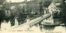
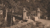
1850: Brivezac
Brivezac, Corrèze, France - Dordogne River
| Bridgemeister ID: | 1974 (added 2005-11-27) |
| Year Completed: | 1850 |
| Name: | Brivezac |
| Location: | Brivezac, Corrèze, France |
| Crossing: | Dordogne River |
| Status: | Removed |
| Suspended Spans: | 1 |
External Links:
Image Sets:
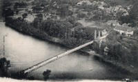
1850: Chain
Aarau, Switzerland - Aare River
| Bridgemeister ID: | 4761 (added 2020-06-28) |
| Year Completed: | 1850 |
| Name: | Chain |
| Also Known As: | Aarau Kettenbrücke |
| Location: | Aarau, Switzerland |
| Crossing: | Aare River |
| Coordinates: | 47.395431 N 8.042028 E |
| Maps: | Acme, GeoHack, Google, OpenStreetMap |
| Principals: | Jean Gaspard Dollfuss |
| References: | AAJ, PTS2 |
| Use: | Vehicular (one-lane) |
| Status: | Replaced, 1949 |
| Main Cables: | Eyebar (iron) |
| Suspended Spans: | 1 |
External Links:
- Kettenbrücke (Aarau) - Wikipedia. Notes bridge was opened for traffic December 28, 1850 and officially inaugurated January 6, 1851.
- Structurae - Structure ID 20043577
Image Sets:
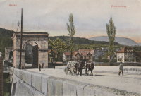
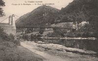
1850: Chambon
Saint-Merd-de-Lapleau, Auriac vicinity, Corrèze, France - Dordogne River
| Bridgemeister ID: | 7029 (added 2022-05-21) |
| Year Completed: | 1850 |
| Name: | Chambon |
| Location: | Saint-Merd-de-Lapleau, Auriac vicinity, Corrèze, France |
| Crossing: | Dordogne River |
| Use: | Vehicular (one-lane) |
| Status: | Removed |
| Main Cables: | Wire |
| Main Span: | 1 |
Notes:
- Later at same location Auriac (Chambon) - Saint-Merd-de-Lapleau, Auriac vicinity, Corrèze, France.
- All past and present bridges at this location.
External Links:
Image Sets:
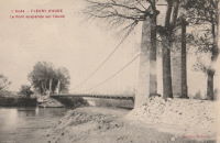
1850: Fleury-d'Aude
Fleury-d'Aude and Salles-d'Aude, Aude, France - Aude River
| Bridgemeister ID: | 1976 (added 2005-11-27) |
| Year Completed: | 1850 |
| Name: | Fleury-d'Aude |
| Also Known As: | Salles-d'Aude |
| Location: | Fleury-d'Aude and Salles-d'Aude, Aude, France |
| Crossing: | Aude River |
| Use: | Vehicular |
| Status: | Removed |
| Main Cables: | Wire |
| Suspended Spans: | 1 |
Image Sets:
1850: Greffier
Le Mans, Sarthe, France - Sarthe River
| Bridgemeister ID: | 4916 (added 2020-07-19) |
| Year Completed: | 1850 |
| Name: | Greffier |
| Also Known As: | Clerk's, Wire |
| Location: | Le Mans, Sarthe, France |
| Crossing: | Sarthe River |
| Coordinates: | 48.001128 N 0.189991 E |
| Maps: | Acme, GeoHack, Google, OpenStreetMap |
| References: | AAJ |
| Use: | Vehicular |
| Status: | Destroyed |
| Main Cables: | Wire (iron) |
Notes:
- Destroyed, 1871, to slow the advancing Prussian army.
External Links:
1850: Lamagistère
Lamagistère, Tarn-et-Garonne, France - Garonne River
| Bridgemeister ID: | 7174 (added 2022-07-01) |
| Year Completed: | 1850 |
| Name: | Lamagistère |
| Location: | Lamagistère, Tarn-et-Garonne, France |
| Crossing: | Garonne River |
| Coordinates: | 44.123345 N 0.819394 E |
| Maps: | Acme, GeoHack, Google, OpenStreetMap |
| Use: | Vehicular |
| Status: | Destroyed, 1875 |
| Main Cables: | Wire |
| Suspended Spans: | 2 |
| Main Spans: | 2 |
Notes:
- 1875: Wrecked by flood
- Replaced by 1876 Lamagistère - Lamagistère, Tarn-et-Garonne, France.
- All past and present bridges at this location.
External Links:
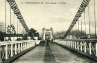
1850: Le Boulou
Le Boulou, Pyrénées-Orientales, France - Tech River
| Bridgemeister ID: | 1704 (added 2005-03-29) |
| Year Completed: | 1850 |
| Name: | Le Boulou |
| Location: | Le Boulou, Pyrénées-Orientales, France |
| Crossing: | Tech River |
| Use: | Vehicular |
| Status: | Demolished, 1962 |
| Main Cables: | Wire (iron) |
| Suspended Spans: | 1 |
| Main Span: | 1 x 120 meters (393.7 feet) |
| Deck width: | 5.74 meters |
External Links:
Image Sets:
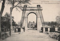
1850: Retournac
Retournac, Haute-Loire, France - Loire River
| Bridgemeister ID: | 4066 (added 2020-03-31) |
| Year Completed: | 1850 |
| Name: | Retournac |
| Location: | Retournac, Haute-Loire, France |
| Crossing: | Loire River |
| Use: | Vehicular |
| Status: | Destroyed, 1866 |
Notes:
- Destroyed by flood, 1866
- Replaced Retournac - Retournac, Haute-Loire, France.
- All past and present bridges at this location.
1850: Woodland Street
Nashville and Edgefield, Tennessee, USA - Cumberland River
| Bridgemeister ID: | 33 (added before 2003) |
| Year Completed: | 1850 |
| Name: | Woodland Street |
| Location: | Nashville and Edgefield, Tennessee, USA |
| Crossing: | Cumberland River |
| Coordinates: | 36.167833 N 86.775444 W |
| Maps: | Acme, GeoHack, Google, OpenStreetMap |
| Principals: | Adolphus Heiman, Mathew Dickinson Field |
| References: | AAJ |
| Use: | Vehicular |
| Status: | Destroyed, 1862 |
| Main Cables: | Wire (iron) |
| Main Span: | 1 x 164 meters (538 feet) |
Notes:
- Collapsed 1855, rebuilt, destroyed 1862 (possibly 1863). Was at site of present-day Woodland Street Bridge.
- Replaced by 1866 Woodland Street - Nashville and Edgefield, Tennessee, USA.
- All past and present bridges at this location.
External Links:
Image Sets:

1851: Chadrac
Chadrac, Haute-Loire, France - Loire River
| Bridgemeister ID: | 7864 (added 2023-09-15) |
| Year Completed: | 1851 |
| Name: | Chadrac |
| Location: | Chadrac, Haute-Loire, France |
| Crossing: | Loire River |
| Use: | Vehicular |
| Status: | Removed |
| Main Cables: | Wire (iron) |
| Suspended Spans: | 1 |
External Links:
Image Sets:
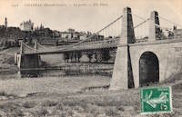
1851: High Falls Aqueduct
High Falls, New York, USA - Rondout Creek
| Bridgemeister ID: | 34 (added before 2003) |
| Year Completed: | 1851 |
| Name: | High Falls Aqueduct |
| Location: | High Falls, New York, USA |
| Crossing: | Rondout Creek |
| Coordinates: | 41.828889 N 74.126583 W |
| Maps: | Acme, GeoHack, Google, OpenStreetMap |
| Principals: | John A. Roebling |
| References: | AAJ, BOB, BPL, RDH, SJR |
| Use: | Aqueduct |
| Status: | Removed, August, 1921 |
| Main Cables: | Wire (iron) |
| Suspended Spans: | 1 |
| Main Span: | 1 x 44.2 meters (145 feet) |
Notes:
- BPL, AAJ say completed 1848, RDH says not used until 1851 canal season.
- Heavy damaged by fire, 1921.
- Built as part of same project as 1848 Delaware Aqueduct (Roebling Aqueduct) - Lackawaxen, Pennsylvania and Minisink Ford, New York, USA.
- Built as part of same project as 1849 Lackawaxen Aqueduct - Lackawaxen, Pennsylvania, USA.
- Built as part of same project as 1851 Neversink Aqueduct - Cuddebackville, New York, USA.
External Links:
1851: Lewiston-Queenston
Lewiston, New York, USA and Queenston, Ontario, Canada - Niagara River
| Bridgemeister ID: | 35 (added before 2003) |
| Year Completed: | 1851 |
| Name: | Lewiston-Queenston |
| Location: | Lewiston, New York, USA and Queenston, Ontario, Canada |
| Crossing: | Niagara River |
| Principals: | Edward Serrell |
| References: | AAJ, BOB, BPL, HBE, PTS2 |
| Use: | Vehicular |
| Status: | Wrecked, 1864 |
| Main Cables: | Wire (iron) |
| Suspended Spans: | 1 |
| Main Span: | 1 x 258.8 meters (849 feet) |
| Deck width: | 21 feet (AAJ: 19.5 feet) |
Notes:
- Wrecked by wind February 1, 1864. Stay cables beneath the bridge had been disconnected to avoid damage from rising ice. Portions of the cables and deck remained, in a derelict state, as late as 1895. Replacement was not started until the late 1890's.
- The February 3, 1864 edition of Niagara Falls Gazette describes the wind event: "Partial Destruction Of The Lewiston Suspension Bridge -- A portion of the flooring and other wood-work of the Lewiston Suspension Bridge was blown down during the gale Monday forenoon. It seems that the long guys had been cut during the late ice jam to prevent injury to the structure and thus its strength to withstand a gale was much weakened. The wind swept through the gorge on Monday with terrific force and swayed the bridge so that some of the cross timbers, near the centre were loosened from their fastenings, and fell, of course carrying the floor with them. A large portion at each end, remains without material injury. The extent of the damage -- financially -- we have not yet learned, but we judge from what we hear that it may be about $10,000. The bridge was built in 1852 and cost not far from $40,000. It will doubtless soon be repaired and in use."
- Later at same location 1899 Lewiston-Queenston - Lewiston, New York, USA and Queenston, Ontario, Canada.
- See 1849 Wheeling (Wheeling and Belmont) - Wheeling, West Virginia, USA. The 1851 Lewiston-Queenston bridge is sometimes claimed to have become the longest in the world with a main span surpassing the length of the Wheeling suspension bridge. However, Don Sayenga notes the length of the suspended span of the Lewiston-Queenston bridge was only 849 feet, not the 1,043 feet sometimes cited. Don writes: "[1,043 feet] was the distance between the towers built high up on the cliffs above the crossing - because there was no space for them below. The roadway suspended from the towers was only 849 feet span over the water from abutment to abutment." Thus, Roebling's Cincinnati bridge should be considered the first to eclipse Wheeling's record main span.
- All past and present bridges at this location.
External Links:
Image Sets:

1851: Neversink Aqueduct
Cuddebackville, New York, USA - Neversink River
| Bridgemeister ID: | 36 (added before 2003) |
| Year Completed: | 1851 |
| Name: | Neversink Aqueduct |
| Location: | Cuddebackville, New York, USA |
| Crossing: | Neversink River |
| Coordinates: | 41.459806 N 74.604889 W |
| Maps: | Acme, GeoHack, Google, OpenStreetMap |
| Principals: | John A. Roebling |
| References: | AAJ, BOB, RDH, SJR |
| Use: | Aqueduct |
| Status: | Removed |
| Main Cables: | Wire (iron) |
| Suspended Spans: | 1 |
| Main Span: | 1 x 51.8 meters (170 feet) |
Notes:
- BPL says 1849, RDH says not used until 1851 canal season.
- Built as part of same project as 1848 Delaware Aqueduct (Roebling Aqueduct) - Lackawaxen, Pennsylvania and Minisink Ford, New York, USA.
- Built as part of same project as 1849 Lackawaxen Aqueduct - Lackawaxen, Pennsylvania, USA.
- Built as part of same project as 1851 High Falls Aqueduct - High Falls, New York, USA.
External Links:
1851: Saint-Just-sur-Loire
Saint-Just-sur-Loire and Saint-Just-Saint-Rambert, Loire, France - Loire River
| Bridgemeister ID: | 2052 (added 2006-06-02) |
| Year Completed: | 1851 |
| Name: | Saint-Just-sur-Loire |
| Location: | Saint-Just-sur-Loire and Saint-Just-Saint-Rambert, Loire, France |
| Crossing: | Loire River |
| Coordinates: | 45.502806 N 4.259306 E |
| Maps: | Acme, GeoHack, Google, OpenStreetMap |
| Use: | Vehicular |
| Status: | Removed, c. 1931 |
| Main Cables: | Wire (iron) |
| Suspended Spans: | 1 |
Notes:
- 1926: Part of the deck fails under a heavily loaded truck. A replacement is completed in 1931.
- Near 1831 Andrézieux - Andrézieux, Loire, France.
- Near future location of 2008 Saint-Just-Saint-Rambert (Grand) - Saint-Just-Saint-Rambert, Loire, France.
External Links:
Image Sets:


| Bridgemeister ID: | 2076 (added 2006-06-10) |
| Year Completed: | 1851 |
| Name: | Sérignan |
| Location: | Sérignan, Béziers vicinity, Hérault, France |
| Crossing: | Orb River |
| Coordinates: | 43.285011 N 3.281313 E |
| Maps: | Acme, GeoHack, Google, OpenStreetMap |
| Use: | Vehicular |
| Status: | Replaced, c. 1909 |
| Suspended Spans: | 1 |
Notes:
- Near future location of 2016 Sérignan - Sérignan, Béziers, Hérault, France.
Image Sets:

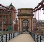
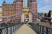
1851: South Portland
Glasgow, Scotland, United Kingdom - River Clyde
| Bridgemeister ID: | 404 (added before 2003) |
| Year Completed: | 1851 |
| Name: | South Portland |
| Also Known As: | Carlton |
| Location: | Glasgow, Scotland, United Kingdom |
| Crossing: | River Clyde |
| Coordinates: | 55.85433 N 4.25618 W |
| Maps: | Acme, GeoHack, Google, OpenStreetMap |
| Principals: | Alexander Kirkland, George Martin |
| References: | BEM, NTB |
| Use: | Footbridge |
| Status: | In use (last checked: 2019) |
| Main Cables: | Eyebar (iron) |
| Suspended Spans: | 1 |
Notes:
- 1853 sometimes cited as the year it opened.
External Links:
Image Sets:
1851: Trévoux
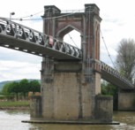
Trévoux, Ain and Quincieux, Métropole de Lyon, France - Saône River
| Bridgemeister ID: | 1625 (added 2005-02-27) |
| Year Completed: | 1851 |
| Name: | Trévoux |
| Location: | Trévoux, Ain and Quincieux, Métropole de Lyon, France |
| Crossing: | Saône River |
| Coordinates: | 45.93945 N 4.772417 E |
| Maps: | Acme, GeoHack, Google, OpenStreetMap |
| Use: | Vehicular (one-lane) |
| Status: | Restricted to foot traffic (last checked: 2020) |
| Main Cables: | Wire (iron) |
| Suspended Spans: | 2 |
| Main Spans: | 2 |
Notes:
- Partially dismantled, 1982. Restored as a footbridge, 1985.
External Links:
Image Sets:
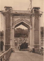
1851: Řetězový
Ostrava, Czechia - Ostravice River
| Bridgemeister ID: | 8428 (added 2024-03-08) |
| Year Completed: | 1851 |
| Name: | Řetězový |
| Also Known As: | Kettenbrücke |
| Location: | Ostrava, Czechia |
| Crossing: | Ostravice River |
| Principals: | Josef Seifert |
| References: | PTS2 |
| Use: | Vehicular |
| Status: | Collapsed, 1886 |
| Main Cables: | Chain (iron) |
| Main Span: | 1 |
External Links:
- Encyklopedie.Ostrava.cz - Zřícení řetězového mostu přes Ostravici v roce 1886. Article about the collapse of the bridge.
- HistorickaOstrava.cz - Kettenbrücke – Řetězový most (1851-1886). History and images of the bridge, including the 1886 collapse.
1852: (suspension bridge)
Frankfort, Kentucky, USA - Kentucky River
| Bridgemeister ID: | 1714 (added 2005-04-03) |
| Year Completed: | 1852 |
| Name: | (suspension bridge) |
| Location: | Frankfort, Kentucky, USA |
| Crossing: | Kentucky River |
| Coordinates: | 38.201998 N 84.881934 W |
| Maps: | Acme, GeoHack, Google, OpenStreetMap |
| Principals: | Mathew Dickinson Field |
| References: | AAJ, ENG18570605, HBE, HOF |
| Use: | Rail |
| Status: | Removed |
| Main Cables: | Wire (iron) |
| Suspended Spans: | 2 |
| Main Spans: | 1 x 61 meters (200 feet) estimated, 1 x 91.4 meters (300 feet) estimated |
Notes:
- An early attempt at a railroad suspension bridge, it was significantly reconstructed (because of excessive vibrations and increasing loads) by Julius W. Adams in 1857 to have three spans of 120, 163, and 163 feet. It is unclear whether the new structure was also a suspension bridge.
- HOF describes the location as "between the foot of Broadway and the neck of land near the mouth of Benson Creek." The coordinates provided here are for the later rail crossing at that general location, likely at or very close to the site of the suspension bridge.
1852: Aamodt
Åmot, Modum, Viken, Norway - Drammenselva
| Bridgemeister ID: | 969 (added 2003-11-01) |
| Year Completed: | 1852 |
| Name: | Aamodt |
| Also Known As: | Åmot, Aamot |
| Location: | Åmot, Modum, Viken, Norway |
| Crossing: | Drammenselva |
| Coordinates: | 59.895203 N 9.913852 E |
| Maps: | Acme, GeoHack, Google, kart.1881.no, OpenStreetMap |
| Use: | Vehicular (one-lane) |
| Status: | Dismantled (last checked: 2018) |
| Main Cables: | Eyebar |
| Suspended Spans: | 1 |
| Main Span: | 1 x 53 meters (173.9 feet) |
Notes:
- Moved to 1958 Aamodt (Åmot, Aamot) - Oslo, Norway.
External Links:
- DigitaltMuseum - Aamodt hengebru over Drammenselva i Åmot, Modum. Oppført 1851-52
- DigitaltMuseum - Ved Kongsfoss Åmot bro ble bygget i 1853
- DigitaltMuseum - Åmot bru (Aamodt bro)
- DigitaltMuseum - Åmot bru (Aamodt bro)
- Structurae - Structure ID 20072046
Image Sets:
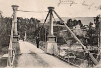
1852: Charleston
Charleston, West Virginia, USA - Elk River
| Bridgemeister ID: | 38 (added before 2003) |
| Year Completed: | 1852 |
| Name: | Charleston |
| Also Known As: | Lovell Street |
| Location: | Charleston, West Virginia, USA |
| Crossing: | Elk River |
| Coordinates: | 38.358222 N 81.639861 W |
| Maps: | Acme, GeoHack, Google, OpenStreetMap |
| Principals: | W. O. Buchanan, William Kuhn, Abraham Wright |
| References: | AAJ, EOV, HBE, PTS2 |
| Use: | Vehicular |
| Status: | Collapsed, December 15, 1904 |
| Main Cables: | Wire (iron) |
| Suspended Spans: | 1 |
| Main Span: | 1 x 145.7 meters (478 feet) |
| Deck width: | 17 feet |
Notes:
- Was still part of Virginia at time of completion. The bridge was located on (or close to) the alignment of Washington Street. East Charleston's Lovell Street eventually became East Washington Street.
- Damaged during Civil War. An article in the August 2, 1861 issue of the New York Times mentions: "A junction of our forces having now been effected, the army at once moved on to Elk River, which debouches into the Kanawha at Charleston, where the army encamped for the night. We would have crossed the stream at once, and marched through the town the same evening, but for the fact that the rebels had partially destroyed the beautiful suspension bridge which spans Elk River at this spot, rendering it unsafe for passage. Not content with burning a portion of the flooring, they nearly severed the strands which support the structure, and aid their work, too, in the most bungling manner. A more shameless piece of vandalism I never witnessed. While the army slept, a company of sappers and miners repaired the damage, and yesterday the army, nearly five thousand strong, marched through the streets of Charleston."
- Near 1884 Spring Street (Virginia Street) - Charleston, West Virginia, USA.
External Links:
Image Sets:


1852: Colgante de Manila
Manila, Philippines - Pasig River
| Bridgemeister ID: | 2112 (added 2006-09-03) |
| Year Completed: | 1852 |
| Name: | Colgante de Manila |
| Also Known As: | Claveria |
| Location: | Manila, Philippines |
| Crossing: | Pasig River |
| Use: | Vehicular |
| Status: | Replaced, 1940 |
| Suspended Spans: | 1 |
| Main Span: | 1 x 110 meters (360.9 feet) |
| Deck width: | 7 meters |
Notes:
- Rene Sumodobila writes: "It had a single lane in each travel way to allow passage of horse-drawn carriages and a pedestrian island in the middle. The Puente Colgante is said to be first suspension bridge in the Far East. The bridge materials were imported from England by Matia Menchacatorre y Cia, a Spanish company, in joint venture with Ayala y Cia, a local company. The contruction was supervised by M. Gabaud, a French engineer. Inaugurated in January 4, 1852, it went into service until 1940 in order to give way to the modern-day Quezon Bridge"
External Links:
Image Sets:


1852: Fairmont and Palatine
Fairmont, West Virginia, USA - Monongahela River
| Bridgemeister ID: | 39 (added before 2003) |
| Year Completed: | 1852 |
| Name: | Fairmont and Palatine |
| Location: | Fairmont, West Virginia, USA |
| Crossing: | Monongahela River |
| Coordinates: | 39.482944 N 80.139611 W |
| Maps: | Acme, GeoHack, Google, OpenStreetMap |
| Principals: | James L. Randolph |
| References: | EOV, PTS2 |
| Use: | Vehicular |
| Status: | Removed, 1908 |
| Main Cables: | Wire (iron) |
| Suspended Spans: | 1 |
Notes:
- Was still part of Virginia at time of completion.
Image Sets:

1852: Gaillac
Gaillac, Tarn, France - Tarn River
| Bridgemeister ID: | 1646 (added 2005-03-18) |
| Year Completed: | 1852 |
| Name: | Gaillac |
| Location: | Gaillac, Tarn, France |
| Crossing: | Tarn River |
| At or Near Feature: | Abbaye Saint-Michel |
| Coordinates: | 43.897361 N 1.894751 E |
| Maps: | Acme, GeoHack, Google, OpenStreetMap |
| Use: | Vehicular |
| Status: | Removed |
| Main Cables: | Wire (iron) |
| Suspended Spans: | 1 |
Image Sets:
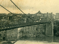

1852: Huse
Yeomet, California, USA - Cosumnes River
| Bridgemeister ID: | 1088 (added 2004-01-01) |
| Year Completed: | 1852 |
| Name: | Huse |
| Location: | Yeomet, California, USA |
| Crossing: | Cosumnes River |
| Coordinates: | 38.55323 N 120.84755 W |
| Maps: | Acme, GeoHack, Google, OpenStreetMap |
| Principals: | E.P. Bowman |
| Use: | Vehicular |
| Status: | Removed |
| Main Cables: | Wire (iron) |
Notes:
- Yeomet was located near the present day California Route 49 crossing of the Cosumnes River by the confluence of the North Fork and Middle Fork of the Cosumnes River. Yeomet was once known as "Forks of the Cosumnes." The location coordinates provided here are only to show the approximate location of the confluence and should not be considered the exact location of the bridge. This inventory entry represents the suspension bridge for which a photograph exists in the Lawrence & Houseworth collection titled "Suspension Bridge over the Cosumnes River, At Yeomet, El Dorado County". This image exists in several online archives.
- Barry Parr, consulting Erwin Gudde's California Gold Camps (University of California Press), writes that Gudde notes the bridge is located "at Yeomet and says it was marked on the County Map in 1866, and was owned by S.E. Huse for a decade. Of Yeomet, Gudde writes: 'Amador County. At the junction of the forks of Cosumnes River, formerly in El Dorado County'. Gudde says the camp developed in 1849 or 1850 and prospered for a number of years, but says nothing further about the bridge." Barry also notes that some sources cite Yeomet as located in Calaveras County, but this is because Amador County was created in 1854 from Calaveras County. Barry continues: "The California Division of Mines Bulletin 141, Geological Guidebook along Highway 49, mentions the Highway 49 bridge across the Cosumnes as also known as the Huse Bridge."
- The October 14, 1976 edition of The Mountain Democrat Times (Placerville, California) has an article about the Huse Bridge (from the Heritage Association of El Dorado) describing Huse's Bridge:
"E.P. Bowman, an early motel keeper in Yeomet had a ferry across the Cosumnes and by 1852 had built a bridge there (J.M. Watrous had a ferry there also). Traffic was heavy and... [the tolls were] as much a 'gold mine' as most of the nearby river claims which ran for miles above and below the town. (Yeomet falls was below the bridge). The famous Mother Lode crossed the river in the vicinity of the town. Samuel Huse bought the bridge at Yeomet in about 1862 and owned it until his death. His widow Laura sold the wire suspension bridge and the exclusive right to collect tolls to John Ballard and W.H. Martin in 1883. William Miller purchased the property in 1887."
It is unclear if the 1852 E.P. Bowman bridge was the same structure as the suspension bridge purchased by Huse ten years later, but it has been assumed here pending additional details. - An obituary for in the August 28, 1949 edition of the Oakland Tribune for Lilian Williams presents a stronger tie between E.P. Bowman and S.E. Huse: "With her foster parents, the E. P. Bowmans, Mrs. Williams spent her childhood in Oakland, San Francisco and Yeomet, between Plymouth and Placerville. Bowman and her foster uncle, S.E. Huse, owned a hotel at Yeomet. They also built and operated a toll bridge there on the Cosumnes River, over which most of the heavy machinery and mining equipment was transported to the old Mother Lode mines."
- See 1852 Wilson's - Cosumne, California, USA.
- See 1863 Lamb's - Latrobe vicinity and Plymouth vicinity, California, USA.
External Links:
1852: Mazères-sur-Salat
Mazères-sur-Salat, Haute-Garonne, France - Salat River
| Bridgemeister ID: | 7201 (added 2022-07-04) |
| Year Completed: | 1852 |
| Name: | Mazères-sur-Salat |
| Location: | Mazères-sur-Salat, Haute-Garonne, France |
| Crossing: | Salat River |
| Coordinates: | 43.132556 N 0.975981 E |
| Maps: | Acme, GeoHack, Google, OpenStreetMap |
| Use: | Vehicular (one-lane) |
| Status: | Removed |
| Main Cables: | Wire (iron) |
Notes:
- Later at same location Mazères-sur-Salat - Mazères-sur-Salat, Haute-Garonne, France. Unclear if the later bridge was a direct replacement.
- All past and present bridges at this location.
External Links:
Image Sets:

1852: Merle
Merle, Corrèze, France - Maronne River
| Bridgemeister ID: | 3030 (added 2019-10-13) |
| Year Completed: | 1852 |
| Name: | Merle |
| Location: | Merle, Corrèze, France |
| Crossing: | Maronne River |
| Coordinates: | 45.061779 N 2.080386 E |
| Maps: | Acme, GeoHack, Google, OpenStreetMap |
| Use: | Vehicular (one-lane) |
| Status: | Replaced, 1999 |
| Main Cables: | Wire (iron) |
| Suspended Spans: | 1 |
Notes:
- As of 2019, piers still present beyond the ends of its replacement bridge.
Image Sets:


1852: Pey
Blantyre, Scotland, United Kingdom - River Clyde
| Bridgemeister ID: | 2633 (added 2019-02-24) |
| Year Completed: | 1852 |
| Name: | Pey |
| Also Known As: | Mill, Toll, Swing |
| Location: | Blantyre, Scotland, United Kingdom |
| Crossing: | River Clyde |
| Coordinates: | 55.801972 N 4.081433 W |
| Maps: | Acme, GeoHack, Google, OpenStreetMap |
| Principals: | Henry Monteith & Co |
| Use: | Footbridge |
| Status: | Removed, 1949 |
| Main Cables: | Rod (iron) |
| Suspended Spans: | 3 |
| Main Span: | 1 |
| Side Spans: | 2 |
Notes:
- Dredge patent bridge.
Image Sets:

1852: Queens Park
Chester and Handbridge, England, United Kingdom - River Dee
| Bridgemeister ID: | 405 (added before 2003) |
| Year Completed: | 1852 |
| Name: | Queens Park |
| Location: | Chester and Handbridge, England, United Kingdom |
| Crossing: | River Dee |
| Principals: | Enoch Gerrard |
| References: | BRB, NTB |
| Use: | Footbridge |
| Status: | Replaced |
| Main Cables: | Chain (iron) |
| Suspended Spans: | 3 |
| Main Span: | 1 |
| Side Spans: | 2 |
Notes:
- Replaced by 1923 Queens Park - Chester and Handbridge, England, United Kingdom.
- All past and present bridges at this location.
Image Sets:
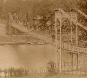


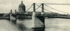
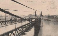
1852: Saint-Pierre
Toulouse, Haute-Garonne, France - Garonne River
| Bridgemeister ID: | 1169 (added 2004-01-23) |
| Year Completed: | 1852 |
| Name: | Saint-Pierre |
| Location: | Toulouse, Haute-Garonne, France |
| Crossing: | Garonne River |
| Coordinates: | 43.602179 N 1.434706 E |
| Maps: | Acme, GeoHack, Google, OpenStreetMap |
| References: | PTS2 |
| Use: | Vehicular |
| Status: | Demolished, 1927 |
| Main Cables: | Wire (iron) |
| Suspended Spans: | 4 |
| Main Spans: | 2 |
| Side Spans: | 2 |
Notes:
- Heavily damaged by flood, 1875. A metal arch bridge, completed 1987, is at this location now.
- Replaced by 1931 Saint-Pierre - Toulouse, Haute-Garonne, France.
- All past and present bridges at this location.
External Links:
Image Sets:

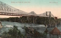
1852: St. John
St. John, New Brunswick, Canada - St. John River
| Bridgemeister ID: | 37 (added before 2003) |
| Year Completed: | 1852 |
| Name: | St. John |
| Location: | St. John, New Brunswick, Canada |
| Crossing: | St. John River |
| Principals: | Edward Serrell |
| References: | AAJ, BPL, HBE, PTS2 |
| Use: | Vehicular (one-lane) |
| Status: | Removed, 1915 |
| Main Cables: | Wire (iron) |
| Suspended Spans: | 1 |
| Main Span: | 1 x 195.1 meters (640 feet) |
Notes:
- Rebuilt 1857.
External Links:
Image Sets:


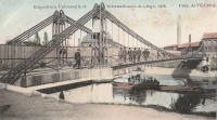
1852: Vennes
Liège, Belgium - Meuse Dérivation
| Bridgemeister ID: | 2319 (added 2007-05-05) |
| Year Completed: | 1852 |
| Name: | Vennes |
| Also Known As: | Boverie, Englebert |
| Location: | Liège, Belgium |
| Crossing: | Meuse Dérivation |
| Coordinates: | 50.62959 N 5.57801 E |
| Maps: | Acme, GeoHack, Google, OpenStreetMap |
| References: | IBB |
| Use: | Vehicular |
| Status: | Removed, 1905 or 1906 |
| Main Cables: | Chain (iron) |
| Suspended Spans: | 1 |
Notes:
- Adjacent replacement completed in 1903. The suspension bridge was still standing at the time of the world's fair (Exposition Universelle et Internationale de Liège) held in Liège in 1905.
- IBB: Precise construction date unknown, but was in time frame 1852-1864. Other sources cite 1852.
- Coordinates refer to the current Vennes Bridge. This is the approximate location of the removed suspension bridge.
External Links:
- Pont des Vennes — Wikipédia
- PONTS SUSPENDUS - Les ponts métalliques historiques belges. Details about this bridge and several other Belgium suspension bridges.
Image Sets:
1852: Veurey
Veurey-Voroize, Isère, France - Isère River
| Bridgemeister ID: | 4880 (added 2020-07-18) |
| Year Completed: | 1852 |
| Name: | Veurey |
| Location: | Veurey-Voroize, Isère, France |
| Crossing: | Isère River |
| Coordinates: | 45.271117 N 5.621434 E |
| Maps: | Acme, GeoHack, Google, OpenStreetMap |
| References: | AAJ |
| Use: | Vehicular |
| Status: | Destroyed, 1928 |
| Main Cables: | Wire (iron) |
Notes:
- 1928: Destroyed by flood.
- Replaced by 1933 Veurey - Veurey-Voroize, Isère, France.
- All past and present bridges at this location.
Image Sets:
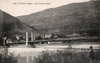
1852: Wilson's
Cosumne, California, USA - Cosumnes River
| Bridgemeister ID: | 2116 (added 2006-09-10) |
| Year Completed: | 1852 |
| Name: | Wilson's |
| Location: | Cosumne, California, USA |
| Crossing: | Cosumnes River |
| Coordinates: | 38.49229 N 121.17183 W |
| Maps: | Acme, GeoHack, Google, OpenStreetMap |
| Principals: | W. D. Wilson |
| References: | DSL200106 |
| Use: | Vehicular |
| Status: | Removed |
| Main Cables: | Wire |
| Main Span: | 1 x 45.7 meters (150 feet) |
| Deck width: | 12 feet |
Notes:
- The location of this bridge was near the present day location of Cosumne in Sacramento County, just east of Sloughhouse. The location coordinates provided here are only to show the approximate location of present-day Cosumne and should not be considered the exact location of the bridge. Don Sayenga writes: "The exact location was at the intersection of [present-day] Dillard Road and State Route 16 a very short distance east of Sloughhouse, Sacramento County, California... The whole area at that time was known as Daylor's Ranch."
- Don Sayenga notes an F.W. Panhorst (of the California Highway Department) citation:
"Alta California July 27, 1852 reprinting an article from Sacramento Union mentions a wire suspension bridge built in Sacramento County across the Cosumnes. The span is described as 150 feet with a roadway width of 12 feet. One W.D. Wilson is mentioned as owner and designer. This structure, according to our best information, was the first suspension bridge in California."
- A January 14, 1862 Sacramento Bee article notes:
"The quartz mill and house of the brothers Wiley, just beyond Butte City, were carried away by the torrent. At Ione City, William's brick stable had fallen, and several other houses had met with a like fate. On Sutter creek, the loss and damage had been terrific - bridges and houses being carried off like chaff. Mr. Haywood, proprietor of a quartz mill on Sutter creek, had been a loser to the amount of at least $75,000. We have it from good authority that in the counties of Calaveras and Amador not a bridge is left standing. Below Ione City, it is thought that there has been loss of life."
which seems to imply a relationship between the Ione Valley, the Cosumnes River, and the bridge at Wilson's Exchange, but this may have just been coincidental that both "Ione Valley" and Wilson's Exchange were mentioned in the same paragraph; they are nearby. Present-day Ione is in Amador County a few miles east of Sacramento County. The Cosumnes River forms the northern border of Amador County several miles to the north of present-day Ione. Barry Parr notes that the Cosumnes River does not flow through the "Ione Valley," but Barry writes: "Recalling Daylor’s name in Historic Spots of California: 'Daylor established himself as a trader and hotel-keeper on the Cosumnes River about a mile east of Slough House. This place, which was at first known as Daylor’s Ranch, later became the Cosumnes post office.' (p. 290) The site of Cosumnes post office is about five miles downstream from Bridge House, and both are on the Sacramento-Ione Road.
"Last Saturday night, the reports of minute guns were heard, as if signals of distress, coming from the direction of a house where lived Mr. Martin and his family. The whole of Ione Valley was many feet under water. No boats were to be had, so that assistance might be rendered those in danger and distress. In a short time a heavy crash was heard, the signals of distress ceased, and our informant tells us that when he left the general impression was that Martin and his family had lost their lives. The wire suspension bridge over the Cosumnes river had disappeared - the house known as Wilson’s Exchange has also been washed away, and Daylor’s adobe house is flat with the ground. These facts go to show that throughout the mountain districts, as well as in the valleys, the destruction of property and loss of human life exceed the worst that was anticipated, and we shall hear repetitions of such tales of distress as the avenues for communication are gradually opened to us." - See 1852 Huse - Yeomet, California, USA.
- See 1863 Lamb's - Latrobe vicinity and Plymouth vicinity, California, USA.
External Links:
- Oliver Plummer. Transcription by Debbie Walke Gramlick of passage from An Illustrated History of Sacramento County, California. (by Hon. Win. J. Davis, Lewis Publishing Company, 1890, Pages 435-436) which sheds more light on W.D. Wilson.
"Mr. Wilson and part of the company concluded to seek the land of gold, while others kept to the original design of going to Oregon. On his arrival Mr. Wilson mined for a short time on Mormon Island and then moved to Hangtown, now Placerville, where in the winter of 1848-49 he built the first house erected in that place. The family then comprised six children; five more were born in California; nine grew to maturity and seven are living in 1889. In the spring of 1850 he moved down on the Cosumnes and purchased 6,000 acres of the Hartnell Grant, and built a tavern, long known as Wilson’s Exchange, across the river from what is now the Cosumnes post office. He was postmaster from the establishment of that office until 1868. He was by trade a millwright and built the first suspension bridge on the Cosumnes."
1853: (suspension bridge)
Delaware, Ohio, USA - Olentangy River
| Bridgemeister ID: | 774 (added 2003-03-14) |
| Year Completed: | 1853 |
| Name: | (suspension bridge) |
| Location: | Delaware, Ohio, USA |
| Crossing: | Olentangy River |
| At or Near Feature: | Winter Street |
| Principals: | John Gray |
| References: | SME20030311 |
| Use: | Footbridge |
| Status: | Destroyed, February 1883 |
| Main Cables: | Wire (iron) |
| Main Span: | 1 x 61 meters (200 feet) estimated |
Notes:
- SME20030311: Intended only for foot traffic, destroyed by ice jam February 1883.
1853: Chain
Ostrov, Pskov Oblast, Russia - Velikaya River
| Bridgemeister ID: | 4644 (added 2020-06-16) |
| Year Completed: | 1853 |
| Name: | Chain |
| Also Known As: | Tsepnyye, Цепные |
| Location: | Ostrov, Pskov Oblast, Russia |
| Crossing: | Velikaya River |
| Coordinates: | 57.340559 N 28.352457 E |
| Maps: | Acme, GeoHack, Google, OpenStreetMap |
| References: | PTS2 |
| Use: | Vehicular |
| Status: | Restricted to foot traffic (last checked: 2016) |
| Main Cables: | Eyebar (iron) |
| Suspended Spans: | 1 |
Notes:
- Connects to 1853 Chain (Tsepnyye, Цепные) - Ostrov, Pskov Oblast, Russia.
- All past and present bridges at this location.
External Links:
Image Sets:
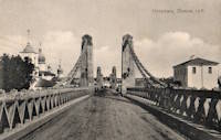
1853: Chain
Ostrov, Pskov Oblast, Russia - Velikaya River
| Bridgemeister ID: | 4645 (added 2020-06-16) |
| Year Completed: | 1853 |
| Name: | Chain |
| Also Known As: | Tsepnyye, Цепные |
| Location: | Ostrov, Pskov Oblast, Russia |
| Crossing: | Velikaya River |
| Coordinates: | 57.338893 N 28.351235 E |
| Maps: | Acme, GeoHack, Google, OpenStreetMap |
| References: | PTS2 |
| Use: | Vehicular |
| Status: | Restricted to foot traffic (last checked: 2016) |
| Main Cables: | Eyebar (iron) |
| Suspended Spans: | 1 |
Notes:
- Connects to 1853 Chain (Tsepnyye, Цепные) - Ostrov, Pskov Oblast, Russia.
- All past and present bridges at this location.
External Links:
Image Sets:

1853: Dresden
Dresden, Ohio, USA - Muskingum River
| Bridgemeister ID: | 43 (added before 2003) |
| Year Completed: | 1853 |
| Name: | Dresden |
| Location: | Dresden, Ohio, USA |
| Crossing: | Muskingum River |
| Coordinates: | 40.120889 N 81.999917 W |
| Maps: | Acme, GeoHack, Google, OpenStreetMap |
| Principals: | George Copland |
| References: | EOV, GBD, OCEN198202 |
| Use: | Vehicular |
| Status: | Destroyed, 1913 |
| Main Cables: | Wire (iron) |
| Suspended Spans: | 1 |
Notes:
- Destroyed by flood 1913.
- Replaced by 1914 Dresden - Dresden, Ohio, USA.
- All past and present bridges at this location.
External Links:
Image Sets:

1853: Falmouth
Falmouth, Kentucky, USA - Licking River
| Bridgemeister ID: | 42 (added before 2003) |
| Year Completed: | 1853 |
| Name: | Falmouth |
| Location: | Falmouth, Kentucky, USA |
| Crossing: | Licking River |
| Coordinates: | 38.678056 N 84.328222 W |
| Maps: | Acme, GeoHack, Google, OpenStreetMap |
| Principals: | D. Griffith Smith |
| References: | AAJ, EOV |
| Use: | Vehicular |
| Status: | Collapsed, 1868 |
| Main Cables: | Wire (iron) |
| Main Span: | 1 x 98.5 meters (323 feet) |
Notes:
- 1854: A brief article in March 22, 1854 Louisville Daily Courier states the bridge was destroyed ("rendering the whole structure useless… it cannot even be repaired") in the early 1854 flood that destroyed other Licking River bridges. However, other sources indicate the Falmouth bridge survived the flood. Unclear if it was completely destroyed and rebuilt or just damaged and repaired.
- Coordinates provided here indicate the likely location of the bridge over the main branch of the Licking River.
External Links:
- New Licking Bridge Stands On The Foundation of Its Predecessors - Rootsweb.com. Several anecdotes and snippets of history about the bridge. Indicates the bridge survived the January 1854 Licking River flood and survived until 1868.
1853: Fort Hunter
Tribes Hill and Fort Hunter, New York, USA - Mohawk River
| Bridgemeister ID: | 44 (added before 2003) |
| Year Completed: | 1853 |
| Name: | Fort Hunter |
| Also Known As: | Fonda |
| Location: | Tribes Hill and Fort Hunter, New York, USA |
| Crossing: | Mohawk River |
| Coordinates: | 42.945500 N 74.287028 W |
| Maps: | Acme, GeoHack, Google, OpenStreetMap |
| Principals: | John W. Murphy, Thomas R. Hulett |
| References: | ONC, PTS2 |
| Use: | Vehicular |
| Status: | Dismantled, 1935 |
| Main Cables: | Wire (iron) |
| Suspended Spans: | 1 |
| Main Span: | 1 x 169.5 meters (556 feet) |
Notes:
- According to ONC: Designed by John W. Murphy (who designed several suspension bridges in the 1850s and 1860s in New York and Pennsylvania). Fort Hunter Suspension Bridge Company incorporated in 1852, but cables were not installed until 1853.
- Crossed the Mohawk River on the old alignment of Main Street, east of the current Main Street bridge, at the ends of the streets now known as Brown Place in Fort Hunter and Locust Avenue in Tribes Hill.
- 1935: Bridge is dismantled (ONC).
External Links:
Image Sets:


1853: General's Well
Inverness, Scotland, United Kingdom - River Ness
| Bridgemeister ID: | 406 (added before 2003) |
| Year Completed: | 1853 |
| Name: | General's Well |
| Location: | Inverness, Scotland, United Kingdom |
| Crossing: | River Ness |
| At or Near Feature: | Ness Islands |
| Coordinates: | 57.460944 N 4.237166 W |
| Maps: | Acme, GeoHack, Google, OpenStreetMap |
| Principals: | James Dredge |
| References: | HBR |
| Use: | Footbridge |
| Status: | In use (last checked: 2014) |
| Main Cables: | Rod (iron) |
| Suspended Spans: | 3 |
| Main Span: | 1 |
| Side Spans: | 2 |
Notes:
- Relocated to a nearby park (Whin Park) where it carries a miniature railway, 1988. The coordinates listed here are for that later (miniature railway park) location.
- Companion to 1853 Island Bank Road - Inverness, Scotland, United Kingdom.
- See 1988 (footbridge) - Inverness, Scotland, United Kingdom.
- See 1988 (footbridge) - Inverness, Scotland, United Kingdom.
External Links:
Image Sets:


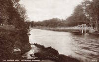
1853: Island Bank Road
Inverness, Scotland, United Kingdom - River Ness
| Bridgemeister ID: | 904 (added 2003-10-11) |
| Year Completed: | 1853 |
| Name: | Island Bank Road |
| Location: | Inverness, Scotland, United Kingdom |
| Crossing: | River Ness |
| At or Near Feature: | Ness Islands |
| Principals: | James Dredge |
| References: | HBR |
| Use: | Footbridge |
| Status: | Removed |
Notes:
- Companion to 1853 General's Well - Inverness, Scotland, United Kingdom.
- See 1988 (footbridge) - Inverness, Scotland, United Kingdom.
- See 1988 (footbridge) - Inverness, Scotland, United Kingdom.
Image Sets:
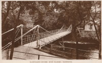
1853: Licking River
Covington and Newport, Kentucky, USA - Licking River
| Bridgemeister ID: | 47 (added before 2003) |
| Year Completed: | 1853 |
| Name: | Licking River |
| Location: | Covington and Newport, Kentucky, USA |
| Crossing: | Licking River |
| Coordinates: | 39.088056 N 84.504667 W |
| Maps: | Acme, GeoHack, Google, OpenStreetMap |
| Principals: | John Gray, George C. Tarvin |
| References: | BOB, BPL, EOV |
| Use: | Vehicular |
| Status: | Collapsed, January 16, 1854 |
| Main Cables: | Wire (iron) |
| Main Span: | 1 |
Notes:
- BPL: Collapsed under weight of cattle 1853. BOB: Indicates year of completion and collapse as 1854. EOV: Appears more authoritative on the matter, "Although the bridge was not quite finished, Tarvin and the mayor of Covington rode the first vehicle across it on December 28, 1853. Less than two weeks later... the bridge collapsed."
- The January 18, 1854 edition of The New York Times has a small article with a January 16, 1854 byline reporting the collapse of the bridge: "The... bridge... gave way this evening, while two men and eighteen cattle were crossing it... The keys which held the wire cable to the anchors gave way."
- Replaced by 1854 Licking River - Covington and Newport, Kentucky, USA.
- All past and present bridges at this location.
External Links:
- Northern Kentucky Tribune - Our Rich History: Newport and Covington Suspension Bridge was completed in 1853. Article dated November 18, 2019. Summarizes the suspension bridge history at this location.
1853: Mill Pond
Kingfield, Maine, USA - Carrabasset River
| Bridgemeister ID: | 45 (added before 2003) |
| Year Completed: | 1853 |
| Name: | Mill Pond |
| Location: | Kingfield, Maine, USA |
| Crossing: | Carrabasset River |
| Principals: | Daniel Beedy |
| References: | AAJ, BPL |
| Use: | Vehicular (one-lane), with walkway |
| Status: | Replaced, 1916 |
| Main Cables: | Chain (iron) |
| Main Span: | 1 x 57.9 meters (190 feet) |
| Deck width: | 15 feet |
Notes:
- Similar to 1856 Strong - Strong, Maine, USA.
Image Sets:


1853: O'Byrne's
Copperopolis vicinity, California, USA - Stanislaus River
| Bridgemeister ID: | 2324 (added 2007-05-06) |
| Year Completed: | 1853 |
| Name: | O'Byrne's |
| Location: | Copperopolis vicinity, California, USA |
| Crossing: | Stanislaus River |
| Use: | Vehicular |
| Status: | Destroyed, 1862 |
Notes:
- Different accounts describe this as a chain and wire suspension bridge. Collapsed November, 1853 under weight of oxen team. Rebuilt, but destroyed by flood, 1862. Replaced by a multi-span covered bridge.
- Name "O'Byrne's" appears to have originated with a "Patrick O. Byrne" who operated a ferry at this location prior to construction of the suspension bridge. After time, it became known as O'Byrne's Ferry.
1853: Parcey
Parcey, Jura, France - Loue River
| Bridgemeister ID: | 2073 (added 2006-06-09) |
| Year Completed: | 1853 |
| Name: | Parcey |
| Location: | Parcey, Jura, France |
| Crossing: | Loue River |
| Use: | Vehicular |
| Status: | Removed |
| Main Cables: | Wire |
| Suspended Spans: | 1 |
External Links:
Image Sets:

1853: Peney
Peney, Satigny vicinity, Geneva, Switzerland - Rhône River
| Bridgemeister ID: | 1827 (added 2005-05-30) |
| Year Completed: | 1853 |
| Name: | Peney |
| Location: | Peney, Satigny vicinity, Geneva, Switzerland |
| Crossing: | Rhône River |
| Principals: | Hug |
| References: | AAJ, GHD |
| Use: | Vehicular |
| Status: | Collapsed, May 24, 1853 |
| Main Cables: | Wire (iron) |
| Suspended Spans: | 1 |
| Main Span: | 1 x 100 meters (328.1 feet) |
Notes:
- GHD describes how Dufour designed the bridge but was replaced (for political reasons) by a novice engineer, Mr. Hug who produced his own design. The bridge collapsed under test loading.
Image Sets:
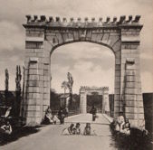
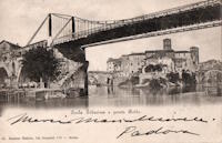
1853: Rotto
Rome, Italy - Tiber River
| Bridgemeister ID: | 6833 (added 2021-12-31) |
| Year Completed: | 1853 |
| Name: | Rotto |
| Location: | Rome, Italy |
| Crossing: | Tiber River |
| Coordinates: | 41.889321 N 12.479023 E |
| Maps: | Acme, GeoHack, Google, OpenStreetMap |
| Principals: | Pietro Lanciani |
| Status: | Removed, 1887 |
| Suspended Spans: | 1 |
| Characteristics: | Braced (trussed) chain/cable |
Notes:
- This was a somewhat temporary suspension bridge built on the piers of the ancient Ponte Rotto (Broken Bridge). It appears to have had a braced chain suspension cable design.
Image Sets:

1853: Saint-Florent-le-Vieil
Saint-Florent-le-Vieil, Maine-et-Loire and Varades, Loire-Atlantique, France - Loire River
| Bridgemeister ID: | 1596 (added 2005-02-06) |
| Year Completed: | 1853 |
| Name: | Saint-Florent-le-Vieil |
| Location: | Saint-Florent-le-Vieil, Maine-et-Loire and Varades, Loire-Atlantique, France |
| Crossing: | Loire River |
| References: | AAJ |
| Use: | Vehicular (one-lane) |
| Status: | Removed |
| Main Cables: | Wire |
Notes:
- Multispan 19th-century suspension bridge distinct from the two 1965 cable-stayed and catenary suspension bridges connecting Varades and Saint-Florent-le-Vieil.
- Connects to 1853 Varades - Varades, Loire-Atlantique and Saint-Florent-le-Vieil, Maine-et-Loire, France.
- Later at same location 1954 Varades - Varades, Loire-Atlantique and Saint-Florent-le-Vieil, Maine-et-Loire, France.
- All past and present bridges at this location.
Image Sets:


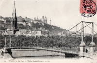
1853: Saint-Georges
Lyon, Métropole de Lyon, France - Saône River
| Bridgemeister ID: | 552 (added before 2003) |
| Year Completed: | 1853 |
| Name: | Saint-Georges |
| Also Known As: | Sala |
| Location: | Lyon, Métropole de Lyon, France |
| Crossing: | Saône River |
| Coordinates: | 45.757117 N 4.82615 E |
| Maps: | Acme, GeoHack, Google, OpenStreetMap |
| References: | AAJ, BPF, PQL |
| Use: | Footbridge |
| Status: | In use (last checked: 2022) |
| Main Cables: | Wire (iron) |
| Suspended Spans: | 1 |
| Main Span: | 1 x 75 meters (246.1 feet) |
Notes:
- Destroyed 1944, rebuilt same year. Reconstructed 1999.
External Links:
Image Sets:


1853: Saint-Quentin-sur-Isère
Saint-Quentin-sur-Isère, Isère, France - Isère River
| Bridgemeister ID: | 2131 (added 2006-10-22) |
| Year Completed: | 1853 |
| Name: | Saint-Quentin-sur-Isère |
| Location: | Saint-Quentin-sur-Isère, Isère, France |
| Crossing: | Isère River |
| Use: | Vehicular |
| Status: | Removed |
| Main Cables: | Wire |
| Suspended Spans: | 1 |
External Links:
Image Sets:

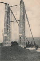
1853: San Ferdinando
Florence, Italy - Arno River
| Bridgemeister ID: | 7935 (added 2023-10-28) |
| Year Completed: | 1853 |
| Name: | San Ferdinando |
| Location: | Florence, Italy |
| Crossing: | Arno River |
| Coordinates: | 43.764617 N 11.270966 E |
| Maps: | Acme, GeoHack, Google, OpenStreetMap |
| Use: | Vehicular |
| Status: | Replaced, 1890 |
| Main Cables: | Wire (iron) |
| Suspended Spans: | 1 |
Notes:
Image Sets:

1853: Tiffin
Tiffin, Ohio, USA - Sandusky River
| Bridgemeister ID: | 46 (added before 2003) |
| Year Completed: | 1853 |
| Name: | Tiffin |
| Location: | Tiffin, Ohio, USA |
| Crossing: | Sandusky River |
| Principals: | John Gray |
| References: | EOV |
| Status: | Removed |
| Main Cables: | Wire (iron) |
1853: Tsar Nicholas I
Kyiv, Ukraine - Dnieper River
| Bridgemeister ID: | 409 (added before 2003) |
| Year Completed: | 1853 |
| Name: | Tsar Nicholas I |
| Location: | Kyiv, Ukraine |
| Crossing: | Dnieper River |
| Principals: | Charles Blacker Vignoles |
| References: | AAJ, HBE, IEA, PTS2 |
| Use: | Vehicular |
| Status: | Destroyed, c. 1920 |
| Main Cables: | Chain (iron, flat link) |
| Suspended Spans: | 6 |
| Main Spans: | 4 x 134.1 meters (440 feet) |
| Side Spans: | 2 x 68.6 meters (225 feet) |
External Links:
Image Sets:
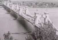
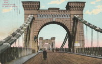
1853: Varades
Varades, Loire-Atlantique and Saint-Florent-le-Vieil, Maine-et-Loire, France - Loire River
| Bridgemeister ID: | 1962 (added 2005-11-06) |
| Year Completed: | 1853 |
| Name: | Varades |
| Location: | Varades, Loire-Atlantique and Saint-Florent-le-Vieil, Maine-et-Loire, France |
| Crossing: | Loire River |
| References: | AAJ |
| Status: | Removed |
Notes:
1854: Brion
Roissard and Lavars, Isère, France - Ebron River
| Bridgemeister ID: | 6998 (added 2022-04-24) |
| Year Completed: | 1854 |
| Name: | Brion |
| Location: | Roissard and Lavars, Isère, France |
| Crossing: | Ebron River |
| Coordinates: | 44.868078 N 5.671040 E |
| Maps: | Acme, GeoHack, Google, OpenStreetMap |
| Use: | Vehicular |
| Status: | Replaced, 1951 |
| Main Cables: | Wire |
| Suspended Spans: | 1 |
Notes:
- Replaced by 1951 Brion - Roissard and Lavars, Isère, France.
- All past and present bridges at this location.
External Links:
Image Sets:

1854: Caerhowel
Caerhowel, Wales, United Kingdom - River Severn
| Bridgemeister ID: | 407 (added before 2003) |
| Year Completed: | 1854 |
| Name: | Caerhowel |
| Location: | Caerhowel, Wales, United Kingdom |
| Crossing: | River Severn |
| Status: | Collapsed, 1858 |
Notes:
- Based on Dredge's patent.
1854: Elk River
Sutton, West Virginia, USA - Elk River
| Bridgemeister ID: | 554 (added before 2003) |
| Year Completed: | 1854 |
| Name: | Elk River |
| Location: | Sutton, West Virginia, USA |
| Crossing: | Elk River |
| Principals: | Ira Hart |
| References: | EOV |
| Use: | Vehicular, with walkway |
| Status: | Removed, 1930 |
| Main Cables: | Wire (iron) |
| Main Span: | 1 x 140.2 meters (460 feet) |
External Links:
Image Sets:

1854: Licking River
Covington and Newport, Kentucky, USA - Licking River
| Bridgemeister ID: | 48 (added before 2003) |
| Year Completed: | 1854 |
| Name: | Licking River |
| Location: | Covington and Newport, Kentucky, USA |
| Crossing: | Licking River |
| Coordinates: | 39.088167 N 84.504167 W |
| Maps: | Acme, GeoHack, Google, OpenStreetMap |
| Principals: | John Gray |
| References: | EOV |
| Use: | Vehicular |
| Status: | Removed |
| Main Cables: | Wire (iron) |
| Main Span: | 1 |
Notes:
- Replaced 1853 Licking River - Covington and Newport, Kentucky, USA which collapsed in January of 1854.
- All past and present bridges at this location.
External Links:
- Northern Kentucky Tribune - Our Rich History: Newport and Covington Suspension Bridge was completed in 1853. Article dated November 18, 2019. Summarizes the suspension bridge history at this location.
1854: Morgantown
Morgantown and Westover, West Virginia, USA - Monongahela River
| Bridgemeister ID: | 49 (added before 2003) |
| Year Completed: | 1854 |
| Name: | Morgantown |
| Also Known As: | Westover |
| Location: | Morgantown and Westover, West Virginia, USA |
| Crossing: | Monongahela River |
| Coordinates: | 39.630806 N 79.960000 W |
| Maps: | Acme, GeoHack, Google, OpenStreetMap |
| References: | AAJ, EN19070918, EOV, HBE, PTS2 |
| Use: | Vehicular, with walkway |
| Status: | Replaced, 1909 |
| Main Cables: | Wire (iron) |
| Suspended Spans: | 1 |
| Main Span: | 1 x 185.3 meters (608 feet) |
| Deck width: | 20 feet |
Notes:
- Was still part of Virginia at time of completion.
External Links:
Image Sets:

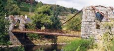
1854: Oich
Aberchalder, Invergarry, Scotland, United Kingdom - River Oich
| Bridgemeister ID: | 403 (added before 2003) |
| Year Completed: | 1854 |
| Name: | Oich |
| Also Known As: | Aberchalder |
| Location: | Aberchalder, Invergarry, Scotland, United Kingdom |
| Crossing: | River Oich |
| Coordinates: | 57.093377 N 4.745271 W |
| Maps: | Acme, GeoHack, Google, OpenStreetMap |
| Principals: | James Dredge |
| References: | BC3, HBR |
| Use: | Vehicular (one-lane) |
| Status: | Restricted to foot traffic (last checked: 2014) |
| Main Cables: | Rod (iron) |
| Suspended Spans: | 1 |
Notes:
- Restored and re-opened, late 1990's.
External Links:
Image Sets:


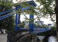
1854: Saint Andrew's
Glasgow, Scotland, United Kingdom - River Clyde
| Bridgemeister ID: | 408 (added before 2003) |
| Year Completed: | 1854 |
| Name: | Saint Andrew's |
| Location: | Glasgow, Scotland, United Kingdom |
| Crossing: | River Clyde |
| Coordinates: | 55.84883 N 4.23835 W |
| Maps: | Acme, GeoHack, Google, OpenStreetMap |
| Principals: | Neil Robson |
| References: | NTB |
| Use: | Footbridge |
| Status: | In use (last checked: 2019) |
| Main Cables: | Eyebar |
| Suspended Spans: | 1 |
| Main Span: | 1 x 67.1 meters (220 feet) |
| Deck width: | 13 feet |
Notes:
- Also sometimes attributed to Neil "Robinson" and completed 1853. May have originally been a narrow vehicular bridge.
External Links:
Image Sets:

| Bridgemeister ID: | 4502 (added 2020-05-02) |
| Year Completed: | 1854 |
| Name: | Sarp |
| Also Known As: | Sarpsbro, Sarpsbrua |
| Location: | Sarpsborg, Viken, Norway |
| Crossing: | Glomma |
| At or Near Feature: | Sarpefossen |
| Coordinates: | 59.276684 N 11.132073 E |
| Maps: | Acme, GeoHack, Google, kart.1881.no, OpenStreetMap |
| Use: | Vehicular |
| Status: | Removed |
| Main Cables: | Eyebar (iron) |
| Suspended Spans: | 3 |
| Main Span: | 1 x 47 meters (154.2 feet) |
| Side Spans: | 1 x 23 meters (75.5 feet), 1 x 15 meters (49.2 feet) |
Notes:
- Originally constructed as a typical eyebar suspension bridge. Reconstructed in 1879 to support a three-span lenticular rail bridge on top of the suspension bridge towers, creating an upper deck for rail traffic. The original deck was suspended from the lower chord of the lenticular trusses.
- See Tamaris-les-Forges - Alès vicinity, Gard, France. Another interesting hybrid rail and suspension bridge.
External Links:
- DigitaltMuseum - Bru over Glomma ved Sarpsfossen
- DigitaltMuseum - Bru over Glomma ved Sarpsfossen, sett fra kjørebanen ved østre hovedpillar
- DigitaltMuseum - Damplokomotiv, trolig type 9a, med godstog på Sarpsfossen bru
- DigitaltMuseum - Sarpsfossen og Sarpsbrua
- DigitaltMuseum - Sarpsfossen og Sarpsbrua, bygd i 1854
- DigitaltMuseum - Tegning til Sarpsbrua i Sarpsborg
- Wikipedia - Sarp Bridge
- Wikiwand - Sarp Bridge
Image Sets:
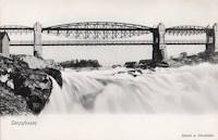
1855: Bessières
Bessières, Haute-Garonne, France - Tarn River
| Bridgemeister ID: | 7157 (added 2022-06-25) |
| Year Completed: | 1855 |
| Name: | Bessières |
| Location: | Bessières, Haute-Garonne, France |
| Crossing: | Tarn River |
| Coordinates: | 43.802017 N 1.609680 E |
| Maps: | Acme, GeoHack, Google, OpenStreetMap |
| Use: | Vehicular |
| Status: | Removed |
| Main Cables: | Wire |
| Suspended Spans: | 1 |
Notes:
- Later at same location 1955 Bessières - Bessières, Haute-Garonne, France.
- All past and present bridges at this location.
External Links:
Image Sets:
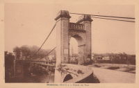
1855: Coudes
Coudes, Montpeyroux vicinity and Parent, Puy-de-Dôme, France - Allier River
| Bridgemeister ID: | 1942 (added 2005-10-29) |
| Year Completed: | 1855 |
| Name: | Coudes |
| Location: | Coudes, Montpeyroux vicinity and Parent, Puy-de-Dôme, France |
| Crossing: | Allier River |
| Coordinates: | 45.615255 N 3.211817 E |
| Maps: | Acme, GeoHack, Google, OpenStreetMap |
| Use: | Vehicular |
| Status: | Destroyed, 1944 |
| Main Cables: | Wire |
| Suspended Spans: | 1 |
Notes:
- 1944, August 22: The bridge is destroyed during WWII. One or more temporary suspended footbridges may have erected before the bridge was rebuilt in 1948.
- Replaced 1846 Coudes - Coudes, Montpeyroux vicinity and Parent, Puy-de-Dôme, France.
- Replaced by 1948 Coudes - Coudes, Montpeyroux vicinity and Parent, Puy-de-Dôme, France.
- All past and present bridges at this location.
External Links:
- Le Pont de Coudes. History of the suspension bridges at Coudes.
Image Sets:

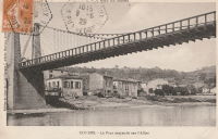
1855: Ferro
Pomarance vicinity, Italy - Cecina River
| Bridgemeister ID: | 7602 (added 2023-05-16) |
| Year Completed: | 1855 |
| Name: | Ferro |
| Also Known As: | Iron |
| Location: | Pomarance vicinity, Italy |
| Crossing: | Cecina River |
| Status: | Demolished, 1922 |
Notes:
- Replaced 1835 Ferro (Iron) - Pomarance vicinity, Italy.
- All past and present bridges at this location.
External Links:
- IL PONTE DI FERRO - I Risoluti - La Storia Continua. Detailed history of the first suspension bridge and its 1855 reconstruction.
1855: Kaiserin-Elisabeth
Děčín (Tetschen), Czechia - Elbe River
| Bridgemeister ID: | 5940 (added 2021-06-29) |
| Year Completed: | 1855 |
| Name: | Kaiserin-Elisabeth |
| Also Known As: | Empress Elisabeth, Kettenbrücke |
| Location: | Děčín (Tetschen), Czechia |
| Crossing: | Elbe River |
| Use: | Vehicular |
| Status: | Removed, c. 1930s |
| Main Cables: | Chain (iron) |
| Suspended Spans: | 3 |
| Main Span: | 1 |
| Side Spans: | 2 |
External Links:
Image Sets:

1855: Minneapolis
Minneapolis, Minnesota, USA - Mississippi River
| Bridgemeister ID: | 50 (added before 2003) |
| Year Completed: | 1855 |
| Name: | Minneapolis |
| Also Known As: | St. Anthony's Falls |
| Location: | Minneapolis, Minnesota, USA |
| Crossing: | Mississippi River |
| At or Near Feature: | Nicollet Island |
| Coordinates: | 44.985556 N 93.263389 W |
| Maps: | Acme, GeoHack, Google, OpenStreetMap |
| Principals: | Thomas M. Griffith |
| References: | AAJ, BPL, HBE, PTS2 |
| Use: | Vehicular |
| Status: | Demolished, 1876 |
| Main Cables: | Wire (iron) |
| Suspended Spans: | 1 |
| Main Span: | 1 x 189 meters (620 feet) |
| Deck width: | 17 feet |
Notes:
- Replaced by 1877 Minneapolis - Minneapolis, Minnesota, USA.
- Later at same location 1990 Hennepin Avenue (Father Louis Hennepin) - Minneapolis, Minnesota, USA.
- All past and present bridges at this location.
External Links:
Image Sets:

1855: Mirepoix-sur-Tarn
Mirepoix-sur-Tarn, Haute-Garonne, France - Tarn River
| Bridgemeister ID: | 7843 (added 2023-09-04) |
| Year Completed: | 1855 |
| Name: | Mirepoix-sur-Tarn |
| Location: | Mirepoix-sur-Tarn, Haute-Garonne, France |
| Crossing: | Tarn River |
| Coordinates: | 43.811766 N 1.571793 E |
| Maps: | Acme, GeoHack, Google, OpenStreetMap |
| Use: | Vehicular |
| Status: | Destroyed, 1930 |
| Main Cables: | Wire |
| Suspended Spans: | 1 |
| Main Span: | 1 |
Notes:
- 1930, March: Destroyed by flood.
- Replaced by 1935 Mirepoix-sur-Tarn - Mirepoix-sur-Tarn, Haute-Garonne, France.
- All past and present bridges at this location.
External Links:
Image Sets:
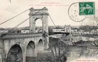
1855: Ness
Inverness, Scotland, United Kingdom - River Ness
| Bridgemeister ID: | 526 (added before 2003) |
| Year Completed: | 1855 |
| Name: | Ness |
| Location: | Inverness, Scotland, United Kingdom |
| Crossing: | River Ness |
| Use: | Vehicular |
| Status: | Demolished, 1961 |
| Main Cables: | Eyebar (iron) |
| Suspended Spans: | 1 |
Notes:
- Near 1881 Greig Street (Wobbly) - Inverness, Scotland, United Kingdom. In some photos, the two bridges are visible within a few hundred yards of each other.
External Links:
Image Sets:

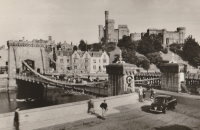
1855: Niagara Suspension
Niagara Falls, New York, USA and Niagara Falls, Ontario, Canada - Niagara River
| Bridgemeister ID: | 51 (added before 2003) |
| Year Completed: | 1855 |
| Name: | Niagara Suspension |
| Location: | Niagara Falls, New York, USA and Niagara Falls, Ontario, Canada |
| Crossing: | Niagara River |
| Principals: | John A. Roebling |
| References: | AAJ, BAAW, BBR, BFL, BMA, BOB, BPL, HBE, LIR, NSB, ONF, PTS2, SA18810716, SJR |
| Use: | Rail (heavy rail) and Vehicular (double-deck), with walkway |
| Status: | Replaced, 1897 |
| Main Cables: | Wire (iron) |
| Suspended Spans: | 1 |
| Main Span: | 1 x 250.3 meters (821.3 feet) |
Notes:
- Cables renovated, 1877. Wooden stiffening trusses replaced, 1880. Towers replaced, c. 1886. Bridge replaced with steel arch, 1897.
- AAJ notes the roadway deck opened in 1854, but the railway deck did not open until 1855.
- Replaced 1848 Niagara Suspension - Niagara Falls, New York, USA and Niagara Falls, Ontario, Canada.
- All past and present bridges at this location.
External Links:
Image Sets:

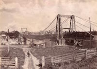
1855: Saint-Cyr
Tours and Saint-Cyr, Indre-et-Loire, France - Loire River
| Bridgemeister ID: | 1645 (added 2005-03-18) |
| Year Completed: | 1855 |
| Name: | Saint-Cyr |
| Also Known As: | Napoleon, Bonaparte |
| Location: | Tours and Saint-Cyr, Indre-et-Loire, France |
| Crossing: | Loire River |
| Principals: | Escarraguel Brothers |
| Use: | Vehicular |
| Status: | Demolished, 1943 |
| Main Cables: | Wire (iron) |
External Links:
Image Sets:
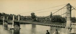

1855: Shohola
Barryville, New York and Shohola, Pennsylvania, USA - Delaware River
| Bridgemeister ID: | 41 (added before 2003) |
| Year Completed: | 1855 |
| Name: | Shohola |
| Also Known As: | Barryville-Shohola, Shohola-Barryville |
| Location: | Barryville, New York and Shohola, Pennsylvania, USA |
| Crossing: | Delaware River |
| Coordinates: | 41.477000 N 74.919000 W |
| Maps: | Acme, GeoHack, Google, OpenStreetMap |
| Principals: | Chauncy Thomas, John A. Roebling |
| References: | BDR, SHO |
| Use: | Vehicular |
| Status: | Dismantled, 1941 |
| Main Cables: | Wire (iron) |
| Suspended Spans: | 1 |
Notes:
- BDR: Built 1856, severely damaged 1859, rebuilt, collapsed Jan. 1st 1865, rebuilt 1866. Dale writes: "A respected historian, John Willard Johnston, who knew Chauncey Thomas personally and visited the area during his ownership of the toll bridge, insisted that Thomas, as the builder, was grossly incompetent."
- Originally constructed with one main span, the center pier was added during the 1866 reconstruction.
- Don Sayenga's research leads him to conclude the bridge was completed in the fall of 1855. He notes an article from the Pike County Democrat (June 21, 1872) stating the bridge was completed in 1855. The article also notes the 1859 collapse occurred on July 2, 1859. Don's interest in this bridge is piqued by the connection to John Roebling, "...this bridge seems to be the only John Roebling bridge that failed in service..." Roebling prepared plans, for the original bridge, for Chauncy Thomas (who, by Dale's account was inexperienced).
Image Sets:


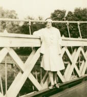
1855: Whiskey Bar
El Dorado County, California, USA - American River
| Bridgemeister ID: | 3357 (added 2019-12-15) |
| Year Completed: | 1855 |
| Name: | Whiskey Bar |
| Also Known As: | Pioneer, Whisky |
| Location: | El Dorado County, California, USA |
| Crossing: | American River |
| Use: | Vehicular |
| Status: | Destroyed, 1862 |
| Main Cables: | Wire (iron) |
Notes:
- Destroyed by flood, 1862. Cables supposedly reused for the Rattlesnake Bar bridge.
- See 1862 Rattlesnake Bar - Folsom vicinity, California, USA.
1856: Bidwell Bar
Oroville, California, USA - Feather River
| Bridgemeister ID: | 52 (added before 2003) |
| Year Completed: | 1856 |
| Name: | Bidwell Bar |
| Location: | Oroville, California, USA |
| Crossing: | Feather River |
| Coordinates: | 39.537483 N 121.45415 W |
| Maps: | Acme, GeoHack, Google, OpenStreetMap |
| Principals: | Bidwell Bridge Co. |
| References: | BPL, DSL200106, LACE |
| Use: | Vehicular (one-lane) |
| Status: | Restricted to foot traffic (last checked: 2020) |
| Main Cables: | Wire (iron) |
| Suspended Spans: | 1 |
| Main Span: | 1 x 67.1 meters (220 feet) estimated |
Notes:
- Dismantled before completion of Oroville Dam and replaced by the 1965 high-level Bidwell Bar suspension bridge. The 1856 structure was later reassembled about 1.5 miles south of the new Bidwell Bar bridge. Coordinates provided here are for the current location of the bridge at Kelly Ridge.
- Replaced by 1965 Bidwell Bar - Oroville, California, USA.
- All past and present bridges at this location.
External Links:
Image Sets:


1856: Boutiron
Creuzier-les-Vieux, Allier, France - Allier River
| Bridgemeister ID: | 6951 (added 2022-02-06) |
| Year Completed: | 1856 |
| Name: | Boutiron |
| Location: | Creuzier-les-Vieux, Allier, France |
| Crossing: | Allier River |
| Coordinates: | 46.153816 N 3.410014 E |
| Maps: | Acme, GeoHack, Google, OpenStreetMap |
| Use: | Vehicular |
| Status: | Replaced, 1911 |
| Main Cables: | Wire |
| Main Spans: | 3 |
External Links:
Image Sets:
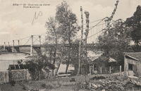
1856: Briord
Briord, Ain and Isère, France - Rhône River
| Bridgemeister ID: | 6997 (added 2022-04-24) |
| Year Completed: | 1856 |
| Name: | Briord |
| Location: | Briord, Ain and Isère, France |
| Crossing: | Rhône River |
| Use: | Vehicular |
| Status: | Removed |
| Main Cables: | Wire |
External Links:
Image Sets:

1856: Carbonne
Carbonne, Haute-Garonne, France - Garonne River
| Bridgemeister ID: | 1157 (added 2004-01-18) |
| Year Completed: | 1856 |
| Name: | Carbonne |
| Location: | Carbonne, Haute-Garonne, France |
| Crossing: | Garonne River |
| Coordinates: | 43.294537 N 1.228567 E |
| Maps: | Acme, GeoHack, Google, OpenStreetMap |
| Status: | Replaced, 1975 |
| Main Cables: | Wire (iron) |
Image Sets:


1856: Genesee
Carthage and Rochester, New York, USA - Genesee River
| Bridgemeister ID: | 54 (added before 2003) |
| Year Completed: | 1856 |
| Name: | Genesee |
| Also Known As: | Bridge of Sighs |
| Location: | Carthage and Rochester, New York, USA |
| Crossing: | Genesee River |
| Coordinates: | 43.161861 N 77.613472 W |
| Maps: | Acme, GeoHack, Google, OpenStreetMap |
| Principals: | Josiah Bissell, Jr. |
| Use: | Vehicular |
| Status: | Collapsed, 1857 |
| Main Cables: | Wire (iron) |
Notes:
- From May 2, 1857 edition of Scientific American: "Fall of a Suspension Bridge. The iron suspension bridge which spans the Genesee River at Rochester, fell on the 21st ult. from the weight of snow on it. The bridge was only finished last summer, and cost over $28,000. It was constructed between iron towers standing on the banks. They were built of cast iron cylinders, bolted together, and standing on high banks, 235 feet above the water. The road-way was 200 feet above the water, and proceeded in almost a straight line from the top of the high bank on one side, to the other. The cables were 780 feet long, and the entire length of the bridge was over 700 feet. It was calculated to sustain a weight of 2.000 tuns [sic]. It spanned the Genesee river below the Falls. The metal, it is stated, appears to be defective. The load that was on it when it fell did not amount to 100 tuns [sic]."
1856: Guyandotte
Guyandotte and Huntington, West Virginia, USA - Guyandotte River
| Bridgemeister ID: | 40 (added before 2003) |
| Year Completed: | 1856 |
| Name: | Guyandotte |
| Location: | Guyandotte and Huntington, West Virginia, USA |
| Crossing: | Guyandotte River |
| Coordinates: | 38.430083 N 82.391694 W |
| Maps: | Acme, GeoHack, Google, OpenStreetMap |
| Principals: | George Wilson Mason |
| References: | AAJ, EOV, PTS2 |
| Use: | Vehicular |
| Status: | Removed, 1907 |
| Main Cables: | Wire (iron) |
| Suspended Spans: | 1 |
| Main Span: | 1 x 137.2 meters (450 feet) |
Notes:
- EOV cites a source claiming the bridge was begun in 1853, but not completed until 1858. AAJ says completed in 1848. Other sources claim it was completed in 1852 and 1856.
- Was still part of Virginia at time of completion.
Image Sets:

1856: Les Mées
Les Mées, Alpes-de-Haute-Provence, France - Durance River
| Bridgemeister ID: | 1522 (added 2004-10-10) |
| Year Completed: | 1856 |
| Name: | Les Mées |
| Location: | Les Mées, Alpes-de-Haute-Provence, France |
| Crossing: | Durance River |
| Use: | Vehicular |
| Status: | Replaced |
| Main Cables: | Wire (iron) |
| Suspended Spans: | 2 |
| Main Spans: | 2 |
Notes:
- Replaced 1842 Les Mées - Les Mées, Alpes-de-Haute-Provence, France.
- All past and present bridges at this location.
External Links:
Image Sets:

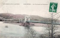
1856: Ollières
Les Ollières-sur-Eyrieux, Ardèche, France - Eyrieux River
| Bridgemeister ID: | 4882 (added 2020-07-18) |
| Year Completed: | 1856 |
| Name: | Ollières |
| Location: | Les Ollières-sur-Eyrieux, Ardèche, France |
| Crossing: | Eyrieux River |
| Coordinates: | 44.804655 N 4.614687 E |
| Maps: | Acme, GeoHack, Google, OpenStreetMap |
| References: | AAJ |
| Use: | Vehicular |
| Status: | Removed |
Notes:
- AAJ assumes completion in 1856 based on an 18-month contract let in August 1854. Appears to have been a quite dramatic bridge, with very large castellated towers, on an alignment adjacent to the current twin-arch bridge.
1856: Strong
Strong, Maine, USA - Sandy River
| Bridgemeister ID: | 53 (added before 2003) |
| Year Completed: | 1856 |
| Name: | Strong |
| Location: | Strong, Maine, USA |
| Crossing: | Sandy River |
| Principals: | Daniel Beedy |
| References: | BPL |
| Use: | Vehicular (one-lane) |
| Status: | Replaced, 1922 |
| Main Cables: | Wire (iron) |
| Suspended Spans: | 1 |
| Main Span: | 1 x 77.4 meters (254 feet) |
| Deck width: | 13 feet |
Notes:
- Similar to 1853 Mill Pond - Kingfield, Maine, USA.
Image Sets:


1856: Westmoreland's
Lancha Plana, California, USA - Mokelumne River
| Bridgemeister ID: | 1089 (added 2004-01-01) |
| Year Completed: | 1856 |
| Name: | Westmoreland's |
| Location: | Lancha Plana, California, USA |
| Crossing: | Mokelumne River |
| References: | DSL200106 |
| Status: | Inundated |
| Main Cables: | Wire (iron) |
Notes:
- Towers and cables were still standing in the 1940s. The location, including the entire former settlement of Lancha Plana, was inundated by the creation of the Camanche Reservoir in 1963. Unclear if remnants are still present (as is the case for some other inundated 19th-century California suspension bridges).
1857: Altenbergsteg
Berne, Switzerland - Aare River
| Bridgemeister ID: | 1475 (added 2004-09-02) |
| Year Completed: | 1857 |
| Name: | Altenbergsteg |
| Location: | Berne, Switzerland |
| Crossing: | Aare River |
| Coordinates: | 46.9503 N 7.4489 E |
| Maps: | Acme, GeoHack, Google, OpenStreetMap |
| References: | PTS2 |
| Use: | Footbridge |
| Status: | In use (last checked: 2019) |
| Main Cables: | Eyebar |
| Suspended Spans: | 1 |
| Main Span: | 1 x 57 meters (187 feet) |
External Links:
Image Sets:

1857: Black River
Watertown, New York, USA - Black River
| Bridgemeister ID: | 55 (added before 2003) |
| Year Completed: | 1857 |
| Name: | Black River |
| Also Known As: | Bradford, Mill Street |
| Location: | Watertown, New York, USA |
| Crossing: | Black River |
| Coordinates: | 43.977000 N 75.906528 W |
| Maps: | Acme, GeoHack, Google, OpenStreetMap |
| Principals: | Gilbert Bradford |
| References: | AAJ, HBE, ONC |
| Use: | Vehicular |
| Status: | Removed, 1890s |
| Main Cables: | Wire (iron) |
| Suspended Spans: | 1 |
| Main Span: | 1 x 53 meters (173.9 feet) |
| Deck width: | 18 feet |
Notes:
- Replaced in 1890's (ONC).
External Links:
Image Sets:

1857: Change
Glendon, Pennsylvania, USA - Lehigh River
| Bridgemeister ID: | 56 (added before 2003) |
| Year Completed: | 1857 |
| Name: | Change |
| Also Known As: | Chain, Lehigh Canal Swinging, Wire Towing Path at Pool No. 8 |
| Location: | Glendon, Pennsylvania, USA |
| Crossing: | Lehigh River |
| Coordinates: | 40.65382 N 75.24774 W |
| Maps: | Acme, GeoHack, Google, OpenStreetMap |
| Principals: | Lehigh Coal and Navigation Co., E.A. Douglas |
| References: | HAERPA461, HBP |
| Use: | Footbridge and Change |
| Status: | Derelict (last checked: 2007) |
| Main Cables: | Wire (iron) |
| Suspended Spans: | 2 |
| Main Spans: | 2 |
Notes:
- Often mistakenly called a "chain" bridge, this is a "change" bridge.
External Links:
- Aldrich Change Bridge. Dale Oswald explains (in the context of the Aldrich Change Bridge, a non-suspension bridge in Palmyra, New York): "A change bridge is one with low railings and an underpass that allowed draft teams to move from one side of the canal to the other without unhitching, cloverleaf-style."
- Bridgehunter.com - BH60140
Image Sets:

1857: Izeron
Izeron and Saint-Sauveur, Isère, France - Isère River
| Bridgemeister ID: | 7159 (added 2022-06-25) |
| Year Completed: | 1857 |
| Name: | Izeron |
| Location: | Izeron and Saint-Sauveur, Isère, France |
| Crossing: | Isère River |
| Coordinates: | 45.154651 N 5.363855 E |
| Maps: | Acme, GeoHack, Google, OpenStreetMap |
| Use: | Vehicular |
| Status: | Removed |
| Main Cables: | Wire (iron) |
| Suspended Spans: | 1 |
Notes:
- Replaced by 1943 Izeron - Izeron and Saint-Sauveur, Isère, France.
- All past and present bridges at this location.
External Links:
- Art-et-Histoire.com - Pont suspendu d'Izeron sur l'Isère - 1857. Art-et-Histoire also mentions a possible earlier suspension bridge that opened in 1849 and collapsed soon after due to a landslide.
Image Sets:
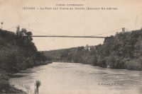
1857: Longues
Longues, Vic-le-Comte and Les Martres-de-Veyre, Puy-de-Dôme, France - Allier River
| Bridgemeister ID: | 7589 (added 2023-05-06) |
| Year Completed: | 1857 |
| Name: | Longues |
| Location: | Longues, Vic-le-Comte and Les Martres-de-Veyre, Puy-de-Dôme, France |
| Crossing: | Allier River |
| Use: | Vehicular |
| Status: | Replaced |
| Main Cables: | Chain (iron) |
| Main Span: | 1 |
Notes:
- Replaced 1833 Longues - Longues, Vic-le-Comte and Les Martres-de-Veyre, Puy-de-Dôme, France.
- Replaced by Longues - Longues, Vic-le-Comte and Les Martres-de-Veyre, Puy-de-Dôme, France.
- All past and present bridges at this location.
Image Sets:

1857: Saint James's Park
London, England, United Kingdom
| Bridgemeister ID: | 6831 (added 2021-12-31) |
| Year Completed: | 1857 |
| Name: | Saint James's Park |
| Location: | London, England, United Kingdom |
| At or Near Feature: | Saint James's Park |
| References: | AAJ |
| Use: | Footbridge |
| Status: | Replaced, 1957 |
| Main Cables: | Eyebar (iron) |
| Suspended Spans: | 1 |
Notes:
- Reviews of this bridge were not favorable. Jakkula (AAJ) sites several contemporary sources (1857) objecting to the bridge obstructing the view of the scenery. One citation is summarized: "Regards the bridge as a hideous structure".
External Links:
Image Sets:
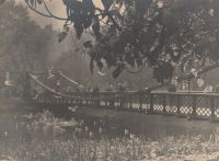
1857: Saint-Lattier
Saint-Lattier, Isère and Eymeux, Drôme, France - Isère River
| Bridgemeister ID: | 7385 (added 2022-11-24) |
| Year Completed: | 1857 |
| Name: | Saint-Lattier |
| Location: | Saint-Lattier, Isère and Eymeux, Drôme, France |
| Crossing: | Isère River |
| Use: | Vehicular |
| Status: | Replaced |
| Main Cables: | Wire |
| Suspended Spans: | 1 |
Notes:
- Later at same location Saint-Lattier (Eymeux) - Saint-Lattier, Isère and Eymeux, Drôme, France. Unclear if the newer bridge was a direct replacement for the older bridge.
- All past and present bridges at this location.
External Links:
Image Sets:
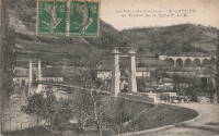
1858: Chaumont-sur-Loire
Chaumont-sur-Loire and Onzain, Veuzain-sur-Loire, Loir-et-Cher, France - Loire River
| Bridgemeister ID: | 1703 (added 2005-03-29) |
| Year Completed: | 1858 |
| Name: | Chaumont-sur-Loire |
| Location: | Chaumont-sur-Loire and Onzain, Veuzain-sur-Loire, Loir-et-Cher, France |
| Crossing: | Loire River |
| Coordinates: | 47.485722 N 1.190222 E |
| Maps: | Acme, GeoHack, Google, OpenStreetMap |
| Use: | Vehicular |
| Status: | Replaced |
| Main Cables: | Wire (iron) |
| Main Spans: | 6 |
Notes:
- Damaged by troops, 1870. Repaired.
- Replaced by 1935 Chaumont-sur-Loire - Chaumont-sur-Loire and Onzain, Veuzain-sur-Loire, Loir-et-Cher, France.
- All past and present bridges at this location.
External Links:
Image Sets:
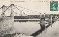
1858: Chelsea
London, England, United Kingdom - River Thames
| Bridgemeister ID: | 410 (added before 2003) |
| Year Completed: | 1858 |
| Name: | Chelsea |
| Also Known As: | Victoria |
| Location: | London, England, United Kingdom |
| Crossing: | River Thames |
| At or Near Feature: | Battersea Park |
| Coordinates: | 51.485061 N 0.149897 W |
| Maps: | Acme, GeoHack, Google, OpenStreetMap |
| Principals: | Thomas Page |
| References: | BTH, HBE, PTS2 |
| Use: | Vehicular |
| Status: | Replaced |
| Main Cables: | Eyebar (iron) |
| Suspended Spans: | 3 |
| Main Span: | 1 x 106.1 meters (348 feet) |
| Side Spans: | 1 x 116.7 meters (383 feet), 1 x 55.8 meters (183 feet) |
Notes:
- Replaced by 1937 Chelsea - London, England, United Kingdom.
- All past and present bridges at this location.
External Links:
Image Sets:

1858: Portsmouth
Portsmouth, Ohio, USA - Scioto River
| Bridgemeister ID: | 57 (added before 2003) |
| Year Completed: | 1858 |
| Name: | Portsmouth |
| Location: | Portsmouth, Ohio, USA |
| Crossing: | Scioto River |
| Principals: | E.B. Gray |
| References: | EOV |
| Status: | Collapsed, 1859 |
Notes:
| Bridgemeister ID: | 1990 (added 2005-12-02) |
| Year Completed: | 1858 |
| Name: | Thoirette |
| Location: | Thoirette, Jura and Ain, France |
| Crossing: | Ain River |
| Coordinates: | 46.268464 N 5.536318 E |
| Maps: | Acme, GeoHack, Google, OpenStreetMap |
| References: | AGP |
| Use: | Vehicular (one-lane) |
| Status: | Replaced, 1922 |
| Main Cables: | Wire |
| Suspended Spans: | 1 |
Notes:
- One end of this bridge appears to have led directly into a building aptly named Hôtel Du Pont with the roadway possibly passing through the building. Remnants of the bridge are still present (as of 2022) on both sides of the river.
- Replaced 1829 Thoirette - Thoirette, Jura and Ain, France.
- All past and present bridges at this location.
External Links:
Image Sets:


| Bridgemeister ID: | 5665 (added 2021-01-03) |
| Year Completed: | 1858 |
| Name: | Trofa |
| Also Known As: | Barca |
| Location: | Trofa and Ribeirão, Portugal |
| Crossing: | Ave River |
| Coordinates: | 41.345251 N 8.556376 W |
| Maps: | Acme, GeoHack, Google, OpenStreetMap |
| References: | AAJ |
| Use: | Vehicular |
| Status: | Removed, 1935 |
| Main Cables: | Wire (iron) |
| Suspended Spans: | 1 |
| Main Span: | 1 x 82 meters (269 feet) |
Notes:
- Coordinates are for the current Ave River crossing at Trofa. The Ponte Pênsil da Trofa may have been located here or slightly west of here.
External Links:
1859: Doux
St Jean de Muzols and Tournon-sur-Rhône, Ardèche, France - Doux River
| Bridgemeister ID: | 5661 (added 2021-01-01) |
| Year Completed: | 1859 |
| Name: | Doux |
| Location: | St Jean de Muzols and Tournon-sur-Rhône, Ardèche, France |
| Crossing: | Doux River |
| Coordinates: | 45.074919 N 4.816389 E |
| Maps: | Acme, GeoHack, Google, OpenStreetMap |
| References: | AAJ |
| Use: | Vehicular |
| Status: | Removed |
| Main Cables: | Wire |
| Suspended Spans: | 1 |
Notes:
- Replaced 1828 Doux - St Jean de Muzols and Tournon-sur-Rhône, Ardèche, France.
- All past and present bridges at this location.
External Links:
Image Sets:
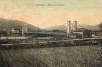
1859: General Dean
Carlyle, Illinois, USA - Kaskaskia River
| Bridgemeister ID: | 58 (added before 2003) |
| Year Completed: | 1859 |
| Name: | General Dean |
| Also Known As: | Carlyle |
| Location: | Carlyle, Illinois, USA |
| Crossing: | Kaskaskia River |
| Coordinates: | 38.611125 N 89.357476 W |
| Maps: | Acme, GeoHack, Google, OpenStreetMap |
| Principals: | D. Griffith Smith |
| References: | BPL, GBD |
| Use: | Vehicular (one-lane) |
| Status: | Restricted to foot traffic (last checked: 2021) |
| Main Cables: | Wire (iron) |
| Suspended Spans: | 1 |
| Main Span: | 1 x 80.5 meters (264 feet) |
Notes:
- Rebuilt 1920s, 1970s. Restored, 1950s, for use as a footbridge.
- Bypassed, 1924.
External Links:
Image Sets:


Do you have any information or photos for these bridges that you would like to share? Please email david.denenberg@bridgemeister.com.
Mail | Facebook | X (Twitter) | Bluesky