Suspension Bridges of Canada (1-100 of 166)
This is a list of bridges 1 through 100 (of 166 total) from the suspension bridge inventory for the country Canada. Wherever you see a Bridgemeister ID number click it to isolate the bridge on its own page.
Related Lists:
1844: Union
Ottawa, Ontario, Canada - Chaudière Falls
| Bridgemeister ID: | 26 (added before 2003) |
| Year Completed: | 1844 |
| Name: | Union |
| Location: | Ottawa, Ontario, Canada |
| Crossing: | Chaudière Falls |
| Principals: | Samuel Keefer |
| References: | AAJ |
| Use: | Vehicular |
| Status: | Replaced, 1889 |
| Main Cables: | Wire (iron) |
| Suspended Spans: | 1 |
| Main Span: | 1 x 74.2 meters (243.5 feet) |
Notes:
- At time of completion, Ottawa was still known as Bytown.
External Links:
Image Sets:

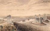
1848: Niagara Suspension
Niagara Falls, New York, USA and Niagara Falls, Ontario, Canada - Niagara River
| Bridgemeister ID: | 29 (added before 2003) |
| Year Completed: | 1848 |
| Name: | Niagara Suspension |
| Location: | Niagara Falls, New York, USA and Niagara Falls, Ontario, Canada |
| Crossing: | Niagara River |
| Principals: | Charles Ellet |
| References: | BOB, BPL, HBE, ONF, PTS2 |
| Use: | Vehicular (one-lane) |
| Status: | Removed |
| Main Cables: | Wire (iron) |
| Suspended Spans: | 1 |
| Main Span: | 1 x 234.7 meters (770 feet) |
| Deck width: | 7.5 feet |
Notes:
1851: Lewiston-Queenston
Lewiston, New York, USA and Queenston, Ontario, Canada - Niagara River
| Bridgemeister ID: | 35 (added before 2003) |
| Year Completed: | 1851 |
| Name: | Lewiston-Queenston |
| Location: | Lewiston, New York, USA and Queenston, Ontario, Canada |
| Crossing: | Niagara River |
| Principals: | Edward Serrell |
| References: | AAJ, BOB, BPL, HBE, PTS2 |
| Use: | Vehicular |
| Status: | Wrecked, 1864 |
| Main Cables: | Wire (iron) |
| Suspended Spans: | 1 |
| Main Span: | 1 x 258.8 meters (849 feet) |
| Deck width: | 21 feet (AAJ: 19.5 feet) |
Notes:
- Wrecked by wind February 1, 1864. Stay cables beneath the bridge had been disconnected to avoid damage from rising ice. Portions of the cables and deck remained, in a derelict state, as late as 1895. Replacement was not started until the late 1890's.
- The February 3, 1864 edition of Niagara Falls Gazette describes the wind event: "Partial Destruction Of The Lewiston Suspension Bridge -- A portion of the flooring and other wood-work of the Lewiston Suspension Bridge was blown down during the gale Monday forenoon. It seems that the long guys had been cut during the late ice jam to prevent injury to the structure and thus its strength to withstand a gale was much weakened. The wind swept through the gorge on Monday with terrific force and swayed the bridge so that some of the cross timbers, near the centre were loosened from their fastenings, and fell, of course carrying the floor with them. A large portion at each end, remains without material injury. The extent of the damage -- financially -- we have not yet learned, but we judge from what we hear that it may be about $10,000. The bridge was built in 1852 and cost not far from $40,000. It will doubtless soon be repaired and in use."
- Later at same location 1899 Lewiston-Queenston - Lewiston, New York, USA and Queenston, Ontario, Canada.
- See 1849 Wheeling (Wheeling and Belmont) - Wheeling, West Virginia, USA. The 1851 Lewiston-Queenston bridge is sometimes claimed to have become the longest in the world with a main span surpassing the length of the Wheeling suspension bridge. However, Don Sayenga notes the length of the suspended span of the Lewiston-Queenston bridge was only 849 feet, not the 1,043 feet sometimes cited. Don writes: "[1,043 feet] was the distance between the towers built high up on the cliffs above the crossing - because there was no space for them below. The roadway suspended from the towers was only 849 feet span over the water from abutment to abutment." Thus, Roebling's Cincinnati bridge should be considered the first to eclipse Wheeling's record main span.
- All past and present bridges at this location.
External Links:
Image Sets:

1852: St. John
St. John, New Brunswick, Canada - St. John River
| Bridgemeister ID: | 37 (added before 2003) |
| Year Completed: | 1852 |
| Name: | St. John |
| Location: | St. John, New Brunswick, Canada |
| Crossing: | St. John River |
| Principals: | Edward Serrell |
| References: | AAJ, BPL, HBE, PTS2 |
| Use: | Vehicular (one-lane) |
| Status: | Removed, 1915 |
| Main Cables: | Wire (iron) |
| Suspended Spans: | 1 |
| Main Span: | 1 x 195.1 meters (640 feet) |
Notes:
- Rebuilt 1857.
External Links:
Image Sets:


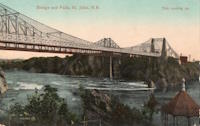
1855: Niagara Suspension
Niagara Falls, New York, USA and Niagara Falls, Ontario, Canada - Niagara River
| Bridgemeister ID: | 51 (added before 2003) |
| Year Completed: | 1855 |
| Name: | Niagara Suspension |
| Location: | Niagara Falls, New York, USA and Niagara Falls, Ontario, Canada |
| Crossing: | Niagara River |
| Principals: | John A. Roebling |
| References: | AAJ, BAAW, BBR, BFL, BMA, BOB, BPL, HBE, LIR, NSB, ONF, PTS2, SA18810716, SJR |
| Use: | Rail (heavy rail) and Vehicular (double-deck), with walkway |
| Status: | Replaced, 1897 |
| Main Cables: | Wire (iron) |
| Suspended Spans: | 1 |
| Main Span: | 1 x 250.3 meters (821.3 feet) |
Notes:
- Cables renovated, 1877. Wooden stiffening trusses replaced, 1880. Towers replaced, c. 1886. Bridge replaced with steel arch, 1897.
- AAJ notes the roadway deck opened in 1854, but the railway deck did not open until 1855.
- Replaced 1848 Niagara Suspension - Niagara Falls, New York, USA and Niagara Falls, Ontario, Canada.
- All past and present bridges at this location.
External Links:
Image Sets:

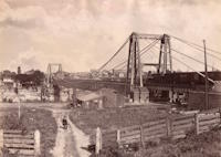
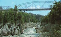
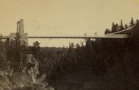
1860: Grand Falls
Grand Falls, New Brunswick, Canada - St. John River
| Bridgemeister ID: | 60 (added before 2003) |
| Year Completed: | 1860 |
| Name: | Grand Falls |
| Location: | Grand Falls, New Brunswick, Canada |
| Crossing: | St. John River |
| Coordinates: | 47.050722 N 67.736611 W |
| Maps: | Acme, GeoHack, Google, OpenStreetMap |
| Principals: | James Tomlinson |
| References: | AAJ |
| Use: | Vehicular (two-lane) |
| Status: | Replaced, 1915 |
| Main Cables: | Wire (iron) |
| Suspended Spans: | 1 |
| Main Span: | 1 x 63.9 meters (209.75 feet) |
| Deck width: | 16 feet |
Notes:
- Out of use, 1912.
Image Sets:
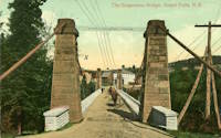
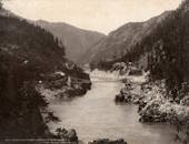
1863: Alexandra
Spuzzum, British Columbia, Canada - Fraser River
| Bridgemeister ID: | 63 (added before 2003) |
| Year Completed: | 1863 |
| Name: | Alexandra |
| Also Known As: | Trutch's |
| Location: | Spuzzum, British Columbia, Canada |
| Crossing: | Fraser River |
| Principals: | Andrew S. Hallidie, Joseph W. Trutch |
| Use: | Vehicular |
| Status: | Removed, 1912 |
| Main Cables: | Wire (iron) |
| Main Span: | 1 x 82 meters (269 feet) |
Notes:
- Fell into disuse, 1884. Damaged by flood 1904. Dismantled 1912. Some sources indicate the flood damage occurred in 1894.
- Replaced by 1926 Second Alexandra - Spuzzum, British Columbia, Canada.
- All past and present bridges at this location.
Image Sets:

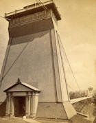
1869: Clifton
Niagara Falls, New York, USA and Niagara Falls, Ontario, Canada - Niagara River
| Bridgemeister ID: | 70 (added before 2003) |
| Year Completed: | 1869 |
| Name: | Clifton |
| Also Known As: | Upper, Niagara-Clifton, Falls View, First Falls View |
| Location: | Niagara Falls, New York, USA and Niagara Falls, Ontario, Canada |
| Crossing: | Niagara River |
| Coordinates: | 43.089722 N 79.069694 W |
| Maps: | Acme, GeoHack, Google, OpenStreetMap |
| Principals: | Samuel Keefer |
| References: | AAJ, BPL, HBE, PTS2 |
| Use: | Vehicular |
| Status: | Replaced, 1889 |
| Main Cables: | Wire (iron) |
| Main Span: | 1 x 386.6 meters (1,268.3 feet) |
| Deck width: | 10 feet |
Notes:
- Opened January 2nd, 1869. Wooden towers replaced with steel towers, 1884. Widened to 17 feet, 1888. Wrecked by wind, January, 1889. Some of the images here may show the replacement bridge.
- Became longest suspension bridge by eclipsing 1867 John A. Roebling (Cincinnati, Cincinnati and Covington) - Cincinnati, Ohio and Covington, Kentucky, USA.
- Eclipsed by new longest suspension bridge 1883 Brooklyn (Great East River) - New York and Brooklyn, New York, USA.
- Replaced by 1889 Second Falls View (Upper) - Niagara Falls, New York, USA and Niagara Falls, Ontario, Canada.
- All past and present bridges at this location.
External Links:
Image Sets:
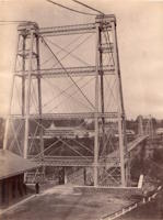
1879: Castor
Cynthia Islands, Niagara Falls, Ontario, Canada - Niagara River
| Bridgemeister ID: | 319 (added before 2003) |
| Year Completed: | 1879 |
| Name: | Castor |
| Also Known As: | Burning Springs |
| Location: | Cynthia Islands, Niagara Falls, Ontario, Canada |
| Crossing: | Niagara River |
| Status: | Removed |
| Main Cables: | Wire |
| Suspended Spans: | 1 |
Notes:
- The "Cynthia Islands" were previously named the "Clark Hill Islands" and are now known as the "Dufferin Islands". The older "Clark Hill Islands" name was often used in describing the location of this bridge and its companion bridge.
- Companion to 1879 Pollux (Burning Springs) - Cynthia Islands, Niagara Falls, Ontario, Canada.
Image Sets:

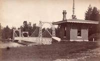
1879: Pollux
Cynthia Islands, Niagara Falls, Ontario, Canada - Niagara River
| Bridgemeister ID: | 848 (added before 2003) |
| Year Completed: | 1879 |
| Name: | Pollux |
| Also Known As: | Burning Springs |
| Location: | Cynthia Islands, Niagara Falls, Ontario, Canada |
| Crossing: | Niagara River |
| Status: | Removed |
| Main Cables: | Wire |
Notes:
- The "Cynthia Islands" were previously named the "Clark Hill Islands" and are now known as the "Dufferin Islands". The older "Clark Hill Islands" name was often used in describing the location of this bridge and its companion bridge.
- Companion to 1879 Castor (Burning Springs) - Cynthia Islands, Niagara Falls, Ontario, Canada.
Image Sets:

1889: Second Falls View
Niagara Falls, New York, USA and Niagara Falls, Ontario, Canada - Niagara River
| Bridgemeister ID: | 2120 (added 2006-09-17) |
| Year Completed: | 1889 |
| Name: | Second Falls View |
| Also Known As: | Upper |
| Location: | Niagara Falls, New York, USA and Niagara Falls, Ontario, Canada |
| Crossing: | Niagara River |
| Coordinates: | 43.088806 N 79.068722 W |
| Maps: | Acme, GeoHack, Google, OpenStreetMap |
| Principals: | G.M. Harrington, George W. McNulty |
| Use: | Vehicular |
| Status: | Removed, late 1890's |
| Main Cables: | Wire |
| Suspended Spans: | 1 |
Notes:
- Damaged by wind, January 1890. Repaired. Dismantled after being replaced by a steel arch bridge (the famous "Honeymoon Bridge"), 1899. Much of the dismantled bridge was reused for the 1899 Lewiston-Queenston bridge.
- Replaced 1869 Clifton (Upper, Niagara-Clifton, Falls View, First Falls View) - Niagara Falls, New York, USA and Niagara Falls, Ontario, Canada.
- See 1899 Lewiston-Queenston - Lewiston, New York, USA and Queenston, Ontario, Canada.
- All past and present bridges at this location.
1895: Swinging
Renfrew, Ontario, Canada - Bonnechere River
| Bridgemeister ID: | 590 (added 2003-01-05) |
| Year Completed: | 1895 |
| Name: | Swinging |
| Location: | Renfrew, Ontario, Canada |
| Crossing: | Bonnechere River |
| Coordinates: | 45.478217 N 76.691764 W |
| Maps: | Acme, GeoHack, Google, OpenStreetMap |
| Use: | Footbridge |
| Status: | In use (last checked: 2020) |
| Main Cables: | Wire (steel) |
| Suspended Spans: | 2 |
| Main Spans: | 2 |
Notes:
- 1983: Rebuilt.
- 2020, December: Rehabilitation project likely.
- 2021, October: Contract awarded for repairs.
Annotated Citations:
- McIntyre, Bruce. "Swinging Bridge will be upgraded at a cost of almost $300,000." Toronto Star, 20 October 2021, https://www.thestar.com/news/canada/2021/10/20/swinging-bridge-will-be-upgraded-at-a-cost-of-almost-300000.html.
"In his report to council recently, Development and Property Director Mike Asselin said the bridge was an important piece of infrastructure and just like other municipal property like bridges and roads, council was faced with the prospect of investing in one of its assets or eventually be forced to close the bridge due to safety concerns. Although there had been some repairs completed in 2020, it was more of a stop-gap measure to deal with some immediate issues."
Image Sets:

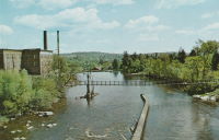
1899: Lewiston-Queenston
Lewiston, New York, USA and Queenston, Ontario, Canada - Niagara River
| Bridgemeister ID: | 108 (added before 2003) |
| Year Completed: | 1899 |
| Name: | Lewiston-Queenston |
| Location: | Lewiston, New York, USA and Queenston, Ontario, Canada |
| Crossing: | Niagara River |
| Principals: | L.L. Buck, R.S. Buck |
| References: | AAJ, BPL, HBE, PTS2 |
| Use: | Vehicular and Rail (streetcar) |
| Status: | Replaced, 1962 |
| Main Cables: | Wire (steel) |
| Suspended Spans: | 1 |
| Main Span: | 1 x 317 meters (1,040 feet) |
| Deck width: | 17 feet |
Notes:
- Reused parts from the recently dismantled Second Falls View Bridge.
- At former location of 1851 Lewiston-Queenston - Lewiston, New York, USA and Queenston, Ontario, Canada.
- See 1889 Second Falls View (Upper) - Niagara Falls, New York, USA and Niagara Falls, Ontario, Canada.
- All past and present bridges at this location.
External Links:
Image Sets:


1904: Chimney Creek
Williams Lake vicinity, British Columbia, Canada - Fraser River
| Bridgemeister ID: | 1641 (added 2005-03-14) |
| Year Completed: | 1904 |
| Name: | Chimney Creek |
| Also Known As: | Chilcotin, Sheep Creek, Fraser River |
| Location: | Williams Lake vicinity, British Columbia, Canada |
| Crossing: | Fraser River |
| Coordinates: | 51.982898 N 122.275076 W |
| Maps: | Acme, GeoHack, Google, OpenStreetMap |
| Use: | Vehicular (one-lane) |
| Status: | Removed, c. 1962 |
| Main Cables: | Wire (steel) |
| Suspended Spans: | 1 |
| Main Span: | 1 |
Notes:
- Crossed the Fraser southwest of Williams Lake next to the present route 20 crossing. Some of the stone piers are still visible next to the present arch bridge. For some time, the two bridges were standing side-by-side (perhaps 100 yards apart). The "stone piers" very much look like pylons from an older suspension bridge but there doesn't appear to be evidence of a prior suspension bridge.
- Some sources say completed in 1905.
- Replacement opened in 1962. Suspension bridge possibly removed in 1961 or 1962.
External Links:
- Chimney Creek Archives - ARCHIVOS. Images of the bridge among several Fraser River bridge images.
- File:Chimney Creek bridge under construction.jpg - Wikimedia Commons. Image of the bridge. Dated c. 1904.
- LISTEN: A Haphazard History of the Fraser River Bridge - The Williams Lake Tribune. Article detailing the history of bridges at this location.
1912: Hagwilget
Hagwilget, British Columbia, Canada - Bulkley River
| Bridgemeister ID: | 1229 (added 2004-02-15) |
| Year Completed: | 1912 |
| Name: | Hagwilget |
| Also Known As: | Bulkley Canyon |
| Location: | Hagwilget, British Columbia, Canada |
| Crossing: | Bulkley River |
| At or Near Feature: | Hagwilget Canyon |
| Coordinates: | 55.257347 N 127.604616 W |
| Maps: | Acme, GeoHack, Google, OpenStreetMap |
| References: | AAJ |
| Use: | Vehicular (one-lane) |
| Status: | Replaced, 1931 |
| Main Cables: | Wire (steel) |
| Suspended Spans: | 1 |
| Main Span: | 1 x 137.5 meters (451 feet) |
| Deck width: | 9 feet |
Notes:
- AAJ: Restricted to foot traffic, 1929.
- Replaced by 1931 Hagwilget (Bulkley Canyon) - Hagwilget, British Columbia, Canada.
- See Walcott - Walcott, British Columbia, Canada. Part or all of the dismantled 1912 Hagwilget bridge may have been reused for this bridge at Walcott.
- All past and present bridges at this location.
Image Sets:

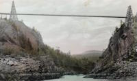
1912: Sewell's Road
Scarborough, Ontario, Canada - Rouge River
| Bridgemeister ID: | 831 (added 2003-06-01) |
| Year Completed: | 1912 |
| Name: | Sewell's Road |
| Location: | Scarborough, Ontario, Canada |
| Crossing: | Rouge River |
| Coordinates: | 43.82754 N 79.19962 W |
| Maps: | Acme, GeoHack, Google, OpenStreetMap |
| Principals: | Frank Barber, Lewis Construction |
| Use: | Vehicular (one-lane) |
| Status: | In use (last checked: 2021) |
| Main Cables: | Wire (steel) |
| Suspended Spans: | 3 |
| Main Span: | 1 x 30.5 meters (100 feet) estimated |
| Side Spans: | 2 x 9.1 meters (30 feet) estimated |
Notes:
- Restoration completed April, 1981.
Image Sets:

1913: Brilliant
Castlegar vicinity, British Columbia, Canada - Kootenay River
| Bridgemeister ID: | 128 (added before 2003) |
| Year Completed: | 1913 |
| Name: | Brilliant |
| Also Known As: | Doukhobor |
| Location: | Castlegar vicinity, British Columbia, Canada |
| Crossing: | Kootenay River |
| Coordinates: | 49.31793 N 117.63023 W |
| Maps: | Acme, GeoHack, Google, OpenStreetMap |
| Principals: | J. R. Grant |
| References: | AAJ, PTS2 |
| Use: | Vehicular (one-lane) |
| Status: | Restricted to foot traffic (last checked: 2010) |
| Main Cables: | Wire (steel) |
| Suspended Spans: | 1 |
| Main Span: | 1 x 100.9 meters (331 feet) |
| Deck width: | 16 feet |
Notes:
- 2010, May: Bridge is reopened for pedestrian traffic after a restoration project. Bridge had been closed and derelict prior.
- Near 1984 Zuckerberg Island Heritage Park - Castlegar, British Columbia, Canada.
External Links:
1914: Churn Creek
Gang Ranch, British Columbia, Canada - Fraser River
| Bridgemeister ID: | 131 (added before 2003) |
| Year Completed: | 1914 |
| Name: | Churn Creek |
| Location: | Gang Ranch, British Columbia, Canada |
| Crossing: | Fraser River |
| Coordinates: | 51.527494 N 122.285082 W |
| Maps: | Acme, GeoHack, Google, OpenStreetMap |
| Principals: | Waddell & Harrington |
| References: | BPL |
| Use: | Vehicular (one-lane) |
| Status: | In use (last checked: 2018) |
| Main Cables: | Wire (steel) |
| Suspended Spans: | 1 |
Image Sets:
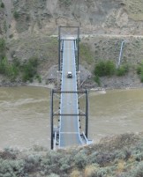
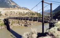
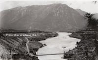
1914: Lillooet
Lillooet, British Columbia, Canada - Fraser River
| Bridgemeister ID: | 130 (added before 2003) |
| Year Completed: | 1914 |
| Name: | Lillooet |
| Also Known As: | Old |
| Location: | Lillooet, British Columbia, Canada |
| Crossing: | Fraser River |
| Coordinates: | 50.711493 N 121.911333 W |
| Maps: | Acme, GeoHack, Google, OpenStreetMap |
| Principals: | Waddell & Harrington |
| References: | BPL |
| Use: | Vehicular (one-lane) |
| Status: | Restricted to foot traffic (last checked: 2015) |
| Main Cables: | Wire (steel) |
| Suspended Spans: | 1 |
| Main Span: | 1 x 121.9 meters (400 feet) estimated |
Notes:
- Known locally as "The Old Bridge."
Image Sets:
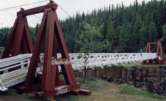
1922: Robert Lowe
Whitehorse vicinity, Yukon, Canada - Miles Canyon
| Bridgemeister ID: | 1054 (added 2003-12-13) |
| Year Completed: | 1922 |
| Name: | Robert Lowe |
| Also Known As: | Miles Canyon |
| Location: | Whitehorse vicinity, Yukon, Canada |
| Crossing: | Miles Canyon |
| Coordinates: | 60.66223 N 135.02921 W |
| Maps: | Acme, GeoHack, Google, OpenStreetMap |
| Use: | Footbridge |
| Status: | In use (last checked: 2022) |
| Main Cables: | Wire (steel) |
| Suspended Spans: | 1 |
| Main Span: | 1 x 39.6 meters (130 feet) estimated |
External Links:
Image Sets:
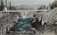
1924: Larry's River
Larry's River, Nova Scotia, Canada - Larry's River Estuary
| Bridgemeister ID: | 7594 (added 2023-05-07) |
| Year Completed: | 1924 |
| Name: | Larry's River |
| Location: | Larry's River, Nova Scotia, Canada |
| Crossing: | Larry's River Estuary |
| Use: | Footbridge |
| Status: | Dismantled, 1944 |
| Main Cables: | Wire (steel) |
| Suspended Spans: | 3 |
| Main Span: | 1 |
| Side Spans: | 2 |
External Links:
- Early Planning and Construction: 1922-1945 - Larry's River Footbridge Preservation Society. Blog post with several images of the site and bridge.
- Nova Scotia Archives - Clara Dennis Nova Scotia Archives 1981-541 no. 655. Image of Larry's River suspension bridge.
- Nova Scotia Archives - Clara Dennis Nova Scotia Archives 1981-541 no. 656. Image of Larry's River suspension bridge.
- Nova Scotia Archives - Clara Dennis Nova Scotia Archives 1981-541 no. 657. Image of Larry's River suspension bridge.
1926: Second Alexandra
Spuzzum, British Columbia, Canada - Fraser River
| Bridgemeister ID: | 147 (added before 2003) |
| Year Completed: | 1926 |
| Name: | Second Alexandra |
| Location: | Spuzzum, British Columbia, Canada |
| Crossing: | Fraser River |
| At or Near Feature: | Caribou Highway |
| Coordinates: | 49.70739 N 121.41669 W |
| Maps: | Acme, GeoHack, Google, OpenStreetMap |
| References: | BPL |
| Use: | Vehicular (one-lane) |
| Status: | Restricted to foot traffic (last checked: 2021) |
| Main Cables: | Wire (steel) |
| Suspended Spans: | 1 |
| Main Span: | 1 x 82.3 meters (270 feet) |
Notes:
- Replaced 1863 Alexandra (Trutch's) - Spuzzum, British Columbia, Canada.
- All past and present bridges at this location.
Image Sets:


1929: Ambassador
Detroit, Michigan, USA and Windsor, Ontario, Canada - Detroit River
| Bridgemeister ID: | 160 (added before 2003) |
| Year Completed: | 1929 |
| Name: | Ambassador |
| Location: | Detroit, Michigan, USA and Windsor, Ontario, Canada |
| Crossing: | Detroit River |
| Coordinates: | 42.31210 N 83.07402 W |
| Maps: | Acme, GeoHack, Google, OpenStreetMap |
| Principals: | Jonathan Jones, McClintic-Marshall |
| References: | AAJ, AMB, GBD, PTS2 |
| Use: | Vehicular (major highway) |
| Status: | In use (last checked: 2022) |
| Main Cables: | Wire (steel) |
| Suspended Spans: | 1 |
| Main Span: | 1 x 563.9 meters (1,850 feet) |
| Deck width: | 55 feet |
Notes:
- Became longest suspension bridge by eclipsing 1926 Benjamin Franklin (Philadelphia-Camden) - Philadelphia, Pennsylvania and Camden, New Jersey, USA.
- Eclipsed by new longest suspension bridge 1931 George Washington (GWB) - New York, New York and Fort Lee, New Jersey, USA.
External Links:
Image Sets:


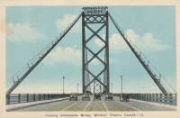
1929: Grand Mère
Grand-Mère, Quebec, Canada - St. Maurice River
| Bridgemeister ID: | 162 (added before 2003) |
| Year Completed: | 1929 |
| Name: | Grand Mère |
| Location: | Grand-Mère, Quebec, Canada |
| Crossing: | St. Maurice River |
| Coordinates: | 46.620117 N 72.6794 W |
| Maps: | Acme, GeoHack, Google, OpenStreetMap |
| Principals: | Robinson and Steinman |
| References: | AAJ, BC3, BPL, PTS2, SJR |
| Use: | Vehicular (two-lane, heavy vehicles), with walkway |
| Status: | In use (last checked: 2019) |
| Main Cables: | Wire (steel) |
| Suspended Spans: | 1 |
| Main Span: | 1 x 289.2 meters (948.8 feet) |
| Deck width: | 26 feet |
External Links:
Image Sets:

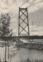
1929: Springbank
London, Ontario, Canada - River Thames
| Bridgemeister ID: | 290 (added before 2003) |
| Year Completed: | 1929 |
| Name: | Springbank |
| Location: | London, Ontario, Canada |
| Crossing: | River Thames |
| At or Near Feature: | Springbank Park |
| Principals: | J. R. Rostron |
| References: | AAJ |
| Use: | Footbridge |
| Status: | Replaced, 2002 |
| Main Cables: | Wire (steel) |
| Suspended Spans: | 1 |
| Main Span: | 1 x 71.6 meters (235 feet) |
| Deck width: | 5 feet |
Notes:
- Replaced by truss, 2002.
1931: Hagwilget
Hagwilget, British Columbia, Canada - Bulkley River
| Bridgemeister ID: | 170 (added before 2003) |
| Year Completed: | 1931 |
| Name: | Hagwilget |
| Also Known As: | Bulkley Canyon |
| Location: | Hagwilget, British Columbia, Canada |
| Crossing: | Bulkley River |
| At or Near Feature: | Hagwilget Canyon |
| Coordinates: | 55.25740 N 127.60380 W |
| Maps: | Acme, GeoHack, Google, OpenStreetMap |
| Principals: | BC Department of Public Works |
| References: | AAJ |
| Use: | Vehicular (one-lane) |
| Status: | In use (last checked: 2008) |
| Main Cables: | Wire (steel) |
| Suspended Spans: | 1 |
| Main Span: | 1 x 140.2 meters (460 feet) |
| Deck width: | 16 feet |
Notes:
- Replaced 1912 Hagwilget (Bulkley Canyon) - Hagwilget, British Columbia, Canada.
- All past and present bridges at this location.
External Links:
Image Sets:
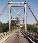
1931: Star Mine
Rosedale, Drumheller vicinity, Alberta, Canada - Red Deer River
| Bridgemeister ID: | 350 (added before 2003) |
| Year Completed: | 1931 |
| Name: | Star Mine |
| Also Known As: | Rosedale Swinging |
| Location: | Rosedale, Drumheller vicinity, Alberta, Canada |
| Crossing: | Red Deer River |
| Coordinates: | 51.420021 N 112.614473 W |
| Maps: | Acme, GeoHack, Google, OpenStreetMap |
| Principals: | George Lester MacKenzie |
| Use: | Footbridge |
| Status: | In use (last checked: 2024) |
| Main Cables: | Wire (steel) |
| Suspended Spans: | 1 |
| Main Span: | 1 x 117 meters (383.9 feet) |
Notes:
- 1958: Rebuilt.
- 2020, May: Closed indefinitely due to safety concerns. During an inspection of the bridge "it was determined the northeast timber bridge support was in extremely poor condition."
- 2023, October: Contract to repair bridge awarded. Expected to reopen in April 2024.
Annotated Citations:
- Nairn, Lacie. "Town waiting on province for Rosedale suspension bridge repairs." The Drumheller Mail, 13 Apr. 2022, www.thestar.com/news/canada/2022/04/13/town-waiting-on-province-for-rosedale-suspension-bridge-repairs.html
The bridge is still closed. "The town initially hoped to complete repairs over the winter of 2021. However, as the land on the northern shore of the bridge was privately owned, land transfer negotiations were conducted between the Town, Alberta Transportation, and the landowner."
External Links:
Image Sets:

1932: (suspension bridge)
Bella Coola, British Columbia, Canada - Bella Coola River
| Bridgemeister ID: | 1436 (added 2004-07-30) |
| Year Completed: | 1932 |
| Name: | (suspension bridge) |
| Location: | Bella Coola, British Columbia, Canada |
| Crossing: | Bella Coola River |
| Status: | Removed, before 1966 |
| Main Cables: | Wire (steel) |
| Suspended Spans: | 1 |
Notes:
- Later at same location 1957 (footbridge) - Bella Coola, British Columbia, Canada.
- All past and present bridges at this location.
Image Sets:

1934: Sifton Boulevard
Calgary, Alberta, Canada - Elbow River
| Bridgemeister ID: | 802 (added 2003-03-29) |
| Year Completed: | 1934 |
| Name: | Sifton Boulevard |
| Also Known As: | Riverdale Avenue, Sifton-Riverdale |
| Location: | Calgary, Alberta, Canada |
| Crossing: | Elbow River |
| Coordinates: | 51.019060 N 114.083178 W |
| Maps: | Acme, GeoHack, Google, OpenStreetMap |
| Use: | Footbridge |
| Status: | Wrecked, 2013 |
| Main Cables: | Wire |
| Suspended Spans: | 1 |
Notes:
- Footbridge with green steel towers. Distinct from the other Elbow River, Calgary footbridges in the inventory, but appeared very similar to the Sandy Beach bridge.
- Wrecked by flood, 2013.
- Similar to 1959 Sandy Beach (River Park, Riverpark) - Calgary, Alberta, Canada.
- Near 1947 Rideau Park - Calgary, Alberta, Canada.
- Near future location of 2014 Rideau Park - Calgary, Alberta, Canada.
- Replaced by 2014 Riverdale Avenue - Calgary, Alberta, Canada.
- All past and present bridges at this location.
Image Sets:

1935: l'Île d'Orléans
Quebec City, Quebec, Canada - St. Lawrence River
| Bridgemeister ID: | 183 (added before 2003) |
| Year Completed: | 1935 |
| Name: | l'Île d'Orléans |
| Also Known As: | Isle of Orleans, Orleans Island, Taschereau |
| Location: | Quebec City, Quebec, Canada |
| Crossing: | St. Lawrence River |
| Coordinates: | 46.880233 N 71.137883 W |
| Maps: | Acme, GeoHack, Google, OpenStreetMap |
| Principals: | Monsarrat and Pratley |
| References: | AAJ |
| Use: | Vehicular (two-lane, heavy vehicles), with walkway |
| Status: | In use (last checked: 2019) |
| Main Cables: | Wire (steel) |
| Suspended Spans: | 3 |
| Main Span: | 1 x 323 meters (1,059.7 feet) |
| Side Spans: | 2 x 127 meters (416.7 feet) |
| Deck width: | 30 feet |
Notes:
- Replacement proposed to start in 2024.
- Near Montmorency Falls - Quebec City vicinity, Quebec, Canada.
External Links:
Image Sets:

1938: Thousand Islands International II
Georgina Island and Selton, Ontario, Canada - St. Lawrence River
| Bridgemeister ID: | 365 (added before 2003) |
| Year Completed: | 1938 |
| Name: | Thousand Islands International II |
| Location: | Georgina Island and Selton, Ontario, Canada |
| Crossing: | St. Lawrence River |
| Coordinates: | 44.36323 N 75.98271 W |
| Maps: | Acme, GeoHack, Google, OpenStreetMap |
| Principals: | Robinson and Steinman |
| References: | AAJ, ADDS |
| Use: | Vehicular (two-lane, heavy vehicles), with walkway |
| Status: | In use (last checked: 2022) |
| Main Cables: | Wire (steel) |
| Suspended Spans: | 3 |
| Main Span: | 1 x 228.6 meters (750 feet) |
| Side Spans: | 2 x 91.4 meters (300 feet) |
Notes:
- Companion to 1938 Thousand Islands International I - Wellesley Island and Collins Landing, New York, USA.
External Links:
Image Sets:

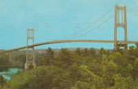
1939: Chute du Brûlé
Grand-Remous, Quebec, Canada - Gatineau River
| Bridgemeister ID: | 192 (added before 2003) |
| Year Completed: | 1939 |
| Name: | Chute du Brûlé |
| Location: | Grand-Remous, Quebec, Canada |
| Crossing: | Gatineau River |
| Coordinates: | 46.619944 N 75.917056 W |
| Maps: | Acme, GeoHack, Google, OpenStreetMap |
| Principals: | Dominion Bridge Co. |
| Use: | Vehicular (two-lane) |
| Status: | Removed |
| Main Cables: | Wire (steel) |
| Suspended Spans: | 1 |
Image Sets:
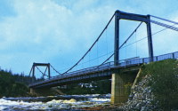
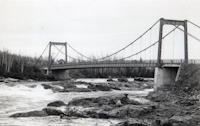
1939: Lions Gate
Vancouver, British Columbia, Canada - Vancouver Harbor
| Bridgemeister ID: | 194 (added before 2003) |
| Year Completed: | 1939 |
| Name: | Lions Gate |
| Also Known As: | First Narrows |
| Location: | Vancouver, British Columbia, Canada |
| Crossing: | Vancouver Harbor |
| At or Near Feature: | Burrard Inlet |
| Coordinates: | 49.31533 N 123.13846 W |
| Maps: | Acme, GeoHack, Google, OpenStreetMap |
| Principals: | Monsarrat and Pratley |
| References: | AAJ, BAR, BMA |
| Use: | Vehicular (major highway) |
| Status: | In use (last checked: 2019) |
| Main Cables: | Wire (steel) |
| Suspended Spans: | 3 |
| Main Span: | 1 x 472.4 meters (1,550 feet) |
| Side Spans: | 2 x 187.5 meters (615 feet) |
| Deck width: | 39 feet |
External Links:
Image Sets:

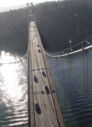
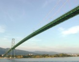
1943: Peace River
Taylor, British Columbia, Canada - Peace River
| Bridgemeister ID: | 205 (added before 2003) |
| Year Completed: | 1943 |
| Name: | Peace River |
| Location: | Taylor, British Columbia, Canada |
| Crossing: | Peace River |
| Coordinates: | 56.138123 N 120.674371 W |
| Maps: | Acme, GeoHack, Google, OpenStreetMap |
| Principals: | John A. Roebling's Sons Co. |
| References: | CTT |
| Use: | Vehicular |
| Status: | Collapsed, 1957 |
| Main Cables: | Wire (steel) |
| Suspended Spans: | 3 |
| Main Span: | 1 x 609.6 meters (2,000 feet) |
| Side Spans: | 2 |
Notes:
- 1957, October: Partially collapsed due to a landslide near one of the bridge's anchorages.
- 1958: The bridge is demolished.
- Near future location of (pipeline bridge) - Taylor, British Columbia, Canada.
External Links:
- YouTube - 1958 Peace River Suspension Bridge collapse clean up and debris removal, Taylor, BC. Video explaining the collapse and subsequent demolition.
- Structurae - Structure ID 20007348
Image Sets:


1944: Canol
Ross River, Yukon, Canada - Ross River
| Bridgemeister ID: | 833 (added 2003-06-01) |
| Year Completed: | 1944 |
| Name: | Canol |
| Also Known As: | Ross River |
| Location: | Ross River, Yukon, Canada |
| Crossing: | Ross River |
| Coordinates: | 61.98769 N 132.44722 W |
| Maps: | Acme, GeoHack, Google, OpenStreetMap |
| Use: | Footbridge |
| Status: | In use (last checked: 2019) |
| Main Span: | 1 x 182.9 meters (600 feet) |
Notes:
- Closed in 2013 due to deteriorating condition and risk of imminent failure. Rehabilitated 2017-2018 and subsequently reopened.
External Links:
Image Sets:

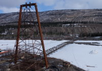
1944: Liard River
Liard River Hot Springs vicinity, British Columbia, Canada - Liard River
| Bridgemeister ID: | 339 (added before 2003) |
| Year Completed: | 1944 |
| Name: | Liard River |
| Location: | Liard River Hot Springs vicinity, British Columbia, Canada |
| Crossing: | Liard River |
| Coordinates: | 59.41312 N 126.09541 W |
| Maps: | Acme, GeoHack, Google, OpenStreetMap |
| Principals: | American Bridge Co. |
| References: | CTT |
| Use: | Vehicular (two-lane, heavy vehicles) |
| Status: | In use (last checked: 2009) |
| Main Cables: | Wire (steel) |
| Suspended Spans: | 3 |
| Main Span: | 1 |
| Side Spans: | 2 |
Notes:
- See 1940 Tacoma Narrows (Galloping Gertie) - Tacoma and Gig Harbor, Washington, USA. According to CTT, "Two sections from the Tacoma bridge's east approach were [re]used in the Liard span."
External Links:
Image Sets:
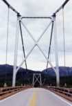

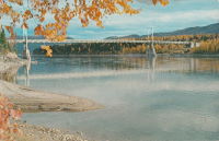
1946: Senkiw
Franklin, Manitoba, Canada - Roseau River
| Bridgemeister ID: | 5177 (added 2020-10-03) |
| Year Completed: | 1946 |
| Name: | Senkiw |
| Location: | Franklin, Manitoba, Canada |
| Crossing: | Roseau River |
| Coordinates: | 49.198470 N 96.882782 W |
| Maps: | Acme, GeoHack, Google, OpenStreetMap |
| Use: | Footbridge |
| Status: | In use (last checked: 2020) |
| Main Cables: | Wire |
| Suspended Spans: | 1 |
Notes:
- Refurbished, 2004-2005.
External Links:
1947: Rideau Park
Calgary, Alberta, Canada - Elbow River
| Bridgemeister ID: | 968 (added 2003-11-01) |
| Year Completed: | 1947 |
| Name: | Rideau Park |
| Location: | Calgary, Alberta, Canada |
| Crossing: | Elbow River |
| At or Near Feature: | Wood's Park-Elbow Island Park |
| Coordinates: | 51.02491 N 114.0781 W |
| Maps: | Acme, GeoHack, Google, OpenStreetMap |
| Use: | Footbridge |
| Status: | Destroyed, 2013 |
| Main Cables: | Wire |
Notes:
- Footbridge with wood towers, distinct from other Elbow River footbridges in the inventory.
- Destroyed by flood, 2013.
- Near 1934 Sifton Boulevard (Riverdale Avenue, Sifton-Riverdale) - Calgary, Alberta, Canada.
- Near future location of 2014 Riverdale Avenue - Calgary, Alberta, Canada.
- Replaced by 2014 Rideau Park - Calgary, Alberta, Canada.
- All past and present bridges at this location.
Image Sets:

1950: (footbridge)
New Hamburg vicinity, Ontario, Canada - Nith River
| Bridgemeister ID: | 803 (added 2003-03-30) |
| Year Completed: | 1950 |
| Name: | (footbridge) |
| Location: | New Hamburg vicinity, Ontario, Canada |
| Crossing: | Nith River |
| Coordinates: | 43.398709 N 80.707671 W |
| Maps: | Acme, GeoHack, Google, OpenStreetMap |
| Use: | Footbridge |
| Status: | Extant (last checked: 2020) |
| Main Cables: | Wire |
| Suspended Spans: | 3 |
| Main Span: | 1 |
| Side Spans: | 2 |
1955: Angus L. Macdonald
Halifax and Dartmouth, Nova Scotia, Canada - Halifax Harbour
| Bridgemeister ID: | 209 (added before 2003) |
| Year Completed: | 1955 |
| Name: | Angus L. Macdonald |
| Location: | Halifax and Dartmouth, Nova Scotia, Canada |
| Crossing: | Halifax Harbour |
| Coordinates: | 44.66116 N 63.5868 W |
| Maps: | Acme, GeoHack, Google, OpenStreetMap |
| Principals: | Philip Pratley |
| References: | ALM |
| Use: | Vehicular (three-lane), with walkway |
| Status: | In use (last checked: 2019) |
| Main Cables: | Wire (steel) |
| Suspended Spans: | 3 |
| Main Span: | 1 x 441 meters (1,447 feet) |
| Side Spans: | 2 x 160.3 meters (526 feet) |
| Deck width: | 11.5 meters |
External Links:
Image Sets:


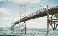
1957: (footbridge)
Bella Coola, British Columbia, Canada - Bella Coola River
| Bridgemeister ID: | 2437 (added 2008-04-22) |
| Year Completed: | 1957 |
| Name: | (footbridge) |
| Location: | Bella Coola, British Columbia, Canada |
| Crossing: | Bella Coola River |
| Principals: | Allison Logging Co. |
| Use: | Footbridge |
| Main Cables: | Wire |
Notes:
1958: Three Nations Crossing
Cornwall, Ontario, Canada and Massena, New York, USA - St. Lawrence River
| Bridgemeister ID: | 325 (added before 2003) |
| Year Completed: | 1958 |
| Name: | Three Nations Crossing |
| Also Known As: | Cornwall-Massena International, Seaway International |
| Location: | Cornwall, Ontario, Canada and Massena, New York, USA |
| Crossing: | St. Lawrence River |
| Coordinates: | 44.989962 N 74.739913 W |
| Maps: | Acme, GeoHack, Google, OpenStreetMap |
| References: | STL |
| Use: | Vehicular |
| Status: | In use (last checked: 2019) |
| Main Cables: | Wire (steel) |
| Suspended Spans: | 3 |
| Main Span: | 1 |
| Side Spans: | 2 |
Notes:
- Renamed "Three Nations Crossing" effective January 1, 2000 in recognition of the Mohawks of Akwesasne
External Links:
Image Sets:


1959: Sandy Beach
Calgary, Alberta, Canada - Elbow River
| Bridgemeister ID: | 606 (added 2003-01-14) |
| Year Completed: | 1959 |
| Name: | Sandy Beach |
| Also Known As: | River Park, Riverpark |
| Location: | Calgary, Alberta, Canada |
| Crossing: | Elbow River |
| At or Near Feature: | Sandy Beach Park |
| Coordinates: | 51.011984 N 114.092351 W |
| Maps: | Acme, GeoHack, Google, OpenStreetMap |
| Use: | Footbridge |
| Status: | Destroyed, June 2013 |
| Main Cables: | Wire (steel) |
| Suspended Spans: | 1 |
Notes:
- Destroyed by flood, June 2013.
- Similar to 1934 Sifton Boulevard (Riverdale Avenue, Sifton-Riverdale) - Calgary, Alberta, Canada.
- Replaced by 2014 Sandy Beach - Calgary, Alberta, Canada.
- All past and present bridges at this location.
Image Sets:
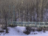

1960: Dunvegan
Dunvegan, Alberta, Canada - Peace River
| Bridgemeister ID: | 212 (added before 2003) |
| Year Completed: | 1960 |
| Name: | Dunvegan |
| Location: | Dunvegan, Alberta, Canada |
| Crossing: | Peace River |
| Coordinates: | 55.921533 N 118.604033 W |
| Maps: | Acme, GeoHack, Google, OpenStreetMap |
| Use: | Vehicular (two-lane, heavy vehicles) |
| Status: | In use (last checked: 2020) |
| Main Cables: | Wire (steel) |
| Suspended Spans: | 3 |
| Main Span: | 1 x 274 meters (899 feet) |
| Side Spans: | 2 |
| Deck width: | 8.2 meters |
Notes:
- Deck replacement project scheduled for 2008-2009.
- Another Deck replacement project expected to be completed November 30, 2020.
External Links:
Image Sets:
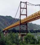
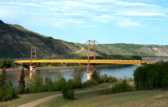

1960: Ogdensburg-Prescott International
Ogdensburg, New York, USA and Prescott, Ontario, Canada - St. Lawrence River
| Bridgemeister ID: | 214 (added before 2003) |
| Year Completed: | 1960 |
| Name: | Ogdensburg-Prescott International |
| Also Known As: | Seaway Skyway |
| Location: | Ogdensburg, New York, USA and Prescott, Ontario, Canada |
| Crossing: | St. Lawrence River |
| Coordinates: | 44.73 N 75.45667 W |
| Maps: | Acme, GeoHack, Google, OpenStreetMap |
| Principals: | Modjeski & Masters |
| Use: | Vehicular (major highway) |
| Status: | In use (last checked: 2019) |
| Main Cables: | Wire (steel) |
| Suspended Spans: | 3 |
| Main Span: | 1 x 350.75 meters (1,150.8 feet) |
| Side Spans: | 2 |
External Links:
Image Sets:


1961: Revelstoke
Revelstoke, British Columbia, Canada - Columbia River
| Bridgemeister ID: | 943 (added 2003-10-29) |
| Year Completed: | 1961 |
| Name: | Revelstoke |
| Location: | Revelstoke, British Columbia, Canada |
| Crossing: | Columbia River |
| Coordinates: | 51.00713 N 118.2189 W |
| Maps: | Acme, GeoHack, Google, OpenStreetMap |
| Use: | Vehicular (two-lane, heavy vehicles), with walkway |
| Status: | In use (last checked: 2019) |
| Main Cables: | Wire (steel) |
| Suspended Spans: | 2 |
| Main Span: | 1 x 300.2 meters (985 feet) |
| Side Span: | 1 |
External Links:
1963: (suspension bridge)
Hope, British Columbia, Canada - Coquihalla River
| Bridgemeister ID: | 2448 (added 2004-02-28) |
| Year Completed: | 1963 |
| Name: | (suspension bridge) |
| Location: | Hope, British Columbia, Canada |
| Crossing: | Coquihalla River |
| Coordinates: | 49.386927 N 121.433118 W |
| Maps: | Acme, GeoHack, Google, OpenStreetMap |
| Principals: | Emil Anderson Construction |
| Use: | Vehicular |
| Status: | Destroyed, January 4, 1984 |
Notes:
- Destroyed by flood, January 4, 1984.
- Replaced by 1984 (suspension bridge) - Hope, British Columbia, Canada.
- All past and present bridges at this location.
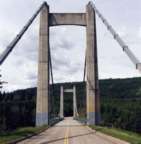
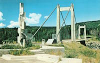
1965: Hudson's Hope
Hudson's Hope, British Columbia, Canada - Peace River
| Bridgemeister ID: | 222 (added before 2003) |
| Year Completed: | 1965 |
| Name: | Hudson's Hope |
| Location: | Hudson's Hope, British Columbia, Canada |
| Crossing: | Peace River |
| Coordinates: | 55.988618 N 121.985539 W |
| Maps: | Acme, GeoHack, Google, OpenStreetMap |
| Use: | Vehicular (two-lane, heavy vehicles) |
| Status: | In use (last checked: 2019) |
| Main Cables: | Wire (steel) |
| Suspended Spans: | 1 |
External Links:
Image Sets:
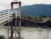
1968: Gitwinksihlkw
Gitwinksihlkw (Canyon City), British Columbia, Canada - Nass River
| Bridgemeister ID: | 254 (added before 2003) |
| Year Completed: | 1968 |
| Name: | Gitwinksihlkw |
| Location: | Gitwinksihlkw (Canyon City), British Columbia, Canada |
| Crossing: | Nass River |
| Coordinates: | 55.191403 N 129.221144 W |
| Maps: | Acme, GeoHack, Google, OpenStreetMap |
| Use: | Footbridge |
| Status: | In use (last checked: 2019) |
| Main Cables: | Wire (steel) |
| Suspended Spans: | 1 |
| Main Span: | 1 x 103.3 meters (339 feet) |
Image Sets:
1970: A. Murray Mackay
Halifax and Dartmouth, Nova Scotia, Canada - Halifax Harbour
| Bridgemeister ID: | 227 (added before 2003) |
| Year Completed: | 1970 |
| Name: | A. Murray Mackay |
| Location: | Halifax and Dartmouth, Nova Scotia, Canada |
| Crossing: | Halifax Harbour |
| Coordinates: | 44.67737 N 63.61219 W |
| Maps: | Acme, GeoHack, Google, OpenStreetMap |
| Use: | Vehicular (four-lane) |
| Status: | In use (last checked: 2019) |
| Main Cables: | Wire (steel) |
| Suspended Spans: | 3 |
| Main Span: | 1 |
| Side Spans: | 2 |
External Links:
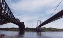
1970: Pierre Laporte
Quebec City and Levis, Quebec, Canada - St. Lawrence River
| Bridgemeister ID: | 228 (added before 2003) |
| Year Completed: | 1970 |
| Name: | Pierre Laporte |
| Location: | Quebec City and Levis, Quebec, Canada |
| Crossing: | St. Lawrence River |
| Coordinates: | 46.741717 N 71.288333 W |
| Maps: | Acme, GeoHack, Google, OpenStreetMap |
| Principals: | Demers-Vandry-Grondquist |
| Use: | Vehicular (major highway) |
| Status: | In use (last checked: 2023) |
| Main Cables: | Wire (steel) |
| Suspended Spans: | 3 |
| Main Span: | 1 x 667.5 meters (2,190 feet) |
| Side Spans: | 2 x 186.5 meters (611.9 feet) |
Notes:
- 2021, November: Weight and lane restrictions imposed pending urgent replacement of several suspender cables.
External Links:
- CBC - Suspension cables on Quebec City's Pierre-Laporte bridge could give way at any time, report finds. June 16, 2022. Article reporting the alarming amount of corrosion found in the bridge's cables. Immediate repairs are recommended.
- Pierre Laporte Bridge - Wikipedia
- Structurae - Structure ID 20003362
Image Sets:

1974: Mestachibo
Beaupré, Quebec, Canada - Sainte-Anne River
| Bridgemeister ID: | 231 (added before 2003) |
| Year Completed: | 1974 |
| Name: | Mestachibo |
| Location: | Beaupré, Quebec, Canada |
| Crossing: | Sainte-Anne River |
| At or Near Feature: | Canyon Sainte-Anne |
| Coordinates: | 47.07486 N 70.87540 W |
| Maps: | Acme, GeoHack, Google, OpenStreetMap |
| Use: | Footbridge |
| Status: | In use (last checked: 2019) |
| Main Cables: | Wire (steel) |
| Suspended Spans: | 3 |
| Main Span: | 1 x 63 meters (206.7 feet) |
| Side Spans: | 2 |
Notes:
| Bridgemeister ID: | 9007 (added 2024-12-25) |
| Year Completed: | 1975 |
| Name: | Aerobus |
| Location: | Mont Sainte-Anne, Beaupré, Quebec, Canada |
| Coordinates: | 47.075417 N 70.907000 W |
| Maps: | Acme, GeoHack, Google, OpenStreetMap |
| Use: | Aerobus |
| Status: | Removed |
| Main Cables: | Wire (steel) |
Notes:
- Coordinates indicate approximate location of one of the system's terminals.
- 1975: An Aerobus system previously erected for testing in Switzerland is dismantled and reassembled at the Mont Sainte-Anne ski center.
- 1992: Use of the Aerobus system is discontinued.
- See 1975 Aerobus - Mannheim, Germany.
External Links:
- Aerobus.com - Aerobus Installations. A list of Aerobus installations. "Ste. Anne, Quebec, Canada / 1975 ~ 1992. Expanded to a suspended guideway length of 820 meters, about one-half mile, the system carried patrons of a ski area from their lodges to the lifts in all weather conditions."
- Gallery of Aerobus Pictures - #2. Two photos of the Aerobus installation at Mont Sainte-Anne.
- X.com. October 1975 news article about an electrical issue forcing the Aerobus to be temporarily closed.
- X.com - Au parc du mont Sainte-Anne ... l'aérobus!. Video of what appears to the be Aerobus in operation in Switzerland before it was dismantled and moved to Mont Sainte-Anne with voiceover about the planned use at Mont Sainte-Anne.
1976: Cheewhat River
British Columbia, Canada - Cheewhat River
| Bridgemeister ID: | 1451 (added 2004-08-01) |
| Year Completed: | 1976 |
| Name: | Cheewhat River |
| Location: | British Columbia, Canada |
| Crossing: | Cheewhat River |
| At or Near Feature: | West Coast Trail |
| Coordinates: | 48.663340 N 124.811974 W |
| Maps: | Acme, GeoHack, Google, OpenStreetMap |
| Use: | Footbridge |
| Status: | In use (last checked: 2016) |
| Main Cables: | Wire (steel) |
| Suspended Spans: | 1 |
1978: Bernier
Bromptonville, Sherbrooke vicinity, Quebec, Canada - St. François River
| Bridgemeister ID: | 1162 (added 2004-01-19) |
| Year Completed: | 1978 |
| Name: | Bernier |
| Location: | Bromptonville, Sherbrooke vicinity, Quebec, Canada |
| Crossing: | St. François River |
| Use: | Footbridge and Snowmobile |
| Status: | Replaced, 2001 |
| Main Cables: | Wire (steel) |
| Main Span: | 1 x 66 meters (216.5 feet) |
Notes:
- Carried Trans Canada Trail. Intended for pedestrians, cyclists, and snowmobiles.
- Replaced by 2001 Bernier - Bromptonville, Sherbrooke vicinity, Quebec, Canada.
- All past and present bridges at this location.
1979: McNicoll
Beaupré, Quebec, Canada - Sainte-Anne River
| Bridgemeister ID: | 232 (added before 2003) |
| Year Completed: | 1979 |
| Name: | McNicoll |
| Location: | Beaupré, Quebec, Canada |
| Crossing: | Sainte-Anne River |
| At or Near Feature: | Canyon Sainte-Anne |
| Coordinates: | 47.07333 N 70.87749 W |
| Maps: | Acme, GeoHack, Google, OpenStreetMap |
| Use: | Footbridge |
| Status: | In use (last checked: 2019) |
| Main Cables: | Wire (steel) |
| Main Span: | 1 x 58 meters (190.3 feet) |
Notes:
1980: Kennebecasis
Sussex, New Brunswick, Canada - Kennebecasis River
| Bridgemeister ID: | 233 (added before 2003) |
| Year Completed: | 1980 |
| Name: | Kennebecasis |
| Location: | Sussex, New Brunswick, Canada |
| Crossing: | Kennebecasis River |
| Use: | Footbridge |
| Status: | Demolished, October, 2002 |
| Main Cables: | Wire (steel) |
1980: Similkameen Ore Conveyor
Princeton, British Columbia, Canada - Similkameen Canyon
| Bridgemeister ID: | 2100 (added 2006-07-07) |
| Year Completed: | 1980 |
| Name: | Similkameen Ore Conveyor |
| Location: | Princeton, British Columbia, Canada |
| Crossing: | Similkameen Canyon |
| Coordinates: | 49.351219 N 120.548909 W |
| Maps: | Acme, GeoHack, Google, OpenStreetMap |
| Principals: | Buckland & Taylor Ltd., Robert McLellan & Co. Ltd. |
| Use: | Conveyor |
| Status: | Extant (last checked: 2019) |
| Main Cables: | Wire (steel) |
| Main Span: | 1 x 403.9 meters (1,325 feet) |
External Links:
1983: Edlewogen Crossing
Holderville, Kingston Peninsula, New Brunswick, Canada
| Bridgemeister ID: | 816 (added 2003-05-30) |
| Year Completed: | 1983 |
| Name: | Edlewogen Crossing |
| Location: | Holderville, Kingston Peninsula, New Brunswick, Canada |
| At or Near Feature: | Camp Holderville Boy Scout Camp |
| Use: | Footbridge |
1983: Yeoman's
Titusville, New Brunswick, Canada - Hammond River
| Bridgemeister ID: | 234 (added before 2003) |
| Year Completed: | 1983 |
| Name: | Yeoman's |
| Location: | Titusville, New Brunswick, Canada |
| Crossing: | Hammond River |
| Coordinates: | 45.482525 N 65.773381 W |
| Maps: | Acme, GeoHack, Google, OpenStreetMap |
| Use: | Footbridge |
| Status: | In use (last checked: 2019) |
| Main Cables: | Wire (steel) |
1984: (suspension bridge)
Hope, British Columbia, Canada - Coquihalla River
| Bridgemeister ID: | 1253 (added 2004-02-28) |
| Year Completed: | 1984 |
| Name: | (suspension bridge) |
| Location: | Hope, British Columbia, Canada |
| Crossing: | Coquihalla River |
| Coordinates: | 49.387210 N 121.432464 W |
| Maps: | Acme, GeoHack, Google, OpenStreetMap |
| Principals: | Emil Anderson Construction |
| Use: | Vehicular (one-lane) |
| Status: | Replaced, 2007 |
| Main Cables: | Wire (steel) |
| Suspended Spans: | 1 |
| Main Span: | 1 x 79.2 meters (260 feet) estimated |
Notes:
- Replaced 1963 (suspension bridge) - Hope, British Columbia, Canada.
- All past and present bridges at this location.
Image Sets:
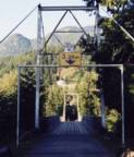
1984: Zuckerberg Island Heritage Park
Castlegar, British Columbia, Canada - Columbia River
| Bridgemeister ID: | 913 (added 2003-10-11) |
| Year Completed: | 1984 |
| Name: | Zuckerberg Island Heritage Park |
| Location: | Castlegar, British Columbia, Canada |
| Crossing: | Columbia River |
| Coordinates: | 49.31616 N 117.65898 W |
| Maps: | Acme, GeoHack, Google, OpenStreetMap |
| Principals: | 44th Field Engineer Squadron |
| Use: | Footbridge |
| Status: | Closed (last checked: 2023) |
| Main Cables: | Wire (steel) |
| Suspended Spans: | 1 |
| Main Span: | 1 x 91.4 meters (300 feet) |
| Deck width: | 3 feet |
Notes:
- 2023, November: Has been closed for some time awaiting repairs.
- 1996: Bridge is reconstructed, according to sign posted at bridge.
- Near 1913 Brilliant (Doukhobor) - Castlegar vicinity, British Columbia, Canada.
1988: Coaticook
Coaticook, Quebec, Canada - Coaticook River
| Bridgemeister ID: | 249 (added before 2003) |
| Year Completed: | 1988 |
| Name: | Coaticook |
| Location: | Coaticook, Quebec, Canada |
| Crossing: | Coaticook River |
| At or Near Feature: | Le Parc de la Gorge de Coaticook |
| Coordinates: | 45.145983 N 71.8112 W |
| Maps: | Acme, GeoHack, Google, OpenStreetMap |
| Use: | Footbridge |
| Status: | In use (last checked: 2023) |
| Main Cables: | Wire (steel) |
| Suspended Spans: | 2 |
| Main Span: | 1 x 114 meters (374 feet) estimated |
| Side Span: | 1 x 52.1 meters (171 feet) estimated |
Notes:
Image Sets:
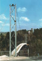
1995: Ville De Causapscal
Causapscal, Quebec, Canada - Matapédia River
| Bridgemeister ID: | 2593 (added 2014-04-14) |
| Year Completed: | 1995 |
| Name: | Ville De Causapscal |
| Location: | Causapscal, Quebec, Canada |
| Crossing: | Matapédia River |
| Use: | Snowmobile |
| Status: | In use (last checked: 2011) |
| Main Cables: | Wire (steel) |
| Suspended Spans: | 1 |
| Main Span: | 1 x 48.8 meters (160 feet) estimated |
Notes:
- Renovated 2010.
1998: Rotary
Pisew Falls, Manitoba, Canada - Grass River
| Bridgemeister ID: | 1185 (added 2004-01-24) |
| Year Completed: | 1998 |
| Name: | Rotary |
| Also Known As: | Pisew Falls |
| Location: | Pisew Falls, Manitoba, Canada |
| Crossing: | Grass River |
| At or Near Feature: | Pisew Falls Provincial Park |
| Coordinates: | 55.198642 N 98.395169 W |
| Maps: | Acme, GeoHack, Google, OpenStreetMap |
| Use: | Footbridge |
| Status: | In use (last checked: 2024) |
| Main Cables: | Wire (steel) |
| Suspended Spans: | 1 |
| Main Span: | 1 x 36.6 meters (120 feet) |
2000: La Manche
La Manche, Newfoundland and Labrador, Canada - La Manche River
| Bridgemeister ID: | 853 (added 2003-08-06) |
| Year Completed: | 2000 |
| Name: | La Manche |
| Location: | La Manche, Newfoundland and Labrador, Canada |
| Crossing: | La Manche River |
| Coordinates: | 47.16658 N 52.86638 W |
| Maps: | Acme, GeoHack, Google, OpenStreetMap |
| Use: | Footbridge |
| Status: | In use (last checked: 2024) |
| Main Cables: | Wire (steel) |
| Suspended Spans: | 1 |
Notes:
- Single-towered footbridge carrying the East Coast Trail. Plaque at the bridge the original suspension bridge (at or near this location) was destroyed January 28, 1966. The current bridge was officially opened June 17, 2000.
2000: McAllister
Ogden, Guysborough vicinity, Nova Scotia, Canada - Salmon River
| Bridgemeister ID: | 2368 (added 2007-09-16) |
| Year Completed: | 2000 |
| Name: | McAllister |
| Location: | Ogden, Guysborough vicinity, Nova Scotia, Canada |
| Crossing: | Salmon River |
| At or Near Feature: | Guysborough Nature Trail |
| Coordinates: | 45.346667 N 61.616139 W |
| Maps: | Acme, GeoHack, Google, OpenStreetMap |
| Principals: | Galeb Construction |
| Use: | Footbridge and Snowmobile |
| Status: | In use (last checked: 2024) |
| Main Cables: | Wire (steel) |
| Suspended Spans: | 2 |
| Main Span: | 1 x 60 meters (196.9 feet) |
| Side Span: | 1 |
2001: Bernier
Bromptonville, Sherbrooke vicinity, Quebec, Canada - St. François River
| Bridgemeister ID: | 1163 (added 2004-01-19) |
| Year Completed: | 2001 |
| Name: | Bernier |
| Location: | Bromptonville, Sherbrooke vicinity, Quebec, Canada |
| Crossing: | St. François River |
| Coordinates: | 45.483752 N 71.960675 W |
| Maps: | Acme, GeoHack, Google, OpenStreetMap |
| Principals: | Canadian Military Engineers (CME) |
| Use: | Footbridge |
| Status: | Destroyed, January, 2018 |
| Main Cables: | Wire (steel) |
Notes:
- Destroyed by flood and ice jam, January 2018, along with the adjacent rail bridge.
- Replaced 1978 Bernier - Bromptonville, Sherbrooke vicinity, Quebec, Canada.
- All past and present bridges at this location.
| Bridgemeister ID: | 916 (added 2003-10-12) |
| Year Completed: | 2003 |
| Name: | (footbridge) |
| Location: | Collingwood, Ontario, Canada |
| Coordinates: | 44.48883 N 80.31083 W |
| Maps: | Acme, GeoHack, Google, OpenStreetMap |
| Use: | Footbridge |
| Status: | In use (last checked: 2005) |
| Main Cables: | Wire (steel) |
| Suspended Spans: | 1 |
| Main Span: | 1 x 126 meters (413.4 feet) |
Notes:
- Located at the Scenic Caves attraction, the owners claim this large (126-meter main span) footbridge is the longest footbridge in Ontario.
2006: (footbridge)
Quebec City, Quebec, Canada - St. Charles River
| Bridgemeister ID: | 8988 (added 2024-12-23) |
| Year Completed: | 2006 |
| Name: | (footbridge) |
| Location: | Quebec City, Quebec, Canada |
| Crossing: | St. Charles River |
| Coordinates: | 46.844789 N 71.344344 W |
| Maps: | Acme, GeoHack, Google, OpenStreetMap |
| Use: | Footbridge |
| Status: | In use (last checked: 2023) |
| Main Cables: | Wire (steel) |
| Suspended Spans: | 1 |
External Links:
2007: Top
Parksville, British Columbia, Canada - Englishman River
| Bridgemeister ID: | 2498 (added 2008-12-24) |
| Year Completed: | 2007 |
| Name: | Top |
| Location: | Parksville, British Columbia, Canada |
| Crossing: | Englishman River |
| At or Near Feature: | Top Bridge Regional Park |
| Coordinates: | 49.297840 N 124.266962 W |
| Maps: | Acme, GeoHack, Google, OpenStreetMap |
| Use: | Footbridge |
| Status: | In use (last checked: 2020) |
| Main Cables: | Wire (steel) |
| Suspended Spans: | 2 |
| Main Spans: | 2 |
2009: (snowmobile bridge)
Saint-Martin, Quebec, Canada - Chaudière River
| Bridgemeister ID: | 2555 (added 2012-01-01) |
| Year Completed: | 2009 |
| Name: | (snowmobile bridge) |
| Location: | Saint-Martin, Quebec, Canada |
| Crossing: | Chaudière River |
| Coordinates: | 45.94855 N 70.65539 W |
| Maps: | Acme, GeoHack, Google, OpenStreetMap |
| Use: | Snowmobile |
| Status: | In use (last checked: 2010) |
| Main Cables: | Wire (steel) |
| Suspended Spans: | 1 |
| Main Span: | 1 x 109.7 meters (360 feet) |
Image Sets:

2011: (snowmobile bridge)
Nipi Katakuat vicinity, Quebec, Canada - Betsiamites River
| Bridgemeister ID: | 8572 (added 2024-04-28) |
| Year Completed: | 2011 |
| Name: | (snowmobile bridge) |
| Location: | Nipi Katakuat vicinity, Quebec, Canada |
| Crossing: | Betsiamites River |
| Coordinates: | 48.955333 N 68.809083 W |
| Maps: | Acme, GeoHack, Google, OpenStreetMap |
| Use: | Snowmobile |
| Status: | In use (last checked: 2021) |
| Main Cables: | Wire (steel) |
| Main Span: | 1 x 90 meters (295.3 feet) estimated |
2011: Fort Edmonton
Edmonton, Alberta, Canada - North Saskatchewan River
| Bridgemeister ID: | 2707 (added 2019-06-16) |
| Year Completed: | 2011 |
| Name: | Fort Edmonton |
| Location: | Edmonton, Alberta, Canada |
| Crossing: | North Saskatchewan River |
| Coordinates: | 53.495304 N 113.590800 W |
| Maps: | Acme, GeoHack, Google, OpenStreetMap |
| Use: | Footbridge |
| Status: | In use (last checked: 2019) |
| Main Cables: | Wire (steel) |
| Suspended Spans: | 3 |
| Main Span: | 1 x 138 meters (452.8 feet) |
| Side Spans: | 2 |
External Links:
2014: Rideau Park
Calgary, Alberta, Canada - Elbow River
| Bridgemeister ID: | 2936 (added 2019-09-16) |
| Year Completed: | 2014 |
| Name: | Rideau Park |
| Location: | Calgary, Alberta, Canada |
| Crossing: | Elbow River |
| At or Near Feature: | Wood's Park |
| Coordinates: | 51.024959 N 114.077580 W |
| Maps: | Acme, GeoHack, Google, OpenStreetMap |
| Use: | Footbridge |
| Status: | In use (last checked: 2019) |
| Main Cables: | Wire (steel) |
| Main Span: | 1 |
Notes:
- Replaced 1947 Rideau Park - Calgary, Alberta, Canada.
- Near 2014 Riverdale Avenue - Calgary, Alberta, Canada.
- Near former location of 1934 Sifton Boulevard (Riverdale Avenue, Sifton-Riverdale) - Calgary, Alberta, Canada.
- All past and present bridges at this location.
Image Sets:

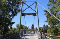
2014: Riverdale Avenue
Calgary, Alberta, Canada - Elbow River
| Bridgemeister ID: | 2935 (added 2019-09-16) |
| Year Completed: | 2014 |
| Name: | Riverdale Avenue |
| Location: | Calgary, Alberta, Canada |
| Crossing: | Elbow River |
| Coordinates: | 51.018727 N 114.083141 W |
| Maps: | Acme, GeoHack, Google, OpenStreetMap |
| Use: | Footbridge |
| Status: | In use (last checked: 2022) |
| Main Cables: | Wire (steel) |
| Main Span: | 1 |
Notes:
- Replaced 1934 Sifton Boulevard (Riverdale Avenue, Sifton-Riverdale) - Calgary, Alberta, Canada.
- Near 2014 Rideau Park - Calgary, Alberta, Canada.
- Near 2014 Sandy Beach - Calgary, Alberta, Canada.
- Near former location of 1947 Rideau Park - Calgary, Alberta, Canada.
- All past and present bridges at this location.
Image Sets:
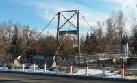
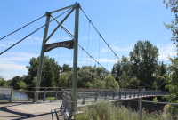
2014: Sandy Beach
Calgary, Alberta, Canada - Elbow River
| Bridgemeister ID: | 2704 (added 2019-06-15) |
| Year Completed: | 2014 |
| Name: | Sandy Beach |
| Location: | Calgary, Alberta, Canada |
| Crossing: | Elbow River |
| At or Near Feature: | Sandy Beach Park |
| Coordinates: | 51.012232 N 114.092064 W |
| Maps: | Acme, GeoHack, Google, OpenStreetMap |
| Use: | Footbridge |
| Status: | In use (last checked: 2022) |
| Main Cables: | Wire (steel) |
| Suspended Spans: | 1 |
Notes:
- Replaced 1959 Sandy Beach (River Park, Riverpark) - Calgary, Alberta, Canada.
- Near 2014 Riverdale Avenue - Calgary, Alberta, Canada.
- All past and present bridges at this location.
Image Sets:
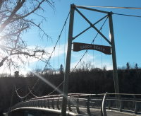

2014: Swift Creek
Valemount, British Columbia, Canada - Swift Creek
| Bridgemeister ID: | 3280 (added 2019-11-23) |
| Year Completed: | 2014 |
| Name: | Swift Creek |
| Location: | Valemount, British Columbia, Canada |
| Crossing: | Swift Creek |
| Coordinates: | 52.862358 N 119.241536 W |
| Maps: | Acme, GeoHack, Google, OpenStreetMap |
| Principals: | Robson Energy Services, G. Carson Logging |
| Use: | Footbridge |
| Status: | In use (last checked: 2014) |
| Main Cables: | Wire (steel) |
2016: Columbia River Skywalk
Trail, British Columbia, Canada - Columbia River
| Bridgemeister ID: | 4957 (added 2020-08-09) |
| Year Completed: | 2016 |
| Name: | Columbia River Skywalk |
| Location: | Trail, British Columbia, Canada |
| Crossing: | Columbia River |
| Coordinates: | 49.094381 N 117.702046 W |
| Maps: | Acme, GeoHack, Google, OpenStreetMap |
| Principals: | COWI North America Ltd., Graham Infrastructure LP |
| Use: | Footbridge |
| Status: | In use (last checked: 2020) |
| Main Cables: | Wire (steel) |
| Suspended Spans: | 3 |
| Main Span: | 1 x 225 meters (738.2 feet) |
| Side Spans: | 2 |
External Links:
2016: Saulteaux
Moose Jaw, Saskatchewan, Canada
| Bridgemeister ID: | 3187 (added 2019-11-09) |
| Year Completed: | 2016 |
| Name: | Saulteaux |
| Location: | Moose Jaw, Saskatchewan, Canada |
| At or Near Feature: | Wakamow Valley, Paashkwow Park |
| Coordinates: | 50.377028 N 105.540583 W |
| Maps: | Acme, GeoHack, Google, OpenStreetMap |
| Use: | Footbridge |
| Status: | In use (last checked: 2019) |
| Main Cables: | Wire (steel) |
| Bridgemeister ID: | 6980 (added 2022-03-27) |
| Year Completed: | 2018 |
| Name: | Calgary Zoo |
| Location: | Calgary, Alberta, Canada |
| Crossing: | Bow River |
| At or Near Feature: | Calgary Zoo, St. George's Island |
| Coordinates: | 51.046454 N 114.030951 W |
| Maps: | Acme, GeoHack, Google, OpenStreetMap |
| Use: | Footbridge |
| Status: | In use (last checked: 2022) |
| Main Cables: | Wire (steel) |
| Suspended Spans: | 1 |
| Main Span: | 1 |
Notes:
2018: Seymour River
North Vancouver, British Columbia, Canada - Seymour River
| Bridgemeister ID: | 2653 (added 2019-03-03) |
| Year Completed: | 2018 |
| Name: | Seymour River |
| Location: | North Vancouver, British Columbia, Canada |
| Crossing: | Seymour River |
| Coordinates: | 49.342497 N 123.002236 W |
| Maps: | Acme, GeoHack, Google, OpenStreetMap |
| Use: | Footbridge |
| Status: | In use (last checked: 2019) |
| Main Cables: | Wire (steel) |
| Suspended Spans: | 1 |
| Bridgemeister ID: | 1318 (added 2004-04-25) |
| Name: | (footbridge) |
| Location: | Bout-du-Monde vicinity, Quebec, Canada |
| Coordinates: | 46.40765 N 73.07795 W |
| Maps: | Acme, GeoHack, Google, OpenStreetMap |
| Use: | Footbridge |
| Status: | In use (last checked: 2005) |
| Main Cables: | Wire |
| Suspended Spans: | 1 |
Notes:
- Tall timber towers, possibly made from telephone poles.
(footbridge)
British Columbia, Canada - Tsocowis Creek
| Bridgemeister ID: | 1317 (added 2004-04-20) |
| Name: | (footbridge) |
| Location: | British Columbia, Canada |
| Crossing: | Tsocowis Creek |
| At or Near Feature: | West Coast Trail |
| Coordinates: | 48.713740 N 125.017662 W |
| Maps: | Acme, GeoHack, Google, OpenStreetMap |
| Use: | Footbridge |
| Status: | In use (last checked: 2020) |
| Main Cables: | Wire (steel) |
(footbridge)
Causapscal, Quebec, Canada - Matapédia River
| Bridgemeister ID: | 2594 (added 2014-04-14) |
| Name: | (footbridge) |
| Location: | Causapscal, Quebec, Canada |
| Crossing: | Matapédia River |
| Coordinates: | 48.352598 N 67.223151 W |
| Maps: | Acme, GeoHack, Google, OpenStreetMap |
| Use: | Footbridge |
| Status: | In use (last checked: 2018) |
| Main Cables: | Wire (steel) |
| Suspended Spans: | 3 |
| Main Span: | 1 x 48.8 meters (160 feet) estimated |
| Side Spans: | 1 x 6.1 meters (20 feet) estimated, 1 x 4.6 meters (15 feet) estimated |
(footbridge)
Coaticook, Quebec, Canada - Coaticook River
| Bridgemeister ID: | 2588 (added 2014-04-14) |
| Name: | (footbridge) |
| Location: | Coaticook, Quebec, Canada |
| Crossing: | Coaticook River |
| At or Near Feature: | Le Parc de la Gorge de Coaticook |
| Use: | Footbridge |
| Status: | In use (last checked: 2011) |
| Main Cables: | Wire |
| Suspended Spans: | 1 |
| Main Span: | 1 x 19.8 meters (65 feet) estimated |
Notes:
(footbridge)
Dawson City, Yukon, Canada - Klondike River
| Bridgemeister ID: | 2449 (added 2008-04-24) |
| Name: | (footbridge) |
| Location: | Dawson City, Yukon, Canada |
| Crossing: | Klondike River |
| Coordinates: | 64.052361 N 139.439222 W |
| Maps: | Acme, GeoHack, Google, OpenStreetMap |
| Use: | Footbridge |
| Status: | Removed |
| Main Cables: | Wire |
| Suspended Spans: | 1 |
Notes:
- Most images of this bridge show a mid-span pier. Unclear if this was part of the original construction.
External Links:
- Suspension Bridge over the Klondike River, c1900 - Dawson City Museum. Image of the bridge, c. 1900.
- University of Washington Digital Collections - Suspension bridge over the Klondike River, Dawson, Yukon territory. Image of the bridge near the mouth of the Klondike at Dawson City, c. 1898
Image Sets:
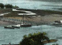
(footbridge)
Englehart vicinity, Ontario, Canada - High Falls of the Englehart River
| Bridgemeister ID: | 870 (added 2003-08-30) |
| Name: | (footbridge) |
| Location: | Englehart vicinity, Ontario, Canada |
| Crossing: | High Falls of the Englehart River |
| At or Near Feature: | Kap-Kig-Iwan ProvincIal Park |
| Coordinates: | 47.7964 N 79.88803 W |
| Maps: | Acme, GeoHack, Google, OpenStreetMap |
| Use: | Footbridge |
| Status: | In use (last checked: 2004) |
| Main Cables: | Wire |
| Suspended Spans: | 2 |
| Main Spans: | 2 |
Notes:
- Two-span footbridge with an interesting bend in the middle (forming a shallow V-shaped bridge).
Image Sets:

(footbridge)
Estevan vicinity, Saskatchewan, Canada - Souris River
| Bridgemeister ID: | 5686 (added 2021-03-26) |
| Name: | (footbridge) |
| Location: | Estevan vicinity, Saskatchewan, Canada |
| Crossing: | Souris River |
| Coordinates: | 49.112326 N 102.580018 W |
| Maps: | Acme, GeoHack, Google, OpenStreetMap |
| Use: | Footbridge |
| Status: | In use (last checked: 2021) |
| Main Cables: | Wire (steel) |
| Main Span: | 1 |
(footbridge)
Guelph, Ontario, Canada - Speed River
| Bridgemeister ID: | 836 (added 2003-06-28) |
| Name: | (footbridge) |
| Location: | Guelph, Ontario, Canada |
| Crossing: | Speed River |
| At or Near Feature: | Riverside Park |
| Use: | Footbridge |
| Status: | Removed, c. 2004. |
| Main Cables: | Wire |
| Suspended Spans: | 1 |
Notes:
- This bridge was closed April 2003. Wayne Grodkiewicz reports that it has since been replaced by a truss bridge.
| Bridgemeister ID: | 7624 (added 2023-05-27) |
| Name: | (footbridge) |
| Location: | Iqaluit, Nunavut, Canada |
| Coordinates: | 63.720294 N 68.523049 W |
| Maps: | Acme, GeoHack, Google, OpenStreetMap |
| Use: | Footbridge |
| Status: | Extant (last checked: 2022) |
| Main Cables: | Wire |
| Suspended Spans: | 1 |
External Links:
- Google Maps. "Street view" image with bridge visible in the distance, to the right, taken while mushing across a frozen bay. Dated 2013.
- Twitter. Image of the bridge, posted October 4, 2022.
(footbridge)
Jasper vicinity, Alberta, Canada - Maligne River
| Bridgemeister ID: | 2376 (added 2007-10-10) |
| Name: | (footbridge) |
| Location: | Jasper vicinity, Alberta, Canada |
| Crossing: | Maligne River |
| At or Near Feature: | Maligne Canyon Trailhead |
| Coordinates: | 52.921546 N 118.016911 W |
| Maps: | Acme, GeoHack, Google, OpenStreetMap |
| Use: | Footbridge |
| Status: | Replaced |
| Main Cables: | Wire (steel) |
| Suspended Spans: | 1 |
Notes:
- Replaced by a cable-stayed bridge at some point between 2007 and 2018.
(footbridge)
Joliette, Quebec, Canada - L'Assomption River
| Bridgemeister ID: | 1741 (added 2005-04-20) |
| Name: | (footbridge) |
| Location: | Joliette, Quebec, Canada |
| Crossing: | L'Assomption River |
| Coordinates: | 46.0082 N 73.419917 W |
| Maps: | Acme, GeoHack, Google, OpenStreetMap |
| Use: | Footbridge |
| Status: | In use (last checked: 2018) |
| Main Cables: | Wire (steel) |
(footbridge)
Kootenay National Park, British Columbia, Canada - Kootenay River
| Bridgemeister ID: | 1471 (added 2004-08-29) |
| Name: | (footbridge) |
| Location: | Kootenay National Park, British Columbia, Canada |
| Crossing: | Kootenay River |
| Coordinates: | 51.17053 N 116.15066 W |
| Maps: | Acme, GeoHack, Google, OpenStreetMap |
| Use: | Footbridge |
| Status: | Removed |
| Main Cables: | Wire |
Notes:
- Replaced at some point between 2005 and 2018.
(footbridge)
Langley City, British Columbia, Canada - Newlands Brook
| Bridgemeister ID: | 4776 (added 2020-07-03) |
| Name: | (footbridge) |
| Location: | Langley City, British Columbia, Canada |
| Crossing: | Newlands Brook |
| At or Near Feature: | Nickomekl Park |
| Coordinates: | 49.098535 N 122.650566 W |
| Maps: | Acme, GeoHack, Google, OpenStreetMap |
| Use: | Footbridge |
| Status: | In use (last checked: 2020) |
| Main Cables: | Wire (steel) |
(footbridge)
Lytton, British Columbia, Canada - Stein River
| Bridgemeister ID: | 2956 (added 2019-10-05) |
| Name: | (footbridge) |
| Location: | Lytton, British Columbia, Canada |
| Crossing: | Stein River |
| At or Near Feature: | Stein Valley Nlaka'pamux Heritage Park |
| Coordinates: | 50.289630 N 121.778241 W |
| Maps: | Acme, GeoHack, Google, OpenStreetMap |
| Use: | Footbridge |
| Status: | In use (last checked: 2018) |
| Main Cables: | Wire (steel) |
| Suspended Spans: | 1 |
(footbridge)
Matane, Quebec, Canada - Matane River
| Bridgemeister ID: | 8645 (added 2024-06-21) |
| Name: | (footbridge) |
| Location: | Matane, Quebec, Canada |
| Crossing: | Matane River |
| At or Near Feature: | Îles de Matane |
| Coordinates: | 48.842972 N 67.529472 W |
| Maps: | Acme, GeoHack, Google, OpenStreetMap |
| Use: | Footbridge |
| Status: | Removed |
| Main Cables: | Wire (steel) |
Notes:
- This bridge appears to have crossed the Matane to the Îles de Matane (an island in the Matane River) on an alignment similar to the cable-stayed bridge present in the 2020s.
Image Sets:
Do you have any information or photos for these bridges that you would like to share? Please email david.denenberg@bridgemeister.com.
Mail | Facebook | X (Twitter) | Bluesky