Suspension Bridges Completed 1920-1929 (1-100 of 204)
This is a list of bridges 1 through 100 (of 204 total) from the suspension bridge inventory completed in the decade 1920-1929. Wherever you see a Bridgemeister ID number click it to isolate the bridge on its own page.
Related Lists:
1920: (footbridge)
Follebu, Innlandet, Norway
| Bridgemeister ID: | 1564 (added 2004-11-27) |
| Year Completed: | 1920 |
| Name: | (footbridge) |
| Location: | Follebu, Innlandet, Norway |
| Coordinates: | 61.2153 N 10.269267 E |
| Maps: | Acme, GeoHack, Google, kart.1881.no, OpenStreetMap |
| Use: | Footbridge |
| Status: | In use (last checked: 2004) |
| Main Cables: | Wire |
Notes:
- Restored, 1977 and 1995.
1920: (suspension bridge)
Petrolia vicinity, California, USA - Mattole River
| Bridgemeister ID: | 4932 (added 2020-08-01) |
| Year Completed: | 1920 |
| Name: | (suspension bridge) |
| Location: | Petrolia vicinity, California, USA |
| Crossing: | Mattole River |
| Coordinates: | 40.276827 N 124.242913 W |
| Maps: | Acme, GeoHack, Google, OpenStreetMap |
| Use: | Vehicular |
| Status: | Replaced, 1974 |
| Main Cables: | Wire (steel) |
Notes:
- The June 29, 1974 edition of The Times-Standard of Eureka, California ran an article "Petrolia plans dedication" describing a new bridge dedicated to Elwyn "Ole" Lindley located 4.6 miles east of Petrolia: "the new re-enforced concrete girder with four bays replaced an old cable suspension bridge built in 1920." There is no other mention of the suspension bridge in the article. The location indicated by the coordinates given here is the location of the present day (2020) Lindley bridge crossing the Mattole River. It is unclear if this was the same Petrolia-area suspension bridge dismantled in 1962.
- See (suspension bridge) - Petrolia, California, USA. This entry may represent the same bridge.
1920: Alves Lima
Irapé, Chavantes, São Paulo and Ribeirão Claro, Paraná, Brazil - Paranapanema River
| Bridgemeister ID: | 3887 (added 2020-03-13) |
| Year Completed: | 1920 |
| Name: | Alves Lima |
| Also Known As: | Pênsil |
| Location: | Irapé, Chavantes, São Paulo and Ribeirão Claro, Paraná, Brazil |
| Crossing: | Paranapanema River |
| Coordinates: | 23.098928 S 49.742944 W |
| Maps: | Acme, GeoHack, Google, OpenStreetMap |
| Status: | Closed, c. November 2020 (last checked: 2021) |
| Main Cables: | Wire (steel) |
| Suspended Spans: | 1 |
Notes:
- 2020, November: Heavily damaged by fire. Closed indefinitely.
1920: Bridge of Smiles
Marlborough Township, Pennsylvania, USA - Unami Creek
| Bridgemeister ID: | 8794 (added 2024-09-14) |
| Year Completed: | 1920 |
| Name: | Bridge of Smiles |
| Location: | Marlborough Township, Pennsylvania, USA |
| Crossing: | Unami Creek |
| At or Near Feature: | Camp Delmont, Musser Scout Reservation |
| Use: | Footbridge |
| Suspended Spans: | 1 |
Notes:
- Located on the grounds of Camp Delmont which is now part of the Musser Scout Reservation. Presumably no longer in existence.
External Links:
- Facebook. Image and history of the bridge.
1920: Colgante
Rio Grande, Tierra del Fuego, Argentina - Rio Grande
| Bridgemeister ID: | 3366 (added 2019-12-21) |
| Year Completed: | 1920 |
| Name: | Colgante |
| Location: | Rio Grande, Tierra del Fuego, Argentina |
| Crossing: | Rio Grande |
| Coordinates: | 53.835799 S 67.792507 W |
| Maps: | Acme, GeoHack, Google, OpenStreetMap |
| Use: | Vehicular (one-lane) |
| Status: | Derelict, since December 13, 2010 (last checked: 2014) |
| Main Cables: | Wire (steel) |
| Suspended Spans: | 1 |
Notes:
- 2010, December 13: Wrecked by wind.
External Links:
- Hoy se cumplen 11 años de la caída del histórico puente colgante - Río Grande | Minuto Fueguino - Noticias de Tierra del Fuego AIAS. Detailed history of the bridge with many photos.
1920: Double
Forks of Coal, Alum Creek vicinity, West Virginia, USA - Little Coal River
| Bridgemeister ID: | 2121 (added 2006-09-17) |
| Year Completed: | 1920 |
| Name: | Double |
| Location: | Forks of Coal, Alum Creek vicinity, West Virginia, USA |
| Crossing: | Little Coal River |
| Coordinates: | 38.27243 N 81.80020 W |
| Maps: | Acme, GeoHack, Google, OpenStreetMap |
| Principals: | Oregonia Bridge Co. |
| Use: | Footbridge |
| Status: | Closed (last checked: February 2011) |
| Main Cables: | Wire (steel) |
| Main Span: | 1 x 45.7 meters (150 feet) estimated |
| Side Spans: | 1 x 15.5 meters (51 feet) estimated, 1 x 17.7 meters (58 feet) estimated |
Notes:
- The two Double Forks of Coal bridges were found to be barricaded in February 2011.
- Connects to 1920 Double - Forks of Coal, Alum Creek vicinity, West Virginia, USA. There are two bridges at this location, known collectively as "Double Bridges," spanning each fork of the Coal River at Forks of Coal.
- All past and present bridges at this location.
Image Sets:

1920: Double
Forks of Coal, Alum Creek vicinity, West Virginia, USA - Big Coal River
| Bridgemeister ID: | 2122 (added 2006-09-17) |
| Year Completed: | 1920 |
| Name: | Double |
| Location: | Forks of Coal, Alum Creek vicinity, West Virginia, USA |
| Crossing: | Big Coal River |
| Coordinates: | 38.27248 N 81.79935 W |
| Maps: | Acme, GeoHack, Google, OpenStreetMap |
| Principals: | Oregonia Bridge Co. |
| Use: | Footbridge |
| Status: | Closed (last checked: February 2011) |
| Main Cables: | Wire (steel) |
| Suspended Spans: | 3 |
| Main Span: | 1 x 61 meters (200 feet) estimated |
| Side Spans: | 1 x 27.7 meters (91 feet), 1 x 21.3 meters (70 feet) |
Notes:
- The two Double Forks of Coal bridges were found to be barricaded in February 2011.
- Connects to 1920 Double - Forks of Coal, Alum Creek vicinity, West Virginia, USA. There are two bridges at this location, known collectively as "Double Bridges," spanning each fork of the Coal River at Forks of Coal.
- All past and present bridges at this location.
Image Sets:
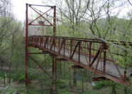
1920: Fort Seward
Fort Seward, California, USA - Eel River
| Bridgemeister ID: | 5671 (added 2021-01-30) |
| Year Completed: | 1920 |
| Name: | Fort Seward |
| Location: | Fort Seward, California, USA |
| Crossing: | Eel River |
| Coordinates: | 40.227599 N 123.646996 W |
| Maps: | Acme, GeoHack, Google, OpenStreetMap |
| Use: | Vehicular (one-lane) |
| Status: | Removed |
| Main Cables: | Wire (steel) |
External Links:
1920: Hayakawa
Osozawa (遅沢), Minobu (身延町), Minamikoma District and Awagura (粟倉), Minobu (身延町), Minamikoma District, Yamanashi, Japan - Haya River
| Bridgemeister ID: | 9050 (added 2025-02-09) |
| Year Completed: | 1920 |
| Name: | Hayakawa |
| Location: | Osozawa (遅沢), Minobu (身延町), Minamikoma District and Awagura (粟倉), Minobu (身延町), Minamikoma District, Yamanashi, Japan |
| Crossing: | Haya River |
| Coordinates: | 35.433806 N 138.422139 E |
| Maps: | Acme, GeoHack, Google, OpenStreetMap |
| Use: | Vehicular |
| Status: | Replaced |
| Main Cables: | Wire |
Notes:
- Coordinates provided here appear to be the approximate location of the bridge.
External Links:
- Old National Route 52, Hayakawa Bridge (旧国道52号線・早川橋). Details about some of the bridges at and near this location.
Image Sets:
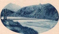
1920: Hyde Park Walking
Hyde Park and Leechburg, Pennsylvania, USA - Kiskiminetas River
| Bridgemeister ID: | 5842 (added 2021-05-13) |
| Year Completed: | 1920 |
| Name: | Hyde Park Walking |
| Location: | Hyde Park and Leechburg, Pennsylvania, USA |
| Crossing: | Kiskiminetas River |
| Coordinates: | 40.627771 N 79.597369 W |
| Maps: | Acme, GeoHack, Google, OpenStreetMap |
| Principals: | John A. Roebling's Sons |
| Use: | Footbridge |
| Status: | Destroyed, March 17, 1936 |
| Main Cables: | Wire (steel) |
| Suspended Spans: | 3 |
| Main Spans: | 3 |
Notes:
- Destroyed by flood, March 17, 1936.
- Replaced by 1937 Hyde Park Walking - Hyde Park and Leechburg, Pennsylvania, USA. The replacement was constructed based on the John A. Roebling's Sons plans from the first bridge.
- All past and present bridges at this location.
1920: Jøssundbrua
Jøssund, Ørland, Trøndelag, Norway - Jøssundstraumen
| Bridgemeister ID: | 4466 (added 2020-04-26) |
| Year Completed: | 1920 |
| Name: | Jøssundbrua |
| Location: | Jøssund, Ørland, Trøndelag, Norway |
| Crossing: | Jøssundstraumen |
| Coordinates: | 63.842912 N 9.811104 E |
| Maps: | Acme, GeoHack, Google, kart.1881.no, OpenStreetMap |
| Use: | Vehicular (one-lane) |
| Status: | Removed |
| Main Cables: | Wire |
| Suspended Spans: | 1 |
| Main Span: | 1 x 44 meters (144.4 feet) estimated |
External Links:
1920: Kaibab Trail
Grand Canyon National Park, Arizona, USA - Colorado River
| Bridgemeister ID: | 2186 (added 2007-01-15) |
| Year Completed: | 1920 |
| Name: | Kaibab Trail |
| Location: | Grand Canyon National Park, Arizona, USA |
| Crossing: | Colorado River |
| Principals: | George C. Goodwin |
| References: | AAJ |
| Use: | Footbridge |
| Status: | Replaced, 1928 |
| Main Cables: | Wire |
| Suspended Spans: | 1 |
Notes:
- Replaced by 1928 Kaibab Trail (Black, South Kaibab) - Bright Angel Campground vicinity, Arizona, USA.
- All past and present bridges at this location.
External Links:
1920: Lacy's
New Zealand - Retaruke River
| Bridgemeister ID: | 701 (added 2003-03-08) |
| Year Completed: | 1920 |
| Name: | Lacy's |
| Location: | New Zealand |
| Crossing: | Retaruke River |
| References: | GAP |
| Use: | Footbridge |
| Status: | Replaced |
Notes:
- GAP: Possibly completed 1915-1916.
- Replaced by 1932 Lacy's - Retaruke, New Zealand.
- All past and present bridges at this location.
1920: Les Andelys
Les Andelys, Eure, France - Seine River
| Bridgemeister ID: | 1597 (added 2005-02-06) |
| Year Completed: | 1920 |
| Name: | Les Andelys |
| Location: | Les Andelys, Eure, France |
| Crossing: | Seine River |
| Coordinates: | 49.236737 N 1.399657 E |
| Maps: | Acme, GeoHack, Google, OpenStreetMap |
| Principals: | Ferdinand Arnodin |
| Use: | Vehicular |
| Status: | Demolished, June 9, 1940 |
| Main Cables: | Wire (steel) |
| Suspended Spans: | 1 |
Notes:
- Completed in 1914 but not opened until 1920.
- The present-day Les Andelys bridge appears to have been constructed on the same piers as this predecessor.
- Demolished in June 1940 by the French army to slow advancing German troops during WWII.
- At former location of 1838 Les Andelys - Les Andelys, Eure, France. The 1920 bridge was not an immediate replacement. A stone arch bridge replaced the 1838 suspension bridge destroyed in 1870. The arch bridge was replaced by this (1920) suspension bridge.
- Replaced by 1947 Les Andelys - Les Andelys, Eure, France.
- All past and present bridges at this location.
Image Sets:

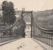
1920: Old Hill Place
Fayette vicinity, Mississippi, USA - Coles Creek South Fork
| Bridgemeister ID: | 137 (added before 2003) |
| Year Completed: | 1920 |
| Name: | Old Hill Place |
| Location: | Fayette vicinity, Mississippi, USA |
| Crossing: | Coles Creek South Fork |
| Coordinates: | 31.669433 N 91.180917 W |
| Maps: | Acme, GeoHack, Google, OpenStreetMap |
| References: | GBD |
| Use: | Vehicular (one-lane) |
| Status: | Derelict (last checked: 2005) |
| Main Cables: | Wire (steel) |
External Links:
Image Sets:


1920: Reeth Swing
Reeth vicinity, Swaledale, England, United Kingdom - River Swale
| Bridgemeister ID: | 807 (added 2003-03-30) |
| Year Completed: | 1920 |
| Name: | Reeth Swing |
| Location: | Reeth vicinity, Swaledale, England, United Kingdom |
| Crossing: | River Swale |
| Coordinates: | 54.385673 N 1.952474 W |
| Maps: | Acme, GeoHack, Google, OpenStreetMap |
| Principals: | J. Hird |
| Use: | Footbridge |
| Status: | In use (last checked: 2014) |
| Main Cables: | Wire |
| Suspended Spans: | 1 |
Notes:
- Destroyed by flood, rebuilt in 2002.
External Links:
Image Sets:

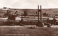
1920: Swinging
Millersburg, Pennsylvania, USA - Wiconisco Creek
| Bridgemeister ID: | 1924 (added 2005-10-23) |
| Year Completed: | 1920 |
| Name: | Swinging |
| Location: | Millersburg, Pennsylvania, USA |
| Crossing: | Wiconisco Creek |
| Use: | Footbridge |
| Status: | Destroyed, 1972 |
Notes:
- Destroyed by Hurricane Agnes, June 22, 1972.
- Replaced by 1996 Swinging - Millersburg, Pennsylvania, USA.
- All past and present bridges at this location.
1921: (footbridge)
Oregon City and West Linn, Oregon, USA - Willamette River
| Bridgemeister ID: | 4954 (added 2020-08-08) |
| Year Completed: | 1921 |
| Name: | (footbridge) |
| Location: | Oregon City and West Linn, Oregon, USA |
| Crossing: | Willamette River |
| Use: | Footbridge |
| Status: | Removed, 1922 |
| Main Cables: | Wire (steel) |
Notes:
- See 1888 Oregon City - Oregon City and West Linn, Oregon, USA. The 1921 structure appears to have been a temporary, but large, footbridge constructed during the construction of the replacement of the older Oregon City suspension bridge.
External Links:
1921: Amposta
Amposta, Spain - Ebro River
| Bridgemeister ID: | 935 (added 2003-10-25) |
| Year Completed: | 1921 |
| Name: | Amposta |
| Also Known As: | Penjant |
| Location: | Amposta, Spain |
| Crossing: | Ebro River |
| Coordinates: | 40.714866 N 0.581695 E |
| Maps: | Acme, GeoHack, Google, OpenStreetMap |
| Principals: | José Eugenio Ribera |
| Use: | Vehicular (two-lane) |
| Status: | In use (last checked: 2019) |
| Main Cables: | Wire (steel) |
| Suspended Spans: | 1 |
Notes:
- Damaged during Spanish Civil War, restored 1941.
External Links:
Image Sets:


1921: Bagni di Lucca
Bagni di Lucca, Italy - Torrente Luna
| Bridgemeister ID: | 1473 (added 2004-09-02) |
| Year Completed: | 1921 |
| Name: | Bagni di Lucca |
| Location: | Bagni di Lucca, Italy |
| Crossing: | Torrente Luna |
| Coordinates: | 44.0092 N 10.5908 E |
| Maps: | Acme, GeoHack, Google, OpenStreetMap |
| Use: | Footbridge |
| Status: | In use (last checked: 2023) |
| Main Cables: | Wire (steel) |
| Suspended Spans: | 1 |
Image Sets:
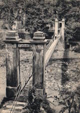
1921: Bridgeport
Bridgeport and Geary, Oklahoma, USA - South Canadian River
| Bridgemeister ID: | 1660 (added 2005-03-19) |
| Year Completed: | 1921 |
| Name: | Bridgeport |
| Also Known As: | Key, Postal |
| Location: | Bridgeport and Geary, Oklahoma, USA |
| Crossing: | South Canadian River |
| Coordinates: | 35.567306 N 98.374731 W |
| Maps: | Acme, GeoHack, Google, OpenStreetMap |
| References: | PTS2 |
| Use: | Vehicular |
| Status: | Removed |
| Main Cables: | Wire (steel) |
Notes:
- Remnants of at least one pier still standing, 2019.
| Bridgemeister ID: | 3908 (added 2020-03-15) |
| Year Completed: | 1921 |
| Name: | Høistad |
| Location: | Høistad, Norway |
| Crossing: | Glomma |
| Coordinates: | 62.50644 N 11.26111 E |
| Maps: | Acme, GeoHack, Google, kart.1881.no, OpenStreetMap |
| Use: | Vehicular (one-lane) |
| Status: | Removed |
| Main Cables: | Wire |
| Main Span: | 1 x 36 meters (118.1 feet) estimated |
Notes:
- Based on historic aerial images, removed 1953-1963.
External Links:
- DigitaltMuseum - Den gamle Høistad bru, med Røstfossen kraftverk i bakgrunnen. The 1818 - 1921 bridge that existed prior with the Røstefossen Kraftverk (Dam) just beyond.
- DigitaltMuseum - Kabelbru. Showing the northwest tower of the suspension bridge being constructed (~1920) on the far side of the river alongside of the 1818 bridge. One of the struts (topped with snow) extending out from the nearside tower is visible half way up the left edge.
1921: Kingston-Port Ewen
Kingston, New York, USA - Rondout Creek
| Bridgemeister ID: | 138 (added before 2003) |
| Year Completed: | 1921 |
| Name: | Kingston-Port Ewen |
| Also Known As: | Wurts Street, Rondout Creek |
| Location: | Kingston, New York, USA |
| Crossing: | Rondout Creek |
| Coordinates: | 41.916129 N 73.983999 W |
| Maps: | Acme, GeoHack, Google, OpenStreetMap |
| Principals: | Holton D. Robinson, Daniel E. Moran, William Yates |
| References: | AAJ, PTS, PTS2, SJR, SSS |
| Use: | Vehicular (two-lane, heavy vehicles), with walkway |
| Status: | In use (last checked: 2024) |
| Main Cables: | Wire (steel) |
| Suspended Spans: | 3 |
| Main Span: | 1 x 214.9 meters (705 feet) |
| Side Spans: | 2 x 53.7 meters (176.25 feet) |
| Deck width: | 37 feet |
Notes:
- 2008, March: Closed for ten weeks for cable inspection.
- 2018, December: Closed for maintenance. Expected to reopen February, 2019.
- 2019: Major rehabilitation continues to be delayed for several years.
- 2020, September: Closed temporarily. Major renovation project continues to be delayed.
- 2020, December: Closed indefinitely.
- 2021, May: Bids for renovation to be sought in June. Work expected to start in September.
- 2021, October: Groundbreaking ceremony for long-anticipated restoration project. Expected to be completed in 2023 at a cost of US$44.6M
- 2024, July: The bridge reopens following the completion of the multi-year restoration project.
Annotated Citations:
- Kirby, Paul. "Bids for Rondout Creek Bridge overhaul to be sought next month; work expected to start in September." Daily Freeman, 5 May 2021, Bids for Rondout Creek Bridge overhaul to be sought next month; work expected to start in September.
"Bids for the planned overhaul of the Rondout Creek Bridge will be sought in June, and the state Department of Transportation expects to award contracts for the work in August, the office of state Assemblyman Kevin Cahill said this week... The rehabilitation of the suspension bridge, which carries Wurts Street over the creek between Kingston and Port Ewen, could cost as much as $37 million, Cahill said previously. The state will pay for the project, which is expected to begin this fall."
External Links:
- Dave Longendyke's website. Several photos of the bridge's construction.
- HudsonValleyOne.com - State and local officials reopen the Wurts Street suspension bridge. Article covering the reopening of the restored bridge, published July 2, 2024.
- Structurae - Structure ID 20007345
Image Sets:


1921: Monowai
Monowai, New Zealand - Waiau River
| Bridgemeister ID: | 7593 (added 2023-05-07) |
| Year Completed: | 1921 |
| Name: | Monowai |
| Location: | Monowai, New Zealand |
| Crossing: | Waiau River |
| Use: | Vehicular |
| Status: | Destroyed, 1959 |
| Main Cables: | Wire (steel) |
| Main Span: | 1 |
Notes:
- 1959: Destroyed by nearby scrub fire.
- Near Lake Monowai Road - Monowai and Blackmount, New Zealand.
External Links:
1921: Niyodo
Japan
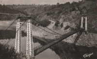
1921: St. Marien
St. Marien, Budelière vicinity, Évaux-les-Bains and Budelière, Creuse, France - Tardes River
| Bridgemeister ID: | 1159 (added 2004-01-18) |
| Year Completed: | 1921 |
| Name: | St. Marien |
| Location: | St. Marien, Budelière vicinity, Évaux-les-Bains and Budelière, Creuse, France |
| Crossing: | Tardes River |
| Coordinates: | 46.233320 N 2.508124 E |
| Maps: | Acme, GeoHack, Google, OpenStreetMap |
| Use: | Vehicular (one-lane) |
| Status: | In use (last checked: 2017) |
| Suspended Spans: | 1 |
Notes:
- Located just before the Tardes flows into the Cher. Sometimes noted as near Evaux-les-Bains.
Image Sets:

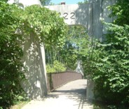
1922: (footbridge)
Bexley, Ohio, USA - Alum Creek
| Bridgemeister ID: | 819 (added 2003-05-31) |
| Year Completed: | 1922 |
| Name: | (footbridge) |
| Location: | Bexley, Ohio, USA |
| Crossing: | Alum Creek |
| At or Near Feature: | Wolfe Park |
| Coordinates: | 39.963831 N 82.947491 W |
| Maps: | Acme, GeoHack, Google, OpenStreetMap |
| References: | AAJ, PTS2 |
| Use: | Footbridge |
| Status: | In use (last checked: 2016) |
| Main Cables: | Wire (steel) |
| Suspended Spans: | 1 |
| Deck width: | 6.25 feet |
Notes:
- Closed 2013 for major refurbishment including a new deck. Reopened March. 2014.
- April 2015: Two main cables snap, causing a partial collapse of the bridge deck. Repaired and reopened August 5, 2016. Failure speculated to have been caused by the weight of the new deck installed 2013-2014.
Image Sets:
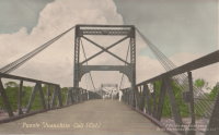
1922: Arauca
Arauca, Colombia - Cauca River
| Bridgemeister ID: | 2017 (added 2006-01-14) |
| Year Completed: | 1922 |
| Name: | Arauca |
| Location: | Arauca, Colombia |
| Crossing: | Cauca River |
| Use: | Vehicular |
| Status: | Replaced, 1957 |
| Main Cables: | Wire (steel) |
| Suspended Spans: | 1 |
| Main Span: | 1 x 10² meters (334.6 feet) |
Notes:
1922: Carlos Holguín
Juanchito, Cali vicinity and Candelaria vicinity, Colombia - Cauca River
| Bridgemeister ID: | 2007 (added 2006-01-04) |
| Year Completed: | 1922 |
| Name: | Carlos Holguín |
| Location: | Juanchito, Cali vicinity and Candelaria vicinity, Colombia |
| Crossing: | Cauca River |
| Use: | Vehicular |
| Status: | Dismantled, 1956 |
| Main Cables: | Wire (steel) |
| Suspended Spans: | 1 |
| Main Span: | 1 x 120 meters (393.7 feet) |
Notes:
- Replaced by 1957 Carlos Holguín - Juanchito, Cali vicinity and Candelaria vicinity, Colombia.
- All past and present bridges at this location.
Image Sets:
1922: Cortazar
Cortazar, Guanajuato, Mexico - Laja River
| Bridgemeister ID: | 6930 (added 2022-01-22) |
| Year Completed: | 1922 |
| Name: | Cortazar |
| Also Known As: | Arquitecto Ernesto Brunel |
| Location: | Cortazar, Guanajuato, Mexico |
| Crossing: | Laja River |
| Coordinates: | 20.491846 N 100.962915 W |
| Maps: | Acme, GeoHack, Google, OpenStreetMap |
| Use: | Vehicular (one-lane) |
| Status: | Restricted to foot traffic (last checked: 2021) |
| Main Cables: | Wire (steel) |
| Suspended Spans: | 1 |
Notes:
- 1922: During inauguration event, one end of the bridge dipped 1-2 feet, possibly due to the weight of the crowd. The bridge was repaired and entered into service.
- 2020-2021: Disassembled, rehabilitated, reassembled and reopened
1922: Dodge
Fontenelle vicinity, Sweetwater County, Wyoming, USA - Green River
| Bridgemeister ID: | 5557 (added 2020-12-18) |
| Year Completed: | 1922 |
| Name: | Dodge |
| Location: | Fontenelle vicinity, Sweetwater County, Wyoming, USA |
| Crossing: | Green River |
| Coordinates: | 41.960083 N 109.967750 W |
| Maps: | Acme, GeoHack, Google, OpenStreetMap |
| Principals: | Harold H. Dodge |
| Use: | Stock |
| Status: | Removed |
| Main Cables: | Wire (steel) |
| Main Span: | 1 |
Notes:
- This bridge was located northwest of the present-day Seedskadee National Wildlife Refuge before Fontenelle somewhere near the current McCullen Bluff boat launch but downstream from the bluff. Coordinates provided here may be the former location of the bridge. Appears to have been primarily a "sheep" bridge.
External Links:
- Museum Shares History of 3 Bridges Across the Green River - SweetwaterNOW. Images of the bridge.
1922: Duck Run
Truebada, Glenville vicinity, West Virginia, USA - Little Kanawha River
| Bridgemeister ID: | 139 (added before 2003) |
| Year Completed: | 1922 |
| Name: | Duck Run |
| Also Known As: | Truebada Swinging |
| Location: | Truebada, Glenville vicinity, West Virginia, USA |
| Crossing: | Little Kanawha River |
| Coordinates: | 38.92830 N 80.78731 W |
| Maps: | Acme, GeoHack, Google, OpenStreetMap |
| Principals: | William M. Moss, Fred Lewis |
| Use: | Vehicular (one-lane) |
| Status: | Closed (last checked: 2007) |
| Main Cables: | Wire |
| Suspended Spans: | 3 |
| Main Span: | 1 x 62.5 meters (205 feet) estimated |
| Side Spans: | 1 x 20.1 meters (66 feet) estimated, 1 x 23.5 meters (77 feet) estimated |
Notes:
- Bypassed, 1991.
External Links:
Image Sets:
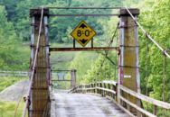

1922: Foy
Foy, Ross-on-Wye, England, United Kingdom - River Wye
| Bridgemeister ID: | 1209 (added 2004-02-07) |
| Year Completed: | 1922 |
| Name: | Foy |
| Location: | Foy, Ross-on-Wye, England, United Kingdom |
| Crossing: | River Wye |
| Coordinates: | 51.952822 N 2.576809 W |
| Maps: | Acme, GeoHack, Google, OpenStreetMap |
| Principals: | David Rowell & Co. |
| References: | BRW |
| Use: | Footbridge |
| Status: | In use (last checked: 2022) |
| Main Cables: | Wire (steel) |
| Suspended Spans: | 1 |
| Main Span: | 1 x 43.2 meters (141.7 feet) |
Notes:
- BRW: Replaced a bridge that was likely a similar suspension bridge built in 1876 and destroyed by flood in 1919.
Image Sets:

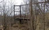
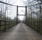
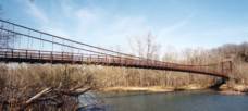
1922: Glaize
Brumley vicinity, Missouri, USA - Grand Glaize Creek
| Bridgemeister ID: | 332 (added before 2003) |
| Year Completed: | 1922 |
| Name: | Glaize |
| Also Known As: | Auglaize, Grand Glaize, Grand Auglaize |
| Location: | Brumley vicinity, Missouri, USA |
| Crossing: | Grand Glaize Creek |
| Coordinates: | 38.077098 N 92.526488 W |
| Maps: | Acme, GeoHack, Google, OpenStreetMap |
| Principals: | Joseph A. Dice |
| References: | BOTO |
| Use: | Vehicular (one-lane) |
| Status: | Closed, January 6, 2021 (last checked: 2021) |
| Main Cables: | Wire (steel) |
| Suspended Spans: | 2 |
| Main Span: | 1 x 126.2 meters (414 feet) estimated |
| Side Span: | 1 |
| Deck width: | 12 feet |
Notes:
- 2020, October 8: Added to National Register of Historic Places.
- 2021, January 6: Closed due to structural issues with the bridge's anchors.
- 2021, February 6: New inspection of the current issue ("loose cables"). Bridge is still closed.
- Near 1925 Mill Creek - Brumley vicinity, Missouri, USA.
External Links:
Image Sets:
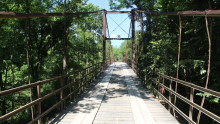
1922: Kawamoto
Japan
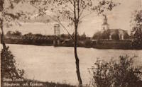
1922: Kyrkälv
Dala-Floda, Gagnef, Dalarna, Sweden - Västerdalälven
| Bridgemeister ID: | 8294 (added 2024-02-08) |
| Year Completed: | 1922 |
| Name: | Kyrkälv |
| Also Known As: | Kyrkälvbro, Kyrkbron |
| Location: | Dala-Floda, Gagnef, Dalarna, Sweden |
| Crossing: | Västerdalälven |
| Coordinates: | 60.507000 N 14.800972 E |
| Maps: | Acme, GeoHack, Google, OpenStreetMap |
| Use: | Vehicular (one-lane) |
| Status: | In use (last checked: 2023) |
| Main Cables: | Wire (steel) |
| Suspended Spans: | 1 |
| Main Span: | 1 x 122 meters (400.3 feet) |
Notes:
- 1980: Heavily damaged by fire. Rebuilt and reopened in 1983.
- Near Swing - Dala-Floda, Gagnef, Dalarna, Sweden.
External Links:
Image Sets:
1922: Llanstephan
Llanstephan, Wales, United Kingdom - River Wye
| Bridgemeister ID: | 1964 (added 2005-11-12) |
| Year Completed: | 1922 |
| Name: | Llanstephan |
| Location: | Llanstephan, Wales, United Kingdom |
| Crossing: | River Wye |
| Coordinates: | 52.06604 N 3.29614 W |
| Maps: | Acme, GeoHack, Google, OpenStreetMap |
| Principals: | David Rowell & Co. |
| References: | BRW |
| Use: | Vehicular (one-lane) |
| Status: | In use (last checked: 2021) |
| Main Cables: | Wire (steel) |
| Suspended Spans: | 1 |
Notes:
- 1994: According to BRW, the bridge is closed due to cable corrosion
External Links:
Image Sets:

1922: Momosuke
Nagiso-cho, Kiso-gun, Nagano, Japan - Kiso River
| Bridgemeister ID: | 1051 (added 2003-12-07) |
| Year Completed: | 1922 |
| Name: | Momosuke |
| Also Known As: | 桃介橋 |
| Location: | Nagiso-cho, Kiso-gun, Nagano, Japan |
| Crossing: | Kiso River |
| Coordinates: | 35.600776 N 137.606515 E |
| Maps: | Acme, GeoHack, Google, OpenStreetMap |
| Use: | Footbridge |
| Status: | In use (last checked: 2019) |
| Main Cables: | Wire (steel) |
| Suspended Spans: | 4 |
| Main Spans: | 2 x 104.5 meters (342.8 feet) |
| Side Spans: | 2 x 23.9 meters (78.4 feet) |
Notes:
- Rebuilt 1993.
External Links:
1922: Porthill
Shrewsbury, England, United Kingdom - River Severn
| Bridgemeister ID: | 434 (added before 2003) |
| Year Completed: | 1922 |
| Name: | Porthill |
| Location: | Shrewsbury, England, United Kingdom |
| Crossing: | River Severn |
| Coordinates: | 52.708233 N 2.763083 W |
| Maps: | Acme, GeoHack, Google, OpenStreetMap |
| Principals: | David Rowell & Co. |
| References: | NTB |
| Use: | Footbridge |
| Status: | In use (last checked: 2010) |
| Suspended Spans: | 1 |
External Links:
Image Sets:
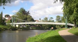
1922: Robert Lowe
Whitehorse vicinity, Yukon, Canada - Miles Canyon
| Bridgemeister ID: | 1054 (added 2003-12-13) |
| Year Completed: | 1922 |
| Name: | Robert Lowe |
| Also Known As: | Miles Canyon |
| Location: | Whitehorse vicinity, Yukon, Canada |
| Crossing: | Miles Canyon |
| Coordinates: | 60.66223 N 135.02921 W |
| Maps: | Acme, GeoHack, Google, OpenStreetMap |
| Use: | Footbridge |
| Status: | In use (last checked: 2020) |
| Main Cables: | Wire (steel) |
| Suspended Spans: | 1 |
| Main Span: | 1 x 39.6 meters (130 feet) estimated |
External Links:
Image Sets:
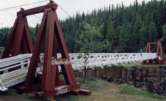
| Bridgemeister ID: | 4499 (added 2020-05-02) |
| Year Completed: | 1922 |
| Name: | Strandvoldbrua |
| Location: | Trysil, Innlandet, Norway |
| Crossing: | Klarälven |
| Coordinates: | 61.343151 N 12.230457 E |
| Maps: | Acme, GeoHack, Google, kart.1881.no, OpenStreetMap |
| Use: | Vehicular (one-lane) |
| Status: | Replaced |
| Main Cables: | Wire (steel) |
| Suspended Spans: | 1 |
| Main Span: | 1 x 90 meters (295.3 feet) estimated |
Notes:
- Closed December 7, 1993 after a cable snapped.
- Replaced by 2018 Strandvoldbrua - Trysil, Innlandet, Norway.
- All past and present bridges at this location.
| Bridgemeister ID: | 3884 (added 2020-03-08) |
| Year Completed: | 1922 |
| Name: | Teigen |
| Also Known As: | Vikvar |
| Location: | Mebonden, Selbu, Trøndelag, Norway |
| Crossing: | Nea |
| Coordinates: | 63.222013 N 11.013363 E |
| Maps: | Acme, GeoHack, Google, kart.1881.no, OpenStreetMap |
| Use: | Vehicular (one-lane) |
| Status: | Removed |
| Main Cables: | Wire |
| Suspended Spans: | 1 |
| Main Span: | 1 x 60 meters (196.9 feet) estimated |
Notes:
- Based on historical aerial images, removed at some point 1962-1975.
- Replaced 1903 Teigen (Vikvar) - Mebonden, Selbu, Trøndelag, Norway.
- All past and present bridges at this location.
1923: (footbridge)
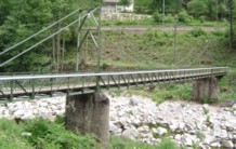
Kirschbaumwasen, Germany - Murg River
| Bridgemeister ID: | 1882 (added 2005-09-24) |
| Year Completed: | 1923 |
| Name: | (footbridge) |
| Location: | Kirschbaumwasen, Germany |
| Crossing: | Murg River |
| Coordinates: | 48.6233 N 8.354967 E |
| Maps: | Acme, GeoHack, Google, OpenStreetMap |
| Use: | Footbridge |
| Status: | In use (last checked: 2005) |
| Suspended Spans: | 1 |
Image Sets:
1923: (suspension bridge)
Karaka, New Zealand - Marokopa River
| Bridgemeister ID: | 703 (added 2003-03-08) |
| Year Completed: | 1923 |
| Name: | (suspension bridge) |
| Location: | Karaka, New Zealand |
| Crossing: | Marokopa River |
| References: | GAP |
1923: (suspension bridge)
Murchison vicinity, New Zealand - Buller River
| Bridgemeister ID: | 702 (added 2003-03-08) |
| Year Completed: | 1923 |
| Name: | (suspension bridge) |
| Location: | Murchison vicinity, New Zealand |
| Crossing: | Buller River |
| Coordinates: | 41.741556 S 172.401472 E |
| Maps: | Acme, GeoHack, Google, OpenStreetMap |
| References: | GAP |
| Status: | Removed |
| Main Span: | 1 x 47.5 meters (155.8 feet) |
| Side Spans: | 2 x 6.7 meters (22 feet) |
Notes:
- Coordinates indicate the approximate location of this bridge. GAP describes it as located where Nuggety Creek flows into the Buller. The current (as of the 2020s) Nuggety Creek Road crosses the Buller about one kilometer north of the coordinates.
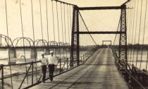
| Bridgemeister ID: | 5589 (added 2020-12-22) |
| Year Completed: | 1923 |
| Name: | 98th Meridian |
| Also Known As: | Byers |
| Location: | Byers vicinity, Texas and Temple, Oklahoma, USA |
| Crossing: | Red River |
| Coordinates: | 34.127249 N 98.214114 W |
| Maps: | Acme, GeoHack, Google, OpenStreetMap |
| Principals: | Austin Bridge Co. |
| References: | AUB |
| Use: | Vehicular |
| Status: | Destroyed, 1938 |
| Main Cables: | Wire (steel) |
Notes:
- AUB describes the Byers bridge: "This bridge, three spans of 567' each, one side span of 107', and a 16' roadway, had originally been built in 1914."
- 1935: Damaged by flood.
- 1938: Destroyed by flood.
- Replaced 1914 98th Meridian (Byers) - Byers, Texas and Temple, Oklahoma, USA.
- All past and present bridges at this location.
Image Sets:
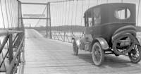
| Bridgemeister ID: | 3921 (added 2020-03-20) |
| Year Completed: | 1923 |
| Name: | Atna |
| Location: | Atna, Stor-Elvdal, Innlandet, Norway |
| Crossing: | Glomma |
| Coordinates: | 61.72890 N 10.82639 E |
| Maps: | Acme, GeoHack, Google, kart.1881.no, OpenStreetMap |
| Use: | Vehicular (one-lane) |
| Status: | In use (last checked: 2019) |
| Main Cables: | Wire (steel) |
| Suspended Spans: | 1 |
| Main Span: | 1 x 150 meters (492.1 feet) estimated |
Notes:
- Rehabilitated, 1989.
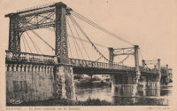
1923: Blagnac
Blagnac, Haute-Garonne, France - Garonne River
| Bridgemeister ID: | 2959 (added 2019-10-06) |
| Year Completed: | 1923 |
| Name: | Blagnac |
| Location: | Blagnac, Haute-Garonne, France |
| Crossing: | Garonne River |
| Coordinates: | 43.624930 N 1.401531 E |
| Maps: | Acme, GeoHack, Google, OpenStreetMap |
| Use: | Vehicular |
| Status: | Replaced, 1983 |
| Main Cables: | Wire (steel) |
| Suspended Spans: | 3 |
| Main Spans: | 3 |
Notes:
- Replaced 1844 Blagnac - Blagnac, Haute-Garonne, France.
- All past and present bridges at this location.
Image Sets:
1923: Kaneyama
Japan
1923: McKeown
Tyrola, Ada vicinity and Konawa, Oklahoma, USA - Canadian River
| Bridgemeister ID: | 2146 (added 2006-11-11) |
| Year Completed: | 1923 |
| Name: | McKeown |
| Also Known As: | Ada-Konawa |
| Location: | Tyrola, Ada vicinity and Konawa, Oklahoma, USA |
| Crossing: | Canadian River |
| References: | PTS2 |
| Use: | Vehicular |
| Status: | Removed, 1936 |
| Main Cables: | Wire |
Notes:
- J.W. Pigg (of Mitchell & Pigg, prominent Texas suspension bridge builders of the early 20th century) was reportedly involved in the construction of the bridge. Steinman gives a date of 1922, but newspaper articles from mid-1923 describe the plans as still under consideration. The bridge was likely completed in 1923 or 1924.
- A photograph of the bridge appears in the December 16, 1934 issue of The Daily Oklahoman (Oklahoma City) with caption: "This Old Bridge Is Doomed," sub-caption "Suspension Bridge on Highway 48 North of Ada," and a blurb: "This old bridge, known as the McKeown bridge, across the Canadian River between Ada and Konawa, is being condemned and will be rebuilt. It is a suspension bridge, one of the few in the state, but when the bridge is rebuilt it will be minus its 'suspenders.'"
- The November 12, 1936 edition of The Ada Evening News reports: "The old suspension, bridge across the river north ot Ada is being torn down, but no one knew just where it will be located when and if it is rebuilt. Konawa wants to build it west of the city of Konawa. Mr. Clark [division engineer for the state highway department] did not know if any provisions have yet been made for its erection."
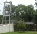
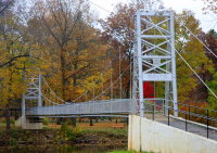
1923: Memorial Swinging
Winamac, Indiana, USA - Tippecanoe River
| Bridgemeister ID: | 849 (added 2003-07-27) |
| Year Completed: | 1923 |
| Name: | Memorial Swinging |
| Also Known As: | Soldiers and Sailors Memorial |
| Location: | Winamac, Indiana, USA |
| Crossing: | Tippecanoe River |
| At or Near Feature: | City Park |
| Coordinates: | 41.05245 N 86.59936 W |
| Maps: | Acme, GeoHack, Google, OpenStreetMap |
| Use: | Footbridge |
| Status: | In use (last checked: 2021) |
| Main Cables: | Wire (steel) |
| Suspended Spans: | 1 |
External Links:
Image Sets:

1923: Oued Yquem
Skhirat and Temara, Morocco - Oued Yquem
| Bridgemeister ID: | 4610 (added 2020-06-07) |
| Year Completed: | 1923 |
| Name: | Oued Yquem |
| Location: | Skhirat and Temara, Morocco |
| Crossing: | Oued Yquem |
| Coordinates: | 33.873400 N 6.995066 W |
| Maps: | Acme, GeoHack, Google, OpenStreetMap |
| Use: | Vehicular |
| Status: | Extant (last checked: 2019) |
| Main Cables: | Wire |
| Suspended Spans: | 1 |
External Links:
Image Sets:

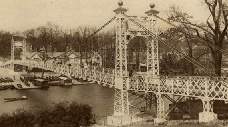
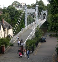
1923: Queens Park
Chester and Handbridge, England, United Kingdom - River Dee
| Bridgemeister ID: | 435 (added before 2003) |
| Year Completed: | 1923 |
| Name: | Queens Park |
| Location: | Chester and Handbridge, England, United Kingdom |
| Crossing: | River Dee |
| Coordinates: | 53.18796 N 2.88421 W |
| Maps: | Acme, GeoHack, Google, OpenStreetMap |
| Principals: | Charles Greenwood, David Rowell & Co., William E. Barker |
| References: | BRB, NTB |
| Use: | Footbridge |
| Status: | In use (last checked: 2019) |
| Main Cables: | Wire (steel) |
| Suspended Spans: | 1 |
| Main Span: | 1 x 83.8 meters (275 feet) |
Notes:
- Replaced 1852 Queens Park - Chester and Handbridge, England, United Kingdom.
- All past and present bridges at this location.
External Links:
- Chesterwiki - Suspension Bridge. Interesting details about the bridge.
Image Sets:

| Bridgemeister ID: | 3956 (added 2020-03-22) |
| Year Completed: | 1923 |
| Name: | Svanfoss |
| Location: | Brårud, Nes, Viken, Norway |
| Crossing: | Vorma |
| Coordinates: | 60.21450 N 11.35531 E |
| Maps: | Acme, GeoHack, Google, kart.1881.no, OpenStreetMap |
| Use: | Vehicular (one-lane) |
| Status: | Removed |
| Main Cables: | Wire (steel) |
| Suspended Spans: | 1 |
| Main Span: | 1 x 49 meters (160.8 feet) estimated |
Notes:
- Originally constructed as a stayed bridge in 1905, rebuilt as a suspension bridge in 1923.
- Based on historic aerial images, removed between 1972 and 2005.
External Links:
1923: Twin
Mangaweka vicinity, New Zealand - Kaiwhatau River
| Bridgemeister ID: | 704 (added 2003-03-08) |
| Year Completed: | 1923 |
| Name: | Twin |
| Location: | Mangaweka vicinity, New Zealand |
| Crossing: | Kaiwhatau River |
| References: | GAP |
1924: (footbridge)
Welling, Oklahoma, USA - Baron Fork Creek
| Bridgemeister ID: | 1804 (added 2005-05-18) |
| Year Completed: | 1924 |
| Name: | (footbridge) |
| Location: | Welling, Oklahoma, USA |
| Crossing: | Baron Fork Creek |
| Coordinates: | 35.888833 N 94.864889 W |
| Maps: | Acme, GeoHack, Google, OpenStreetMap |
| Use: | Footbridge |
| Status: | Extant (last checked: 2024) |
| Main Cables: | Wire (steel) |
| Suspended Spans: | 1 |
| Main Span: | 1 x 48.8 meters (160 feet) |
Image Sets:
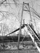
1924: (suspension bridge)
Cattle Flat, West Wanaka, Wanaka vicinity, New Zealand - Matukituki River
| Bridgemeister ID: | 715 (added 2003-03-08) |
| Year Completed: | 1924 |
| Name: | (suspension bridge) |
| Location: | Cattle Flat, West Wanaka, Wanaka vicinity, New Zealand |
| Crossing: | Matukituki River |
| Coordinates: | 44.636005 S 168.992132 E |
| Maps: | Acme, GeoHack, Google, OpenStreetMap |
| References: | GAP |
| Use: | Vehicular |
| Status: | Destroyed, September 10, 1970 |
| Main Cables: | Wire (steel) |
| Suspended Spans: | 1 |
Notes:
- GAP: Built circa 1924. Destroyed by flood c.1971.
- Later at same location Matukituki River - Cattle Flat, West Wanaka, Wanaka vicinity, Otago, New Zealand.
- All past and present bridges at this location.
External Links:
- Papers Past | Newspapers | Press | 12 September 1970 | BRIDGE DOWN. Article dated September 11, 1970: "The single-span suspension bridge across the West Matukituki River, 13 miles from Wanaka, was blown away by gale-force winds yesterday afternoon, cutting the only road access to West Wanaka station, where 10 persons are now isolated."
1924: (suspension bridge)
Moorefield, West Virginia, USA - South Fork South Branch Potomac River
| Bridgemeister ID: | 5584 (added 2020-12-21) |
| Year Completed: | 1924 |
| Name: | (suspension bridge) |
| Location: | Moorefield, West Virginia, USA |
| Crossing: | South Fork South Branch Potomac River |
| Coordinates: | 39.027926 N 78.947506 W |
| Maps: | Acme, GeoHack, Google, OpenStreetMap |
| Use: | Vehicular (one-lane) |
| Status: | Destroyed, After 1974 |
| Main Cables: | Wire (steel) |
| Main Span: | 1 |
Notes:
- Coordinates indicate likely location of this bridge, destroyed by flood debris at some point after 1974.
External Links:
1924: (suspension bridge)
Tolaga Bay vicinity, New Zealand - Mangaheia River
| Bridgemeister ID: | 712 (added 2003-03-08) |
| Year Completed: | 1924 |
| Name: | (suspension bridge) |
| Location: | Tolaga Bay vicinity, New Zealand |
| Crossing: | Mangaheia River |
| Principals: | Tom Ryan |
| References: | GAP |
Notes:
- GAP: completed circa 1924, in addition to "The Five Bridges" also spanning the Mangaheia
1924: Agness
Agness, Oregon, USA - Rogue River
| Bridgemeister ID: | 273 (added before 2003) |
| Year Completed: | 1924 |
| Name: | Agness |
| Location: | Agness, Oregon, USA |
| Crossing: | Rogue River |
| At or Near Feature: | Singing Springs Ranch |
| Coordinates: | 42.551639 N 124.063722 W |
| Maps: | Acme, GeoHack, Google, OpenStreetMap |
| Principals: | U.S. Forest Service |
| References: | AAJ |
| Use: | Vehicular |
| Status: | Destroyed, 1964 |
| Main Cables: | Wire (steel) |
| Main Span: | 1 x 92.7 meters (304 feet) |
| Side Span: | 1 |
Notes:
- A postcard reads, "This historic forestry suspension bridge over the Rogue River was... constructed of steel carried piece by piece up-river from Gold Beach by the mail boats. This bridge was swept away by flood waters 100 feet over flood stage during December 1964."
Image Sets:
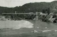
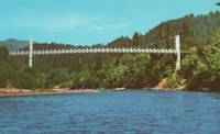
1924: Bear Mountain
Anthony's Nose and Bear Mountain, New York, USA - Hudson River
| Bridgemeister ID: | 141 (added before 2003) |
| Year Completed: | 1924 |
| Name: | Bear Mountain |
| Location: | Anthony's Nose and Bear Mountain, New York, USA |
| Crossing: | Hudson River |
| Coordinates: | 41.32 N 73.985 W |
| Maps: | Acme, GeoHack, Google, OpenStreetMap |
| Principals: | Howard C. Baird |
| References: | AAJ, BAAW, BBR, CPW, PTS2, SJR |
| Use: | Vehicular (two-lane, heavy vehicles), with walkway |
| Status: | In use (last checked: 2022) |
| Main Cables: | Wire (steel) |
| Suspended Spans: | 1 |
| Main Span: | 1 x 497.4 meters (1,632 feet) |
| Deck width: | 48 feet |
Notes:
- Became longest suspension bridge by eclipsing 1903 Williamsburg - New York and Brooklyn, New York, USA.
- Eclipsed by new longest suspension bridge 1926 Benjamin Franklin (Philadelphia-Camden) - Philadelphia, Pennsylvania and Camden, New Jersey, USA.
- Near 2002 Popolopen (William J. Moreau Popolopen) - Fort Montgomery, New York, USA.
External Links:
Image Sets:


1924: Burrator Reservoir
Sheepstor, England, United Kingdom - Burrator Reservoir
| Bridgemeister ID: | 2314 (added 2007-05-05) |
| Year Completed: | 1924 |
| Name: | Burrator Reservoir |
| Location: | Sheepstor, England, United Kingdom |
| Crossing: | Burrator Reservoir |
| Use: | Vehicular |
| Status: | Removed |
| Main Cables: | Wire (steel) |
| Suspended Spans: | 1 |
| Main Span: | 1 |
Notes:
- Large temporary bridge built to carry traffic across the reservoir while work was underway to raise Burrator Dam. Possibly completed 1925.
Image Sets:
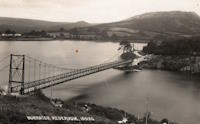
1924: Curry
Curry, Alaska, USA - Susitna River
| Bridgemeister ID: | 1189 (added 2004-01-24) |
| Year Completed: | 1924 |
| Name: | Curry |
| Location: | Curry, Alaska, USA |
| Crossing: | Susitna River |
| Use: | Footbridge |
| Status: | Removed |
| Main Cables: | Wire |
| Suspended Spans: | 1 |
Notes:
- Long narrow footbridge with timber towers. Deck replaced, 1926.
Image Sets:

1924: Eikernsund
Darbu, Eikeren, Viken, Norway - Strait separating Eikeren and Fiskumvannet
| Bridgemeister ID: | 4085 (added 2020-04-04) |
| Year Completed: | 1924 |
| Name: | Eikernsund |
| Also Known As: | Eikernsundet, Eikern Strait |
| Location: | Darbu, Eikeren, Viken, Norway |
| Crossing: | Strait separating Eikeren and Fiskumvannet |
| Coordinates: | 59.699851 N 9.844541 E |
| Maps: | Acme, GeoHack, Google, kart.1881.no, OpenStreetMap |
| Use: | Vehicular (one-lane) |
| Status: | Removed |
| Main Cables: | Wire (steel) |
| Suspended Spans: | 1 |
| Main Span: | 1 x 90 meters (295.3 feet) estimated |
| Deck width: | ~3 meters |
Notes:
- Out of service, circa 1980. Subsequently removed.
External Links:
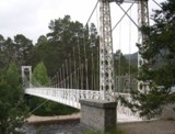
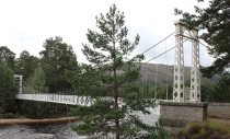
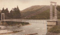
1924: Invercauld
Braemar vicinity, Scotland, United Kingdom - River Dee
| Bridgemeister ID: | 1906 (added 2005-10-08) |
| Year Completed: | 1924 |
| Name: | Invercauld |
| Also Known As: | Ballochbuie, Garbh Allt Shiel |
| Location: | Braemar vicinity, Scotland, United Kingdom |
| Crossing: | River Dee |
| Coordinates: | 57.001768 N 3.322743 W |
| Maps: | Acme, GeoHack, Google, OpenStreetMap |
| Principals: | James Abernethy & Co. |
| References: | HARPER, HBR |
| Use: | Footbridge |
| Status: | In use (last checked: 2014) |
| Main Cables: | Wire (steel) |
| Suspended Spans: | 1 |
External Links:
Image Sets:

1924: Kemna
St. Elizabeth, Missouri, USA - Tavern Creek
| Bridgemeister ID: | 611 (added 2003-01-14) |
| Year Completed: | 1924 |
| Name: | Kemna |
| Location: | St. Elizabeth, Missouri, USA |
| Crossing: | Tavern Creek |
| Coordinates: | 38.247265 N 92.245431 W |
| Maps: | Acme, GeoHack, Google, OpenStreetMap |
| Principals: | Joseph A. Dice |
| References: | BOTO |
| Use: | Vehicular (one-lane) |
| Status: | In use (last checked: 2019) |
| Main Cables: | Wire (steel) |
| Suspended Spans: | 1 |
| Main Span: | 1 x 50.9 meters (167 feet) |
| Deck width: | 11.1 feet |
Notes:
- Original timber towers replaced, 1978.
- Similar to 1925 Mill Creek - Brumley vicinity, Missouri, USA.
- Near 1925 Kliethermes (Brumley) - St. Anthony vicinity, Missouri, USA.
External Links:
Image Sets:


1924: Komnes
Komnes, Viken, Norway - Numedalslågen
| Bridgemeister ID: | 4094 (added 2020-04-05) |
| Year Completed: | 1924 |
| Name: | Komnes |
| Location: | Komnes, Viken, Norway |
| Crossing: | Numedalslågen |
| Coordinates: | 59.506986 N 9.890720 E |
| Maps: | Acme, GeoHack, Google, kart.1881.no, OpenStreetMap |
| Use: | Vehicular (one-lane) |
| Status: | In use (last checked: 2018) |
| Main Cables: | Wire (steel) |
| Suspended Spans: | 1 |
| Main Span: | 1 x 100 meters (328.1 feet) estimated |
External Links:
1924: Larry's River
Larry's River, Nova Scotia, Canada - Larry's River Estuary
| Bridgemeister ID: | 7594 (added 2023-05-07) |
| Year Completed: | 1924 |
| Name: | Larry's River |
| Location: | Larry's River, Nova Scotia, Canada |
| Crossing: | Larry's River Estuary |
| Use: | Footbridge |
| Status: | Dismantled, 1944 |
| Main Cables: | Wire (steel) |
| Suspended Spans: | 3 |
| Main Span: | 1 |
| Side Spans: | 2 |
External Links:
- Early Planning and Construction: 1922-1945 - Larry's River Footbridge Preservation Society. Blog post with several images of the site and bridge.
- Nova Scotia Archives - Clara Dennis Nova Scotia Archives 1981-541 no. 655. Image of Larry's River suspension bridge.
- Nova Scotia Archives - Clara Dennis Nova Scotia Archives 1981-541 no. 656. Image of Larry's River suspension bridge.
- Nova Scotia Archives - Clara Dennis Nova Scotia Archives 1981-541 no. 657. Image of Larry's River suspension bridge.
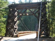
1924: Longmire
Packwood vicinity, Washington, USA - Nisqually River
| Bridgemeister ID: | 142 (added before 2003) |
| Year Completed: | 1924 |
| Name: | Longmire |
| Also Known As: | Nisqually |
| Location: | Packwood vicinity, Washington, USA |
| Crossing: | Nisqually River |
| At or Near Feature: | Mt. Rainier National Park |
| Coordinates: | 46.74903 N 121.80777 W |
| Maps: | Acme, GeoHack, Google, OpenStreetMap |
| Principals: | James A. French |
| Use: | Vehicular (one-lane) and Pipeline |
| Status: | In use (last checked: 2024) |
| Main Cables: | Wire (steel) |
| Suspended Spans: | 1 |
| Main Span: | 1 x 55.8 meters (183 feet) estimated |
Notes:
- 1950: Reconstructed.
- 2024, August: Weight restrictions imposed due to concerns over the bridge's age and condition.
External Links:
Image Sets:

1924: Mangaheia I
Tauwhareparae Road, Tolaga Bay vicinity, New Zealand - Mangaheia River
| Bridgemeister ID: | 707 (added 2003-03-08) |
| Year Completed: | 1924 |
| Name: | Mangaheia I |
| Location: | Tauwhareparae Road, Tolaga Bay vicinity, New Zealand |
| Crossing: | Mangaheia River |
| Principals: | Tom Ryan |
| References: | GAP |
| Use: | Vehicular (one-lane) |
| Status: | Replaced |
| Main Cables: | Wire (steel) |
| Suspended Spans: | 1 |
| Main Span: | 1 x 41 meters (134.5 feet) |
Notes:
- GAP: completed circa 1924. One of "The Five Bridges" that spanned the Mangaheia on the Tauwhareparae Road.
1924: Mangaheia II
Tauwhareparae Road, Tolaga Bay vicinity, New Zealand - Mangaheia River
| Bridgemeister ID: | 708 (added 2003-03-08) |
| Year Completed: | 1924 |
| Name: | Mangaheia II |
| Location: | Tauwhareparae Road, Tolaga Bay vicinity, New Zealand |
| Crossing: | Mangaheia River |
| Principals: | Tom Ryan |
| References: | GAP |
| Use: | Vehicular (one-lane) |
| Status: | Replaced |
| Main Cables: | Wire (steel) |
Notes:
- GAP: completed circa 1924. One of "The Five Bridges" that spanned the Mangaheia on the Tauwhareparae Road.
1924: Mangaheia III
Tauwhareparae Road, Tolaga Bay vicinity, New Zealand - Mangaheia River
| Bridgemeister ID: | 709 (added 2003-03-08) |
| Year Completed: | 1924 |
| Name: | Mangaheia III |
| Location: | Tauwhareparae Road, Tolaga Bay vicinity, New Zealand |
| Crossing: | Mangaheia River |
| Principals: | Tom Ryan |
| References: | GAP |
| Use: | Vehicular (one-lane) |
| Status: | Replaced |
| Main Cables: | Wire (steel) |
Notes:
- GAP: completed circa 1924. One of "The Five Bridges" that spanned the Mangaheia on the Tauwhareparae Road.
1924: Mangaheia IV
Tauwhareparae Road, Tolaga Bay vicinity, New Zealand - Mangaheia River
| Bridgemeister ID: | 710 (added 2003-03-08) |
| Year Completed: | 1924 |
| Name: | Mangaheia IV |
| Location: | Tauwhareparae Road, Tolaga Bay vicinity, New Zealand |
| Crossing: | Mangaheia River |
| Principals: | Tom Ryan |
| References: | GAP |
| Use: | Vehicular (one-lane) |
| Status: | Replaced |
| Main Cables: | Wire (steel) |
Notes:
- GAP: completed circa 1924. One of "The Five Bridges" that spanned the Mangaheia on the Tauwhareparae Road.
1924: Mangaheia V
Tauwhareparae Road, Tolaga Bay vicinity, New Zealand - Mangaheia River
| Bridgemeister ID: | 711 (added 2003-03-08) |
| Year Completed: | 1924 |
| Name: | Mangaheia V |
| Location: | Tauwhareparae Road, Tolaga Bay vicinity, New Zealand |
| Crossing: | Mangaheia River |
| Principals: | Tom Ryan |
| References: | GAP |
| Use: | Vehicular (one-lane) |
| Status: | Replaced |
| Main Cables: | Wire (steel) |
Notes:
- GAP: completed circa 1924. One of "The Five Bridges" that spanned the Mangaheia on the Tauwhareparae Road.
| Bridgemeister ID: | 140 (added before 2003) |
| Year Completed: | 1924 |
| Name: | Nocona |
| Also Known As: | Bluff, Ketchum Bluff, Ketchum's Bluff |
| Location: | Nocona vicinity, Texas and Jefferson County, Oklahoma, USA |
| Crossing: | Red River |
| At or Near Feature: | Ketchum Bluff |
| Coordinates: | 33.93579 N 97.75869 W |
| Maps: | Acme, GeoHack, Google, OpenStreetMap |
| Principals: | Austin Bridge Co. |
| References: | AUB, HAERTX98, PTS2 |
| Use: | Vehicular |
| Status: | Only towers remain (last checked: 2007) |
| Main Cables: | Wire (steel) |
| Main Span: | 1 x 213.4 meters (700 feet) |
Notes:
- Legend has it the bridge was burned during a dispute. This likely occurred before 1955. Some sources suggest it occurred before or during 1950. The road that leads to the Texas side of the former crossing is "Burned Out Bridge Road." Follow the image of the derelict tower to see the remains of the bridge.
- AUB mentions: "In January 1924, a contract was entered into with Nocona Bridge Company for a bridge across Red River, nine miles north of Nocona, connecting Texas and Oklahoma. The plans called for a 700' span, 16' roadway, and the main cables to contain 1,000 No. 9 galvanized wires each. The building of this, [the Austin Bridge Company's] first complete cable bridge, and the experience gained therefrom helped to launch Austin Bridge Company into an interesting and profitable line of work."
External Links:
- Nocona Suspension Bridge at Ketchum Bluff, Texas. University of Texas Arlington Libraries Digital Gallery
Image Sets:

1924: Otowi
Otowi, New Mexico, USA - Rio Grande
| Bridgemeister ID: | 143 (added before 2003) |
| Year Completed: | 1924 |
| Name: | Otowi |
| Location: | Otowi, New Mexico, USA |
| Crossing: | Rio Grande |
| Coordinates: | 35.874725 N 106.141861 W |
| Maps: | Acme, GeoHack, Google, OpenStreetMap |
| Principals: | James A. French |
| References: | GBD |
| Use: | Vehicular |
| Status: | Extant (last checked: 2019) |
| Main Cables: | Wire (steel) |
| Suspended Spans: | 1 |
| Main Span: | 1 x 53 meters (174 feet) |
| Deck width: | 10 feet |
Notes:
- Bypassed, 1948.
External Links:
Image Sets:

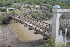
1924: Saint-Leu
Saint-Leu-d'Esserent, Oise, France - Oise River
| Bridgemeister ID: | 1947 (added 2005-11-04) |
| Year Completed: | 1924 |
| Name: | Saint-Leu |
| Location: | Saint-Leu-d'Esserent, Oise, France |
| Crossing: | Oise River |
| Coordinates: | 49.213680 N 2.422861 E |
| Maps: | Acme, GeoHack, Google, OpenStreetMap |
| References: | AAJ |
| Use: | Vehicular (two-lane) |
| Status: | In use (last checked: 2022) |
| Main Cables: | Wire (steel) |
| Suspended Spans: | 1 |
External Links:
Image Sets:
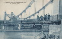
1924: Shoki
Japan
| Bridgemeister ID: | 3355 (added 2019-12-15) |
| Year Completed: | 1924 |
| Name: | Skutskär |
| Location: | Skutskär, Sweden |
| Crossing: | Dalälven |
| Coordinates: | 60.611988 N 17.442079 E |
| Maps: | Acme, GeoHack, Google, OpenStreetMap |
| Use: | Vehicular (one-lane) |
| Status: | In use (last checked: 2019) |
| Main Cables: | Wire (steel) |
| Suspended Spans: | 1 |
| Main Span: | 1 x 10⁷ meters (351 feet) estimated |
Image Sets:
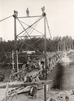
1924: Swinging
Thomson, Minnesota, USA - St. Louis River
| Bridgemeister ID: | 2103 (added 2006-08-19) |
| Year Completed: | 1924 |
| Name: | Swinging |
| Location: | Thomson, Minnesota, USA |
| Crossing: | St. Louis River |
| At or Near Feature: | Jay Cooke State Park |
| Coordinates: | 46.653649 N 92.370458 W |
| Maps: | Acme, GeoHack, Google, OpenStreetMap |
| Principals: | U.S. Forest Service |
| Use: | Footbridge |
| Status: | Replaced, 1935 |
| Main Cables: | Wire |
Notes:
Image Sets:

1924: Villemur-sur-Tarn
Villemur-sur-Tarn, Haute-Garonne, France - Tarn River
| Bridgemeister ID: | 1851 (added 2005-07-16) |
| Year Completed: | 1924 |
| Name: | Villemur-sur-Tarn |
| Location: | Villemur-sur-Tarn, Haute-Garonne, France |
| Crossing: | Tarn River |
| Use: | Vehicular |
| Status: | Destroyed, 1930 |
| Main Cables: | Wire (steel) |
Notes:
- 1930: Destroyed by flood.
- Replaced 1845 Villemur-sur-Tarn - Villemur-sur-Tarn, Haute-Garonne, France.
- Replaced by 1932 Villemur-sur-Tarn - Villemur-sur-Tarn, Haute-Garonne, France.
- All past and present bridges at this location.
Image Sets:
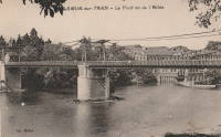
| Bridgemeister ID: | 1856 (added 2005-07-17) |
| Year Completed: | 1925 |
| Name: | (pipeline bridge) |
| Location: | Byers vicinity, Texas and Hastings, Oklahoma, USA |
| Crossing: | Red River |
| Coordinates: | 34.126861 N 98.213639 W |
| Maps: | Acme, GeoHack, Google, OpenStreetMap |
| Principals: | Austin Bridge Co. |
| References: | AUB |
| Use: | Pipeline |
| Status: | Removed |
| Main Cables: | Wire (steel) |
Notes:
- Coordinates provided here are the likely approximate location of the bridge. Two pipelines cross the Red River here. For many years they were elevated above the river. Piers are still (as of the 2020s) visible on the alignment indicated by the coordinates, and another set of piers slightly west.
- In AUB, two main spans and part of another suspended span are visible.
1925: (suspension bridge)
Hakis, Gilgit-Baltistan, Pakistan - Gilgit River
| Bridgemeister ID: | 6716 (added 2021-10-09) |
| Year Completed: | 1925 |
| Name: | (suspension bridge) |
| Location: | Hakis, Gilgit-Baltistan, Pakistan |
| Crossing: | Gilgit River |
| Coordinates: | 36.218917 N 73.510083 E |
| Maps: | Acme, GeoHack, Google, OpenStreetMap |
| Use: | Vehicular (one-lane) |
| Status: | In use (last checked: 2021) |
| Main Cables: | Wire |
| Suspended Spans: | 1 |
| Main Span: | 1 x 60.4 meters (198 feet) estimated |
External Links:
- X (Twitter). Post with several images of the bridge. September 12, 2021.
1925: A.A. Hadley
Honeydew vicinity, California, USA - Mattole River
| Bridgemeister ID: | 589 (added 2003-01-05) |
| Year Completed: | 1925 |
| Name: | A.A. Hadley |
| Also Known As: | Mattole River, Lindley |
| Location: | Honeydew vicinity, California, USA |
| Crossing: | Mattole River |
| Coordinates: | 40.25 N 124.165 W |
| Maps: | Acme, GeoHack, Google, OpenStreetMap |
| Use: | Vehicular (one-lane) |
| Status: | In use (last checked: 2004) |
| Main Cables: | Wire (steel) |
| Suspended Spans: | 1 |
External Links:
Image Sets:

1925: Blair Grove
Miranda vicinity, California, USA - South Fok Eel River
| Bridgemeister ID: | 5667 (added 2021-01-30) |
| Year Completed: | 1925 |
| Name: | Blair Grove |
| Location: | Miranda vicinity, California, USA |
| Crossing: | South Fok Eel River |
| Coordinates: | 40.258954 N 123.841625 W |
| Maps: | Acme, GeoHack, Google, OpenStreetMap |
| Use: | Vehicular (one-lane) |
| Status: | Removed |
| Main Cables: | Wire (steel) |
| Main Span: | 1 |
Notes:
- May have been completed 1923-1924. Coordinates represent the suspected former location of this bridge.
- See 1925 A.A. Hadley (Mattole River, Lindley) - Honeydew vicinity, California, USA. The towers of the Blair Grove and Hadley bridges appear identical.
External Links:
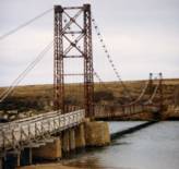
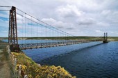
1925: Bodie Creek
Falkland Islands
| Bridgemeister ID: | 1922 (added 2005-10-09) |
| Year Completed: | 1925 |
| Name: | Bodie Creek |
| Location: | Falkland Islands |
| Coordinates: | 51.853916 S 59.016884 W |
| Maps: | Acme, GeoHack, Google, OpenStreetMap |
| Principals: | David Rowell & Co., Charles Peters |
| Use: | Vehicular (one-lane) and Stock |
| Status: | Closed, 1997 (last checked: 2018) |
| Main Cables: | Wire (steel) |
| Suspended Spans: | 1 |
External Links:
- The Bodie Creek Suspension Bridge. Detailed account of the bridge's history and construction.
- Structurae - Structure ID 20035736
Image Sets:
1925: Buechter
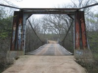
St. Anthony vicinity, Missouri, USA - Tavern Creek
| Bridgemeister ID: | 610 (added 2003-01-14) |
| Year Completed: | 1925 |
| Name: | Buechter |
| Location: | St. Anthony vicinity, Missouri, USA |
| Crossing: | Tavern Creek |
| Coordinates: | 38.141573 N 92.297910 W |
| Maps: | Acme, GeoHack, Google, OpenStreetMap |
| Principals: | Joseph A. Dice |
| References: | BOTO |
| Use: | Vehicular (one-lane) |
| Status: | Demolished, 2011 |
| Main Cables: | Wire (steel) |
| Suspended Spans: | 1 |
| Main Span: | 1 x 42.7 meters (140 feet) |
| Deck width: | 12.1 feet |
Notes:
- Completed circa 1925.
- Sometimes spelled Buetcher. The road the bridge carried is named with the "Buechter" spelling.
- Renovated 1986.
- Similar to 1925 Kliethermes (Brumley) - St. Anthony vicinity, Missouri, USA.
External Links:
- Historic Bridges of the United States - Buechter Bridge - Miller County, Missouri
- Structurae - Structure ID 20014258
Image Sets:



1925: Elvenes
Elvenes, Kirkenes, Sør-Varanger, Troms og Finnmark, Norway - Pasvikelva
| Bridgemeister ID: | 3765 (added 2020-02-29) |
| Year Completed: | 1925 |
| Name: | Elvenes |
| Location: | Elvenes, Kirkenes, Sør-Varanger, Troms og Finnmark, Norway |
| Crossing: | Pasvikelva |
| Coordinates: | 69.679423 N 30.113124 E |
| Maps: | Acme, GeoHack, Google, kart.1881.no, OpenStreetMap |
| Use: | Vehicular (one-lane) |
| Status: | Destroyed, 1944 |
| Main Cables: | Wire (steel) |
| Suspended Spans: | 1 |
| Main Span: | 1 x 10⁷ meters (351 feet) |
| Deck width: | 2.6 meters |
Notes:
- Later at same location 1950 Elvenes - Elvenes, Kirkenes, Sør-Varanger, Troms og Finnmark, Norway.
- All past and present bridges at this location.
External Links:
1925: Grimma
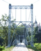
Grimma, Saxony, Germany - Mulde River
| Bridgemeister ID: | 1504 (added 2004-10-08) |
| Year Completed: | 1925 |
| Name: | Grimma |
| Location: | Grimma, Saxony, Germany |
| Crossing: | Mulde River |
| Coordinates: | 51.22805 N 12.72555 E |
| Maps: | Acme, GeoHack, Google, OpenStreetMap |
| Use: | Footbridge |
| Status: | In use (last checked: 2022) |
| Main Cables: | Wire (steel) |
| Suspended Spans: | 1 |
| Main Span: | 1 x 80 meters (262.5 feet) |
| Deck width: | 1.8 meters between side rails |
Notes:
- Rebuilt, 1949. Reconstruction, 1989, 1998, and in 2003 after 2002 flood damage.
External Links:
Image Sets:
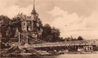
1925: Kliethermes
St. Anthony vicinity, Missouri, USA - Tavern Creek
| Bridgemeister ID: | 609 (added 2003-01-14) |
| Year Completed: | 1925 |
| Name: | Kliethermes |
| Also Known As: | Brumley |
| Location: | St. Anthony vicinity, Missouri, USA |
| Crossing: | Tavern Creek |
| Coordinates: | 38.178223 N 92.322981 W |
| Maps: | Acme, GeoHack, Google, OpenStreetMap |
| Principals: | Joseph A. Dice |
| References: | BOTO |
| Use: | Vehicular (one-lane) |
| Status: | Removed, March, 2008 |
| Main Cables: | Wire (steel) |
| Suspended Spans: | 1 |
| Main Span: | 1 x 65.8 meters (215.8 feet) |
| Deck width: | 10.8 feet |
Notes:
- Renovated, 1988. Closed, Spring 2006. Subsequently demolished in 2008.
- Completed circa 1925.
- Similar to 1925 Buechter - St. Anthony vicinity, Missouri, USA.
External Links:
Image Sets:
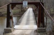

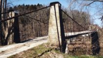

1925: Luzancy
Luzancy, Seine-et-Marne, France - Marne River
| Bridgemeister ID: | 4920 (added 2020-07-26) |
| Year Completed: | 1925 |
| Name: | Luzancy |
| Location: | Luzancy, Seine-et-Marne, France |
| Crossing: | Marne River |
| References: | AAJ, PTS2 |
| Use: | Vehicular |
| Status: | Destroyed |
| Main Cables: | Reinforced Concrete |
| Suspended Spans: | 1 |
Notes:
- Described as a "rigid suspension bridge of reinforced concrete."
- Replaced 1831 Luzancy - Luzancy, Seine-et-Marne, France.
- Similar to 1926 Laon - Laon, Aisne, France.
- Similar to Pommiers - Pommiers, Aisne, France.
- All past and present bridges at this location.
Image Sets:
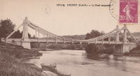
1925: Mellah Slimane
Constantine, Algeria - Oued Rhumel
| Bridgemeister ID: | 1117 (added 2004-01-05) |
| Year Completed: | 1925 |
| Name: | Mellah Slimane |
| Also Known As: | Perrégaux |
| Location: | Constantine, Algeria |
| Crossing: | Oued Rhumel |
| Coordinates: | 36.366261 N 6.615007 E |
| Maps: | Acme, GeoHack, Google, OpenStreetMap |
| Principals: | Ferdinand Arnodin |
| Use: | Footbridge |
| Status: | In use (last checked: 2019) |
| Main Cables: | Wire (steel) |
| Suspended Spans: | 1 |
| Main Span: | 1 x 125 meters (410.1 feet) |
| Deck width: | 2.4 meters |
External Links:
- Mellah Slimane Bridge - Wikipedia
- Perregaux Footbridge - HighestBridges.com
- Structurae - Structure ID 20009826
Image Sets:
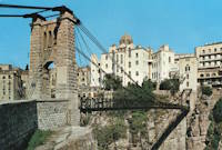
1925: Mill Creek
Brumley vicinity, Missouri, USA - Mill Creek
| Bridgemeister ID: | 342 (added before 2003) |
| Year Completed: | 1925 |
| Name: | Mill Creek |
| Location: | Brumley vicinity, Missouri, USA |
| Crossing: | Mill Creek |
| Coordinates: | 38.078408 N 92.524264 W |
| Maps: | Acme, GeoHack, Google, OpenStreetMap |
| Principals: | Joseph A. Dice |
| References: | BOTO |
| Use: | Vehicular (one-lane) |
| Status: | In use (last checked: 2020) |
| Main Cables: | Wire (steel) |
| Suspended Spans: | 2 |
| Main Span: | 1 x 29.3 meters (96 feet) estimated |
| Side Span: | 1 |
| Deck width: | 11.1 feet |
Notes:
- Original cables now assisted by additional steel cables.
- Similar to 1924 Kemna - St. Elizabeth, Missouri, USA.
- Near 1922 Glaize (Auglaize, Grand Glaize, Grand Auglaize) - Brumley vicinity, Missouri, USA. The bridges are less than half a mile apart.
External Links:
Image Sets:


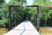
1925: Pandora
Pandora, Limón, Costa Rica - Estrella River
| Bridgemeister ID: | 436 (added before 2003) |
| Year Completed: | 1925 |
| Name: | Pandora |
| Also Known As: | Southeast Passage |
| Location: | Pandora, Limón, Costa Rica |
| Crossing: | Estrella River |
| Coordinates: | 9.736861 N 82.962167 W |
| Maps: | Acme, GeoHack, Google, OpenStreetMap |
| References: | PTS2, USS |
| Use: | Vehicular (one-lane) |
| Status: | Extant (last checked: 2022) |
| Main Cables: | Wire (steel) |
| Suspended Spans: | 1 |
| Main Span: | 1 x 73.2 meters (240 feet) |
Notes:
- Originally built with a set of tram tracks designed for cars hauling bananas.
- Next to (footbridge) - Pandora, Limón, Costa Rica.
- All past and present bridges at this location.
Image Sets:
1925: Powhatan
Powhatan, Arkansas, USA - Black River
| Bridgemeister ID: | 144 (added before 2003) |
| Year Completed: | 1925 |
| Name: | Powhatan |
| Location: | Powhatan, Arkansas, USA |
| Crossing: | Black River |
| Coordinates: | 36.081556 N 91.116222 W |
| Maps: | Acme, GeoHack, Google, OpenStreetMap |
| Principals: | Austin Bridge Co. |
| References: | AAJ, AUB |
| Use: | Vehicular |
| Status: | Removed |
| Main Cables: | Wire (steel) |
| Suspended Spans: | 1 |
| Main Span: | 1 x 116.4 meters (382 feet) |
External Links:
1925: Springvale
Taihape vicinity, New Zealand - Rangitikei River
| Bridgemeister ID: | 713 (added 2003-03-08) |
| Year Completed: | 1925 |
| Name: | Springvale |
| Location: | Taihape vicinity, New Zealand |
| Crossing: | Rangitikei River |
| Coordinates: | 39.488097 S 176.033601 E |
| Maps: | Acme, GeoHack, Google, OpenStreetMap |
| References: | GAP |
| Use: | Vehicular (one-lane) |
| Status: | Restricted to foot traffic (last checked: 2015) |
| Main Cables: | Wire (steel) |
| Suspended Spans: | 1 |
External Links:
1925: Swinging
River Falls, Wisconsin, USA - Kinnickinnic River South Fork
| Bridgemeister ID: | 1193 (added 2004-01-25) |
| Year Completed: | 1925 |
| Name: | Swinging |
| Location: | River Falls, Wisconsin, USA |
| Crossing: | Kinnickinnic River South Fork |
| At or Near Feature: | Glen Park |
| Coordinates: | 44.853817 N 92.6333 W |
| Maps: | Acme, GeoHack, Google, OpenStreetMap |
| Use: | Footbridge |
| Status: | In use (last checked: 2006) |
| Main Cables: | Wire (steel) |
| Suspended Spans: | 3 |
| Main Span: | 1 x 39.6 meters (130 feet) |
| Side Spans: | 2 x 9.1 meters (30 feet) |
Notes:
- Rehabilitated, 1985.
Image Sets:

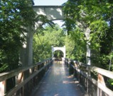
1925: Térénez
Landévennec vicinity and Rosnoen vicinity, Finistère, France - Aulne River
| Bridgemeister ID: | 1912 (added 2005-10-08) |
| Year Completed: | 1925 |
| Name: | Térénez |
| Location: | Landévennec vicinity and Rosnoen vicinity, Finistère, France |
| Crossing: | Aulne River |
| Coordinates: | 48.269120 N 4.262766 W |
| Maps: | Acme, GeoHack, Google, OpenStreetMap |
| Use: | Vehicular |
| Status: | Destroyed, 1944 |
| Main Cables: | Wire |
| Main Span: | 1 x 272 meters (892.4 feet) |
Notes:
- Coordinates are approximate, adjacent to the two subsequent replacement bridges.
- Replaced by 1952 Térénez - Landévennec vicinity and Rosnoen vicinity, Finistère, France.
- All past and present bridges at this location.
External Links:
Image Sets:
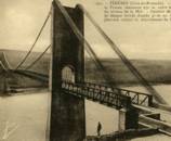

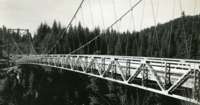
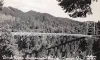
1925: Wind River
Carson, Washington, USA - Wind River
| Bridgemeister ID: | 1004 (added 2003-11-21) |
| Year Completed: | 1925 |
| Name: | Wind River |
| Location: | Carson, Washington, USA |
| Crossing: | Wind River |
| Coordinates: | 45.758333 N 121.837083 W |
| Maps: | Acme, GeoHack, Google, OpenStreetMap |
| References: | SPW |
| Use: | Vehicular |
| Status: | Replaced, 1961 |
| Main Cables: | Wire (steel) |
| Suspended Spans: | 1 |
Notes:
- Circa 1930's steel vehicular suspension bridge. Bypassed, 1961 (by the Conrad Lundy Jr. bridge) and removed some time after.
- Replaced 1913 Wind River - Carson, Washington, USA.
- All past and present bridges at this location.
Image Sets:

Do you have any information or photos for these bridges that you would like to share? Please email david.denenberg@bridgemeister.com.
Mail | Facebook | X (Twitter) | Bluesky