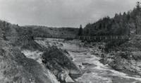
This is a single suspension bridge from the Bridgemeister historical inventory of suspension bridges.
1935: Swinging
Thomson, Minnesota, USA - St. Louis River
| Bridgemeister ID: | 286 (added before 2003) |
| Year Completed: | 1935 |
| Name: | Swinging |
| Location: | Thomson, Minnesota, USA |
| Crossing: | St. Louis River |
| At or Near Feature: | Jay Cooke State Park |
| Coordinates: | 46.653436 N 92.370438 W |
| Maps: | Acme, GeoHack, Google, OpenStreetMap |
| Principals: | Oscar Newstrom, CCC |
| Use: | Footbridge |
| Status: | Destroyed, 1950 |
| Main Cables: | Wire |
| Main Span: | 1 x 38.4 meters (126 feet) |
Notes:
- Deck raised four feet, 1941. Wrecked by flood May, 1950.
- Replaced 1924 Swinging - Thomson, Minnesota, USA.
- Replaced by 1953 Swinging - Thomson, Minnesota, USA.
- All past and present bridges at this location.
External Links:
Image Sets:

Jochem Hollestelle contributed to the information and/or images for this bridge.
Do you have any information or photos about this bridge that you would like to share? Please email david.denenberg@bridgemeister.com.
Mail | Facebook | X (Twitter) | Bluesky