Suspension Bridges Completed 1860-1869
This is a list of all 66 bridges from the suspension bridge inventory completed in the decade 1860-1869. Wherever you see a Bridgemeister ID number click it to isolate the bridge on its own page.
Related Lists:
1860: Allegheny River
Pittsburgh, Pennsylvania, USA - Allegheny River
| Bridgemeister ID: | 59 (added before 2003) |
| Year Completed: | 1860 |
| Name: | Allegheny River |
| Also Known As: | Sixth Street, St. Clair |
| Location: | Pittsburgh, Pennsylvania, USA |
| Crossing: | Allegheny River |
| Coordinates: | 40.445028 N 80.003028 W |
| Maps: | Acme, GeoHack, Google, OpenStreetMap |
| Principals: | John A. Roebling |
| References: | BOB, BOP, BPL, HBE, PBR, PTS2, SJR |
| Use: | Vehicular, with walkway |
| Status: | Replaced, 1892 |
| Main Cables: | Wire (iron) |
| Suspended Spans: | 4 |
| Main Spans: | 2 x 104.9 meters (344 feet) |
| Side Spans: | 2 x 52.1 meters (171 feet) |
| Deck width: | 40 feet |
Notes:
- BPL cites this bridge as the first suspension bridge with metal towers. However, at least two earlier suspension bridges (1857 Watertown, New York and 1856 Bidwell Bar, California) are known to have metal towers and even Roebling's 1846 Smithfield Street Bridge in Pittsburgh had cast iron towers.
- Next to 1884 North Side (Seventh Street) - Pittsburgh, Pennsylvania, USA.
- Later at same location 1928 Roberto Clemente (Sixth Street) - Pittsburgh, Pennsylvania, USA.
- All past and present bridges at this location.
External Links:
Image Sets:

1860: Auburn-Coloma
Auburn and Coloma, California, USA - North Fork American River
| Bridgemeister ID: | 274 (added before 2003) |
| Year Completed: | 1860 |
| Name: | Auburn-Coloma |
| Location: | Auburn and Coloma, California, USA |
| Crossing: | North Fork American River |
| Principals: | John Mollett |
| References: | PTS2 |
| Use: | Vehicular (one-lane) |
| Status: | Removed |
| Main Cables: | Wire (iron) |
| Suspended Spans: | 1 |
Notes:
- 1865 and 1866 are sometimes cited as the year of completion for this bridge.
- Replaced by 1929 Auburn-Coloma - Auburn and Coloma, California, USA.
- All past and present bridges at this location.
Image Sets:

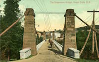
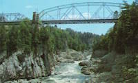
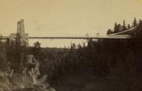
1860: Grand Falls
Grand Falls, New Brunswick, Canada - St. John River
| Bridgemeister ID: | 60 (added before 2003) |
| Year Completed: | 1860 |
| Name: | Grand Falls |
| Location: | Grand Falls, New Brunswick, Canada |
| Crossing: | St. John River |
| Coordinates: | 47.050722 N 67.736611 W |
| Maps: | Acme, GeoHack, Google, OpenStreetMap |
| Principals: | James Tomlinson |
| References: | AAJ |
| Use: | Vehicular (two-lane) |
| Status: | Replaced, 1915 |
| Main Cables: | Wire (iron) |
| Suspended Spans: | 1 |
| Main Span: | 1 x 63.9 meters (209.75 feet) |
| Deck width: | 16 feet |
Notes:
- Out of use, 1912.
Image Sets:
1860: Lascellas
Lascellas, Huesca, Spain - Rio Alcanadre
| Bridgemeister ID: | 4718 (added 2020-06-26) |
| Year Completed: | 1860 |
| Name: | Lascellas |
| Location: | Lascellas, Huesca, Spain |
| Crossing: | Rio Alcanadre |
| Coordinates: | 42.096776 N 0.107794 W |
| Maps: | Acme, GeoHack, Google, OpenStreetMap |
| Use: | Vehicular |
| Status: | Removed |
| Main Cables: | Wire |
| Suspended Spans: | 1 |
| Characteristics: | Partially underspanned |
Notes:
- Deck wrecked circa 1939. Bridge appears to have been replaced soon after.
External Links:
1860: Ponte delle Catene
Fornoli, Bagni di Lucca and Chifenti, Italy - Lima River
| Bridgemeister ID: | 411 (added before 2003) |
| Year Completed: | 1860 |
| Name: | Ponte delle Catene |
| Also Known As: | Catena, Bridge of Chains |
| Location: | Fornoli, Bagni di Lucca and Chifenti, Italy |
| Crossing: | Lima River |
| Coordinates: | 44.006048 N 10.562356 E |
| Maps: | Acme, GeoHack, Google, OpenStreetMap |
| Principals: | Lorenzo Nottolini, Bettino Ricasoli |
| References: | BC2, BC3 |
| Use: | Vehicular |
| Status: | Restricted to foot traffic (last checked: 2019) |
| Main Cables: | Chain (iron) |
| Suspended Spans: | 1 |
Notes:
- Damaged during WWII, rebuilt 1953.
External Links:
Image Sets:

1860: Port Gibson
Grindstone Ford, Port Gibson vicinity, Mississippi, USA - Bayou Pierre
| Bridgemeister ID: | 1659 (added 2005-03-19) |
| Year Completed: | 1860 |
| Name: | Port Gibson |
| Location: | Grindstone Ford, Port Gibson vicinity, Mississippi, USA |
| Crossing: | Bayou Pierre |
| References: | PTS2 |
| Status: | Removed, circa 1920's |
Notes:
- Partially burned by retreating Confederate troops May 2nd, 1863 during the Vicksburg Campaign of the Civil War. Union troops extinquished the fire and quickly repaired the bridge.
- Demolished, circa 1920's. Descriptions for the Vicksburg Campaign imply there may have been another suspension bridge in the Port Gibson area.
1861: Cúcuta
Cúcuta, North Santander, Colombia - Rio Pamplonita
| Bridgemeister ID: | 8985 (added 2024-12-22) |
| Year Completed: | 1861 |
| Name: | Cúcuta |
| Also Known As: | San Rafael |
| Location: | Cúcuta, North Santander, Colombia |
| Crossing: | Rio Pamplonita |
| Coordinates: | 7.868056 N 72.500778 W |
| Maps: | Acme, GeoHack, Google, OpenStreetMap |
| Use: | Vehicular |
| Status: | Removed |
| Main Cables: | Wire |
Notes:
- Crossed at the location of the present-day Puente San Rafael (Puente Benito Hernández). The suspension bridge was still standing in the 1930s.
External Links:
- CRONICAS DE CUCUTA: 96.- PUENTE CUCUTA O PUENTE SAN RAFAEL. History of the bridge.
1861: Connellsville
Connellsville and New Haven, Pennsylvania, USA - Youghiogheny River
| Bridgemeister ID: | 278 (added before 2003) |
| Year Completed: | 1861 |
| Name: | Connellsville |
| Location: | Connellsville and New Haven, Pennsylvania, USA |
| Crossing: | Youghiogheny River |
| Coordinates: | 40.017528 N 79.592722 W |
| Maps: | Acme, GeoHack, Google, OpenStreetMap |
| Use: | Vehicular (one-lane) |
| Status: | Replaced, 1898 |
| Main Cables: | Wire |
| Suspended Spans: | 1 |
Image Sets:


1861: Gauley River
Gauley Bridge, West Virginia, USA - Gauley River
| Bridgemeister ID: | 2123 (added 2006-09-17) |
| Year Completed: | 1861 |
| Name: | Gauley River |
| Location: | Gauley Bridge, West Virginia, USA |
| Crossing: | Gauley River |
| Principals: | John W. Murphy |
| References: | AAJ |
| Use: | Vehicular |
| Status: | Destroyed, 1862 |
| Main Cables: | Wire (iron) |
Notes:
- Don Sayenga writes:
"It was built in great haste out of military necessity utilizing abutments and piers of an earlier wooden bridge that had been burnt by a unit of the Confederate Army commanded by Gen. John B. Floyd. This occurred just after the fight known as the Battle of Carnifex Ferry on September 10, 1861. Later the Confederate Army recaptured the bridge location and burnt the new one also. The designer/builder was John W. Murphy (1828-1874) who was working as an engineer in Alabama when the war began in 1861. He held a Civil Engineer degree from Rensselaer. Murphy's concept involved multiple factory-made wire ropes as main cables combined with wooden bracing. The exact location of the bridge seems to have been called the New River Cliffs but I haven't found this on a map. Photos of the bridge came into the possession of Prof. George Plympton, an associate of Murphy's in the latter part of his career. Plympton presented a paper about bridges in 1894 reported by The Railroad Gazette August 24. The photos were given to the Gazette - one of their artists converted the photos to pen-and-ink drawings for publication in the issue of November 9, 1894, p. 773."
Don transcribed the following:
The Railroad Gazette, August 24, 1894, Page 579."Prof. Plympton then related two reminiscences of bridge building between 1852 and 1861...The other instance was the building of a military suspension bridge over the Gauley River in 1861. The government called for a bridge of sufficient strength to permit the passage of General Rosecrans corps, allowing twenty-four days' time. The abutments and piers of the former bridge remained in good condition. Murphy submitted an original plan, which was accepted. The plans were drawn up by Mr. Murphy on the cars, while he was traveling to Washington to submit his ideas to the United States army en gineers. The plans were accepted and Murphy at once went to work. Four one-inch wire ropes, laid side by side, formed his cables. A pyramidal tower was constructed of heavy timbers, and in place of suspending rods a loosely-formed truss was hung upon the cable without fastening. This truss, connected with the floor of the bridge, was finished on the 22nd day after receiving the order to build."
Proceedings of the Franklin Institute, October 21, 1874, Page 306."It was a suspension bridge 520 feet in length, 10 feet roadway, consisting of three spans, supported by eight cables. There was some doubt in the mind of the commanding officer that it would answer the purpose...To test it ...he asked that a battalion be ordered to make a charge over it, which was done, to the satisfaction of the General in command...it afterwards passed and repassed the whole command as long as they occupied that portion of the country. A change of base put it into the possession of the Confederates who burnt it down."
- An article in the July 15, 1951 edition of The Charleston Daily Mail describes the bridge and its demise:
"After the Confederate forces had retreated and burned the old covered bridge, the Federal engineers constructed a make-shift bridge across the Gauley. There are pictures in existence showing this light, cable bridge erected on the old piers of the original bridge. This structure was cut down Sept. 11, 1862, when the Federals retreated from an attack by Confederate Gen. W. W. Loring, who routed the Unionists from the valley for a brief time."
- Jakkula has an 1862 entry for "Gauley River Bridge" with little information, citing the American Railroad Journal, Vol. 37, No. 1472, July 2, 1864, p.651: "A suspension bridge built over the Gauley River, Virginia, by the Government in 1862." It is unclear if this reference is for the same bridge.
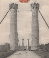
1861: Gray
Gray, Haute-Saône, France - Saône River
| Bridgemeister ID: | 1127 (added 2004-01-14) |
| Year Completed: | 1861 |
| Name: | Gray |
| Location: | Gray, Haute-Saône, France |
| Crossing: | Saône River |
| Use: | Vehicular |
| Status: | Removed |
| Main Cables: | Wire (iron) |
| Suspended Spans: | 1 |
Image Sets:

1861: Portsmouth
Portsmouth, Ohio, USA - Scioto River
| Bridgemeister ID: | 61 (added before 2003) |
| Year Completed: | 1861 |
| Name: | Portsmouth |
| Location: | Portsmouth, Ohio, USA |
| Crossing: | Scioto River |
| Principals: | Max J. Becker |
| References: | EOV |
| Status: | Removed |
Notes:
- Reconstruction of the 1858 Portsmouth bridge. A completion year of 1861 is assumed given information provided in EOV. Failed 1884.
- Replaced 1858 Portsmouth - Portsmouth, Ohio, USA.
- All past and present bridges at this location.
1861: Weitchpec
Weitchpec, California, USA - Klamath River
| Bridgemeister ID: | 1090 (added 2004-01-01) |
| Year Completed: | 1861 |
| Name: | Weitchpec |
| Location: | Weitchpec, California, USA |
| Crossing: | Klamath River |
| Principals: | Andrew S. Hallidie |
| References: | DSL200106 |
| Use: | Vehicular |
| Status: | Removed |
| Main Cables: | Wire (iron) |
| Suspended Spans: | 1 |
Notes:
1862: (footbridge)
Greystead, England, United Kingdom - River North Tyne
| Bridgemeister ID: | 1252 (added 2004-02-21) |
| Year Completed: | 1862 |
| Name: | (footbridge) |
| Location: | Greystead, England, United Kingdom |
| Crossing: | River North Tyne |
| Coordinates: | 55.169017 N 2.353408 W |
| Maps: | Acme, GeoHack, Google, OpenStreetMap |
| Use: | Footbridge |
| Status: | Extant (last checked: 2019) |
| Main Cables: | Chain |
| Suspended Spans: | 1 |
Notes:
- Footbridge with large stone towers. Near Tarset Burn.
- Several sources suggest this bridge was completed in 1862.
- Similar to 1878 Sedgwick (Low Park Woods, New Sedgwick) - Sedgwick and Sizergh, England, United Kingdom.
External Links:
- Bridges on the Tyne. "Built to connect with Thorneyburn station on the Border Counties Railway."
1862: (suspension bridge)
California, USA - Trinity River
| Bridgemeister ID: | 1093 (added 2004-01-01) |
| Year Completed: | 1862 |
| Name: | (suspension bridge) |
| Location: | California, USA |
| Crossing: | Trinity River |
| Principals: | Andrew S. Hallidie |
| References: | DSL200106 |
| Status: | Removed |
| Main Cables: | Wire (iron) |
1862: (suspension bridge)
California, USA - Stanislaus River
| Bridgemeister ID: | 1094 (added 2004-01-01) |
| Year Completed: | 1862 |
| Name: | (suspension bridge) |
| Location: | California, USA |
| Crossing: | Stanislaus River |
| Principals: | Andrew S. Hallidie |
| References: | DSL200106 |
| Status: | Removed |
| Main Cables: | Wire (iron) |
1862: (suspension bridge)
California, USA - Tuolumne River
| Bridgemeister ID: | 1095 (added 2004-01-01) |
| Year Completed: | 1862 |
| Name: | (suspension bridge) |
| Location: | California, USA |
| Crossing: | Tuolumne River |
| Principals: | Andrew S. Hallidie |
| References: | DSL200106 |
| Status: | Removed |
| Main Cables: | Wire |
1862: (suspension bridge)
McCourtney's Crossing, California, USA - Bear River
| Bridgemeister ID: | 1092 (added 2004-01-01) |
| Year Completed: | 1862 |
| Name: | (suspension bridge) |
| Location: | McCourtney's Crossing, California, USA |
| Crossing: | Bear River |
| Principals: | Andrew S. Hallidie |
| References: | DSL200106 |
| Status: | Removed |
| Main Cables: | Wire (iron) |
1862: Bessan
Bessan, Hérault, France - Hérault River
| Bridgemeister ID: | 1938 (added 2005-10-29) |
| Year Completed: | 1862 |
| Name: | Bessan |
| Location: | Bessan, Hérault, France |
| Crossing: | Hérault River |
| Status: | Removed |
| Main Cables: | Wire |
| Suspended Spans: | 1 |
External Links:
Image Sets:

1862: Chatham
Fredericksburg, Virginia, USA - Rappahannock River
| Bridgemeister ID: | 271 (added before 2003) |
| Year Completed: | 1862 |
| Name: | Chatham |
| Location: | Fredericksburg, Virginia, USA |
| Crossing: | Rappahannock River |
| Coordinates: | 38.304981 N 77.456280 W |
| Maps: | Acme, GeoHack, Google, OpenStreetMap |
| Principals: | Washington A. Roebling |
| References: | GB |
| Status: | Destroyed |
| Main Cables: | Wire |
Notes:
- After several attempts by the Union Army to restore Rappahannock River bridges near Fredericksburg with pontoon bridges during the Civil War, Washington Roebling built a temporary wire suspension bridge on the piers of the former Chatham Bridge. The suspension bridge may have had twelve or more suspended spans (the former Chatham Bridge supposedly had 13 piers). Started July 1 and completed July 18, it survived less than two months, destroyed on September 1, 1862 by an evacuating Union Army.
External Links:
1862: Ecklon Toll
Folsom, California, USA - American River
| Bridgemeister ID: | 1552 (added 2004-11-14) |
| Year Completed: | 1862 |
| Name: | Ecklon Toll |
| Location: | Folsom, California, USA |
| Crossing: | American River |
| Coordinates: | 38.682343 N 121.175714 W |
| Maps: | Acme, GeoHack, Google, OpenStreetMap |
| References: | IHS |
| Use: | Vehicular (one-lane) |
| Status: | Collapsed, 1892 |
| Main Cables: | Wire (iron) |
| Suspended Spans: | 1 |
Notes:
- IHS: Bridge is purchased by Christian L. Ecklon (a local butcher) in 1872 from "Kinsey & Whitely."
- Some sources indicate the 1862 Ecklon bridge replaced an 1861 suspension bridge that collapsed in 1862.
Image Sets:

1862: Gloucester Street
Christchurch, New Zealand - Avon River
| Bridgemeister ID: | 655 (added 2003-03-08) |
| Year Completed: | 1862 |
| Name: | Gloucester Street |
| Location: | Christchurch, New Zealand |
| Crossing: | Avon River |
| References: | GAP |
1862: Lambeth
London, England, United Kingdom - River Thames
| Bridgemeister ID: | 829 (added 2003-05-31) |
| Year Completed: | 1862 |
| Name: | Lambeth |
| Location: | London, England, United Kingdom |
| Crossing: | River Thames |
| Principals: | P. W. Barlow |
| References: | BRB, HBE, ONF, PTS2 |
| Use: | Vehicular, with walkway |
| Status: | Replaced, 1932 |
| Suspended Spans: | 3 |
| Main Spans: | 3 x 81.7 meters (268 feet) |
External Links:
Image Sets:

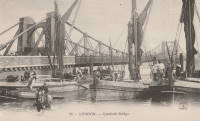
1862: Pine Street
Nevada City, California, USA - Deer Creek
| Bridgemeister ID: | 62 (added before 2003) |
| Year Completed: | 1862 |
| Name: | Pine Street |
| Location: | Nevada City, California, USA |
| Crossing: | Deer Creek |
| Coordinates: | 39.260861 N 121.019333 W |
| Maps: | Acme, GeoHack, Google, OpenStreetMap |
| Principals: | Andrew S. Hallidie |
| References: | DSL200106 |
| Use: | Vehicular (one-lane) |
| Status: | Replaced, 1903 |
| Main Cables: | Wire (iron) |
| Suspended Spans: | 1 |
Image Sets:

1862: Rattlesnake Bar
Folsom vicinity, California, USA - American River
| Bridgemeister ID: | 1091 (added 2004-01-01) |
| Year Completed: | 1862 |
| Name: | Rattlesnake Bar |
| Location: | Folsom vicinity, California, USA |
| Crossing: | American River |
| At or Near Feature: | Rattlesnake Bar |
| Coordinates: | 38.814397 N 121.091726 W |
| Maps: | Acme, GeoHack, Google, OpenStreetMap |
| Principals: | Andrew S. Hallidie |
| References: | DSL200106 |
| Use: | Vehicular (one-lane) |
| Status: | Collapsed, December 21, 1954 |
| Main Cables: | Wire (iron) |
| Suspended Spans: | 1 |
Notes:
- The location of Rattlesnake Bar is closer to present-day Auburn than Folsom, near the location of Goose Flat marked on modern topographical maps of the region. The area was inundated during the creation of Folsom Lake, but the piers and abutments of the Rattlesnake Bar bridge are visible when the water level is low.
- Rodi Lee writes: "[The bridge] collapsed in 1954 when an overweight truck filled with manure crossed it. The driver was unhurt. There are newspaper articles about the incident (Auburn Journal, Auburn). There are some photos in the article as well. The bridge abutments show when the the lake water is low. The bridge was upstream of Wild Goose Flats."
- See 1855 Whiskey Bar (Pioneer, Whisky) - El Dorado County, California, USA. The cables of the Rattlesnake Bar bridge were reportedly reused from the damaged Whiskey Bar bridge.
External Links:
- 1057. The Suspension Bridge over the American River at Rattlesnake Bar, Placer County - Calisphere.org
- Rattlesnake Bridge - Christine's Blog. Several images of the remnants of the bridge.
Image Sets:


1863: Alexandra
Spuzzum, British Columbia, Canada - Fraser River
| Bridgemeister ID: | 63 (added before 2003) |
| Year Completed: | 1863 |
| Name: | Alexandra |
| Also Known As: | Trutch's |
| Location: | Spuzzum, British Columbia, Canada |
| Crossing: | Fraser River |
| Principals: | Andrew S. Hallidie, Joseph W. Trutch |
| Use: | Vehicular |
| Status: | Removed, 1912 |
| Main Cables: | Wire (iron) |
| Main Span: | 1 x 82 meters (269 feet) |
Notes:
- Fell into disuse, 1884. Damaged by flood 1904. Dismantled 1912. Some sources indicate the flood damage occurred in 1894.
- Replaced by 1926 Second Alexandra - Spuzzum, British Columbia, Canada.
- All past and present bridges at this location.
Image Sets:

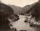
1863: Confolent
Confolent, Beauzac vicinity and Saint-Marice-de-Lignon, Haute-Loire, France - Loire River
| Bridgemeister ID: | 412 (added before 2003) |
| Year Completed: | 1863 |
| Name: | Confolent |
| Also Known As: | Lignon |
| Location: | Confolent, Beauzac vicinity and Saint-Marice-de-Lignon, Haute-Loire, France |
| Crossing: | Loire River |
| Coordinates: | 45.258031 N 4.144228 E |
| Maps: | Acme, GeoHack, Google, OpenStreetMap |
| Principals: | Adolphe Boulland |
| References: | BPF |
| Use: | Vehicular (one-lane), with walkway |
| Status: | In use (last checked: 2019) |
| Main Cables: | Wire (iron) |
| Suspended Spans: | 1 |
Notes:
- Cables damaged 1913, 1921. Refurbished 1922.
External Links:
Image Sets:
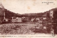
1863: Lamb's
Latrobe vicinity and Plymouth vicinity, California, USA - Cosumnes River
| Bridgemeister ID: | 2117 (added 2006-09-10) |
| Year Completed: | 1863 |
| Name: | Lamb's |
| Location: | Latrobe vicinity and Plymouth vicinity, California, USA |
| Crossing: | Cosumnes River |
| Coordinates: | 38.52222 N 120.95587 W |
| Maps: | Acme, GeoHack, Google, OpenStreetMap |
| Use: | Vehicular (one-lane) |
| Status: | Derelict (last checked: 2020) |
| Main Cables: | Wire (iron) |
| Suspended Spans: | 1 |
Notes:
- The location coordinates provided here are the approximate location of this bridge, crossing the Cosumnes between present day El Dorado and Amador counties at Michigan Bar (as named on USGS topographical maps) on current Latrobe Road where Clark Creek meets the Cosumnes River. Note that USGS topographical maps show another, more prominently marked, "Michigan Bar" a few miles west in Sacramento County.
- A California Highways and Public Works article (unsure of exact citation but it may be the article on the history of California bridges that appeared in the 1941 June issue and was reprinted in the 1950 September/October issue) says "there were four [suspension bridges] on the Cosumnes River, one of which (Lamb's Bridge on the Latrobe-Plymouth Road) killed one man and seven horses when it fell in 1869."
- The October 14, 1976 edition of The Mountain Democrat Times (Placerville, California) has an article about the nearby Huse Bridge (from the Heritage Association of El Dorado) which mentions Lamb's Bridge: "...Lamb's Bridge, several miles downriver, was reconstructed in 1872 and was also a wire bridge of the same type [as Huse's]."
- The Statutes of California passed at the Fourteenth Session of the Legislature, 1863 records: "Chapter XLI. An Act to grant to Larkin Lamb and his Associates the right to construct and maintain a Toll Bridge across the Cosumnes River, in the Counties of Amador and El Dorado. Approved March 6, 1863. The People of the State of California, represented in Senate and Assembly, do enact as follows: Section 1. Larkin Lamb, and those he may associate with him, their heirs and assigns, shall have full power to build, erect, construct, and maintain a public toll bridge across the Cosumnes River, at a point about eighty (80) rods below Dutch Hill;..."
- A November 12, 2017 article in Ledger Dispatch (of Amador and Calaveras counties) titled "Vestiges of Amador-Communities Along the Cosumnes, Part VI: The Lower Reaches - Michigan Bar to Wisconsin Bar" by Deborah Coleen Cook gives a more complete history of Lamb's bridge citing the enactment (February 9, 1863) of the bill to permit construction, construction completing six months later, failure of one of the cables in 1869 under the weight of a large freight wagon, and another cable/anchorage failure in 1872 while the bridge was undergoing major repairs.
- See 1852 Huse - Yeomet, California, USA.
- See 1852 Wilson's - Cosumne, California, USA.
Image Sets:


1863: Paul-Fischer
Wettingen and Neuenhof, Aargau, Switzerland - Limmat River
| Bridgemeister ID: | 8883 (added 2024-10-27) |
| Year Completed: | 1863 |
| Name: | Paul-Fischer |
| Also Known As: | Gwaggelibrugg, Wobbly |
| Location: | Wettingen and Neuenhof, Aargau, Switzerland |
| Crossing: | Limmat River |
| Coordinates: | 47.454944 N 8.311917 E |
| Maps: | Acme, GeoHack, Google, OpenStreetMap |
| Use: | Footbridge |
| Status: | In use (last checked: 2022) |
| Main Cables: | Wire |
| Main Span: | 1 |
Notes:
- 1982: The bridge is strengthened with additional towers and cables.
External Links:
1863: Ponsonnas
Ponsonnas, Isère, France - Drac River
| Bridgemeister ID: | 1079 (added 2003-12-29) |
| Year Completed: | 1863 |
| Name: | Ponsonnas |
| Location: | Ponsonnas, Isère, France |
| Crossing: | Drac River |
| Use: | Vehicular |
| Status: | Replaced, 1941 |
| Suspended Spans: | 1 |
| Main Span: | 1 x 123 meters (403.5 feet) |
Notes:
- Replaced by a 1941 arch bridge that is popular with bungee jumpers.
External Links:
Image Sets:
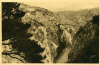

1863: Rousset
Rousset, Curbans vicinity, Alpes-de-Haute-Provence and Hautes-Alpes, France - Durance River
| Bridgemeister ID: | 2063 (added 2006-06-06) |
| Year Completed: | 1863 |
| Name: | Rousset |
| Location: | Rousset, Curbans vicinity, Alpes-de-Haute-Provence and Hautes-Alpes, France |
| Crossing: | Durance River |
| Use: | Vehicular |
| Status: | Removed |
| Main Cables: | Wire |
| Suspended Spans: | 1 |
External Links:
Image Sets:

1864: (suspension bridge)
Porta Westfalica, Germany - Weser River
| Bridgemeister ID: | 637 (added 2003-02-13) |
| Year Completed: | 1864 |
| Name: | (suspension bridge) |
| Location: | Porta Westfalica, Germany |
| Crossing: | Weser River |
| References: | BRU, PTS2 |
| Use: | Rail and Vehicular |
| Status: | Destroyed, April 3, 1945 |
| Main Cables: | Eyebar (iron) |
| Suspended Spans: | 1 |
Notes:
- At the time of completion, the bridge connected the villages of Barkhausen and Hausberge, later merged into Porta Westfalica.
Image Sets:
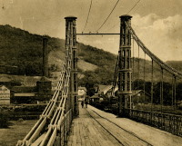
1864: Archidiacre
Venterol, Alpes-de-Haute-Provence and Valserres, Hautes-Alpes, France - Durance River
| Bridgemeister ID: | 4690 (added 2020-06-20) |
| Year Completed: | 1864 |
| Name: | Archidiacre |
| Also Known As: | Venterol |
| Location: | Venterol, Alpes-de-Haute-Provence and Valserres, Hautes-Alpes, France |
| Crossing: | Durance River |
| Coordinates: | 44.475805 N 6.111924 E |
| Maps: | Acme, GeoHack, Google, OpenStreetMap |
| Use: | Vehicular (one-lane) |
| Status: | Demolished, 2010 |
| Main Cables: | Wire |
| Suspended Spans: | 1 |
External Links:
Image Sets:
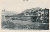
1864: Aspern
Vienna, Austria
| Bridgemeister ID: | 3076 (added 2019-10-26) |
| Year Completed: | 1864 |
| Name: | Aspern |
| Location: | Vienna, Austria |
| Coordinates: | 48.211858 N 16.383001 E |
| Maps: | Acme, GeoHack, Google, OpenStreetMap |
| Principals: | Friedrich Schnirch |
| References: | AAJ, PTS2 |
| Use: | Vehicular |
| Status: | Demolished, 1913 |
| Main Cables: | Eyebar (iron) |
| Suspended Spans: | 1 |
| Main Span: | 1 |
External Links:
Image Sets:
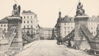
1864: Clifton
Bristol, England, United Kingdom - River Avon
| Bridgemeister ID: | 413 (added before 2003) |
| Year Completed: | 1864 |
| Name: | Clifton |
| Location: | Bristol, England, United Kingdom |
| Crossing: | River Avon |
| Coordinates: | 51.45496 N 2.62781 W |
| Maps: | Acme, GeoHack, Google, OpenStreetMap |
| Principals: | Isambard K. Brunel, P.W. Barlow, Hawkshaw |
| References: | AOB, BBR, BC3, BEM, BMA, BOU, BRB, CTW, HBE, NTB, ONF, PTS2 |
| Use: | Vehicular, with walkway |
| Status: | In use (last checked: 2021) |
| Main Cables: | Eyebar (iron) |
| Suspended Spans: | 1 |
| Main Span: | 1 x 214 meters (702 feet) |
Notes:
- Built with chain cables reused from the Hungerford bridge.
- See 1845 Hungerford - London, England, United Kingdom.
External Links:
Image Sets:


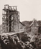
1864: Franklin
Franklin, Pennsylvania, USA - Allegheny River
| Bridgemeister ID: | 3186 (added 2019-11-09) |
| Year Completed: | 1864 |
| Name: | Franklin |
| Location: | Franklin, Pennsylvania, USA |
| Crossing: | Allegheny River |
| Principals: | John Murphy |
| References: | AAJ |
| Status: | Destroyed, 1870 |
Notes:
- 1870: Cable ends caught fire precipitating collapse, killing two.
1864: Taieri River
Outram, New Zealand - Taieri River
| Bridgemeister ID: | 656 (added 2003-03-08) |
| Year Completed: | 1864 |
| Name: | Taieri River |
| Also Known As: | West Taieri |
| Location: | Outram, New Zealand |
| Crossing: | Taieri River |
| Principals: | John Turnbull Thomson |
| References: | GAP |
| Use: | Vehicular |
| Status: | Replaced, 1966 |
| Main Cables: | Eyebar (iron) |
| Suspended Spans: | 4 |
| Main Spans: | 2 |
| Side Spans: | 2 |
External Links:
1865: Market Street
Williamsport, Pennsylvania, USA - Susquehanna River
| Bridgemeister ID: | 64 (added before 2003) |
| Year Completed: | 1865 |
| Name: | Market Street |
| Location: | Williamsport, Pennsylvania, USA |
| Crossing: | Susquehanna River |
| Coordinates: | 41.237556 N 76.997861 W |
| Maps: | Acme, GeoHack, Google, OpenStreetMap |
| Principals: | Alfred P. Boller |
| References: | AAJ, JFI186604 |
| Use: | Vehicular |
| Status: | Destroyed, June 1, 1889 |
| Main Cables: | Wire (iron) |
| Suspended Spans: | 5 |
| Main Spans: | 5 x 61 meters (200 feet) |
Notes:
- JFI186604 (in which Boller mentions about the bridge's "peculiar system of trussing": "This general arrangement for suspension bridges was first practised by John Murphy, Esq., C.E., over the Gauley, in West Virginia, and also at Franklin, Pennsylvania.")
- Destroyed by flood June 1, 1889.
- Near 1878 Maynard Street - Williamsport, Pennsylvania, USA.
- Replaced by 1889 Market Street - Williamsport, Pennsylvania, USA.
- All past and present bridges at this location.
Image Sets:

1865: Moulin
Vernosc-lès-Annonay, Ardèche, France - Cance River
| Bridgemeister ID: | 4553 (added 2020-05-31) |
| Year Completed: | 1865 |
| Name: | Moulin |
| Location: | Vernosc-lès-Annonay, Ardèche, France |
| Crossing: | Cance River |
| Coordinates: | 45.210908 N 4.703327 E |
| Maps: | Acme, GeoHack, Google, OpenStreetMap |
| Status: | Removed |
| Main Cables: | Wire (iron) |
| Suspended Spans: | 1 |
Notes:
- Structurae equates this bridge (which was replaced in 2012-2013) to the famous Seguin Brothers test structure at Annonay. Other sources suggest the derelict bridge replaced in 2012-2013 only dated to the 1860s. The detailed description and depiction of the Seguin's Annonay bridge in Tom F. Peters book on early 19th-century suspension bridges definitely does not resemble the 19th-century Moulin bridge. Peters describes the 1822-1823 Seguin bridge as a very narrow, very light, catwalk-style bridge. Peters additionally describes the main cables: "It had a single continuous parallel wire cable made of eight 1.23mm (no. 8 gauge) wires."
- Replaced by 2013 Moulin - Vernosc-lès-Annonay, Ardèche, France.
- See 1822 (footbridge) - Annonay, Ardèche, France.
- All past and present bridges at this location.
External Links:
| Bridgemeister ID: | 7460 (added 2022-12-24) |
| Year Completed: | 1866 |
| Name: | Cessenon-sur-Orb |
| Location: | Cessenon-sur-Orb, Hérault, France |
| Crossing: | Orb River |
| Coordinates: | 43.451360 N 3.046595 E |
| Maps: | Acme, GeoHack, Google, OpenStreetMap |
| Use: | Vehicular (one-lane) |
| Status: | Replaced |
| Main Cables: | Wire |
| Suspended Spans: | 1 |
Notes:
- Replaced by Cessenon-sur-Orb - Cessenon-sur-Orb, Hérault, France.
- All past and present bridges at this location.
External Links:
Image Sets:

1866: Woodland Street
Nashville and Edgefield, Tennessee, USA - Cumberland River
| Bridgemeister ID: | 1965 (added 2005-11-20) |
| Year Completed: | 1866 |
| Name: | Woodland Street |
| Location: | Nashville and Edgefield, Tennessee, USA |
| Crossing: | Cumberland River |
| Coordinates: | 36.167528 N 86.776083 W |
| Maps: | Acme, GeoHack, Google, OpenStreetMap |
| References: | AAJ |
| Use: | Vehicular |
| Status: | Removed, 1884 |
| Main Cables: | Wire |
Notes:
1867: (suspension bridge)
Albuquerque, New Mexico, USA - Rio Grande
| Bridgemeister ID: | 5559 (added 2020-12-18) |
| Year Completed: | 1867 |
| Name: | (suspension bridge) |
| Location: | Albuquerque, New Mexico, USA |
| Crossing: | Rio Grande |
| Use: | Vehicular |
| Status: | Removed |
| Main Cables: | Wire |
Notes:
- Likely completed 1867.
External Links:
1867: (suspension bridge)
Mataura, New Zealand
| Bridgemeister ID: | 657 (added 2003-03-08) |
| Year Completed: | 1867 |
| Name: | (suspension bridge) |
| Location: | Mataura, New Zealand |
| Principals: | John Turnbull Thomson |
| References: | GAP |
1867: Corrieshalloch
Braemore, Scotland, United Kingdom - River Droma
| Bridgemeister ID: | 1308 (added 2004-04-10) |
| Year Completed: | 1867 |
| Name: | Corrieshalloch |
| Location: | Braemore, Scotland, United Kingdom |
| Crossing: | River Droma |
| At or Near Feature: | Corrieshalloch Gorge, Falls of Measach |
| Coordinates: | 57.755753 N 5.021048 W |
| Maps: | Acme, GeoHack, Google, OpenStreetMap |
| Principals: | John Fowler |
| References: | AAJ, HBR |
| Use: | Footbridge |
| Status: | Closed, July 2024 (last checked: 2024) |
| Main Cables: | Wire |
| Suspended Spans: | 1 |
| Main Span: | 1 x 25.1 meters (82.5 feet) |
Notes:
- AAJ lists the bridge at "Corry Halloch" bridge completed in 1875. Other sources mention 1867, and 1874.
- 1977: Anchorages replaced (HBR).
- 2021: Closed September 10 due to safety concerns. Repaired and re-opened in October.
- 2022, May: Closed again for maintenance and inspection, reopened by month's end.
- 2024, July: Closed again as a precaution pending inspection of its structural integrity.
Image Sets:


1867: Doldowlod
Doldowlod, Llandrindod Wells, Wales, United Kingdom - River Wye
| Bridgemeister ID: | 5085 (added 2020-09-04) |
| Year Completed: | 1867 |
| Name: | Doldowlod |
| Also Known As: | Llanwrthyl, Ystrad |
| Location: | Doldowlod, Llandrindod Wells, Wales, United Kingdom |
| Crossing: | River Wye |
| Coordinates: | 52.244210 N 3.462324 W |
| Maps: | Acme, GeoHack, Google, OpenStreetMap |
| Principals: | William Dredge |
| References: | BRW |
| Use: | Footbridge |
| Status: | In use (last checked: 2018) |
| Main Cables: | Rod (iron) |
| Suspended Spans: | 1 |
Notes:
- Dredge patent bridge, possibly completed by his son William Dredge.
External Links:
- The Happy Pontist: Welsh Bridges: 10. Doldowlod Bridge. Photos and discussion of its history and uncertainty about the year it was completed.
1867: John A. Roebling
Cincinnati, Ohio and Covington, Kentucky, USA - Ohio River
| Bridgemeister ID: | 65 (added before 2003) |
| Year Completed: | 1867 |
| Name: | John A. Roebling |
| Also Known As: | Cincinnati, Cincinnati and Covington |
| Location: | Cincinnati, Ohio and Covington, Kentucky, USA |
| Crossing: | Ohio River |
| Coordinates: | 39.09167 N 84.50833 W |
| Maps: | Acme, GeoHack, Google, OpenStreetMap |
| Principals: | John A. Roebling |
| References: | BAAW, BC3, BOB, BPL, COB, EOV, HBE, LAB, LACE, ONF, PTS2, SJR, TOB |
| Use: | Vehicular (two-lane), with walkway |
| Status: | Closed, February, 2021 (last checked: 2021) |
| Main Cables: | Wire (iron) |
| Suspended Spans: | 3 |
| Main Span: | 1 x 322.2 meters (1,057 feet) |
| Side Spans: | 2 |
Notes:
- 1892: Cable ends restored.
- 1899: Steel cables added to assist original cables.
- 2021, February: Closed to all vehicular traffic for a nine-month restoration project.
- Became longest suspension bridge by eclipsing 1849 Wheeling (Wheeling and Belmont) - Wheeling, West Virginia, USA.
- Eclipsed by new longest suspension bridge 1869 Clifton (Upper, Niagara-Clifton, Falls View, First Falls View) - Niagara Falls, New York, USA and Niagara Falls, Ontario, Canada.
External Links:
Image Sets:


1867: Mosquito Road
Placerville, California, USA - South Fork American River
| Bridgemeister ID: | 2323 (added 2007-05-06) |
| Year Completed: | 1867 |
| Name: | Mosquito Road |
| Location: | Placerville, California, USA |
| Crossing: | South Fork American River |
| Coordinates: | 38.775791 N 120.748441 W |
| Maps: | Acme, GeoHack, Google, OpenStreetMap |
| Use: | Vehicular |
| Status: | Replaced |
| Main Cables: | Wire |
Notes:
- The February 23, 1995 edition of the Mountain Democrat (Placerville, California) has an article about the Mosquito crossing that mentions: "According to the El Dorado County History of 1883 by Paolo Sioli, 'Mosquito is connected to Placerville by a good wagon-road and a suspension bridge across the South Fork of the American River, a trail is running in the direction of Kelsey, the township center... The original bridge was constructed in 1867, and according to Orval Beckett, as quoted in the booklet, Mosquito Memories, 'This original bridge had no banisters on the sides. It was a suspension cable with No. 9 telephone wires strung between the supports. When you drove onto the bridge, it would 'swing and sway' much like we have seen in the movies. When one end went down the other went up, etc. Imagine the thrill!'"
- Replaced by 1939 Mosquito Road - Placerville, California, USA.
- All past and present bridges at this location.
External Links:
- Calisphere.org - Cable supports of suspension bridge across south fork of American River. Photo dated 1923, likely of the original Mosquito Road bridge.
| Bridgemeister ID: | 516 (added before 2003) |
| Year Completed: | 1867 |
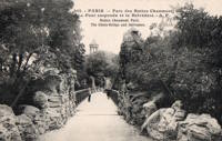
| Name: | Parc des Buttes-Chaumont |
| Location: | Paris, France |
| At or Near Feature: | Parc des Buttes-Chaumont |
| Coordinates: | 48.880933 N 2.381533 E |
| Maps: | Acme, GeoHack, Google, OpenStreetMap |
| References: | AAJ |
| Use: | Footbridge |
| Status: | In use (last checked: 2021) |
| Main Cables: | Wire |
| Suspended Spans: | 1 |
| Main Span: | 1 x 61 meters (200 feet) |
External Links:
Image Sets:


1867: Public Garden
Boston, Massachusetts, USA - Public Garden lagoon
| Bridgemeister ID: | 245 (added before 2003) |
| Year Completed: | 1867 |
| Name: | Public Garden |
| Location: | Boston, Massachusetts, USA |
| Crossing: | Public Garden lagoon |
| Coordinates: | 42.354119 N 71.069920 W |
| Maps: | Acme, GeoHack, Google, OpenStreetMap |
| Principals: | William Gibbons Preston, Clemens Herschel |
| References: | HBE |
| Use: | Footbridge |
| Status: | In use (last checked: 2019) |
| Main Cables: | Eyebar (iron) |
| Suspended Spans: | 3 |
| Main Span: | 1 x 15.2 meters (50 feet) estimated |
| Side Spans: | 2 |
Notes:
- Often claimed to have been the shortest "functioning" suspension bridge up until 1921 when a steel girder was added as the primary means of support. However this was not true. There were shorter suspension bridges, some of which are still in existence. For example, see Schaukelbrücke Ilmpark completed in 1833, still in use as of the 2010s, and only 48.6 feet long. Likely the shortest functioning suspension bridge ever built was at Castle Bergedorf in Hamburg, Germany with a main span of 22.6 feet (6.9 meters).
External Links:
Image Sets:


1868: Afton
Afton, New York, USA - Susquehanna River
| Bridgemeister ID: | 66 (added before 2003) |
| Year Completed: | 1868 |
| Name: | Afton |
| Location: | Afton, New York, USA |
| Crossing: | Susquehanna River |
| Coordinates: | 42.227167 N 75.524222 W |
| Maps: | Acme, GeoHack, Google, OpenStreetMap |
| Principals: | G. W. & J. V. V. Fishler, James Crowell |
| Use: | Vehicular |
| Status: | Removed |
| Main Cables: | Wire (iron) |
| Suspended Spans: | 1 |
| Main Span: | 1 x 110.3 meters (362 feet) |
| Deck width: | 16 feet |
Image Sets:

1868: Blue Lick Springs
Kentucky, USA - Licking River
| Bridgemeister ID: | 2659 (added 2019-03-09) |
| Year Completed: | 1868 |
| Name: | Blue Lick Springs |
| Location: | Kentucky, USA |
| Crossing: | Licking River |
| Coordinates: | 38.422314 N 83.999076 W |
| Maps: | Acme, GeoHack, Google, OpenStreetMap |
| Use: | Vehicular (one-lane) |
| Status: | Removed |
| Main Cables: | Wire |
| Suspended Spans: | 1 |
Notes:
- 1897: Replaced by two-span truss bridge that is still (as of 2019) at the same location. The truss bridge was built between the main suspension bridge cables and, apparently, the suspension bridge remained standing for several years.
1868: Calloway's Ford
Elizabethtown vicinity, Hamilton County, Ohio, USA - Whitewater River
| Bridgemeister ID: | 68 (added before 2003) |
| Year Completed: | 1868 |
| Name: | Calloway's Ford |
| Also Known As: | Whitewater, Harrison's |
| Location: | Elizabethtown vicinity, Hamilton County, Ohio, USA |
| Crossing: | Whitewater River |
| Coordinates: | 39.183116 N 84.792638 W |
| Maps: | Acme, GeoHack, Google, OpenStreetMap |
| Principals: | John Gray, Morse, Young |
| References: | EOV |
| Use: | Vehicular |
| Status: | Removed, 1920 |
| Main Cables: | Wire (iron) |
| Main Span: | 1 x 144.8 meters (475 feet) |
| Deck width: | 22 feet |
Notes:
- This bridge was located where present-day Suspension Bridge Road crosses the Whitewater River next to I-275 and north of US50. According to information provided by Sharon Lutz from Marjorie Byrnside Burress, this bridge was renamed "Harrison's Suspension Bridge" in 1891. This should not be confused with the nearby suspension bridge at Harrison.
- According to the information provided by Sharon Lutz from Marjorie Byrnside Burress, "Crossing this bridge was the main thoroughfare from Indiana into Ohio for many years (US 50 was not completed by then). [In 1920] it was decided that the Suspension Bridge had become obsolete and could no longer safely withstand the weight of vehicles. [On May 19, 1920] the cables were severed by means of an oxygen flame, the weight of the cables pulled down some towers. Other towers were weakened by dynamite at their bases and later they were pulled down by the weight of the cables severed at one end with an oxygen flame."
- See 1873 Harrison - Harrison, Ohio and Dearborn County, Indiana, USA.
Image Sets:


1868: Carpenter's Point
Port Jervis and Tristates, New York, USA - Neversink River
| Bridgemeister ID: | 2251 (added 2007-03-31) |
| Year Completed: | 1868 |
| Name: | Carpenter's Point |
| Also Known As: | Tristates |
| Location: | Port Jervis and Tristates, New York, USA |
| Crossing: | Neversink River |
| Coordinates: | 41.361194 N 74.685194 W |
| Maps: | Acme, GeoHack, Google, OpenStreetMap |
| Use: | Vehicular (one-lane) |
| Status: | Destroyed, 1904 |
| Main Cables: | Wire |
| Suspended Spans: | 1 |
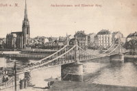
1868: Eiserner Steg
Frankfurt, Germany - Main River
| Bridgemeister ID: | 6429 (added 2021-08-11) |
| Year Completed: | 1868 |
| Name: | Eiserner Steg |
| Also Known As: | Eiserne Steg |
| Location: | Frankfurt, Germany |
| Crossing: | Main River |
| Coordinates: | 50.108108 N 8.682128 E |
| Maps: | Acme, GeoHack, Google, OpenStreetMap |
| Principals: | Peter Schmick |
| References: | AAJ, PTS2 |
| Use: | Footbridge |
| Status: | Replaced, 1912 |
| Suspended Spans: | 3 |
| Main Span: | 1 |
| Side Spans: | 2 |
Notes:
- A "stiffened" braced chain suspension bridge. Like several other similar eastern European bridges constructed in the late 1800s and early 1900s it is somewhat questionable whether this bridge should be included in a list of suspension bridges. It was replaced in 1912 by a cantilever bridge that resembles the shape and lines of the former suspension bridge.
External Links:
Image Sets:
1868: High Street
Hamilton, Ohio, USA - Great Miami River
| Bridgemeister ID: | 67 (added before 2003) |
| Year Completed: | 1868 |
| Name: | High Street |
| Also Known As: | Hamilton |
| Location: | Hamilton, Ohio, USA |
| Crossing: | Great Miami River |
| Coordinates: | 39.401444 N 84.565389 W |
| Maps: | Acme, GeoHack, Google, OpenStreetMap |
| Principals: | John Gray |
| References: | EOV |
| Use: | Vehicular |
| Status: | Removed |
| Main Cables: | Wire |
| Suspended Spans: | 1 |
External Links:
- Butler County Engineer's Office (BCOE). Mentions this bridge stood from 1866 through 1895.
1868: Skippers Canyon
Maori Point vicinity, New Zealand - Shotover River
| Bridgemeister ID: | 658 (added 2003-03-08) |
| Year Completed: | 1868 |
| Name: | Skippers Canyon |
| Location: | Maori Point vicinity, New Zealand |
| Crossing: | Shotover River |
| At or Near Feature: | Skippers Canyon |
| Principals: | John Turnbull Thomson |
| References: | GAP |
| Use: | Footbridge |
| Status: | Removed |
| Main Cables: | Wire |
Notes:
- Replaced by 1901 Skippers - Maori Point vicinity, New Zealand at a nearby location.
- All past and present bridges at this location.
1868: Wire
New Portland, Maine, USA - Carrabasset River
| Bridgemeister ID: | 69 (added before 2003) |
| Year Completed: | 1868 |
| Name: | Wire |
| Location: | New Portland, Maine, USA |
| Crossing: | Carrabasset River |
| Coordinates: | 44.890783 N 70.0925 W |
| Maps: | Acme, GeoHack, Google, OpenStreetMap |
| References: | BC3, BPL, GBD, LAB, RDH |
| Use: | Vehicular (one-lane) |
| Status: | In use (last checked: 2023) |
| Main Cables: | Wire (iron) |
| Suspended Spans: | 1 |
| Main Span: | 1 x 60.5 meters (198.4 feet) |
Notes:
- BPL says c. 1866. Historic landmark plaque at bridge also says 1866.
- Extensive repairs, 1960.
External Links:
Image Sets:


1869: (footbridge)
Salado, Texas, USA - Salado Creek
| Bridgemeister ID: | 920 (added 2003-10-18) |
| Year Completed: | 1869 |
| Name: | (footbridge) |
| Location: | Salado, Texas, USA |
| Crossing: | Salado Creek |
| At or Near Feature: | Salado College |
| Use: | Footbridge |
| Status: | Destroyed, 1913 |
| Main Cables: | Wire (iron) |
Notes:
- Destroyed by flood, 1913.
1869: Chavanay
Chavanay, Loire and Isère, France - Rhône River
| Bridgemeister ID: | 1702 (added 2005-03-29) |
| Year Completed: | 1869 |
| Name: | Chavanay |
| Location: | Chavanay, Loire and Isère, France |
| Crossing: | Rhône River |
| Coordinates: | 45.417327 N 4.740458 E |
| Maps: | Acme, GeoHack, Google, OpenStreetMap |
| Use: | Vehicular |
| Status: | Only towers remain (last checked: 2019) |
| Main Cables: | Wire (iron) |
| Suspended Spans: | 1 |
Notes:
- In 2019, one pair of pylons were still standing on the west bank of the Rhône.
Image Sets:

1869: Clifton
Niagara Falls, New York, USA and Niagara Falls, Ontario, Canada - Niagara River
| Bridgemeister ID: | 70 (added before 2003) |
| Year Completed: | 1869 |
| Name: | Clifton |
| Also Known As: | Upper, Niagara-Clifton, Falls View, First Falls View |
| Location: | Niagara Falls, New York, USA and Niagara Falls, Ontario, Canada |
| Crossing: | Niagara River |
| Coordinates: | 43.089722 N 79.069694 W |
| Maps: | Acme, GeoHack, Google, OpenStreetMap |
| Principals: | Samuel Keefer |
| References: | AAJ, BPL, HBE, PTS2 |
| Use: | Vehicular |
| Status: | Replaced, 1889 |
| Main Cables: | Wire (iron) |
| Main Span: | 1 x 386.6 meters (1,268.3 feet) |
| Deck width: | 10 feet |
Notes:
- Opened January 2nd, 1869. Wooden towers replaced with steel towers, 1884. Widened to 17 feet, 1888. Wrecked by wind, January, 1889. Some of the images here may show the replacement bridge.
- Became longest suspension bridge by eclipsing 1867 John A. Roebling (Cincinnati, Cincinnati and Covington) - Cincinnati, Ohio and Covington, Kentucky, USA.
- Eclipsed by new longest suspension bridge 1883 Brooklyn (Great East River) - New York and Brooklyn, New York, USA.
- Replaced by 1889 Second Falls View (Upper) - Niagara Falls, New York, USA and Niagara Falls, Ontario, Canada.
- All past and present bridges at this location.
External Links:
Image Sets:
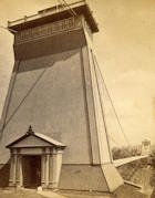
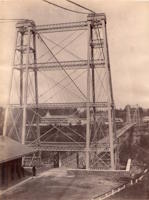
1869: Drahtsteg
Passau, Bavaria, Germany - Danube River
| Bridgemeister ID: | 5560 (added 2020-12-19) |
| Year Completed: | 1869 |
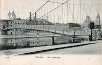
| Name: | Drahtsteg |
| Location: | Passau, Bavaria, Germany |
| Crossing: | Danube River |
| Coordinates: | 48.575501 N 13.472755 E |
| Maps: | Acme, GeoHack, Google, OpenStreetMap |
| References: | PTS2 |
| Use: | Footbridge |
| Status: | Only towers remain, since 1910 (last checked: 2020) |
| Main Cables: | Wire |
| Suspended Spans: | 1 |
Notes:
- Near future location of 1948 Luitpoldbrücke - Passau, Bavaria, Germany.
External Links:
Image Sets:
1869: Lordville
Lordville, New York and Equinunk, Pennsylvania, USA - Delaware River
| Bridgemeister ID: | 71 (added before 2003) |
| Year Completed: | 1869 |
| Name: | Lordville |
| Location: | Lordville, New York and Equinunk, Pennsylvania, USA |
| Crossing: | Delaware River |
| Coordinates: | 41.867938 N 75.213785 W |
| Maps: | Acme, GeoHack, Google, OpenStreetMap |
| Principals: | E.F. Farrington |
| References: | BDR, BOL, PTS2 |
| Use: | Vehicular (one-lane) |
| Status: | Destroyed, 1903 |
| Main Cables: | Wire (iron) |
Notes:
- Destroyed by flood 1903.
- Replaced by 1904 Lordville-Equinunk - Lordville, New York and Equinunk, Pennsylvania, USA.
- All past and present bridges at this location.
Image Sets:

1869: Rudolfova Lávka
Prague, Czechia - Vltava River
| Bridgemeister ID: | 5939 (added 2021-06-29) |
| Year Completed: | 1869 |
| Name: | Rudolfova Lávka |
| Also Known As: | Rudolfsteg, Kettensteg, Železna Lávka |
| Location: | Prague, Czechia |
| Crossing: | Vltava River |
| Coordinates: | 50.090185 N 14.412677 E |
| Maps: | Acme, GeoHack, Google, OpenStreetMap |
| Principals: | Karel Veselý, František Schön, Ruston and Co. |
| References: | AAJ, PTS2 |
| Use: | Footbridge |
| Status: | Removed, c. 1914 |
| Main Cables: | Chain (iron) |
Notes:
- Removed at some point after the adjacent Mánes bridge was opened in 1914.
External Links:
Image Sets:

1869: San Francisco
Bilbao, Spain
1869: Stadspark
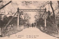
Antwerp, Belgium
| Bridgemeister ID: | 2078 (added 2006-06-10) |
| Year Completed: | 1869 |
| Name: | Stadspark |
| Also Known As: | City Park |
| Location: | Antwerp, Belgium |
| Coordinates: | 51.211054 N 4.414975 E |
| Maps: | Acme, GeoHack, Google, OpenStreetMap |
| Principals: | Cail et Halot |
| References: | ISFF |
| Use: | Footbridge |
| Status: | In use (last checked: 2019) |
| Main Cables: | Chain (iron) |
| Main Span: | 1 x 27.5 meters (90.2 feet) |
| Deck width: | 3.5 |
Notes:
- Cables and deck replaced, 1976.
External Links:
Image Sets:
1869: Swinging
Warren and Glade, Pennsylvania, USA - Conewango Creek
| Bridgemeister ID: | 1623 (added 2005-02-27) |
| Year Completed: | 1869 |
| Name: | Swinging |
| Location: | Warren and Glade, Pennsylvania, USA |
| Crossing: | Conewango Creek |
| Coordinates: | 41.847389 N 79.141000 W |
| Maps: | Acme, GeoHack, Google, OpenStreetMap |
| Use: | Footbridge |
| Status: | Replaced, 1904 |
| Main Cables: | Wire (iron) |
Notes:
- Coordinates indicate approximate original location of the bridge.
- Destroyed by storm soon after completion and rebuilt.
- Images of America: Warren by Jodi L. Brandon shows an image of this bridge with a caption stating the bridge was moved to Kelletville (in Forest County, Pennsylvania) in 1906.
Image Sets:

1869: Waco
Waco, Texas, USA - Brazos River
| Bridgemeister ID: | 72 (added before 2003) |
| Year Completed: | 1869 |
| Name: | Waco |
| Location: | Waco, Texas, USA |
| Crossing: | Brazos River |
| Coordinates: | 31.561314 N 97.127063 W |
| Maps: | Acme, GeoHack, Google, OpenStreetMap |
| Principals: | Thomas M. Griffith |
| References: | AAJ, BC3, BPL, BRAZ, GBD, HAERTX98, HBE, PTS2, WSB |
| Use: | Vehicular, with walkway |
| Status: | Restricted to foot traffic (last checked: 2023) |
| Main Cables: | Wire (iron) |
| Suspended Spans: | 1 |
| Main Span: | 1 x 144.8 meters (475 feet) |
| Deck width: | 18 feet |
Notes:
- 1915: Rebuilt.
- 2020, October: Closed for restoration project expecting to last 18-24 months.
- 2021, March: Major restoration project underway, led by Sparks Engineering, Inc.
- 2023, April: The restored bridge is rededicated on April 22. Patrick Sparks of Sparks Engineering reports: . The rededication was held April 22, 2023. "The project involved full rehabilitation including: replacement of the suspension system and anchor rods, strengthening of the anchorages, replacement of the saddle bearings, retrofit strengthening of the east tower, and deck replacement (concrete on the main deck, tropical hardwood on the side walks)."
External Links:
Image Sets:


Do you have any information or photos for these bridges that you would like to share? Please email david.denenberg@bridgemeister.com.
Mail | Facebook | X (Twitter) | Bluesky