Suspension Bridges Crossing Osage River
This is a list of all 16 bridges from the suspension bridge inventory crossing Osage River. Please note that different rivers with the same name will be grouped together. For example, selecting 'Bear Creek' shows bridges across several different Bear Creeks. Also, similarly named rivers are grouped separately. For example, 'River Dee' (UK) bridges are grouped separately from 'Dee River' (Australia) bridges. Wherever you see a Bridgemeister ID number click it to isolate the bridge on its own page.
Related Lists:
1895: Drake
Warsaw, Missouri, USA - Osage River
| Bridgemeister ID: | 1069 (added 2003-12-27) |
| Year Completed: | 1895 |
| Name: | Drake |
| Location: | Warsaw, Missouri, USA |
| Crossing: | Osage River |
| Principals: | Dr. Daniel M. Eddy |
| References: | BOTO |
| Use: | Vehicular |
| Status: | Collapsed, 1913 |
| Main Cables: | Wire |
Notes:
- Collapsed under weight of cattle 1913.
- Replaced by 1913 Middle - Warsaw, Missouri, USA.
- All past and present bridges at this location.
Image Sets:
1897: Hackberry
Warsaw, Missouri, USA - Osage River
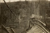
| Bridgemeister ID: | 2538 (added 2011-12-28) |
| Year Completed: | 1897 |
| Name: | Hackberry |
| Also Known As: | Lower |
| Location: | Warsaw, Missouri, USA |
| Crossing: | Osage River |
| Principals: | Joseph A. Dice, Dr. Daniel M. Eddy |
| References: | BOTO |
| Use: | Vehicular |
| Status: | Destroyed, 1926 |
| Main Cables: | Wire |
| Main Span: | 1 x 158.5 meters (520 feet) |
Notes:
- Destroyed by fire, 1926.
External Links:
1904: Upper
Warsaw, Missouri, USA - Osage River
| Bridgemeister ID: | 2537 (added 2011-12-28) |
| Year Completed: | 1904 |
| Name: | Upper |
| Also Known As: | Swinging |
| Location: | Warsaw, Missouri, USA |
| Crossing: | Osage River |
| Coordinates: | 38.244449 N 93.387608 W |
| Maps: | Acme, GeoHack, Google, OpenStreetMap |
| Principals: | Joseph A. Dice, Dr. Daniel M. Eddy |
| References: | BOTO |
| Use: | Vehicular |
| Status: | Destroyed, 1924 |
| Main Cables: | Wire |
Notes:
- Destroyed by a tornado.
- Replaced by 1927 Upper (Swinging) - Warsaw, Missouri, USA.
- All past and present bridges at this location.
1905: Tuscumbia
Tuscumbia, Missouri, USA - Osage River
| Bridgemeister ID: | 1977 (added 2005-11-27) |
| Year Completed: | 1905 |
| Name: | Tuscumbia |
| Location: | Tuscumbia, Missouri, USA |
| Crossing: | Osage River |
| Coordinates: | 38.23526 N 92.44763 W |
| Maps: | Acme, GeoHack, Google, OpenStreetMap |
| Principals: | Joseph Dice |
| References: | BOTO |
| Use: | Vehicular (one-lane) |
| Status: | Replaced, 1933 |
| Main Cables: | Wire |
| Main Span: | 1 |
| Side Spans: | 2 |
Notes:
- Some remains still visible at site, 2007.
- Near (suspension bridge) - Tuscumbia vicinity, Missouri, USA.
External Links:
Image Sets:

1908: Bailey
Warsaw vicinity, Missouri, USA - Osage River
| Bridgemeister ID: | 3516 (added 2019-12-24) |
| Year Completed: | 1908 |
| Name: | Bailey |
| Location: | Warsaw vicinity, Missouri, USA |
| Crossing: | Osage River |
| Principals: | Joseph A. Dice |
| References: | BOTO |
| Use: | Vehicular |
| Status: | Removed |
| Main Cables: | Wire (steel) |
Notes:
- Location inundated by the Harry S. Truman Reservoir.
External Links:
1908: Heath Ford
Warsaw vicinity, Missouri, USA - Osage River
| Bridgemeister ID: | 3515 (added 2019-12-24) |
| Year Completed: | 1908 |
| Name: | Heath Ford |
| Location: | Warsaw vicinity, Missouri, USA |
| Crossing: | Osage River |
| Principals: | Joseph A. Dice |
| References: | BOTO |
| Use: | Vehicular |
| Status: | Removed |
| Main Cables: | Wire (iron) |
| Main Span: | 1 x 157.6 meters (517 feet) |
Notes:
- Damaged by wind, 1932. Replaced, 1937
- Location inundated by the Harry S. Truman Reservoir.
External Links:
1908: Sagrada
Sagrada, Missouri, USA - Osage River
| Bridgemeister ID: | 2304 (added 2007-04-26) |
| Year Completed: | 1908 |
| Name: | Sagrada |
| Location: | Sagrada, Missouri, USA |
| Crossing: | Osage River |
| Principals: | J.S. Kidwell |
| References: | BOTO |
| Status: | Removed, 1931 |
| Main Cables: | Wire |
External Links:
1910: Linn Creek
Linn Creek, Missouri, USA - Osage River
| Bridgemeister ID: | 289 (added before 2003) |
| Year Completed: | 1910 |
| Name: | Linn Creek |
| Location: | Linn Creek, Missouri, USA |
| Crossing: | Osage River |
| Principals: | T.S. Hart |
| References: | AAJ, PTS2 |
| Use: | Vehicular |
| Status: | Removed, 1931 |
| Main Cables: | Wire |
| Suspended Spans: | 1 |
| Main Span: | 1 x 160 meters (525 feet) |
Notes:
- Dismantled 1931 in preparation for inundation that created Lake Of The Ozarks.
External Links:
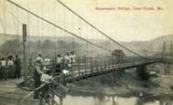
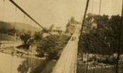
- www.LakeHistory.info. Michael Gillespie writes: "The supporting cables were cut and the tower was allowed to fall into the Osage River. The entire flood plain was being inundated by the waters of the newly created Lake of the Ozarks. During World War 2, the cables and tower were raised and sold for scrap. The shoreline of today's Lake of the Ozarks is just at the base of the bridge abutment. The toll house, seen in the photo just to the left of the bridge, is long gone, and everything below that has been underwater for 77 years. I have created a map of the road system at that location."
- Bridgehunter.com - BH84963
Image Sets:
1912: Branstetter
Warsaw vicinity, Missouri, USA - Osage River
| Bridgemeister ID: | 2042 (added 2006-05-07) |
| Year Completed: | 1912 |
| Name: | Branstetter |
| Also Known As: | Peal Bend |
| Location: | Warsaw vicinity, Missouri, USA |
| Crossing: | Osage River |
| Principals: | Joseph A. Dice |
| References: | BOTO |
| Use: | Vehicular (one-lane) |
| Status: | Removed |
| Main Cables: | Wire (steel) |
| Main Span: | 1 x 182.9 meters (600 feet) |
Notes:
- Heavily damaged by wind, 1924. Rebuilt.
- Location inundated by the Harry S. Truman Reservoir.
External Links:
1912: County Line
Henry County and St. Clair County, Missouri, USA - Osage River
| Bridgemeister ID: | 3518 (added 2019-12-24) |
| Year Completed: | 1912 |
| Name: | County Line |
| Also Known As: | Gilbert-Harris |
| Location: | Henry County and St. Clair County, Missouri, USA |
| Crossing: | Osage River |
| Principals: | Joseph A. Dice |
| References: | BOTO |
| Use: | Vehicular (one-lane) |
| Status: | Removed |
| Main Cables: | Wire (steel) |
Notes:
- Location inundated by the Harry S. Truman Reservoir.
External Links:
- Bridgehunter.com - BH21593. Robert Hayden (BOTO) describes the County Line bridge briefly as being the first steel-towered Joe Dice bridge but the image at shows large timber towers like other pre-steel towered Dice bridges.
1913: Middle
Warsaw, Missouri, USA - Osage River
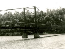
| Bridgemeister ID: | 149 (added before 2003) |
| Year Completed: | 1913 |
| Name: | Middle |
| Location: | Warsaw, Missouri, USA |
| Crossing: | Osage River |
| Principals: | J.S. Kidwell, C.F. Bibb |
| References: | BOTO |
| Use: | Vehicular (one-lane) |
| Status: | Demolished |
| Main Cables: | Wire |
| Suspended Spans: | 2 |
| Main Span: | 1 x 140.8 meters (462 feet) |
| Side Span: | 1 x 36.6 meters (120 feet) |
| Deck width: | 12 feet |
Notes:
- Repaired 1927, repaired 1936, damaged by flood 1943. Closed, 1975.
- Replaced 1895 Drake - Warsaw, Missouri, USA.
- All past and present bridges at this location.
External Links:
Image Sets:
1915: Brown's Ford
Brown's Ford and Lowry City vicinity, Missouri, USA - Osage River
| Bridgemeister ID: | 2325 (added 2007-05-06) |
| Year Completed: | 1915 |
| Name: | Brown's Ford |
| Location: | Brown's Ford and Lowry City vicinity, Missouri, USA |
| Crossing: | Osage River |
| References: | AAJ |
| Status: | Removed |
| Main Cables: | Wire |
Notes:
- The June 22, 1940 edition of The Chillicothe Constitution-Tribune (Chillicothe, Missouri) has an article titled "Three Killed in Bridge Collapse, Workmen were repairing the structure near Lowry City, Mo." describing a fatal collapse of the bridge: "Three men were killed, three injured critically and an 8-year old boy believed drowned when cribbing on a wooden suspension bridge across the Osage River six miles east of Lowry City collapsed about 4 o'clock yesterday afternoon. The bridge, on a farm-to-market road in St. Clair County, was being remodeled. Of the ten men working and bystanders on and near the structure when it fell, only one escaped without injury. All those killed or injured lived in St. Clair County. On the west side of the bridge a framework of heavy timbers had been inserted between one of the suspension cables and an old wooden pier, which originally had supported the cable. The workmen were attempting to slide a steel pier under the cable, to replace the wooden pier. The cribbing suddenly gave way, and the pressure from the cable hurled the wood supports in all directions. The bridge floor dropped into the river, except for a small section near the east end."
External Links:
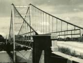
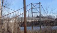
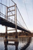
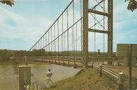
1927: Upper
Warsaw, Missouri, USA - Osage River
| Bridgemeister ID: | 1070 (added 2003-12-27) |
| Year Completed: | 1927 |
| Name: | Upper |
| Also Known As: | Swinging |
| Location: | Warsaw, Missouri, USA |
| Crossing: | Osage River |
| Coordinates: | 38.244110 N 93.388767 W |
| Maps: | Acme, GeoHack, Google, OpenStreetMap |
| Principals: | Joseph A. Dice |
| References: | BOTO |
| Use: | Vehicular (one-lane) |
| Status: | Restricted to foot traffic (last checked: 2020) |
| Main Cables: | Wire (steel) |
| Suspended Spans: | 2 |
| Main Span: | 1 x 152.4 meters (500 feet) estimated |
| Side Span: | 1 x 29 meters (95 feet) estimated |
Notes:
- Joseph Dice supervised the construction of this bridge to replace the 1904 structure destroyed in a tornado in 1924. A postcard of this bridge reads: "built in 1927 by the Benton County Court and by popular subscription of citizens to replace a similar bridge destroyed by a windstorm two years earlier. Structure swings on two wire cables imbedded and anchored in concrete and stone. The towers and floor beams are of steel while the floor is of wood. A state highway crosses this bridge."
- Reopened for pedestrians, 2007, after being closed for several years.
- Replaced 1904 Upper (Swinging) - Warsaw, Missouri, USA.
- All past and present bridges at this location.
External Links:
Image Sets:



1931: Long Shoal
Warsaw vicinity, Missouri, USA - Osage River
| Bridgemeister ID: | 3517 (added 2019-12-24) |
| Year Completed: | 1931 |
| Name: | Long Shoal |
| Location: | Warsaw vicinity, Missouri, USA |
| Crossing: | Osage River |
| Principals: | Joseph A. Dice |
| References: | BOTO |
| Use: | Vehicular |
| Status: | Collapsed, September 21, 1965 |
| Main Cables: | Wire (steel) |
Notes:
- Collapsed, killing three people, September 1965.
External Links:
Crow Island
Osceola, Missouri, USA - Osage River
| Bridgemeister ID: | 7925 (added 2023-10-22) |
| Name: | Crow Island |
| Location: | Osceola, Missouri, USA |
| Crossing: | Osage River |
| Coordinates: | 38.061667 N 93.693472 W |
| Maps: | Acme, GeoHack, Google, OpenStreetMap |
| Use: | Vehicular |
| Status: | Removed |
| Main Cables: | Wire (iron) |
| Suspended Spans: | 1 |
External Links:
- Crow Island Bridge, Osage River, Osceola, Mo. | Library of Congress. Image of the bridge, c. 1914.
Monegaw Springs
Monegaw Springs, Missouri, USA - Osage River
| Bridgemeister ID: | 1476 (added 2004-09-02) |
| Name: | Monegaw Springs |
| Location: | Monegaw Springs, Missouri, USA |
| Crossing: | Osage River |
| Coordinates: | 38.024250 N 93.842083 W |
| Maps: | Acme, GeoHack, Google, OpenStreetMap |
| References: | BOTO |
| Use: | Vehicular (one-lane) |
| Status: | Removed |
| Main Cables: | Wire |
| Suspended Spans: | 1 |
External Links:
Do you have any information or photos for these bridges that you would like to share? Please email david.denenberg@bridgemeister.com.
Mail | Facebook | X (Twitter) | Bluesky