Suspension Bridges Crossing Ohio River
This is a list of all 13 bridges from the suspension bridge inventory crossing Ohio River. Please note that different rivers with the same name will be grouped together. For example, selecting 'Bear Creek' shows bridges across several different Bear Creeks. Also, similarly named rivers are grouped separately. For example, 'River Dee' (UK) bridges are grouped separately from 'Dee River' (Australia) bridges. Wherever you see a Bridgemeister ID number click it to isolate the bridge on its own page.
Related Lists:
1849: Wheeling
Wheeling, West Virginia, USA - Ohio River
| Bridgemeister ID: | 32 (added before 2003) |
| Year Completed: | 1849 |
| Name: | Wheeling |
| Also Known As: | Wheeling and Belmont |
| Location: | Wheeling, West Virginia, USA |
| Crossing: | Ohio River |
| Coordinates: | 40.070250 N 80.727028 W |
| Maps: | Acme, GeoHack, Google, OpenStreetMap |
| Principals: | Charles Ellet |
| References: | AAJ, BBR, BC3, BOB, BPL, CEJ, COB, GBD, HBE, LAB, LACE, ONF, PTS2, RWS, WCC, WHSB |
| Use: | Vehicular (two-lane, light vehicles only) |
| Status: | Restricted to foot traffic, since September 2019 (last checked: 2025) |
| Main Cables: | Wire (iron) |
| Suspended Spans: | 1 |
| Main Span: | 1 x 307.8 meters (1,010 feet) |
Notes:
- Was still part of Virginia at time of completion.
- 1854: Rebuilt after it was wrecked by a windstorm. Contrary to popular myth, the rebuilding was undertaken by Ellet and his assistant William K. McComas, not by John A. Roebling.
- 1860: Overhauled. Popular myth often attributes this work to the Roeblings. WHSB attributes this work to William K. McComas. After this overhaul, the bridge still does not have the distinctive diagonal cable stays that give it the appearance of a Roebling bridge.
- 1872: Overhauled according to a design by Washington Roebling. John A. Roebling had died in 1869 and was not involved with this work. WHSB notes, "The design essentially Roeblingized the bridge with the diagonal cable stays that are such a prominent feature of the bridge."
- 2019, September: Closed to vehicular traffic indefinitely due to safety concerns after repeated overweight vehicle violations.
- 2020, November: Bids being evaluated for renovation project. Bridge remains closed to vehicular traffic.
- 2021, April: Single bid received was rejected. Bids expected to be resolicited in June. The bridge remains closed to all vehicular traffic.
- 2022, February: $17.9 million renovation project expected to start soon.
- Became longest suspension bridge by eclipsing 1834 Zaehringen (Grand Pont Suspendu) - Fribourg, Switzerland.
- Eclipsed by new longest suspension bridge 1867 John A. Roebling (Cincinnati, Cincinnati and Covington) - Cincinnati, Ohio and Covington, Kentucky, USA.
External Links:
Image Sets:


1867: John A. Roebling
Cincinnati, Ohio and Covington, Kentucky, USA - Ohio River
| Bridgemeister ID: | 65 (added before 2003) |
| Year Completed: | 1867 |
| Name: | John A. Roebling |
| Also Known As: | Cincinnati, Cincinnati and Covington |
| Location: | Cincinnati, Ohio and Covington, Kentucky, USA |
| Crossing: | Ohio River |
| Coordinates: | 39.09167 N 84.50833 W |
| Maps: | Acme, GeoHack, Google, OpenStreetMap |
| Principals: | John A. Roebling |
| References: | BAAW, BC3, BOB, BPL, COB, EOV, HBE, LAB, LACE, ONF, PTS2, SJR, TOB |
| Use: | Vehicular (two-lane), with walkway |
| Status: | Closed, February, 2021 (last checked: 2021) |
| Main Cables: | Wire (iron) |
| Suspended Spans: | 3 |
| Main Span: | 1 x 322.2 meters (1,057 feet) |
| Side Spans: | 2 |
Notes:
- 1892: Cable ends restored.
- 1899: Steel cables added to assist original cables.
- 2021, February: Closed to all vehicular traffic for a nine-month restoration project.
- Became longest suspension bridge by eclipsing 1849 Wheeling (Wheeling and Belmont) - Wheeling, West Virginia, USA.
- Eclipsed by new longest suspension bridge 1869 Clifton (Upper, Niagara-Clifton, Falls View, First Falls View) - Niagara Falls, New York, USA and Niagara Falls, Ontario, Canada.
- Near 1854 Licking River - Covington and Newport, Kentucky, USA.
- Near former location of 1853 Licking River - Covington and Newport, Kentucky, USA.
External Links:
Image Sets:


1897: Lincoln Highway
East Liverpool, Ohio and Chester, West Virginia, USA - Ohio River
| Bridgemeister ID: | 105 (added before 2003) |
| Year Completed: | 1897 |
| Name: | Lincoln Highway |
| Also Known As: | Chester |
| Location: | East Liverpool, Ohio and Chester, West Virginia, USA |
| Crossing: | Ohio River |
| Coordinates: | 40.613056 N 80.572806 W |
| Maps: | Acme, GeoHack, Google, OpenStreetMap |
| Principals: | Hermann Laub, E.S. Fickes |
| References: | AAJ, BPL, HBE, PTS2 |
| Use: | Vehicular, with walkway |
| Status: | Removed, 1970 |
| Main Cables: | Wire (steel) |
| Suspended Spans: | 3 |
| Main Span: | 1 x 214.9 meters (705 feet) |
| Side Spans: | 1 x 109.7 meters (360 feet), 1 x 128 meters (420 feet) |
| Deck width: | 27 feet |
Notes:
- Rebuilt 1939 by David Steinman. Closed and demolished, 1970.
External Links:
Image Sets:

1897: Rochester-Monaca
Rochester and Monaca, Pennsylvania, USA - Ohio River
| Bridgemeister ID: | 104 (added before 2003) |
| Year Completed: | 1897 |
| Name: | Rochester-Monaca |
| Location: | Rochester and Monaca, Pennsylvania, USA |
| Crossing: | Ohio River |
| Coordinates: | 40.696833 N 80.280806 W |
| Maps: | Acme, GeoHack, Google, OpenStreetMap |
| Principals: | Edwin Kirtland Morse |
| References: | AAJ, BPL, HBE, PTS2 |
| Use: | Vehicular, with walkway |
| Status: | Replaced, 1930 |
| Main Cables: | Wire (steel) |
| Suspended Spans: | 3 |
| Main Span: | 1 x 243.8 meters (800 feet) |
| Side Spans: | 1 x 121.9 meters (400 feet), 1 x 126.8 meters (416 feet) |
| Deck width: | 28 feet |
External Links:
- Wikipedia - Rochester–Monaca Bridge
- YouTube - History in a Minute: Rochester-Monaca Bridge. Brief video about the bridges at this location.
- Structurae - Structure ID 20009575
Image Sets:

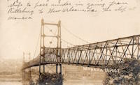
1905: Market Street
Steubenville, Ohio and East Steubenville, West Virginia, USA - Ohio River
| Bridgemeister ID: | 114 (added before 2003) |
| Year Completed: | 1905 |
| Name: | Market Street |
| Location: | Steubenville, Ohio and East Steubenville, West Virginia, USA |
| Crossing: | Ohio River |
| Coordinates: | 40.358222 N 80.609167 W |
| Maps: | Acme, GeoHack, Google, OpenStreetMap |
| Principals: | Hermann Laub |
| References: | AAJ, BPL, PTS2 |
| Use: | Vehicular (two-lane) |
| Status: | Closed, December 2023 (last checked: 2024) |
| Main Cables: | Wire (steel) |
| Suspended Spans: | 3 |
| Main Span: | 1 x 207.3 meters (680 feet) |
| Side Spans: | 2 x 79.2 meters (260 feet) |
Notes:
- 2023, December: Closed by WVDOT because of safety concerns.
- 2024, July: Funds are allocated for reconstruction of the Market Street bridge.
- Near 1928 Fort Steuben - Steubenville, Ohio and Weirton, West Virginia, USA.
External Links:
Image Sets:
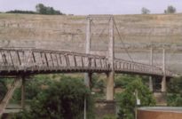


1905: Newell
East Liverpool, Ohio and Newell, West Virginia, USA - Ohio River
| Bridgemeister ID: | 117 (added before 2003) |
| Year Completed: | 1905 |
| Name: | Newell |
| Location: | East Liverpool, Ohio and Newell, West Virginia, USA |
| Crossing: | Ohio River |
| Coordinates: | 40.62167 N 80.595 W |
| Maps: | Acme, GeoHack, Google, OpenStreetMap |
| Principals: | Edwin Kirtland Morse, Dravo Company |
| References: | AAJ, BPL, PTS2 |
| Use: | Vehicular (two-lane), with walkway |
| Status: | In use (last checked: 2022) |
| Main Cables: | Wire (steel) |
| Suspended Spans: | 3 |
| Main Span: | 1 x 228.6 meters (750 feet) |
| Side Spans: | 2 |
Annotated Citations:
- Huba, Stephen. "There’s a new owner for the Newell Bridge." The Weirton Daily Times, 6 May 2022, www.weirtondailytimes.com/news/local-news/2022/05/theres-a-new-owner-for-the-newell-bridge/.
"Frank Six of Six Enterprises in Newell, assumed ownership Wednesday of one of the oldest suspension bridges on the Ohio River for an undisclosed sum from HLC Holdings Inc., parent company of the Fiesta Tableware Co., formerly known as the Homer Laughlin China Co."
- Bobby-Gilbert, Jo-Ann., "Fiesta Tableware Parent Sells Iconic Newell Bridge." The Business Journal, 5 May 2022, businessjournaldaily.com/fiesta-tableware-parent-sells-iconic-newell-bridge/.
"After 116 years of ownership by HLC Holdings Inc., parent company of The Fiesta Tableware Co., the Newell Bridge and Railway Co. changed hands at midnight Wednesday. Officials of Fiesta Tableware, formerly known as Homer Laughlin China Co., announced that the bridge has been purchased by Frank Six, owner of Six Enterprises in Newell."
External Links:
Image Sets:


1916: Belpre-Parkersburg
Parkersburg, West Virginia and Belpre, Ohio, USA - Ohio River
| Bridgemeister ID: | 134 (added before 2003) |
| Year Completed: | 1916 |
| Name: | Belpre-Parkersburg |
| Location: | Parkersburg, West Virginia and Belpre, Ohio, USA |
| Crossing: | Ohio River |
| Coordinates: | 39.270500 N 81.566528 W |
| Maps: | Acme, GeoHack, Google, OpenStreetMap |
| Principals: | Hermann Laub |
| References: | AAJ, BPL, PTS2, SJR |
| Use: | Vehicular, with walkway |
| Status: | Demolished, March 16, 1980 |
| Main Cables: | Wire (steel) |
| Suspended Spans: | 3 |
| Main Span: | 1 x 236.2 meters (775 feet) |
| Side Spans: | 1 x 114.3 meters (375 feet), 1 x 83.8 meters (275 feet) |
| Deck width: | 22 feet |
External Links:
Image Sets:
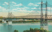
1927: General U.S. Grant
Portsmouth, Ohio and Fullerton, Kentucky, USA - Ohio River
| Bridgemeister ID: | 151 (added before 2003) |
| Year Completed: | 1927 |
| Name: | General U.S. Grant |
| Location: | Portsmouth, Ohio and Fullerton, Kentucky, USA |
| Crossing: | Ohio River |
| Coordinates: | 38.725 N 82.99833 W |
| Maps: | Acme, GeoHack, Google, OpenStreetMap |
| Principals: | Robinson and Steinman, J.E. Greiner, Dravo Co. |
| References: | AAJ, PTS2, SSS |
| Use: | Vehicular (two-lane, heavy vehicles) |
| Status: | Demolished, July 2001 |
| Main Cables: | Wire (steel) |
| Suspended Spans: | 3 |
| Main Span: | 1 x 213.4 meters (700 feet) |
| Side Spans: | 2 x 106.7 meters (350 feet) |
| Deck width: | 28.5 feet |
Notes:
- AAJ: "Recabled" in 1939.
External Links:
Image Sets:
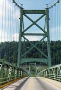

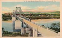
1928: Fort Steuben
Steubenville, Ohio and Weirton, West Virginia, USA - Ohio River
| Bridgemeister ID: | 154 (added before 2003) |
| Year Completed: | 1928 |
| Name: | Fort Steuben |
| Location: | Steubenville, Ohio and Weirton, West Virginia, USA |
| Crossing: | Ohio River |
| Coordinates: | 40.37833 N 80.615 W |
| Maps: | Acme, GeoHack, Google, OpenStreetMap |
| Principals: | Dravo Co. |
| References: | AAJ, PTS2 |
| Use: | Vehicular (two-lane, heavy vehicles), with walkway |
| Status: | Demolished, February 2012 |
| Main Cables: | Wire (steel) |
| Suspended Spans: | 3 |
| Main Span: | 1 x 209.9 meters (688.75 feet) |
| Side Spans: | 2 x 86.3 meters (283 feet) |
| Deck width: | 20.25 feet |
Notes:
- January 2009: Closed indefinitely following inspections revealing major deterioration. Demolished in 2012.
- Near 1905 Market Street - Steubenville, Ohio and East Steubenville, West Virginia, USA.
External Links:
Image Sets:

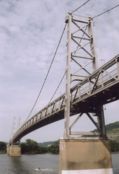
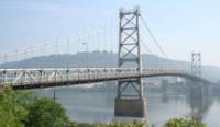
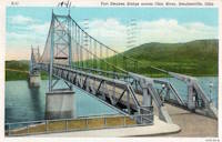
1928: Point Pleasant
Point Pleasant, West Virginia and Kanauga, Gallipolis vicinity, Ohio, USA - Ohio River
| Bridgemeister ID: | 156 (added before 2003) |
| Year Completed: | 1928 |
| Name: | Point Pleasant |
| Also Known As: | Silver |
| Location: | Point Pleasant, West Virginia and Kanauga, Gallipolis vicinity, Ohio, USA |
| Crossing: | Ohio River |
| Coordinates: | 38.845 N 82.141111 W |
| Maps: | Acme, GeoHack, Google, OpenStreetMap |
| Principals: | J.E. Greiner Co. |
| References: | AAJ, BDO, ENR19290620a, ENR19290620b, GBD, LAB, PTS2, SSS |
| Use: | Vehicular, with walkway |
| Status: | Collapsed, 1967 |
| Main Cables: | Eyebar (steel) |
| Suspended Spans: | 3 |
| Main Span: | 1 x 213.4 meters (700 feet) |
| Side Spans: | 2 x 115.8 meters (380 feet) |
| Deck width: | 27 feet |
Notes:
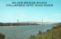
- Hybrid truss, suspension bridge. Collapsed December 15, 1967 while full with traffic. 46 people died.
- Companion to 1928 Saint Marys (Hi Carpenter, Short Route) - Saint Marys, West Virginia and Newport, Ohio, USA.
External Links:
Image Sets:

1928: Saint Marys
Saint Marys, West Virginia and Newport, Ohio, USA - Ohio River
| Bridgemeister ID: | 159 (added before 2003) |
| Year Completed: | 1928 |
| Name: | Saint Marys |
| Also Known As: | Hi Carpenter, Short Route |
| Location: | Saint Marys, West Virginia and Newport, Ohio, USA |
| Crossing: | Ohio River |
| Coordinates: | 39.391694 N 81.211083 W |
| Maps: | Acme, GeoHack, Google, OpenStreetMap |
| Principals: | J.E. Greiner Co. |
| References: | BPL, GBD, PTS2 |
| Use: | Vehicular |
| Status: | Demolished, 1971 |
| Main Cables: | Eyebar (steel) |
| Suspended Spans: | 3 |
| Main Span: | 1 x 213.4 meters (700 feet) |
| Side Spans: | 2 |
Notes:
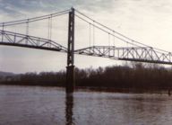
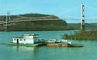
- Same design as the Silver Bridge that famously collapsed in 1967. Demolished 1971 as a precautionary measure because the engineers decided they could not tell if it suffered from the same flaw as the Silver Bridge without dismantling the eyebars.
- Companion to 1928 Point Pleasant (Silver) - Point Pleasant, West Virginia and Kanauga, Gallipolis vicinity, Ohio, USA.
Image Sets:
1931: Simon Kenton Memorial
Maysville, Kentucky and Aberdeen, Ohio, USA - Ohio River
| Bridgemeister ID: | 172 (added before 2003) |
| Year Completed: | 1931 |
| Name: | Simon Kenton Memorial |
| Also Known As: | Maysville |
| Location: | Maysville, Kentucky and Aberdeen, Ohio, USA |
| Crossing: | Ohio River |
| Coordinates: | 38.649890 N 83.759670 W |
| Maps: | Acme, GeoHack, Google, OpenStreetMap |
| Principals: | Modjeski, Masters & Chase |
| References: | AAJ, SJR, SSS |
| Use: | Vehicular (two-lane), with walkway |
| Status: | In use (last checked: 2022) |
| Main Cables: | Wire (steel) |
| Suspended Spans: | 3 |
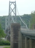
| Main Span: | 1 x 323.1 meters (1,060 feet) |
| Side Spans: | 2 x 141.7 meters (464.9 feet) |
| Deck width: | 28 feet |
Notes:
- 2022, March: USD$23.4 million budgeted for rehabilitation project including suspender cable replacements, steel repairs, and painting.
- 2019: Closed late 2019 due to suspender cable corrosion. Short-term fixes applied to reduce the stress on the suspenders and to prevent rusting.
- 2020, June: Reopened with a 15-ton weight limit after installation of temporary support rods and brackets to reduce the stress on damaged cables.
External Links:
Image Sets:



1962: (pipeline bridge)
Grays Branch, Greenup vicinity, Kentucky and Franklin Furnace, Ohio, USA - Ohio River
| Bridgemeister ID: | 880 (added 2003-09-01) |
| Year Completed: | 1962 |
| Name: | (pipeline bridge) |
| Location: | Grays Branch, Greenup vicinity, Kentucky and Franklin Furnace, Ohio, USA |
| Crossing: | Ohio River |
| Coordinates: | 38.66058 N 82.85889 W |
| Maps: | Acme, GeoHack, Google, OpenStreetMap |
| Principals: | Weldon F. Appelt, P.E., Clear Span Engineering, Inc |
| Use: | Pipeline |
| Status: | Extant (last checked: 2021) |
| Main Cables: | Wire (steel) |
| Main Span: | 1 x 609.6 meters (2,000 feet) |
Notes:
- Just downstream of Greenup Dam. Built for Tennessee Gas Pipeline Co. Carries two 30" gas pipelines.
External Links:
Image Sets:
Do you have any information or photos for these bridges that you would like to share? Please email david.denenberg@bridgemeister.com.
Mail | Facebook | X (Twitter) | Bluesky