Suspension Bridges Crossing Ardèche River
This is a list of all 7 bridges from the suspension bridge inventory crossing Ardèche River. Please note that different rivers with the same name will be grouped together. For example, selecting 'Bear Creek' shows bridges across several different Bear Creeks. Also, similarly named rivers are grouped separately. For example, 'River Dee' (UK) bridges are grouped separately from 'Dee River' (Australia) bridges. Wherever you see a Bridgemeister ID number click it to isolate the bridge on its own page.
Related Lists:
1832: Vals-les-bains
Vals-les-bains and Labégude, Ardèche, France - Ardèche River
| Bridgemeister ID: | 1761 (added 2005-04-22) |
| Year Completed: | 1832 |
| Name: | Vals-les-bains |
| Location: | Vals-les-bains and Labégude, Ardèche, France |
| Crossing: | Ardèche River |
| References: | AAJ |
| Use: | Vehicular |
| Main Cables: | Wire (iron) |
Notes:
- AAJ notes the contract was let in late 1831 and guesses at 1833 as the year of completion. 1832 is more likely given the rate at which these early iron wire French bridges were constructed.
1837: Vallon
Vallon-Pont-D'arc and Salavas, Ardèche, France - Ardèche River
| Bridgemeister ID: | 1766 (added 2005-04-22) |
| Year Completed: | 1837 |
| Name: | Vallon |
| Also Known As: | Salavas |
| Location: | Vallon-Pont-D'arc and Salavas, Ardèche, France |
| Crossing: | Ardèche River |
| Coordinates: | 44.398624 N 4.385082 E |
| Maps: | Acme, GeoHack, Google, OpenStreetMap |
| References: | AAJ |
| Use: | Vehicular |
| Status: | Removed |
| Main Cables: | Wire |
| Main Spans: | 2 |
Notes:
- The current (2022) bridge at this location is built on the piers of the suspension bridge.
Image Sets:
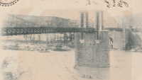
1838: Ruoms
Ruoms and Labeaume, Ardèche, France - Ardèche River
| Bridgemeister ID: | 7314 (added 2022-08-28) |
| Year Completed: | 1838 |
| Name: | Ruoms |
| Also Known As: | Les Brasseries |
| Location: | Ruoms and Labeaume, Ardèche, France |
| Crossing: | Ardèche River |
| Coordinates: | 44.456715 N 4.334095 E |
| Maps: | Acme, GeoHack, Google, OpenStreetMap |
| Use: | Vehicular |
| Status: | Only towers remain (last checked: 2022) |
| Main Span: | 1 |
External Links:
Image Sets:
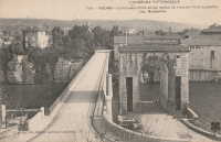
1905: Saint-Martin
Saint-Martin-d'Ardèche, Ardèche and Aiguèze, Gard, France - Ardèche River
| Bridgemeister ID: | 1523 (added 2004-10-10) |
| Year Completed: | 1905 |
| Name: | Saint-Martin |
| Location: | Saint-Martin-d'Ardèche, Ardèche and Aiguèze, Gard, France |
| Crossing: | Ardèche River |
| Coordinates: | 44.3007 N 4.567283 E |
| Maps: | Acme, GeoHack, Google, OpenStreetMap |
| Use: | Vehicular (one-lane) |
| Status: | In use (last checked: 2005) |
| Main Cables: | Wire |
| Suspended Spans: | 1 |
External Links:
Image Sets:
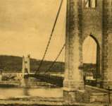
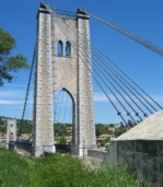

1936: Saint-Didier-sous-Aubenas
Saint-Didier-sous-Aubenas, Ardèche, France - Ardèche River
| Bridgemeister ID: | 2930 (added 2019-09-16) |
| Year Completed: | 1936 |
| Name: | Saint-Didier-sous-Aubenas |
| Location: | Saint-Didier-sous-Aubenas, Ardèche, France |
| Crossing: | Ardèche River |
| Coordinates: | 44.604219 N 4.419136 E |
| Maps: | Acme, GeoHack, Google, OpenStreetMap |
| Use: | Vehicular (two-lane) |
| Status: | Collapsed, 1995 |
| Main Cables: | Wire (steel) |
Notes:
- Collapsed, 1995. One tower remains.
- Replaced Saint-Didier-sous-Aubenas - Saint-Didier-sous-Aubenas, Ardèche, France.
- All past and present bridges at this location.
Image Sets:
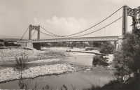
Issoux
Les Issoux, Vals-des-Bains and Lalevade-d'Ardèche, Ardèche, France - Ardèche River
| Bridgemeister ID: | 7856 (added 2023-09-15) |
| Name: | Issoux |
| Location: | Les Issoux, Vals-des-Bains and Lalevade-d'Ardèche, Ardèche, France |
| Crossing: | Ardèche River |
| Use: | Footbridge |
| Status: | Removed |
| Suspended Spans: | 1 |
External Links:
- Facebook - Ancienne passerelle des Issoux. Image of the bridge.
- Facebook - Ancienne passerelle des Issoux. Image of the bridge.
- Facebook - Ancienne passerelle des Issoux. Image of the bridge.
- Facebook - La passerelle des Issoux 1962 Archives départementales. Image of the bridge.
- Facebook - La passerelle des Issoux 1962 Archives départementales. Image of the bridge.
Image Sets:

Saint-Didier-sous-Aubenas
Saint-Didier-sous-Aubenas, Ardèche, France - Ardèche River
| Bridgemeister ID: | 2929 (added 2019-09-16) |
| Name: | Saint-Didier-sous-Aubenas |
| Location: | Saint-Didier-sous-Aubenas, Ardèche, France |
| Crossing: | Ardèche River |
| Coordinates: | 44.603719 N 4.419774 E |
| Maps: | Acme, GeoHack, Google, OpenStreetMap |
| Use: | Vehicular |
| Status: | Replaced, 1936 |
Notes:
Do you have any information or photos for these bridges that you would like to share? Please email david.denenberg@bridgemeister.com.
Mail | Facebook | X (Twitter) | Bluesky