Suspension Bridges of Chile
This is a list of all 46 bridges from the suspension bridge inventory for the country Chile . Wherever you see a Bridgemeister ID number click it to isolate the bridge on its own page.
Related Lists:
Bridgemeister ID: 7930 (added 2023-10-22)Year Completed: 1874 Name: Isidora Location: Lota, Chile At or Near Feature: Parque Isidora Cousiño De Lota Status: Only towers remain (last checked: 2023)
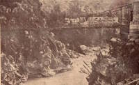
Bridgemeister ID: 6917 (added 2022-01-21)Year Completed: 1931 Name: Rubens Location: Los Angeles vicinity, Natales, Chile Crossing: Rio Rubens Coordinates: 52.036240 S 71.947632 W Maps: Acme , GeoHack , Google , OpenStreetMap Use: Vehicular Status: Derelict (last checked: 2021) Main Cables: Wire (steel) Main Span: 1 x 42 meters (137.8 feet) estimated
Bridgemeister ID: 1081 (added 2003-12-29)Year Completed: 1966 Name: Presidente Ibañez Location: Aisén, Chile Coordinates: 45.404861 S 72.684361 W Maps: Acme , GeoHack , Google , OpenStreetMap Use: Vehicular (two-lane, heavy vehicles) Status: In use (last checked: 2019) Main Cables: Wire (steel) Suspended Spans: 1
Bridgemeister ID: 7928 (added 2023-10-22)Year Completed: 1969 Name: Hermanos Carrera Location: San Antonio, Valparaiso, Chile Coordinates: 33.577701 S 71.611576 W Maps: Acme , GeoHack , Google , OpenStreetMap Use: Footbridge Status: In use (last checked: 2023) Main Cables: Wire (steel) Main Span: 1 x 62 meters (203.4 feet) estimated
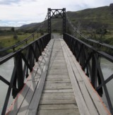
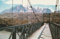
Bridgemeister ID: 2507 (added 2009-12-29)Name: (footbridge) Location: Camp Italiano vicinity, Torres del Paine, Chile Use: Footbridge Status: In use (last checked: 2020) Main Cables: Wire Suspended Spans: 1
Bridgemeister ID: 6231 (added 2021-07-17)Name: (footbridge) Location: Cancura, Osorno, Chile Crossing: Rahue River Coordinates: 40.760684 S 72.966358 W Maps: Acme , GeoHack , Google , OpenStreetMap Use: Footbridge Status: In use (last checked: 2021) Main Cables: Wire (steel) Main Span: 1
Bridgemeister ID: 4093 (added 2020-04-05)Name: (footbridge) Location: El Traum, Troyo vicinity, Lonquimay, Chile Crossing: Rio Biobío Coordinates: 38.211070 S 71.296577 W Maps: Acme , GeoHack , Google , OpenStreetMap Use: Footbridge Status: In use (last checked: 2012) Main Cables: Wire (steel)
Bridgemeister ID: 4019 (added 2020-03-28)Name: (footbridge) Location: Hualaihué, Chile Crossing: Estero Pichicolo Coordinates: 41.985445 S 72.564372 W Maps: Acme , GeoHack , Google , OpenStreetMap Use: Footbridge Status: In use (last checked: 2014) Main Cables: Wire Suspended Spans: 1 Main Span: 1
Bridgemeister ID: 3508 (added 2019-12-24)Name: (footbridge) Location: Huentemo, Chiloé, Chile Crossing: Rio Colecole Coordinates: 42.507064 S 74.183216 W Maps: Acme , GeoHack , Google , OpenStreetMap Use: Footbridge Status: In use (last checked: 2019) Main Cables: Wire (steel)
Bridgemeister ID: 6122 (added 2021-07-04)Name: (footbridge) Location: Osorno, Chile Crossing: Rio Damas Coordinates: 40.568974 S 73.131853 W Maps: Acme , GeoHack , Google , OpenStreetMap Use: Footbridge Status: In use (last checked: 2013) Main Cables: Wire (steel) Suspended Spans: 1 Main Span: 1
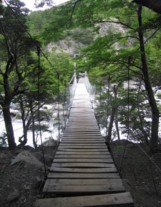
Bridgemeister ID: 1206 (added 2004-02-06)Name: (footbridge) Location: Rio Pingo, Lago Grey vicinity, Torres de Paine, Chile Crossing: Rio Avutardas Coordinates: 51.123452 S 73.129797 W Maps: Acme , GeoHack , Google , OpenStreetMap Use: Footbridge Status: In use (last checked: 2019) Main Cables: Wire (steel) Suspended Spans: 1
Bridgemeister ID: 7643 (added 2023-05-29)Name: (footbridge) Location: San Vicente de Tagua Tagua, San Vicente, Chile Crossing: Estero Zamprano Coordinates: 34.452551 S 71.153271 W Maps: Acme , GeoHack , Google , OpenStreetMap Use: Footbridge Status: In use (last checked: 2022) Main Cables: Wire (steel) Suspended Spans: 1
Bridgemeister ID: 2508 (added 2009-12-29)Name: (footbridge) Location: Torres del Paine, Chile Use: Footbridge Status: In use (last checked: 2009) Main Cables: Wire Suspended Spans: 1
Bridgemeister ID: 8019 (added 2023-12-10)Name: (pipeline bridge) Location: Central Sauzal vicinity, Machali, Chile Crossing: Cachapoal River Coordinates: 34.269139 S 70.584722 W Maps: Acme , GeoHack , Google , OpenStreetMap Use: Pipeline Status: Extant (last checked: 2023) Main Cables: Wire (steel) Suspended Spans: 2 Main Span: 1 x 97 meters (318.2 feet) estimated Side Span: 1 x 50 meters (164 feet) estimated
Bridgemeister ID: 6121 (added 2021-07-04)Name: (pipeline bridge) Location: Osorno, Chile Crossing: Rahue River Coordinates: 40.584360 S 73.154973 W Maps: Acme , GeoHack , Google , OpenStreetMap Use: Pipeline and Footbridge Status: Extant (last checked: 2021) Main Cables: Wire (steel) Suspended Spans: 1 Main Span: 1
Bridgemeister ID: 4092 (added 2020-04-05)Name: (suspension bridge) Location: Boquintallin, Troyo vicinity, Lonquimay, Chile Crossing: Rio Biobío Coordinates: 38.308321 S 71.333573 W Maps: Acme , GeoHack , Google , OpenStreetMap Status: Extant (last checked: 2019)
Bridgemeister ID: 8151 (added 2024-02-03)Name: (suspension bridge) Location: Casa Pangue, Puerto Varas, Chile Use: Vehicular (one-lane) Main Cables: Wire Suspended Spans: 1
Bridgemeister ID: 3509 (added 2019-12-24)Name: (suspension bridge) Location: Casas Nuevas, Temuco, Chile Crossing: Cautin River Coordinates: 38.770435 S 72.878837 W Maps: Acme , GeoHack , Google , OpenStreetMap Use: Vehicular Status: Extant (last checked: 2019) Main Cables: Wire (steel)
Bridgemeister ID: 9073 (added 2025-02-20)Name: (suspension bridge) Location: Futaleufu, Chile Crossing: Futaleufu River Coordinates: 43.351889 S 72.058250 W Maps: Acme , GeoHack , Google , OpenStreetMap Use: Vehicular (one-lane) Status: In use (last checked: 2019) Main Cables: Wire (steel) Suspended Spans: 1 Main Span: 1 x 67 meters (219.8 feet) estimated
Bridgemeister ID: 2500 (added 2008-12-24)Name: (suspension bridge) Location: Lago Verde, Aysén, Chile Crossing: Rio Pico Coordinates: 44.198632 S 71.847055 W Maps: Acme , GeoHack , Google , OpenStreetMap Use: Vehicular (one-lane) Status: Extant (last checked: 2019) Suspended Spans: 1
Bridgemeister ID: 3513 (added 2019-12-24)Name: (suspension bridge) Location: Luis Soto, Puerto Guadal vicinity, Aysén, Chile Crossing: Bertrand Lake Coordinates: 46.845118 S 72.802793 W Maps: Acme , GeoHack , Google , OpenStreetMap Use: Vehicular Status: In use (last checked: 2019) Main Cables: Wire (steel) Suspended Spans: 1
Bridgemeister ID: 3511 (added 2019-12-24)Name: (suspension bridge) Location: O'Higgins, Aysén, Chile Crossing: Mayer River Coordinates: 48.415212 S 72.546255 W Maps: Acme , GeoHack , Google , OpenStreetMap Use: Vehicular (one-lane) Status: In use (last checked: 2019) Main Cables: Wire (steel) Suspended Spans: 1
Bridgemeister ID: 3512 (added 2019-12-24)Name: (suspension bridge) Location: O'Higgins, Aysén, Chile Crossing: Mayer River Coordinates: 48.482535 S 72.588396 W Maps: Acme , GeoHack , Google , OpenStreetMap Use: Vehicular Status: In use (last checked: 2019) Main Cables: Wire (steel)
Bridgemeister ID: 1293 (added 2004-03-16)Name: (suspension bridge) Location: Pucon, Araucania, Chile Crossing: Trancura River Coordinates: 39.272781 S 71.922559 W Maps: Acme , GeoHack , Google , OpenStreetMap Use: Vehicular (one-lane) Status: Bypassed (last checked: 2019) Main Cables: Wire
Bridgemeister ID: 6918 (added 2022-01-21)Name: (suspension bridge) Location: Timaukel, Tierra del Fuego, Chile Crossing: Rio Grande Coordinates: 53.892564 S 68.881894 W Maps: Acme , GeoHack , Google , OpenStreetMap Status: Extant (last checked: 2017) Main Span: 1 x 51 meters (167.3 feet) estimated
Bridgemeister ID: 7604 (added 2023-05-16)Name: Coiron Location: Coiron, Salamanca, Chile Crossing: Rio Choapa Coordinates: 31.897482 S 70.772009 W Maps: Acme , GeoHack , Google , OpenStreetMap Use: Vehicular (one-lane) Status: Restricted to foot traffic (last checked: 2023) Main Cables: Wire (steel) Suspended Spans: 1 Main Span: 1 x 61 meters (200.1 feet) estimated
Bridgemeister ID: 4113 (added 2020-04-06)Name: Huequecura Location: Carmen, Santa Bárbara, Bio Bio, Chile Crossing: Rio Huequecura Coordinates: 37.707859 S 71.776444 W Maps: Acme , GeoHack , Google , OpenStreetMap Use: Vehicular (one-lane) Status: In use (last checked: 2020) Main Cables: Wire (steel) Suspended Spans: 1 Main Span: 1 x 75 meters (246.1 feet) estimated
Bridgemeister ID: 1205 (added 2004-02-05)Name: Kusanovic Location: Torres del Paine and Amarga, Chile Crossing: Rio Paine Coordinates: 50.974692 S 72.802274 W Maps: Acme , GeoHack , Google , OpenStreetMap Principals: David Rowell & Co. Use: Vehicular (one-lane) Status: Bypassed (last checked: 2019) Main Cables: Wire Suspended Spans: 1 Main Span: 1
Bridgemeister ID: 5769 (added 2021-04-08)Name: Las Veguillas Location: San Fabián, Ñuble, Chile Crossing: Ñuble River Coordinates: 36.655620 S 71.384376 W Maps: Acme , GeoHack , Google , OpenStreetMap Use: Vehicular (one-lane) Status: In use (last checked: 2021) Main Cables: Wire (steel) Suspended Spans: 1 Main Span: 1 x 138 meters (452.8 feet) estimated
Instagram . Several images of the bridge, posted November 5, 2022.Bridgemeister ID: 7428 (added 2022-12-10)Name: Licantén Also Known As: Los Escalones Location: Licantén, Curicó, Chile Crossing: Mataquito River Coordinates: 34.984763 S 72.009507 W Maps: Acme , GeoHack , Google , OpenStreetMap Use: Footbridge Status: In use (last checked: 2022) Main Cables: Wire (steel) Suspended Spans: 1 Main Span: 1 x 161 meters (528.2 feet) estimated
Bridgemeister ID: 8972 (added 2024-12-20)Name: Liquiñe Location: Liquiñe, Panguipulli, Valdivia, Chile Crossing: Rio Liquiñe Coordinates: 39.757694 S 71.816917 W Maps: Acme , GeoHack , Google , OpenStreetMap Use: Footbridge Status: In use (last checked: 2024) Main Cables: Wire (steel) Main Span: 1
Bridgemeister ID: 1044 (added 2003-12-06)Name: Maquehue Location: Maquehue, Padre Las Casas, Chile Crossing: Rio Quepe Use: Vehicular (one-lane)
Bridgemeister ID: 6120 (added 2021-07-04)Name: Ovejeria Bajo Location: Osorno, Chile Crossing: Rahue River Coordinates: 40.584181 S 73.154793 W Maps: Acme , GeoHack , Google , OpenStreetMap Use: Footbridge Status: In use (last checked: 2021) Main Cables: Wire (steel) Suspended Spans: 1
Bridgemeister ID: 3035 (added 2019-10-13)Name: Palos Location: Puerto Aysén, Chile Crossing: Rio Pangal Coordinates: 45.395001 S 72.712269 W Maps: Acme , GeoHack , Google , OpenStreetMap Use: Vehicular (one-lane) Status: In use (last checked: 2019) Main Cables: Wire (steel) Suspended Spans: 1
Bridgemeister ID: 3033 (added 2019-10-13)Name: Piedra del Indio Location: Coyhaique, Chile Crossing: Rio Simpson Coordinates: 45.577684 S 72.080090 W Maps: Acme , GeoHack , Google , OpenStreetMap Use: Vehicular (one-lane) Status: In use (last checked: 2018) Main Cables: Wire (steel)
Bridgemeister ID: 8402 (added 2024-03-03)Name: Primer Corral Location: Llanada Grande, Cochamó, Llanquihue, Chile Crossing: Rio Puelo Coordinates: 41.999139 S 71.908611 W Maps: Acme , GeoHack , Google , OpenStreetMap Use: Footbridge Status: In use (last checked: 2023) Main Cables: Wire (steel) Suspended Spans: 1 Main Span: 1 x 32 meters (105 feet)
Bridgemeister ID: 7642 (added 2023-05-29)Name: Ránquil Location: Ránquil, Ñuble, Chile Coordinates: 36.651574 S 72.594023 W Maps: Acme , GeoHack , Google , OpenStreetMap Use: Footbridge Status: In use (last checked: 2022) Main Cables: Wire (steel) Suspended Spans: 1
Bridgemeister ID: 3514 (added 2019-12-24)Name: Senador Exequiel González Location: Aysén, Chile Crossing: Rio Palena Coordinates: 43.810956 S 72.354821 W Maps: Acme , GeoHack , Google , OpenStreetMap Use: Vehicular (one-lane) Status: In use (last checked: 2019) Main Cables: Wire (steel) Suspended Spans: 1 Main Span: 1 x 152 meters (498.7 feet) estimated
Bridgemeister ID: 9238 (added 2025-06-01)Name: Senador Sergio Sepúlveda Location: La Junta, Aysén, Chile Crossing: Rio Rosselot Coordinates: 43.961444 S 72.396694 W Maps: Acme , GeoHack , Google , OpenStreetMap Use: Vehicular (one-lane) Status: In use (last checked: 2014) Main Cables: Wire (steel) Suspended Spans: 1 Main Span: 1 x 128 meters (419.9 feet) estimated
Bridgemeister ID: 8165 (added 2024-02-03)Name: Termas de Cauquenes Location: Termas de Cauquenes, Rancagua vicinity, Chile Crossing: Cachapoal River Coordinates: 34.245472 S 70.553833 W Maps: Acme , GeoHack , Google , OpenStreetMap Use: Footbridge Status: Derelict (last checked: 2020) Main Cables: Wire Suspended Spans: 1
The coordinates provided here appear to be the location of the bridge in the associated image set. Satellite images (as of the 2000s) show what appears to be a derelict suspension bridge at this location crossing an arm of the Cachapoal River to reach a large outcropping. Near Termas de Cauquenes - Termas de Cauquenes, Rancagua vicinity, Chile . Bridgemeister ID: 9051 (added 2025-02-15)Name: Termas de Cauquenes Location: Termas de Cauquenes, Rancagua vicinity, Chile At or Near Feature: Hotel Termas de Cauquenes Coordinates: 34.247750 S 70.553944 W Maps: Acme , GeoHack , Google , OpenStreetMap Use: Footbridge Status: In use (last checked: 2015) Main Cables: Wire Suspended Spans: 1
Bridgemeister ID: 3034 (added 2019-10-13)Name: Torreones Location: El Balseo, Chile Crossing: Rio Simpson Coordinates: 45.424330 S 72.427564 W Maps: Acme , GeoHack , Google , OpenStreetMap Use: Vehicular (one-lane) Status: In use (last checked: 2019) Main Cables: Wire (steel) Suspended Spans: 1
Bridgemeister ID: 9137 (added 2025-04-06)Name: Valle Chacabuco Location: Valle Chacabuco, Cochrane, Chile Crossing: Rio Chacabuco At or Near Feature: Chacabuco Canyon Trail, Patagonia National Park Coordinates: 47.085472 S 72.497583 W Maps: Acme , GeoHack , Google , OpenStreetMap Use: Footbridge Status: In use (last checked: 2022) Main Cables: Wire (steel) Suspended Spans: 1 Main Span: 1 x 100 meters (328.1 feet) estimated
Bridgemeister ID: 6420 (added 2021-07-31)Name: Valparaiso Pier Location: Valparaiso, Chile Principals: Charles D. Young and Co., Frederick W. Etheredge Use: Footbridge Status: Destroyed, March, 1856 Main Cables: Rod (iron) Suspended Spans: 3 Main Span: 1 Side Spans: 2
Suspension pier based on James Dredge's patent. A large illustration of a suspension pier built based on Dredge's patent appears in Illustrated and Descriptive Catalogue of Machinery, Implements, Tools, Manufactured Articles, Raw Materials, etc.… published by Charles D. Young & Co. in the 1850s. Lloyd, William. A Railway Pioneer Notes by a Civil Engineer in Europe and America from 1838 to 1888 . London, Baines and Scarsbrook, 1900.Mentions "In March of the same year [1856], a disastrous gale at Valparaiso drove several ships on shore, destroying a large iron suspension pier, erected by one of my Directors". This is very likely referring to the Dredge patent pier.
Do you have any information or photos for these bridges that you would like to share? Please email david.denenberg@bridgemeister.com .
Mail
| Facebook
| X (Twitter)
| Bluesky


