Inventory Search Results
199 suspension bridges were found for search criteria: "(pipeline bridge)" .
All 199 bridges from the search results appear below. Click the Bridgemeister ID number to isolate the bridge on its own page.
If you don't see what you were looking for, try an image search with the same criteria: "(pipeline bridge)"
Related:
Multi-span pipeline suspension bridge carrying a large water main. Since replaced with a bridge carrying both pedestrians and a large pipeline. Bridgemeister ID: 1856 (added 2005-07-17)Year Completed: 1925 Name: (pipeline bridge) Location: Byers vicinity, Texas , USA Crossing: Red River Principals: Austin Bridge Co. References: AUB Use: Pipeline Main Cables: Wire
In AUB, two main spans and part of another suspended span are visible. Bridgemeister ID: 167 (added before 2003)Year Completed: 1930 Name: (pipeline bridge) Location: Hollenberg, Kansas , USA Crossing: Little Blue River Principals: Matthews & Kenan References: USS Use: Pipeline Main Cables: Wire (steel) Suspended Spans: 3 Main Span: 1 x 152.4 meters (500 feet) Side Spans: 2 x 70.1 meters (230 feet)
Bridgemeister ID: 2252 (added 2007-03-31)Year Completed: 1940 Name: (pipeline bridge) Location: Sioux City, Iowa and Dakota City vicinity, Nebraska , USA Crossing: Missouri River Coordinates: 42.43842 N 96.38387 W Maps: Acme , GeoHack , Google , OpenStreetMap References: AAJ Use: Pipeline Status: Removed, 2005 Main Cables: Wire (steel) Main Span: 1 x 404 meters (1,325.5 feet) estimated
Large pipeline suspension bridge located near the Big Soo terminal. Bridgemeister ID: 1447 (added 2004-07-31)Year Completed: 1949 Name: (pipeline bridge) Location: Purcell vicinity, Oklahoma , USA Crossing: Canadian River Principals: Austin Bridge Co. References: AUB Use: Pipeline Main Cables: Wire (steel)
Unusual for a pipeline suspension bridge, this bridge has at least two main spans. Bridgemeister ID: 1446 (added 2004-07-31)Year Completed: 1950 Name: (pipeline bridge) Location: Clanton vicinity, Alabama , USA Crossing: Coosa River Coordinates: 32.794583 N 86.429267 W Maps: Acme , GeoHack , Google , OpenStreetMap Principals: Austin Bridge Co. References: AUB Use: Pipeline Status: Extant (last checked: 2005) Main Cables: Wire (steel) Suspended Spans: 1 Main Span: 1 x 213.4 meters (700 feet)
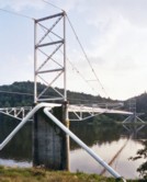
Bridgemeister ID: 3100 (added 2019-10-27)Year Completed: 1958 Name: (pipeline bridge) Location: Leoben, Austria Crossing: Mur River Coordinates: 47.387642 N 15.104475 E Maps: Acme , GeoHack , Google , OpenStreetMap Use: Pipeline Status: Extant (last checked: 2019) Main Cables: Wire (steel) Main Span: 1 x 80 meters (262.5 feet)
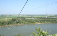
Bridgemeister ID: 3809 (added 2020-03-01)Year Completed: 1961 Name: (pipeline bridge) Location: Jefferson vicinity, South Dakota and Ponca State Park, Nebraska , USA Crossing: Missouri River Coordinates: 42.593000 N 96.698267 W Maps: Acme , GeoHack , Google , OpenStreetMap Use: Pipeline Status: Removed, 2006 or 2007 Main Cables: Wire (steel) Main Span: 1 x 823 meters (2,700 feet) estimated
Bridgemeister ID: 2153 (added 2006-11-21)Year Completed: 1962 Name: (pipeline bridge) Location: Aldingen, Baden-Württemberg, Germany Crossing: Neckar River Coordinates: 48.853198 N 9.249430 E Maps: Acme , GeoHack , Google , OpenStreetMap Principals: Waagner-Biro Brückenbau AG Use: Pipeline and Footbridge Status: In use (last checked: 2006) Main Cables: Wire (steel) Suspended Spans: 1 Main Span: 1 x 10³ meters (337.9 feet) Deck width: 0.35 meter walkway, 0.44 meter diameter pipe
Carries a fresh water pipeline. Bridgemeister ID: 1309 (added 2004-04-10)Year Completed: 1962 Name: (pipeline bridge) Location: Flaming Gorge National Recreation Area, Wyoming , USA Crossing: Green River At or Near Feature: Flaming Gorge Reservoir Coordinates: 41.03215 N 109.55519 W Maps: Acme , GeoHack , Google , OpenStreetMap Use: Pipeline Status: In use (last checked: 2019) Main Cables: Wire (steel) Suspended Spans: 1 Main Span: 1 x 584.9 meters (1,919 feet)
Located two miles north of the Utah-Wyoming border. Bridgemeister ID: 880 (added 2003-09-01)Year Completed: 1962 Name: (pipeline bridge) Location: Grays Branch, Greenup vicinity, Kentucky and Franklin Furnace, Ohio , USA Crossing: Ohio River Coordinates: 38.66058 N 82.85889 W Maps: Acme , GeoHack , Google , OpenStreetMap Principals: Weldon F. Appelt, P.E., Clear Span Engineering, Inc Use: Pipeline Status: Extant (last checked: 2021) Main Cables: Wire (steel) Main Span: 1 x 609.6 meters (2,000 feet)
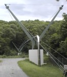
Just downstream of Greenup Dam. Built for Tennessee Gas Pipeline Co. Carries two 30" gas pipelines. Bridgemeister ID: 2150 (added 2006-11-18)Year Completed: 1967 Name: (pipeline bridge) Location: Neckargröningen, Remseck, Baden-Württemberg, Germany Crossing: Neckar River Coordinates: 48.878357 N 9.277363 E Maps: Acme , GeoHack , Google , OpenStreetMap Principals: Waagner-Biro Brückenbau AG Use: Pipeline and Footbridge Status: Extant (last checked: 2018) Main Cables: Wire (steel) Suspended Spans: 1 Main Span: 1 x 80 meters (262.5 feet) Deck width: 0.75 meters
Carries two water pipelines (1 fresh water, 1 waste water) with a gated service walkway above the pipes. Eckhard Bernstorff notes: "it supplies Neckargröningen with fresh water and pipelines waste water back (central waterworks and waste water treatment plant are on the other side of Neckar river)." Bridgemeister ID: 4600 (added 2020-06-06)Year Completed: 1967 Name: (pipeline bridge) Location: Savage River, Tasmania , Australia Crossing: Savage River Coordinates: 41.475961 S 145.215867 E Maps: Acme , GeoHack , Google , OpenStreetMap Use: Pipeline Status: Extant (last checked: 2019) Main Cables: Wire (steel) Suspended Spans: 1 Main Span: 1 x 305 meters (1,000.7 feet)
Bridgemeister ID: 1807 (added 2005-05-19)Year Completed: 1975 Name: (pipeline bridge) Location: Calumet vicinity, Louisiana , USA Crossing: Wax Lake Outlet Coordinates: 29.693867 N 91.374017 W Maps: Acme , GeoHack , Google , OpenStreetMap Principals: Clear Span Engineering Use: Pipeline Status: Extant (last checked: 1990) Main Cables: Wire (steel) Suspended Spans: 1 Main Span: 1 x 243.8 meters (800 feet)
Carries a 22" oil line. Near 1976 (pipeline bridge) - Calumet vicinity, Louisiana, USA . Near 1976 (pipeline bridge) - Calumet vicinity, Louisiana, USA . Near 1980 (pipeline bridge) - Calumet vicinity, Louisiana, USA . Near 1980 (pipeline bridge) - Calumet vicinity, Louisiana, USA . Near 1980 (pipeline bridge) - Calumet vicinity, Louisiana, USA . Bridgemeister ID: 1808 (added 2005-05-19)Year Completed: 1976 Name: (pipeline bridge) Location: Calumet vicinity, Louisiana , USA Crossing: Wax Lake Outlet Coordinates: 29.693233 N 91.3743 W Maps: Acme , GeoHack , Google , OpenStreetMap Principals: Clear Span Engineering Use: Pipeline Status: Extant (last checked: 1990) Main Cables: Wire (steel) Suspended Spans: 1 Main Span: 1 x 243.8 meters (800 feet)
Carries a 30" natural gas line. Near 1975 (pipeline bridge) - Calumet vicinity, Louisiana, USA . Near 1976 (pipeline bridge) - Calumet vicinity, Louisiana, USA . Near 1980 (pipeline bridge) - Calumet vicinity, Louisiana, USA . Near 1980 (pipeline bridge) - Calumet vicinity, Louisiana, USA . Near 1980 (pipeline bridge) - Calumet vicinity, Louisiana, USA . Bridgemeister ID: 1809 (added 2005-05-19)Year Completed: 1976 Name: (pipeline bridge) Location: Calumet vicinity, Louisiana , USA Crossing: Wax Lake Outlet Coordinates: 29.691483 N 91.37495 W Maps: Acme , GeoHack , Google , OpenStreetMap Principals: Clear Span Engineering Use: Pipeline Status: Extant (last checked: 1990) Main Cables: Wire (steel) Suspended Spans: 1 Main Span: 1 x 243.8 meters (800 feet)
Carries three natural gas lines. Near 1975 (pipeline bridge) - Calumet vicinity, Louisiana, USA . Near 1976 (pipeline bridge) - Calumet vicinity, Louisiana, USA . Near 1980 (pipeline bridge) - Calumet vicinity, Louisiana, USA . Near 1980 (pipeline bridge) - Calumet vicinity, Louisiana, USA . Near 1980 (pipeline bridge) - Calumet vicinity, Louisiana, USA . Bridgemeister ID: 1431 (added 2004-07-25)Year Completed: 1979 Name: (pipeline bridge) Location: Saporoshje (Zaporizzja) vicinity, Ukraine Crossing: Dnieper River Coordinates: 48.121897 N 35.068470 E Maps: Acme , GeoHack , Google , OpenStreetMap Use: Pipeline Status: Extant (last checked: 2019) Main Cables: Wire (steel) Suspended Spans: 1 Main Span: 1 x 720 meters (2,362.2 feet)
This is likely the same bridge as the Pridneprovsk pipeline bridge referenced on Structurae. Bridgemeister ID: 1810 (added 2005-05-19)Year Completed: 1980 Name: (pipeline bridge) Location: Calumet vicinity, Louisiana , USA Crossing: Wax Lake Outlet Coordinates: 29.69095 N 91.374967 W Maps: Acme , GeoHack , Google , OpenStreetMap Principals: Clear Span Engineering Use: Pipeline Status: Extant (last checked: 1990) Main Cables: Wire (steel) Suspended Spans: 1 Main Span: 1 x 259.1 meters (850 feet)
Carries a 30" natural gas line. Near 1975 (pipeline bridge) - Calumet vicinity, Louisiana, USA . Near 1976 (pipeline bridge) - Calumet vicinity, Louisiana, USA . Near 1976 (pipeline bridge) - Calumet vicinity, Louisiana, USA . Near 1980 (pipeline bridge) - Calumet vicinity, Louisiana, USA . Near 1980 (pipeline bridge) - Calumet vicinity, Louisiana, USA . Bridgemeister ID: 1811 (added 2005-05-19)Year Completed: 1980 Name: (pipeline bridge) Location: Calumet vicinity, Louisiana , USA Crossing: Wax Lake Outlet Coordinates: 29.710683 N 91.3673 W Maps: Acme , GeoHack , Google , OpenStreetMap Principals: Clear Span Engineering Use: Pipeline Status: Extant (last checked: 2005) Main Cables: Wire (steel) Suspended Spans: 1 Main Span: 1 x 304.8 meters (1,000 feet)
Carries a 24-inch natural gas line. Near 1975 (pipeline bridge) - Calumet vicinity, Louisiana, USA . Near 1976 (pipeline bridge) - Calumet vicinity, Louisiana, USA . Near 1976 (pipeline bridge) - Calumet vicinity, Louisiana, USA . Near 1980 (pipeline bridge) - Calumet vicinity, Louisiana, USA . Near 1980 (pipeline bridge) - Calumet vicinity, Louisiana, USA . Bridgemeister ID: 1812 (added 2005-05-19)Year Completed: 1980 Name: (pipeline bridge) Location: Calumet vicinity, Louisiana , USA Crossing: Wax Lake Outlet Coordinates: 29.68845 N 91.375933 W Maps: Acme , GeoHack , Google , OpenStreetMap Principals: Clear Span Engineering Use: Pipeline Status: Extant (last checked: 1990) Main Cables: Wire (steel) Suspended Spans: 1 Main Span: 1 x 266.7 meters (875 feet)
Carries a 36-inch natural gas line. Near 1975 (pipeline bridge) - Calumet vicinity, Louisiana, USA . Near 1976 (pipeline bridge) - Calumet vicinity, Louisiana, USA . Near 1976 (pipeline bridge) - Calumet vicinity, Louisiana, USA . Near 1980 (pipeline bridge) - Calumet vicinity, Louisiana, USA . Near 1980 (pipeline bridge) - Calumet vicinity, Louisiana, USA . Bridgemeister ID: 1963 (added 2005-11-12)Year Completed: 1982 Name: (pipeline bridge) Location: Gelsenkirchen, North Rhine-Westphalia, Germany Crossing: Rhein-Herne Canal Coordinates: 51.534661 N 7.065796 E Maps: Acme , GeoHack , Google , OpenStreetMap Use: Pipeline Status: Extant (last checked: 2019) Main Cables: Wire (steel) Suspended Spans: 1
Bridgemeister ID: 1513 (added 2004-10-09)Year Completed: 1982 Name: (pipeline bridge) Location: Idaho Falls, Idaho , USA Crossing: Snake River Coordinates: 43.46399 N 112.07037 W Maps: Acme , GeoHack , Google , OpenStreetMap Principals: Clear Span Engineering, Inc. Use: Pipeline Status: Extant (last checked: 2019) Main Cables: Wire (steel) Suspended Spans: 1 Main Span: 1 x 167.6 meters (550 feet)
Carries a 24-inch sewer pipe. Bridgemeister ID: 1515 (added 2004-10-10)Year Completed: 1986 Name: (pipeline bridge) Location: Summit Bridge, Delaware , USA Crossing: Chesapeake and Delaware Canal Coordinates: 39.54241 N 75.72397 W Maps: Acme , GeoHack , Google , OpenStreetMap Principals: Clear Span Engineering, Inc., Trinity Steel Co. Use: Pipeline Status: In use (last checked: 2019) Main Cables: Wire (steel) Main Span: 1 x 371.9 meters (1,220 feet)
Carries a 12-inch natural gas line. Bridgemeister ID: 3325 (added 2019-12-01)Year Completed: 1988 Name: (pipeline bridge) Location: Cody, Wyoming , USA Crossing: Sulphur Creek Coordinates: 44.523354 N 109.084426 W Maps: Acme , GeoHack , Google , OpenStreetMap Principals: Clear Span Engineering Use: Pipeline Status: Extant (last checked: 2019) Main Cables: Wire (steel) Main Span: 1 x 137.2 meters (450 feet)
Carries a 16-inch sewer line. Bridgemeister ID: 1514 (added 2004-10-10)Year Completed: 1992 Name: (pipeline bridge) Location: Watson, Oklahoma , USA Crossing: Mountain Fork River Coordinates: 34.461641 N 94.554642 W Maps: Acme , GeoHack , Google , OpenStreetMap Principals: Clear Span Engineering, Inc. Use: Pipeline Status: Extant (last checked: 2019) Main Cables: Wire (steel) Main Span: 1 x 236.2 meters (775 feet)
Carries a 48-inch gas pipeline. Bridgemeister ID: 3302 (added 2019-11-27)Year Completed: 2012 Name: (pipeline bridge) Location: Cayma and Alto Selva Alegre, Arequipa, Peru Crossing: Rio Chili Coordinates: 16.324340 S 71.525940 W Maps: Acme , GeoHack , Google , OpenStreetMap Principals: Inprocon Asociados S.A. Use: Pipeline Status: Extant (last checked: 2014) Main Cables: Wire (steel) Suspended Spans: 1 Main Span: 1 x 78 meters (255.9 feet)
Bridgemeister ID: 8363 (added 2024-02-11)Year Completed: 2014 Name: (pipeline bridge) Location: Taipingzhen (太平镇), Shidian County (施甸县), Baoshan (保山市), Yunnan , China Crossing: Nujiang Coordinates: 24.836000 N 98.911806 E Maps: Acme , GeoHack , Google , OpenStreetMap Use: Pipeline Status: Extant (last checked: 2022) Main Span: 1 x 316 meters (1,036.7 feet) estimated
Bridgemeister ID: 3636 (added 2020-01-05)Year Completed: 2019 Name: (pipeline bridge) Location: Fuling, Chongqing , China Crossing: Wujiang Coordinates: 29.587410 N 107.452185 E Maps: Acme , GeoHack , Google , OpenStreetMap Use: Pipeline Status: In use (last checked: 2019) Main Cables: Wire (steel) Main Span: 1 x 355 meters (1,164.7 feet)
Bridgemeister ID: 8416 (added 2024-03-03)Year Completed: 2022 Name: (pipeline bridge) Location: Qurgonteppa (Қӯрғонтеппа) vicinity, Tajikistan Crossing: Vakhsh River Coordinates: 37.881889 N 68.884583 E Maps: Acme , GeoHack , Google , OpenStreetMap Use: Pipeline Status: Extant (last checked: 2023) Main Span: 1 x 115 meters (377.3 feet) estimated
Bridgemeister ID: 5148 (added 2020-09-07)Name: (pipeline bridge) Location: Aizuwakamatsu, Fukushima , Japan Crossing: Aga River Coordinates: 37.403093 N 139.923350 E Maps: Acme , GeoHack , Google , OpenStreetMap Use: Pipeline Status: Extant (last checked: 2014) Main Cables: Wire (steel) Suspended Spans: 1 Main Span: 1 x 124 meters (406.8 feet) estimated
Bridgemeister ID: 8715 (added 2024-06-30)Name: (pipeline bridge) Location: Albasuyoc, Echarate, La Convención, Peru Coordinates: 12.814056 S 72.597250 W Maps: Acme , GeoHack , Google , OpenStreetMap Use: Pipeline Status: Extant (last checked: 2024) Main Cables: Wire (steel) Suspended Spans: 1
2019: Appears to be flood damaged. Carrys a 66-inch water pipeline. Patrick O'Donnell estimates the length of the suspended portion of the span at 250 feet. Bridgemeister ID: 7229 (added 2022-07-16)Name: (pipeline bridge) Location: Babahoyo, Los Rios, Ecuador Crossing: Babahoyo River Coordinates: 1.797178 S 79.533913 W Maps: Acme , GeoHack , Google , OpenStreetMap Use: Pipeline Status: Extant (last checked: 2015) Main Cables: Wire (steel) Suspended Spans: 1 Main Span: 1 x 171 meters (561 feet) estimated
Small pipeline suspension bridge between two road bridges. Bridgemeister ID: 6788 (added 2021-10-29)Name: (pipeline bridge) Location: Bogor, West Java , Indonesia Crossing: Ciliwung At or Near Feature: Bogor Botanical Gardens Coordinates: 6.601567 S 106.801665 E Maps: Acme , GeoHack , Google , OpenStreetMap Use: Pipeline Status: Extant (last checked: 2020) Main Cables: Wire Suspended Spans: 1
Bridgemeister ID: 4827 (added 2020-07-05)Name: (pipeline bridge) Location: Bradford, Pennsylvania , USA Coordinates: 41.967963 N 78.625340 W Maps: Acme , GeoHack , Google , OpenStreetMap Use: Pipeline Status: Extant (last checked: 2020) Main Cables: Wire (steel) Suspended Spans: 1
Bridgemeister ID: 2346 (added 2007-08-12)Name: (pipeline bridge) Location: Burgess Falls, Sparta vicinity, Tennessee , USA Crossing: Falling Water River At or Near Feature: Burgess Falls State Park Use: Pipeline Status: Derelict (last checked: 2007) Main Cables: Wire
Likely constructed in 1920s as part of the dam and powerhouse project at Burgess Falls. There may have been two of these bridges at this location. The current map for Burgess Falls State Park shows two historical "pipeline bridges." I have only seen images of one derelict suspension bridge. Burstall is in Saskatchewan, but the bridge appears to be located west of Burstall in Alberta. Bridgemeister ID: 5705 (added 2021-04-02)Name: (pipeline bridge) Location: Bydgoszcz, Poland Crossing: Brda Coordinates: 53.117059 N 18.061958 E Maps: Acme , GeoHack , Google , OpenStreetMap Use: Pipeline Status: Extant (last checked: 2020) Main Cables: Wire (steel) Main Span: 1
Bridgemeister ID: 1259 (added 2004-03-06)Name: (pipeline bridge) Location: Canyon Country, California , USA Crossing: Soledad Canyon Coordinates: 34.43219 N 118.39074 W Maps: Acme , GeoHack , Google , OpenStreetMap Use: Pipeline Status: In use (last checked: 2007) Main Cables: Wire (steel) Suspended Spans: 2 Main Span: 1 x 187.5 meters (615 feet) estimated Side Span: 1
Bridgemeister ID: 2107 (added 2006-09-03)Name: (pipeline bridge) Location: Casper, Wyoming , USA Crossing: North Platte River Coordinates: 42.859117 N 106.327517 W Maps: Acme , GeoHack , Google , OpenStreetMap Use: Pipeline Status: Extant (last checked: 2006) Main Cables: Wire (steel) Suspended Spans: 1 Main Span: 1 x 61 meters (200 feet) estimated
Bridgemeister ID: 2329 (added 2007-07-04)Name: (pipeline bridge) Location: Castaic vicinity, California , USA Crossing: Castaic Creek Coordinates: 34.47552 N 118.61212 W Maps: Acme , GeoHack , Google , OpenStreetMap Use: Pipeline Status: Extant (last checked: 2007) Main Cables: Wire (steel) Suspended Spans: 2 Side Spans: 2
Bridgemeister ID: 8623 (added 2024-06-02)Name: (pipeline bridge) Location: Cayma and Alto Selva Alegre, Arequipa, Peru Crossing: Rio Chili Coordinates: 16.371861 S 71.535139 W Maps: Acme , GeoHack , Google , OpenStreetMap Use: Pipeline Status: Extant (last checked: 2013) Main Cables: Wire Suspended Spans: 1
Bridgemeister ID: 8019 (added 2023-12-10)Name: (pipeline bridge) Location: Central Sauzal vicinity, Machali, Chile Crossing: Cachapoal River Coordinates: 34.269139 S 70.584722 W Maps: Acme , GeoHack , Google , OpenStreetMap Use: Pipeline Status: Extant (last checked: 2023) Main Cables: Wire (steel) Suspended Spans: 2 Main Span: 1 x 97 meters (318.2 feet) estimated Side Span: 1 x 50 meters (164 feet) estimated
Bridgemeister ID: 6395 (added 2021-07-27)Name: (pipeline bridge) Location: Chalat, Gilgit-Baltistan, Pakistan Crossing: Hunza River Coordinates: 36.256315 N 74.351727 E Maps: Acme , GeoHack , Google , OpenStreetMap Use: Pipeline Status: Extant (last checked: 2021) Main Span: 1 x 144.5 meters (474 feet) estimated
Bridgemeister ID: 2036 (added 2006-05-01)Name: (pipeline bridge) Location: Charleston, Tennessee , USA Crossing: Hiwassee River Principals: John A. Roebling's Sons Co., Pittsburgh Bridge & Iron Co. Use: Pipeline Main Cables: Wire (steel)
Built to connect Blaw-Knox chemical plan to nearby Bowaters Southern Paper Corp. Described in Roebling ad in March 1963 issue of Civil Engineering. Bridgemeister ID: 1573 (added 2004-12-11)Name: (pipeline bridge) Location: Chula Vista vicinity, California , USA Crossing: Otay River Coordinates: 32.6003 N 116.92888 W Maps: Acme , GeoHack , Google , OpenStreetMap Use: Pipeline Status: In use (last checked: 2004) Main Cables: Wire (steel) Suspended Spans: 1
Bridgemeister ID: 5984 (added 2021-07-01)Name: (pipeline bridge) Location: Chupaca, Peru Crossing: Rio Cunas Coordinates: 12.056637 S 75.273844 W Maps: Acme , GeoHack , Google , OpenStreetMap Use: Pipeline Status: Extant (last checked: 2021) Main Cables: Wire (steel) Suspended Spans: 1
Bridgemeister ID: 7783 (added 2023-08-18)Name: (pipeline bridge) Location: Colimes, Guayas, Ecuador Crossing: Rio Daule Coordinates: 1.548917 S 80.003660 W Maps: Acme , GeoHack , Google , OpenStreetMap Use: Pipeline Status: Extant (last checked: 2022) Main Span: 1 x 188 meters (616.8 feet) estimated
Patrick S. O'Donnell estimated the main span of this bridge at roughly 550 feet. Bridgemeister ID: 1413 (added 2004-07-04)Name: (pipeline bridge) Location: Covington, Virginia , USA Crossing: Potts Creek Coordinates: 37.75240 N 79.99713 W Maps: Acme , GeoHack , Google , OpenStreetMap Use: Pipeline Status: In use (last checked: 2008) Main Cables: Wire (steel) Suspended Spans: 1 Main Span: 1 x 61 meters (200 feet) estimated
Just barely visible to the north as your cross over Potts Creek on VA18 heading into Covington. Bridgemeister ID: 7939 (added 2023-10-29)Name: (pipeline bridge) Location: Cremona, Cremona, Italy Crossing: Po River Coordinates: 45.127917 N 9.995194 E Maps: Acme , GeoHack , Google , OpenStreetMap Use: Pipeline and Footbridge Status: Removed Main Cables: Wire (steel) Suspended Spans: 3 Main Span: 1 Side Spans: 2
Built at some point in the 1960s. Removed prior to 2003, but likely much earlier. Main span was likely 225-235 meters. Bridgemeister ID: 2432 (added 2008-04-22)Name: (pipeline bridge) Location: Curtis vicinity, Arkansas , USA Crossing: South Boat Ditch Use: Pipeline Status: Extant (last checked: 2008) Main Cables: Wire (steel) Suspended Spans: 1
Bridgemeister ID: 6696 (added 2021-10-02)Name: (pipeline bridge) Location: Dahimal, Gilgit-Baltistan, Pakistan Crossing: Gilgit River Coordinates: 36.201420 N 73.246198 E Maps: Acme , GeoHack , Google , OpenStreetMap Use: Pipeline Status: Extant (last checked: 2021) Main Cables: Wire (steel) Suspended Spans: 1 Main Span: 1 x 42.7 meters (140 feet) estimated
Built at some point after mid-2017. Immediately adjacent to a drooping suspension footbridge that is not included in the inventory. Bridgemeister ID: 7125 (added 2022-06-17)Name: (pipeline bridge) Location: Dearborn, Michigan , USA Crossing: Rouge River Coordinates: 42.290501 N 83.166260 W Maps: Acme , GeoHack , Google , OpenStreetMap Use: Pipeline Status: Extant (last checked: 2022) Main Cables: Wire (steel) Main Span: 1 x 76 meters (249.3 feet) estimated
Bridgemeister ID: 2108 (added 2006-09-03)Name: (pipeline bridge) Location: Durkee, Worland vicinity, Wyoming , USA Crossing: Big Horn River Coordinates: 44.125767 N 107.927817 W Maps: Acme , GeoHack , Google , OpenStreetMap Use: Pipeline Status: Extant (last checked: 2006) Main Cables: Wire (steel) Suspended Spans: 1
Bridgemeister ID: 8412 (added 2024-03-03)Name: (pipeline bridge) Location: Eagle Creek Township and Keener Township, Indiana , USA Crossing: Kankakee River Coordinates: 41.220361 N 87.270806 W Maps: Acme , GeoHack , Google , OpenStreetMap Use: Pipeline Status: Extant (last checked: 2023) Main Spans: 1 x 72 meters (236.2 feet) estimated,
One of six short suspended pipelines along a five mile stretch of, what appears to be, the same pipeline. This one, crossing the Kankakee River is the longest of the group by far. Connects to (pipeline bridge) - Eagle Creek Township, Indiana, USA . Connects to (pipeline bridge) - Eagle Creek Township, Indiana, USA . Connects to (pipeline bridge) - Eagle Creek Township, Indiana, USA . Connects to (pipeline bridge) - Keener Township, Indiana, USA . Connects to (pipeline bridge) - Keener Township, Indiana, USA . Bridgemeister ID: 8409 (added 2024-03-03)Name: (pipeline bridge) Location: Eagle Creek Township, Indiana , USA Crossing: Singleton Ditch Coordinates: 41.260667 N 87.300861 W Maps: Acme , GeoHack , Google , OpenStreetMap Use: Pipeline Status: Extant (last checked: 2023) Suspended Spans: 1 Main Span: 1 x 20 meters (65.6 feet) estimated
One of six short suspended pipelines along a five mile stretch of, what appears to be, the same pipeline. Connects to (pipeline bridge) - Eagle Creek Township and Keener Township, Indiana, USA . Connects to (pipeline bridge) - Eagle Creek Township, Indiana, USA . Connects to (pipeline bridge) - Eagle Creek Township, Indiana, USA . Connects to (pipeline bridge) - Keener Township, Indiana, USA . Connects to (pipeline bridge) - Keener Township, Indiana, USA . Bridgemeister ID: 8410 (added 2024-03-03)Name: (pipeline bridge) Location: Eagle Creek Township, Indiana , USA Crossing: Little Ditch Coordinates: 41.257639 N 87.298583 W Maps: Acme , GeoHack , Google , OpenStreetMap Use: Pipeline Status: Extant (last checked: 2023) Suspended Spans: 1 Main Span: 1 x 21 meters (68.9 feet) estimated
One of six short suspended pipelines along a five mile stretch of, what appears to be, the same pipeline. Connects to (pipeline bridge) - Eagle Creek Township and Keener Township, Indiana, USA . Connects to (pipeline bridge) - Eagle Creek Township, Indiana, USA . Connects to (pipeline bridge) - Eagle Creek Township, Indiana, USA . Connects to (pipeline bridge) - Keener Township, Indiana, USA . Connects to (pipeline bridge) - Keener Township, Indiana, USA . Bridgemeister ID: 8411 (added 2024-03-03)Name: (pipeline bridge) Location: Eagle Creek Township, Indiana , USA Crossing: Brown Ditch Coordinates: 41.239583 N 87.285444 W Maps: Acme , GeoHack , Google , OpenStreetMap Use: Pipeline Status: Extant (last checked: 2023) Suspended Spans: 1 Main Span: 1 x 16 meters (52.5 feet) estimated
One of six short suspended pipelines along a five mile stretch of, what appears to be, the same pipeline. Connects to (pipeline bridge) - Eagle Creek Township and Keener Township, Indiana, USA . Connects to (pipeline bridge) - Eagle Creek Township, Indiana, USA . Connects to (pipeline bridge) - Eagle Creek Township, Indiana, USA . Connects to (pipeline bridge) - Keener Township, Indiana, USA . Connects to (pipeline bridge) - Keener Township, Indiana, USA . Bridgemeister ID: 2109 (added 2006-09-03)Name: (pipeline bridge) Location: Eccles, Worland vicinity, Wyoming , USA Crossing: Big Horn River Coordinates: 44.15685 N 107.928117 W Maps: Acme , GeoHack , Google , OpenStreetMap Use: Pipeline Status: Extant (last checked: 2006) Main Cables: Wire (steel) Suspended Spans: 1
Patrick S. O'Donnell estimates the main span at 400 feet based on aerial imagery. Bridgemeister ID: 7768 (added 2023-08-17)Name: (pipeline bridge) Location: Escobal, Alajuela and San Pablo, San José Province, Costa Rica Crossing: Rio Tárcoles Coordinates: 9.922923 N 84.430955 W Maps: Acme , GeoHack , Google , OpenStreetMap Use: Pipeline Status: Extant (last checked: 2022) Main Span: 1
Bridgemeister ID: 2148 (added 2006-11-18)Name: (pipeline bridge) Location: Eugene vicinity, Oregon , USA Crossing: McKenzie River At or Near Feature: Armitage State Park vicinity Coordinates: 44.11456 N 123.05380 W Maps: Acme , GeoHack , Google , OpenStreetMap Use: Pipeline Status: Extant (last checked: 2006) Main Cables: Wire
Bridgemeister ID: 1820 (added 2005-05-21)Name: (pipeline bridge) Location: Fulton, Arkansas , USA Crossing: Red River Coordinates: 33.60368 N 93.81316 W Maps: Acme , GeoHack , Google , OpenStreetMap Use: Pipeline Status: Extant (last checked: 2007) Main Cables: Wire (steel) Suspended Spans: 3 Main Span: 1 Side Spans: 2
Call numbers ECD0860-1 and ECD0860-2 of the Arkansas History Commission's image archives show this large pipeline bridge. Bridgemeister ID: 1928 (added 2005-10-23)Name: (pipeline bridge) Location: Gelsenkirchen, North Rhine-Westphalia, Germany At or Near Feature: Gelsenkirchen Port Coordinates: 51.533124 N 7.067890 E Maps: Acme , GeoHack , Google , OpenStreetMap Use: Pipeline Status: Extant (last checked: 2019)
Bridgemeister ID: 8185 (added 2024-02-05)Name: (pipeline bridge) Location: Girón, Santander, Colombia Crossing: Rio Frio Coordinates: 7.066056 N 73.166333 W Maps: Acme , GeoHack , Google , OpenStreetMap Use: Pipeline Status: Extant (last checked: 2023) Main Cables: Wire (steel) Suspended Spans: 1
Bridgemeister ID: 2225 (added 2007-03-18)Name: (pipeline bridge) Location: Glenwood Springs, Colorado , USA Crossing: Colorado River Coordinates: 39.55085 N 107.31878 W Maps: Acme , GeoHack , Google , OpenStreetMap Use: Pipeline Status: Extant (last checked: 2006) Main Cables: Wire (steel) Suspended Spans: 1 Main Span: 1 x 61 meters (200 feet) estimated
Span length of approximately 200 feet is for the suspended pipeline. Patrick O'Donnell estimates the anchorage-to-anchorage distance is 450 feet. Bridgemeister ID: 7869 (added 2023-09-17)Name: (pipeline bridge) Location: Grassobbio, Bergamo, Italy Crossing: Serio Coordinates: 45.657637 N 9.732027 E Maps: Acme , GeoHack , Google , OpenStreetMap Use: Pipeline Status: Extant (last checked: 2023) Main Cables: Wire (steel) Suspended Spans: 3 Main Span: 1 x 101 meters (331.4 feet) estimated Side Spans: 2
Bridgemeister ID: 3975 (added 2020-03-22)Name: (pipeline bridge) Location: Greåker, Sarpsborg, Viken, Norway Crossing: Visterflo Coordinates: 59.26354 N 11.02993 E Maps: Acme , GeoHack , Google , kart.1881.no , OpenStreetMap Use: Pipeline Status: Extant (last checked: 2018) Suspended Spans: 1 Main Span: 1 x 60 meters (196.9 feet) estimated
Bridgemeister ID: 2215 (added 2007-02-13)Name: (pipeline bridge) Location: Helper vicinity, Utah , USA Crossing: Price River Coordinates: 39.70666 N 110.86906 W Maps: Acme , GeoHack , Google , OpenStreetMap Use: Pipeline Status: Extant (last checked: 2006) Main Cables: Wire Suspended Spans: 1 Main Span: 1 x 45.7 meters (150 feet) estimated
The bridge was adjacent to, and clearly visible from, the Washington Boulevard bridge. It was removed at some point between 2017 and 2019. Bridgemeister ID: 8555 (added 2024-04-06)Name: (pipeline bridge) Location: Huzhou (湖州市), Zhejiang , China Crossing: Xitiao River Coordinates: 30.880300 N 120.039878 E Maps: Acme , GeoHack , Google , OpenStreetMap Use: Pipeline Status: Extant (last checked: 2024) Suspended Spans: 1 Main Span: 1 x 120 meters (393.7 feet) estimated
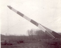
Completed at some point in the 2015-2017 time frame. The structure(s) at this location may be two separate but adjacent suspended pipelines. The postcard says "Suspension Bridge. Jefferson, S.D." The bridge pictured here may be a predecessor to the current pipeline suspension bridge at Ponca, Nebraska, eight miles west of Jefferson. Patrick S. O'Donnell visited this area in 2006 to photograph the Ponca bridge , but could not locate a pipeline bridge matching the postcard. In late 2006, Pete Rissell writes that one of the piers from this pipeline bridge is still visible in the middle of the Missouri River: "In the early 1970s I visited the Ponca State Park and noticed a single concrete bridge support in the middle of the Missouri River. I always thought it was strange because there were no abandoned road or rail right-of-ways in that location... I'm sure that this concrete support matches the one in the foreground shown on your website's postcard labeled "Suspension Bridge, Jefferson SD". My guess is that the current Ponca Pipeline bridge (photographed in 2006) is the replacement because the former suspension bridge had to be relocated due to river flooding. The old concrete support is located approximately 1 mile up-river (to the northwest) from the current pipeline bridge." This pier is visible in satellite imagery at the location provided with this inventory entry. In 2009, Dale Harkness writes: "I grew up on a farm only a few miles from the existing pipeline . I believe you are correct that the cement pier does belong to the original gas pipeline. My aunt told me that my grandfather was present while the bridge was being constructed. From my understanding, my grandfather had been filming the construction and almost photographed an unusual event where one of the piers crashed down to the ground after a failed attempt to raise it using a pivot." Dale also provided photos of the construction of the newer bridge in 1961. The replacement span appears to have been demolished in late 2006 or 2007. Replaced by 1961 (pipeline bridge) - Jefferson vicinity, South Dakota and Ponca State Park, Nebraska, USA . Bridgemeister ID: 6887 (added 2022-01-15)Name: (pipeline bridge) Location: Jenesano, Boyaca, Colombia Crossing: Rio Jenesano Coordinates: 5.384360 N 73.361741 W Maps: Acme , GeoHack , Google , OpenStreetMap Use: Pipeline Status: Extant (last checked: 2021) Main Cables: Wire Suspended Spans: 1
Bridgemeister ID: 6708 (added 2021-10-05)Name: (pipeline bridge) Location: Junction City, California , USA Crossing: Trinity River Use: Pipeline Status: Removed Main Cables: Wire Main Span: 1
Likely built in late 1800s, maybe early 1900s. Bridgemeister ID: 7303 (added 2022-08-07)Name: (pipeline bridge) Location: Karolin, Poznań, Poland Crossing: Warta River Coordinates: 52.440219 N 16.975219 E Maps: Acme , GeoHack , Google , OpenStreetMap Use: Pipeline Status: Extant (last checked: 2022) Main Cables: Wire (steel)
Bridgemeister ID: 8413 (added 2024-03-03)Name: (pipeline bridge) Location: Keener Township, Indiana , USA Crossing: Brent Ditch Coordinates: 41.206889 N 87.261222 W Maps: Acme , GeoHack , Google , OpenStreetMap Use: Pipeline Status: Extant (last checked: 2023) Suspended Spans: 1 Main Span: 1 x 14 meters (45.9 feet) estimated
One of six short suspended pipelines along a five mile stretch of, what appears to be, the same pipeline. Connects to (pipeline bridge) - Eagle Creek Township and Keener Township, Indiana, USA . Connects to (pipeline bridge) - Eagle Creek Township, Indiana, USA . Connects to (pipeline bridge) - Eagle Creek Township, Indiana, USA . Connects to (pipeline bridge) - Eagle Creek Township, Indiana, USA . Connects to (pipeline bridge) - Keener Township, Indiana, USA . Bridgemeister ID: 8414 (added 2024-03-03)Name: (pipeline bridge) Location: Keener Township, Indiana , USA Crossing: Dehaan Ditch Coordinates: 41.202500 N 87.258056 W Maps: Acme , GeoHack , Google , OpenStreetMap Use: Pipeline Status: Extant (last checked: 2023) Suspended Spans: 1 Main Span: 1 x 14.5 meters (47.6 feet) estimated
One of six short suspended pipelines along a five mile stretch of, what appears to be, the same pipeline. Connects to (pipeline bridge) - Eagle Creek Township and Keener Township, Indiana, USA . Connects to (pipeline bridge) - Eagle Creek Township, Indiana, USA . Connects to (pipeline bridge) - Eagle Creek Township, Indiana, USA . Connects to (pipeline bridge) - Eagle Creek Township, Indiana, USA . Connects to (pipeline bridge) - Keener Township, Indiana, USA . Just north of the US-190 Atchafalaya River crossing. Bridgemeister ID: 5954 (added 2021-06-30)Name: (pipeline bridge) Location: La Oroya, Peru Crossing: Mantaro River Coordinates: 11.516175 S 75.921634 W Maps: Acme , GeoHack , Google , OpenStreetMap Use: Pipeline Status: Extant (last checked: 2014) Main Cables: Wire (steel) Suspended Spans: 1
Bridgemeister ID: 5963 (added 2021-06-30)Name: (pipeline bridge) Location: La Oroya, Peru Crossing: Mantaro River Coordinates: 11.522438 S 75.897436 W Maps: Acme , GeoHack , Google , OpenStreetMap Use: Pipeline Status: Extant (last checked: 2021) Main Cables: Wire (steel) Suspended Spans: 1
Bridgemeister ID: 8820 (added 2024-09-28)Name: (pipeline bridge) Location: La Oroya, Peru Crossing: Mantaro River Coordinates: 11.521500 S 75.905611 W Maps: Acme , GeoHack , Google , OpenStreetMap Use: Pipeline Status: Extant (last checked: 2022) Main Cables: Wire (steel) Main Span: 1 x 51 meters (167.3 feet) estimated
Bridgemeister ID: 6310 (added 2021-07-23)Name: (pipeline bridge) Location: Libiš, Czechia Crossing: Elbe River Coordinates: 50.278064 N 14.525232 E Maps: Acme , GeoHack , Google , OpenStreetMap Use: Pipeline Status: Extant (last checked: 2021) Main Span: 1 x 99 meters (324.8 feet) estimated
Located a few hundred yards southeast of the I-710/I-405 intersection. Visible to the south as you cross the Los Angeles River on I-405. Bridgemeister ID: 8608 (added 2024-05-26)Name: (pipeline bridge) Location: Lunahuaná, Peru Crossing: Rio Cañete Coordinates: 12.919056 S 76.101028 W Maps: Acme , GeoHack , Google , OpenStreetMap Use: Pipeline Status: Extant (last checked: 2023) Main Cables: Wire (steel) Main Span: 1
Bridgemeister ID: 7518 (added 2023-01-13)Name: (pipeline bridge) Location: Marriott-Slaterville, Ogden vicinity, Utah , USA Crossing: Weber River Coordinates: 41.237267 N 112.013819 W Maps: Acme , GeoHack , Google , OpenStreetMap Use: Pipeline Status: Extant (last checked: 2022) Main Cables: Wire (steel) Suspended Spans: 1 Main Span: 1 x 45.4 meters (149 feet) estimated
Bridgemeister ID: 1815 (added 2005-05-19)Name: (pipeline bridge) Location: Melville, Louisiana , USA Crossing: Atchafalaya River Coordinates: 30.70815 N 91.738933 W Maps: Acme , GeoHack , Google , OpenStreetMap Use: Pipeline Status: Extant (last checked: 2021) Main Cables: Wire (steel) Suspended Spans: 3 Main Span: 1 x 609.9 meters (2,001 feet) estimated Side Spans: 2
Patrick S. O'Donnell estimates the total suspended length of this huge pipeline bridge is 3,600 feet (2000-foot main span, 600- and 1050-foot side spans). Bridgemeister ID: 8565 (added 2024-04-06)Name: (pipeline bridge) Location: Mocoa, Putumayo, Colombia Crossing: Rio Sangoyaco Coordinates: 1.148944 N 76.648167 W Maps: Acme , GeoHack , Google , OpenStreetMap Use: Pipeline Status: Extant (last checked: 2024) Main Cables: Wire (steel) Suspended Spans: 1
Bridgemeister ID: 2354 (added 2007-08-19)Name: (pipeline bridge) Location: Mojave Heights, Victorville vicinity, California , USA Crossing: Mojave River Coordinates: 34.56782 N 117.31254 W Maps: Acme , GeoHack , Google , OpenStreetMap Use: Pipeline Status: Extant (last checked: 2023) Main Cables: Wire (steel) Suspended Spans: 1
Bridgemeister ID: 2361 (added 2007-09-08)Name: (pipeline bridge) Location: Montebello and Pico Rivera, California , USA Crossing: Rio Hondo At or Near Feature: Whittier Narrows Dam vicinity Coordinates: 34.01791 N 118.08627 W Maps: Acme , GeoHack , Google , OpenStreetMap Use: Pipeline Status: Removed, c. 2009-2011 Main Span: 1
Removed at some point in the 2009-2011 time frame. Bridgemeister ID: 8010 (added 2023-12-09)Name: (pipeline bridge) Location: Natakhtari (ნატახტარი) and Saguramo (საგურამო), Georgia Crossing: Aragvi River Coordinates: 41.910806 N 44.739444 E Maps: Acme , GeoHack , Google , OpenStreetMap Use: Pipeline Status: Extant (last checked: 2023) Main Spans: 6 x 159 meters (521.7 feet) estimated
Bridgemeister ID: 8082 (added 2023-12-24)Name: (pipeline bridge) Location: Nelahozeves, Mělník and Kralupy nad Vltavou, Mělník, Czechia Crossing: Vltava River Coordinates: 50.266222 N 14.306028 E Maps: Acme , GeoHack , Google , OpenStreetMap Use: Pipeline Status: Extant (last checked: 2019) Main Cables: Wire (steel) Suspended Spans: 1 Main Span: 1 x 160 meters (524.9 feet) estimated
Bridgemeister ID: 2040 (added 2006-05-07)Name: (pipeline bridge) Location: New Haven, Connecticut , USA Crossing: Quinnipiac River Coordinates: 41.320917 N 72.89015 W Maps: Acme , GeoHack , Google , OpenStreetMap Use: Pipeline Status: Extant (last checked: 2005) Main Cables: Wire (steel) Suspended Spans: 1 Main Span: 1 x 45.7 meters (150 feet) estimated
Bridgemeister ID: 6781 (added 2021-10-29)Name: (pipeline bridge) Location: Novomikhailovskii (Новомихайловский), Krasnodar Krai, Russia Crossing: Reka Nechepsukho Coordinates: 44.255891 N 38.852097 E Maps: Acme , GeoHack , Google , OpenStreetMap Use: Pipeline Status: Extant (last checked: 2019) Main Cables: Wire (steel) Suspended Spans: 1 Main Span: 1
Bridgemeister ID: 6222 (added 2021-07-17)Name: (pipeline bridge) Location: Orotina vicinity, Alajuela Province, Costa Rica Crossing: Rio Tárcoles Coordinates: 9.912271 N 84.479721 W Maps: Acme , GeoHack , Google , OpenStreetMap Use: Pipeline Status: Extant (last checked: 2021) Main Cables: Wire (steel) Main Span: 1 x 82.9 meters (272 feet) estimated
Bridgemeister ID: 6121 (added 2021-07-04)Name: (pipeline bridge) Location: Osorno, Chile Crossing: Rahue River Coordinates: 40.584360 S 73.154973 W Maps: Acme , GeoHack , Google , OpenStreetMap Use: Pipeline and Footbridge Status: Extant (last checked: 2021) Main Cables: Wire (steel) Suspended Spans: 1 Main Span: 1
Demolished at some point in 2022. Appears to have carried an electrical or communications conduit track, possibly an pipeline. Bridgemeister ID: 5928 (added 2021-06-27)Name: (pipeline bridge) Location: Paso Agres, Orotina vicinity, Costa Rica Crossing: Rio Tárcoles Coordinates: 9.879692 N 84.527795 W Maps: Acme , GeoHack , Google , OpenStreetMap Use: Pipeline Status: Extant (last checked: 2021) Main Cables: Wire (steel) Main Span: 1
Bridgemeister ID: 1727 (added 2005-04-05)Name: (pipeline bridge) Location: Paterson, New Jersey , USA Crossing: Passaic Falls Use: Pipeline Status: Removed Main Cables: Wire Suspended Spans: 1
The 1950's-era postcard shows a small suspension bridge behind the arch. Bridgemeister ID: 4758 (added 2020-06-28)Name: (pipeline bridge) Location: Pavia, Italy Crossing: Ticino River Coordinates: 45.172989 N 9.170309 E Maps: Acme , GeoHack , Google , OpenStreetMap Use: Pipeline Status: Extant (last checked: 2019) Main Cables: Wire (steel) Main Span: 1 x 240 meters (787.4 feet)
Bridgemeister ID: 2124 (added 2006-10-21)Name: (pipeline bridge) Location: Plains vicinity and Thompson Falls vicinity, Montana , USA Crossing: Clark Fork River Coordinates: 47.52982 N 115.05720 W Maps: Acme , GeoHack , Google , OpenStreetMap Use: Pipeline Status: Extant (last checked: 2006) Main Cables: Wire (steel) Suspended Spans: 1 Main Span: 1 x 274.3 meters (900 feet)
Bridgemeister ID: 6862 (added 2022-01-02)Name: (pipeline bridge) Location: Plandaan, Tulungagung Regency, East Java , Indonesia Coordinates: 8.055110 S 111.897790 E Maps: Acme , GeoHack , Google , OpenStreetMap Use: Pipeline Status: Extant (last checked: 2021) Main Cables: Wire (steel) Suspended Spans: 1
Bridgemeister ID: 2038 (added 2006-05-07)Name: (pipeline bridge) Location: Plattsmouth, Nebraska and Pacific Junction vicinity, Iowa , USA Crossing: Missouri River Coordinates: 41.0028 N 95.8679 W Maps: Acme , GeoHack , Google , OpenStreetMap Use: Pipeline Status: Extant (last checked: 2023) Main Cables: Wire (steel) Suspended Spans: 2 Main Span: 1 x 457.2 meters (1,500 feet) estimated Side Span: 1 x 228.6 meters (750 feet) estimated
Bridgemeister ID: 3229 (added 2019-11-11)Name: (pipeline bridge) Location: Ponte San Giovanni, Perugia, Italy Coordinates: 43.093200 N 12.451178 E Maps: Acme , GeoHack , Google , OpenStreetMap Use: Pipeline Status: Extant (last checked: 2011) Main Cables: Wire (steel)
Bridgemeister ID: 2841 (added 2019-07-06)Name: (pipeline bridge) Location: Prackovice nad Labem, Czechia Crossing: Elbe River Coordinates: 50.579858 N 14.036253 E Maps: Acme , GeoHack , Google , OpenStreetMap Use: Pipeline Status: Extant (last checked: 2019) Main Cables: Wire (steel) Suspended Spans: 1
Bridgemeister ID: 2293 (added 2007-04-26)Name: (pipeline bridge) Location: Pyramid Lake vicinity and Liebre Gulch vicinity, California , USA Coordinates: 34.68632 N 118.73605 W Maps: Acme , GeoHack , Google , OpenStreetMap Use: Pipeline Status: In use (last checked: 2007) Main Cables: Wire (steel) Suspended Spans: 1 Main Span: 1 x 114.3 meters (375 feet)
Bridgemeister ID: 2294 (added 2007-04-26)Name: (pipeline bridge) Location: Pyramid Lake vicinity, California , USA Crossing: Liebre Gulch Coordinates: 34.69553 N 118.73782 W Maps: Acme , GeoHack , Google , OpenStreetMap Use: Pipeline Status: In use (last checked: 2007) Main Cables: Wire (steel) Main Span: 1 x 152.4 meters (500 feet)
Bridgemeister ID: 2295 (added 2007-04-26)Name: (pipeline bridge) Location: Pyramid Lake vicinity, California , USA Crossing: Liebre Gulch Coordinates: 34.69357 N 118.73703 W Maps: Acme , GeoHack , Google , OpenStreetMap Use: Pipeline Status: In use (last checked: 2007) Main Cables: Wire (steel) Main Span: 1 x 61 meters (200 feet)
Bridgemeister ID: 2331 (added 2007-07-04)Name: (pipeline bridge) Location: Pyramid Lake vicinity, California , USA Crossing: Canada de Los Alamos At or Near Feature: Hungry Valley State Vehicular Rec. Area Coordinates: 34.70264 N 118.79825 W Maps: Acme , GeoHack , Google , OpenStreetMap Use: Pipeline Status: Extant (last checked: 2007) Main Cables: Wire (steel) Suspended Spans: 1
Visible from the Sundial cable-stayed bridge. Bridgemeister ID: 2823 (added 2019-07-04)Name: (pipeline bridge) Location: Ren'ai Township, Nantou County, Taiwan Coordinates: 23.917088 N 121.055192 E Maps: Acme , GeoHack , Google , OpenStreetMap Use: Pipeline Status: Extant (last checked: 2016) Main Cables: Wire
Bridgemeister ID: 3593 (added 2019-12-30)Name: (pipeline bridge) Location: Roldanillo vicinity and Zarzal vicinity, Colombia Crossing: Cauca River Coordinates: 4.405403 N 76.101366 W Maps: Acme , GeoHack , Google , OpenStreetMap Use: Pipeline Status: Extant (last checked: 2015) Main Cables: Wire (steel)
Bridgemeister ID: 7094 (added 2022-05-29)Name: (pipeline bridge) Location: Roseville, Ohio , USA Crossing: Moxahala Creek Coordinates: 39.800219 N 82.081253 W Maps: Acme , GeoHack , Google , OpenStreetMap Use: Pipeline Status: Extant (last checked: 2021) Main Cables: Wire (steel) Suspended Spans: 1 Main Span: 1
Bridgemeister ID: 2035 (added 2006-05-01)Name: (pipeline bridge) Location: Rumford, Maine , USA Principals: John A. Roebling's Sons Co. Use: Pipeline Main Cables: Wire (steel) Suspended Spans: 8
Described in a Roebling ad: "...carries 900 ft. of a 14 inch diameter stainless steel pulpline [built for Oxford Paper Co.] over a canal and uneven terrain. It has eight spans, the longest of which is 166 ft. Rigidity of the suspension system was achieved by running a pair of tie cables from one anchorage to the other, connecting all tower tops. The cost of a steel trestle to support this pulpline would have been much higher." See (footbridge) - Rumford, Maine, USA . The pipelines were constructed as part of the same project. Bridgemeister ID: 2330 (added 2007-07-04)Name: (pipeline bridge) Location: Santa Clarita and Valencia, California , USA Crossing: Santa Clara River Coordinates: 34.42707 N 118.57484 W Maps: Acme , GeoHack , Google , OpenStreetMap Use: Pipeline Status: Extant (last checked: 2007) Main Cables: Wire (steel) Suspended Spans: 3 Main Span: 1 Side Spans: 2
Bridgemeister ID: 3110 (added 2019-10-28)Name: (pipeline bridge) Location: Santa Maria de Nieva, Peru Crossing: Nieva River Coordinates: 4.593157 S 77.863501 W Maps: Acme , GeoHack , Google , OpenStreetMap Use: Pipeline Status: Extant (last checked: 2018) Main Cables: Wire
Bridgemeister ID: 7261 (added 2022-07-16)Name: (pipeline bridge) Location: Santiago de Méndez, Morona-Santiago, Ecuador Crossing: Rio Paute Coordinates: 2.712519 S 78.325938 W Maps: Acme , GeoHack , Google , OpenStreetMap Use: Pipeline Status: Extant (last checked: 2018) Main Cables: Wire (steel) Main Span: 1
Bridgemeister ID: 1511 (added 2004-10-09)Name: (pipeline bridge) Location: Savona, British Columbia , Canada Crossing: Thompson River Use: Pipeline Status: Extant (last checked: 2004) Main Cables: Wire (steel) Suspended Spans: 1 Main Span: 1 x 182.9 meters (600 feet)
Bridgemeister ID: 2655 (added 2019-03-03)Name: (pipeline bridge) Location: Sealy and Brookshire, Texas , USA Crossing: Brazos River Coordinates: 29.772165 N 96.036434 W Maps: Acme , GeoHack , Google , OpenStreetMap Use: Pipeline Status: Extant (last checked: 2014) Main Cables: Wire (steel)
Adjacent to I-10 Brazos River crossing. Bridgemeister ID: 3982 (added 2020-03-22)Name: (pipeline bridge) Location: Shirakawa, Gifu , Japan Crossing: Shō River Coordinates: 36.254784 N 136.896063 E Maps: Acme , GeoHack , Google , OpenStreetMap Use: Pipeline Status: Extant (last checked: 2019) Main Cables: Wire (steel) Suspended Spans: 1
Bridgemeister ID: 2597 (added 2014-04-14)Name: (pipeline bridge) Location: Skawina, Poland Coordinates: 49.975852 N 19.783271 E Maps: Acme , GeoHack , Google , OpenStreetMap Use: Pipeline Status: Extant (last checked: 2014)
Bridgemeister ID: 2132 (added 2006-10-22)Name: (pipeline bridge) Location: Spokane, Washington , USA Crossing: Spokane River Coordinates: 47.69664 N 117.47906 W Maps: Acme , GeoHack , Google , OpenStreetMap Use: Pipeline and Footbridge Status: Extant (last checked: 2022) Main Cables: Wire (steel) Suspended Spans: 1 Main Span: 1 x 106.7 meters (350 feet) estimated
Bridgemeister ID: 6623 (added 2021-09-06)Name: (pipeline bridge) Location: Sukasirna, Jonggol, Bogor and Sirnagalih, Bogor, West Java , Indonesia Coordinates: 6.479375 S 107.075284 E Maps: Acme , GeoHack , Google , OpenStreetMap Use: Pipeline Status: Extant (last checked: 2021) Main Cables: Wire (iron) Main Span: 1
Bridgemeister ID: 3833 (added 2020-03-01)Name: (pipeline bridge) Location: Surabaya, East Java , Indonesia Coordinates: 7.299689 S 112.737081 E Maps: Acme , GeoHack , Google , OpenStreetMap Use: Pipeline Status: Extant (last checked: 2019) Main Cables: Wire (steel) Suspended Spans: 1
Bridgemeister ID: 4379 (added 2020-04-12)Name: (pipeline bridge) Location: Thimphu Chu, Bhutan Crossing: Thimphu Chu Coordinates: 27.452146 N 89.653199 E Maps: Acme , GeoHack , Google , OpenStreetMap Use: Pipeline Status: Extant (last checked: 2013) Main Cables: Wire (steel) Suspended Spans: 1
Bridgemeister ID: 2125 (added 2006-10-21)Name: (pipeline bridge) Location: Thompson Falls vicinity, Montana , USA Crossing: Clark Fork River Coordinates: 47.57957 N 115.20910 W Maps: Acme , GeoHack , Google , OpenStreetMap Use: Pipeline Status: Extant (last checked: 2006) Main Cables: Wire (steel) Main Span: 1 x 274.3 meters (900 feet) estimated
Bridgemeister ID: 2126 (added 2006-10-21)Name: (pipeline bridge) Location: Thompson Falls vicinity, Montana , USA Crossing: Clark Fork River Coordinates: 47.57604 N 115.19292 W Maps: Acme , GeoHack , Google , OpenStreetMap Use: Pipeline Status: Extant (last checked: 2006) Main Cables: Wire (steel) Main Span: 1 x 176.8 meters (580 feet) estimated
Bridgemeister ID: 2127 (added 2006-10-21)Name: (pipeline bridge) Location: Thompson Falls vicinity, Montana , USA Crossing: Clark Fork River Coordinates: 47.56988 N 115.17832 W Maps: Acme , GeoHack , Google , OpenStreetMap Use: Pipeline Status: Extant (last checked: 2006) Main Cables: Wire (steel) Main Span: 1 x 189 meters (620 feet) estimated
Bridgemeister ID: 2128 (added 2006-10-21)Name: (pipeline bridge) Location: Thompson Falls, Montana , USA Crossing: Clark Fork River Coordinates: 47.58064 N 115.32105 W Maps: Acme , GeoHack , Google , OpenStreetMap Use: Pipeline Status: Extant (last checked: 2006) Main Cables: Wire (steel) Suspended Spans: 1 Main Span: 1 x 304.8 meters (1,000 feet) estimated
Bridgemeister ID: 3435 (added 2019-12-22)Name: (pipeline bridge) Location: Tinta, Peru Crossing: Highway 3S Coordinates: 14.121610 S 71.414306 W Maps: Acme , GeoHack , Google , OpenStreetMap Use: Pipeline Status: Extant (last checked: 2014) Main Cables: Wire Suspended Spans: 1
Bridgemeister ID: 5626 (added 2020-12-28)Name: (pipeline bridge) Location: Tonjong, Sukabumi, West Java , Indonesia Coordinates: 6.997694 S 106.606586 E Maps: Acme , GeoHack , Google , OpenStreetMap Use: Pipeline Status: Extant (last checked: 2019) Main Cables: Wire (steel) Suspended Spans: 1
Bridgemeister ID: 5620 (added 2020-12-28)Name: (pipeline bridge) Location: Ubrug, Warung Kiara, Sukabumi, West Java , Indonesia Coordinates: 6.948058 S 106.758202 E Maps: Acme , GeoHack , Google , OpenStreetMap Use: Pipeline Status: Extant (last checked: 2019) Main Cables: Wire (steel) Suspended Spans: 1
Bridgemeister ID: 5621 (added 2020-12-28)Name: (pipeline bridge) Location: Ubrug, Warung Kiara, Sukabumi, West Java , Indonesia Coordinates: 6.948169 S 106.758258 E Maps: Acme , GeoHack , Google , OpenStreetMap Use: Pipeline Status: Extant (last checked: 2019) Main Cables: Wire (steel) Suspended Spans: 1
There are two pipeline suspension bridges here, separated by just a few feet. This entry is for, what appears to be, the newer of the two bridges having tubular towers and a stiffening truss. Next to (pipeline bridge) - Ubrug, Warung Kiara, Sukabumi, West Java, Indonesia . Similar to (pipeline bridge) - Tonjong, Sukabumi, West Java, Indonesia . Bridgemeister ID: 8279 (added 2024-02-08)Name: (pipeline bridge) Location: Urcos, Peru Crossing: Urubamba River Coordinates: 13.676083 S 71.628722 W Maps: Acme , GeoHack , Google , OpenStreetMap Use: Pipeline Status: Extant (last checked: 2022) Main Cables: Wire (steel) Suspended Spans: 1
See Vemork - Vemork, Våer vicinity, Telemark, Norway . The pipeline was effectively a separate suspension bridge built on top of the main suspension bridge at Vemork resulting in a unique "stack" of two suspension bridges. The pipeline structure was removed at some point in the 1900s. Bridgemeister ID: 5309 (added 2020-11-11)Name: (pipeline bridge) Location: Villesse, Gorizia, Italy Crossing: Soča Coordinates: 45.855609 N 13.458577 E Maps: Acme , GeoHack , Google , OpenStreetMap Use: Pipeline Status: Removed, c. 2016 Main Cables: Wire (steel) Suspended Spans: 3
Appears to have been removed or destroyed around 2016. Just south of the I-10 Whisky Bay Pilot Channel crossing. Bridgemeister ID: 7926 (added 2023-10-22)Name: (pipeline bridge) Location: Wroclaw, Poland Crossing: Oder River Coordinates: 51.0973479 N 17.0856074 E Maps: Acme , GeoHack , Google , OpenStreetMap Use: Pipeline Status: Extant (last checked: 2023) Main Cables: Wire (steel) Suspended Spans: 1 Main Span: 1 x 318 meters (1,043.3 feet) estimated
Bridgemeister ID: 8127 (added 2024-01-13)Name: (pipeline bridge) Location: Xigu District (西固区), Lanzhou (兰州市), Gansu , China Crossing: Yellow River Coordinates: 36.158750 N 103.432750 E Maps: Acme , GeoHack , Google , OpenStreetMap Use: Pipeline Status: Extant (last checked: 2022) Main Span: 1 x 297 meters (974.4 feet) estimated
Bridgemeister ID: 7437 (added 2022-12-16)Name: (pipeline bridge) Location: Yopal and Aguazul, Casanare, Colombia Crossing: Rio Charte Coordinates: 5.255028 N 72.484250 W Maps: Acme , GeoHack , Google , OpenStreetMap Use: Pipeline Status: Extant (last checked: 2022) Main Cables: Wire (steel) Main Span: 1 x 178.3 meters (585 feet) estimated
Facebook . Image with bridge visible in the background, posted August 25, 2016.Mail | Facebook | Twitter
