Undated/Unnamed Suspension Footbridges (1-100 of 1,813)
This is a list of bridges 1 through 100 (of 1,813 total) in the suspension bridge inventory that are undated and unnamed footbridges. Wherever you see a Bridgemeister ID number click it to isolate the bridge on its own page.
Related Lists:
(footbridge)
Kinokawa, Wakayama, Japan - Kishi River
| Bridgemeister ID: | 4860 (added 2020-07-12) |
| Name: | (footbridge) |
| Also Known As: | きしべはし |
| Location: | Kinokawa, Wakayama, Japan |
| Crossing: | Kishi River |
| Coordinates: | 34.203697 N 135.311855 E |
| Maps: | Acme, GeoHack, Google, OpenStreetMap |
| Use: | Footbridge |
| Status: | In use (last checked: 2019) |
| Main Cables: | Wire (steel) |
| Suspended Spans: | 1 |
(footbridge)
Aanbu Khaireni and Deurali, Nepal - Marsyangdi River
| Bridgemeister ID: | 4824 (added 2020-07-04) |
| Name: | (footbridge) |
| Location: | Aanbu Khaireni and Deurali, Nepal |
| Crossing: | Marsyangdi River |
| Coordinates: | 27.929268 N 84.482577 E |
| Maps: | Acme, GeoHack, Google, OpenStreetMap |
| Use: | Footbridge |
| Status: | In use (last checked: 2020) |
| Main Cables: | Wire (steel) |
(footbridge)
Aanbu Khaireni and Deurali, Nepal - Marsyangdi River
| Bridgemeister ID: | 4896 (added 2020-07-18) |
| Name: | (footbridge) |
| Location: | Aanbu Khaireni and Deurali, Nepal |
| Crossing: | Marsyangdi River |
| Coordinates: | 27.915488 N 84.523710 E |
| Maps: | Acme, GeoHack, Google, OpenStreetMap |
| Use: | Footbridge |
| Status: | Extant (last checked: 2019) |
(footbridge)
Abadzekhskaya (Абадзехская), Adygea Republic, Russia - Reka Belaya
| Bridgemeister ID: | 6267 (added 2021-07-18) |
| Name: | (footbridge) |
| Location: | Abadzekhskaya (Абадзехская), Adygea Republic, Russia |
| Crossing: | Reka Belaya |
| Coordinates: | 44.389362 N 40.212834 E |
| Maps: | Acme, GeoHack, Google, OpenStreetMap |
| Use: | Footbridge |
| Status: | In use (last checked: 2018) |
| Main Cables: | Wire (steel) |
| Main Span: | 1 x 105.2 meters (345 feet) estimated |
| Side Span: | 1 x 44.2 meters (145 feet) estimated |
(footbridge)
Abbanuangnge, Wajo Regency, South Sulawesi, Indonesia
| Bridgemeister ID: | 5736 (added 2021-04-04) |
| Name: | (footbridge) |
| Location: | Abbanuangnge, Wajo Regency, South Sulawesi, Indonesia |
| Coordinates: | 4.161476 S 120.075402 E |
| Maps: | Acme, GeoHack, Google, OpenStreetMap |
| Use: | Footbridge |
| Status: | In use (last checked: 2019) |
| Main Cables: | Wire (steel) |
| Main Span: | 1 |
(footbridge)
Abbanuangnge, Wajo Regency, South Sulawesi, Indonesia
| Bridgemeister ID: | 5738 (added 2021-04-04) |
| Name: | (footbridge) |
| Location: | Abbanuangnge, Wajo Regency, South Sulawesi, Indonesia |
| Coordinates: | 4.149211 S 120.088925 E |
| Maps: | Acme, GeoHack, Google, OpenStreetMap |
| Use: | Footbridge |
| Status: | In use (last checked: 2017) |
| Main Cables: | Wire (steel) |
| Main Span: | 1 |
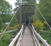
(footbridge)
Aberlour, Scotland, United Kingdom - Burn of Aberlour
| Bridgemeister ID: | 2529 (added 2010-05-19) |
| Name: | (footbridge) |
| Location: | Aberlour, Scotland, United Kingdom |
| Crossing: | Burn of Aberlour |
| At or Near Feature: | Speyside Way |
| Coordinates: | 57.4688 N 3.2317 W |
| Maps: | Acme, GeoHack, Google, OpenStreetMap |
| Use: | Footbridge |
| Status: | In use (last checked: 2009) |
| Main Cables: | Wire (steel) |
| Suspended Spans: | 1 |
| Main Span: | 1 x 23.2 meters (76 feet) |
Notes:
- Near Victoria (Penny, Aberlour) - Charlestown of Aberlour and Wester Elchies, Scotland, United Kingdom.
Image Sets:
(footbridge)
Abisko vicinity, Abisko National Park, Sweden
(footbridge)
Acharisaghmarti, Georgia
(footbridge)
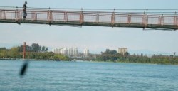
Adana, Türkiye - Seyhan River
| Bridgemeister ID: | 2558 (added 2012-01-15) |
| Name: | (footbridge) |
| Location: | Adana, Türkiye |
| Crossing: | Seyhan River |
| Coordinates: | 37.00017 N 35.33750 E |
| Maps: | Acme, GeoHack, Google, OpenStreetMap |
| Use: | Footbridge |
| Status: | In use (last checked: 2011) |
| Main Cables: | Wire (steel) |
| Suspended Spans: | 3 |
| Main Span: | 1 |
| Side Spans: | 2 |
Notes:
- One of two similar large footbridges in the large downtown Adana park along the Seyhan River.
- Near (footbridge) - Adana, Türkiye.
Image Sets:
(footbridge)
Adana, Türkiye - Seyhan River
| Bridgemeister ID: | 2559 (added 2012-01-15) |
| Name: | (footbridge) |
| Location: | Adana, Türkiye |
| Crossing: | Seyhan River |
| Coordinates: | 36.99724 N 35.33793 E |
| Maps: | Acme, GeoHack, Google, OpenStreetMap |
| Use: | Footbridge |
| Status: | In use (last checked: 2011) |
| Main Cables: | Wire (steel) |
| Suspended Spans: | 3 |
| Main Span: | 1 |
| Side Spans: | 2 |
Notes:
- One of two similar large footbridges in the large downtown Adana park along the Seyhan River.
- Near (footbridge) - Adana, Türkiye.
Image Sets:

(footbridge)
Adana, Türkiye - Seyhan River
| Bridgemeister ID: | 3182 (added 2019-11-09) |
| Name: | (footbridge) |
| Location: | Adana, Türkiye |
| Crossing: | Seyhan River |
| Coordinates: | 37.030039 N 35.329353 E |
| Maps: | Acme, GeoHack, Google, OpenStreetMap |
| Use: | Footbridge |
| Status: | In use (last checked: 2019) |
| Main Cables: | Wire (steel) |
Notes:
- Near Gençlik - Adana, Türkiye.
(footbridge)
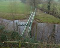
Addingham, England, United Kingdom - River Wharfe
| Bridgemeister ID: | 1208 (added 2004-02-07) |
| Name: | (footbridge) |
| Location: | Addingham, England, United Kingdom |
| Crossing: | River Wharfe |
| Coordinates: | 53.94536 N 1.87446 W |
| Maps: | Acme, GeoHack, Google, OpenStreetMap |
| Use: | Footbridge |
| Status: | In use (last checked: 2013) |
| Main Cables: | Wire (steel) |
| Suspended Spans: | 1 |
Notes:
- Replaced 1897 (footbridge) - Addingham, England, United Kingdom.
- All past and present bridges at this location.
Image Sets:
(footbridge)
Aek Libung, South Tapanuli Regency, North Sumatra, Indonesia - Batang Angkola
| Bridgemeister ID: | 8057 (added 2023-12-24) |
| Name: | (footbridge) |
| Location: | Aek Libung, South Tapanuli Regency, North Sumatra, Indonesia |
| Crossing: | Batang Angkola |
| Coordinates: | 1.155222 N 99.421056 E |
| Maps: | Acme, GeoHack, Google, OpenStreetMap |
| Use: | Footbridge |
| Status: | In use (last checked: 2023) |
| Main Cables: | Wire (steel) |
| Suspended Spans: | 1 |
Notes:
(footbridge)
Aek Libung, South Tapanuli Regency, North Sumatra, Indonesia - Batang Angkola
| Bridgemeister ID: | 8058 (added 2023-12-24) |
| Name: | (footbridge) |
| Location: | Aek Libung, South Tapanuli Regency, North Sumatra, Indonesia |
| Crossing: | Batang Angkola |
| Coordinates: | 1.154639 N 99.422139 E |
| Maps: | Acme, GeoHack, Google, OpenStreetMap |
| Use: | Footbridge |
| Status: | In use (last checked: 2023) |
| Main Cables: | Wire (steel) |
| Suspended Spans: | 1 |
Notes:
(footbridge)
Aek Silaiya, South Tapanuli Regency, North Sumatra, Indonesia - Batang Angkola
| Bridgemeister ID: | 8059 (added 2023-12-24) |
| Name: | (footbridge) |
| Location: | Aek Silaiya, South Tapanuli Regency, North Sumatra, Indonesia |
| Crossing: | Batang Angkola |
| Coordinates: | 1.167389 N 99.410556 E |
| Maps: | Acme, GeoHack, Google, OpenStreetMap |
| Use: | Footbridge |
| Status: | Extant (last checked: 2023) |
| Main Span: | 1 |
Notes:
(footbridge)
Aek Silaiya, South Tapanuli Regency, North Sumatra, Indonesia - Batang Angkola
| Bridgemeister ID: | 8060 (added 2023-12-24) |
| Name: | (footbridge) |
| Location: | Aek Silaiya, South Tapanuli Regency, North Sumatra, Indonesia |
| Crossing: | Batang Angkola |
| Coordinates: | 1.170167 N 99.409444 E |
| Maps: | Acme, GeoHack, Google, OpenStreetMap |
| Use: | Footbridge |
| Status: | In use (last checked: 2023) |
| Main Cables: | Wire (steel) |
| Suspended Spans: | 1 |
Notes:
(footbridge)
Agoyán, Ecuador - Rio Pastaza
| Bridgemeister ID: | 6909 (added 2022-01-21) |
| Name: | (footbridge) |
| Location: | Agoyán, Ecuador |
| Crossing: | Rio Pastaza |
| At or Near Feature: | Cascada Manto de la Novia |
| Coordinates: | 1.403847 S 78.334456 W |
| Maps: | Acme, GeoHack, Google, OpenStreetMap |
| Use: | Footbridge |
| Status: | In use (last checked: 2018) |
| Main Cables: | Wire (steel) |
| Main Span: | 1 |
(footbridge)
Agua Caliente, Padilla, Bolivia
(footbridge)
Aguas Calientes, Machu Picchu, Peru - Urubamba River
| Bridgemeister ID: | 3438 (added 2019-12-22) |
| Name: | (footbridge) |
| Location: | Aguas Calientes, Machu Picchu, Peru |
| Crossing: | Urubamba River |
| Coordinates: | 13.187022 S 72.529714 W |
| Maps: | Acme, GeoHack, Google, OpenStreetMap |
| Use: | Footbridge |
| Status: | Extant (last checked: 2015) |
| Main Cables: | Wire (steel) |
(footbridge)
Aguas Calientes, Machu Picchu, Peru - Urubamba River
| Bridgemeister ID: | 3439 (added 2019-12-22) |
| Name: | (footbridge) |
| Location: | Aguas Calientes, Machu Picchu, Peru |
| Crossing: | Urubamba River |
| At or Near Feature: | Inca Trail 104 Km Checkpoint |
| Coordinates: | 13.186273 S 72.508611 W |
| Maps: | Acme, GeoHack, Google, OpenStreetMap |
| Use: | Footbridge |
| Status: | In use (last checked: 2019) |
| Main Cables: | Wire (steel) |
| Suspended Spans: | 1 |
(footbridge)
Akhaldaba (ახალდაბა), Georgia - Kura River
| Bridgemeister ID: | 7994 (added 2023-12-08) |
| Name: | (footbridge) |
| Location: | Akhaldaba (ახალდაბა), Georgia |
| Crossing: | Kura River |
| Coordinates: | 41.924056 N 43.485861 E |
| Maps: | Acme, GeoHack, Google, OpenStreetMap |
| Use: | Footbridge |
| Status: | In use (last checked: 2023) |
| Main Span: | 1 |
(footbridge)
Akron and Rothsville, Pennsylvania, USA - Cocalico Creek
| Bridgemeister ID: | 2393 (added 2007-12-02) |
| Name: | (footbridge) |
| Location: | Akron and Rothsville, Pennsylvania, USA |
| Crossing: | Cocalico Creek |
| Coordinates: | 40.14121 N 76.21860 W |
| Maps: | Acme, GeoHack, Google, OpenStreetMap |
| Use: | Footbridge |
| Status: | Derelict (last checked: 2020) |
| Main Cables: | Wire |
| Suspended Spans: | 1 |
Notes:
- Appears to have been damaged by flood in the 2018-2019 time frame.
Image Sets:


(footbridge)
Akron, Ohio, USA - Cuyahoga River
| Bridgemeister ID: | 1151 (added 2004-01-18) |
| Name: | (footbridge) |
| Location: | Akron, Ohio, USA |
| Crossing: | Cuyahoga River |
| At or Near Feature: | High Bridge Glens Park, now Gorge Metro Park |
| Use: | Footbridge |
| Status: | Removed |
| Main Cables: | Wire |
Notes:
- This bridge is visible in the foreground of a popular late 19th century stereoview showing the "high bridge" and falls. No longer in existence.
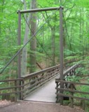
| Bridgemeister ID: | 1784 (added 2005-05-16) |
| Name: | (footbridge) |
| Location: | Akron, Ohio, USA |
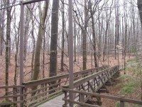
| At or Near Feature: | F.A. Seiberling Nature Realm, Sand Run Metro Park |
| Coordinates: | 41.135883 N 81.5735 W |
| Maps: | Acme, GeoHack, Google, OpenStreetMap |
| Use: | Footbridge |
| Status: | In use (last checked: 2012) |
| Main Cables: | Wire |
| Suspended Spans: | 1 |
Image Sets:
(footbridge)
Alamadevi, Nepal - Kali Gandaki River
| Bridgemeister ID: | 4680 (added 2020-06-20) |
| Name: | (footbridge) |
| Location: | Alamadevi, Nepal |
| Crossing: | Kali Gandaki River |
| Coordinates: | 27.928551 N 83.527879 E |
| Maps: | Acme, GeoHack, Google, OpenStreetMap |
| Use: | Footbridge |
| Status: | In use (last checked: 2020) |
| Main Cables: | Wire (steel) |
| Main Span: | 1 |
Notes:
- Adjacent to Ranighat Palace (Rani Mahal).
(footbridge)
Alatyr (Алатырь), Chuvashia Republic, Russia - Reka Alatyr
| Bridgemeister ID: | 6758 (added 2021-10-24) |
| Name: | (footbridge) |
| Location: | Alatyr (Алатырь), Chuvashia Republic, Russia |
| Crossing: | Reka Alatyr |
| Coordinates: | 54.870633 N 46.584543 E |
| Maps: | Acme, GeoHack, Google, OpenStreetMap |
| Use: | Footbridge |
| Status: | In use (last checked: 2021) |
| Main Cables: | Wire (steel) |
| Suspended Spans: | 1 |
| Main Span: | 1 |
(footbridge)
Albarracín, Teruel, Spain - Rio Guadalaviar
| Bridgemeister ID: | 9002 (added 2024-12-25) |
| Name: | (footbridge) |
| Location: | Albarracín, Teruel, Spain |
| Crossing: | Rio Guadalaviar |
| Coordinates: | 40.404778 N 1.442500 W |
| Maps: | Acme, GeoHack, Google, OpenStreetMap |
| Use: | Footbridge |
| Status: | In use (last checked: 2024) |
| Main Cables: | Chain |
| Suspended Spans: | 1 |
| Main Span: | 1 x 14 meters (45.9 feet) estimated |
(footbridge)
Aldeire, Granada, Spain - Rio Benéjar
| Bridgemeister ID: | 9003 (added 2024-12-25) |
| Name: | (footbridge) |
| Location: | Aldeire, Granada, Spain |
| Crossing: | Rio Benéjar |
| Coordinates: | 37.145306 N 3.074278 W |
| Maps: | Acme, GeoHack, Google, OpenStreetMap |
| Use: | Footbridge |
| Status: | In use (last checked: 2019) |
| Main Cables: | Wire (steel) |
| Suspended Spans: | 1 |
| Main Span: | 1 |
(footbridge)
Alice, West Virginia, USA - Leading Creek
| Bridgemeister ID: | 8812 (added 2024-09-28) |
| Name: | (footbridge) |
| Location: | Alice, West Virginia, USA |
| Crossing: | Leading Creek |
| Coordinates: | 38.999139 N 80.819972 W |
| Maps: | Acme, GeoHack, Google, OpenStreetMap |
| Use: | Footbridge |
| Status: | Extant (last checked: 2023) |
| Main Cables: | Rope |
| Main Span: | 1 |
(footbridge)
Alijosiskes, Lithuania
| Bridgemeister ID: | 3223 (added 2019-11-11) |
| Name: | (footbridge) |
| Location: | Alijosiskes, Lithuania |
| Coordinates: | 55.390022 N 22.233411 E |
| Maps: | Acme, GeoHack, Google, OpenStreetMap |
| Use: | Footbridge |
| Status: | In use (last checked: 2019) |
| Main Cables: | Wire (steel) |
| Main Span: | 1 |
Notes:
- There are several small bridges in the park at this location. A small level deck suspension bridge was observed at the coordinates indicated in the late 2010s. There is at least one other droopy suspension bridge in the park.
(footbridge)
Alishan Township, Chiayi County, Taiwan
| Bridgemeister ID: | 5810 (added 2021-04-10) |
| Name: | (footbridge) |
| Location: | Alishan Township, Chiayi County, Taiwan |
| At or Near Feature: | Shipangu Falls - 石盤谷瀑布 |
| Coordinates: | 23.599119 N 120.745541 E |
| Maps: | Acme, GeoHack, Google, OpenStreetMap |
| Use: | Footbridge |
| Status: | In use (last checked: 2020) |
| Main Cables: | Wire (steel) |
| Main Span: | 1 |
(footbridge)
Alishan Township, Chiayi County, Taiwan
(footbridge)
Alishan Township, Taiwan
(footbridge)
Alnasca, Brione, Ticino, Switzerland - Verzasca River
| Bridgemeister ID: | 1792 (added 2005-05-17) |
| Name: | (footbridge) |
| Location: | Alnasca, Brione, Ticino, Switzerland |
| Crossing: | Verzasca River |
| At or Near Feature: | Val Verzasca |
| Coordinates: | 46.304296 N 8.795310 E |
| Maps: | Acme, GeoHack, Google, OpenStreetMap |
| Use: | Footbridge |
| Status: | In use (last checked: 2014) |
| Main Cables: | Wire (steel) |
| Suspended Spans: | 1 |
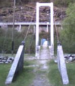
| Main Span: | 1 x 79 meters (259.2 feet) |
| Deck width: | 1.1 meters |
Notes:
- Only one tower. On one side the cables are anchored directly into rock.
Image Sets:
(footbridge)
Aloban, Rondaman Lombang, North Padang Lawas Regency, North Sumatra, Indonesia - Batang Pane
| Bridgemeister ID: | 8622 (added 2024-06-02) |
| Name: | (footbridge) |
| Location: | Aloban, Rondaman Lombang, North Padang Lawas Regency, North Sumatra, Indonesia |
| Crossing: | Batang Pane |
| Coordinates: | 1.435833 N 99.686361 E |
| Maps: | Acme, GeoHack, Google, OpenStreetMap |
| Use: | Footbridge |
| Status: | In use (last checked: 2019) |
| Main Cables: | Wire (steel) |
| Main Span: | 1 |
(footbridge)
Altapass vicinity, North Carolina, USA - North Toe River
| Bridgemeister ID: | 2271 (added 2007-04-21) |
| Name: | (footbridge) |
| Location: | Altapass vicinity, North Carolina, USA |
| Crossing: | North Toe River |
| Coordinates: | 35.90085 N 82.03152 W |
| Maps: | Acme, GeoHack, Google, OpenStreetMap |
| Use: | Footbridge |
| Status: | In use (last checked: 2007) |
| Main Cables: | Wire |
| Suspended Spans: | 1 |
| Main Span: | 1 x 39.6 meters (130 feet) estimated |
Image Sets:

(footbridge)
Altusried, Germany - Iller River
| Bridgemeister ID: | 3054 (added 2019-10-20) |
| Name: | (footbridge) |
| Location: | Altusried, Germany |
| Crossing: | Iller River |
| Coordinates: | 47.827773 N 10.209338 E |
| Maps: | Acme, GeoHack, Google, OpenStreetMap |
| Use: | Footbridge |
| Status: | In use (last checked: 2019) |
| Main Cables: | Wire (steel) |
External Links:
(footbridge)
Alum Springs, Virginia, USA - Little Walker Creek
| Bridgemeister ID: | 787 (added 2003-03-22) |
| Name: | (footbridge) |
| Location: | Alum Springs, Virginia, USA |
| Crossing: | Little Walker Creek |
| Coordinates: | 37.15938 N 80.80502 W |
| Maps: | Acme, GeoHack, Google, OpenStreetMap |
| Principals: | VDOT |
| Use: | Footbridge |
| Status: | In use |
| Main Cables: | Wire |
| Main Span: | 1 x 28 meters (92 feet) estimated |
Image Sets:

(footbridge)
Alum Wells vicinity and Craigs Mill vicinity, Virginia, USA - North Fork Holston River
| Bridgemeister ID: | 1342 (added 2004-05-08) |
| Name: | (footbridge) |
| Location: | Alum Wells vicinity and Craigs Mill vicinity, Virginia, USA |
| Crossing: | North Fork Holston River |
| At or Near Feature: | Buffalo Ford |
| Coordinates: | 36.74740 N 82.18636 W |
| Maps: | Acme, GeoHack, Google, OpenStreetMap |
| Principals: | VDOT |
| Use: | Footbridge |
| Status: | In use (last checked: 2004) |
| Main Cables: | Wire (steel) |
| Suspended Spans: | 2 |
| Main Span: | 1 x 58.2 meters (191 feet) estimated |
| Side Span: | 1 x 18.3 meters (60 feet) estimated |
Image Sets:

(footbridge)
Amberg, Bavaria, Germany - Vils River
| Bridgemeister ID: | 1742 (added 2005-04-20) |
| Name: | (footbridge) |
| Location: | Amberg, Bavaria, Germany |
| Crossing: | Vils River |
| Coordinates: | 49.439033 N 11.8616 E |
| Maps: | Acme, GeoHack, Google, OpenStreetMap |
| Use: | Footbridge |
| Status: | In use (last checked: 2019) |
| Main Cables: | Wire |
External Links:
(footbridge)
Amden vicinity, Switzerland
| Bridgemeister ID: | 1926 (added 2005-10-23) |
| Name: | (footbridge) |
| Location: | Amden vicinity, Switzerland |
| Coordinates: | 47.141933 N 9.14025 E |
| Maps: | Acme, GeoHack, Google, OpenStreetMap |
| Use: | Footbridge |
| Status: | In use (last checked: 2005) |
| Main Cables: | Wire |
| Suspended Spans: | 1 |
Notes:
- Narrow footbridge with A-shaped towers.
(footbridge)
Anikovo (Аниково) and Karinskoye (Каринское), Moscow Oblast, Russia - Moskva River
| Bridgemeister ID: | 3885 (added 2020-03-13) |
| Name: | (footbridge) |
| Location: | Anikovo (Аниково) and Karinskoye (Каринское), Moscow Oblast, Russia |
| Crossing: | Moskva River |
| Coordinates: | 55.705680 N 36.688922 E |
| Maps: | Acme, GeoHack, Google, OpenStreetMap |
| Use: | Footbridge |
| Status: | In use (last checked: 2022) |
| Main Cables: | Wire (steel) |
(footbridge)
Annapolis, California, USA - Wheatfield Fork Gualala River
| Bridgemeister ID: | 7672 (added 2023-06-15) |
| Name: | (footbridge) |
| Location: | Annapolis, California, USA |
| Crossing: | Wheatfield Fork Gualala River |
| At or Near Feature: | Camp Liahona Redwoods |
| Coordinates: | 38.678412 N 123.285527 W |
| Maps: | Acme, GeoHack, Google, OpenStreetMap |
| Use: | Footbridge |
| Status: | Extant (last checked: 2019) |
| Main Span: | 1 |
External Links:
(footbridge)
Ansonia, Pennsylvania, USA - Pine Creek
| Bridgemeister ID: | 4830 (added 2020-07-05) |
| Name: | (footbridge) |
| Location: | Ansonia, Pennsylvania, USA |
| Crossing: | Pine Creek |
| Coordinates: | 41.712839 N 77.456030 W |
| Maps: | Acme, GeoHack, Google, OpenStreetMap |
| Use: | Footbridge |
| Status: | In use (last checked: 2020) |
| Main Cables: | Wire (steel) |
| Main Span: | 1 |
Image Sets:

(footbridge)
Antes Fort vicinity, Pennsylvania, USA - Antes Creek
| Bridgemeister ID: | 1689 (added 2005-03-27) |
| Name: | (footbridge) |
| Location: | Antes Fort vicinity, Pennsylvania, USA |
| Crossing: | Antes Creek |
| Coordinates: | 41.179603 N 77.226050 W |
| Maps: | Acme, GeoHack, Google, OpenStreetMap |
| Use: | Footbridge |
| Status: | In use (last checked: 2020) |
| Main Cables: | Wire (steel) |
| Suspended Spans: | 1 |
| Main Span: | 1 x 30.8 meters (101 feet) estimated |
Image Sets:


(footbridge)
Antonio Stomayor, Los Rios, Ecuador - Rio Vinces
| Bridgemeister ID: | 7248 (added 2022-07-16) |
| Name: | (footbridge) |
| Location: | Antonio Stomayor, Los Rios, Ecuador |
| Crossing: | Rio Vinces |
| Coordinates: | 1.639569 S 79.802726 W |
| Maps: | Acme, GeoHack, Google, OpenStreetMap |
| Use: | Footbridge |
| Status: | In use (last checked: 2017) |
| Main Cables: | Wire (steel) |
| Main Span: | 1 x 159 meters (521.7 feet) estimated |
| Bridgemeister ID: | 5839 (added 2021-05-09) |
| Name: | (footbridge) |
| Location: | Aoba Ward, Yokohama, Kanagawa, Japan |
| At or Near Feature: | Kodomo no Kuni |
| Coordinates: | 35.562558 N 139.490068 E |
| Maps: | Acme, GeoHack, Google, OpenStreetMap |
| Use: | Footbridge |
| Status: | In use (last checked: 2021) |
| Main Cables: | Wire (steel) |
| Suspended Spans: | 1 |
(footbridge)
Apartadó, Antioquia, Colombia - Rio Apartadó
| Bridgemeister ID: | 7404 (added 2022-12-04) |
| Name: | (footbridge) |
| Location: | Apartadó, Antioquia, Colombia |
| Crossing: | Rio Apartadó |
| Coordinates: | 7.881961 N 76.627881 W |
| Maps: | Acme, GeoHack, Google, OpenStreetMap |
| Use: | Footbridge |
| Status: | Removed, c. 2017-2018 |
| Main Cables: | Wire (steel) |
| Suspended Spans: | 1 |
| Main Span: | 1 x 56.4 meters (185 feet) estimated |
External Links:
- Twitter. March 19, 2015: Photos of the inauguration of a nearby replacement bridge and one image of the suspension bridge.
(footbridge)
Apertin, Sweden
(footbridge)
Apopa, El Salvador - Rio Acelhuate
| Bridgemeister ID: | 7381 (added 2022-11-24) |
| Name: | (footbridge) |
| Location: | Apopa, El Salvador |
| Crossing: | Rio Acelhuate |
| Coordinates: | 13.797794 N 89.186269 W |
| Maps: | Acme, GeoHack, Google, OpenStreetMap |
| Use: | Footbridge |
| Status: | In use (last checked: 2022) |
| Main Cables: | Wire (steel) |
| Suspended Spans: | 1 |
| Main Span: | 1 |
External Links:
- apopaonline.com - Video: Apopa El Puente Se Esta Cayendo, Esta Tarde Se Cayo Una Señora Y La Alcaldia No Hace Nada. Images and video of the poor condition of the bridge.
- Facebook. Image of repairs being made to the bridge's suspenders, posted April 23, 2013.
- Facebook. Image of repairs being made to the bridge's suspenders, posted April 23, 2013.
- Facebook - Los angeles apopa puente de amaca. Video of a flood at the bridge, posted May 31, 2020.
- Facebook - Puente en colonia Los Angeles Apopa. Image of the bridge, posted February 19, 2012.
- Twitter - Apopa, Puente De Colonia Los Angeles Se Esta Cayendo, Pasan Niños, Ancianos Y Se Pueden Caer. Video of the poor condition of the bridge, posted January 7, 2022.
(footbridge)
Aralle, Mamasa Regency, West Sulawesi, Indonesia
| Bridgemeister ID: | 6850 (added 2022-01-01) |
| Name: | (footbridge) |
| Location: | Aralle, Mamasa Regency, West Sulawesi, Indonesia |
| Coordinates: | 2.881599 S 119.148929 E |
| Maps: | Acme, GeoHack, Google, OpenStreetMap |
| Use: | Footbridge |
| Status: | In use (last checked: 2019) |
| Main Cables: | Wire (steel) |
| Main Span: | 1 |
Notes:
- Next to 2019 (footbridge) - Aralle, Mamasa Regency, West Sulawesi, Indonesia.
- All past and present bridges at this location.
External Links:
(footbridge)
Arando, Gilgit-Baltistan, Pakistan - Shigar River
| Bridgemeister ID: | 7335 (added 2022-09-03) |
| Name: | (footbridge) |
| Location: | Arando, Gilgit-Baltistan, Pakistan |
| Crossing: | Shigar River |
| Coordinates: | 35.868625 N 75.334283 E |
| Maps: | Acme, GeoHack, Google, OpenStreetMap |
| Use: | Footbridge |
| Status: | In use (last checked: 2021) |
| Main Cables: | Wire (steel) |
| Suspended Spans: | 1 |
| Main Span: | 1 x 49.4 meters (162 feet) estimated |
External Links:
- Facebook - Shigar arando baltistan. Image of the bridge, posted June 2019.
- Facebook - Suspension bridge, Karfo Guro Glacier and Arando Village Basha Shigar Baltistan. Image of the bridge, posted June 2021.
(footbridge)
Aranzazu vicinity, Colombia - Páez River
| Bridgemeister ID: | 3618 (added 2019-12-31) |
| Name: | (footbridge) |
| Location: | Aranzazu vicinity, Colombia |
| Crossing: | Páez River |
| Coordinates: | 2.479102 N 75.930574 W |
| Maps: | Acme, GeoHack, Google, OpenStreetMap |
| Use: | Footbridge |
| Status: | In use (last checked: 2017) |
| Main Cables: | Wire (steel) |
(footbridge)
Arashiyama Kitamatsuoyama, Nishikyo Ward, Kyoto, Japan - Katsura River
| Bridgemeister ID: | 7475 (added 2022-12-25) |
| Name: | (footbridge) |
| Location: | Arashiyama Kitamatsuoyama, Nishikyo Ward, Kyoto, Japan |
| Crossing: | Katsura River |
| At or Near Feature: | Hozukyō Gorge - 保津峡 |
| Coordinates: | 35.026157 N 135.645702 E |
| Maps: | Acme, GeoHack, Google, OpenStreetMap |
| Use: | Footbridge |
| Status: | In use |
| Main Cables: | Wire (steel) |
| Suspended Spans: | 1 |
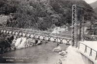
| Main Span: | 1 x 50 meters (164 feet) estimated |
Image Sets:
(footbridge)
Archidona, Ecuador - Rio Misahualli
| Bridgemeister ID: | 2888 (added 2019-09-13) |
| Name: | (footbridge) |
| Location: | Archidona, Ecuador |
| Crossing: | Rio Misahualli |
| Coordinates: | 0.892101 S 77.802470 W |
| Maps: | Acme, GeoHack, Google, OpenStreetMap |
| Use: | Footbridge |
| Status: | In use (last checked: 2019) |
| Main Cables: | Wire (steel) |
(footbridge)
Aridagawa, Wakayama, Japan - Arita River
| Bridgemeister ID: | 4224 (added 2020-04-09) |
| Name: | (footbridge) |
| Location: | Aridagawa, Wakayama, Japan |
| Crossing: | Arita River |
| Coordinates: | 34.107668 N 135.479246 E |
| Maps: | Acme, GeoHack, Google, OpenStreetMap |
| Use: | Footbridge |
| Status: | In use (last checked: 2014) |
| Main Cables: | Wire (steel) |
| Suspended Spans: | 1 |
(footbridge)
Aridagawa, Wakayama, Japan - Arita River
| Bridgemeister ID: | 4225 (added 2020-04-09) |
| Name: | (footbridge) |
| Location: | Aridagawa, Wakayama, Japan |
| Crossing: | Arita River |
| Coordinates: | 34.118910 N 135.494725 E |
| Maps: | Acme, GeoHack, Google, OpenStreetMap |
| Use: | Footbridge |
| Status: | In use (last checked: 2018) |
| Main Cables: | Wire (steel) |
| Suspended Spans: | 1 |
(footbridge)
Aridagawa, Wakayama, Japan - Arita River
| Bridgemeister ID: | 4226 (added 2020-04-09) |
| Name: | (footbridge) |
| Location: | Aridagawa, Wakayama, Japan |
| Crossing: | Arita River |
| Coordinates: | 34.125489 N 135.506440 E |
| Maps: | Acme, GeoHack, Google, OpenStreetMap |
| Use: | Footbridge |
| Status: | In use (last checked: 2014) |
| Main Cables: | Wire (steel) |
| Suspended Spans: | 1 |
(footbridge)
Aridagawa, Wakayama, Japan - Arita River
| Bridgemeister ID: | 4230 (added 2020-04-09) |
| Name: | (footbridge) |
| Location: | Aridagawa, Wakayama, Japan |
| Crossing: | Arita River |
| Coordinates: | 34.051282 N 135.337517 E |
| Maps: | Acme, GeoHack, Google, OpenStreetMap |
| Use: | Footbridge |
| Status: | In use (last checked: 2018) |
| Main Cables: | Wire (steel) |
| Suspended Spans: | 3 |
| Main Span: | 1 |
| Side Spans: | 2 |
(footbridge)
Aridagawa, Wakayama, Japan - Arita River
| Bridgemeister ID: | 4231 (added 2020-04-09) |
| Name: | (footbridge) |
| Location: | Aridagawa, Wakayama, Japan |
| Crossing: | Arita River |
| Coordinates: | 34.056019 N 135.333119 E |
| Maps: | Acme, GeoHack, Google, OpenStreetMap |
| Use: | Footbridge |
| Status: | Extant (last checked: 2018) |
| Main Cables: | Wire (steel) |
(footbridge)
Aridagawa, Wakayama, Japan - Yukawa River
| Bridgemeister ID: | 4233 (added 2020-04-09) |
| Name: | (footbridge) |
| Location: | Aridagawa, Wakayama, Japan |
| Crossing: | Yukawa River |
| Coordinates: | 34.082291 N 135.424915 E |
| Maps: | Acme, GeoHack, Google, OpenStreetMap |
| Use: | Footbridge |
| Status: | In use (last checked: 2014) |
| Main Cables: | Wire (steel) |
| Suspended Spans: | 1 |
(footbridge)
Arilje, Serbia - Veliki Rzav
| Bridgemeister ID: | 9163 (added 2025-04-06) |
| Name: | (footbridge) |
| Location: | Arilje, Serbia |
| Crossing: | Veliki Rzav |
| Coordinates: | 43.751750 N 20.091806 E |
| Maps: | Acme, GeoHack, Google, OpenStreetMap |
| Use: | Footbridge |
| Status: | In use (last checked: 2024) |
| Main Cables: | Wire (steel) |
| Main Span: | 1 |
External Links:
- Google Maps. Image of the bridge. Dated March 2024.
- Instagram. Image of the bridge. Posted April 7, 2022.
(footbridge)
Arkhangelsk, Arkhangelsk Oblast, Russia - Reka Solombalka
| Bridgemeister ID: | 5573 (added 2020-12-20) |
| Name: | (footbridge) |
| Location: | Arkhangelsk, Arkhangelsk Oblast, Russia |
| Crossing: | Reka Solombalka |
| Coordinates: | 64.587903 N 40.532004 E |
| Maps: | Acme, GeoHack, Google, OpenStreetMap |
| Use: | Footbridge |
| Status: | In use (last checked: 2020) |
| Main Cables: | Wire (steel) |
| Suspended Spans: | 1 |
Notes:
(footbridge)
Arkhangelsk, Arkhangelsk Oblast, Russia
(footbridge)
Arkhipo-Osipovka (Архипо-Осиповка), Krasnodar Krai, Russia - Reka Vulan
| Bridgemeister ID: | 6762 (added 2021-10-24) |
| Name: | (footbridge) |
| Location: | Arkhipo-Osipovka (Архипо-Осиповка), Krasnodar Krai, Russia |
| Crossing: | Reka Vulan |
| Coordinates: | 44.365995 N 38.521985 E |
| Maps: | Acme, GeoHack, Google, OpenStreetMap |
| Use: | Footbridge |
| Status: | In use (last checked: 2021) |
| Main Cables: | Wire |
| Main Span: | 1 |
(footbridge)
Arnhem, Netherlands
| Bridgemeister ID: | 4236 (added 2020-04-09) |
| Name: | (footbridge) |
| Location: | Arnhem, Netherlands |
| At or Near Feature: | Stadsblokken-Meinerswijk |
| Coordinates: | 51.977847 N 5.878371 E |
| Maps: | Acme, GeoHack, Google, OpenStreetMap |
| Use: | Footbridge |
| Status: | In use (last checked: 2020) |
| Main Cables: | Wire (steel) |
Notes:
- Similar to Kasteel Enghuizen - Hummelo, Netherlands.
(footbridge)
Arroyito, Cordoba, Argentina - Segundo River
| Bridgemeister ID: | 5352 (added 2020-11-15) |
| Name: | (footbridge) |
| Location: | Arroyito, Cordoba, Argentina |
| Crossing: | Segundo River |
| Coordinates: | 31.409600 S 63.064538 W |
| Maps: | Acme, GeoHack, Google, OpenStreetMap |
| Use: | Footbridge |
| Status: | In use (last checked: 2019) |
| Main Cables: | Wire (steel) |
Notes:
- Damaged by flood, February 2016. Appears to have since been repaired.
(footbridge)
Artrip, Virginia, USA - Clinch River
| Bridgemeister ID: | 2367 (added 2007-09-08) |
| Name: | (footbridge) |
| Location: | Artrip, Virginia, USA |
| Crossing: | Clinch River |
| Coordinates: | 36.96490 N 82.11193 W |
| Maps: | Acme, GeoHack, Google, OpenStreetMap |
| Principals: | VDOT |
| Status: | Closed (last checked: 2004) |
| Main Cables: | Wire |
| Suspended Spans: | 3 |
| Main Span: | 1 |
| Side Spans: | 2 |
Image Sets:

(footbridge)
Ary, Kentucky, USA - Troublesome Creek
| Bridgemeister ID: | 3782 (added 2020-02-29) |
| Name: | (footbridge) |
| Location: | Ary, Kentucky, USA |
| Crossing: | Troublesome Creek |
| Coordinates: | 37.368240 N 83.141350 W |
| Maps: | Acme, GeoHack, Google, OpenStreetMap |
| Use: | Footbridge |
| Status: | In use (last checked: 2008) |
| Main Cables: | Wire (steel) |
| Suspended Spans: | 3 |
| Main Span: | 1 |
| Side Spans: | 2 |
Image Sets:

(footbridge)
Ary, Kentucky, USA - Troublesome Creek
| Bridgemeister ID: | 3783 (added 2020-02-29) |
| Name: | (footbridge) |
| Location: | Ary, Kentucky, USA |
| Crossing: | Troublesome Creek |
| Coordinates: | 37.385960 N 83.169710 W |
| Maps: | Acme, GeoHack, Google, OpenStreetMap |
| Use: | Footbridge |
| Status: | Derelict (last checked: 2007) |
| Main Cables: | Wire |
Image Sets:

(footbridge)
Ary, Kentucky, USA - Troublesome Creek
| Bridgemeister ID: | 3817 (added 2020-03-01) |
| Name: | (footbridge) |
| Location: | Ary, Kentucky, USA |
| Crossing: | Troublesome Creek |
| Coordinates: | 37.383740 N 83.167130 W |
| Maps: | Acme, GeoHack, Google, OpenStreetMap |
| Use: | Footbridge |
| Status: | Derelict (last checked: 2009) |
| Main Cables: | Wire |
| Main Span: | 1 |
Image Sets:
(footbridge)
Ary, Kentucky, USA - Troublesome Creek
| Bridgemeister ID: | 3819 (added 2020-03-01) |
| Name: | (footbridge) |
| Location: | Ary, Kentucky, USA |
| Crossing: | Troublesome Creek |
| Coordinates: | 37.357490 N 83.136850 W |
| Maps: | Acme, GeoHack, Google, OpenStreetMap |
| Status: | Derelict (last checked: 2007) |
| Main Cables: | Wire |
| Main Span: | 1 |
Image Sets:

(footbridge)
Ary, Kentucky, USA - Troublesome Creek
| Bridgemeister ID: | 3821 (added 2020-03-01) |
| Name: | (footbridge) |
| Location: | Ary, Kentucky, USA |
| Crossing: | Troublesome Creek |
| Coordinates: | 37.380444 N 83.149273 W |
| Maps: | Acme, GeoHack, Google, OpenStreetMap |
| Use: | Footbridge |
| Status: | In use (last checked: 2008) |
| Main Cables: | Wire |
| Main Span: | 1 x 33.5 meters (110 feet) estimated |
| Side Spans: | 2 |
Image Sets:
(footbridge)
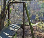
Ary, Kentucky, USA - Troublesome Creek
| Bridgemeister ID: | 3823 (added 2020-03-01) |
| Name: | (footbridge) |
| Location: | Ary, Kentucky, USA |
| Crossing: | Troublesome Creek |
| Coordinates: | 37.381630 N 83.166180 W |
| Maps: | Acme, GeoHack, Google, OpenStreetMap |
| Use: | Footbridge |
| Status: | Derelict (last checked: 2007) |
| Main Cables: | Wire |
| Main Span: | 1 |
Image Sets:

| Bridgemeister ID: | 2913 (added 2019-09-15) |
| Name: | (footbridge) |
| Location: | Ashino Lake, Goshogawara, Aomori, Japan |
| At or Near Feature: | Ashinochishogun Prefectural Natural Park |
| Coordinates: | 40.914930 N 140.452633 E |
| Maps: | Acme, GeoHack, Google, OpenStreetMap |
| Use: | Footbridge |
| Status: | In use (last checked: 2019) |
| Main Cables: | Wire (steel) |
(footbridge)
Asrang (अस्रंग) and Manthali (मन्थली), Nepal - Bagmati River
| Bridgemeister ID: | 6367 (added 2021-07-26) |
| Name: | (footbridge) |
| Location: | Asrang (अस्रंग) and Manthali (मन्थली), Nepal |
| Crossing: | Bagmati River |
| Coordinates: | 27.438371 N 85.325775 E |
| Maps: | Acme, GeoHack, Google, OpenStreetMap |
| Use: | Footbridge |
| Status: | Extant (last checked: 2021) |
| Main Cables: | Wire (steel) |
| Main Span: | 1 x 75 meters (246.1 feet) estimated |
(footbridge)
Asrang (अस्रंग), Nepal - Bagmati River
| Bridgemeister ID: | 6376 (added 2021-07-27) |
| Name: | (footbridge) |
| Location: | Asrang (अस्रंग), Nepal |
| Crossing: | Bagmati River |
| Coordinates: | 27.449395 N 85.302769 E |
| Maps: | Acme, GeoHack, Google, OpenStreetMap |
| Status: | Extant (last checked: 2021) |
| Main Span: | 1 |
(footbridge)
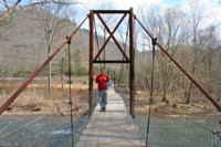
Atwell, McDowell County, West Virginia, USA - Dry Fork of the Tug Fork of the Big Sandy River
| Bridgemeister ID: | 2509 (added 2009-12-30) |
| Name: | (footbridge) |
| Location: | Atwell, McDowell County, West Virginia, USA |
| Crossing: | Dry Fork of the Tug Fork of the Big Sandy River |
| Coordinates: | 37.34525 N 81.76831 W |
| Maps: | Acme, GeoHack, Google, OpenStreetMap |
| Use: | Footbridge |
| Status: | In use (last checked: 2008) |
| Main Cables: | Wire |
| Suspended Spans: | 3 |
| Main Span: | 1 x 42.7 meters (140 feet) |
| Side Spans: | 2 x 10.1 meters (33 feet) |
Image Sets:
(footbridge)
Auberives-en-Royans, Isère and Drôme, France - Bourne River
| Bridgemeister ID: | 5564 (added 2020-12-19) |
| Name: | (footbridge) |
| Location: | Auberives-en-Royans, Isère and Drôme, France |
| Crossing: | Bourne River |
| Coordinates: | 45.055189 N 5.325440 E |
| Maps: | Acme, GeoHack, Google, OpenStreetMap |
| Use: | Footbridge |
| Status: | In use (last checked: 2020) |
| Main Cables: | Wire (steel) |
(footbridge)
Auburn, Washington, USA - Green River
| Bridgemeister ID: | 2169 (added 2007-01-12) |
| Name: | (footbridge) |
| Location: | Auburn, Washington, USA |
| Crossing: | Green River |
| At or Near Feature: | Isaac Evans Park |
| Coordinates: | 47.32745 N 122.21021 W |
| Maps: | Acme, GeoHack, Google, OpenStreetMap |
| Use: | Footbridge |
| Status: | In use (last checked: 2007) |
| Main Cables: | Wire (steel) |
| Suspended Spans: | 1 |
| Main Span: | 1 x 50 meters (164 feet) estimated |
Image Sets:

(footbridge)
Aucará, Lucanas, Peru
(footbridge)
Audru, Pärnu County, Estonia - Audru jõgi
| Bridgemeister ID: | 9123 (added 2025-03-30) |
| Name: | (footbridge) |
| Location: | Audru, Pärnu County, Estonia |
| Crossing: | Audru jõgi |
| At or Near Feature: | Audru Manor Park |
| Coordinates: | 58.407667 N 24.357806 E |
| Maps: | Acme, GeoHack, Google, OpenStreetMap |
| Use: | Footbridge |
| Status: | In use (last checked: 2024) |
| Main Cables: | Wire (steel) |
| Suspended Spans: | 1 |
Notes:
(footbridge)
Audru, Pärnu County, Estonia - Audru jõgi
| Bridgemeister ID: | 9124 (added 2025-03-30) |
| Name: | (footbridge) |
| Location: | Audru, Pärnu County, Estonia |
| Crossing: | Audru jõgi |
| At or Near Feature: | Audru Manor Park |
| Coordinates: | 58.405972 N 24.357278 E |
| Maps: | Acme, GeoHack, Google, OpenStreetMap |
| Use: | Footbridge |
| Status: | In use (last checked: 2024) |
| Main Cables: | Wire (steel) |
| Suspended Spans: | 2 |
| Main Spans: | 2 |
Notes:
- Unusual two-span footbridge with monopole towers and main cables running down the center of the deck.
- Near (footbridge) - Audru, Pärnu County, Estonia.
External Links:
- Audru Manor Park - Visit Estonia. Images of the multiple bridges in this park.
| Bridgemeister ID: | 2976 (added 2019-10-12) |
| Name: | (footbridge) |
| Location: | Aukland, Kristiansand, Agder, Norway |
| Crossing: | Otra |
| Coordinates: | 58.208090 N 7.931710 E |
| Maps: | Acme, GeoHack, Google, kart.1881.no, OpenStreetMap |
| Use: | Footbridge |
| Status: | In use (last checked: 2010) |
| Main Cables: | Wire (steel) |
(footbridge)
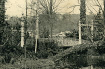
Aulnay, Châtenay-Malabry, Hauts-de-Seine, France
| Bridgemeister ID: | 5576 (added 2020-12-20) |
| Name: | (footbridge) |
| Location: | Aulnay, Châtenay-Malabry, Hauts-de-Seine, France |
| At or Near Feature: | Arboretum de la Vallée aux Loups |
| Coordinates: | 48.771694 N 2.271225 E |
| Maps: | Acme, GeoHack, Google, OpenStreetMap |
| Use: | Footbridge |
| Status: | In use (last checked: 2020) |
| Suspended Spans: | 1 |
Notes:
- This small garden footbridge appears to currently (2020) be aided by a substantial steel beam supporting the deck.
Image Sets:
(footbridge)
Aurec-sur-Loire, Haute-Loire, France - Loire River
| Bridgemeister ID: | 6806 (added 2021-11-21) |
| Name: | (footbridge) |
| Location: | Aurec-sur-Loire, Haute-Loire, France |
| Crossing: | Loire River |
| Coordinates: | 45.369532 N 4.197222 E |
| Maps: | Acme, GeoHack, Google, OpenStreetMap |
| Use: | Footbridge |
| Status: | In use (last checked: 2021) |
| Main Cables: | Wire (steel) |
| Suspended Spans: | 3 |
| Main Span: | 1 |
| Side Spans: | 2 |
Notes:
- 2010s: This suspension footbridge is installed on the piers of the old vehicular suspension bridge at this location.
- At former location of 1892 Aurec-sur-Loire - Aurec-sur-Loire, Haute-Loire, France.
- All past and present bridges at this location.
(footbridge)
Aurora, Illinois, USA - Blackberry Creek
| Bridgemeister ID: | 1559 (added 2004-11-26) |
| Name: | (footbridge) |
| Location: | Aurora, Illinois, USA |
| Crossing: | Blackberry Creek |
| At or Near Feature: | Virgil L. Gilman Trail |
| Coordinates: | 41.760533 N 88.388141 W |
| Maps: | Acme, GeoHack, Google, OpenStreetMap |
| Use: | Footbridge |
| Status: | In use (last checked: 2020) |
| Main Cables: | Wire (steel) |
| Suspended Spans: | 1 |
| Main Span: | 1 x 33 meters (108.3 feet) estimated |
| Deck width: | 2.7 meters |
Notes:
- On the Virgil L. Gilman Trail near the intersection of Orchard Rd. and Prairie St. At mile marker 6.5 on the trail.
External Links:
Image Sets:

(footbridge)
Aurora, Santa Catarina, Brazil - Rio Itajaí do Sul
| Bridgemeister ID: | 5011 (added 2020-08-16) |
| Name: | (footbridge) |
| Location: | Aurora, Santa Catarina, Brazil |
| Crossing: | Rio Itajaí do Sul |
| Coordinates: | 27.302514 S 49.640170 W |
| Maps: | Acme, GeoHack, Google, OpenStreetMap |
| Use: | Footbridge |
| Status: | Replaced, c. 2011-2017 |
| Main Cables: | Wire (steel) |
Notes:
- Replaced at some point in 2011-2017 time frame.
- Replaced by (footbridge) - Aurora, Santa Catarina, Brazil.
- All past and present bridges at this location.
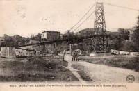
(footbridge)
Auzat-la-Combelle, Puy-de-Dôme, France
| Bridgemeister ID: | 7538 (added 2023-01-22) |
| Name: | (footbridge) |
| Location: | Auzat-la-Combelle, Puy-de-Dôme, France |
| Use: | Footbridge |
| Status: | Removed |
| Main Cables: | Wire (steel) |
| Suspended Spans: | 1 |
Notes:
- Location known as Auzat-sur-Allier at the time the bridge was completed.
Image Sets:
(footbridge)
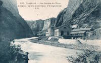
Avignonet, Isère, France - Drac River
| Bridgemeister ID: | 8220 (added 2024-02-06) |
| Name: | (footbridge) |
| Location: | Avignonet, Isère, France |
| Crossing: | Drac River |
| At or Near Feature: | Avignonet Hydroelectric Plant |
| Use: | Footbridge |
| Main Span: | 1 |
Notes:
- Exact location of this bridge is unclear, but likely in close proximity to the current (as of 2023) Drac River dam at Avignonet.
Image Sets:
(footbridge)
Ayacucho, Peru
(footbridge)
Ayacucho, Peru
(footbridge)
Aying Muri and Dingser, Arunachal Pradesh, India - Subansiri River
| Bridgemeister ID: | 7265 (added 2022-07-17) |
| Name: | (footbridge) |
| Location: | Aying Muri and Dingser, Arunachal Pradesh, India |
| Crossing: | Subansiri River |
| Coordinates: | 28.368736 N 93.944903 E |
| Maps: | Acme, GeoHack, Google, OpenStreetMap |
| Use: | Footbridge |
| Status: | In use (last checked: 2019) |
| Main Cables: | Wire |
| Main Span: | 1 x 102.1 meters (335 feet) estimated |
External Links:
(footbridge)
Ayun, Khyber Pakhtunkhwa, Pakistan - Kunar/Chitral/Mastuj River
| Bridgemeister ID: | 7192 (added 2022-07-04) |
| Name: | (footbridge) |
| Location: | Ayun, Khyber Pakhtunkhwa, Pakistan |
| Crossing: | Kunar/Chitral/Mastuj River |
| Coordinates: | 35.706519 N 71.773531 E |
| Maps: | Acme, GeoHack, Google, OpenStreetMap |
| Use: | Footbridge and Pipeline |
| Status: | Extant (last checked: 2021) |
| Main Cables: | Wire (steel) |
| Main Span: | 1 x 80.5 meters (264 feet) estimated |
External Links:
- Facebook - Suspension bridge over Chitral River in Ayun, Chitral, Pakistan. Image of the bridge, posted March 2013.
(footbridge)
Ålefjær, Kristiansand, Agder, Norway
| Bridgemeister ID: | 4460 (added 2020-04-25) |
| Name: | (footbridge) |
| Location: | Ålefjær, Kristiansand, Agder, Norway |
| Coordinates: | 58.224771 N 7.994212 E |
| Maps: | Acme, GeoHack, Google, kart.1881.no, OpenStreetMap |
| Use: | Footbridge |
| Status: | In use (last checked: 2019) |
| Main Cables: | Wire (steel) |
| Suspended Spans: | 1 |
| Main Span: | 1 x 35 meters (114.8 feet) estimated |
Notes:
- Completed at some point between 1978 and 2002.
Do you have any information or photos for these bridges that you would like to share? Please email david.denenberg@bridgemeister.com.
Mail | Facebook | X (Twitter) | Bluesky