Suspension Bridges Completed 1980-1989
This is a list of all 97 bridges from the suspension bridge inventory completed in the decade 1980-1989. Wherever you see a Bridgemeister ID number click it to isolate the bridge on its own page.
Related Lists:
1980: (pipeline bridge)
Calumet vicinity, Louisiana, USA - Wax Lake Outlet
| Bridgemeister ID: | 1810 (added 2005-05-19) |
| Year Completed: | 1980 |
| Name: | (pipeline bridge) |
| Location: | Calumet vicinity, Louisiana, USA |
| Crossing: | Wax Lake Outlet |
| Coordinates: | 29.69095 N 91.374967 W |
| Maps: | Acme, GeoHack, Google, OpenStreetMap |
| Principals: | Clear Span Engineering |
| Use: | Pipeline |
| Status: | Extant (last checked: 2023) |
| Main Cables: | Wire (steel) |
| Suspended Spans: | 1 |
| Main Span: | 1 x 259.1 meters (850 feet) |
Notes:
- Carries a 30" natural gas line.
- Next to 1975 (pipeline bridge) - Calumet vicinity, Louisiana, USA.
- Next to 1976 (pipeline bridge) - Calumet vicinity, Louisiana, USA.
- Next to 1976 (pipeline bridge) - Calumet vicinity, Louisiana, USA.
- Next to 1980 (pipeline bridge) - Calumet vicinity, Louisiana, USA.
- Near 1980 (pipeline bridge) - Calumet vicinity, Louisiana, USA.
- All past and present bridges at this location.
Image Sets:

1980: (pipeline bridge)
Calumet vicinity, Louisiana, USA - Wax Lake Outlet
| Bridgemeister ID: | 1811 (added 2005-05-19) |
| Year Completed: | 1980 |
| Name: | (pipeline bridge) |
| Location: | Calumet vicinity, Louisiana, USA |
| Crossing: | Wax Lake Outlet |
| Coordinates: | 29.710683 N 91.3673 W |
| Maps: | Acme, GeoHack, Google, OpenStreetMap |
| Principals: | Clear Span Engineering |
| Use: | Pipeline |
| Status: | Extant (last checked: 2023) |
| Main Cables: | Wire (steel) |
| Suspended Spans: | 1 |
| Main Span: | 1 x 304.8 meters (1,000 feet) |
Notes:
- Carries a 24-inch natural gas line.
- Near 1975 (pipeline bridge) - Calumet vicinity, Louisiana, USA.
- Near 1976 (pipeline bridge) - Calumet vicinity, Louisiana, USA.
- Near 1976 (pipeline bridge) - Calumet vicinity, Louisiana, USA.
- Near 1980 (pipeline bridge) - Calumet vicinity, Louisiana, USA.
- Near 1980 (pipeline bridge) - Calumet vicinity, Louisiana, USA.
Image Sets:
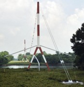
1980: (pipeline bridge)
Calumet vicinity, Louisiana, USA - Wax Lake Outlet
| Bridgemeister ID: | 1812 (added 2005-05-19) |
| Year Completed: | 1980 |
| Name: | (pipeline bridge) |
| Location: | Calumet vicinity, Louisiana, USA |
| Crossing: | Wax Lake Outlet |
| Coordinates: | 29.68845 N 91.375933 W |
| Maps: | Acme, GeoHack, Google, OpenStreetMap |
| Principals: | Clear Span Engineering |
| Use: | Pipeline |
| Status: | Extant (last checked: 2023) |
| Main Cables: | Wire (steel) |
| Suspended Spans: | 1 |
| Main Span: | 1 x 266.7 meters (875 feet) |
Notes:
- Carries a 36-inch natural gas line.
- Next to 1975 (pipeline bridge) - Calumet vicinity, Louisiana, USA.
- Next to 1976 (pipeline bridge) - Calumet vicinity, Louisiana, USA.
- Next to 1976 (pipeline bridge) - Calumet vicinity, Louisiana, USA.
- Next to 1980 (pipeline bridge) - Calumet vicinity, Louisiana, USA.
- Near 1980 (pipeline bridge) - Calumet vicinity, Louisiana, USA.
- All past and present bridges at this location.
Image Sets:

| Bridgemeister ID: | 3915 (added 2020-03-20) |
| Year Completed: | 1980 |
| Name: | Åbrua |
| Also Known As: | Aaen |
| Location: | Tynset, Innlandet, Norway |
| Crossing: | Glomma |
| Coordinates: | 62.288074 N 10.823862 E |
| Maps: | Acme, GeoHack, Google, kart.1881.no, OpenStreetMap |
| Use: | Vehicular (one-lane) |
| Status: | In use (last checked: 2019) |
| Main Cables: | Wire (steel) |
| Suspended Spans: | 1 |
| Main Span: | 1 x 10⁶ meters (347.8 feet) estimated |
Notes:
- Replaced 1928 Åbrua (Aaen) - Tynset, Innlandet, Norway.
- All past and present bridges at this location.
External Links:
1980: Cadereyta
Cadereyta Jiménez, Nuevo Leon, Mexico - Rio Santa Catarina
| Bridgemeister ID: | 7085 (added 2022-05-29) |
| Year Completed: | 1980 |
| Name: | Cadereyta |
| Location: | Cadereyta Jiménez, Nuevo Leon, Mexico |
| Crossing: | Rio Santa Catarina |
| Coordinates: | 25.596181 N 99.992324 W |
| Maps: | Acme, GeoHack, Google, OpenStreetMap |
| Use: | Footbridge |
| Status: | Destroyed, September, 1988 |
| Main Cables: | Wire (steel) |
| Suspended Spans: | 3 |
| Main Span: | 1 x 81.4 meters (267 feet) estimated |
| Side Spans: | 2 |
Notes:
- Destroyed during Hurricane Gilbert, September 1988.
External Links:
- Facebook - PUENTE COLGANTE DE CADEREYTA. Image of the bridge, posted in 2012.
- Facebook - Puente Colgante en Cadereyta, Año de 1980. Image of the bridge, posted in 2012.
1980: Kennebecasis
Sussex, New Brunswick, Canada - Kennebecasis River
| Bridgemeister ID: | 233 (added before 2003) |
| Year Completed: | 1980 |
| Name: | Kennebecasis |
| Location: | Sussex, New Brunswick, Canada |
| Crossing: | Kennebecasis River |
| Use: | Footbridge |
| Status: | Demolished, October, 2002 |
| Main Cables: | Wire (steel) |
1980: Osijek
Osijek, Croatia - Drava River
| Bridgemeister ID: | 936 (added 2003-10-25) |
| Year Completed: | 1980 |
| Name: | Osijek |
| Location: | Osijek, Croatia |
| Crossing: | Drava River |
| Coordinates: | 45.563540 N 18.685271 E |
| Maps: | Acme, GeoHack, Google, OpenStreetMap |
| Principals: | GP "Mostogradnja", Branimir Tripalo, Vukan Njagulj |
| Use: | Footbridge |
| Status: | In use (last checked: 2019) |
| Main Cables: | Wire (steel) |
| Suspended Spans: | 1 |
| Main Span: | 1 x 210 meters (689 feet) |
| Deck width: | 5 meters |
External Links:
Image Sets:
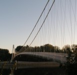
1980: Shakin
Burnhervie, Inverurie vicinity, Scotland, United Kingdom - River Don
| Bridgemeister ID: | 1578 (added 2005-01-22) |
| Year Completed: | 1980 |
| Name: | Shakin |
| Location: | Burnhervie, Inverurie vicinity, Scotland, United Kingdom |
| Crossing: | River Don |
| Coordinates: | 57.261031 N 2.440388 W |
| Maps: | Acme, GeoHack, Google, OpenStreetMap |
| Use: | Footbridge |
| Status: | Replaced, 2005 |
| Main Cables: | Wire (steel) |
| Suspended Spans: | 1 |
Notes:
- Replaced by a cable-stayed bridge, 2005.
- Replaced 1880 Burnhervie - Burnhervie, Inverurie vicinity, Scotland, United Kingdom.
- All past and present bridges at this location.
1980: Similkameen Ore Conveyor
Princeton, British Columbia, Canada - Similkameen Canyon
| Bridgemeister ID: | 2100 (added 2006-07-07) |
| Year Completed: | 1980 |
| Name: | Similkameen Ore Conveyor |
| Location: | Princeton, British Columbia, Canada |
| Crossing: | Similkameen Canyon |
| Coordinates: | 49.351219 N 120.548909 W |
| Maps: | Acme, GeoHack, Google, OpenStreetMap |
| Principals: | Buckland & Taylor Ltd., Robert McLellan & Co. Ltd. |
| Use: | Conveyor |
| Status: | Extant (last checked: 2019) |
| Main Cables: | Wire (steel) |
| Main Span: | 1 x 403.9 meters (1,325 feet) |
External Links:
1980: Vantovyy
Yoshkar-Ola (Йошкар-Ола), Mari El Republic, Russia - Reka Malaya Kokshaga
| Bridgemeister ID: | 7096 (added 2022-06-03) |
| Year Completed: | 1980 |
| Name: | Vantovyy |
| Location: | Yoshkar-Ola (Йошкар-Ола), Mari El Republic, Russia |
| Crossing: | Reka Malaya Kokshaga |
| Coordinates: | 56.626708 N 47.897903 E |
| Maps: | Acme, GeoHack, Google, OpenStreetMap |
| Use: | Footbridge |
| Status: | In use (last checked: 2022) |
| Main Cables: | Wire (steel) |
| Suspended Spans: | 1 |
| Main Span: | 1 x 10⁶ meters (347.8 feet) estimated |
1981: (footbridge)
Slavuta, Khmelnytskyi Oblast, Ukraine - Horyn River
| Bridgemeister ID: | 9162 (added 2025-04-06) |
| Year Completed: | 1981 |
| Name: | (footbridge) |
| Location: | Slavuta, Khmelnytskyi Oblast, Ukraine |
| Crossing: | Horyn River |
| Coordinates: | 50.282056 N 26.839750 E |
| Maps: | Acme, GeoHack, Google, OpenStreetMap |
| Use: | Footbridge |
| Status: | In use (last checked: 2024) |
| Main Cables: | Wire (steel) |
| Suspended Spans: | 1 |
External Links:
- Bluesky. Image of the bridge after it was restored and freshly painted in 2021.
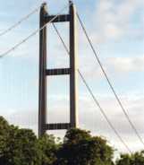
1981: Humber
Hull, Humberside, England, United Kingdom - Humber River
| Bridgemeister ID: | 475 (added before 2003) |
| Year Completed: | 1981 |
| Name: | Humber |
| Location: | Hull, Humberside, England, United Kingdom |
| Crossing: | Humber River |
| Coordinates: | 53.70654 N 0.44997 W |
| Maps: | Acme, GeoHack, Google, OpenStreetMap |
| Principals: | Gilbert Roberts, Bill Harvey, Freeman Fox & Partners |
| References: | AOB, BAR, BC3, BDU, BFL |
| Use: | Vehicular (four-lane), with walkway |
| Status: | In use (last checked: 2021) |
| Main Cables: | Wire (steel) |
| Suspended Spans: | 3 |
| Main Span: | 1 x 1,410 meters (4,626 feet) |
| Side Spans: | 1 x 280 meters (918.6 feet), 1 x 530 meters (1,738.8 feet) |
| Deck width: | 28.5 meters |
Notes:
- Became longest suspension bridge by eclipsing 1964 Verrazzano Narrows (Verrazano Narrows) - Brooklyn and Staten Island, New York, USA.
- Eclipsed by new longest suspension bridge 1998 Akashi Kaikyo (明石海峡大橋) - Maiko, Tarumi-ward, Kobe and Matsuho, Awaji Island, Hyogo, Japan.
External Links:
Image Sets:

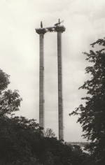
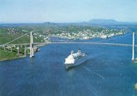
| Bridgemeister ID: | 1496 (added 2004-09-25) |
| Year Completed: | 1981 |
| Name: | Nærøysundet |
| Location: | Rørvik, Nærøysund, Trøndelag, Norway |
| Crossing: | Nærøysund |
| Coordinates: | 64.85033 N 11.21795 E |
| Maps: | Acme, GeoHack, Google, kart.1881.no, OpenStreetMap |
| Use: | Vehicular (two-lane, heavy vehicles), with walkway |
| Status: | In use (last checked: 2019) |
| Main Cables: | Wire (steel) |
| Suspended Spans: | 1 |
| Main Span: | 1 x 325 meters (1,066.3 feet) |
External Links:
Image Sets:
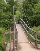
1982: (footbridge)
Glen Nevis vicinity, Scotland, United Kingdom - River Nevis
| Bridgemeister ID: | 1458 (added 2004-08-21) |
| Year Completed: | 1982 |
| Name: | (footbridge) |
| Location: | Glen Nevis vicinity, Scotland, United Kingdom |
| Crossing: | River Nevis |
| Coordinates: | 56.811717 N 5.076033 W |
| Maps: | Acme, GeoHack, Google, OpenStreetMap |
| Use: | Footbridge |
| Status: | In use (last checked: 2009) |
| Main Cables: | Wire (steel) |
| Suspended Spans: | 1 |
| Main Span: | 1 x 32.6 meters (107 feet) |
Notes:
- This is not the popular wire rope crossing at Glen Nevis which is literally three ropes -- two to hold onto and one to walk on. Instead, this listing is a traditional suspension footbridge just north of Glen Nevis.
- Don McGillivray worked on this bridge and sent information about its construction.
"The Suspension bridge was principally built by five Royal Engineers from 15 Field Support Squadron Royal Engineers in the summer of 1982. They were Sapper Terry Bradley (Metal workworker) Sapper Paul Brookes (Draughtsman), Sapper Ian Duggan (Surveyor), Sapper Taff Green (Draughtsman) Sapper Don McGillivray (Blacksmith).
"The pier footings and anchorages were excavated by hand as the plant machines were being used on another project at Caol and upriver at the priority bridge opposite the YMCA.The Accrow shuttering and Re-bar was humped and Concrete was pumped across the river over a series of aluminium Mk4 assualt boats. Once the concrete cured, the steel work, provided by Highland Engineering was manhandled across the river using the same boats. The steel uprights and main cable were raised and positioned using a block and tackle from a wooden Gyn. The main cables were anchored on the east bank and were tensioned on the west bank using two tirfor winches. The hangers and stringers were strung out from the west bank in a series like stepping stones until the decking could be positioned.
"The Bridge took five weeks start to finish the best part of the build was the weather which was hot and as we were constantly dropping tools etc. in the river, you had to jump in after it. We later moved up to finish the two span through deck bridge at the YMCA. This bridge replaced an old narrow bridge that used to be a part of a WW2 Mulberry Harbour section."
Image Sets:
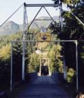
| Bridgemeister ID: | 7793 (added 2023-08-21) |
| Year Completed: | 1982 |
| Name: | (footbridge) |
| Location: | Zhytomyr (Житомир), Zhytomyr Oblast, Ukraine |
| Crossing: | Teteriv |
| At or Near Feature: | Gagarin Park |
| Coordinates: | 50.243169 N 28.662776 E |
| Maps: | Acme, GeoHack, Google, OpenStreetMap |
| Use: | Footbridge |
| Status: | In use (last checked: 2021) |
| Main Cables: | Wire (steel) |
| Suspended Spans: | 1 |
| Main Span: | 1 x 159 meters (521.7 feet) estimated |
External Links:
1982: (pipeline bridge)
Gelsenkirchen, North Rhine-Westphalia, Germany - Rhein-Herne Canal
| Bridgemeister ID: | 1963 (added 2005-11-12) |
| Year Completed: | 1982 |
| Name: | (pipeline bridge) |
| Location: | Gelsenkirchen, North Rhine-Westphalia, Germany |
| Crossing: | Rhein-Herne Canal |
| Coordinates: | 51.534661 N 7.065796 E |
| Maps: | Acme, GeoHack, Google, OpenStreetMap |
| Use: | Pipeline |
| Status: | Extant (last checked: 2019) |
| Main Cables: | Wire (steel) |
| Suspended Spans: | 1 |
External Links:
1982: (pipeline bridge)
Idaho Falls, Idaho, USA - Snake River
| Bridgemeister ID: | 1513 (added 2004-10-09) |
| Year Completed: | 1982 |
| Name: | (pipeline bridge) |
| Location: | Idaho Falls, Idaho, USA |
| Crossing: | Snake River |
| Coordinates: | 43.46399 N 112.07037 W |
| Maps: | Acme, GeoHack, Google, OpenStreetMap |
| Principals: | Clear Span Engineering, Inc. |
| Use: | Pipeline |
| Status: | Extant (last checked: 2019) |
| Main Cables: | Wire (steel) |
| Suspended Spans: | 1 |
| Main Span: | 1 x 167.6 meters (550 feet) |
Notes:
- Carries a 24-inch sewer pipe.
1982: (suspension bridge)
Tyungur (Тюнгур), Altai Republic, Russia - Katun River
| Bridgemeister ID: | 3090 (added 2019-10-27) |
| Year Completed: | 1982 |
| Name: | (suspension bridge) |
| Location: | Tyungur (Тюнгур), Altai Republic, Russia |
| Crossing: | Katun River |
| Coordinates: | 50.158762 N 86.302831 E |
| Maps: | Acme, GeoHack, Google, OpenStreetMap |
| Status: | Removed (last checked: 2019) |
| Main Cables: | Wire (steel) |
| Suspended Spans: | 1 |
| Main Span: | 1 x 162 meters (531.5 feet) estimated |
Notes:
- Large suspension bridge featured in viral images (in mid-2010s) often misattributed to various locations around the world.
External Links:
1982: Hagelsund
Flatøy, Alver, Vestland and Knarvik, Lindås, Hordaland, Norway - Hagelsundet
| Bridgemeister ID: | 3200 (added 2019-11-10) |
| Year Completed: | 1982 |
| Name: | Hagelsund |
| Location: | Flatøy, Alver, Vestland and Knarvik, Lindås, Hordaland, Norway |
| Crossing: | Hagelsundet |
| Coordinates: | 60.543487 N 5.273555 E |
| Maps: | Acme, GeoHack, Google, kart.1881.no, OpenStreetMap |
| Use: | Vehicular |
| Status: | In use (last checked: 2019) |
| Main Cables: | Wire (steel) |
| Suspended Spans: | 1 |
| Main Span: | 1 x 250 meters (820.2 feet) |
External Links:
1982: Shirakawa
Sapporo, Hokkaido, Japan - Toyohira River
| Bridgemeister ID: | 1874 (added 2005-08-06) |
| Year Completed: | 1982 |
| Name: | Shirakawa |
| Location: | Sapporo, Hokkaido, Japan |
| Crossing: | Toyohira River |
| Coordinates: | 42.966342 N 141.301643 E |
| Maps: | Acme, GeoHack, Google, OpenStreetMap |
| Use: | Footbridge |
| Status: | In use (last checked: 2019) |
| Main Cables: | Wire (steel) |
| Suspended Spans: | 1 |
| Main Span: | 1 x 50 meters (164 feet) |
| Deck width: | 1.5 meters |
External Links:
1983: (footbridge)
Glenlivet, Scotland, United Kingdom - River Livet
| Bridgemeister ID: | 2638 (added 2019-03-02) |
| Year Completed: | 1983 |
| Name: | (footbridge) |
| Location: | Glenlivet, Scotland, United Kingdom |
| Crossing: | River Livet |
| At or Near Feature: | Speyside Way - Tomintoul Spur |
| Coordinates: | 57.347297 N 3.331187 W |
| Maps: | Acme, GeoHack, Google, OpenStreetMap |
| Use: | Footbridge |
| Status: | In use (last checked: 2014) |
| Main Cables: | Wire (steel) |
| Suspended Spans: | 1 |
Image Sets:

1983: Edlewogen Crossing
Holderville, Kingston Peninsula, New Brunswick, Canada
| Bridgemeister ID: | 816 (added 2003-05-30) |
| Year Completed: | 1983 |
| Name: | Edlewogen Crossing |
| Location: | Holderville, Kingston Peninsula, New Brunswick, Canada |
| At or Near Feature: | Camp Holderville Boy Scout Camp |
| Use: | Footbridge |
1983: Flat Rock
Ithaca, New York, USA - Fall Creek
| Bridgemeister ID: | 864 (added 2003-08-23) |
| Year Completed: | 1983 |
| Name: | Flat Rock |
| Also Known As: | Eva Howe Stevens, Rifle Range |
| Location: | Ithaca, New York, USA |
| Crossing: | Fall Creek |
| At or Near Feature: | Cornell Botanic Gardens |
| Coordinates: | 42.454983 N 76.45545 W |
| Maps: | Acme, GeoHack, Google, OpenStreetMap |
| Principals: | Cornell Student Chapter of American Society of Civil Engineers (ASCE) |
| Use: | Footbridge |
| Status: | In use (last checked: 2024) |
| Main Cables: | Wire (steel) |
| Suspended Spans: | 1 |
| Main Span: | 1 x 54.9 meters (180 feet) estimated |
Notes:
- 2023: Renovated by students in the same ASCE chapter that built the bridge in 1983.
Image Sets:

1983: Innoshima
Onomichi, Hiroshima, Japan - Mekariseto Strait
| Bridgemeister ID: | 476 (added before 2003) |
| Year Completed: | 1983 |
| Name: | Innoshima |
| Also Known As: | 因島大橋 |
| Location: | Onomichi, Hiroshima, Japan |
| Crossing: | Mekariseto Strait |
| Coordinates: | 34.357320 N 133.180017 E |
| Maps: | Acme, GeoHack, Google, OpenStreetMap |
| Principals: | Honshu-Shikoku Bridge Authority |
| References: | BAAW, BDU |
| Use: | Vehicular (major highway), with walkway |
| Status: | In use (last checked: 2019) |
| Main Cables: | Wire (steel) |
| Suspended Spans: | 3 |
| Main Span: | 1 x 770 meters (2,526.2 feet) |
| Side Spans: | 2 x 250 meters (820.2 feet) |
External Links:
Image Sets:


1983: Jiake
Jiakedixiang (架科底乡), Fugong County (福贡县), Nujiang Lisu (怒江傈僳族自治州), Yunnan, China - Nujiang
| Bridgemeister ID: | 1241 (added 2004-02-15) |
| Year Completed: | 1983 |
| Name: | Jiake |
| Location: | Jiakedixiang (架科底乡), Fugong County (福贡县), Nujiang Lisu (怒江傈僳族自治州), Yunnan, China |
| Crossing: | Nujiang |
| Coordinates: | 26.765472 N 98.889738 E |
| Maps: | Acme, GeoHack, Google, OpenStreetMap |
| References: | BYU |
| Use: | Vehicular |
| Status: | Extant (last checked: 2019) |
| Main Cables: | Wire (steel) |
| Suspended Spans: | 1 |
| Main Span: | 1 x 118 meters (387.1 feet) |
1983: Lammetunbrua
Lammetun, Fjaler, Vestland, Norway - Lammetusundet
| Bridgemeister ID: | 4087 (added 2020-04-04) |
| Year Completed: | 1983 |
| Name: | Lammetunbrua |
| Location: | Lammetun, Fjaler, Vestland, Norway |
| Crossing: | Lammetusundet |
| Coordinates: | 61.269033 N 4.974068 E |
| Maps: | Acme, GeoHack, Google, kart.1881.no, OpenStreetMap |
| Use: | Vehicular (one-lane) |
| Status: | In use |
| Main Cables: | Wire (steel) |
| Main Span: | 1 x 95 meters (311.7 feet) estimated |
Notes:
1983: Manjiedu
Fengqing County, Yunnan, China - Lancang River
| Bridgemeister ID: | 1225 (added 2004-02-15) |
| Year Completed: | 1983 |
| Name: | Manjiedu |
| Location: | Fengqing County, Yunnan, China |
| Crossing: | Lancang River |
| References: | BYU |
| Use: | Vehicular |
| Main Cables: | Wire (steel) |
| Suspended Spans: | 1 |
| Main Span: | 1 x 10⁶ meters (347.8 feet) |
1983: Matadi
Matadi, Dem. Rep. of the Congo (Zaire) - Congo River
| Bridgemeister ID: | 477 (added before 2003) |
| Year Completed: | 1983 |
| Name: | Matadi |
| Location: | Matadi, Dem. Rep. of the Congo (Zaire) |
| Crossing: | Congo River |
| Coordinates: | 5.825215 S 13.434341 E |
| Maps: | Acme, GeoHack, Google, OpenStreetMap |
| References: | BAAW |
| Use: | Vehicular (two-lane, heavy vehicles) |
| Status: | In use (last checked: 2019) |
| Main Cables: | Wire (steel) |
| Suspended Spans: | 1 |
| Main Span: | 1 x 520 meters (1,706 feet) |
Notes:
- Longest suspension bridge in Africa when completed.
- Designed to carry a railway on deck below the roadway, but it does not appear the railway was ever operational. From photos of the site, it doesn't appear rail approaches could have been accomodated unless there are tunnels on both sides of the bridge.
External Links:
1983: Odo Dam
Niyodogawa, Kochi, Japan - Niyodo River
| Bridgemeister ID: | 4650 (added 2020-06-17) |
| Year Completed: | 1983 |
| Name: | Odo Dam |
| Also Known As: | 大渡ダム大橋 |
| Location: | Niyodogawa, Kochi, Japan |
| Crossing: | Niyodo River |
| Coordinates: | 33.545547 N 133.100352 E |
| Maps: | Acme, GeoHack, Google, OpenStreetMap |
| Use: | Vehicular (two-lane) |
| Status: | In use (last checked: 2019) |
| Main Cables: | Wire (steel) |
| Suspended Spans: | 1 |
| Main Span: | 1 x 238 meters (780.8 feet) |
External Links:
1983: Yeoman's
Titusville, New Brunswick, Canada - Hammond River
| Bridgemeister ID: | 234 (added before 2003) |
| Year Completed: | 1983 |
| Name: | Yeoman's |
| Location: | Titusville, New Brunswick, Canada |
| Crossing: | Hammond River |
| Coordinates: | 45.482525 N 65.773381 W |
| Maps: | Acme, GeoHack, Google, OpenStreetMap |
| Use: | Footbridge |
| Status: | In use (last checked: 2019) |
| Main Cables: | Wire (steel) |
| Bridgemeister ID: | 1866 (added 2005-08-02) |
| Year Completed: | 1984 |
| Name: | (footbridge) |
| Location: | Martensdale vicinity, Iowa, USA |
| At or Near Feature: | Zo-El Annett Woods |
| Coordinates: | 41.395367 N 93.698733 W |
| Maps: | Acme, GeoHack, Google, OpenStreetMap |
| Principals: | Iowa Youth Conservation Corp |
| Use: | Footbridge |
| Status: | In use (last checked: 2007) |
| Main Cables: | Wire (steel) |
| Suspended Spans: | 1 |
| Main Span: | 1 x 36.6 meters (120 feet) estimated |
Notes:
- Lisa Youngblut writes: "My husband and his summer crew, the Iowa Youth Conservation Corp, built this bridge in the summer 1984. They used spades, shovels, hammers and nails, a handsaw and a brace and bit. Half of the materials, including 4 yards of concrete, were shipped to the other side of the ravine on a zip line. The cement was bucket brigaded from the zip line to the piling and the anchors."
Image Sets:

1984: (suspension bridge)
Hope, British Columbia, Canada - Coquihalla River
| Bridgemeister ID: | 1253 (added 2004-02-28) |
| Year Completed: | 1984 |
| Name: | (suspension bridge) |
| Location: | Hope, British Columbia, Canada |
| Crossing: | Coquihalla River |
| Coordinates: | 49.387210 N 121.432464 W |
| Maps: | Acme, GeoHack, Google, OpenStreetMap |
| Principals: | Emil Anderson Construction |
| Use: | Vehicular (one-lane) |
| Status: | Replaced (last checked: 2007) |
| Main Cables: | Wire (steel) |
| Suspended Spans: | 1 |
| Main Span: | 1 x 79.2 meters (260 feet) estimated |
Notes:
- Replaced 1963 (suspension bridge) - Hope, British Columbia, Canada.
- All past and present bridges at this location.
Image Sets:
| Bridgemeister ID: | 4649 (added 2020-06-17) |
| Year Completed: | 1984 |
| Name: | (suspension bridge) |
| Location: | Oliana and Peramola, Lleida, Spain |
| Crossing: | El Segre |
| Coordinates: | 42.064619 N 1.296664 E |
| Maps: | Acme, GeoHack, Google, OpenStreetMap |
| Use: | Vehicular (one-lane) |
| Status: | In use (last checked: 2015) |
| Main Cables: | Wire (steel) |
| Suspended Spans: | 1 |
| Main Span: | 1 x 10² meters (334.6 feet) |
External Links:
1984: Aya Teruha
Aya, Miyazaki, Japan - Aya Minami River
| Bridgemeister ID: | 478 (added before 2003) |
| Year Completed: | 1984 |
| Name: | Aya Teruha |
| Also Known As: | 綾の照葉大吊橋 |
| Location: | Aya, Miyazaki, Japan |
| Crossing: | Aya Minami River |
| Coordinates: | 32.029677 N 131.194746 E |
| Maps: | Acme, GeoHack, Google, OpenStreetMap |
| Use: | Footbridge |
| Status: | In use (last checked: 2019) |
| Main Cables: | Wire (steel) |
| Suspended Spans: | 1 |
| Main Span: | 1 x 240 meters (787.4 feet) |
Notes:
- World's longest span footbridge upon completion. Since surpassed.
- Near (suspension bridge) - Aya, Miyazaki, Japan.
External Links:
Image Sets:
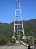
| Bridgemeister ID: | 479 (added before 2003) |
| Year Completed: | 1984 |
| Name: | Dazi |
| Location: | Lasa, Tibet, China |
| Principals: | Highway Bureau of Xizang Autonomous Region |
| References: | BCG |
| Use: | Vehicular (one-lane) |
| Status: | In use |
| Main Cables: | Wire (steel) |
| Main Span: | 1 x 415 meters (1,361.5 feet) |
Notes:
- BCG says completed 1983.
External Links:
1984: Margaret Baker Memorial
Phoenixville, Pennsylvania, USA - Pickering Creek
| Bridgemeister ID: | 7371 (added 2022-11-06) |
| Year Completed: | 1984 |
| Name: | Margaret Baker Memorial |
| Location: | Phoenixville, Pennsylvania, USA |
| Crossing: | Pickering Creek |
| At or Near Feature: | Phoenixville YMCA |
| Coordinates: | 40.108065 N 75.519473 W |
| Maps: | Acme, GeoHack, Google, OpenStreetMap |
| Use: | Footbridge |
| Status: | Derelict, since September, 2021 |
| Main Cables: | Chain (steel) |
| Suspended Spans: | 1 |
Notes:
- 2021, September: Damaged by Hurricane Ida.
Image Sets:


1984: Ohnaruto
Awajishima, Hyogo and Naruto, Tokushima, Japan - Naruto Strait
| Bridgemeister ID: | 480 (added before 2003) |
| Year Completed: | 1984 |
| Name: | Ohnaruto |
| Also Known As: | Onaruto |
| Location: | Awajishima, Hyogo and Naruto, Tokushima, Japan |
| Crossing: | Naruto Strait |
| Coordinates: | 34.238877 N 134.651243 E |
| Maps: | Acme, GeoHack, Google, OpenStreetMap |
| Principals: | Honshu-Shikoku Bridge Authority |
| References: | BAAW, BAR, BBR, BDU |
| Use: | Vehicular (major highway) |
| Status: | In use (last checked: 2019) |
| Main Cables: | Wire (steel) |
| Suspended Spans: | 3 |
| Main Span: | 1 x 876 meters (2,874 feet) |
| Side Spans: | 2 x 330 meters (1,082.7 feet) |
| Deck width: | 34 meters |
External Links:
Image Sets:

1984: Zuckerberg Island Heritage Park
Castlegar, British Columbia, Canada - Columbia River
| Bridgemeister ID: | 913 (added 2003-10-11) |
| Year Completed: | 1984 |
| Name: | Zuckerberg Island Heritage Park |
| Location: | Castlegar, British Columbia, Canada |
| Crossing: | Columbia River |
| Coordinates: | 49.31616 N 117.65898 W |
| Maps: | Acme, GeoHack, Google, OpenStreetMap |
| Principals: | 44th Field Engineer Squadron |
| Use: | Footbridge |
| Status: | Closed (last checked: 2023) |
| Main Cables: | Wire (steel) |
| Suspended Spans: | 1 |
| Main Span: | 1 x 91.4 meters (300 feet) |
| Deck width: | 3 feet |
Notes:
- 2023, November: Has been closed for some time awaiting repairs.
- 1996: Bridge is reconstructed, according to sign posted at bridge.
- Near 1913 Brilliant (Doukhobor) - Castlegar vicinity, British Columbia, Canada.
1985: (footbridge)
Salina, Kansas, USA - Smoky Hill River
| Bridgemeister ID: | 1847 (added 2005-07-16) |
| Year Completed: | 1985 |
| Name: | (footbridge) |
| Location: | Salina, Kansas, USA |
| Crossing: | Smoky Hill River |
| At or Near Feature: | Oakdale Park |
| Coordinates: | 38.833167 N 97.6041 W |
| Maps: | Acme, GeoHack, Google, OpenStreetMap |
| Principals: | Frank R. Weinhold |
| Use: | Footbridge |
| Status: | In use (last checked: 2010) |
| Main Cables: | Wire |
| Suspended Spans: | 3 |
| Main Span: | 1 x 27.4 meters (90 feet) estimated |
| Side Spans: | 2 x 13.7 meters (45 feet) estimated |
1985: Harding Road
Preston, Victoria, Australia - Merri Creek
| Bridgemeister ID: | 2696 (added 2019-05-27) |
| Year Completed: | 1985 |
| Name: | Harding Road |
| Location: | Preston, Victoria, Australia |
| Crossing: | Merri Creek |
| At or Near Feature: | W.H. Robinson Reserve |
| Coordinates: | 37.746454 S 144.980239 E |
| Maps: | Acme, GeoHack, Google, OpenStreetMap |
| Use: | Footbridge |
| Status: | In use (last checked: 2019) |
| Main Cables: | Wire (steel) |
1985: Ka Latamu
Ka Latamu (喀拉塔木), Ghulja, Ili, Xinjiang, China - Yili River
| Bridgemeister ID: | 6869 (added 2022-01-02) |
| Year Completed: | 1985 |
| Name: | Ka Latamu |
| Also Known As: | Kalatamu |
| Location: | Ka Latamu (喀拉塔木), Ghulja, Ili, Xinjiang, China |
| Crossing: | Yili River |
| Coordinates: | 43.649432 N 81.689586 E |
| Maps: | Acme, GeoHack, Google, OpenStreetMap |
| Use: | Vehicular (one-lane) |
| Status: | Extant (last checked: 2021) |
| Main Cables: | Wire (steel) |
| Suspended Spans: | 1 |
| Main Span: | 1 x 126 meters (413.4 feet) estimated |
External Links:
1985: Menglun
Menglun (Jinghong vicinity), Yunnan, China - Lancang River
| Bridgemeister ID: | 1216 (added 2004-02-14) |
| Year Completed: | 1985 |
| Name: | Menglun |
| Location: | Menglun (Jinghong vicinity), Yunnan, China |
| Crossing: | Lancang River |
| References: | BYU |
| Use: | Footbridge |
| Status: | In use |
| Main Cables: | Wire (steel) |
| Main Span: | 1 x 140 meters (459.3 feet) |
Notes:
- In vicinity of Xishuangbanna Botanical Research Institute. The English translation in BCG puts this over the "Buyuan River" but several web sites show this bridge over the Lancang. Feel free to email me if this is a matter of translation or multiple accepted names.
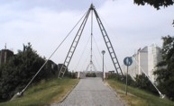
1985: Raumseilbrücke
Munich, Bavaria, Germany - Schenkendorfstraße
| Bridgemeister ID: | 899 (added 2003-09-07) |
| Year Completed: | 1985 |
| Name: | Raumseilbrücke |
| Location: | Munich, Bavaria, Germany |
| Crossing: | Schenkendorfstraße |
| Coordinates: | 48.174717 N 11.59445 E |
| Maps: | Acme, GeoHack, Google, OpenStreetMap |
| Principals: | Richard Johann Dietrich, Suess-Staller-Schmitt |
| Use: | Footbridge |
| Status: | In use (last checked: 2006) |
| Main Cables: | Wire (steel) |
| Suspended Spans: | 1 |
| Main Span: | 1 x 60 meters (196.9 feet) |
| Deck width: | 3.5 meters between side rails, 4.3 meters total |
| Characteristics: | Monocable |
Notes:
- Monocable over A-shaped towers.
External Links:
Image Sets:
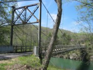
1985: Sylamore Creek
Allison, Arkansas, USA - South Sylamore Creek
| Bridgemeister ID: | 202 (added before 2003) |
| Year Completed: | 1985 |
| Name: | Sylamore Creek |
| Also Known As: | Swinging |
| Location: | Allison, Arkansas, USA |
| Crossing: | South Sylamore Creek |
| Coordinates: | 35.936067 N 92.121528 W |
| Maps: | Acme, GeoHack, Google, OpenStreetMap |
| Use: | Vehicular (one-lane) |
| Status: | In use (last checked: 2021) |
| Main Cables: | Wire (steel) |
| Suspended Spans: | 1 |
| Main Span: | 1 x 61 meters (200 feet) |
Notes:
- Some references locate this bridge over North Sylamore Creek and most have it "north of Mountain View". The bridge is located over South Sylamore Creek about one-half mile due west of Allison, Arkansas on what is now Stone County route 283 and appropriately named Swinging Bridge Road.
- Replaced 1943 Swinging - Allison, Arkansas, USA.
- All past and present bridges at this location.
External Links:
- Historic Bridges of the United States - Sylamore Creek Swinging Bridge - Stone County, Arkansas
- Structurae - Structure ID 20008201
Image Sets:
1985: Val-Joly
Eppe-Sauvage vicinity, Nord, France - Lac du Val-Joly
| Bridgemeister ID: | 2137 (added 2006-10-28) |
| Year Completed: | 1985 |
| Name: | Val-Joly |
| Location: | Eppe-Sauvage vicinity, Nord, France |
| Crossing: | Lac du Val-Joly |
| Coordinates: | 50.122243 N 4.124874 E |
| Maps: | Acme, GeoHack, Google, OpenStreetMap |
| Use: | Footbridge |
| Status: | In use (last checked: 2019) |
| Main Cables: | Wire (steel) |
| Suspended Spans: | 1 |
External Links:
1986: (pipeline bridge)
Summit Bridge, Delaware, USA - Chesapeake and Delaware Canal
| Bridgemeister ID: | 1515 (added 2004-10-10) |
| Year Completed: | 1986 |
| Name: | (pipeline bridge) |
| Location: | Summit Bridge, Delaware, USA |
| Crossing: | Chesapeake and Delaware Canal |
| Coordinates: | 39.54241 N 75.72397 W |
| Maps: | Acme, GeoHack, Google, OpenStreetMap |
| Principals: | Clear Span Engineering, Inc., Trinity Steel Co. |
| Use: | Pipeline |
| Status: | In use (last checked: 2019) |
| Main Cables: | Wire (steel) |
| Main Span: | 1 x 371.9 meters (1,220 feet) |
Notes:
- Carries a 12-inch natural gas line.
Image Sets:

1986: Lancang River
Yunnan, China - Lancang River
| Bridgemeister ID: | 1061 (added 2003-12-13) |
| Year Completed: | 1986 |
| Name: | Lancang River |
| Location: | Yunnan, China |
| Crossing: | Lancang River |
| References: | BCG |
| Use: | Vehicular (one-lane) |
| Suspended Spans: | 1 |
| Main Span: | 1 x 164 meters (538.1 feet) |
1986: Qihama Yellow River
Qihamaxiang (齐哈玛镇), Maqu (玛曲县), Gannan (甘南州), Gansu, China - Yellow River
| Bridgemeister ID: | 1062 (added 2003-12-13) |
| Year Completed: | 1986 |
| Name: | Qihama Yellow River |
| Location: | Qihamaxiang (齐哈玛镇), Maqu (玛曲县), Gannan (甘南州), Gansu, China |
| Crossing: | Yellow River |
| Coordinates: | 33.446889 N 101.930139 E |
| Maps: | Acme, GeoHack, Google, OpenStreetMap |
| References: | BCG |
| Use: | Vehicular (one-lane) |
| Status: | Extant (last checked: 2020) |
| Main Cables: | Wire (steel) |
| Suspended Spans: | 1 |
| Main Span: | 1 x 195.25 meters (640.6 feet) |
1986: Rex Creek
Mossman Gorge, Queensland, Australia - Rex Creek
| Bridgemeister ID: | 2623 (added 2018-12-31) |
| Year Completed: | 1986 |
| Name: | Rex Creek |
| Location: | Mossman Gorge, Queensland, Australia |
| Crossing: | Rex Creek |
| Use: | Footbridge |
| Status: | Replaced (last checked: 2010) |
| Main Cables: | Wire (steel) |
Notes:
1986: Te Rata
King Country, New Zealand - Retaruke River
| Bridgemeister ID: | 2097 (added 2006-07-04) |
| Year Completed: | 1986 |
| Name: | Te Rata |
| Also Known As: | Berryman |
| Location: | King Country, New Zealand |
| Crossing: | Retaruke River |
| Coordinates: | 39.113030 S 175.096169 E |
| Maps: | Acme, GeoHack, Google, OpenStreetMap |
| Principals: | New Zealand Army, John Armstrong |
| Use: | Vehicular |
| Status: | Derelict, since March 22, 1994 (last checked: 2013) |
| Main Cables: | Wire (steel) |
Notes:
- Collapsed under weight of a light truck driven by Kenneth Richards killing Richards. Built by the New Zealand Army for the Berryman family, the bridge's collapse precipitated a long legal battle between the Berrymans (on whose land the bridge was built), the Occupation Safety and Health Department (suing the Berrymans over Richards' death) and the Army (accused of concealing a report stating the bridge's collapse was partially due to a design flaw).
- Replaced Hayes - Retaruke, King Country, New Zealand.
- All past and present bridges at this location.
1987: (footbridge)
Criglersville, Virginia, USA - Robinson River
| Bridgemeister ID: | 1331 (added 2004-04-30) |
| Year Completed: | 1987 |
| Name: | (footbridge) |
| Location: | Criglersville, Virginia, USA |
| Crossing: | Robinson River |
| Coordinates: | 38.4633 N 78.309933 W |
| Maps: | Acme, GeoHack, Google, OpenStreetMap |
| Principals: | VDOT |
| Use: | Footbridge |
| Status: | In use (last checked: 2021) |
| Main Cables: | Wire (steel) |
| Suspended Spans: | 1 |
| Main Span: | 1 x 36.6 meters (120 feet) estimated |
Notes:
- There are two suspension footbridges across the Robinson River at Criglersville. This one is visible from county road 670 just west of Criglersville.
- Near Lindsay Lane - Criglersville, Virginia, USA.
Image Sets:


1987: (footbridge)
Kelheim, Germany - Rhine-Main-Danube Channel
| Bridgemeister ID: | 955 (added 2003-11-01) |
| Year Completed: | 1987 |
| Name: | (footbridge) |
| Location: | Kelheim, Germany |
| Crossing: | Rhine-Main-Danube Channel |
| Coordinates: | 48.920467 N 11.8731 E |
| Maps: | Acme, GeoHack, Google, OpenStreetMap |
| Principals: | Schlaich Bergermann Partner |
| Use: | Footbridge |
| Status: | In use (last checked: 2005) |
| Main Cables: | Wire (steel) |
| Suspended Spans: | 1 |
Notes:
- Unconventional design, curved deck, only suspended along one edge.
- Similar to 2003 Erzbahnschwinge - Bochum, Germany.
- Similar to 2004 Liberty - Greenville, South Carolina, USA.
External Links:
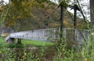
1987: (footbridge)
Waldbreitbach, Rheinland-Pfalz, Germany - Wied River
| Bridgemeister ID: | 2206 (added 2007-02-11) |
| Year Completed: | 1987 |
| Name: | (footbridge) |
| Location: | Waldbreitbach, Rheinland-Pfalz, Germany |
| Crossing: | Wied River |
| Coordinates: | 50.552841 N 7.426353 E |
| Maps: | Acme, GeoHack, Google, OpenStreetMap |
| Principals: | Lermer GmbH |
| Use: | Footbridge |
| Status: | In use (last checked: 2006) |
| Main Cables: | Wire (steel) |
| Suspended Spans: | 1 |
| Main Span: | 1 x 29.7 meters (97.4 feet) |
| Deck width: | 1.2 meters between side rails, 1.5 meters total |
Notes:
- Eckhard Bernstorff notes: "Hangers are 'plates' with cross-section 1 x 5 cm, backstays 3 x 5 cm. Steel towers."
- Replaced 1956 (footbridge) - Waldbreitbach, Rheinland-Pfalz, Germany.
- All past and present bridges at this location.
Image Sets:
| Bridgemeister ID: | 482 (added before 2003) |
| Year Completed: | 1987 |
| Name: | Beida |
| Also Known As: | North |
| Location: | Dalian (大连市), Liaoning, China |
| Coordinates: | 38.864585 N 121.663324 E |
| Maps: | Acme, GeoHack, Google, OpenStreetMap |
| Principals: | Dalian 1st Construction Engineering Co. |
| Use: | Vehicular (two-lane, heavy vehicles) |
| Status: | In use |
| Main Cables: | Wire (steel) |
| Suspended Spans: | 3 |
| Main Span: | 1 x 132 meters (433.1 feet) |
| Side Spans: | 2 x 48 meters (157.5 feet) |
External Links:
| Bridgemeister ID: | 1009 (added 2003-11-21) |
| Year Completed: | 1987 |
| Name: | Carl XVI Gustafs I |
| Location: | Älvkarleby, Sweden |
| Crossing: | Dalälven |
| Coordinates: | 60.570243 N 17.443392 E |
| Maps: | Acme, GeoHack, Google, OpenStreetMap |
| Use: | Footbridge |
| Status: | In use (last checked: 2019) |
| Main Cables: | Wire (steel) |
| Suspended Spans: | 1 |
Notes:
- One of two footbridges at this location.
- Connects to 1987 Carl XVI Gustafs II - Älvkarleby, Sweden.
- All past and present bridges at this location.
External Links:
| Bridgemeister ID: | 1010 (added 2003-11-21) |
| Year Completed: | 1987 |
| Name: | Carl XVI Gustafs II |
| Location: | Älvkarleby, Sweden |
| Crossing: | Dalälven |
| Coordinates: | 60.569625 N 17.441710 E |
| Maps: | Acme, GeoHack, Google, OpenStreetMap |
| Use: | Footbridge |
| Status: | In use (last checked: 2019) |
| Main Cables: | Wire (steel) |
| Suspended Spans: | 1 |
Notes:
- Second of two footbridges at this location
- Connects to 1987 Carl XVI Gustafs I - Älvkarleby, Sweden.
- All past and present bridges at this location.
External Links:
1987: Grabensaal
Fribourg, Switzerland - Sarine River
| Bridgemeister ID: | 4548 (added 2020-05-30) |
| Year Completed: | 1987 |
| Name: | Grabensaal |
| Location: | Fribourg, Switzerland |
| Crossing: | Sarine River |
| Coordinates: | 46.807646 N 7.164400 E |
| Maps: | Acme, GeoHack, Google, OpenStreetMap |
| Use: | Footbridge |
| Status: | In use |
| Main Cables: | Wire (steel) |
| Suspended Spans: | 1 |
External Links:
1987: Kita Bisan-Seto
Yoshima Island and Sakaide, Kagawa, Japan - Seto Inland Sea
| Bridgemeister ID: | 481 (added before 2003) |
| Year Completed: | 1987 |
| Name: | Kita Bisan-Seto |
| Also Known As: | 北備讃瀬戸大橋 |
| Location: | Yoshima Island and Sakaide, Kagawa, Japan |
| Crossing: | Seto Inland Sea |
| Coordinates: | 34.379065 N 133.820065 E |
| Maps: | Acme, GeoHack, Google, OpenStreetMap |
| Principals: | Honshu-Shikoku Bridge Authority |
| References: | BAAW, BAR, BBR, BDU |
| Use: | Vehicular (major highway) and Rail |
| Status: | In use (last checked: 2019) |
| Main Cables: | Wire (steel) |
| Suspended Spans: | 3 |
| Main Span: | 1 x 990 meters (3,248 feet) |
| Side Spans: | 2 x 274 meters (899 feet) |
| Deck width: | 35 meters upper deck, 30 meters lower deck |
Notes:
- Connects to 1988 Minami Bisan-Seto (南備讃瀬戸大橋) - Yoshima Island (与島) and Sakaide (坂出市), Kagawa, Japan.
- Near 1988 Shimotsui-Seto (下津井瀬戸大橋) - Kojima, Okayama and Hitsuishijima (櫃石島), Kagawa, Japan.
- All past and present bridges at this location.
External Links:
Image Sets:
| Bridgemeister ID: | 541 (added before 2003) |
| Year Completed: | 1987 |
| Name: | Konohana |
| Also Known As: | 此花大橋 |
| Location: | Osaka, Osaka, Japan |
| Coordinates: | 34.666526 N 135.414947 E |
| Maps: | Acme, GeoHack, Google, OpenStreetMap |
| Use: | Vehicular (four-lane) |
| Status: | In use (last checked: 2019) |
| Main Cables: | Wire (steel) |
| Suspended Spans: | 3 |
| Main Span: | 1 x 300 meters (984.3 feet) |
| Side Spans: | 2 x 120 meters (393.7 feet) |
| Deck width: | 26.5 meters |
| Characteristics: | Monocable |
Notes:
- Monocable.
External Links:
1987: Swing
Sheboygan Falls, Wisconsin, USA - Sheboygan River
| Bridgemeister ID: | 1802 (added 2005-05-18) |
| Year Completed: | 1987 |
| Name: | Swing |
| Location: | Sheboygan Falls, Wisconsin, USA |
| Crossing: | Sheboygan River |
| At or Near Feature: | River Park |
| Coordinates: | 43.72765 N 87.81647 W |
| Maps: | Acme, GeoHack, Google, OpenStreetMap |
| Principals: | Donohue & Associates, Pheifer Brothers Construction Co. |
| Use: | Footbridge |
| Status: | In use (last checked: 2005) |
| Main Cables: | Wire (steel) |
| Suspended Spans: | 1 |
| Main Span: | 1 x 45.7 meters (150 feet) estimated |
Notes:
- Replaced 1913 Swing (Swinging) - Sheboygan Falls, Wisconsin, USA.
- All past and present bridges at this location.
Image Sets:
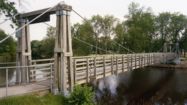
1987: Xiluodu
Sichuan and Yongshan County, Yunnan, China - Jinsha River
1988: (footbridge)
Dayton, Tennessee, USA - Richland Creek
| Bridgemeister ID: | 1263 (added 2004-03-13) |
| Year Completed: | 1988 |
| Name: | (footbridge) |
| Location: | Dayton, Tennessee, USA |
| Crossing: | Richland Creek |
| Coordinates: | 35.49 N 85.013667 W |
| Maps: | Acme, GeoHack, Google, OpenStreetMap |
| Use: | Footbridge |
| Status: | In use (last checked: 2006) |
| Main Cables: | Wire |
| Suspended Spans: | 1 |
Image Sets:

1988: (footbridge)
Inverness, Scotland, United Kingdom - River Ness
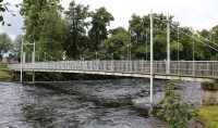
| Bridgemeister ID: | 905 (added 2003-10-11) |
| Year Completed: | 1988 |
| Name: | (footbridge) |
| Location: | Inverness, Scotland, United Kingdom |
| Crossing: | River Ness |
| At or Near Feature: | Ness Islands |
| Coordinates: | 57.462946 N 4.233579 W |
| Maps: | Acme, GeoHack, Google, OpenStreetMap |
| Principals: | Cruden and Tough |
| References: | HBR |
| Use: | Footbridge |
| Status: | In use (last checked: 2019) |
| Main Cables: | Wire (steel) |
| Suspended Spans: | 3 |
| Main Span: | 1 |
| Side Spans: | 2 |
Notes:
- One of two footbridges in the Ness Islands near the locations of the two 1853 Ness Islands bridges. This one has towers that are more in the river than the other 1988 bridge.
- Near 1988 (footbridge) - Inverness, Scotland, United Kingdom.
- See 1853 General's Well - Inverness, Scotland, United Kingdom.
- See 1853 Island Bank Road - Inverness, Scotland, United Kingdom.
External Links:
Image Sets:
1988: (footbridge)
Inverness, Scotland, United Kingdom - River Ness
| Bridgemeister ID: | 906 (added 2003-10-11) |
| Year Completed: | 1988 |
| Name: | (footbridge) |
| Location: | Inverness, Scotland, United Kingdom |
| Crossing: | River Ness |
| At or Near Feature: | Ness Islands |
| Coordinates: | 57.465699 N 4.228247 W |
| Maps: | Acme, GeoHack, Google, OpenStreetMap |
| References: | HBR |
| Use: | Footbridge |
| Status: | In use (last checked: 2019) |
| Main Cables: | Wire (steel) |
| Suspended Spans: | 1 |
Notes:
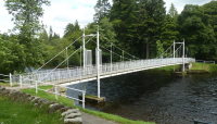
- One of two footbridges in the Ness Islands near the locations of the two 1853 Ness Islands bridges. This one has towers set back from the river.
- Near 1988 (footbridge) - Inverness, Scotland, United Kingdom.
- See 1853 General's Well - Inverness, Scotland, United Kingdom.
- See 1853 Island Bank Road - Inverness, Scotland, United Kingdom.
External Links:
Image Sets:
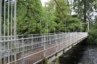
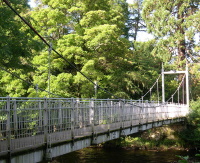
1988: (footbridge)
Richmond, Indiana, USA - Whitewater River
| Bridgemeister ID: | 2307 (added 2007-04-30) |
| Year Completed: | 1988 |
| Name: | (footbridge) |
| Location: | Richmond, Indiana, USA |
| Crossing: | Whitewater River |
| At or Near Feature: | Whitewater Gorge |
| Coordinates: | 39.83331 N 84.89902 W |
| Maps: | Acme, GeoHack, Google, OpenStreetMap |
| Use: | Footbridge |
| Status: | In use (last checked: 2007) |
| Main Cables: | Wire (steel) |
Image Sets:
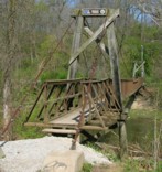
1988: (footbridge)
Sanger vicinity, North Dakota, USA
| Bridgemeister ID: | 1319 (added 2004-04-25) |
| Year Completed: | 1988 |
| Name: | (footbridge) |
| Location: | Sanger vicinity, North Dakota, USA |
| At or Near Feature: | Cross Ranch State Park |
| Coordinates: | 47.198983 N 100.99675 W |
| Maps: | Acme, GeoHack, Google, OpenStreetMap |
| Principals: | North Dakota National Guard |
| Use: | Footbridge |
| Status: | In use (last checked: 2004) |
| Main Cables: | Wire |
| Suspended Spans: | 1 |
Notes:
- Short footbridge with simple tubular metal towers. Crosses a small river just upstream of where the river flows into the Missouri.
1988: (pipeline bridge)
Cody, Wyoming, USA - Sulphur Creek
| Bridgemeister ID: | 3325 (added 2019-12-01) |
| Year Completed: | 1988 |
| Name: | (pipeline bridge) |
| Location: | Cody, Wyoming, USA |
| Crossing: | Sulphur Creek |
| Coordinates: | 44.523354 N 109.084426 W |
| Maps: | Acme, GeoHack, Google, OpenStreetMap |
| Principals: | Clear Span Engineering |
| Use: | Pipeline |
| Status: | Extant (last checked: 2019) |
| Main Cables: | Wire (steel) |
| Main Span: | 1 x 137.2 meters (450 feet) |
Notes:
- Carries a 16-inch sewer line.
1988: (suspension bridge)
San Fernando de Henares, Madrid, Spain - Rio Jarama
| Bridgemeister ID: | 4717 (added 2020-06-26) |
| Year Completed: | 1988 |
| Name: | (suspension bridge) |
| Location: | San Fernando de Henares, Madrid, Spain |
| Crossing: | Rio Jarama |
| Coordinates: | 40.413190 N 3.511548 W |
| Maps: | Acme, GeoHack, Google, OpenStreetMap |
| Use: | Footbridge and Pipeline |
| Status: | In use (last checked: 2018) |
| Main Cables: | Wire (steel) |
| Suspended Spans: | 3 |
| Main Span: | 1 |
| Side Spans: | 2 |
External Links:
1988: (suspension bridge)
Untereggersberg, Bavaria, Germany - Rhine-Main-Danube Channel
| Bridgemeister ID: | 2241 (added 2007-03-28) |
| Year Completed: | 1988 |
| Name: | (suspension bridge) |
| Location: | Untereggersberg, Bavaria, Germany |
| Crossing: | Rhine-Main-Danube Channel |
| Coordinates: | 48.975310 N 11.654543 E |
| Maps: | Acme, GeoHack, Google, OpenStreetMap |
| Principals: | S.E.H. Stahlbau Engineering |
| Use: | Vehicular (two-lane, heavy vehicles) |
| Status: | In use (last checked: 2019) |
| Main Cables: | Wire (steel) |
| Suspended Spans: | 1 |
| Main Span: | 1 x 77.2 meters (253.3 feet) |
| Deck width: | 9.24 meters |
Notes:
- This bridge only has three sets of suspenders on each side of the deck along the 77-meter main span.
External Links:
| Bridgemeister ID: | 1242 (added 2004-02-15) |
| Year Completed: | 1988 |
| Name: | Bangjie |
| Location: | Lianghe County, Yunnan, China |
| Crossing: | Longjiang |
| References: | BYU |
| Use: | Vehicular |
| Status: | In use |
| Main Cables: | Wire (steel) |
| Suspended Spans: | 4 |
| Main Spans: | 2 x 60 meters (196.9 feet) |
| Side Spans: | 2 x 24 meters (78.7 feet) |
Notes:
- Multi-span vehicular bridge.
1988: Coaticook
Coaticook, Quebec, Canada - Coaticook River
| Bridgemeister ID: | 249 (added before 2003) |
| Year Completed: | 1988 |
| Name: | Coaticook |
| Location: | Coaticook, Quebec, Canada |
| Crossing: | Coaticook River |
| At or Near Feature: | Le Parc de la Gorge de Coaticook |
| Coordinates: | 45.145983 N 71.8112 W |
| Maps: | Acme, GeoHack, Google, OpenStreetMap |
| Use: | Footbridge |
| Status: | In use (last checked: 2023) |
| Main Cables: | Wire (steel) |
| Suspended Spans: | 2 |
| Main Span: | 1 x 114 meters (374 feet) estimated |
| Side Span: | 1 x 52.1 meters (171 feet) estimated |
Notes:
Image Sets:
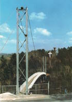
1988: Dunmanu Samba
Luoxuzhen (洛须镇), Sêrxü County (石渠县), Garzê (甘孜藏族自治州) and Dengkexiang (邓柯乡), Jomda County (江达县), Sichuan, China - Jinsha River
| Bridgemeister ID: | 8505 (added 2024-03-23) |
| Year Completed: | 1988 |
| Name: | Dunmanu Samba |
| Also Known As: | 邓玛奴桑巴桥, Luoxu Jinsha River, Dengmanu Samba, |
| Location: | Luoxuzhen (洛须镇), Sêrxü County (石渠县), Garzê (甘孜藏族自治州) and Dengkexiang (邓柯乡), Jomda County (江达县), Sichuan, China |
| Crossing: | Jinsha River |
| Coordinates: | 32.461111 N 97.996222 E |
| Maps: | Acme, GeoHack, Google, OpenStreetMap |
| Use: | Vehicular (one-lane) |
| Status: | Extant (last checked: 2021) |
| Main Cables: | Wire (steel) |
| Suspended Spans: | 1 |
| Main Span: | 1 x 150 meters (492.1 feet) |
External Links:
1988: Exeter Quay
Exeter, Devon, England, United Kingdom
| Bridgemeister ID: | 1104 (added 2004-01-03) |
| Year Completed: | 1988 |
| Name: | Exeter Quay |
| Also Known As: | Cricklepit |
| Location: | Exeter, Devon, England, United Kingdom |
| Coordinates: | 50.71811 N 3.53233 W |
| Maps: | Acme, GeoHack, Google, OpenStreetMap |
| Use: | Footbridge |
| Status: | In use (last checked: 2004) |
| Main Cables: | Wire (steel) |
| Suspended Spans: | 1 |
Notes:
- This is a distinct footbridge from the nearby Trews Weir (New Cricklepit) bridge.
External Links:
Image Sets:

1988: Fatih Sultan Mehmet
Istanbul, Türkiye - Bosporus Strait
| Bridgemeister ID: | 483 (added before 2003) |
| Year Completed: | 1988 |
| Name: | Fatih Sultan Mehmet |
| Also Known As: | Bosporus II |
| Location: | Istanbul, Türkiye |
| Crossing: | Bosporus Strait |
| Coordinates: | 41.091363 N 29.061628 E |
| Maps: | Acme, GeoHack, Google, OpenStreetMap |
| References: | BBR, BDU |
| Use: | Vehicular (major highway) |
| Status: | In use (last checked: 2023) |
| Main Cables: | Wire (steel) |
| Suspended Spans: | 1 |
| Main Span: | 1 x 1,091.2 meters (3,580 feet) |
External Links:
Image Sets:
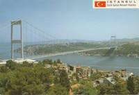
1988: Lago
Seville, Spain
1988: Max-Eyth
Stuttgart-Mühlhausen and Stuttgart-Hofen, Baden-Württemberg, Germany - Neckar River
| Bridgemeister ID: | 577 (added 2002-12-31) |
| Year Completed: | 1988 |
| Name: | Max-Eyth |
| Also Known As: | Neckar River |
| Location: | Stuttgart-Mühlhausen and Stuttgart-Hofen, Baden-Württemberg, Germany |
| Crossing: | Neckar River |
| At or Near Feature: | Max-Eyth-See |
| Coordinates: | 48.834163 N 9.208899 E |
| Maps: | Acme, GeoHack, Google, OpenStreetMap |
| Principals: | Schlaich Bergermann Partner |
| References: | BAR, BBU |
| Use: | Footbridge |
| Status: | In use (last checked: 2019) |
| Main Cables: | Wire (steel) |
| Suspended Spans: | 2 |
| Main Span: | 1 x 114 meters (374 feet) |
| Side Span: | 1 x 14 meters (45.9 feet) |
| Deck width: | 3.16 meters between side rails, 3.67 meters total |
External Links:
Image Sets:

1988: Minami Bisan-Seto
Yoshima Island (与島) and Sakaide (坂出市), Kagawa, Japan - Seto Inland Sea
| Bridgemeister ID: | 485 (added before 2003) |
| Year Completed: | 1988 |
| Name: | Minami Bisan-Seto |
| Also Known As: | 南備讃瀬戸大橋 |
| Location: | Yoshima Island (与島) and Sakaide (坂出市), Kagawa, Japan |
| Crossing: | Seto Inland Sea |
| Coordinates: | 34.364167 N 133.825278 E |
| Maps: | Acme, GeoHack, Google, OpenStreetMap |
| Principals: | Honshu-Shikoku Bridge Authority |
| References: | BAAW, BAR, BBR, BDU |
| Use: | Vehicular (major highway) and Rail |
| Status: | In use (last checked: 2019) |
| Main Cables: | Wire (steel) |
| Suspended Spans: | 3 |
| Main Span: | 1 x 1,100 meters (3,608.9 feet) |
| Side Spans: | 2 x 274 meters (899 feet) |
| Deck width: | 35 meters upper deck, 30 meters lower deck |
Notes:
- Connects to 1987 Kita Bisan-Seto (北備讃瀬戸大橋) - Yoshima Island and Sakaide, Kagawa, Japan.
- Near 1988 Shimotsui-Seto (下津井瀬戸大橋) - Kojima, Okayama and Hitsuishijima (櫃石島), Kagawa, Japan.
- All past and present bridges at this location.
External Links:
Image Sets:


| Bridgemeister ID: | 484 (added before 2003) |
| Year Completed: | 1988 |
| Name: | Ohshima |
| Also Known As: | 伯方・大島大橋 |
| Location: | Hakata Island, Imabari and Imabari (今治市), Ehime, Japan |
| Coordinates: | 34.192724 N 133.072966 E |
| Maps: | Acme, GeoHack, Google, OpenStreetMap |
| Principals: | Honshu-Shikoku Bridge Authority |
| References: | BAAW, BAR |
| Use: | Vehicular (major highway) |
| Status: | In use (last checked: 2019) |
| Main Cables: | Wire (steel) |
| Suspended Spans: | 1 |
| Main Span: | 1 x 560 meters (1,837.3 feet) |
| Deck width: | 23.7 meters |
External Links:
Image Sets:
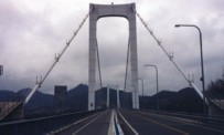
1988: Shimotsui-Seto
Kojima, Okayama and Hitsuishijima (櫃石島), Kagawa, Japan - Seto Inland Sea
| Bridgemeister ID: | 486 (added before 2003) |
| Year Completed: | 1988 |
| Name: | Shimotsui-Seto |
| Also Known As: | 下津井瀬戸大橋 |
| Location: | Kojima, Okayama and Hitsuishijima (櫃石島), Kagawa, Japan |
| Crossing: | Seto Inland Sea |
| Coordinates: | 34.431483 N 133.807833 E |
| Maps: | Acme, GeoHack, Google, OpenStreetMap |
| Principals: | Honshu-Shikoku Bridge Authority |
| References: | AOB, BAAW, BAR, BBR, BDU |
| Use: | Vehicular (major highway) |
| Status: | In use (last checked: 2019) |
| Main Cables: | Wire (steel) |
| Suspended Spans: | 1 |
| Main Span: | 1 x 940 meters (3,084 feet) |
Notes:
- Near 1987 Kita Bisan-Seto (北備讃瀬戸大橋) - Yoshima Island and Sakaide, Kagawa, Japan.
- Near 1988 Minami Bisan-Seto (南備讃瀬戸大橋) - Yoshima Island (与島) and Sakaide (坂出市), Kagawa, Japan.
External Links:
Image Sets:
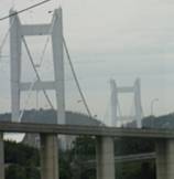
1988: York Swing
York, Western Australia, Australia - Avon River
| Bridgemeister ID: | 1300 (added 2004-04-03) |
| Year Completed: | 1988 |
| Name: | York Swing |
| Location: | York, Western Australia, Australia |
| Crossing: | Avon River |
| Coordinates: | 31.8868 S 116.770717 E |
| Maps: | Acme, GeoHack, Google, OpenStreetMap |
| Use: | Footbridge |
| Status: | In use (last checked: 2007) |
| Main Cables: | Wire (steel) |
Notes:
- Replaced a 1906 structure that was likely a suspension bridge.
1989: Amechuru
Aranthodu (ಅರಂತೋಡು) and Peraje (ಆಲಟ್ಟಿ), Karnataka, India - Payaswini River
| Bridgemeister ID: | 7690 (added 2023-07-04) |
| Year Completed: | 1989 |
| Name: | Amechuru |
| Location: | Aranthodu (ಅರಂತೋಡು) and Peraje (ಆಲಟ್ಟಿ), Karnataka, India |
| Crossing: | Payaswini River |
| Coordinates: | 12.512009 N 75.458217 E |
| Maps: | Acme, GeoHack, Google, OpenStreetMap |
| Principals: | Girish Bharadwaj |
| Use: | Footbridge |
| Status: | In use (last checked: 2023) |
| Main Cables: | Wire (steel) |
External Links:
- Weeks after Morbi bridge collapse, Peraje hanging footbridge in Karnataka awaits repairs- The New Indian Express. November 2022 article calling for repairs for the bridge in light of the recent Morbi bridge collapse.
1989: Backwater
East Bairnsdale, Victoria, Australia - Clifton Creek
| Bridgemeister ID: | 9141 (added 2025-04-06) |
| Year Completed: | 1989 |
| Name: | Backwater |
| Location: | East Bairnsdale, Victoria, Australia |
| Crossing: | Clifton Creek |
| At or Near Feature: | Howitt Park |
| Coordinates: | 37.824250 S 147.640306 E |
| Maps: | Acme, GeoHack, Google, OpenStreetMap |
| Principals: | 38 Field Squadron, 7th Field Engineer Regiment |
| Use: | Footbridge |
| Status: | In use (last checked: 2024) |
| Main Cables: | Wire (steel) |
| Main Span: | 1 |
Notes:
- 1990, April: The bridge is damaged by a flood.
- 1991, February: The 38 Field Squadron rebuilds the bridge.
1989: Baji
Deqin County, Yunnan, China - Lancang River
| Bridgemeister ID: | 1239 (added 2004-02-15) |
| Year Completed: | 1989 |
| Name: | Baji |
| Location: | Deqin County, Yunnan, China |
| Crossing: | Lancang River |
| References: | BYU |
| Use: | Footbridge |
| Main Cables: | Wire (steel) |
| Suspended Spans: | 1 |
| Main Span: | 1 x 74 meters (242.8 feet) |
1989: Kochenhof
Stuttgart, Baden-Württemberg, Germany - Am Kochenhof
| Bridgemeister ID: | 923 (added 2003-10-18) |
| Year Completed: | 1989 |
| Name: | Kochenhof |
| Location: | Stuttgart, Baden-Württemberg, Germany |
| Crossing: | Am Kochenhof |
| Coordinates: | 48.798917 N 9.17 E |
| Maps: | Acme, GeoHack, Google, OpenStreetMap |
| Principals: | Schlaich Bergermann Partner |
| Use: | Footbridge |
| Status: | In use (last checked: 2019) |
| Main Cables: | Wire (steel) |
| Suspended Spans: | 1 |
| Main Span: | 1 x 42.5 meters (139.4 feet) |
| Deck width: | 3 meters |
Notes:
- Eckhard Bernstorff notes the bridge has "only one Pylon at one end of span, but [it is a] real suspension bridge, gravity anchored at both ends of span."
External Links:
Image Sets:
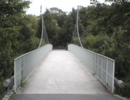
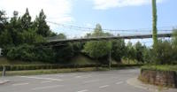
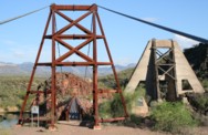
1989: Sheep
Sheep Crossing (Cave Creek vicinity), Arizona, USA - Verde River
| Bridgemeister ID: | 235 (added before 2003) |
| Year Completed: | 1989 |
| Name: | Sheep |
| Location: | Sheep Crossing (Cave Creek vicinity), Arizona, USA |
| Crossing: | Verde River |
| Coordinates: | 34.077578 N 111.707317 W |
| Maps: | Acme, GeoHack, Google, OpenStreetMap |
| Use: | Footbridge and Stock |
| Status: | In use (last checked: 2007) |
| Main Cables: | Wire (steel) |
| Suspended Spans: | 1 |
| Main Span: | 1 x 152.4 meters (500 feet) estimated |
Notes:
- Replaced 1943 Sheep (Red Point Sheep, Verde River Sheep) - Sheep Crossing (Cave Creek vicinity), Arizona, USA.
- All past and present bridges at this location.
Image Sets:
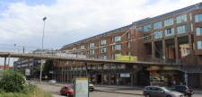
1989: Wullesteg
Stuttgart, Baden-Württemberg, Germany - B14/Willy-Brandt-Straße
| Bridgemeister ID: | 1627 (added 2005-02-27) |
| Year Completed: | 1989 |
| Name: | Wullesteg |
| Location: | Stuttgart, Baden-Württemberg, Germany |
| Crossing: | B14/Willy-Brandt-Straße |
| Coordinates: | 48.783971 N 9.188608 E |
| Maps: | Acme, GeoHack, Google, OpenStreetMap |
| Principals: | Schlaich Bergermann Partner |
| Use: | Footbridge |
| Status: | In use (last checked: 2018) |
| Main Cables: | Wire (steel) |
| Suspended Spans: | 1 |
| Main Span: | 1 x 35 meters (114.8 feet) |
| Deck width: | varies 3.4-11.5 meters |
| Characteristics: | Self-anchored |
Notes:
- Eckhard Bernstorff notes: "Asymmetric self-anchored bridge. Horizontal rest force and vertical force at highest point of cable conducted to walls of hotel (tower function)."
External Links:
Image Sets:

24 de Julio
Corral Quemado, Utcubamba, Amazonas and Jaén, Cajamarca, Peru - Rio Marañón
| Bridgemeister ID: | 7473 (added 2022-12-25) |
| Name: | 24 de Julio |
| Location: | Corral Quemado, Utcubamba, Amazonas and Jaén, Cajamarca, Peru |
| Crossing: | Rio Marañón |
| Coordinates: | 5.754081 S 78.692978 W |
| Maps: | Acme, GeoHack, Google, OpenStreetMap |
| Use: | Vehicular (two-lane) |
| Status: | In use (last checked: 2021) |
| Main Cables: | Wire (steel) |
| Suspended Spans: | 1 |
| Main Span: | 1 x 156.1 meters (512 feet) estimated |
Notes:
- Completed at some point in the 1980s, this is the newer of two suspension bridges present at this location in the 2020s.
- Replaced 1956 24 de Julio - Corral Quemado, Utcubamba, Amazonas and Jaén, Cajamarca, Peru.
- All past and present bridges at this location.
External Links:
- Facebook. Image of the two suspension bridges at this location, posted August 9, 2017.
- INFRAESTRUCTURA PERUANA: Puente 24 de Julio (Corral Quemado). Blog post about the two suspension bridges at this location, posted April 14, 2014.
Arung Sanghu
Dhading Besi (धादिङ बेसी), Nilkantha (निलकण्ठ), Nepal - Arung Khola
| Bridgemeister ID: | 8754 (added 2024-07-06) |
| Name: | Arung Sanghu |
| Location: | Dhading Besi (धादिङ बेसी), Nilkantha (निलकण्ठ), Nepal |
| Crossing: | Arung Khola |
| Coordinates: | 27.909217 N 84.893156 E |
| Maps: | Acme, GeoHack, Google, OpenStreetMap |
| Use: | Footbridge |
| Status: | Extant (last checked: 2020) |
| Main Cables: | Wire (steel) |
| Suspended Spans: | 1 |
| Main Span: | 1 x 43 meters (141.1 feet) |
Notes:
- Likely completed in 1983 or 1984.
External Links:
- Google Maps. Image with the bridge visible in the foreground. A truck appears to be parked where a section of the bridge deck is missing. Dated September 2020.
Bajhgara Jhopu
Dangsing (दांगसिङ्), Kaski and Bhuktangle (भुक्तान्गले), Parbat, Nepal - Bhurungdi Khola
| Bridgemeister ID: | 8755 (added 2024-07-07) |
| Name: | Bajhgara Jhopu |
| Location: | Dangsing (दांगसिङ्), Kaski and Bhuktangle (भुक्तान्गले), Parbat, Nepal |
| Crossing: | Bhurungdi Khola |
| Coordinates: | 28.326760 N 83.748458 E |
| Maps: | Acme, GeoHack, Google, OpenStreetMap |
| Use: | Footbridge |
| Status: | Extant (last checked: 2024) |
| Main Span: | 1 x 59 meters (193.6 feet) |
Notes:
- Likely completed in 1982 or 1983.
External Links:
- Google Maps. Image with bridge visible in the background. Dated February 2015.
Hariyapani
Khadang, Lhan (ल्ह्ना), Nepal - Thuli Bheri
| Bridgemeister ID: | 8158 (added 2024-02-03) |
| Name: | Hariyapani |
| Location: | Khadang, Lhan (ल्ह्ना), Nepal |
| Crossing: | Thuli Bheri |
| Coordinates: | 28.990581 N 82.664137 E |
| Maps: | Acme, GeoHack, Google, OpenStreetMap |
| Use: | Footbridge |
| Status: | In use (last checked: 2020) |
| Main Cables: | Wire (steel) |
| Main Span: | 1 x 44.9 meters (147.3 feet) |
Notes:
- Completed at some point around 1988-1989.
External Links:
- The Himalayan - Crossing Bheri River by 'tuin'. Image showing a vehicle crossing the the river via "tuin" (a cable and pulley system) between a drooping suspension bridge and the suspended deck bridge tracked by this record. Posted January 4, 2020.
Manthali Ghat
Manthali (मन्थली) and Bhatauli (भटौली), Nepal - Tama Koshi
| Bridgemeister ID: | 8253 (added 2024-02-08) |
| Name: | Manthali Ghat |
| Location: | Manthali (मन्थली) and Bhatauli (भटौली), Nepal |
| Crossing: | Tama Koshi |
| Coordinates: | 27.383953 N 86.045973 E |
| Maps: | Acme, GeoHack, Google, OpenStreetMap |
| Use: | Footbridge |
| Status: | In use (last checked: 2018) |
| Main Cables: | Wire (steel) |
| Main Span: | 1 x 124.6 meters (408.8 feet) |
Notes:
- Completed at some point in 1983-1984.
External Links:
- Facebook. Image of man posing on the bridge. Posted January 15, 2015.
Sinwa
Sinwa, Limkhim (लिमखिम) and Sawadin (सवादिन), Nepal - Tamor River
| Bridgemeister ID: | 8156 (added 2024-02-03) |
| Name: | Sinwa |
| Location: | Sinwa, Limkhim (लिमखिम) and Sawadin (सवादिन), Nepal |
| Crossing: | Tamor River |
| Coordinates: | 27.441229 N 87.700855 E |
| Maps: | Acme, GeoHack, Google, OpenStreetMap |
| Use: | Footbridge |
| Status: | Extant |
| Main Span: | 1 x 10⁸ meters (354.3 feet) |
Notes:
- Completed at some point around 1983-1984.
- Replaced Sinwa - Sinwa, Limkhim (लिमखिम) and Sawadin (सवादिन), Nepal.
- All past and present bridges at this location.
Do you have any information or photos for these bridges that you would like to share? Please email david.denenberg@bridgemeister.com.
Mail | Facebook | X (Twitter) | Bluesky