Suspension Bridges Completed 1880-1889
This is a list of all 60 bridges from the suspension bridge inventory completed in the decade 1880-1889. Wherever you see a Bridgemeister ID number click it to isolate the bridge on its own page.
Related Lists:
1880: Birkhall
Birkhall, Ballater, Scotland, United Kingdom - River Muick
| Bridgemeister ID: | 2193 (added 2007-01-26) |
| Year Completed: | 1880 |
| Name: | Birkhall |
| Location: | Birkhall, Ballater, Scotland, United Kingdom |
| Crossing: | River Muick |
| Coordinates: | 57.028215 N 3.072693 W |
| Maps: | Acme, GeoHack, Google, OpenStreetMap |
| Principals: | Harper & Co. |
| References: | HARPER |
| Use: | Footbridge |
| Status: | Destroyed, December, 2015 |
| Main Cables: | Wire |
| Suspended Spans: | 1 |
| Main Span: | 1 x 18.3 meters (60 feet) |
Notes:
- 2015, December: Destroyed by flooding during Storm Frank.
- Replaced by Birkhall - Birkhall, Ballater, Scotland, United Kingdom.
- All past and present bridges at this location.
External Links:
1880: Burnhervie
Burnhervie, Inverurie vicinity, Scotland, United Kingdom - River Don
| Bridgemeister ID: | 2174 (added 2007-01-13) |
| Year Completed: | 1880 |
| Name: | Burnhervie |
| Location: | Burnhervie, Inverurie vicinity, Scotland, United Kingdom |
| Crossing: | River Don |
| Coordinates: | 57.261024 N 2.440063 W |
| Maps: | Acme, GeoHack, Google, OpenStreetMap |
| Principals: | Harper & Co. |
| References: | HARPER |
| Use: | Footbridge |
| Status: | Collapsed, 1979 |
| Main Cables: | Wire |
| Main Span: | 1 x 30.5 meters (100 feet) |
Notes:
- Completed c. 1880. Douglas Harper writes: "The original bridge was built by Harper & Co, Aberdeen, around 1880 and its timber pylons were replaced with cast iron ones. In 1979 when overloaded during a raft race a bank stay cable failed and a major rebuild was undertaken by the local authority. This version was similar to its predecessor but was repalced in 2005 by a cable stayed bridge."
- Replaced by 1980 Shakin - Burnhervie, Inverurie vicinity, Scotland, United Kingdom.
- All past and present bridges at this location.
External Links:
Image Sets:
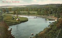
1880: Daniel O'Connell
Ophir, New Zealand - Manuherikia River
| Bridgemeister ID: | 666 (added 2003-03-08) |
| Year Completed: | 1880 |
| Name: | Daniel O'Connell |
| Location: | Ophir, New Zealand |
| Crossing: | Manuherikia River |
| Coordinates: | 45.110783 S 169.590268 E |
| Maps: | Acme, GeoHack, Google, OpenStreetMap |
| Principals: | L.D. Macgeorge, J.S. Derby, R. Edgar |
| References: | GAP |
| Use: | Vehicular (one-lane) |
| Status: | In use (last checked: 2018) |
| Main Cables: | Wire |
| Suspended Spans: | 1 |
| Main Span: | 1 x 65.5 meters (214.9 feet) |
External Links:
1880: Fitzroy
Rockhampton, Queensland, Australia - Fitzroy River
| Bridgemeister ID: | 416 (added before 2003) |
| Year Completed: | 1880 |
| Name: | Fitzroy |
| Location: | Rockhampton, Queensland, Australia |
| Crossing: | Fitzroy River |
| Principals: | F. J. Byerley, Owen Jones |
| References: | AAJ, STC |
| Use: | Vehicular |
| Status: | Demolished, 1956 |
| Main Cables: | Chain (iron) |
| Suspended Spans: | 6 |
| Main Spans: | 4 x 70.7 meters (232 feet) |
| Side Spans: | 2 x 26.5 meters (86.9 feet) |
| Deck width: | 21 feet |
Notes:
- Completed in late 1880. Officially opened January 1, 1881. Damaged during flood, 1890. Repaired, 1891.
External Links:
Image Sets:

1880: Kawarau Gorge
Kawarau Gorge, Central Otago, New Zealand - Kawarau River Gorge
| Bridgemeister ID: | 667 (added 2003-03-08) |
| Year Completed: | 1880 |
| Name: | Kawarau Gorge |
| Location: | Kawarau Gorge, Central Otago, New Zealand |
| Crossing: | Kawarau River Gorge |
| Coordinates: | 45.008882 S 168.899938 E |
| Maps: | Acme, GeoHack, Google, OpenStreetMap |
| Principals: | H.P. Higginson, A.R.W Fulton, W.C. Edwards |
| References: | AAJ, GAP |
| Use: | Vehicular (one-lane) |
| Status: | Restricted to foot traffic (last checked: 2017) |
| Main Cables: | Wire (iron) |
| Suspended Spans: | 1 |
| Main Span: | 1 x 91.4 meters (300 feet) |
Notes:
- Appears to now be used solely as a bungee-jumping platform.
External Links:
Image Sets:

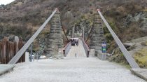
1880: Rosentalbrücke
Braunschweig, Niedersachsen, Germany - Westlicher Umflutgraben, Oker River
| Bridgemeister ID: | 1409 (added 2004-07-04) |
| Year Completed: | 1880 |
| Name: | Rosentalbrücke |
| Location: | Braunschweig, Niedersachsen, Germany |
| Crossing: | Westlicher Umflutgraben, Oker River |
| At or Near Feature: | Inselwall |
| Coordinates: | 52.2686 N 10.5143 E |
| Maps: | Acme, GeoHack, Google, OpenStreetMap |
| Use: | Footbridge |
| Status: | In use (last checked: 2006) |
| Suspended Spans: | 1 |
| Main Span: | 1 x 36 meters (118.1 feet) |
| Deck width: | 1.7 meters |
Notes:
- Eckhard Bernstorff notes: "Suspended with connections from 'chains' to towers, gravity anchored in the ground (backstays), but 'hangers' not adjustable (like truss)."
Image Sets:
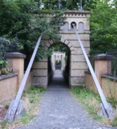
1880: Suspension Pier
Seaview, Isle of Wight, England, United Kingdom
| Bridgemeister ID: | 2409 (added 2007-12-24) |
| Year Completed: | 1880 |
| Name: | Suspension Pier |
| Location: | Seaview, Isle of Wight, England, United Kingdom |
| References: | AAJ |
| Use: | Footbridge |
| Status: | Destroyed, December, 1950 |
| Main Spans: | 3 |
1881: Clyde
Clyde, New Zealand - Clutha River
| Bridgemeister ID: | 663 (added 2003-03-08) |
| Year Completed: | 1881 |
| Name: | Clyde |
| Location: | Clyde, New Zealand |
| Crossing: | Clutha River |
| Coordinates: | 45.190387 S 169.315977 E |
| Maps: | Acme, GeoHack, Google, OpenStreetMap |
| Principals: | William Grant, McKellar |
| References: | GAP |
| Use: | Vehicular (one-lane) |
| Status: | Replaced, 1936 |
| Main Cables: | Wire |
| Suspended Spans: | 3 |
| Main Span: | 1 |
| Side Spans: | 2 |
Notes:
- Replaced by a large single-span truss bridge that sits on the suspension bridge piers.
- Replaced 1875 (suspension bridge) - Clyde, New Zealand.
- All past and present bridges at this location.
Image Sets:
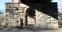
1881: Cromdale
Cromdale, Scotland, United Kingdom - River Spey
| Bridgemeister ID: | 2194 (added 2007-01-26) |
| Year Completed: | 1881 |
| Name: | Cromdale |
| Location: | Cromdale, Scotland, United Kingdom |
| Crossing: | River Spey |
| Coordinates: | 57.341944 N 3.553111 W |
| Maps: | Acme, GeoHack, Google, OpenStreetMap |
| Principals: | Harper & Co. |
| References: | HARPER |
| Use: | Footbridge |
| Status: | Collapsed, 1892 |
| Main Cables: | Wire |
| Main Span: | 1 x 59.4 meters (195 feet) |
Notes:
- Replaced by 1894 Cromdale - Cromdale, Scotland, United Kingdom.
- All past and present bridges at this location.
Image Sets:

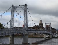
1881: Greig Street
Inverness, Scotland, United Kingdom - River Ness
| Bridgemeister ID: | 538 (added before 2003) |
| Year Completed: | 1881 |
| Name: | Greig Street |
| Also Known As: | Wobbly |
| Location: | Inverness, Scotland, United Kingdom |
| Crossing: | River Ness |
| Coordinates: | 57.479111 N 4.229796 W |
| Maps: | Acme, GeoHack, Google, OpenStreetMap |
| References: | HBR |
| Use: | Footbridge |
| Status: | In use (last checked: 2021) |
| Main Cables: | Wire |
| Suspended Spans: | 3 |
| Main Span: | 1 |
| Side Spans: | 2 |
Notes:
- Companion to 1879 Infirmary - Inverness, Scotland, United Kingdom.
- Near 1855 Ness - Inverness, Scotland, United Kingdom. In some photos, the two bridges are visible within a few hundred yards of each other.
External Links:
Image Sets:

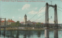
1881: Kettenbrücke
Leipzig, Germany
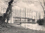
1881: Vicq-sur-Gartempe
Vicq-sur-Gartempe, Vienne, France - Gartempe River
| Bridgemeister ID: | 3996 (added 2020-03-27) |
| Year Completed: | 1881 |
| Name: | Vicq-sur-Gartempe |
| Location: | Vicq-sur-Gartempe, Vienne, France |
| Crossing: | Gartempe River |
| Use: | Vehicular |
| Status: | Removed |
| Main Cables: | Wire |
Notes:
- Replaced 1840 Vicq-sur-Gartempe - Vicq-sur-Gartempe and Champagne, Vienne, France.
- Replaced by 1931 Vicq-sur-Gartempe - Vicq-sur-Gartempe, Vienne, France.
- All past and present bridges at this location.
Image Sets:
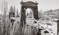
1882: Alexandra
Alexandra, New Zealand - Clutha River
| Bridgemeister ID: | 668 (added 2003-03-08) |
| Year Completed: | 1882 |
| Name: | Alexandra |
| Location: | Alexandra, New Zealand |
| Crossing: | Clutha River |
| Coordinates: | 45.258245 S 169.391270 E |
| Maps: | Acme, GeoHack, Google, OpenStreetMap |
| Principals: | L.D. Macgeorge, Jeremiah Drummey, Robert Hay |
| References: | GAP |
| Use: | Vehicular (one-lane) |
| Status: | Only towers remain (last checked: 2017) |
| Main Cables: | Wire |
| Main Span: | 1 x 79.9 meters (262.1 feet) |
Notes:
- Bypassed, 1958, at which point the bridge deck and cables were removed leaving only the towers.
- Near 1879 Shaky (Manuherikia) - Alexandra, New Zealand.
External Links:
Image Sets:

1882: Fitch's
Elmira, New York, USA - Chemung River
| Bridgemeister ID: | 88 (added before 2003) |
| Year Completed: | 1882 |
| Name: | Fitch's |
| Also Known As: | Fitches, Fisches, Lumbermens |
| Location: | Elmira, New York, USA |
| Crossing: | Chemung River |
| Coordinates: | 42.082409 N 76.866470 W |
| Maps: | Acme, GeoHack, Google, OpenStreetMap |
| Use: | Vehicular (one-lane) |
| Status: | Removed |
| Main Cables: | Wire |
| Main Span: | 1 |
External Links:
- Fitch Family History and Genealogy. Although this bridge is known by a variety of names (and misspellings), this Fitch family site states Daniel Hollenbeck Fitch contributed $10,000 to the construction of the bridge and refer to it as "Fitch's Bridge".
Image Sets:

1882: Long Creek
Melvern vicinity, Kansas, USA - Long Creek
| Bridgemeister ID: | 2062 (added 2006-06-03) |
| Year Completed: | 1882 |
| Name: | Long Creek |
| Location: | Melvern vicinity, Kansas, USA |
| Crossing: | Long Creek |
| At or Near Feature: | Francis Crossing |
| Principals: | Wilden Bridge Company |
| Use: | Vehicular (one-lane) |
| Status: | Removed, c. 1970 |
Notes:
- In the June 18, 1970 edition of the Daily Tribune newspaper (Great Bend, Kansas) an article titled "Last Suspension Bridge to Fall" describes this bridge: "The suspension bridge appears to be going the way of the old covered bridge in Kansas. At least, the particular type of suspension span represented by Osage County Bridge No. 18 may be gone when this structure is replaced within two years. L.D. Pierce, Osage County engineer, said he believes this 'homemade' suspension bridge probably is the last of its kind in this state. He said it was built in 1882 from a pencil-drawn plan that probably was prepared by asurveyor or a millwright. He said it was constructed with materials that could be found in any hardware store and lumber yard. For example, cables are No. 9 gauge wire, bound together. Pierce said at one time there were five or six of these bridges in Osage County. The 100-foot span over Long Creek has been closed to traffic since 1967."
- See Long Creek - Melvern, Kansas, USA.
1883: Brooklyn
New York and Brooklyn, New York, USA - East River
| Bridgemeister ID: | 89 (added before 2003) |
| Year Completed: | 1883 |
| Name: | Brooklyn |
| Also Known As: | Great East River |
| Location: | New York and Brooklyn, New York, USA |
| Crossing: | East River |
| Coordinates: | 40.706 N 73.99667 W |
| Maps: | Acme, GeoHack, Google, OpenStreetMap |
| Principals: | John A. Roebling, Washington A. Roebling |
| References: | AAJ, BAAW, BBR, BBTS, BC3, BFL, BLD, BMA, BOB, BOU, BPL, COB, CTW, GB, GBD, HBE, LAB, LACE, NG198305, ONF, PTS2, SJR |
| Use: | Rail (light rail) and Vehicular (major highway), with walkway |
| Status: | In use (last checked: 2022) |
| Main Cables: | Wire (steel) |
| Suspended Spans: | 3 |
| Main Span: | 1 x 486.3 meters (1,595.5 feet) |
| Side Spans: | 2 x 283.5 meters (930 feet) |
| Deck width: | 85 feet |
Notes:
- Became longest suspension bridge by eclipsing 1869 Clifton (Upper, Niagara-Clifton, Falls View, First Falls View) - Niagara Falls, New York, USA and Niagara Falls, Ontario, Canada.
- Eclipsed by new longest suspension bridge 1903 Williamsburg - New York and Brooklyn, New York, USA.
- Next to 1909 Manhattan - New York and Brooklyn, New York, USA.
- Near 1903 Williamsburg - New York and Brooklyn, New York, USA.
- All past and present bridges at this location.
External Links:
Image Sets:


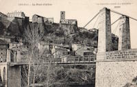
1883: Chilhac
Chilhac, Haute-Loire, France - Allier River
| Bridgemeister ID: | 1131 (added 2004-01-15) |
| Year Completed: | 1883 |
| Name: | Chilhac |
| Location: | Chilhac, Haute-Loire, France |
| Crossing: | Allier River |
| Coordinates: | 45.154731 N 3.437122 E |
| Maps: | Acme, GeoHack, Google, OpenStreetMap |
| Use: | Vehicular (one-lane) |
| Status: | In use (last checked: 2019) |
| Main Cables: | Wire |
| Suspended Spans: | 1 |
External Links:
Image Sets:
1883: Swinging
Skowhegan, Maine, USA - Kennebec River
| Bridgemeister ID: | 1575 (added 2004-12-19) |
| Year Completed: | 1883 |
| Name: | Swinging |
| Location: | Skowhegan, Maine, USA |
| Crossing: | Kennebec River |
| References: | KJ20030410 |
| Use: | Footbridge |
| Status: | Collapsed, 1888 |
| Main Cables: | Wire (steel) |
Notes:
- KJ20030410: "[The] span collapsed in 1888: it turned out the steel cables were not all steel, they had a core of hemp, according to the history 'Skowhegan on the Kennebec'."
- Replaced by 1888 Swinging - Skowhegan, Maine, USA.
- All past and present bridges at this location.
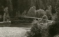
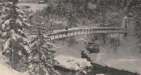
1883: Turrian
Château-d'Oex, Switzerland - Sarine River
| Bridgemeister ID: | 2878 (added 2019-09-13) |
| Year Completed: | 1883 |
| Name: | Turrian |
| Location: | Château-d'Oex, Switzerland |
| Crossing: | Sarine River |
| Coordinates: | 46.468703 N 7.135172 E |
| Maps: | Acme, GeoHack, Google, OpenStreetMap |
| Use: | Footbridge |
| Status: | In use (last checked: 2019) |
| Main Cables: | Wire (steel) |
| Suspended Spans: | 1 |
External Links:
Image Sets:
1883: Yenne
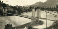
Yenne, Savoie and Ain, France - Rhône River
| Bridgemeister ID: | 1968 (added 2005-11-26) |
| Year Completed: | 1883 |
| Name: | Yenne |
| Location: | Yenne, Savoie and Ain, France |
| Crossing: | Rhône River |
| Coordinates: | 45.706294 N 5.751086 E |
| Maps: | Acme, GeoHack, Google, OpenStreetMap |
| References: | AGP |
| Use: | Vehicular (one-lane) |
| Status: | Destroyed, 1940 |
| Main Cables: | Wire |
| Suspended Spans: | 1 |
Notes:
- 1940: Destroyed during WWII.
- Later at same location 1951 Yenne - Yenne, Savoie and Ain, France.
- All past and present bridges at this location.
Image Sets:
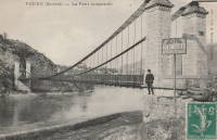
1884: Lamothe
Lamothe and Brioude, Haute-Loire, France - Allier River
| Bridgemeister ID: | 1764 (added 2005-04-22) |
| Year Completed: | 1884 |
| Name: | Lamothe |
| Location: | Lamothe and Brioude, Haute-Loire, France |
| Crossing: | Allier River |
| Coordinates: | 45.302968 N 3.406201 E |
| Maps: | Acme, GeoHack, Google, OpenStreetMap |
| References: | PTS2 |
| Use: | Vehicular |
| Status: | Only towers remain, since 1977 (last checked: 2019) |
| Main Cables: | Wire |
| Suspended Spans: | 1 |
| Main Span: | 1 |
Notes:
- Next to 1834 Lamothe - Lamothe and Brioude, Haute-Loire, France. In 1866, a flood caused a major change in the course of the Allier River such that the main channel no longer flowed under the older bridge. The newer bridge crossed the main channel of the Allier just slightly east of the older bridge.
- All past and present bridges at this location.
External Links:
Image Sets:

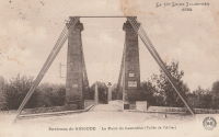
1884: McKeesport-Reynoldton
McKeesport, Pennsylvania, USA - Youghiogheny River
| Bridgemeister ID: | 90 (added before 2003) |
| Year Completed: | 1884 |
| Name: | McKeesport-Reynoldton |
| Also Known As: | Third Avenue |
| Location: | McKeesport, Pennsylvania, USA |
| Crossing: | Youghiogheny River |
| Coordinates: | 40.352359 N 79.870561 W |
| Maps: | Acme, GeoHack, Google, OpenStreetMap |
| Principals: | McKeesport and Reynoldton Bridge Co. |
| References: | AAJ, HAERPA461 |
| Use: | Rail (streetcar) and Vehicular |
| Status: | Dismantled, 1961 |
| Main Cables: | Wire (steel) |
| Suspended Spans: | 3 |
| Main Span: | 1 x 97.5 meters (320 feet) |
| Side Spans: | 2 x 48.8 meters (160 feet) |
Notes:
- 1896: Reconstructed by Hermann Laub
1884: North Side
Pittsburgh, Pennsylvania, USA - Allegheny River
| Bridgemeister ID: | 91 (added before 2003) |
| Year Completed: | 1884 |
| Name: | North Side |
| Also Known As: | Seventh Street |
| Location: | Pittsburgh, Pennsylvania, USA |
| Crossing: | Allegheny River |
| Coordinates: | 40.445972 N 80.001361 W |
| Maps: | Acme, GeoHack, Google, OpenStreetMap |
| Principals: | Gustav Lindenthal |
| References: | AAJ, BPL, HBE, PBR, PTS2 |
| Use: | Vehicular |
| Status: | Removed, 1924 |
| Main Cables: | Eyebar |
| Suspended Spans: | 4 |
| Main Spans: | 2 x 97.5 meters (320 feet) |
| Side Spans: | 2 x 50.3 meters (165 feet) |
| Deck width: | 42 feet |
Notes:
- Next to 1860 Allegheny River (Sixth Street, St. Clair) - Pittsburgh, Pennsylvania, USA.
- Replaced by 1926 Andy Warhol (Seventh Street) - Pittsburgh, Pennsylvania, USA.
- All past and present bridges at this location.
External Links:
1884: Real
Girardot, Colombia - Magdalena River
| Bridgemeister ID: | 3606 (added 2019-12-31) |
| Year Completed: | 1884 |
| Name: | Real |
| Also Known As: | Royal |
| Location: | Girardot, Colombia |
| Crossing: | Magdalena River |
| Coordinates: | 4.288316 N 74.808793 W |
| Maps: | Acme, GeoHack, Google, OpenStreetMap |
| Use: | Vehicular, with walkway |
| Status: | Collapsed |
| Main Cables: | Wire |
Notes:
- Coordinates provided are for the 1950 replacement bridge which is assumed to be the approximate location of the earlier bridge.
- Replaced by 1950 Ospina Perez - Girardot, Colombia.
- All past and present bridges at this location.
Image Sets:

1884: Spring Street
Charleston, West Virginia, USA - Elk River
| Bridgemeister ID: | 1427 (added 2004-07-24) |
| Year Completed: | 1884 |
| Name: | Spring Street |
| Also Known As: | Virginia Street |
| Location: | Charleston, West Virginia, USA |
| Crossing: | Elk River |
| Coordinates: | 38.358306 N 81.627444 W |
| Maps: | Acme, GeoHack, Google, OpenStreetMap |
| References: | AAJ, HBE, PTS2 |
| Use: | Vehicular and Rail (streetcar) |
| Status: | Removed |
| Main Cables: | Wire |
| Main Span: | 1 x 83.2 meters (273 feet) |
Notes:
- Originally crossed the Elk River at Virginia Street. The bridge was dismantled and erected at Sprint Street a bit. The 1884 year of completion may represent the relocation to Spring Street and not the original construction at Virginia Street.
- AAJ: Repaired by William Hildenbrand a few years after completion.
- Near 1852 Charleston (Lovell Street) - Charleston, West Virginia, USA.
External Links:
- Spring Street Bridge - mywvhome.com. Images and history of the bridge.
1884: Tonnay-Charente
Tonnay-Charente, Charente-Maritime, France - Charente River
| Bridgemeister ID: | 7337 (added 2022-09-04) |
| Year Completed: | 1884 |
| Name: | Tonnay-Charente |
| Location: | Tonnay-Charente, Charente-Maritime, France |
| Crossing: | Charente River |
| Coordinates: | 45.940048 N 0.886059 W |
| Maps: | Acme, GeoHack, Google, OpenStreetMap |
| Use: | Vehicular |
| Status: | Replaced, 1934 |
| Main Cables: | Wire |
| Suspended Spans: | 3 |
| Main Span: | 1 x 90 meters (295.3 feet) |
| Side Spans: | 2 |
Notes:
- Replaced 1842 Tonnay-Charente - Tonnay-Charente, Charente-Maritime, France.
- Replaced by 1934 Tonnay-Charente - Tonnay-Charente, Charente-Maritime, France.
- All past and present bridges at this location.
External Links:
Image Sets:

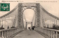
1885: Abergeldie Castle
Balmoral vicinity, Scotland, United Kingdom - River Dee
| Bridgemeister ID: | 1705 (added 2005-03-29) |
| Year Completed: | 1885 |
| Name: | Abergeldie Castle |
| Location: | Balmoral vicinity, Scotland, United Kingdom |
| Crossing: | River Dee |
| Coordinates: | 57.043806 N 3.176197 W |
| Maps: | Acme, GeoHack, Google, OpenStreetMap |
| Principals: | Blaikie Brothers |
| References: | AAJ, HBR |
| Use: | Footbridge |
| Status: | Derelict (last checked: 2016) |
| Main Cables: | Wire |
| Suspended Spans: | 1 |
Notes:
- William Craig describes the bridge, "A wood and angle iron deck supported from two pairs of wire cables and rod suspenders. The railings are of light woven wire. Pylons with ornamental heads are of lattice gider construction on concrete bases five miles west of Ballater, Scotland."
- Was already derelict before December 2015 flooding (Storm Frank) that severely damaged several River Dee bridges. Dave Cooper writes in early 2016: "The bridge's southern tower and its base are gone. The river bank has eroded back to within feet of the grade one listed Abergeldie Castle. Seat of Baron Abergeldie."
External Links:
Image Sets:


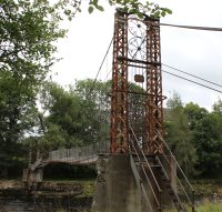


1885: Argenbrücke Achberg
Flunau, Achberg vicinity and Blumegg, Baden-Württemberg, Germany - Argen River
| Bridgemeister ID: | 2242 (added 2007-03-28) |
| Year Completed: | 1885 |
| Name: | Argenbrücke Achberg |
| Location: | Flunau, Achberg vicinity and Blumegg, Baden-Württemberg, Germany |
| Crossing: | Argen River |
| Coordinates: | 47.632307 N 9.710757 E |
| Maps: | Acme, GeoHack, Google, OpenStreetMap |
| Use: | Footbridge |
| Status: | In use (last checked: 2019) |
| Main Cables: | Wire |
| Suspended Spans: | 1 |
| Main Span: | 1 x 48.6 meters (159.4 feet) |
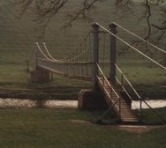
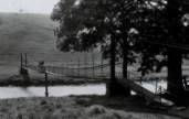
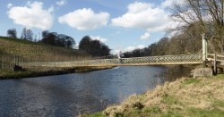
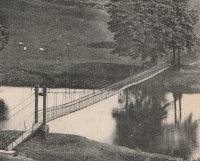
1885: Hebden
Hebden, England, United Kingdom - River Wharfe
| Bridgemeister ID: | 1340 (added 2004-05-02) |
| Year Completed: | 1885 |
| Name: | Hebden |
| Location: | Hebden, England, United Kingdom |
| Crossing: | River Wharfe |
| Coordinates: | 54.057126 N 1.962584 W |
| Maps: | Acme, GeoHack, Google, OpenStreetMap |
| Principals: | William Bell |
| Use: | Footbridge |
| Status: | In use (last checked: 2014) |
| Main Cables: | Wire |
| Suspended Spans: | 1 |
Notes:
- Refurbished, 1989.
- John Gardner writes that William Bell was the village blacksmith and that the bridge once had an unusual mid-span support pillar. John writes: "It is not known when [the pillar] was dismantled, but the bottom section (you can see the dividing flange in the linked picture) can still be seen in normal water conditions."
- John Gardner later added: "[the bridge] was badly damaged by floods on December 14th 1936. It was reconstructed with the span a little higher, which was when the supporting pillar was removed."
Image Sets:
1885: Hope River Stock
Glynn Wye, North Canterbury, New Zealand - Hope River
| Bridgemeister ID: | 670 (added 2003-03-08) |
| Year Completed: | 1885 |
| Name: | Hope River Stock |
| Location: | Glynn Wye, North Canterbury, New Zealand |
| Crossing: | Hope River |
| Coordinates: | 42.588804 S 172.510846 E |
| Maps: | Acme, GeoHack, Google, OpenStreetMap |
| Principals: | J. & A. Anderson Ltd. |
| References: | GAP |
| Use: | Footbridge and Stock |
| Status: | Derelict (last checked: 2019) |
| Main Cables: | Wire |
| Suspended Spans: | 1 |
| Main Span: | 1 x 75.3 meters (247 feet) |
Notes:
- GAP: Collapsed late 20th century.
External Links:
Image Sets:
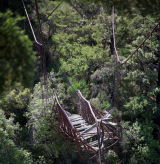
1885: Sutton
Sutton vicinity and Middlemarch vicinity, New Zealand - Taieri River
| Bridgemeister ID: | 669 (added 2003-03-08) |
| Year Completed: | 1885 |
| Name: | Sutton |
| Location: | Sutton vicinity and Middlemarch vicinity, New Zealand |
| Crossing: | Taieri River |
| Coordinates: | 45.575599 S 170.131762 E |
| Maps: | Acme, GeoHack, Google, OpenStreetMap |
| Principals: | Bain |
| References: | GAP |
| Use: | Vehicular (one-lane) |
| Status: | Dismantled, October, 2017 (last checked: 2017) |
| Main Cables: | Wire |
| Suspended Spans: | 1 |
| Main Span: | 1 x 44 meters (144.4 feet) estimated |
Notes:
- Wrecked by flood, July 2017. Dismantled, October 2017
External Links:
1886: (footbridge)
Huttons Ambo, North Yorkshire, England, United Kingdom - River Derwent
| Bridgemeister ID: | 417 (added before 2003) |
| Year Completed: | 1886 |
| Name: | (footbridge) |
| Location: | Huttons Ambo, North Yorkshire, England, United Kingdom |
| Crossing: | River Derwent |
| Coordinates: | 54.09975 N 0.8311 W |
| Maps: | Acme, GeoHack, Google, OpenStreetMap |
| References: | NTB |
| Use: | Footbridge |
| Status: | In use (last checked: 2014) |
| Main Cables: | Wire |
| Suspended Spans: | 1 |
| Main Span: | 1 x 29 meters (95 feet) |
Image Sets:
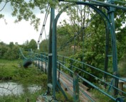

1886: Blairgowrie
Blairgowrie, Scotland, United Kingdom - River Ericht
| Bridgemeister ID: | 2181 (added 2007-01-13) |
| Year Completed: | 1886 |
| Name: | Blairgowrie |
| Location: | Blairgowrie, Scotland, United Kingdom |
| Crossing: | River Ericht |
| At or Near Feature: | Craighall Castle |
| Principals: | Louis Harper |
| References: | HARPER |
| Use: | Footbridge |
| Status: | Removed |
| Main Cables: | Wire |
| Suspended Spans: | 1 |
| Main Span: | 1 x 27.4 meters (89.9 feet) |
Notes:
- HARPER: Some remnants of the bridge still present, 2006.
External Links:
1886: Lower
Easton, Pennsylvania, USA - Lehigh River
| Bridgemeister ID: | 813 (added 2003-05-29) |
| Year Completed: | 1886 |
| Name: | Lower |
| Location: | Easton, Pennsylvania, USA |
| Crossing: | Lehigh River |
| Coordinates: | 40.683778 N 75.223472 W |
| Maps: | Acme, GeoHack, Google, OpenStreetMap |
| References: | DSL20030414, WGE20030513 |
| Use: | Footbridge |
| Status: | Demolished, 1951 |
| Main Cables: | Wire |
| Suspended Spans: | 2 |
| Main Spans: | 1 x 158.5 meters (520 feet), 1 x 136.7 meters (448.6 feet) |
Notes:
- Damaged by windstorm 1950.
- From WGE20030513 (email from Lance Metz to Wayne Grodkiewicz): "Crossed the Lehigh at 10th street in Easton and went to the Lehigh Valley Railroad Shops in South Easton. This bridge was erected in 1886 and it cost a penny to walk across it. The bridge was over 1,020 feet in length and 128 feet above the Lehigh River and canal. Its cables were suspended from two steel towers. It remained in use until 1950 when it was damaged by a windstorm. It was demolished in 1951." It appears the bridge was actually closer to the alignment of 11th street than 10th street, terminating near the present-day playground southwest of the corner of Elm and South Warren streets.
- Near 1900 Upper - Easton, Pennsylvania, USA.
External Links:
- YouTube - Easton Pa & Walking Bridge over Lehigh River 1940s. Starting from 1:13, film of the derelict bridge supposedly in the 1940s but may reflect the windstorm damage of 1950.
Image Sets:

1886: Pescadero Ituango
Ituango, Antioquia, Colombia - Cauca River
| Bridgemeister ID: | 7637 (added 2023-05-28) |
| Year Completed: | 1886 |
| Name: | Pescadero Ituango |
| Location: | Ituango, Antioquia, Colombia |
| Crossing: | Cauca River |
| Coordinates: | 7.088510 N 75.694706 W |
| Maps: | Acme, GeoHack, Google, OpenStreetMap |
| Principals: | José María Villa |
| Use: | Footbridge and Vehicular |
| Status: | Removed |
| Main Cables: | Wire |
| Suspended Spans: | 1 |
Notes:
- 1963: Replaced by Puente Juan de la Cruz Posada
- 2018: Former location of both bridges completely inundated behind the Pescadero-Ituango dam.
External Links:
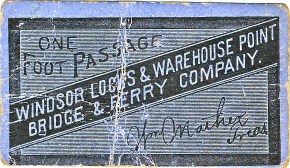
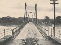
1886: Windsor Locks
Windsor Locks and Warehouse Point, Connecticut, USA - Connecticut River
| Bridgemeister ID: | 306 (added before 2003) |
| Year Completed: | 1886 |
| Name: | Windsor Locks |
| Also Known As: | Bridge Street |
| Location: | Windsor Locks and Warehouse Point, Connecticut, USA |
| Crossing: | Connecticut River |
| Coordinates: | 41.929111 N 72.624167 W |
| Maps: | Acme, GeoHack, Google, OpenStreetMap |
| Principals: | James Shipman |
| References: | AAJ, PTS2 |
| Use: | Vehicular (one-lane) |
| Status: | Removed, c. 1921 |
| Main Cables: | Wire |
| Suspended Spans: | 3 |
| Main Span: | 1 x 167.6 meters (550 feet) |
| Side Spans: | 2 x 91.4 meters (300 feet) |
Notes:
- 1921: Replacement multi-span truss bridge completed. Unclear when the suspension bridge was removed.
External Links:
Image Sets:

1887: (footbridge)
Offord, England, United Kingdom - Great Northern Railway track
| Bridgemeister ID: | 5084 (added 2020-09-04) |
| Year Completed: | 1887 |
| Name: | (footbridge) |
| Location: | Offord, England, United Kingdom |
| Crossing: | Great Northern Railway track |
| Principals: | John Harper, Harpers Limited |
| References: | HARPER |
| Use: | Footbridge |
| Status: | Removed |
| Main Cables: | Wire |
| Suspended Spans: | 1 |
External Links:
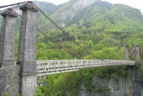
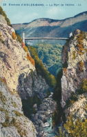
1887: de l'Abîme
Cusy and Gruffy, Haute-Savoie, France - Chéran River
| Bridgemeister ID: | 418 (added before 2003) |
| Year Completed: | 1887 |
| Name: | de l'Abîme |
| Location: | Cusy and Gruffy, Haute-Savoie, France |
| Crossing: | Chéran River |
| Coordinates: | 45.764583 N 6.057117 E |
| Maps: | Acme, GeoHack, Google, OpenStreetMap |
| Principals: | Ferdinand Arnodin |
| References: | BPF |
| Use: | Vehicular (one-lane) |
| Status: | In use (last checked: 2021) |
| Main Cables: | Wire |
| Suspended Spans: | 1 |
| Main Span: | 1 x 64 meters (210 feet) |
External Links:
Image Sets:
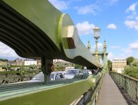
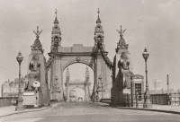
1887: Hammersmith
London, England, United Kingdom - River Thames
| Bridgemeister ID: | 419 (added before 2003) |
| Year Completed: | 1887 |
| Name: | Hammersmith |
| Location: | London, England, United Kingdom |
| Crossing: | River Thames |
| Coordinates: | 51.48845 N 0.23019 W |
| Maps: | Acme, GeoHack, Google, OpenStreetMap |
| Principals: | Sir Joseph Bazalgette |
| References: | BEM, BPL, HBE, NTB, PTS2 |
| Use: | Vehicular (two-lane), with walkway |
| Status: | Restricted to foot traffic, since 2021 (last checked: 2021) |
| Main Cables: | Eyebar |
| Suspended Spans: | 3 |
| Main Span: | 1 |
| Side Spans: | 2 |
Notes:
- 2019, April: Closed to vehicular traffic due to safety concerns after an inspection found fractures in the cast iron casings around the bridge pedestals. Some repair work followed, but was not fully funded or finished (as of mid-2020)
- 2020, August: Fractures found to have worsened during recent heatwave. Bridge is completely closed to all pedestrian and bicycle traffic. Pedestrian walkways under the bridge and all river traffic under the bridge are also prohibited (implying risk of collapse).
- 2020, December: Bridge may reopen to pedestrians and cyclists if deemed safe by maintenance contractor, Mott MacDonald.
- 2021, January: Plan discussed to "thread" a temporary truss along the length of the deck to permit traffic while the suspension bridge undergoes repairs.
- 2021, March: Feasibility study on "double-decker" temporary truss plan determines it is feasible, possibly opening to pedestrian and vehicular traffic by mid-2022.
- 2021, July: Reopened for pedestrian and bicycle use.
- Replaced 1827 Hammersmith - London, England, United Kingdom.
- All past and present bridges at this location.
External Links:
- ENR - Engineers Ponder Solutions for Damaged London Bridge. February 22, 2021 Engineering News-Record article discusses proposal to thread a temporary truss between the towers to allow traffic while the larger suspension bridge repairs are completed. Recaps the issue: "Cracks have been found in the cast-iron pedestals that support suspension cable saddles at the abutments. Engineers suspect that roller bearings between the saddles and pedestals seized up at least 30 years ago…"
- Hammersmith Bridge | Temporary ‘double-decker’ proposal deemed technically feasible - New Civil Engineer. March 22, 2021
- The Happy Pontist: London Bridges: 33. Hammersmith Bridge
- Structurae - Structure ID 20008013
Image Sets:

1887: Jubilee
Nairn, Scotland, United Kingdom - River Nairn
| Bridgemeister ID: | 1945 (added 2005-10-29) |
| Year Completed: | 1887 |
| Name: | Jubilee |
| Location: | Nairn, Scotland, United Kingdom |
| Crossing: | River Nairn |
| Principals: | Harpers Limited |
| References: | HARPER |
| Use: | Footbridge |
| Status: | Replaced, 1915 |
| Main Cables: | Wire |
| Suspended Spans: | 1 |
| Main Span: | 1 x 30.5 meters (100 feet) |
External Links:
Image Sets:

1887: Roxburgh
Roxburgh, New Zealand - Clutha River
| Bridgemeister ID: | 671 (added 2003-03-08) |
| Year Completed: | 1887 |
| Name: | Roxburgh |
| Location: | Roxburgh, New Zealand |
| Crossing: | Clutha River |
| Coordinates: | 45.542731 S 169.320220 E |
| Maps: | Acme, GeoHack, Google, OpenStreetMap |
| Principals: | J. McCormack |
| References: | GAP |
| Use: | Vehicular (one-lane) |
| Status: | Only towers remain (last checked: 2017) |
| Main Cables: | Wire |
| Suspended Spans: | 1 |
Notes:
- Bypassed, 1974.
External Links:
Image Sets:

1887: Swinging
Reading, Pennsylvania, USA - Philadelphia and Reading Railroad tracks
| Bridgemeister ID: | 92 (added before 2003) |
| Year Completed: | 1887 |
| Name: | Swinging |
| Location: | Reading, Pennsylvania, USA |
| Crossing: | Philadelphia and Reading Railroad tracks |
| Coordinates: | 40.3405 N 75.923638 W |
| Maps: | Acme, GeoHack, Google, OpenStreetMap |
| Principals: | William Hildenbrand, John A. Roebling's Sons Co. |
| Use: | Footbridge |
| Status: | Dismantled, 1983 |
| Main Cables: | Wire |
| Suspended Spans: | 1 |
Notes:
- Dismantled 1983. One tower used in extant (2007) Workers Memorial Tower at Reading, PA.
- The coordinates provided are for the original location of the bridge. The memorial is located at N 40.3245 W 75.9263.
External Links:
Image Sets:


1888: Évieu
Évieu, Ain and Les Avenières Veyrins-Thuellin, Isère, France - Rhône River
| Bridgemeister ID: | 7099 (added 2022-06-03) |
| Year Completed: | 1888 |
| Name: | Évieu |
| Location: | Évieu, Ain and Les Avenières Veyrins-Thuellin, Isère, France |
| Crossing: | Rhône River |
| Status: | Removed |
| Main Cables: | Wire |
| Main Spans: | 2 |
Notes:
- Replaced 1847 Évieu - Évieu, Ain and Les Avenières Veyrins-Thuellin, Isère, France.
- All past and present bridges at this location.
Image Sets:
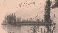
1888: Crathorne
Carthorne, England, United Kingdom - River Leven
| Bridgemeister ID: | 2195 (added 2007-01-26) |
| Year Completed: | 1888 |
| Name: | Crathorne |
| Location: | Carthorne, England, United Kingdom |
| Crossing: | River Leven |
| Principals: | Louis Harper |
| References: | HARPER |
| Use: | Footbridge |
| Status: | Destroyed, by flood, July 1930 |
| Main Cables: | Wire |
| Main Span: | 1 x 16.8 meters (55 feet) estimated |
External Links:
- Crathorne | Harper Bridges
- Suspension Bridge, Yorkshire – Arberdeen Archives, Gallery and Museums. Image of the bridge: "Suspension bridge at Craythorne, Yorkshire."
1888: Oregon City
Oregon City and West Linn, Oregon, USA - Willamette River
| Bridgemeister ID: | 295 (added before 2003) |
| Year Completed: | 1888 |
| Name: | Oregon City |
| Location: | Oregon City and West Linn, Oregon, USA |
| Crossing: | Willamette River |
| Coordinates: | 45.359000 N 122.609611 W |
| Maps: | Acme, GeoHack, Google, OpenStreetMap |
| References: | AAJ |
| Use: | Vehicular |
| Status: | Dismantled, 1922 |
| Main Cables: | Wire |
| Suspended Spans: | 3 |
| Main Span: | 1 |
| Side Spans: | 2 |
Notes:
Image Sets:
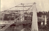
1888: Suspension
Sheldon Springs, Vermont, USA - Missisquoi River
| Bridgemeister ID: | 94 (added before 2003) |
| Year Completed: | 1888 |
| Name: | Suspension |
| Location: | Sheldon Springs, Vermont, USA |
| Crossing: | Missisquoi River |
| Coordinates: | 44.909917 N 72.972806 W |
| Maps: | Acme, GeoHack, Google, OpenStreetMap |
| Use: | Vehicular |
| Status: | Removed, c. 1927-1929 |
| Main Cables: | Wire |
| Suspended Spans: | 1 |
Notes:
- Likely damaged or destroyed during the catastrophic Vermont flood event in early November 1927. Replacement completed in 1929.
Image Sets:

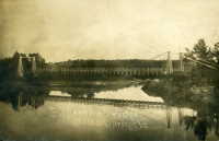
1888: Swing
Keeseville, New York, USA - Ausable River
| Bridgemeister ID: | 93 (added before 2003) |
| Year Completed: | 1888 |
| Name: | Swing |
| Location: | Keeseville, New York, USA |
| Crossing: | Ausable River |
| Coordinates: | 44.503653 N 73.482490 W |
| Maps: | Acme, GeoHack, Google, OpenStreetMap |
| Principals: | Berlin Iron Bridge Co. |
| References: | ONC |
| Use: | Footbridge |
| Status: | In use (last checked: 2023) |
| Main Cables: | Wire (steel) |
| Suspended Spans: | 1 |
| Main Span: | 1 x 73.2 meters (240 feet) |
Notes:
- 2024, June: New York State announces US$1,948,000 awarded to to the Clinton County Planning Department for rehabilitation and refurbishment of the Keeseville Swing Bridge.
- At (or near) former location of Swing - Keeseville, New York, USA.
- All past and present bridges at this location.
External Links:
1888: Swinging
Skowhegan, Maine, USA - Kennebec River
| Bridgemeister ID: | 1576 (added 2004-12-19) |
| Year Completed: | 1888 |
| Name: | Swinging |
| Location: | Skowhegan, Maine, USA |
| Crossing: | Kennebec River |
| References: | KJ20030410 |
| Use: | Footbridge |
| Status: | Destroyed, 1901 |
| Main Cables: | Wire |
Notes:
- Destroyed by flood, 1901.
- Replaced 1883 Swinging - Skowhegan, Maine, USA.
- Replaced by 1902 Swinging - Skowhegan, Maine, USA.
- All past and present bridges at this location.
1888: Tidewater Pipeline
Jim Thorpe, Pennsylvania, USA - Lehigh River
| Bridgemeister ID: | 1527 (added 2004-10-24) |
| Year Completed: | 1888 |
| Name: | Tidewater Pipeline |
| Location: | Jim Thorpe, Pennsylvania, USA |
| Crossing: | Lehigh River |
| Coordinates: | 40.90714 N 75.748544 W |
| Maps: | Acme, GeoHack, Google, OpenStreetMap |
| Principals: | William Hildenbrand |
| References: | AAJ, HBE |
| Use: | Pipeline |
| Status: | Extant (last checked: 2020) |
| Main Cables: | Wire |
| Main Span: | 1 x 109.7 meters (360 feet) |
Notes:
- The town was named "Mauch Chunk" at the time the pipeline was built.
Image Sets:

1889: Chesterfield
Chesterfield vicinity, New Hampshire and Brattleboro, Vermont, USA - Connecticut River
| Bridgemeister ID: | 95 (added before 2003) |
| Year Completed: | 1889 |
| Name: | Chesterfield |
| Also Known As: | Brattleboro |
| Location: | Chesterfield vicinity, New Hampshire and Brattleboro, Vermont, USA |
| Crossing: | Connecticut River |
| Coordinates: | 42.883889 N 72.551833 W |
| Maps: | Acme, GeoHack, Google, OpenStreetMap |
| Principals: | Berlin Iron Bridge Co. |
| References: | AAJ, CCR |
| Use: | Vehicular |
| Status: | Destroyed, March 19, 1936 |
| Main Cables: | Wire |
| Suspended Spans: | 1 |
Notes:
- Destroyed by flood March 19, 1936.
External Links:
- The one-bridge idea that faded into history | Community-news | reformer.com. Article about the bridge by the Brattleboro Historic Society. Dated August 5, 2021. Photos and history of the bridge.
Image Sets:
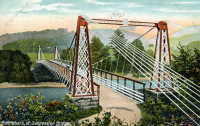
1889: Fiorentini
Rome, Italy - Tiber River
| Bridgemeister ID: | 828 (added 2003-05-31) |
| Year Completed: | 1889 |
| Name: | Fiorentini |
| Also Known As: | Ferro, Soldo, Soldino |
| Location: | Rome, Italy |
| Crossing: | Tiber River |
| Coordinates: | 41.898801 N 12.463689 E |
| Maps: | Acme, GeoHack, Google, OpenStreetMap |
| References: | AAJ, ONF, PTS2 |
| Use: | Vehicular |
| Status: | Demolished, July 15, 1941 |
| Main Cables: | Eyebar |
| Suspended Spans: | 1 |
| Characteristics: | Braced (trussed) chain/cable, Hinged cables |
Notes:
- Jakkula (AAJ) lists this bridge as completed in 1889 based on articles from 1899-1900 discussing braced chain suspension bridges. Various internet sources consistently cite 1863 as the year of completion. The 1889 date is more consistent with several similar braced-chain suspension bridges built in the 1890, but it is unclear which sources are accurate.
- "Braced chain" main cables.
- Similar to 1936 Ininskiy (Ининский) - Inya (Иня), Altai Republic, Russia.
- Similar to 1936 Kindee - Kindee, Ellenborough vicinity, New South Wales, Australia.
- Similar to 1951 Marias River (Pugsley) - Chester vicinity, Montana, USA.
- Similar to (footbridge) - Sarov (Саров), Nizhny Novgorod Oblast, Russia.
- Similar to Allan - Segenhoe, Scone vicinity, New South Wales, Australia.
- Similar to Reku Vel' - Solginskiy (Солгинский), Arkhangelsk Oblast, Russia.
External Links:
Image Sets:
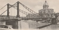
1889: La Voulte-sur-Rhône
La Voulte-sur-Rhône, Rhône, France - Rhône River
| Bridgemeister ID: | 1521 (added 2004-10-10) |
| Year Completed: | 1889 |
| Name: | La Voulte-sur-Rhône |
| Location: | La Voulte-sur-Rhône, Rhône, France |
| Crossing: | Rhône River |
| Coordinates: | 44.800217 N 4.784367 E |
| Maps: | Acme, GeoHack, Google, OpenStreetMap |
| Use: | Vehicular |
| Status: | In use (last checked: 2022) |
| Main Cables: | Wire |
| Suspended Spans: | 3 |
| Main Span: | 1 |
| Side Spans: | 2 |
Notes:
External Links:
Image Sets:
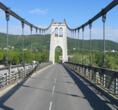

1889: Market Street
Williamsport, Pennsylvania, USA - Susquehanna River
| Bridgemeister ID: | 2134 (added 2006-10-27) |
| Year Completed: | 1889 |
| Name: | Market Street |
| Location: | Williamsport, Pennsylvania, USA |
| Crossing: | Susquehanna River |
| Coordinates: | 41.237333 N 76.997611 W |
| Maps: | Acme, GeoHack, Google, OpenStreetMap |
| Use: | Vehicular |
| Status: | Removed |
| Main Cables: | Wire |
| Suspended Spans: | 5 |
| Main Spans: | 5 x 61 meters (200 feet) |
Notes:
- Replaced 1865 Market Street - Williamsport, Pennsylvania, USA.
- All past and present bridges at this location.
Image Sets:

1889: Second Falls View
Niagara Falls, New York, USA and Niagara Falls, Ontario, Canada - Niagara River
| Bridgemeister ID: | 2120 (added 2006-09-17) |
| Year Completed: | 1889 |
| Name: | Second Falls View |
| Also Known As: | Upper |
| Location: | Niagara Falls, New York, USA and Niagara Falls, Ontario, Canada |
| Crossing: | Niagara River |
| Coordinates: | 43.088806 N 79.068722 W |
| Maps: | Acme, GeoHack, Google, OpenStreetMap |
| Principals: | G.M. Harrington, George W. McNulty |
| Use: | Vehicular |
| Status: | Removed, late 1890's |
| Main Cables: | Wire |
| Suspended Spans: | 1 |
Notes:
- Damaged by wind, January 1890. Repaired. Dismantled after being replaced by a steel arch bridge (the famous "Honeymoon Bridge"), 1899. Much of the dismantled bridge was reused for the 1899 Lewiston-Queenston bridge.
- Replaced 1869 Clifton (Upper, Niagara-Clifton, Falls View, First Falls View) - Niagara Falls, New York, USA and Niagara Falls, Ontario, Canada.
- See 1899 Lewiston-Queenston - Lewiston, New York, USA and Queenston, Ontario, Canada.
- All past and present bridges at this location.
1889: Stapenhill
Burton-upon-Trent, Staffordshire, England, United Kingdom - River Trent
| Bridgemeister ID: | 2138 (added 2006-10-28) |
| Year Completed: | 1889 |
| Name: | Stapenhill |
| Also Known As: | Ferry |
| Location: | Burton-upon-Trent, Staffordshire, England, United Kingdom |
| Crossing: | River Trent |
| Coordinates: | 52.79455 N 1.62607 W |
| Maps: | Acme, GeoHack, Google, OpenStreetMap |
| Principals: | Thornewill & Warham |
| Use: | Footbridge |
| Status: | In use (last checked: 2007) |
| Suspended Spans: | 3 |
| Main Span: | 1 x 36.6 meters (120 feet) |
| Side Spans: | 2 x 18.3 meters (60 feet) |
| Deck width: | 11.5 feet |
External Links:
- The Happy Pontist: Staffordshire Bridges: 1. Ferry Bridge, Stapenhill
- Structurae - Structure ID 20024241
Image Sets:

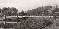
1889: Swing
Milford, New Hampshire, USA - Souhegan River
| Bridgemeister ID: | 293 (added before 2003) |
| Year Completed: | 1889 |
| Name: | Swing |
| Location: | Milford, New Hampshire, USA |
| Crossing: | Souhegan River |
| Coordinates: | 42.8366 N 71.645533 W |
| Maps: | Acme, GeoHack, Google, OpenStreetMap |
| Principals: | Berlin Iron Bridge Co. |
| Use: | Footbridge |
| Status: | In use (last checked: 2021) |
| Main Cables: | Wire (steel) |
| Suspended Spans: | 1 |
Image Sets:
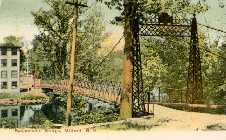
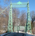

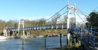
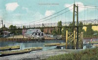
1889: Teddington
Teddington, England, United Kingdom - River Thames
| Bridgemeister ID: | 783 (added 2003-03-16) |
| Year Completed: | 1889 |
| Name: | Teddington |
| Location: | Teddington, England, United Kingdom |
| Crossing: | River Thames |
| Coordinates: | 51.42981 N 0.322517 W |
| Maps: | Acme, GeoHack, Google, OpenStreetMap |
| Use: | Footbridge |
| Status: | In use (last checked: 2015) |
| Main Cables: | Wire |
| Suspended Spans: | 2 |
| Main Span: | 1 |
| Side Span: | 1 |
External Links:
Image Sets:

(footbridge)
Zelzate, East Flanders, Belgium
| Bridgemeister ID: | 4584 (added 2020-06-05) |
| Name: | (footbridge) |
| Location: | Zelzate, East Flanders, Belgium |
| Coordinates: | 51.198797 N 3.814564 E |
| Maps: | Acme, GeoHack, Google, OpenStreetMap |
| References: | ISFF |
| Use: | Footbridge |
| Status: | Derelict (last checked: 2006) |
| Main Cables: | Wire |
| Suspended Spans: | 1 |
| Main Span: | 1 x 8.25 meters (27.1 feet) |
| Deck width: | 1.5 meters |
Notes:
- ISFF: Built 1880-1885 in a private garden and noted (in 2006) the bridge was in poor condition.
External Links:
San Isidro de Picará
El Pintado, Filadelfia, Caldas, Colombia - Cauca River
| Bridgemeister ID: | 2020 (added 2006-01-14) |
| Name: | San Isidro de Picará |
| Also Known As: | Pintado |
| Location: | El Pintado, Filadelfia, Caldas, Colombia |
| Crossing: | Cauca River |
| Coordinates: | 5.331773 N 75.636210 W |
| Maps: | Acme, GeoHack, Google, OpenStreetMap |
| Use: | Vehicular (one-lane) |
| Status: | Restricted to foot traffic (last checked: 2005) |
| Main Cables: | Wire |
| Suspended Spans: | 1 |
Notes:
- Likely completed 1885 or 1886.
Do you have any information or photos for these bridges that you would like to share? Please email david.denenberg@bridgemeister.com.
Mail | Facebook | X (Twitter) | Bluesky
