Suspension Bridges Crossing Sheyenne River
This is a list of all 4 bridges from the suspension bridge inventory crossing Sheyenne River. Please note that different rivers with the same name will be grouped together. For example, selecting 'Bear Creek' shows bridges across several different Bear Creeks. Also, similarly named rivers are grouped separately. For example, 'River Dee' (UK) bridges are grouped separately from 'Dee River' (Australia) bridges. Wherever you see a Bridgemeister ID number click it to isolate the bridge on its own page.
Related Lists:
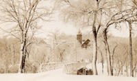
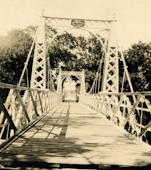
1901: VCSU Footbridge
Valley City, North Dakota, USA - Sheyenne River
| Bridgemeister ID: | 592 (added 2003-01-05) |
| Year Completed: | 1901 |
| Name: | VCSU Footbridge |
| Location: | Valley City, North Dakota, USA |
| Crossing: | Sheyenne River |
| At or Near Feature: | Valley City State Univ. |
| Coordinates: | 46.92000 N 98.00288 W |
| Maps: | Acme, GeoHack, Google, OpenStreetMap |
| Principals: | Dibley and Robinson Bridge Co. |
| Use: | Footbridge |
| Status: | In use (last checked: 2021) |
| Main Cables: | Wire (steel) |
| Suspended Spans: | 3 |
| Main Span: | 1 x 27.4 meters (90 feet) |
| Side Spans: | 2 x 9.1 meters (30 feet) |
Notes:
- Rebuilt 1994.
External Links:
Image Sets:


1971: Bjarne Ness Memorial
Fort Ransom, North Dakota, USA - Sheyenne River
| Bridgemeister ID: | 1367 (added 2004-07-03) |
| Year Completed: | 1971 |
| Name: | Bjarne Ness Memorial |
| Location: | Fort Ransom, North Dakota, USA |
| Crossing: | Sheyenne River |
| Coordinates: | 46.51907 N 97.92599 W |
| Maps: | Acme, GeoHack, Google, OpenStreetMap |
| Principals: | Lisbon National Guard |
| Use: | Footbridge |
| Status: | In use (last checked: 2003) |
| Main Cables: | Wire (steel) |
| Suspended Spans: | 1 |
| Main Span: | 1 x 44.2 meters (145 feet) estimated |
External Links:
Image Sets:

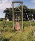
1974: Slattum-Hewett
Fort Ransom vicinity, North Dakota, USA - Sheyenne River
| Bridgemeister ID: | 1366 (added 2004-07-03) |
| Year Completed: | 1974 |
| Name: | Slattum-Hewett |
| Location: | Fort Ransom vicinity, North Dakota, USA |
| Crossing: | Sheyenne River |
| Coordinates: | 46.56435 N 97.90429 W |
| Maps: | Acme, GeoHack, Google, OpenStreetMap |
| Use: | Footbridge |
| Status: | In use (last checked: 2003) |
| Main Cables: | Wire (steel) |
| Suspended Spans: | 1 |
| Main Span: | 1 x 38.1 meters (125 feet) estimated |
External Links:
Image Sets:

(footbridge)
Lisbon, North Dakota, USA - Sheyenne River
| Bridgemeister ID: | 7678 (added 2023-06-24) |
| Name: | (footbridge) |
| Location: | Lisbon, North Dakota, USA |
| Crossing: | Sheyenne River |
| Coordinates: | 46.438540 N 97.679893 W |
| Maps: | Acme, GeoHack, Google, OpenStreetMap |
| Use: | Footbridge |
| Status: | Collapsed, September 24, 2008 |
| Main Cables: | Wire (steel) |
| Main Span: | 1 |
Notes:
- Likely built in the 1970s.
- 2008, September 24: Collapsed with five people on it. All five were injured, but no fatalities.
External Links:
- The Bismarck Tribune - Walking bridge collapse injures five in Lisbon. September 25, 2008 article about the collapse.
Do you have any information or photos for these bridges that you would like to share? Please email david.denenberg@bridgemeister.com.
Mail | Facebook | X (Twitter) | Bluesky