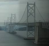
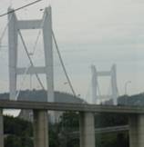
Suspension Bridges Crossing Seto Inland Sea
This is a list of all 3 bridges from the suspension bridge inventory crossing Seto Inland Sea. Please note that different rivers with the same name will be grouped together. For example, selecting 'Bear Creek' shows bridges across several different Bear Creeks. Also, similarly named rivers are grouped separately. For example, 'River Dee' (UK) bridges are grouped separately from 'Dee River' (Australia) bridges. Wherever you see a Bridgemeister ID number click it to isolate the bridge on its own page.
Related Lists:
1987: Kita Bisan-Seto
Yoshima Island and Sakaide, Kagawa, Japan - Seto Inland Sea
| Bridgemeister ID: | 481 (added before 2003) |
| Year Completed: | 1987 |
| Name: | Kita Bisan-Seto |
| Also Known As: | 北備讃瀬戸大橋 |
| Location: | Yoshima Island and Sakaide, Kagawa, Japan |
| Crossing: | Seto Inland Sea |
| Coordinates: | 34.379065 N 133.820065 E |
| Maps: | Acme, GeoHack, Google, OpenStreetMap |
| Principals: | Honshu-Shikoku Bridge Authority |
| References: | BAAW, BAR, BBR, BDU |
| Use: | Vehicular (major highway) and Rail |
| Status: | In use (last checked: 2019) |
| Main Cables: | Wire (steel) |
| Suspended Spans: | 3 |
| Main Span: | 1 x 990 meters (3,248 feet) |
| Side Spans: | 2 x 274 meters (899 feet) |
| Deck width: | 35 meters upper deck, 30 meters lower deck |
Notes:
- Connects to 1988 Minami Bisan-Seto (南備讃瀬戸大橋) - Yoshima Island (与島) and Sakaide (坂出市), Kagawa, Japan.
- Near 1988 Shimotsui-Seto (下津井瀬戸大橋) - Kojima, Okayama and Hitsuishijima (櫃石島), Kagawa, Japan.
- All past and present bridges at this location.
External Links:
Image Sets:

1988: Minami Bisan-Seto
Yoshima Island (与島) and Sakaide (坂出市), Kagawa, Japan - Seto Inland Sea
| Bridgemeister ID: | 485 (added before 2003) |
| Year Completed: | 1988 |
| Name: | Minami Bisan-Seto |
| Also Known As: | 南備讃瀬戸大橋 |
| Location: | Yoshima Island (与島) and Sakaide (坂出市), Kagawa, Japan |
| Crossing: | Seto Inland Sea |
| Coordinates: | 34.364167 N 133.825278 E |
| Maps: | Acme, GeoHack, Google, OpenStreetMap |
| Principals: | Honshu-Shikoku Bridge Authority |
| References: | BAAW, BAR, BBR, BDU |
| Use: | Vehicular (major highway) and Rail |
| Status: | In use (last checked: 2019) |
| Main Cables: | Wire (steel) |
| Suspended Spans: | 3 |
| Main Span: | 1 x 1,100 meters (3,608.9 feet) |
| Side Spans: | 2 x 274 meters (899 feet) |
| Deck width: | 35 meters upper deck, 30 meters lower deck |
Notes:
- Connects to 1987 Kita Bisan-Seto (北備讃瀬戸大橋) - Yoshima Island and Sakaide, Kagawa, Japan.
- Near 1988 Shimotsui-Seto (下津井瀬戸大橋) - Kojima, Okayama and Hitsuishijima (櫃石島), Kagawa, Japan.
- All past and present bridges at this location.
External Links:
Image Sets:


1988: Shimotsui-Seto
Kojima, Okayama and Hitsuishijima (櫃石島), Kagawa, Japan - Seto Inland Sea
| Bridgemeister ID: | 486 (added before 2003) |
| Year Completed: | 1988 |
| Name: | Shimotsui-Seto |
| Also Known As: | 下津井瀬戸大橋 |
| Location: | Kojima, Okayama and Hitsuishijima (櫃石島), Kagawa, Japan |
| Crossing: | Seto Inland Sea |
| Coordinates: | 34.431483 N 133.807833 E |
| Maps: | Acme, GeoHack, Google, OpenStreetMap |
| Principals: | Honshu-Shikoku Bridge Authority |
| References: | AOB, BAAW, BAR, BBR, BDU |
| Use: | Vehicular (major highway) |
| Status: | In use (last checked: 2019) |
| Main Cables: | Wire (steel) |
| Suspended Spans: | 1 |
| Main Span: | 1 x 940 meters (3,084 feet) |
Notes:
- Near 1987 Kita Bisan-Seto (北備讃瀬戸大橋) - Yoshima Island and Sakaide, Kagawa, Japan.
- Near 1988 Minami Bisan-Seto (南備讃瀬戸大橋) - Yoshima Island (与島) and Sakaide (坂出市), Kagawa, Japan.
External Links:
Image Sets:

Do you have any information or photos for these bridges that you would like to share? Please email david.denenberg@bridgemeister.com.
Mail | Facebook | X (Twitter) | Bluesky