Suspension Bridges Crossing Rhône River
This is a list of all 58 bridges from the suspension bridge inventory crossing Rhône River. Please note that different rivers with the same name will be grouped together. For example, selecting 'Bear Creek' shows bridges across several different Bear Creeks. Also, similarly named rivers are grouped separately. For example, 'River Dee' (UK) bridges are grouped separately from 'Dee River' (Australia) bridges. Wherever you see a Bridgemeister ID number click it to isolate the bridge on its own page.
Related Lists:
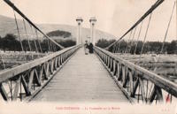
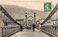
1825: Tain-Tournon
Tournon-sur-Rhône, Ardèche and Tain, Drôme, France - Rhône River
| Bridgemeister ID: | 378 (added before 2003) |
| Year Completed: | 1825 |
| Name: | Tain-Tournon |
| Location: | Tournon-sur-Rhône, Ardèche and Tain, Drôme, France |
| Crossing: | Rhône River |
| Principals: | Marc Seguin |
| References: | AAJ, ASB, BBR, BPF, GHD, LAB, MOS, PTS2, TTSB |
| Use: | Vehicular |
| Status: | Removed, 1965 |
| Main Cables: | Wire (iron) |
| Suspended Spans: | 2 |
| Main Spans: | 2 x 85 meters (278.88 feet) |
| Deck width: | 13.75 feet |
Notes:
- Often credited as being the first large wire suspension bridge in France (and elsewhere). Rebuilt 1847 as a footbridge. Removed 1965.
- Near 1849 Marc Seguin - Tournon-sur-Rhône, Ardèche and Tain-L'Hermitage, Drôme, France.
- Near 1958 Gustave Toursier - Tournon-sur-Rhône, Ardèche and Tain-L'Hermitage, Drôme, France.
External Links:
Image Sets:
1827: Andance
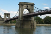
Andance, Ardèche and Andancette, Drôme, France - Rhône River
| Bridgemeister ID: | 976 (added 2003-11-14) |
| Year Completed: | 1827 |
| Name: | Andance |
| Location: | Andance, Ardèche and Andancette, Drôme, France |
| Crossing: | Rhône River |
| Coordinates: | 45.242194 N 4.801638 E |
| Maps: | Acme, GeoHack, Google, OpenStreetMap |
| Principals: | Marc Seguin |
| References: | AAJ, ASB |
| Use: | Vehicular (one-lane) |
| Status: | In use (last checked: 2009) |
| Main Cables: | Wire (iron) |
| Suspended Spans: | 2 |
| Main Spans: | 2 |
Notes:
- Destroyed August 30, 1944. Rebuilt 1946.
External Links:
Image Sets:
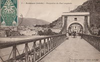
1828: Sablons
Sablons, Isère and Serrières, Ardèche, France - Rhône River
| Bridgemeister ID: | 890 (added 2003-09-06) |
| Year Completed: | 1828 |
| Name: | Sablons |
| Location: | Sablons, Isère and Serrières, Ardèche, France |
| Crossing: | Rhône River |
| Principals: | Marc Seguin |
| References: | AAJ, ASB |
| Use: | Vehicular |
| Status: | Replaced, 1933 |
| Main Cables: | Wire (iron) |
| Main Spans: | 2 x 101 meters (331.38 feet) |
| Deck width: | 13.12 feet |
Notes:
- Replaced by 1933 Sablons - Sablons, Isère and Serrières, Ardèche, France.
- All past and present bridges at this location.
External Links:
Image Sets:
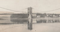
1829: Beaucaire
Beaucaire, Gard and Tarascon, Bouches-du-Rhône, France - Rhône River
| Bridgemeister ID: | 626 (added 2003-01-20) |
| Year Completed: | 1829 |
| Name: | Beaucaire |
| Location: | Beaucaire, Gard and Tarascon, Bouches-du-Rhône, France |
| Crossing: | Rhône River |
| Principals: | Jules Seguin, Joseph Chaley |
| References: | AAJ, ASB, GHD, PTS2 |
| Use: | Vehicular |
| Status: | Destroyed, August 6, 1944 |
| Main Cables: | Wire (iron) |
| Suspended Spans: | 4 |
| Main Spans: | 2 x 120 meters (393.72 feet) |
| Side Spans: | 2 x 93.6 meters (307.1 feet) |
Notes:
- 1887: Flooring failed.
- 1944: Bombed by Allied Forces, August 6.
External Links:
Image Sets:
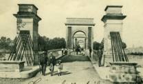

1829: Vienne
Vienne, Isère and Sainte-Colombe, Rhône, France - Rhône River
| Bridgemeister ID: | 977 (added 2003-11-15) |
| Year Completed: | 1829 |
| Name: | Vienne |
| Location: | Vienne, Isère and Sainte-Colombe, Rhône, France |
| Crossing: | Rhône River |
| Coordinates: | 45.524867 N 4.87035 E |
| Maps: | Acme, GeoHack, Google, OpenStreetMap |
| Principals: | Marc Seguin |
| References: | AAJ, ASB |
| Use: | Vehicular (one-lane) |
| Status: | Restricted to foot traffic (last checked: 2005) |
| Main Cables: | Wire (iron) |
| Suspended Spans: | 2 |
| Main Spans: | 2 |
Notes:
- Damaged by flood in 1840. Rebuilt.
External Links:
Image Sets:
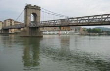

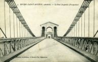
1830: Bourg-Saint-Andéol
Bourg-Saint-Andéol, Ardèche, France - Rhône River
| Bridgemeister ID: | 1719 (added 2005-04-05) |
| Year Completed: | 1830 |
| Name: | Bourg-Saint-Andéol |
| Location: | Bourg-Saint-Andéol, Ardèche, France |
| Crossing: | Rhône River |
| References: | AAJ |
| Use: | Vehicular |
| Status: | Replaced, 1971 |
| Main Cables: | Wire (iron) |
| Suspended Spans: | 3 |
| Main Spans: | 1 x 88.9 meters (291.7 feet), 1 x 85.7 meters (281.2 feet), 1 x 87 meters (285.4 feet) |
Notes:
- 1944: Heavily damaged.
- 1945: Repaired and reopened.
- Similar to Saint-Vallier - Saint-Vallier, Drôme, France.
External Links:
Image Sets:

1830: Valence
Valence, Drôme and Guilherand-Granges, Ardèche, France - Rhône River
| Bridgemeister ID: | 631 (added 2003-01-20) |
| Year Completed: | 1830 |
| Name: | Valence |
| Location: | Valence, Drôme and Guilherand-Granges, Ardèche, France |
| Crossing: | Rhône River |
| Coordinates: | 44.932022 N 4.882951 E |
| Maps: | Acme, GeoHack, Google, OpenStreetMap |
| Principals: | Marc Seguin |
| References: | ASB, PTS2 |
| Use: | Vehicular |
| Status: | Removed |
| Main Cables: | Wire (iron) |
| Suspended Spans: | 2 |
| Main Spans: | 2 x 110 meters (360.9 feet) |
| Deck width: | 7 meters |
Notes:
- Two side spans meeting at a single midstream tower.
- Later at same location 1949 (footbridge) - Valence, Drôme and Guilherand-Granges, Ardèche, France.
- All past and present bridges at this location.
External Links:
Image Sets:


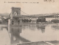
1831: Condrieu
Condrieu, Rhône and Les Roches-de-Condrieu, Isère, France - Rhône River
| Bridgemeister ID: | 981 (added 2003-11-15) |
| Year Completed: | 1831 |
| Name: | Condrieu |
| Location: | Condrieu, Rhône and Les Roches-de-Condrieu, Isère, France |
| Crossing: | Rhône River |
| Coordinates: | 45.457394 N 4.768694 E |
| Maps: | Acme, GeoHack, Google, OpenStreetMap |
| Use: | Vehicular |
| Status: | Replaced, 1935 |
| Main Cables: | Wire (iron) |
| Suspended Spans: | 2 |
| Main Spans: | 1 x 96 meters (315 feet), 1 x 96.8 meters (317.6 feet) |
Notes:
- Appears to have been replaced with another suspension bridge of similar proportions.
- Single midstream tower.
- Replaced by 1935 Condrieu - Condrieu, Rhône and Les Roches-de-Condrieu, Isère, France.
- All past and present bridges at this location.
External Links:
Image Sets:
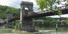
1835: Chasse
Chasse-sur-Rhône, Isère and Givors, Métropole De Lyon, France - Rhône River
| Bridgemeister ID: | 980 (added 2003-11-15) |
| Year Completed: | 1835 |
| Name: | Chasse |
| Also Known As: | Givors |
| Location: | Chasse-sur-Rhône, Isère and Givors, Métropole De Lyon, France |
| Crossing: | Rhône River |
| Coordinates: | 45.581666 N 4.780083 E |
| Maps: | Acme, GeoHack, Google, OpenStreetMap |
| References: | AAJ |
| Use: | Vehicular (one-lane) |
| Status: | In use (last checked: 2005) |
| Main Cables: | Wire (iron) |
| Suspended Spans: | 3 |
| Main Span: | 1 |
| Side Spans: | 2 |
Notes:
- Cables and deck appear to have been replaced (at least once).
- AAJ describes an accident in 1836: "...some of the iron-work, which was faulty, gave way and the platform fell into the river. Six persons were drowned."
External Links:
Image Sets:

1835: Lagnieu
Lagnieu, Ain and Isère, France - Rhône River
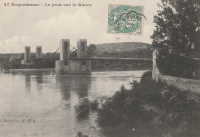
1835: Roquemaure
Roquemaure, Gard and Orange, Vaucluse, France - Rhône River
| Bridgemeister ID: | 1735 (added 2005-04-19) |
| Year Completed: | 1835 |
| Name: | Roquemaure |
| Location: | Roquemaure, Gard and Orange, Vaucluse, France |
| Crossing: | Rhône River |
| Coordinates: | 44.069467 N 4.7689 E |
| Maps: | Acme, GeoHack, Google, OpenStreetMap |
| References: | AAJ |
| Use: | Vehicular |
| Status: | Only towers remain (last checked: 2021) |
| Main Cables: | Wire (iron) |
| Suspended Spans: | 4 |
| Main Spans: | 4 |
Notes:
- One of the four spans, effectively a separate bridge over a small channel of the Rhône to an island that connected to the main river spans, was still standing in early 2005, but closed to all traffic. The deck and cables were removed or destroyed at some point in 2005 or 2006 leaving just the pylons of this span.
- Replaced by Roquemaure - Roquemaure, Gard and Orange, Vaucluse, France.
- All past and present bridges at this location.
External Links:
Image Sets:

1837: La Balme
La Balme, Savoie and Virignin, Ain, France - Rhône River
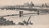
1839: L'Hôtel Dieu
Lyon, Métropole de Lyon, France - Rhône River
| Bridgemeister ID: | 966 (added 2003-11-01) |
| Year Completed: | 1839 |
| Name: | L'Hôtel Dieu |
| Location: | Lyon, Métropole de Lyon, France |
| Crossing: | Rhône River |
| Principals: | Clauzel |
| References: | AAJ, PQL |
| Use: | Vehicular |
| Status: | Demolished, 1912 |
| Main Cables: | Wire (iron) |
Notes:
- Was at location of present-day Pont Wilson.
- Rebuilt, 1850.
- Near 1845 College (Collège) - Lyon, Métropole de Lyon, France.
External Links:
Image Sets:
1839: Loyettes
Loyettes, Ain and Isère, France - Rhône River
| Bridgemeister ID: | 2334 (added 2007-07-09) |
| Year Completed: | 1839 |
| Name: | Loyettes |
| Location: | Loyettes, Ain and Isère, France |
| Crossing: | Rhône River |
| Coordinates: | 45.772075 N 5.205653 E |
| Maps: | Acme, GeoHack, Google, OpenStreetMap |
| Use: | Vehicular |
| Status: | Replaced, 1940 |
| Main Cables: | Wire (iron) |
| Suspended Spans: | 2 |
| Main Spans: | 2 |
Image Sets:

1839: Teil
Le Teil, Ardèche and Montélimar, Drôme, France - Rhône River
| Bridgemeister ID: | 1733 (added 2005-04-06) |
| Year Completed: | 1839 |
| Name: | Teil |
| Location: | Le Teil, Ardèche and Montélimar, Drôme, France |
| Crossing: | Rhône River |
| Coordinates: | 44.552213 N 4.691909 E |
| Maps: | Acme, GeoHack, Google, OpenStreetMap |
| References: | AAJ |
| Status: | Replaced, 1931 |
| Main Cables: | Wire (iron) |
| Suspended Spans: | 4 |
| Main Spans: | 4 |
| Deck width: | 19.68 feet |
Notes:
- Damaged by flood, 1840. Rebuilt and reopened, 1843. Damaged by floods, 1856 and 1881.
- Replaced by 1931 Teil - Le Teil, Ardèche and Montélimar, Drôme, France.
- All past and present bridges at this location.
External Links:
- Pont routier du Teil - Inventaire Général du Patrimoine Culturel. Detailed history and many images of the suspension bridges at Le Teil.
Image Sets:
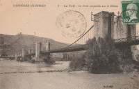
1840: Cordon
Brégnier-Cordon, Ain, France - Rhône River
| Bridgemeister ID: | 7050 (added 2022-05-26) |
| Year Completed: | 1840 |
| Name: | Cordon |
| Location: | Brégnier-Cordon, Ain, France |
| Crossing: | Rhône River |
| Use: | Vehicular |
| Status: | Destroyed, 1940 |
| Main Cables: | Wire |
Notes:
- Destroyed, 1940, during WWII.
Image Sets:

1840: Seyssel
Seyssel, Haute-Savoie and Seyssel, Ain, France - Rhône River
| Bridgemeister ID: | 3037 (added 2019-10-13) |
| Year Completed: | 1840 |
| Name: | Seyssel |
| Location: | Seyssel, Haute-Savoie and Seyssel, Ain, France |
| Crossing: | Rhône River |
| Coordinates: | 45.958542 N 5.832941 E |
| Maps: | Acme, GeoHack, Google, OpenStreetMap |
| References: | AGP |
| Use: | Vehicular |
| Status: | In use (last checked: 2019) |
| Main Cables: | Wire |
| Suspended Spans: | 2 |
| Main Span: | 1 |
| Side Span: | 1 |
External Links:
Image Sets:
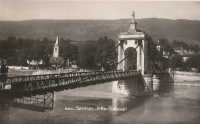
1842: Rochemaure
Rochemaure, Ardèche and Ancône, Drôme, France - Rhône River
| Bridgemeister ID: | 950 (added 2003-10-31) |
| Year Completed: | 1842 |
| Name: | Rochemaure |
| Location: | Rochemaure, Ardèche and Ancône, Drôme, France |
| Crossing: | Rhône River |
| Coordinates: | 44.583117 N 4.71035 E |
| Maps: | Acme, GeoHack, Google, OpenStreetMap |
| References: | BPF |
| Use: | Vehicular (one-lane) |
| Status: | Only towers remain (last checked: 2021) |
| Main Cables: | Wire |
| Suspended Spans: | 2 |
| Main Spans: | 2 |
Notes:
- Failed 1856, rebuilt 1858, destroyed 1940 (war), rebuilt 1942, destroyed 1944 (war), rebuilt 1946, restricted to pedestrians, 1983. Abandoned in the 1990s. Stood in a derelict state for several years.
- 2013: Work is completed to replace the derelict deck with a suspension footbridge that sits on the original piers but does not use the towers of the former suspension bridge. This new installation is tracked separately.
- Replaced by 2013 Himalayenne (Rochemaure, Himalayan) - Rochemaure, Ardèche, France.
- All past and present bridges at this location.
External Links:
Image Sets:

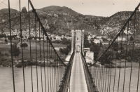
1843: Avignon
Avignon, Vaucluse and Villeneuve-lès-Avignon, Gard, France - Rhône River
| Bridgemeister ID: | 986 (added 2003-11-15) |
| Year Completed: | 1843 |
| Name: | Avignon |
| Location: | Avignon, Vaucluse and Villeneuve-lès-Avignon, Gard, France |
| Crossing: | Rhône River |
| Coordinates: | 43.951490 N 4.800048 E |
| Maps: | Acme, GeoHack, Google, OpenStreetMap |
| Principals: | Seguin Brothers |
| Use: | Vehicular |
| Status: | Demolished, c. 1960 |
| Main Cables: | Wire (iron) |
| Suspended Spans: | 3 |
| Main Span: | 1 |
| Side Spans: | 2 |
Notes:
- Coordinates are for the present day (2022) Pont Édouard Daladier. The suspension bridge was on an alignment immediately adjacent to it.
- 1888-1890: Strengthened, and perhaps largely rebuilt, by Ferdinand Arnodin. This introduced the hybrid cable-stayed/suspension system commonly seen in images of the bridge.
- 1944, June: Heavily damaged by US bombardment. Eventually repaired and reopened.
External Links:
Image Sets:
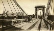

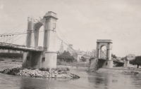
1845: College
Lyon, Métropole de Lyon, France - Rhône River
| Bridgemeister ID: | 1021 (added 2003-11-22) |
| Year Completed: | 1845 |
| Name: | College |
| Also Known As: | Collège |
| Location: | Lyon, Métropole de Lyon, France |
| Crossing: | Rhône River |
| Coordinates: | 45.765483 N 4.838717 E |
| Maps: | Acme, GeoHack, Google, OpenStreetMap |
| References: | BPF, PQL |
| Use: | Footbridge |
| Status: | Destroyed, 1944 |
| Main Cables: | Wire (iron) |
| Suspended Spans: | 3 |
| Main Span: | 1 |
| Side Spans: | 2 |
Notes:
- Destroyed 1944.
- Near 1831 La Feuillée - Lyon, Métropole de Lyon, France.
- Near 1832 Saint-Vincent - Lyon, Métropole de Lyon, France.
- Near 1839 L'Hôtel Dieu - Lyon, Métropole de Lyon, France.
- Near 1846 Saint Clair (Louis Philippe, Vaïsse) - Lyon, Métropole de Lyon, France.
- Near 1910 La Feuillée - Lyon, Métropole de Lyon, France.
- Replaced by 1945 College (Collège) - Lyon, Métropole de Lyon, France.
- All past and present bridges at this location.
External Links:
Image Sets:

1846: Saint Clair
Lyon, Métropole de Lyon, France - Rhône River
| Bridgemeister ID: | 551 (added before 2003) |
| Year Completed: | 1846 |
| Name: | Saint Clair |
| Also Known As: | Louis Philippe, Vaïsse |
| Location: | Lyon, Métropole de Lyon, France |
| Crossing: | Rhône River |
| References: | AAJ, PQL |
| Use: | Vehicular |
| Status: | Demolished, 1953 |
| Main Cables: | Wire (iron) |
| Suspended Spans: | 2 |
| Deck width: | 7 meters |
Notes:
- Damaged by drifting boat, 1854. Rebuilt, 1856. Bombed, 1944. Rebuilt, 1946. Demolished, 1953.
- Crossed at present-day location of Pont Maréchal de Lattre de Tassigny.
- Originally constructed with two suspended spans. When it was rebuilt in 1856, towers were added increasing the number of suspended spans to six.
- Near 1845 College (Collège) - Lyon, Métropole de Lyon, France.
External Links:
Image Sets:

1847: Évieu
Évieu, Ain and Les Avenières Veyrins-Thuellin, Isère, France - Rhône River
| Bridgemeister ID: | 7098 (added 2022-06-03) |
| Year Completed: | 1847 |
| Name: | Évieu |
| Location: | Évieu, Ain and Les Avenières Veyrins-Thuellin, Isère, France |
| Crossing: | Rhône River |
| Use: | Vehicular |
| Status: | Replaced, 1888 |
| Main Cables: | Wire |
Notes:
- Damaged in 1885 and replaced in 1888.
- Replaced by 1888 Évieu - Évieu, Ain and Les Avenières Veyrins-Thuellin, Isère, France.
- All past and present bridges at this location.
External Links:
1847: Donzère
Donzère, Drôme and Viviers, Ardèche, France - Rhône River
| Bridgemeister ID: | 970 (added 2003-11-13) |
| Year Completed: | 1847 |
| Name: | Donzère |
| Also Known As: | Robinet |
| Location: | Donzère, Drôme and Viviers, Ardèche, France |
| Crossing: | Rhône River |
| Coordinates: | 44.452367 N 4.6981 E |
| Maps: | Acme, GeoHack, Google, OpenStreetMap |
| References: | AAJ, BPF |
| Use: | Vehicular (one-lane) |
| Status: | In use (last checked: 2021) |
| Main Cables: | Wire (iron) |
| Suspended Spans: | 3 |
| Main Spans: | 3 x 100 meters (328.1 feet) estimated |
External Links:
Image Sets:
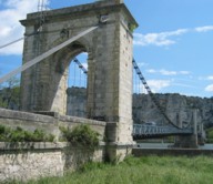

1847: Viviers
Viviers, Ardèche and Drôme, France - Rhône River
| Bridgemeister ID: | 1961 (added 2005-11-05) |
| Year Completed: | 1847 |
| Name: | Viviers |
| Location: | Viviers, Ardèche and Drôme, France |
| Crossing: | Rhône River |
| Coordinates: | 44.481667 N 4.699698 E |
| Maps: | Acme, GeoHack, Google, OpenStreetMap |
| References: | AAJ |
| Use: | Vehicular (one-lane) |
| Status: | Destroyed, 1944 |
| Main Cables: | Wire |
Notes:
- Later at same location 1954 Viviers - Viviers, Ardèche and Châteauneuf-Du-Rhône, Drôme, France.
- All past and present bridges at this location.
External Links:
Image Sets:
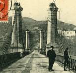
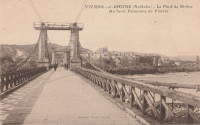
1849: Galliéni
Lyon, Métropole de Lyon, France - Rhône River
| Bridgemeister ID: | 1164 (added 2004-01-19) |
| Year Completed: | 1849 |
| Name: | Galliéni |
| Also Known As: | Napoleon |
| Location: | Lyon, Métropole de Lyon, France |
| Crossing: | Rhône River |
| Principals: | Seguin Brothers |
| References: | PQL, PTS2 |
| Use: | Vehicular |
| Status: | Replaced |
| Main Cables: | Wire (iron) |
| Suspended Spans: | 3 |
| Main Span: | 1 x 60 meters (196.9 feet) |
| Side Spans: | 1 x 39 meters (128 feet), 1 x 67 meters (219.8 feet) |
| Deck width: | 7.4 meters |
Notes:
- Replaced by an arch bridge in the early 20th century. Built as part of the same project as the Kitchener-Marchand bridge; they were on the same alignment, with one crossing the Saône and the other the Rhône. Both were originally known as the Napoleon bridges.
- Companion to 1849 Kitchener-Marchand (Napoleon, Kitchener, Midi) - Lyon, Métropole de Lyon, France.
1849: Le Pouzin
Le Pouzin, Ardèche, France - Rhône River
| Bridgemeister ID: | 1153 (added 2004-01-18) |
| Year Completed: | 1849 |
| Name: | Le Pouzin |
| Location: | Le Pouzin, Ardèche, France |
| Crossing: | Rhône River |
| Principals: | Adolphe Boulland |
| References: | AAJ |
| Use: | Vehicular |
| Status: | Destroyed, 1940 |
| Main Cables: | Wire (iron) |
| Suspended Spans: | 3 |
| Main Spans: | 3 x 100 meters (328.1 feet) |
External Links:
Image Sets:
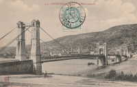
1849: Marc Seguin
Tournon-sur-Rhône, Ardèche and Tain-L'Hermitage, Drôme, France - Rhône River
| Bridgemeister ID: | 975 (added 2003-11-14) |
| Year Completed: | 1849 |
| Name: | Marc Seguin |
| Location: | Tournon-sur-Rhône, Ardèche and Tain-L'Hermitage, Drôme, France |
| Crossing: | Rhône River |
| Coordinates: | 45.068638 N 4.834972 E |
| Maps: | Acme, GeoHack, Google, OpenStreetMap |
| Principals: | Marc Seguin |
| References: | AAJ, BPF |
| Use: | Vehicular |
| Status: | Restricted to foot traffic (last checked: 2021) |
| Main Cables: | Wire (iron) |
| Suspended Spans: | 2 |
| Main Spans: | 2 |
Notes:
- A second bridge at Tournon, by Seguin, approximately 100 meters downstream from his 1825 bridge. Restored 1989.
- Near 1825 Tain-Tournon - Tournon-sur-Rhône, Ardèche and Tain, Drôme, France.
- Near 1958 Gustave Toursier - Tournon-sur-Rhône, Ardèche and Tain-L'Hermitage, Drôme, France.
External Links:
Image Sets:


1853: Peney
Peney, Satigny vicinity, Geneva, Switzerland - Rhône River
| Bridgemeister ID: | 1827 (added 2005-05-30) |
| Year Completed: | 1853 |
| Name: | Peney |
| Location: | Peney, Satigny vicinity, Geneva, Switzerland |
| Crossing: | Rhône River |
| Principals: | Hug |
| References: | AAJ, GHD |
| Use: | Vehicular |
| Status: | Collapsed, May 24, 1853 |
| Main Cables: | Wire (iron) |
| Suspended Spans: | 1 |
| Main Span: | 1 x 100 meters (328.1 feet) |
Notes:
- GHD describes how Dufour designed the bridge but was replaced (for political reasons) by a novice engineer, Mr. Hug who produced his own design. The bridge collapsed under test loading.
Image Sets:
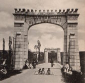
1856: Briord
Briord, Ain and Isère, France - Rhône River
| Bridgemeister ID: | 6997 (added 2022-04-24) |
| Year Completed: | 1856 |
| Name: | Briord |
| Location: | Briord, Ain and Isère, France |
| Crossing: | Rhône River |
| Use: | Vehicular |
| Status: | Removed |
| Main Cables: | Wire |
External Links:
Image Sets:

1869: Chavanay
Chavanay, Loire and Isère, France - Rhône River
| Bridgemeister ID: | 1702 (added 2005-03-29) |
| Year Completed: | 1869 |
| Name: | Chavanay |
| Location: | Chavanay, Loire and Isère, France |
| Crossing: | Rhône River |
| Coordinates: | 45.417327 N 4.740458 E |
| Maps: | Acme, GeoHack, Google, OpenStreetMap |
| Use: | Vehicular |
| Status: | Only towers remain (last checked: 2019) |
| Main Cables: | Wire (iron) |
| Suspended Spans: | 1 |
Notes:
- In 2019, one pair of pylons were still standing on the west bank of the Rhône.
Image Sets:

1883: Yenne
Yenne, Savoie and Ain, France - Rhône River
| Bridgemeister ID: | 1968 (added 2005-11-26) |
| Year Completed: | 1883 |
| Name: | Yenne |
| Location: | Yenne, Savoie and Ain, France |
| Crossing: | Rhône River |
| Coordinates: | 45.706294 N 5.751086 E |
| Maps: | Acme, GeoHack, Google, OpenStreetMap |
| References: | AGP |
| Use: | Vehicular (one-lane) |
| Status: | Destroyed, 1940 |
| Main Cables: | Wire |
| Suspended Spans: | 1 |
Notes:
- 1940: Destroyed during WWII.
- Later at same location 1951 Yenne - Yenne, Savoie and Ain, France.
- All past and present bridges at this location.
Image Sets:
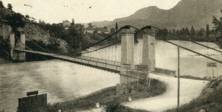
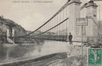
1888: Évieu
Évieu, Ain and Les Avenières Veyrins-Thuellin, Isère, France - Rhône River
| Bridgemeister ID: | 7099 (added 2022-06-03) |
| Year Completed: | 1888 |
| Name: | Évieu |
| Location: | Évieu, Ain and Les Avenières Veyrins-Thuellin, Isère, France |
| Crossing: | Rhône River |
| Status: | Removed |
| Main Cables: | Wire |
| Main Spans: | 2 |
Notes:
- Replaced 1847 Évieu - Évieu, Ain and Les Avenières Veyrins-Thuellin, Isère, France.
- All past and present bridges at this location.
Image Sets:
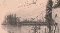
1889: La Voulte-sur-Rhône
La Voulte-sur-Rhône, Rhône, France - Rhône River
| Bridgemeister ID: | 1521 (added 2004-10-10) |
| Year Completed: | 1889 |
| Name: | La Voulte-sur-Rhône |
| Location: | La Voulte-sur-Rhône, Rhône, France |
| Crossing: | Rhône River |
| Coordinates: | 44.800217 N 4.784367 E |
| Maps: | Acme, GeoHack, Google, OpenStreetMap |
| Use: | Vehicular |
| Status: | In use (last checked: 2022) |
| Main Cables: | Wire |
| Suspended Spans: | 3 |
| Main Span: | 1 |
| Side Spans: | 2 |
Notes:
External Links:
Image Sets:
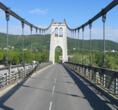

1901: Aramon
Aramon, Gard, France - Rhône River
| Bridgemeister ID: | 6432 (added 2021-08-12) |
| Year Completed: | 1901 |
| Name: | Aramon |
| Location: | Aramon, Gard, France |
| Crossing: | Rhône River |
| References: | PTS2 |
| Use: | Vehicular |
| Status: | Destroyed, August 15, 1944 |
| Main Cables: | Wire (steel) |
Image Sets:

1902: Vernaison
Vernaison, Métropole de Lyon, France - Rhône River
| Bridgemeister ID: | 6431 (added 2021-08-11) |
| Year Completed: | 1902 |
| Name: | Vernaison |
| Location: | Vernaison, Métropole de Lyon, France |
| Crossing: | Rhône River |
| Coordinates: | 45.646369 N 4.815423 E |
| Maps: | Acme, GeoHack, Google, OpenStreetMap |
| Principals: | Ferdinand Arnodin |
| References: | AAJ, PTS2 |
| Use: | Vehicular |
| Status: | Destroyed, June 1940 |
| Main Cables: | Wire (steel) |
Notes:
- Later at same location 1959 Vernaison - Vernaison and Solaize, Métropole de Lyon, France.
- All past and present bridges at this location.
External Links:
Image Sets:
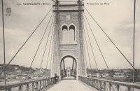
1904: Jons-Niévroz
Jons, Rhône and Niévroz, Ain, France - Rhône River
| Bridgemeister ID: | 2033 (added 2006-04-23) |
| Year Completed: | 1904 |
| Name: | Jons-Niévroz |
| Location: | Jons, Rhône and Niévroz, Ain, France |
| Crossing: | Rhône River |
| References: | AAJ |
| Use: | Vehicular |
| Status: | Destroyed, 1940 |
| Suspended Spans: | 1 |
| Main Span: | 1 x 200 meters (656.2 feet) |
Notes:
- Destroyed, 1940, during WWII.
- Similar to 1912 Groslée - Groslée, Ain and Brangues, Isère, France.
Image Sets:
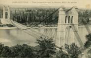
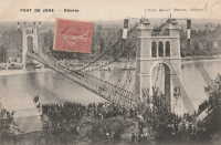
1912: Groslée
Groslée, Ain and Brangues, Isère, France - Rhône River
| Bridgemeister ID: | 1536 (added 2004-10-31) |
| Year Completed: | 1912 |
| Name: | Groslée |
| Location: | Groslée, Ain and Brangues, Isère, France |
| Crossing: | Rhône River |
| Coordinates: | 45.712333 N 5.548533 E |
| Maps: | Acme, GeoHack, Google, OpenStreetMap |
| Principals: | Ferdinand Arnodin |
| References: | BPF |
| Use: | Vehicular, with walkway |
| Status: | In use (last checked: 2019) |
| Main Cables: | Wire (steel) |
| Suspended Spans: | 1 |
| Main Span: | 1 x 177 meters (580.7 feet) estimated |
Notes:
External Links:
Image Sets:

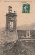
1927: Chartrouse
Arles, Bouches-du-Rhône, France - Rhône River
| Bridgemeister ID: | 4846 (added 2020-07-11) |
| Year Completed: | 1927 |
| Name: | Chartrouse |
| Location: | Arles, Bouches-du-Rhône, France |
| Crossing: | Rhône River |
| At or Near Feature: | Lône des Pilotes |
| Coordinates: | 43.463752 N 4.743590 E |
| Maps: | Acme, GeoHack, Google, OpenStreetMap |
| Use: | Vehicular (one-lane) |
| Status: | In use (last checked: 2019) |
| Main Cables: | Wire (steel) |
| Suspended Spans: | 1 |
External Links:
1931: Teil
Le Teil, Ardèche and Montélimar, Drôme, France - Rhône River
| Bridgemeister ID: | 1549 (added 2004-11-13) |
| Year Completed: | 1931 |
| Name: | Teil |
| Location: | Le Teil, Ardèche and Montélimar, Drôme, France |
| Crossing: | Rhône River |
| Coordinates: | 44.5519 N 4.692617 E |
| Maps: | Acme, GeoHack, Google, OpenStreetMap |
| References: | AAJ, BPF |
| Use: | Vehicular (two-lane, heavy vehicles), with walkway |
| Status: | In use (last checked: 2023) |
| Main Cables: | Wire (steel) |
| Suspended Spans: | 1 |
| Main Span: | 1 x 235 meters (771 feet) |
Notes:
- Destroyed, 1940. Rebuilt, 1943. Destroyed again, 1944. Rebuilt, 1950.
- Replaced 1839 Teil - Le Teil, Ardèche and Montélimar, Drôme, France.
- All past and present bridges at this location.
External Links:
- Pont routier du Teil - Inventaire Général du Patrimoine Culturel. Detailed history and many images of the suspension bridges at Le Teil. Translated: "In June 1940, the retreating French army cut the cables, which caused the deck and pylons to fall. A ferry was then put back into service. Rebuilt and reopened to traffic in 1943, the bridge was destroyed again in August 1944, following bombings, except for the gantries. Its reconstruction, almost identically, was undertaken from 1947 and completed in 1950, the year of its inauguration. In September 2007, following the rupture of a load-bearing cable, the bridge was closed to the public. Traffic was temporarily restored before definitive repairs were carried out in 2009."
- Structurae - Structure ID 20001106
Image Sets:
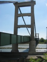

1933: Sablons
Sablons, Isère and Serrières, Ardèche, France - Rhône River
| Bridgemeister ID: | 891 (added 2003-09-06) |
| Year Completed: | 1933 |
| Name: | Sablons |
| Location: | Sablons, Isère and Serrières, Ardèche, France |
| Crossing: | Rhône River |
| Status: | Destroyed, 1944 |
Notes:
- Replaced 1828 Sablons - Sablons, Isère and Serrières, Ardèche, France.
- Replaced by 1951 Sablons - Sablons, Isère and Serrières, Ardèche, France.
- All past and present bridges at this location.
Image Sets:
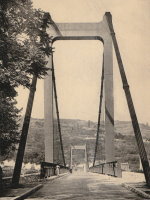
1935: Condrieu
Condrieu, Rhône and Les Roches-de-Condrieu, Isère, France - Rhône River
| Bridgemeister ID: | 1494 (added 2004-09-19) |
| Year Completed: | 1935 |
| Name: | Condrieu |
| Location: | Condrieu, Rhône and Les Roches-de-Condrieu, Isère, France |
| Crossing: | Rhône River |
| Coordinates: | 45.45655 N 4.768722 E |
| Maps: | Acme, GeoHack, Google, OpenStreetMap |
| References: | AAJ |
| Use: | Vehicular (two-lane), with walkway |
| Status: | Destroyed, June 1940 |
| Main Cables: | Wire (steel) |
| Suspended Spans: | 2 |
| Main Spans: | 2 |
Notes:
- Replaced 1831 Condrieu - Condrieu, Rhône and Les Roches-de-Condrieu, Isère, France.
- Replaced by Condrieu - Condrieu, Rhône and Les Roches-de-Condrieu, Isère, France.
- All past and present bridges at this location.
External Links:
- Pont de Condrieu - Wikipedia
- Pont entre Condrieu et les Roches detruit le 20 juin 1940 - Wikimedia. Image of the destroyed bridge.
- Structurae - Structure ID 20013233
Image Sets:
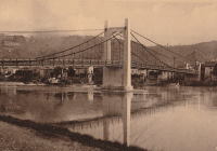
1945: College
Lyon, Métropole de Lyon, France - Rhône River
| Bridgemeister ID: | 6423 (added 2021-08-09) |
| Year Completed: | 1945 |
| Name: | College |
| Also Known As: | Collège |
| Location: | Lyon, Métropole de Lyon, France |
| Crossing: | Rhône River |
| Coordinates: | 45.765661 N 4.840563 E |
| Maps: | Acme, GeoHack, Google, OpenStreetMap |
| References: | BPF, PQL |
| Use: | Footbridge |
| Status: | In use (last checked: 2021) |
| Main Cables: | Wire (steel) |
| Suspended Spans: | 3 |
| Main Span: | 1 x 109.7 meters (359.9 feet) |
| Side Spans: | 2 |
Notes:
- Replaced 1845 College (Collège) - Lyon, Métropole de Lyon, France.
- Near 1832 Saint-Vincent - Lyon, Métropole de Lyon, France.
- Near former location of 1831 La Feuillée - Lyon, Métropole de Lyon, France.
- Near former location of 1910 La Feuillée - Lyon, Métropole de Lyon, France.
- All past and present bridges at this location.
Image Sets:
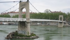
1945: Saint-Esprit
Pont-Saint-Esprit, Gard and Mondragon, Vaucluse, France - Rhône River
| Bridgemeister ID: | 8139 (added 2024-01-20) |
| Year Completed: | 1945 |
| Name: | Saint-Esprit |
| Location: | Pont-Saint-Esprit, Gard and Mondragon, Vaucluse, France |
| Crossing: | Rhône River |
| Coordinates: | 44.258917 N 4.650833 E |
| Maps: | Acme, GeoHack, Google, OpenStreetMap |
| Use: | Vehicular |
| Status: | Replaced, 1954 |
| Main Cables: | Wire (steel) |
| Suspended Spans: | 1 |
Notes:
- This suspension span replaced one arch of the Saint-Espirit bridge that had been destroyed in 1944 during WWII. It was replaced by a new concrete arch in 1954.
External Links:
Image Sets:

1947: Grésin
Bellegarde-sur-Valserine vicinity, Ain and Haute-Savoie, France - Rhône River
| Bridgemeister ID: | 1003 (added 2003-11-18) |
| Year Completed: | 1947 |
| Name: | Grésin |
| Location: | Bellegarde-sur-Valserine vicinity, Ain and Haute-Savoie, France |
| Crossing: | Rhône River |
| Coordinates: | 46.085407 N 5.861124 E |
| Maps: | Acme, GeoHack, Google, OpenStreetMap |
| Use: | Footbridge |
| Status: | In use (last checked: 2018) |
| Main Cables: | Wire (steel) |
| Suspended Spans: | 1 |
External Links:
1949: (footbridge)
Valence, Drôme and Guilherand-Granges, Ardèche, France - Rhône River
| Bridgemeister ID: | 6517 (added 2021-08-27) |
| Year Completed: | 1949 |
| Name: | (footbridge) |
| Location: | Valence, Drôme and Guilherand-Granges, Ardèche, France |
| Crossing: | Rhône River |
| Coordinates: | 44.931773 N 4.883700 E |
| Maps: | Acme, GeoHack, Google, OpenStreetMap |
| Use: | Footbridge |
| Status: | Removed, 1960s |
| Main Cables: | Wire (steel) |
| Main Spans: | 2 |
Notes:
- At former location of 1830 Valence - Valence, Drôme and Guilherand-Granges, Ardèche, France.
- All past and present bridges at this location.
Image Sets:

1951: Sablons
Sablons, Isère and Serrières, Ardèche, France - Rhône River
| Bridgemeister ID: | 892 (added 2003-09-06) |
| Year Completed: | 1951 |
| Name: | Sablons |
| Location: | Sablons, Isère and Serrières, Ardèche, France |
| Crossing: | Rhône River |
| Coordinates: | 45.318183 N 4.766867 E |
| Maps: | Acme, GeoHack, Google, OpenStreetMap |
| References: | BPF |
| Use: | Vehicular (two-lane, heavy vehicles), with walkway |
| Status: | In use (last checked: 2005) |
| Main Cables: | Wire (steel) |
| Suspended Spans: | 1 |
| Main Span: | 1 x 185 meters (607 feet) |
Notes:
- Replaced 1933 Sablons - Sablons, Isère and Serrières, Ardèche, France.
- All past and present bridges at this location.
External Links:
Image Sets:
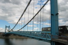
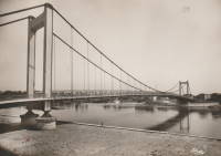
1951: Yenne
Yenne, Savoie and Ain, France - Rhône River
| Bridgemeister ID: | 1969 (added 2005-11-26) |
| Year Completed: | 1951 |
| Name: | Yenne |
| Location: | Yenne, Savoie and Ain, France |
| Crossing: | Rhône River |
| Coordinates: | 45.705713 N 5.750965 E |
| Maps: | Acme, GeoHack, Google, OpenStreetMap |
| Use: | Vehicular (one-lane) |
| Status: | In use (last checked: 2019) |
| Main Cables: | Wire (steel) |
| Suspended Spans: | 1 |
| Main Span: | 1 x 10⁶ meters (347.8 feet) estimated |
Notes:
- At former location of 1883 Yenne - Yenne, Savoie and Ain, France.
- All past and present bridges at this location.
External Links:
Image Sets:
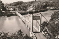
1954: Viviers
Viviers, Ardèche and Châteauneuf-Du-Rhône, Drôme, France - Rhône River
| Bridgemeister ID: | 1545 (added 2004-11-05) |
| Year Completed: | 1954 |
| Name: | Viviers |
| Location: | Viviers, Ardèche and Châteauneuf-Du-Rhône, Drôme, France |
| Crossing: | Rhône River |
| Coordinates: | 44.481583 N 4.698717 E |
| Maps: | Acme, GeoHack, Google, OpenStreetMap |
| Use: | Vehicular (two-lane, heavy vehicles), with walkway |
| Status: | In use (last checked: 2021) |
| Main Cables: | Wire (steel) |
| Suspended Spans: | 3 |
| Main Span: | 1 |
| Side Spans: | 2 |
Notes:
- At former location of 1847 Viviers - Viviers, Ardèche and Drôme, France.
- All past and present bridges at this location.
External Links:
Image Sets:
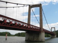
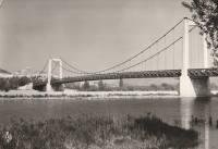
1958: Gustave Toursier
Tournon-sur-Rhône, Ardèche and Tain-L'Hermitage, Drôme, France - Rhône River
| Bridgemeister ID: | 1455 (added 2004-08-14) |
| Year Completed: | 1958 |
| Name: | Gustave Toursier |
| Location: | Tournon-sur-Rhône, Ardèche and Tain-L'Hermitage, Drôme, France |
| Crossing: | Rhône River |
| Coordinates: | 45.066638 N 4.840666 E |
| Maps: | Acme, GeoHack, Google, OpenStreetMap |
| Use: | Vehicular (two-lane, heavy vehicles), with walkway |
| Status: | In use (last checked: 2022) |
| Main Cables: | Wire (steel) |
| Suspended Spans: | 3 |
| Main Span: | 1 x 144 meters (472.4 feet) estimated |
| Side Spans: | 2 |
Notes:
- Near 1825 Tain-Tournon - Tournon-sur-Rhône, Ardèche and Tain, Drôme, France.
- Near 1849 Marc Seguin - Tournon-sur-Rhône, Ardèche and Tain-L'Hermitage, Drôme, France.
External Links:
Image Sets:

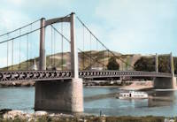
1959: Vernaison
Vernaison and Solaize, Métropole de Lyon, France - Rhône River
| Bridgemeister ID: | 1832 (added 2005-05-30) |
| Year Completed: | 1959 |
| Name: | Vernaison |
| Location: | Vernaison and Solaize, Métropole de Lyon, France |
| Crossing: | Rhône River |
| Coordinates: | 45.645621 N 4.816518 E |
| Maps: | Acme, GeoHack, Google, OpenStreetMap |
| Use: | Vehicular (two-lane) |
| Status: | In use (last checked: 2019) |
| Main Cables: | Wire (steel) |
| Suspended Spans: | 3 |
| Main Span: | 1 |
| Side Spans: | 2 |
Notes:
- At former location of 1902 Vernaison - Vernaison, Métropole de Lyon, France.
- Connects to Solaize - Solaize and Vernaison, Métropole de Lyon, France.
- All past and present bridges at this location.
External Links:
Image Sets:
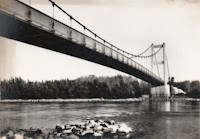
1998: Ile Falcon
Sierre, Switzerland - Rhône River
| Bridgemeister ID: | 2047 (added 2006-05-10) |
| Year Completed: | 1998 |
| Name: | Ile Falcon |
| Location: | Sierre, Switzerland |
| Crossing: | Rhône River |
| Coordinates: | 46.284582 N 7.550457 E |
| Maps: | Acme, GeoHack, Google, OpenStreetMap |
| Use: | Footbridge |
| Status: | In use (last checked: 2013) |
| Main Cables: | Wire (steel) |
| Suspended Spans: | 1 |
| Main Span: | 1 x 68 meters (223.1 feet) |
External Links:
2013: Himalayenne
Rochemaure, Ardèche, France - Rhône River
| Bridgemeister ID: | 6717 (added 2021-10-12) |
| Year Completed: | 2013 |
| Name: | Himalayenne |
| Also Known As: | Rochemaure, Himalayan |
| Location: | Rochemaure, Ardèche, France |
| Crossing: | Rhône River |
| At or Near Feature: | ViaRhôna Cycle Path |
| Coordinates: | 44.582660 N 4.711102 E |
| Maps: | Acme, GeoHack, Google, OpenStreetMap |
| Use: | Footbridge |
| Status: | In use (last checked: 2021) |
| Main Cables: | Wire (steel) |
Notes:
- Built on the rehabilitated piers of the older Rochemaure bridge.
- Replaced 1842 Rochemaure - Rochemaure, Ardèche and Ancône, Drôme, France.
- All past and present bridges at this location.
External Links:
2021: Virignin
La Balme, Savoie and Virignin, Ain, France - Rhône River
| Bridgemeister ID: | 7575 (added 2023-04-21) |
| Year Completed: | 2021 |
| Name: | Virignin |
| Location: | La Balme, Savoie and Virignin, Ain, France |
| Crossing: | Rhône River |
| At or Near Feature: | Véloroute ViaRhôna |
| Coordinates: | 45.710808 N 5.705120 E |
| Maps: | Acme, GeoHack, Google, OpenStreetMap |
| Use: | Footbridge |
| Status: | In use (last checked: 2022) |
| Main Cables: | Wire (steel) |
| Suspended Spans: | 1 |
| Main Span: | 1 x 164 meters (538.1 feet) estimated |
(footbridge)
Injoux-Génissiat, Ain and Franclens, Haute-Savoie, France - Rhône River
| Bridgemeister ID: | 7403 (added 2022-12-03) |
| Name: | (footbridge) |
| Location: | Injoux-Génissiat, Ain and Franclens, Haute-Savoie, France |
| Crossing: | Rhône River |
| At or Near Feature: | Barrage de Génissiat |
| Coordinates: | 46.050202 N 5.811581 E |
| Maps: | Acme, GeoHack, Google, OpenStreetMap |
| Use: | Footbridge |
| Status: | Removed |
| Main Cables: | Wire (steel) |
| Suspended Spans: | 1 |
Notes:
- Likely built around 1946-1947 during construction of the Génissiat dam.
Image Sets:
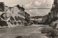
Condrieu
Condrieu, Rhône and Les Roches-de-Condrieu, Isère, France - Rhône River
| Bridgemeister ID: | 7506 (added 2023-01-02) |
| Name: | Condrieu |
| Location: | Condrieu, Rhône and Les Roches-de-Condrieu, Isère, France |
| Crossing: | Rhône River |
| Coordinates: | 45.456769 N 4.768646 E |
| Maps: | Acme, GeoHack, Google, OpenStreetMap |
| Use: | Vehicular |
| Status: | In use (last checked: 2022) |
| Main Cables: | Wire (steel) |
| Suspended Spans: | 2 |
| Main Spans: | 2 |
Notes:
- May have been completed in 1944.
- Replaced 1935 Condrieu - Condrieu, Rhône and Les Roches-de-Condrieu, Isère, France.
- All past and present bridges at this location.
External Links:
Image Sets:


Pougny-Chancy
Pougny-Chancy, Ain, France and Chancy, Switzerland - Rhône River
| Bridgemeister ID: | 9136 (added 2025-04-06) |
| Name: | Pougny-Chancy |
| Location: | Pougny-Chancy, Ain, France and Chancy, Switzerland |
| Crossing: | Rhône River |
| Status: | Removed |
| Suspended Spans: | 1 |
Notes:
- Appears to have been a temporary suspension bridge built in the 1920s during the construction of the hydroelectric dam just north of Pougny-Chancy
Image Sets:
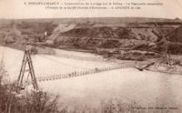
Roquemaure
Roquemaure, Gard and Orange, Vaucluse, France - Rhône River
| Bridgemeister ID: | 1736 (added 2005-04-19) |
| Name: | Roquemaure |
| Location: | Roquemaure, Gard and Orange, Vaucluse, France |
| Crossing: | Rhône River |
| Coordinates: | 44.071967 N 4.768917 E |
| Maps: | Acme, GeoHack, Google, OpenStreetMap |
| Use: | Vehicular (two-lane, heavy vehicles), with walkway |
| Status: | In use (last checked: 2019) |
| Main Cables: | Wire (steel) |
| Suspended Spans: | 3 |
| Main Span: | 1 |
| Side Spans: | 2 |
Notes:
- Replaced 1835 Roquemaure - Roquemaure, Gard and Orange, Vaucluse, France. One span of the older bridge is still standing next to the replacement.
- All past and present bridges at this location.
External Links:
Image Sets:

Saint-Vallier
Saint-Vallier, Drôme, France - Rhône River
| Bridgemeister ID: | 1754 (added 2005-04-20) |
| Name: | Saint-Vallier |
| Location: | Saint-Vallier, Drôme, France |
| Crossing: | Rhône River |
| Use: | Vehicular |
| Status: | Removed |
| Main Cables: | Wire (iron) |
Notes:
- Likely completed early 1830s.
- Similar to 1830 Bourg-Saint-Andéol - Bourg-Saint-Andéol, Ardèche, France.
Image Sets:
Do you have any information or photos for these bridges that you would like to share? Please email david.denenberg@bridgemeister.com.
Mail | Facebook | X (Twitter) | Bluesky
