Suspension Bridges Crossing Mississippi River
This is a list of all 10 bridges from the suspension bridge inventory crossing Mississippi River. Please note that different rivers with the same name will be grouped together. For example, selecting 'Bear Creek' shows bridges across several different Bear Creeks. Also, similarly named rivers are grouped separately. For example, 'River Dee' (UK) bridges are grouped separately from 'Dee River' (Australia) bridges. Wherever you see a Bridgemeister ID number click it to isolate the bridge on its own page.
Related Lists:
1855: Minneapolis
Minneapolis, Minnesota, USA - Mississippi River
| Bridgemeister ID: | 50 (added before 2003) |
| Year Completed: | 1855 |
| Name: | Minneapolis |
| Also Known As: | St. Anthony's Falls |
| Location: | Minneapolis, Minnesota, USA |
| Crossing: | Mississippi River |
| At or Near Feature: | Nicollet Island |
| Coordinates: | 44.985556 N 93.263389 W |
| Maps: | Acme, GeoHack, Google, OpenStreetMap |
| Principals: | Thomas M. Griffith |
| References: | AAJ, BPL, HBE, PTS2 |
| Use: | Vehicular |
| Status: | Demolished, 1876 |
| Main Cables: | Wire (iron) |
| Suspended Spans: | 1 |
| Main Span: | 1 x 189 meters (620 feet) |
| Deck width: | 17 feet |
Notes:
- Replaced by 1877 Minneapolis - Minneapolis, Minnesota, USA.
- Later at same location 1990 Hennepin Avenue (Father Louis Hennepin) - Minneapolis, Minnesota, USA.
- All past and present bridges at this location.
External Links:
Image Sets:

1877: Minneapolis
Minneapolis, Minnesota, USA - Mississippi River
| Bridgemeister ID: | 86 (added before 2003) |
| Year Completed: | 1877 |
| Name: | Minneapolis |
| Location: | Minneapolis, Minnesota, USA |
| Crossing: | Mississippi River |
| At or Near Feature: | Nicollet Island |
| Coordinates: | 44.985028 N 93.264556 W |
| Maps: | Acme, GeoHack, Google, OpenStreetMap |
| Principals: | Thomas M. Griffith |
| References: | AAJ, BPL, HBE, PTS2 |
| Use: | Vehicular, with walkway |
| Status: | Replaced, 1890 |
| Main Cables: | Wire (iron) |
| Suspended Spans: | 1 |
| Main Span: | 1 x 205.8 meters (675.1 feet) |
| Deck width: | 32 feet |
Notes:
- Replaced 1855 Minneapolis (St. Anthony's Falls) - Minneapolis, Minnesota, USA.
- Later at same location 1990 Hennepin Avenue (Father Louis Hennepin) - Minneapolis, Minnesota, USA.
- All past and present bridges at this location.
External Links:
Image Sets:

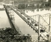
1932: Prairie du Chien
Praire du Chien, Wisconsin and Marquette, Iowa, USA - Mississippi River
| Bridgemeister ID: | 177 (added before 2003) |
| Year Completed: | 1932 |
| Name: | Prairie du Chien |
| Location: | Praire du Chien, Wisconsin and Marquette, Iowa, USA |
| Crossing: | Mississippi River |
| Coordinates: | 43.046 N 91.17 W |
| Maps: | Acme, GeoHack, Google, OpenStreetMap |
| Principals: | Austin Bridge Co. |
| References: | AAJ, AUB, BPL |
| Use: | Vehicular (two-lane) |
| Status: | Removed, 1974 |
| Main Cables: | Wire (steel) |
| Main Span: | 1 x 144.2 meters (473 feet) |
Notes:
- There were two back-to-back suspension bridges at this location.
- Connects to 1932 Prairie du Chien - Praire du Chien, Wisconsin and Marquette, Iowa, USA.
- All past and present bridges at this location.
External Links:
Image Sets:
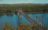
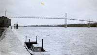
1932: Prairie du Chien
Praire du Chien, Wisconsin and Marquette, Iowa, USA - Mississippi River
| Bridgemeister ID: | 1256 (added before 2003) |
| Year Completed: | 1932 |
| Name: | Prairie du Chien |
| Location: | Praire du Chien, Wisconsin and Marquette, Iowa, USA |
| Crossing: | Mississippi River |
| Coordinates: | 43.05 N 91.162 W |
| Maps: | Acme, GeoHack, Google, OpenStreetMap |
| Principals: | Austin Bridge Co. |
| References: | AAJ, AUB, BPL |
| Use: | Vehicular (two-lane) |
| Status: | Removed, 1974 |
| Main Cables: | Wire (steel) |
| Main Span: | 1 x 144.2 meters (473 feet) |
Notes:
- There were two back-to-back suspension bridges at this location.
- Connects to 1932 Prairie du Chien - Praire du Chien, Wisconsin and Marquette, Iowa, USA.
- All past and present bridges at this location.
External Links:
Image Sets:


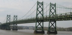
1935: Iowa-Illinois Memorial
Bettendorf, Iowa and Moline, Illinois, USA - Mississippi River
| Bridgemeister ID: | 180 (added before 2003) |
| Year Completed: | 1935 |
| Name: | Iowa-Illinois Memorial |
| Also Known As: | Interstate 74 Bridge, I-74 Bridge |
| Location: | Bettendorf, Iowa and Moline, Illinois, USA |
| Crossing: | Mississippi River |
| Coordinates: | 41.520264 N 90.513034 W |
| Maps: | Acme, GeoHack, Google, OpenStreetMap |
| Principals: | Modjeski, Masters, and Chase |
| References: | AAJ, CMR |
| Use: | Vehicular, with walkway |
| Status: | Demolished, 2024 |
| Main Cables: | Wire (steel) |
| Suspended Spans: | 3 |
| Main Span: | 1 x 225.6 meters (740 feet) |
| Side Spans: | 2 x 112.8 meters (370 feet) |
| Deck width: | 24.2 feet |
Notes:
- 2017, June 26: Groundbreaking ceremony for a replacement bridge for the twin Iowa-Illinois Memorial bridges. The new bridge is expected to be completed in 2020.
- 2020, November: Replacement span opens (for Iowa-bound traffic previously carried across the older of the two suspension bridges). Suspension bridge expected to be demolished in 2022.
- 2023: Demolition expected to be completed in 2024.
- 2024: Demolition of both bridges is complete.
- Next to 1960 Iowa-Illinois Memorial (Interstate 74 Bridge, I-74 Bridge) - Bettendorf, Iowa and Moline, Illinois, USA.
- All past and present bridges at this location.
External Links:
Image Sets:
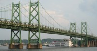


1955: Gateway
Clinton, Iowa and East Clinton, Illinois, USA - Mississippi River
| Bridgemeister ID: | 331 (added before 2003) |
| Year Completed: | 1955 |
| Name: | Gateway |
| Location: | Clinton, Iowa and East Clinton, Illinois, USA |
| Crossing: | Mississippi River |
| Coordinates: | 41.83785 N 90.18455 W |
| Maps: | Acme, GeoHack, Google, OpenStreetMap |
| References: | CMR |
| Use: | Vehicular (two-lane, heavy vehicles) |
| Status: | In use (last checked: 2019) |
| Main Cables: | Wire (steel) |
| Suspended Spans: | 1 |
| Main Span: | 1 x 196.3 meters (644 feet) |
External Links:
Image Sets:
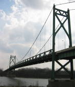

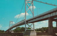
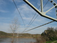
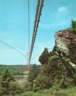
1955: Grand Tower Pipeline
Grand Tower, Illinois and Wittenberg vicinity, Missouri, USA - Mississippi River
| Bridgemeister ID: | 1028 (added 2003-11-30) |
| Year Completed: | 1955 |
| Name: | Grand Tower Pipeline |
| Location: | Grand Tower, Illinois and Wittenberg vicinity, Missouri, USA |
| Crossing: | Mississippi River |
| Coordinates: | 37.6417 N 89.513217 W |
| Maps: | Acme, GeoHack, Google, OpenStreetMap |
| Use: | Pipeline |
| Status: | In use (last checked: 2005) |
| Main Cables: | Wire (steel) |
| Suspended Spans: | 1 |
| Main Span: | 1 x 658.8 meters (2,161.5 feet) |
Notes:
- Large pipeline bridge, sometimes claimed to be "world's largest pipeline suspension bridge".
External Links:
Image Sets:
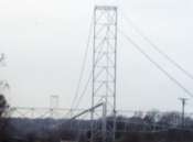
1960: Iowa-Illinois Memorial
Bettendorf, Iowa and Moline, Illinois, USA - Mississippi River
| Bridgemeister ID: | 213 (added before 2003) |
| Year Completed: | 1960 |
| Name: | Iowa-Illinois Memorial |
| Also Known As: | Interstate 74 Bridge, I-74 Bridge |
| Location: | Bettendorf, Iowa and Moline, Illinois, USA |
| Crossing: | Mississippi River |
| Coordinates: | 41.519372 N 90.513259 W |
| Maps: | Acme, GeoHack, Google, OpenStreetMap |
| References: | CMR |
| Use: | Vehicular |
| Status: | Demolished, 2024 |
| Main Cables: | Wire (steel) |
| Suspended Spans: | 3 |
| Main Span: | 1 |
| Side Spans: | 2 |
Notes:
- 2017, June 26: Groundbreaking ceremony for a replacement bridge for the twin Iowa-Illinois Memorial bridges. The new bridge is expected to be completed in 2020.
- 2021, December: Replacement span opens. Suspension bridge expected to be demolished in 2022.
- 2023: Demolition expected to be completed in 2024.
- 2024: Demolition of both bridges is complete.
- Next to 1935 Iowa-Illinois Memorial (Interstate 74 Bridge, I-74 Bridge) - Bettendorf, Iowa and Moline, Illinois, USA.
- All past and present bridges at this location.
External Links:
Image Sets:


1990: Hennepin Avenue
Minneapolis, Minnesota, USA - Mississippi River
| Bridgemeister ID: | 336 (added before 2003) |
| Year Completed: | 1990 |
| Name: | Hennepin Avenue |
| Also Known As: | Father Louis Hennepin |
| Location: | Minneapolis, Minnesota, USA |
| Crossing: | Mississippi River |
| Coordinates: | 44.985 N 93.26333 W |
| Maps: | Acme, GeoHack, Google, OpenStreetMap |
| Principals: | Henn. Co. Pub. Wrks., HNTB Corp |
| Use: | Vehicular (four or more lanes), with walkway |
| Status: | In use (last checked: 2006) |
| Main Cables: | Wire (steel) |
| Suspended Spans: | 1 |
| Main Span: | 1 x 190.5 meters (625 feet) |
Notes:
- At former location of 1855 Minneapolis (St. Anthony's Falls) - Minneapolis, Minnesota, USA.
- At former location of 1877 Minneapolis - Minneapolis, Minnesota, USA.
- All past and present bridges at this location.
External Links:
Image Sets:
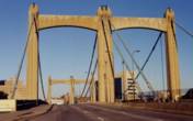

(footbridge)
Little Falls, Minnesota, USA - Mississippi River
| Bridgemeister ID: | 2102 (added 2006-08-19) |
| Name: | (footbridge) |
| Location: | Little Falls, Minnesota, USA |
| Crossing: | Mississippi River |
| At or Near Feature: | Little Falls Hydro Electric Station |
| Coordinates: | 45.976983 N 94.369717 W |
| Maps: | Acme, GeoHack, Google, OpenStreetMap |
| Use: | Footbridge |
| Status: | In use (last checked: 2006) |
| Main Cables: | Wire |
| Suspended Spans: | 1 |
Image Sets:

Do you have any information or photos for these bridges that you would like to share? Please email david.denenberg@bridgemeister.com.
Mail | Facebook | X (Twitter) | Bluesky