Suspension Bridges Crossing Green River
This is a list of all 5 bridges from the suspension bridge inventory crossing Green River. Please note that different rivers with the same name will be grouped together. For example, selecting 'Bear Creek' shows bridges across several different Bear Creeks. Also, similarly named rivers are grouped separately. For example, 'River Dee' (UK) bridges are grouped separately from 'Dee River' (Australia) bridges. Wherever you see a Bridgemeister ID number click it to isolate the bridge on its own page.
Related Lists:
1922: Dodge
Fontenelle vicinity, Sweetwater County, Wyoming, USA - Green River
| Bridgemeister ID: | 5557 (added 2020-12-18) |
| Year Completed: | 1922 |
| Name: | Dodge |
| Location: | Fontenelle vicinity, Sweetwater County, Wyoming, USA |
| Crossing: | Green River |
| Coordinates: | 41.960083 N 109.967750 W |
| Maps: | Acme, GeoHack, Google, OpenStreetMap |
| Principals: | Harold H. Dodge |
| Use: | Stock |
| Status: | Removed |
| Main Cables: | Wire (steel) |
| Main Span: | 1 |
Notes:
- This bridge was located northwest of the present-day Seedskadee National Wildlife Refuge before Fontenelle somewhere near the current McCullen Bluff boat launch but downstream from the bluff. Coordinates provided here may be the former location of the bridge. Appears to have been primarily a "sheep" bridge.
External Links:
- Museum Shares History of 3 Bridges Across the Green River - SweetwaterNOW. Images of the bridge.
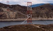
1962: (pipeline bridge)
Flaming Gorge National Recreation Area, Wyoming, USA - Green River
| Bridgemeister ID: | 1309 (added 2004-04-10) |
| Year Completed: | 1962 |
| Name: | (pipeline bridge) |
| Location: | Flaming Gorge National Recreation Area, Wyoming, USA |
| Crossing: | Green River |
| At or Near Feature: | Flaming Gorge Reservoir |
| Coordinates: | 41.03215 N 109.55519 W |
| Maps: | Acme, GeoHack, Google, OpenStreetMap |
| Use: | Pipeline |
| Status: | In use (last checked: 2019) |
| Main Cables: | Wire (steel) |
| Suspended Spans: | 1 |
| Main Span: | 1 x 584.9 meters (1,919 feet) |
Notes:
- Located two miles north of the Utah-Wyoming border.
External Links:
Image Sets:

(footbridge)
Auburn, Washington, USA - Green River
| Bridgemeister ID: | 2169 (added 2007-01-12) |
| Name: | (footbridge) |
| Location: | Auburn, Washington, USA |
| Crossing: | Green River |
| At or Near Feature: | Isaac Evans Park |
| Coordinates: | 47.32745 N 122.21021 W |
| Maps: | Acme, GeoHack, Google, OpenStreetMap |
| Use: | Footbridge |
| Status: | In use (last checked: 2007) |
| Main Cables: | Wire (steel) |
| Suspended Spans: | 1 |
| Main Span: | 1 x 50 meters (164 feet) estimated |
Image Sets:

(footbridge)
Palmer vicinity, Washington, USA - Green River
| Bridgemeister ID: | 1619 (added 2005-02-26) |
| Name: | (footbridge) |
| Location: | Palmer vicinity, Washington, USA |
| Crossing: | Green River |
| At or Near Feature: | Tacoma Water Supply Intake Diversion Dam |
| Coordinates: | 47.301141 N 121.842975 W |
| Maps: | Acme, GeoHack, Google, OpenStreetMap |
| Use: | Footbridge |
| Status: | In use (last checked: 2016) |
| Main Cables: | Wire |
| Suspended Spans: | 1 |
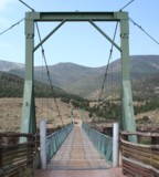
Swinging
Browns Park National Wildlife Refuge vicinity, Colorado, USA - Green River
| Bridgemeister ID: | 1442 (added 2004-07-31) |
| Name: | Swinging |
| Location: | Browns Park National Wildlife Refuge vicinity, Colorado, USA |
| Crossing: | Green River |
| Coordinates: | 40.827833 N 109.030444 W |
| Maps: | Acme, GeoHack, Google, OpenStreetMap |
| Use: | Vehicular (one-lane) |
| Status: | In use (last checked: 2019) |
| Main Cables: | Wire (steel) |
| Suspended Spans: | 1 |
| Main Span: | 1 x 96.3 meters (316 feet) estimated |
Notes:
- June 2014: Damaged when a tractor, well over the posted weight limit, tried to cross and broke through the bridge deck. Reopened August 23, 2018 after an "extensive reconstruction" that completely replaced the deck and possibly cables. After reconstruction, the weight limit was increased from 3 tons to 20 tons.
- November 2009: Closed due to safety concerns after six cable strrands were found to be broken. Repaired June-August 2010 and reopened.
External Links:
Image Sets:


Do you have any information or photos for these bridges that you would like to share? Please email david.denenberg@bridgemeister.com.
Mail | Facebook | X (Twitter) | Bluesky