Suspension Bridges Crossing Elk River
This is a list of all 16 bridges from the suspension bridge inventory crossing Elk River. Please note that different rivers with the same name will be grouped together. For example, selecting 'Bear Creek' shows bridges across several different Bear Creeks. Also, similarly named rivers are grouped separately. For example, 'River Dee' (UK) bridges are grouped separately from 'Dee River' (Australia) bridges. Wherever you see a Bridgemeister ID number click it to isolate the bridge on its own page.
Related Lists:
1852: Charleston
Charleston, West Virginia, USA - Elk River
| Bridgemeister ID: | 38 (added before 2003) |
| Year Completed: | 1852 |
| Name: | Charleston |
| Also Known As: | Lovell Street |
| Location: | Charleston, West Virginia, USA |
| Crossing: | Elk River |
| Coordinates: | 38.358222 N 81.639861 W |
| Maps: | Acme, GeoHack, Google, OpenStreetMap |
| Principals: | W. O. Buchanan, William Kuhn, Abraham Wright |
| References: | AAJ, EOV, HBE, PTS2 |
| Use: | Vehicular |
| Status: | Collapsed, December 15, 1904 |
| Main Cables: | Wire (iron) |
| Suspended Spans: | 1 |
| Main Span: | 1 x 145.7 meters (478 feet) |
| Deck width: | 17 feet |
Notes:
- Was still part of Virginia at time of completion. The bridge was located on (or close to) the alignment of Washington Street. East Charleston's Lovell Street eventually became East Washington Street.
- Damaged during Civil War. An article in the August 2, 1861 issue of the New York Times mentions: "A junction of our forces having now been effected, the army at once moved on to Elk River, which debouches into the Kanawha at Charleston, where the army encamped for the night. We would have crossed the stream at once, and marched through the town the same evening, but for the fact that the rebels had partially destroyed the beautiful suspension bridge which spans Elk River at this spot, rendering it unsafe for passage. Not content with burning a portion of the flooring, they nearly severed the strands which support the structure, and aid their work, too, in the most bungling manner. A more shameless piece of vandalism I never witnessed. While the army slept, a company of sappers and miners repaired the damage, and yesterday the army, nearly five thousand strong, marched through the streets of Charleston."
- Near 1884 Spring Street (Virginia Street) - Charleston, West Virginia, USA.
External Links:
Image Sets:


1854: Elk River
Sutton, West Virginia, USA - Elk River
| Bridgemeister ID: | 554 (added before 2003) |
| Year Completed: | 1854 |
| Name: | Elk River |
| Location: | Sutton, West Virginia, USA |
| Crossing: | Elk River |
| Principals: | Ira Hart |
| References: | EOV |
| Use: | Vehicular, with walkway |
| Status: | Removed, 1930 |
| Main Cables: | Wire (iron) |
| Main Span: | 1 x 140.2 meters (460 feet) |
External Links:
Image Sets:

1884: Spring Street
Charleston, West Virginia, USA - Elk River
| Bridgemeister ID: | 1427 (added 2004-07-24) |
| Year Completed: | 1884 |
| Name: | Spring Street |
| Also Known As: | Virginia Street |
| Location: | Charleston, West Virginia, USA |
| Crossing: | Elk River |
| Coordinates: | 38.358306 N 81.627444 W |
| Maps: | Acme, GeoHack, Google, OpenStreetMap |
| References: | AAJ, HBE, PTS2 |
| Use: | Vehicular and Rail (streetcar) |
| Status: | Removed |
| Main Cables: | Wire |
| Main Span: | 1 x 83.2 meters (273 feet) |
Notes:
- Originally crossed the Elk River at Virginia Street. The bridge was dismantled and erected at Sprint Street a bit. The 1884 year of completion may represent the relocation to Spring Street and not the original construction at Virginia Street.
- AAJ: Repaired by William Hildenbrand a few years after completion.
- Near 1852 Charleston (Lovell Street) - Charleston, West Virginia, USA.
External Links:
- Spring Street Bridge - mywvhome.com. Images and history of the bridge.
(footbridge)
Bergoo vicinity, West Virginia, USA - Elk River
| Bridgemeister ID: | 1688 (added 2005-03-27) |
| Name: | (footbridge) |
| Location: | Bergoo vicinity, West Virginia, USA |
| Crossing: | Elk River |
| Coordinates: | 38.49306 N 80.29407 W |
| Maps: | Acme, GeoHack, Google, OpenStreetMap |
| Use: | Footbridge |
| Status: | In use (last checked: 2005) |
| Main Cables: | Wire |
| Suspended Spans: | 1 |
Image Sets:
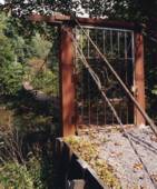
(footbridge)
Clifton Ford vicinity and Webster Springs vicinity, West Virginia, USA - Elk River
| Bridgemeister ID: | 1670 (added 2005-03-22) |
| Name: | (footbridge) |
| Location: | Clifton Ford vicinity and Webster Springs vicinity, West Virginia, USA |
| Crossing: | Elk River |
| Coordinates: | 38.57102 N 80.48879 W |
| Maps: | Acme, GeoHack, Google, OpenStreetMap |
| Use: | Footbridge |
| Status: | In use (last checked: 2005) |
| Main Cables: | Wire |
| Suspended Spans: | 1 |
| Main Span: | 1 x 70.1 meters (230 feet) estimated |
Notes:
Image Sets:

(footbridge)
Clifton Ford vicinity and Webster Springs vicinity, West Virginia, USA - Elk River
| Bridgemeister ID: | 1671 (added 2005-03-22) |
| Name: | (footbridge) |
| Location: | Clifton Ford vicinity and Webster Springs vicinity, West Virginia, USA |
| Crossing: | Elk River |
| Coordinates: | 38.56377 N 80.48884 W |
| Maps: | Acme, GeoHack, Google, OpenStreetMap |
| Use: | Footbridge |
| Status: | In use (last checked: 2005) |
| Main Cables: | Wire |
| Suspended Spans: | 1 |
| Main Span: | 1 x 79.2 meters (260 feet) estimated |
Notes:
- Near (footbridge) - Clifton Ford vicinity and Webster Springs vicinity, West Virginia, USA.
- Near (footbridge) - Clifton Ford vicinity and Webster Springs vicinity, West Virginia, USA.
Image Sets:

(footbridge)
Clifton Ford vicinity and Webster Springs vicinity, West Virginia, USA - Elk River
| Bridgemeister ID: | 1672 (added 2005-03-22) |
| Name: | (footbridge) |
| Location: | Clifton Ford vicinity and Webster Springs vicinity, West Virginia, USA |
| Crossing: | Elk River |
| Coordinates: | 38.55854 N 80.48617 W |
| Maps: | Acme, GeoHack, Google, OpenStreetMap |
| Use: | Footbridge |
| Status: | In use (last checked: 2005) |
| Main Cables: | Wire |
| Suspended Spans: | 1 |
| Main Span: | 1 x 63.4 meters (208 feet) estimated |
Notes:
Image Sets:

(footbridge)
Clifton Ford vicinity and Webster Springs vicinity, West Virginia, USA - Elk River
| Bridgemeister ID: | 1673 (added 2005-03-22) |
| Name: | (footbridge) |
| Location: | Clifton Ford vicinity and Webster Springs vicinity, West Virginia, USA |
| Crossing: | Elk River |
| Coordinates: | 38.52709 N 80.47652 W |
| Maps: | Acme, GeoHack, Google, OpenStreetMap |
| Use: | Footbridge |
| Status: | In use (last checked: 2005) |
| Main Cables: | Wire |
| Suspended Spans: | 1 |
| Main Span: | 1 x 72.5 meters (238 feet) estimated |
Notes:
Image Sets:

(footbridge)
Clifton Ford vicinity and Webster Springs vicinity, West Virginia, USA - Elk River
| Bridgemeister ID: | 1674 (added 2005-03-22) |
| Name: | (footbridge) |
| Location: | Clifton Ford vicinity and Webster Springs vicinity, West Virginia, USA |
| Crossing: | Elk River |
| Coordinates: | 38.52487 N 80.48331 W |
| Maps: | Acme, GeoHack, Google, OpenStreetMap |
| Use: | Footbridge |
| Status: | In use (last checked: 2005) |
| Main Cables: | Wire |
| Suspended Spans: | 1 |
| Main Span: | 1 x 55.8 meters (183 feet) estimated |
Notes:
- Near (footbridge) - Clifton Ford vicinity and Webster Springs vicinity, West Virginia, USA.
- Near (footbridge) - Clifton Ford vicinity and Webster Springs vicinity, West Virginia, USA.
Image Sets:
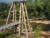
(footbridge)
Clifton Ford vicinity and Webster Springs vicinity, West Virginia, USA - Elk River
| Bridgemeister ID: | 1675 (added 2005-03-22) |
| Name: | (footbridge) |
| Location: | Clifton Ford vicinity and Webster Springs vicinity, West Virginia, USA |
| Crossing: | Elk River |
| Coordinates: | 38.51794 N 80.48419 W |
| Maps: | Acme, GeoHack, Google, OpenStreetMap |
| Use: | Footbridge |
| Status: | In use (last checked: 2005) |
| Main Cables: | Wire |
| Suspended Spans: | 1 |
| Main Span: | 1 x 59.4 meters (195 feet) estimated |
Notes:
Image Sets:
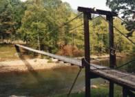
(footbridge)
Clifton Ford vicinity and Webster Springs vicinity, West Virginia, USA - Elk River
| Bridgemeister ID: | 1682 (added 2005-03-26) |
| Name: | (footbridge) |
| Location: | Clifton Ford vicinity and Webster Springs vicinity, West Virginia, USA |
| Crossing: | Elk River |
| Coordinates: | 38.59299 N 80.49238 W |
| Maps: | Acme, GeoHack, Google, OpenStreetMap |
| Use: | Footbridge |
| Status: | Derelict (last checked: 2005) |
| Main Cables: | Wire |
| Suspended Spans: | 1 |
Notes:
- Bridgemeister.com gives you the good, the bad, and the ugly.
Image Sets:
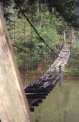
(footbridge)
Clifton Ford vicinity and Webster Springs vicinity, West Virginia, USA - Elk River
| Bridgemeister ID: | 1683 (added 2005-03-26) |
| Name: | (footbridge) |
| Location: | Clifton Ford vicinity and Webster Springs vicinity, West Virginia, USA |
| Crossing: | Elk River |
| Coordinates: | 38.50829 N 80.47778 W |
| Maps: | Acme, GeoHack, Google, OpenStreetMap |
| Use: | Footbridge |
| Status: | In use (last checked: 2005) |
| Main Cables: | Wire |
| Suspended Spans: | 1 |
| Main Span: | 1 x 77.1 meters (253 feet) estimated |
Image Sets:
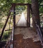
(suspension bridge)
Dorfee, Procious vicinity, Clay County, West Virginia, USA - Elk River
| Bridgemeister ID: | 4938 (added 2020-08-08) |
| Name: | (suspension bridge) |
| Location: | Dorfee, Procious vicinity, Clay County, West Virginia, USA |
| Crossing: | Elk River |
| Coordinates: | 38.451155 N 81.169155 W |
| Maps: | Acme, GeoHack, Google, OpenStreetMap |
| Status: | Derelict (last checked: 2020) |
| Main Cables: | Wire |
External Links:
(suspension bridge)
Falling Rock, West Virginia, USA - Elk River
| Bridgemeister ID: | 3288 (added 2019-11-23) |
| Name: | (suspension bridge) |
| Location: | Falling Rock, West Virginia, USA |
| Crossing: | Elk River |
| Coordinates: | 38.466899 N 81.401232 W |
| Maps: | Acme, GeoHack, Google, OpenStreetMap |
| Status: | Extant (last checked: 2019) |
Elkhurst
Elkhurst, Clay County, West Virginia, USA - Elk River
| Bridgemeister ID: | 327 (added before 2003) |
| Name: | Elkhurst |
| Location: | Elkhurst, Clay County, West Virginia, USA |
| Crossing: | Elk River |
| Coordinates: | 38.45182 N 81.15428 W |
| Maps: | Acme, GeoHack, Google, OpenStreetMap |
| Use: | Vehicular (one-lane) |
| Status: | Closed, 2003 (last checked: 2004) |
| Main Cables: | Wire (steel) |
| Suspended Spans: | 3 |
| Main Span: | 1 |
| Side Spans: | 2 |
Notes:
- Very narrow vehicular suspension bridge.
- 4,200-pound weight limit imposed, 1968.
External Links:
Image Sets:

Pleasant Island
Elkview, West Virginia, USA - Elk River
| Bridgemeister ID: | 3287 (added 2019-11-23) |
| Name: | Pleasant Island |
| Location: | Elkview, West Virginia, USA |
| Crossing: | Elk River |
| Coordinates: | 38.446935 N 81.462663 W |
| Maps: | Acme, GeoHack, Google, OpenStreetMap |
| Use: | Footbridge |
| Status: | Extant (last checked: 2015) |
| Main Cables: | Wire (steel) |
Do you have any information or photos for these bridges that you would like to share? Please email david.denenberg@bridgemeister.com.
Mail | Facebook | X (Twitter) | Bluesky