Suspension Bridges Crossing Connecticut River
This is a list of all 4 bridges from the suspension bridge inventory crossing Connecticut River. Please note that different rivers with the same name will be grouped together. For example, selecting 'Bear Creek' shows bridges across several different Bear Creeks. Also, similarly named rivers are grouped separately. For example, 'River Dee' (UK) bridges are grouped separately from 'Dee River' (Australia) bridges. Wherever you see a Bridgemeister ID number click it to isolate the bridge on its own page.
Related Lists:
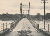
1872: Lower
Turners Falls, Montague, Massachusetts, USA - Connecticut River
| Bridgemeister ID: | 340 (added before 2003) |
| Year Completed: | 1872 |
| Name: | Lower |
| Also Known As: | White |
| Location: | Turners Falls, Montague, Massachusetts, USA |
| Crossing: | Connecticut River |
| Coordinates: | 42.609165 N 72.561433 W |
| Maps: | Acme, GeoHack, Google, OpenStreetMap |
| References: | CCR, PTS2 |
| Use: | Vehicular |
| Status: | Removed, circa 1936 |
| Main Cables: | Wire |
| Suspended Spans: | 1 |
Notes:
- Damaged by flood, 1936 and removed soon after.
- Near 1878 Upper (Red) - Turners Falls, Montague and Riverside, Gill, Massachusetts, USA.
External Links:
Image Sets:

1878: Upper
Turners Falls, Montague and Riverside, Gill, Massachusetts, USA - Connecticut River
| Bridgemeister ID: | 87 (added before 2003) |
| Year Completed: | 1878 |
| Name: | Upper |
| Also Known As: | Red |
| Location: | Turners Falls, Montague and Riverside, Gill, Massachusetts, USA |
| Crossing: | Connecticut River |
| Coordinates: | 42.607611 N 72.549278 W |
| Maps: | Acme, GeoHack, Google, OpenStreetMap |
| Principals: | J.W. Shipman |
| References: | CCR |
| Use: | Vehicular |
| Status: | Dismantled, 1942 |
| Main Cables: | Wire |
| Suspended Spans: | 1 |
| Main Span: | 1 x 166 meters (544.6 feet) estimated |
Notes:
External Links:
Image Sets:

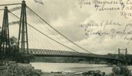
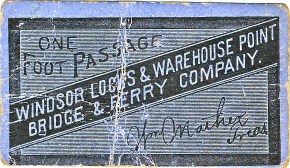
1886: Windsor Locks
Windsor Locks and Warehouse Point, Connecticut, USA - Connecticut River
| Bridgemeister ID: | 306 (added before 2003) |
| Year Completed: | 1886 |
| Name: | Windsor Locks |
| Also Known As: | Bridge Street |
| Location: | Windsor Locks and Warehouse Point, Connecticut, USA |
| Crossing: | Connecticut River |
| Coordinates: | 41.929111 N 72.624167 W |
| Maps: | Acme, GeoHack, Google, OpenStreetMap |
| Principals: | James Shipman |
| References: | AAJ, PTS2 |
| Use: | Vehicular (one-lane) |
| Status: | Removed, c. 1921 |
| Main Cables: | Wire |
| Suspended Spans: | 3 |
| Main Span: | 1 x 167.6 meters (550 feet) |
| Side Spans: | 2 x 91.4 meters (300 feet) |
Notes:
- 1921: Replacement multi-span truss bridge completed. Unclear when the suspension bridge was removed.
External Links:
Image Sets:


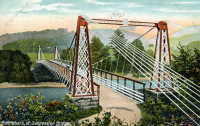
1889: Chesterfield
Chesterfield vicinity, New Hampshire and Brattleboro, Vermont, USA - Connecticut River
| Bridgemeister ID: | 95 (added before 2003) |
| Year Completed: | 1889 |
| Name: | Chesterfield |
| Also Known As: | Brattleboro |
| Location: | Chesterfield vicinity, New Hampshire and Brattleboro, Vermont, USA |
| Crossing: | Connecticut River |
| Coordinates: | 42.883889 N 72.551833 W |
| Maps: | Acme, GeoHack, Google, OpenStreetMap |
| Principals: | Berlin Iron Bridge Co. |
| References: | AAJ, CCR |
| Use: | Vehicular |
| Status: | Destroyed, March 19, 1936 |
| Main Cables: | Wire |
| Suspended Spans: | 1 |
Notes:
- Destroyed by flood March 19, 1936.
External Links:
- The one-bridge idea that faded into history | Community-news | reformer.com. Article about the bridge by the Brattleboro Historic Society. Dated August 5, 2021. Photos and history of the bridge.
- Bridgehunter.com - BH64259
Image Sets:

Do you have any information or photos for these bridges that you would like to share? Please email david.denenberg@bridgemeister.com.
Mail | Facebook | X (Twitter) | Bluesky