Suspension Bridges of Japan (1-100 of 636)
This is a list of bridges 1 through 100 (of 636 total) from the suspension bridge inventory for the country Japan. Wherever you see a Bridgemeister ID number click it to isolate the bridge on its own page.
Related Lists:
1902: (suspension bridge)
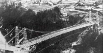
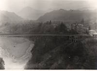
Chichibu, Saitama, Japan - Arakawa River
| Bridgemeister ID: | 5051 (added 2020-08-28) |
| Year Completed: | 1902 |
| Name: | (suspension bridge) |
| Location: | Chichibu, Saitama, Japan |
| Crossing: | Arakawa River |
| Coordinates: | 35.961412 N 138.975878 E |
| Maps: | Acme, GeoHack, Google, OpenStreetMap |
| Status: | Dismantled, 1980 |
| Main Cables: | Wire (steel) |
| Suspended Spans: | 1 |
Notes:
- Another suspension bridge was built on its piers (c. 2020) as part of the Gravity Park attraction.
Image Sets:
1916: Katsuyama
Japan
1916: Mino
Mino, Gifu, Japan - Nagara River
| Bridgemeister ID: | 7908 (added 2023-10-21) |
| Year Completed: | 1916 |
| Name: | Mino |
| Also Known As: | 美濃橋 |
| Location: | Mino, Gifu, Japan |
| Crossing: | Nagara River |
| Coordinates: | 35.552417 N 136.910267 E |
| Maps: | Acme, GeoHack, Google, OpenStreetMap |
| Use: | Vehicular (one-lane) |
| Status: | Restricted to foot traffic, since c. 1960s (last checked: 2023) |
| Main Cables: | Wire (steel) |
| Suspended Spans: | 1 |
External Links:
1918: Ookui
Yamaura, Komoro City, Nagano, Japan - Chikuma River
| Bridgemeister ID: | 6958 (added 2022-02-19) |
| Year Completed: | 1918 |
| Name: | Ookui |
| Also Known As: | Ookui-bashi, 大杭橋 |
| Location: | Yamaura, Komoro City, Nagano, Japan |
| Crossing: | Chikuma River |
| Coordinates: | 36.302159 N 138.422041 E |
| Maps: | Acme, GeoHack, Google, OpenStreetMap |
| Use: | Vehicular |
| Status: | Derelict (last checked: 2022) |
| Main Cables: | Wire (steel) |
| Suspended Spans: | 1 |
| Main Span: | 1 x 50 meters (164 feet) estimated |
Notes:
- 2019: Heavily damaged by typhoon. Appears to have already been closed to all traffic prior.
1920: Hayakawa
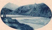
Osozawa (遅沢), Minobu (身延町), Minamikoma District and Awagura (粟倉), Minobu (身延町), Minamikoma District, Yamanashi, Japan - Haya River
| Bridgemeister ID: | 9050 (added 2025-02-09) |
| Year Completed: | 1920 |
| Name: | Hayakawa |
| Location: | Osozawa (遅沢), Minobu (身延町), Minamikoma District and Awagura (粟倉), Minobu (身延町), Minamikoma District, Yamanashi, Japan |
| Crossing: | Haya River |
| Coordinates: | 35.433806 N 138.422139 E |
| Maps: | Acme, GeoHack, Google, OpenStreetMap |
| Use: | Vehicular |
| Status: | Replaced |
| Main Cables: | Wire |
Notes:
- Coordinates provided here appear to be the approximate location of the bridge.
External Links:
- Old National Route 52, Hayakawa Bridge (旧国道52号線・早川橋). Details about some of the bridges at and near this location.
Image Sets:
1921: Niyodo
Japan
1922: Kawamoto
Japan
1922: Momosuke
Nagiso-cho, Kiso-gun, Nagano, Japan - Kiso River
| Bridgemeister ID: | 1051 (added 2003-12-07) |
| Year Completed: | 1922 |
| Name: | Momosuke |
| Also Known As: | 桃介橋 |
| Location: | Nagiso-cho, Kiso-gun, Nagano, Japan |
| Crossing: | Kiso River |
| Coordinates: | 35.600776 N 137.606515 E |
| Maps: | Acme, GeoHack, Google, OpenStreetMap |
| Use: | Footbridge |
| Status: | In use (last checked: 2019) |
| Main Cables: | Wire (steel) |
| Suspended Spans: | 4 |
| Main Spans: | 2 x 104.5 meters (342.8 feet) |
| Side Spans: | 2 x 23.9 meters (78.4 feet) |
Notes:
- Rebuilt 1993.
External Links:
1923: Kaneyama
Japan
1924: Shoki
Japan
1926: Shirakawa
Shirakawa, Gifu, Japan - Hida River
| Bridgemeister ID: | 3206 (added 2019-11-10) |
| Year Completed: | 1926 |
| Name: | Shirakawa |
| Also Known As: | 白川橋 |
| Location: | Shirakawa, Gifu, Japan |
| Crossing: | Hida River |
| Coordinates: | 35.579518 N 137.186653 E |
| Maps: | Acme, GeoHack, Google, OpenStreetMap |
| Use: | Vehicular (one-lane) |
| Status: | Restricted to foot traffic (last checked: 2014) |
| Main Cables: | Wire (steel) |
| Suspended Spans: | 3 |
| Main Span: | 1 x 74.6 meters (244.8 feet) |
| Side Spans: | 2 x 20 meters (65.6 feet) |
External Links:
1927: Miyoshi
Tokushima, Tokushima, Japan - Yoshino River
| Bridgemeister ID: | 1145 (added 2004-01-17) |
| Year Completed: | 1927 |
| Name: | Miyoshi |
| Location: | Tokushima, Tokushima, Japan |
| Crossing: | Yoshino River |
| References: | BAAW |
| Status: | Removed |
| Main Cables: | Wire |
| Main Span: | 1 x 139.9 meters (459 feet) |
Notes:
- BAAW: suspension cables removed, 1989, replaced by arches. However, the modified structure (pictured in BAAW) appears to be more of a continuous truss than an arch-based structure. The bridge appears to have been subsequently removed entirely as there are no current (as of 2020) Yoshino River bridges near Myoshi resembling the bridge.
1928: Kiyosu
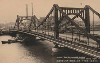
Chuo City, Tokyo, Japan - Sumida River
| Bridgemeister ID: | 440 (added before 2003) |
| Year Completed: | 1928 |
| Name: | Kiyosu |
| Also Known As: | 清洲橋 |
| Location: | Chuo City, Tokyo, Japan |
| Crossing: | Sumida River |
| Coordinates: | 35.682395 N 139.792022 E |
| Maps: | Acme, GeoHack, Google, OpenStreetMap |
| Principals: | Yutaka Tanaka |
| References: | AAJ, BAAW, PTS2, SSS |
| Use: | Vehicular (four-lane), with walkway |
| Status: | In use (last checked: 2022) |
| Main Cables: | Eyebar (steel) |
| Suspended Spans: | 3 |
| Main Span: | 1 x 91.4 meters (299.9 feet) |
| Side Spans: | 2 |
| Deck width: | 85 feet |
| Characteristics: | Self-anchored |
Notes:
- Self-anchored.
- 2019: Major rehabilitation in progress.
External Links:
Image Sets:
1928: Tamate
Kashiwara, Osaka, Japan - Ishi River
| Bridgemeister ID: | 4651 (added 2020-06-17) |
| Year Completed: | 1928 |
| Name: | Tamate |
| Also Known As: | 玉手橋 |
| Location: | Kashiwara, Osaka, Japan |
| Crossing: | Ishi River |
| Coordinates: | 34.566634 N 135.621691 E |
| Maps: | Acme, GeoHack, Google, OpenStreetMap |
| Status: | Restricted to foot traffic (last checked: 2019) |
| Main Cables: | Wire (steel) |
| Suspended Spans: | 5 |
| Main Spans: | 3 |
| Side Spans: | 2 |
External Links:
| Bridgemeister ID: | 446 (added before 2003) |
| Year Completed: | 1931 |
| Name: | Yagi-yama |
| Location: | Sendai, Miyagi, Japan |
| Coordinates: | 38.250273 N 140.852256 E |
| Maps: | Acme, GeoHack, Google, OpenStreetMap |
| Principals: | Yagi Kyubei |
| Use: | Vehicular |
| Status: | Replaced, 1965 |
| Main Cables: | Wire |
| Main Span: | 1 x 106.7 meters (350.1 feet) |
| Deck width: | 3.7 meters |
1938: Kamui-Ohashi
Asahikawa vicinity, Hokkaido, Japan - Ishikari River
| Bridgemeister ID: | 1877 (added 2005-09-22) |
| Year Completed: | 1938 |
| Name: | Kamui-Ohashi |
| Also Known As: | 神居大橋 |
| Location: | Asahikawa vicinity, Hokkaido, Japan |
| Crossing: | Ishikari River |
| Coordinates: | 43.732417 N 142.200883 E |
| Maps: | Acme, GeoHack, Google, OpenStreetMap |
| Status: | In use (last checked: 2021) |
| Main Cables: | Wire (steel) |
| Suspended Spans: | 3 |
| Main Span: | 1 x 38.8 meters (127.3 feet) estimated |
| Side Spans: | 2 |
1950: Takayama
Sapporo, Hokkaido, Japan - Toyohira River
| Bridgemeister ID: | 1872 (added 2005-08-06) |
| Year Completed: | 1950 |
| Name: | Takayama |
| Also Known As: | 高山橋, Koyama |
| Location: | Sapporo, Hokkaido, Japan |
| Crossing: | Toyohira River |
| Coordinates: | 42.968122 N 141.166456 E |
| Maps: | Acme, GeoHack, Google, OpenStreetMap |
| Use: | Footbridge |
| Status: | In use (last checked: 2017) |
| Main Cables: | Wire (steel) |
| Suspended Spans: | 1 |
| Main Span: | 1 x 47 meters (154.2 feet) |
| Deck width: | 1.5 meters |
Notes:
External Links:
1953: Azumabashi
Iwakuni, Yamaguchi, Japan - Nishiki River
| Bridgemeister ID: | 7807 (added 2023-08-26) |
| Year Completed: | 1953 |
| Name: | Azumabashi |
| Location: | Iwakuni, Yamaguchi, Japan |
| Crossing: | Nishiki River |
| Coordinates: | 34.263870 N 131.959515 E |
| Maps: | Acme, GeoHack, Google, OpenStreetMap |
| Use: | Footbridge |
| Status: | In use (last checked: 2023) |
| Main Cables: | Wire (steel) |
| Suspended Spans: | 1 |
External Links:
- Twitter. Several photos of the bridge, posted August 25, 2023.
1954: Tanize
Totsukawa, Nara, Japan - Totsukawa River
| Bridgemeister ID: | 1620 (added 2005-02-27) |
| Year Completed: | 1954 |
| Name: | Tanize |
| Also Known As: | Tanise, 谷瀬の吊り橋 |
| Location: | Totsukawa, Nara, Japan |
| Crossing: | Totsukawa River |
| Coordinates: | 34.101943 N 135.762696 E |
| Maps: | Acme, GeoHack, Google, OpenStreetMap |
| Use: | Footbridge |
| Status: | In use (last checked: 2019) |
| Main Cables: | Wire (steel) |
| Suspended Spans: | 1 |
| Main Span: | 1 x 297 meters (974.4 feet) |
1955: Futami-Tsurihashi
Sapporo, Hokkaido, Japan - Toyohira River
| Bridgemeister ID: | 1873 (added 2005-08-06) |
| Year Completed: | 1955 |
| Name: | Futami-Tsurihashi |
| Also Known As: | 二見吊橋 |
| Location: | Sapporo, Hokkaido, Japan |
| Crossing: | Toyohira River |
| Coordinates: | 42.963842 N 141.158148 E |
| Maps: | Acme, GeoHack, Google, OpenStreetMap |
| Use: | Footbridge |
| Status: | In use (last checked: 2020) |
| Main Cables: | Wire (steel) |
| Suspended Spans: | 1 |
| Main Span: | 1 x 23 meters (75.5 feet) |
| Deck width: | 1.5 meters |
Notes:
External Links:
| Bridgemeister ID: | 2937 (added 2019-09-17) |
| Year Completed: | 1961 |
| Name: | Konaruto |
| Also Known As: | 小鳴門橋 |
| Location: | Naruto, Tokushima, Japan |
| Coordinates: | 34.192241 N 134.611933 E |
| Maps: | Acme, GeoHack, Google, OpenStreetMap |
| Use: | Vehicular (two-lane) |
| Status: | In use (last checked: 2019) |
| Main Cables: | Wire (steel) |
| Suspended Spans: | 4 |
| Main Spans: | 2 |
| Side Spans: | 2 |
Image Sets:
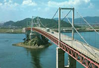
1962: Mera
Saito (西都市), Miyazaki, Japan - Shiromi River
| Bridgemeister ID: | 3866 (added 2020-03-07) |
| Year Completed: | 1962 |
| Name: | Mera |
| Also Known As: | 米良大橋 |
| Location: | Saito (西都市), Miyazaki, Japan |
| Crossing: | Shiromi River |
| Coordinates: | 32.221314 N 131.268821 E |
| Maps: | Acme, GeoHack, Google, OpenStreetMap |
| Use: | Vehicular (two-lane) |
| Status: | In use (last checked: 2024) |
| Main Cables: | Wire (steel) |
| Suspended Spans: | 1 |
| Main Span: | 1 x 158 meters (518.4 feet) estimated |
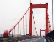
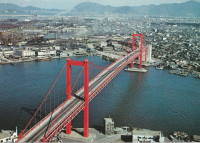
| Bridgemeister ID: | 462 (added before 2003) |
| Year Completed: | 1962 |
| Name: | Wakato |
| Also Known As: | 若戸大橋 |
| Location: | Kita-Kyusyu, Fukuoka, Japan |
| Crossing: | Dokai Bay |
| Coordinates: | 33.902895 N 130.816602 E |
| Maps: | Acme, GeoHack, Google, OpenStreetMap |
| Use: | Vehicular (major highway) |
| Status: | In use (last checked: 2019) |
| Main Cables: | Wire (steel) |
| Suspended Spans: | 3 |
| Main Span: | 1 |
| Side Spans: | 2 |
Notes:
- BAAW: First suspension bridge in Japan with main span exceeding 300 meters.
External Links:
Image Sets:
1963: Kasai
Koto City, Tokyo, Japan - Arakawa River
| Bridgemeister ID: | 6825 (added 2021-12-25) |
| Year Completed: | 1963 |
| Name: | Kasai |
| Also Known As: | 葛西橋 |
| Location: | Koto City, Tokyo, Japan |
| Crossing: | Arakawa River |
| Coordinates: | 35.671444 N 139.845119 E |
| Maps: | Acme, GeoHack, Google, OpenStreetMap |
| Use: | Vehicular (four-lane), with walkway |
| Status: | In use (last checked: 2021) |
| Main Cables: | Riveted plate |
| Suspended Spans: | 3 |
| Main Span: | 1 x 142 meters (465.9 feet) |
| Side Spans: | 2 x 69 meters (226.4 feet) |
External Links:
1969: Tsutsuji
Iida, Nagano, Japan - Tenryu River
| Bridgemeister ID: | 4251 (added 2020-04-10) |
| Year Completed: | 1969 |
| Name: | Tsutsuji |
| Also Known As: | つつじ橋 |
| Location: | Iida, Nagano, Japan |
| Crossing: | Tenryu River |
| Coordinates: | 35.437473 N 137.820659 E |
| Maps: | Acme, GeoHack, Google, OpenStreetMap |
| Use: | Footbridge |
| Status: | In use (last checked: 2020) |
| Main Cables: | Wire (steel) |
| Suspended Spans: | 1 |
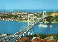
1973: Kanmon
Shimonoseki (下関市), Yamaguchi and Moji Ward, Kitakyushu City ( 北九州市), Fukuoka, Japan - Kanmon Straits
| Bridgemeister ID: | 468 (added before 2003) |
| Year Completed: | 1973 |
| Name: | Kanmon |
| Also Known As: | 関門橋, Kanmonkyō |
| Location: | Shimonoseki (下関市), Yamaguchi and Moji Ward, Kitakyushu City ( 北九州市), Fukuoka, Japan |
| Crossing: | Kanmon Straits |
| Coordinates: | 33.961829 N 130.958562 E |
| Maps: | Acme, GeoHack, Google, OpenStreetMap |
| References: | BAAW |
| Use: | Vehicular (major highway) |
| Status: | In use (last checked: 2019) |
| Main Cables: | Wire (steel) |
| Suspended Spans: | 3 |
| Main Span: | 1 x 712 meters (2,336 feet) |
| Side Spans: | 2 |
External Links:
Image Sets:

1977: Hirado
Hirado, Nagasaki and Japan - Hiradoseto Strait
| Bridgemeister ID: | 474 (added before 2003) |
| Year Completed: | 1977 |
| Name: | Hirado |
| Also Known As: | 平戸大橋 |
| Location: | Hirado, Nagasaki and Japan |
| Crossing: | Hiradoseto Strait |
| Coordinates: | 33.356794 N 129.572374 E |
| Maps: | Acme, GeoHack, Google, OpenStreetMap |
| References: | BAAW |
| Use: | Vehicular (two-lane, heavy vehicles), with walkway |
| Status: | In use (last checked: 2019) |
| Main Cables: | Wire (steel) |
| Suspended Spans: | 1 |
| Main Span: | 1 x 465.5 meters (1,527.2 feet) |
External Links:
Image Sets:

1982: Shirakawa
Sapporo, Hokkaido, Japan - Toyohira River
| Bridgemeister ID: | 1874 (added 2005-08-06) |
| Year Completed: | 1982 |
| Name: | Shirakawa |
| Location: | Sapporo, Hokkaido, Japan |
| Crossing: | Toyohira River |
| Coordinates: | 42.966342 N 141.301643 E |
| Maps: | Acme, GeoHack, Google, OpenStreetMap |
| Use: | Footbridge |
| Status: | In use (last checked: 2019) |
| Main Cables: | Wire (steel) |
| Suspended Spans: | 1 |
| Main Span: | 1 x 50 meters (164 feet) |
| Deck width: | 1.5 meters |
External Links:
1983: Innoshima
Onomichi, Hiroshima, Japan - Mekariseto Strait
| Bridgemeister ID: | 476 (added before 2003) |
| Year Completed: | 1983 |
| Name: | Innoshima |
| Also Known As: | 因島大橋 |
| Location: | Onomichi, Hiroshima, Japan |
| Crossing: | Mekariseto Strait |
| Coordinates: | 34.357320 N 133.180017 E |
| Maps: | Acme, GeoHack, Google, OpenStreetMap |
| Principals: | Honshu-Shikoku Bridge Authority |
| References: | BAAW, BDU |
| Use: | Vehicular (major highway), with walkway |
| Status: | In use (last checked: 2019) |
| Main Cables: | Wire (steel) |
| Suspended Spans: | 3 |
| Main Span: | 1 x 770 meters (2,526.2 feet) |
| Side Spans: | 2 x 250 meters (820.2 feet) |
External Links:
Image Sets:


1983: Odo Dam
Niyodogawa, Kochi, Japan - Niyodo River
| Bridgemeister ID: | 4650 (added 2020-06-17) |
| Year Completed: | 1983 |
| Name: | Odo Dam |
| Also Known As: | 大渡ダム大橋 |
| Location: | Niyodogawa, Kochi, Japan |
| Crossing: | Niyodo River |
| Coordinates: | 33.545547 N 133.100352 E |
| Maps: | Acme, GeoHack, Google, OpenStreetMap |
| Use: | Vehicular (two-lane) |
| Status: | In use (last checked: 2019) |
| Main Cables: | Wire (steel) |
| Suspended Spans: | 1 |
| Main Span: | 1 x 238 meters (780.8 feet) |
External Links:
1984: Aya Teruha
Aya, Miyazaki, Japan - Aya Minami River
| Bridgemeister ID: | 478 (added before 2003) |
| Year Completed: | 1984 |
| Name: | Aya Teruha |
| Also Known As: | 綾の照葉大吊橋 |
| Location: | Aya, Miyazaki, Japan |
| Crossing: | Aya Minami River |
| Coordinates: | 32.029677 N 131.194746 E |
| Maps: | Acme, GeoHack, Google, OpenStreetMap |
| Use: | Footbridge |
| Status: | In use (last checked: 2019) |
| Main Cables: | Wire (steel) |
| Suspended Spans: | 1 |
| Main Span: | 1 x 240 meters (787.4 feet) |
Notes:
- World's longest span footbridge upon completion. Since surpassed.
- Near (suspension bridge) - Aya, Miyazaki, Japan.
External Links:
Image Sets:
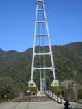
1984: Ohnaruto
Awajishima, Hyogo and Naruto, Tokushima, Japan - Naruto Strait
| Bridgemeister ID: | 480 (added before 2003) |
| Year Completed: | 1984 |
| Name: | Ohnaruto |
| Also Known As: | Onaruto |
| Location: | Awajishima, Hyogo and Naruto, Tokushima, Japan |
| Crossing: | Naruto Strait |
| Coordinates: | 34.238877 N 134.651243 E |
| Maps: | Acme, GeoHack, Google, OpenStreetMap |
| Principals: | Honshu-Shikoku Bridge Authority |
| References: | BAAW, BAR, BBR, BDU |
| Use: | Vehicular (major highway) |
| Status: | In use (last checked: 2019) |
| Main Cables: | Wire (steel) |
| Suspended Spans: | 3 |
| Main Span: | 1 x 876 meters (2,874 feet) |
| Side Spans: | 2 x 330 meters (1,082.7 feet) |
| Deck width: | 34 meters |
External Links:
Image Sets:

1987: Kita Bisan-Seto
Yoshima Island and Sakaide, Kagawa, Japan - Seto Inland Sea
| Bridgemeister ID: | 481 (added before 2003) |
| Year Completed: | 1987 |
| Name: | Kita Bisan-Seto |
| Also Known As: | 北備讃瀬戸大橋 |
| Location: | Yoshima Island and Sakaide, Kagawa, Japan |
| Crossing: | Seto Inland Sea |
| Coordinates: | 34.379065 N 133.820065 E |
| Maps: | Acme, GeoHack, Google, OpenStreetMap |
| Principals: | Honshu-Shikoku Bridge Authority |
| References: | BAAW, BAR, BBR, BDU |
| Use: | Vehicular (major highway) and Rail |
| Status: | In use (last checked: 2019) |
| Main Cables: | Wire (steel) |
| Suspended Spans: | 3 |
| Main Span: | 1 x 990 meters (3,248 feet) |
| Side Spans: | 2 x 274 meters (899 feet) |
| Deck width: | 35 meters upper deck, 30 meters lower deck |
Notes:
- Connects to 1988 Minami Bisan-Seto (南備讃瀬戸大橋) - Yoshima Island (与島) and Sakaide (坂出市), Kagawa, Japan.
- Near 1988 Shimotsui-Seto (下津井瀬戸大橋) - Kojima, Okayama and Hitsuishijima (櫃石島), Kagawa, Japan.
- All past and present bridges at this location.
External Links:
Image Sets:
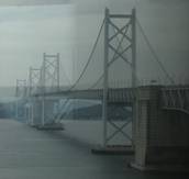
| Bridgemeister ID: | 541 (added before 2003) |
| Year Completed: | 1987 |
| Name: | Konohana |
| Also Known As: | 此花大橋 |
| Location: | Osaka, Osaka, Japan |
| Coordinates: | 34.666526 N 135.414947 E |
| Maps: | Acme, GeoHack, Google, OpenStreetMap |
| Use: | Vehicular (four-lane) |
| Status: | In use (last checked: 2019) |
| Main Cables: | Wire (steel) |
| Suspended Spans: | 3 |
| Main Span: | 1 x 300 meters (984.3 feet) |
| Side Spans: | 2 x 120 meters (393.7 feet) |
| Deck width: | 26.5 meters |
| Characteristics: | Monocable |
Notes:
- Monocable.
External Links:
1988: Minami Bisan-Seto
Yoshima Island (与島) and Sakaide (坂出市), Kagawa, Japan - Seto Inland Sea
| Bridgemeister ID: | 485 (added before 2003) |
| Year Completed: | 1988 |
| Name: | Minami Bisan-Seto |
| Also Known As: | 南備讃瀬戸大橋 |
| Location: | Yoshima Island (与島) and Sakaide (坂出市), Kagawa, Japan |
| Crossing: | Seto Inland Sea |
| Coordinates: | 34.364167 N 133.825278 E |
| Maps: | Acme, GeoHack, Google, OpenStreetMap |
| Principals: | Honshu-Shikoku Bridge Authority |
| References: | BAAW, BAR, BBR, BDU |
| Use: | Vehicular (major highway) and Rail |
| Status: | In use (last checked: 2019) |
| Main Cables: | Wire (steel) |
| Suspended Spans: | 3 |
| Main Span: | 1 x 1,100 meters (3,608.9 feet) |
| Side Spans: | 2 x 274 meters (899 feet) |
| Deck width: | 35 meters upper deck, 30 meters lower deck |
Notes:
- Connects to 1987 Kita Bisan-Seto (北備讃瀬戸大橋) - Yoshima Island and Sakaide, Kagawa, Japan.
- Near 1988 Shimotsui-Seto (下津井瀬戸大橋) - Kojima, Okayama and Hitsuishijima (櫃石島), Kagawa, Japan.
- All past and present bridges at this location.
External Links:
Image Sets:


| Bridgemeister ID: | 484 (added before 2003) |
| Year Completed: | 1988 |
| Name: | Ohshima |
| Also Known As: | 伯方・大島大橋 |
| Location: | Hakata Island, Imabari and Imabari (今治市), Ehime, Japan |
| Coordinates: | 34.192724 N 133.072966 E |
| Maps: | Acme, GeoHack, Google, OpenStreetMap |
| Principals: | Honshu-Shikoku Bridge Authority |
| References: | BAAW, BAR |
| Use: | Vehicular (major highway) |
| Status: | In use (last checked: 2019) |
| Main Cables: | Wire (steel) |
| Suspended Spans: | 1 |
| Main Span: | 1 x 560 meters (1,837.3 feet) |
| Deck width: | 23.7 meters |
External Links:
Image Sets:
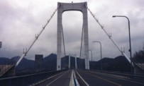
1988: Shimotsui-Seto
Kojima, Okayama and Hitsuishijima (櫃石島), Kagawa, Japan - Seto Inland Sea
| Bridgemeister ID: | 486 (added before 2003) |
| Year Completed: | 1988 |
| Name: | Shimotsui-Seto |
| Also Known As: | 下津井瀬戸大橋 |
| Location: | Kojima, Okayama and Hitsuishijima (櫃石島), Kagawa, Japan |
| Crossing: | Seto Inland Sea |
| Coordinates: | 34.431483 N 133.807833 E |
| Maps: | Acme, GeoHack, Google, OpenStreetMap |
| Principals: | Honshu-Shikoku Bridge Authority |
| References: | AOB, BAAW, BAR, BBR, BDU |
| Use: | Vehicular (major highway) |
| Status: | In use (last checked: 2019) |
| Main Cables: | Wire (steel) |
| Suspended Spans: | 1 |
| Main Span: | 1 x 940 meters (3,084 feet) |
Notes:
- Near 1987 Kita Bisan-Seto (北備讃瀬戸大橋) - Yoshima Island and Sakaide, Kagawa, Japan.
- Near 1988 Minami Bisan-Seto (南備讃瀬戸大橋) - Yoshima Island (与島) and Sakaide (坂出市), Kagawa, Japan.
External Links:
Image Sets:
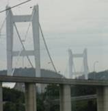
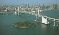
| Bridgemeister ID: | 491 (added before 2003) |
| Year Completed: | 1994 |
| Name: | Rainbow |
| Also Known As: | レインボーブリッジ |
| Location: | Minato City, Tokyo, Japan |
| Crossing: | Tokyo Bay |
| Coordinates: | 35.636808 N 139.762576 E |
| Maps: | Acme, GeoHack, Google, OpenStreetMap |
| Use: | Vehicular (double-deck) |
| Status: | In use (last checked: 2019) |
| Main Cables: | Wire (steel) |
| Suspended Spans: | 3 |
| Main Span: | 1 x 570 meters (1,870.1 feet) |
| Side Spans: | 2 |
External Links:
Image Sets:

1994: Ryujin
Suifu, Ibarakai, Japan - Ryujin Gorge
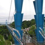
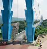
| Bridgemeister ID: | 777 (added 2003-03-16) |
| Year Completed: | 1994 |
| Name: | Ryujin |
| Also Known As: | Ryujinotsuri, 竜神大吊橋 |
| Location: | Suifu, Ibarakai, Japan |
| Crossing: | Ryujin Gorge |
| At or Near Feature: | Okukuji Prefectural Nature Park |
| Coordinates: | 36.684164 N 140.465490 E |
| Maps: | Acme, GeoHack, Google, OpenStreetMap |
| Use: | Footbridge |
| Status: | In use (last checked: 2019) |
| Main Cables: | Wire (steel) |
| Suspended Spans: | 1 |
| Main Span: | 1 x 375 meters (1,230.3 feet) |
Notes:
- This is one of the longest footbridges in the world.
External Links:
Image Sets:
| Bridgemeister ID: | 495 (added before 2003) |
| Year Completed: | 1997 |
| Name: | Hakucho |
| Also Known As: | Shiratori, 白鳥大橋 |
| Location: | Muroran City, Hokkaido, Japan |
| Coordinates: | 42.353507 N 140.949909 E |
| Maps: | Acme, GeoHack, Google, OpenStreetMap |
| Principals: | Matsuo Co., Kawasaki Heavy Industries |
| Use: | Vehicular (two-lane, heavy vehicles) |
| Status: | In use (last checked: 2019) |
| Main Cables: | Wire (steel) |
| Suspended Spans: | 3 |
| Main Span: | 1 x 720 meters (2,362.2 feet) |
| Side Spans: | 2 x 330 meters (1,082.7 feet) |
| Deck width: | 14.25 meters |
Notes:
- Matsuo site says completed 1997. Kawasaki Heavy Industries site says completed 1998.
External Links:
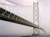
1998: Akashi Kaikyo
Maiko, Tarumi-ward, Kobe and Matsuho, Awaji Island, Hyogo, Japan - Akashi Strait
| Bridgemeister ID: | 501 (added before 2003) |
| Year Completed: | 1998 |
| Name: | Akashi Kaikyo |
| Also Known As: | 明石海峡大橋 |
| Location: | Maiko, Tarumi-ward, Kobe and Matsuho, Awaji Island, Hyogo, Japan |
| Crossing: | Akashi Strait |
| Coordinates: | 34.630617 N 135.0327 E |
| Maps: | Acme, GeoHack, Google, OpenStreetMap |
| Principals: | Honshu-Shikoku Bridge Authority |
| References: | BAR, BBR, BDU, CTW, PS199803, SA199712b |
| Use: | Vehicular (major highway) |
| Status: | In use (last checked: 2020) |
| Main Cables: | Wire (steel) |
| Suspended Spans: | 3 |
| Main Span: | 1 x 1,991 meters (6,532.2 feet) |
| Side Spans: | 2 x 960 meters (3,149.6 feet) |
| Deck width: | 35.5 meters |
Notes:
- Became longest suspension bridge by eclipsing 1981 Humber - Hull, Humberside, England, United Kingdom.
- Eclipsed by new longest suspension bridge 2022 Çanakkale 1915 - Sütlüce, Gelibolu and Lapseki, Çanakkale, Türkiye.
External Links:
Image Sets:
| Bridgemeister ID: | 503 (added before 2003) |
| Year Completed: | 1999 |
| Name: | Kurushima Kaikyō I |
| Also Known As: | 来島海峡大橋 |
| Location: | Ōshima (大島) and Imabari (今治市), Ehime, Japan |
| Coordinates: | 34.125903 N 133.013167 E |
| Maps: | Acme, GeoHack, Google, OpenStreetMap |
| Principals: | Honshu-Shikoku Bridge Authority |
| References: | BAR |
| Use: | Vehicular (major highway) |
| Status: | In use (last checked: 2019) |
| Main Cables: | Wire (steel) |
| Suspended Spans: | 3 |
| Main Span: | 1 x 600 meters (1,968.5 feet) |
| Side Spans: | 1 x 140 meters (459.3 feet), 1 x 170 meters (557.7 feet) |
| Deck width: | 27 meters |
Notes:
- Connects to 1999 Kurushima Kaikyō II (来島海峡大橋) - Onomichi and Imabari (今治市), Ehime, Japan.
- Connects to 1999 Kurushima Kaikyō III (来島海峡大橋) - Onomichi and Imabari (今治市), Ehime, Japan.
- All past and present bridges at this location.
External Links:
| Bridgemeister ID: | 504 (added before 2003) |
| Year Completed: | 1999 |
| Name: | Kurushima Kaikyō II |
| Also Known As: | 来島海峡大橋 |
| Location: | Onomichi and Imabari (今治市), Ehime, Japan |
| Coordinates: | 34.121616 N 133.001921 E |
| Maps: | Acme, GeoHack, Google, OpenStreetMap |
| Principals: | Honshu-Shikoku Bridge Authority |
| References: | BAR |
| Use: | Vehicular (major highway) |
| Status: | In use (last checked: 2019) |
| Main Cables: | Wire (steel) |
| Suspended Spans: | 2 |
| Main Span: | 1 x 1,020 meters (3,346.5 feet) |
| Side Span: | 1 x 250 meters (820.2 feet) |
| Deck width: | 27 meters |
Notes:
- Connects to 1999 Kurushima Kaikyō I (来島海峡大橋) - Ōshima (大島) and Imabari (今治市), Ehime, Japan.
- Connects to 1999 Kurushima Kaikyō III (来島海峡大橋) - Onomichi and Imabari (今治市), Ehime, Japan.
- All past and present bridges at this location.
External Links:
| Bridgemeister ID: | 505 (added before 2003) |
| Year Completed: | 1999 |
| Name: | Kurushima Kaikyō III |
| Also Known As: | 来島海峡大橋 |
| Location: | Onomichi and Imabari (今治市), Ehime, Japan |
| Coordinates: | 34.115198 N 132.984055 E |
| Maps: | Acme, GeoHack, Google, OpenStreetMap |
| Principals: | Honshu-Shikoku Bridge Authority |
| References: | BAR |
| Use: | Vehicular (major highway) |
| Status: | In use (last checked: 2019) |
| Main Cables: | Wire (steel) |
| Suspended Spans: | 1 |
| Main Span: | 1 x 1,030 meters (3,379.3 feet) |
| Deck width: | 27 meters |
Notes:
- Connects to 1999 Kurushima Kaikyō I (来島海峡大橋) - Ōshima (大島) and Imabari (今治市), Ehime, Japan.
- Connects to 1999 Kurushima Kaikyō II (来島海峡大橋) - Onomichi and Imabari (今治市), Ehime, Japan.
- All past and present bridges at this location.
External Links:
2000: Akinada
Kawajirichokashiwa, Hiroshima, Japan - Menekonoseto Strait
| Bridgemeister ID: | 506 (added before 2003) |
| Year Completed: | 2000 |
| Name: | Akinada |
| Also Known As: | 安芸灘大橋 |
| Location: | Kawajirichokashiwa, Hiroshima, Japan |
| Crossing: | Menekonoseto Strait |
| Coordinates: | 34.206374 N 132.679199 E |
| Maps: | Acme, GeoHack, Google, OpenStreetMap |
| References: | BAR |
| Use: | Vehicular (two-lane, heavy vehicles), with walkway |
| Status: | In use (last checked: 2019) |
| Main Cables: | Wire (steel) |
| Suspended Spans: | 3 |
| Main Span: | 1 x 750 meters (2,460.6 feet) |
| Side Spans: | 1 x 170 meters (557.7 feet), 1 x 255 meters (836.6 feet) |
External Links:
| Bridgemeister ID: | 1923 (added 2005-10-22) |
| Year Completed: | 2000 |
| Name: | Minami Alps Sesso |
| Also Known As: | 南アルプス接岨大吊橋 |
| Location: | Kawanehon (Honkawane), Haibara District, Shizuoka, Japan |
| Coordinates: | 35.174071 N 138.189618 E |
| Maps: | Acme, GeoHack, Google, OpenStreetMap |
| Use: | Footbridge |
| Status: | In use (last checked: 2024) |
| Main Cables: | Wire (steel) |
| Suspended Spans: | 3 |
| Main Span: | 1 x 160 meters (524.9 feet) |
| Side Spans: | 2 x 30 meters (98.4 feet) |
2002: Kamimoku Yume
Minakami, Gunma, Japan - Tone River
| Bridgemeister ID: | 7899 (added 2023-10-15) |
| Year Completed: | 2002 |
| Name: | Kamimoku Yume |
| Also Known As: | 上牧夢のブリッジ |
| Location: | Minakami, Gunma, Japan |
| Crossing: | Tone River |
| Coordinates: | 36.735561 N 138.981120 E |
| Maps: | Acme, GeoHack, Google, OpenStreetMap |
| Suspended Spans: | 2 |
| Main Spans: | 2 |
External Links:
2002: Nagisa
Ajigasawa, Aomori, Japan - Nakamura River
| Bridgemeister ID: | 1991 (added 2005-12-03) |
| Year Completed: | 2002 |
| Name: | Nagisa |
| Also Known As: | なぎさブリッジ |
| Location: | Ajigasawa, Aomori, Japan |
| Crossing: | Nakamura River |
| At or Near Feature: | Hamanasu Park, Shinsetsu Seaside Park |
| Coordinates: | 40.779559 N 140.220842 E |
| Maps: | Acme, GeoHack, Google, OpenStreetMap |
| Use: | Footbridge |
| Status: | In use (last checked: 2019) |
| Main Cables: | Wire (steel) |
| Suspended Spans: | 1 |
| Main Span: | 1 x 110.15 meters (361.4 feet) |
Notes:
- In a paper title "Construction of Nagisa Bridge Hybrid System of Cable Stayed PC Bridge and Steel Suspension Bridge" (by Yuzuru Sato, et. al.) the bridge is described as "The structure of this bridge is a hybrid structure of cable-stayed prestressed concrete bridge and steel suspension bridge. It is the first application as this structure type of bridge in the world. Concrete girders near pylons are supported by stay cables. Steel girders are supported by suspension cables in the central part of the span. This is new type system for prestressed concrete bridges with longer span and has many structural features compared with ordinary cable-stayed bridge and suspension bridge." and makes comparison to Arnodin suspension bridges where cable stays are the primary support for part of the deck.
- See 1879 Saint-Ilpize - Saint-Ilpize, Haute-Loire, France.
- See 1887 de l'Abîme - Cusy and Gruffy, Haute-Savoie, France.
- See 1898 Rouen Transporter - Rouen, Seine-Maritime, France.
| Bridgemeister ID: | 2517 (added 2009-12-30) |
| Year Completed: | 2006 |
| Name: | Kokonoe Yume |
| Also Known As: | 九重“夢”大吊橋 |
| Location: | Kokonoe, Oita, Japan |
| At or Near Feature: | Naruko Gorge |
| Coordinates: | 33.173899 N 131.226751 E |
| Maps: | Acme, GeoHack, Google, OpenStreetMap |
| Use: | Footbridge |
| Status: | In use (last checked: 2016) |
| Main Cables: | Wire (steel) |
| Suspended Spans: | 1 |
| Main Span: | 1 x 390 meters (1,279.5 feet) |
| Deck width: | 1.5 meters |
Notes:
- Longest suspension footbridge in Japan at time of completion.
External Links:
| Bridgemeister ID: | 7872 (added 2023-09-23) |
| Year Completed: | 2008 |
| Name: | Toyoshima |
| Also Known As: | 豊島大橋 |
| Location: | Teshima Island, Kure and Kami-Kamagari Island, Kure, Hiroshima, Japan |
| Coordinates: | 34.177049 N 132.767549 E |
| Maps: | Acme, GeoHack, Google, OpenStreetMap |
| Use: | Vehicular (two-lane, heavy vehicles), with walkway |
| Status: | In use (last checked: 2023) |
| Main Cables: | Wire (steel) |
| Suspended Spans: | 1 |
| Main Span: | 1 x 540 meters (1,771.7 feet) |
External Links:
2009: Kinu-Tateiwa
Nikko, Tochigi, Japan - Kinugawa River
| Bridgemeister ID: | 3119 (added 2019-11-02) |
| Year Completed: | 2009 |
| Name: | Kinu-Tateiwa |
| Also Known As: | 鬼怒楯岩大吊橋, Kinutateiwaotsuri |
| Location: | Nikko, Tochigi, Japan |
| Crossing: | Kinugawa River |
| Coordinates: | 36.820661 N 139.708437 E |
| Maps: | Acme, GeoHack, Google, OpenStreetMap |
| Use: | Footbridge |
| Status: | In use (last checked: 2022) |
| Main Cables: | Wire (steel) |
2012: Mii-Soyokaze
Sagamihara, Kanagawa, Japan - Sagami River
| Bridgemeister ID: | 5052 (added 2020-08-29) |
| Year Completed: | 2012 |
| Name: | Mii-Soyokaze |
| Location: | Sagamihara, Kanagawa, Japan |
| Crossing: | Sagami River |
| Coordinates: | 35.588856 N 139.267925 E |
| Maps: | Acme, GeoHack, Google, OpenStreetMap |
| Use: | Footbridge |
| Status: | In use (last checked: 2020) |
| Main Cables: | Wire (steel) |
| Suspended Spans: | 1 |
| Main Span: | 1 x 230 meters (754.6 feet) estimated |
External Links:
| Bridgemeister ID: | 3112 (added 2019-10-29) |
| Year Completed: | 2015 |
| Name: | Mishima Sky Walk |
| Also Known As: | 三島スカイウォーク |
| Location: | Mishima, Shizuoka, Japan |
| Coordinates: | 35.152804 N 138.980564 E |
| Maps: | Acme, GeoHack, Google, OpenStreetMap |
| Use: | Footbridge |
| Status: | In use (last checked: 2019) |
| Main Cables: | Wire (steel) |
| Suspended Spans: | 1 |
| Main Span: | 1 x 400 meters (1,312.3 feet) |
External Links:
| Bridgemeister ID: | 9175 (added 2025-05-17) |
| Year Completed: | 2025 |
| Name: | Goda |
| Location: | Ibaraki (茨木市), Osaka, Japan |
| Crossing: | Ai River |
| At or Near Feature: | Dam Park Ibakita |
| Coordinates: | 34.876972 N 135.561722 E |
| Maps: | Acme, GeoHack, Google, OpenStreetMap |
| Use: | Footbridge |
| Status: | In use (last checked: 2025) |
| Main Cables: | Wire (steel) |
| Suspended Spans: | 1 |
| Main Span: | 1 x 420 meters (1,378 feet) |
External Links:
- Osaka: Japan’s longest pedestrian suspension bridge opens; structure spans 420m over lake | The Star. Article covering the bridge opening. Dated April 5, 2025.
(conveyor bridge)
Takahashi, Okayama, Japan - Nariwa River
| Bridgemeister ID: | 6062 (added 2021-07-03) |
| Name: | (conveyor bridge) |
| Location: | Takahashi, Okayama, Japan |
| Crossing: | Nariwa River |
| Coordinates: | 34.786127 N 133.479621 E |
| Maps: | Acme, GeoHack, Google, OpenStreetMap |
| Use: | Conveyor |
| Status: | Extant (last checked: 2014) |
| Main Cables: | Wire (steel) |
| Main Span: | 1 x 122 meters (400.3 feet) estimated |
(footbridge)
Kinokawa, Wakayama, Japan - Kishi River
| Bridgemeister ID: | 4860 (added 2020-07-12) |
| Name: | (footbridge) |
| Also Known As: | きしべはし |
| Location: | Kinokawa, Wakayama, Japan |
| Crossing: | Kishi River |
| Coordinates: | 34.203697 N 135.311855 E |
| Maps: | Acme, GeoHack, Google, OpenStreetMap |
| Use: | Footbridge |
| Status: | In use (last checked: 2019) |
| Main Cables: | Wire (steel) |
| Suspended Spans: | 1 |
| Bridgemeister ID: | 5839 (added 2021-05-09) |
| Name: | (footbridge) |
| Location: | Aoba Ward, Yokohama, Kanagawa, Japan |
| At or Near Feature: | Kodomo no Kuni |
| Coordinates: | 35.562558 N 139.490068 E |
| Maps: | Acme, GeoHack, Google, OpenStreetMap |
| Use: | Footbridge |
| Status: | In use (last checked: 2021) |
| Main Cables: | Wire (steel) |
| Suspended Spans: | 1 |
(footbridge)
Arashiyama Kitamatsuoyama, Nishikyo Ward, Kyoto, Japan - Katsura River
| Bridgemeister ID: | 7475 (added 2022-12-25) |
| Name: | (footbridge) |
| Location: | Arashiyama Kitamatsuoyama, Nishikyo Ward, Kyoto, Japan |
| Crossing: | Katsura River |
| At or Near Feature: | Hozukyō Gorge - 保津峡 |
| Coordinates: | 35.026157 N 135.645702 E |
| Maps: | Acme, GeoHack, Google, OpenStreetMap |
| Use: | Footbridge |
| Status: | In use |
| Main Cables: | Wire (steel) |
| Suspended Spans: | 1 |
| Main Span: | 1 x 50 meters (164 feet) estimated |
Image Sets:
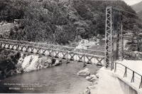
(footbridge)
Aridagawa, Wakayama, Japan - Arita River
| Bridgemeister ID: | 4224 (added 2020-04-09) |
| Name: | (footbridge) |
| Location: | Aridagawa, Wakayama, Japan |
| Crossing: | Arita River |
| Coordinates: | 34.107668 N 135.479246 E |
| Maps: | Acme, GeoHack, Google, OpenStreetMap |
| Use: | Footbridge |
| Status: | In use (last checked: 2014) |
| Main Cables: | Wire (steel) |
| Suspended Spans: | 1 |
(footbridge)
Aridagawa, Wakayama, Japan - Arita River
| Bridgemeister ID: | 4225 (added 2020-04-09) |
| Name: | (footbridge) |
| Location: | Aridagawa, Wakayama, Japan |
| Crossing: | Arita River |
| Coordinates: | 34.118910 N 135.494725 E |
| Maps: | Acme, GeoHack, Google, OpenStreetMap |
| Use: | Footbridge |
| Status: | In use (last checked: 2018) |
| Main Cables: | Wire (steel) |
| Suspended Spans: | 1 |
(footbridge)
Aridagawa, Wakayama, Japan - Arita River
| Bridgemeister ID: | 4226 (added 2020-04-09) |
| Name: | (footbridge) |
| Location: | Aridagawa, Wakayama, Japan |
| Crossing: | Arita River |
| Coordinates: | 34.125489 N 135.506440 E |
| Maps: | Acme, GeoHack, Google, OpenStreetMap |
| Use: | Footbridge |
| Status: | In use (last checked: 2014) |
| Main Cables: | Wire (steel) |
| Suspended Spans: | 1 |
(footbridge)
Aridagawa, Wakayama, Japan - Arita River
| Bridgemeister ID: | 4230 (added 2020-04-09) |
| Name: | (footbridge) |
| Location: | Aridagawa, Wakayama, Japan |
| Crossing: | Arita River |
| Coordinates: | 34.051282 N 135.337517 E |
| Maps: | Acme, GeoHack, Google, OpenStreetMap |
| Use: | Footbridge |
| Status: | In use (last checked: 2018) |
| Main Cables: | Wire (steel) |
| Suspended Spans: | 3 |
| Main Span: | 1 |
| Side Spans: | 2 |
(footbridge)
Aridagawa, Wakayama, Japan - Arita River
| Bridgemeister ID: | 4231 (added 2020-04-09) |
| Name: | (footbridge) |
| Location: | Aridagawa, Wakayama, Japan |
| Crossing: | Arita River |
| Coordinates: | 34.056019 N 135.333119 E |
| Maps: | Acme, GeoHack, Google, OpenStreetMap |
| Use: | Footbridge |
| Status: | Extant (last checked: 2018) |
| Main Cables: | Wire (steel) |
(footbridge)
Aridagawa, Wakayama, Japan - Yukawa River
| Bridgemeister ID: | 4233 (added 2020-04-09) |
| Name: | (footbridge) |
| Location: | Aridagawa, Wakayama, Japan |
| Crossing: | Yukawa River |
| Coordinates: | 34.082291 N 135.424915 E |
| Maps: | Acme, GeoHack, Google, OpenStreetMap |
| Use: | Footbridge |
| Status: | In use (last checked: 2014) |
| Main Cables: | Wire (steel) |
| Suspended Spans: | 1 |
| Bridgemeister ID: | 2913 (added 2019-09-15) |
| Name: | (footbridge) |
| Location: | Ashino Lake, Goshogawara, Aomori, Japan |
| At or Near Feature: | Ashinochishogun Prefectural Natural Park |
| Coordinates: | 40.914930 N 140.452633 E |
| Maps: | Acme, GeoHack, Google, OpenStreetMap |
| Use: | Footbridge |
| Status: | In use (last checked: 2019) |
| Main Cables: | Wire (steel) |
(footbridge)
Chichibu, Saitama, Japan - Arakawa River
| Bridgemeister ID: | 4727 (added 2020-06-27) |
| Name: | (footbridge) |
| Location: | Chichibu, Saitama, Japan |
| Crossing: | Arakawa River |
| Coordinates: | 35.941604 N 138.892125 E |
| Maps: | Acme, GeoHack, Google, OpenStreetMap |
| Use: | Footbridge |
| Status: | In use (last checked: 2014) |
| Main Cables: | Wire (steel) |
| Suspended Spans: | 1 |
(footbridge)
Doshi, Yamanashi, Japan - Doshi River
| Bridgemeister ID: | 5066 (added 2020-08-29) |
| Name: | (footbridge) |
| Location: | Doshi, Yamanashi, Japan |
| Crossing: | Doshi River |
| Coordinates: | 35.503456 N 138.990390 E |
| Maps: | Acme, GeoHack, Google, OpenStreetMap |
| Use: | Footbridge |
| Status: | In use (last checked: 2014) |
| Main Cables: | Wire (steel) |
| Suspended Spans: | 1 |
(footbridge)
Gero vicinity, Gifu, Japan - Hida River
| Bridgemeister ID: | 3202 (added 2019-11-10) |
| Name: | (footbridge) |
| Location: | Gero vicinity, Gifu, Japan |
| Crossing: | Hida River |
| Coordinates: | 35.768254 N 137.227652 E |
| Maps: | Acme, GeoHack, Google, OpenStreetMap |
| Use: | Footbridge |
| Status: | Extant (last checked: 2018) |
| Main Cables: | Wire (steel) |
(footbridge)
Gero vicinity, Gifu, Japan - Hida River
| Bridgemeister ID: | 3203 (added 2019-11-10) |
| Name: | (footbridge) |
| Location: | Gero vicinity, Gifu, Japan |
| Crossing: | Hida River |
| Coordinates: | 35.749028 N 137.218280 E |
| Maps: | Acme, GeoHack, Google, OpenStreetMap |
| Use: | Footbridge |
| Status: | Extant (last checked: 2018) |
| Main Cables: | Wire (steel) |
(footbridge)
Gero, Gifu, Japan - Hida River
| Bridgemeister ID: | 3201 (added 2019-11-10) |
| Name: | (footbridge) |
| Location: | Gero, Gifu, Japan |
| Crossing: | Hida River |
| Coordinates: | 35.914450 N 137.203422 E |
| Maps: | Acme, GeoHack, Google, OpenStreetMap |
| Use: | Footbridge |
| Status: | In use (last checked: 2014) |
| Main Cables: | Wire |
| Suspended Spans: | 1 |
(footbridge)
Gero, Gifu, Japan - Maze River
| Bridgemeister ID: | 3990 (added 2020-03-22) |
| Name: | (footbridge) |
| Location: | Gero, Gifu, Japan |
| Crossing: | Maze River |
| Coordinates: | 35.710779 N 137.141005 E |
| Maps: | Acme, GeoHack, Google, OpenStreetMap |
| Status: | Extant (last checked: 2019) |
(footbridge)
Gojo, Nara, Japan - Amano River
| Bridgemeister ID: | 3397 (added 2019-12-21) |
| Name: | (footbridge) |
| Location: | Gojo, Nara, Japan |
| Crossing: | Amano River |
| Coordinates: | 34.153827 N 135.744407 E |
| Maps: | Acme, GeoHack, Google, OpenStreetMap |
| Use: | Footbridge |
| Status: | Extant (last checked: 2019) |
(footbridge)
Gojo, Nara, Japan - Amano River
| Bridgemeister ID: | 3398 (added 2019-12-21) |
| Name: | (footbridge) |
| Location: | Gojo, Nara, Japan |
| Crossing: | Amano River |
| Coordinates: | 34.203768 N 135.732808 E |
| Maps: | Acme, GeoHack, Google, OpenStreetMap |
| Use: | Footbridge |
| Status: | In use (last checked: 2019) |
| Main Cables: | Wire (steel) |
(footbridge)
Hamamatsu, Shizuoka, Japan - Keta River
| Bridgemeister ID: | 4302 (added 2020-04-10) |
| Name: | (footbridge) |
| Location: | Hamamatsu, Shizuoka, Japan |
| Crossing: | Keta River |
| Coordinates: | 34.969871 N 137.900579 E |
| Maps: | Acme, GeoHack, Google, OpenStreetMap |
| Use: | Footbridge |
| Status: | In use (last checked: 2018) |
| Main Cables: | Wire (steel) |
| Suspended Spans: | 1 |
| Main Span: | 1 x 115 meters (377.3 feet) estimated |
(footbridge)
Hamamatsu, Shizuoka, Japan - Keta River
| Bridgemeister ID: | 4304 (added 2020-04-10) |
| Name: | (footbridge) |
| Location: | Hamamatsu, Shizuoka, Japan |
| Crossing: | Keta River |
| Coordinates: | 35.024900 N 137.917659 E |
| Maps: | Acme, GeoHack, Google, OpenStreetMap |
| Use: | Footbridge |
| Status: | Extant (last checked: 2019) |
(footbridge)
Hamamatsu, Shizuoka, Japan - Kumakiri River
| Bridgemeister ID: | 4311 (added 2020-04-10) |
| Name: | (footbridge) |
| Location: | Hamamatsu, Shizuoka, Japan |
| Crossing: | Kumakiri River |
| Coordinates: | 34.977110 N 137.912241 E |
| Maps: | Acme, GeoHack, Google, OpenStreetMap |
| Use: | Footbridge |
| Status: | In use (last checked: 2012) |
| Main Cables: | Wire (steel) |
| Suspended Spans: | 1 |
(footbridge)
Hayakawa (早川町), Yamanashi, Japan - Haya River
| Bridgemeister ID: | 5141 (added 2020-09-06) |
| Name: | (footbridge) |
| Location: | Hayakawa (早川町), Yamanashi, Japan |
| Crossing: | Haya River |
| At or Near Feature: | Minami Alps Murayacho Park |
| Coordinates: | 35.471410 N 138.337956 E |
| Maps: | Acme, GeoHack, Google, OpenStreetMap |
| Use: | Footbridge |
| Status: | In use (last checked: 2016) |
| Main Cables: | Wire (steel) |
| Suspended Spans: | 1 |
| Main Span: | 1 x 97 meters (318.2 feet) estimated |
(footbridge)
Hayakawa (早川町), Yamanashi, Japan - Haya River
| Bridgemeister ID: | 5142 (added 2020-09-06) |
| Name: | (footbridge) |
| Location: | Hayakawa (早川町), Yamanashi, Japan |
| Crossing: | Haya River |
| Coordinates: | 35.483012 N 138.331139 E |
| Maps: | Acme, GeoHack, Google, OpenStreetMap |
| Use: | Footbridge |
| Status: | Extant (last checked: 2014) |
| Main Cables: | Wire (steel) |
| Suspended Spans: | 1 |
(footbridge)
Hayakawa (早川町), Yamanashi, Japan - Haya River
| Bridgemeister ID: | 5145 (added 2020-09-06) |
| Name: | (footbridge) |
| Location: | Hayakawa (早川町), Yamanashi, Japan |
| Crossing: | Haya River |
| Coordinates: | 35.555442 N 138.305333 E |
| Maps: | Acme, GeoHack, Google, OpenStreetMap |
| Use: | Footbridge |
| Status: | Extant (last checked: 2014) |
| Main Cables: | Wire (steel) |
(footbridge)
Hayakawa (早川町), Yamanashi, Japan - Amehata River
| Bridgemeister ID: | 9319 (added 2025-06-23) |
| Name: | (footbridge) |
| Location: | Hayakawa (早川町), Yamanashi, Japan |
| Crossing: | Amehata River |
| Coordinates: | 35.410488 N 138.354867 E |
| Maps: | Acme, GeoHack, Google, OpenStreetMap |
| Use: | Footbridge |
| Status: | Removed, c. 2018-2023 |
| Main Cables: | Wire (steel) |
| Main Span: | 1 |
Notes:
- Removed or destroyed at some point in the 2018-2023 time frame.
External Links:
- Google Maps. Street view image of the bridge. Dated September 2014.
(footbridge)
Hayakawa (早川町), Yamanashi, Japan - Amehata River
| Bridgemeister ID: | 9324 (added 2025-06-29) |
| Name: | (footbridge) |
| Location: | Hayakawa (早川町), Yamanashi, Japan |
| Crossing: | Amehata River |
| Coordinates: | 35.395228 N 138.325247 E |
| Maps: | Acme, GeoHack, Google, OpenStreetMap |
| Use: | Footbridge |
| Status: | Removed, c. 2019-2023 |
| Main Cables: | Wire (steel) |
| Main Span: | 1 |
Notes:
- Removed or destroyed at some point in the 2019-2023 time frame.
External Links:
- Google Maps. Image of the bridge. Dated May 2019.
(footbridge)
Hinokage, Miyazaki, Japan - Hinokage River
| Bridgemeister ID: | 3277 (added 2019-11-23) |
| Name: | (footbridge) |
| Location: | Hinokage, Miyazaki, Japan |
| Crossing: | Hinokage River |
| Coordinates: | 32.699559 N 131.403163 E |
| Maps: | Acme, GeoHack, Google, OpenStreetMap |
| Use: | Footbridge |
| Status: | Extant (last checked: 2013) |
| Main Cables: | Wire (steel) |
(footbridge)
Hinokage, Miyazaki, Japan - Hinokage River
| Bridgemeister ID: | 3278 (added 2019-11-23) |
| Name: | (footbridge) |
| Location: | Hinokage, Miyazaki, Japan |
| Crossing: | Hinokage River |
| Coordinates: | 32.777562 N 131.439672 E |
| Maps: | Acme, GeoHack, Google, OpenStreetMap |
| Use: | Footbridge |
| Status: | In use (last checked: 2013) |
| Main Cables: | Wire (steel) |
| Suspended Spans: | 1 |
(footbridge)
Hita, Oita, Japan - Kawabaru River
| Bridgemeister ID: | 5331 (added 2020-11-11) |
| Name: | (footbridge) |
| Location: | Hita, Oita, Japan |
| Crossing: | Kawabaru River |
| Coordinates: | 33.113181 N 130.961153 E |
| Maps: | Acme, GeoHack, Google, OpenStreetMap |
| Use: | Footbridge |
| Status: | In use (last checked: 2017) |
| Main Cables: | Wire (steel) |
| Suspended Spans: | 1 |
(footbridge)
Iida, Nagano, Japan - Nosoko River
| Bridgemeister ID: | 7167 (added 2022-06-26) |
| Name: | (footbridge) |
| Location: | Iida, Nagano, Japan |
| Crossing: | Nosoko River |
| At or Near Feature: | Nosokoyama Forest Park (野底山森林公園) |
| Coordinates: | 35.541114 N 137.818050 E |
| Maps: | Acme, GeoHack, Google, OpenStreetMap |
| Use: | Footbridge |
| Status: | In use (last checked: 2022) |
| Main Cables: | Wire (steel) |
| Suspended Spans: | 1 |
| Main Span: | 1 x 44 meters (144.4 feet) estimated |
| Bridgemeister ID: | 5216 (added 2020-10-11) |
| Name: | (footbridge) |
| Location: | Ikawa, Aoi Ward, Shizuoka, Japan |
| Crossing: | Ōi River |
| At or Near Feature: | Ikawa Dam and Power Station |
| Coordinates: | 35.209232 N 138.220423 E |
| Maps: | Acme, GeoHack, Google, OpenStreetMap |
| Use: | Footbridge |
| Status: | Extant (last checked: 2021) |
| Main Cables: | Wire (steel) |
| Main Span: | 1 x 86.6 meters (284 feet) estimated |
Notes:
- Appears to be a very narrow footbridge.
External Links:
- Google Maps. Image with the bridge visible in the background. Dated April 2017. Patrick S. O'Donnell notes the stairs leading to one end of the bridge visible in this photo, making it likely this is a narrow footbridge and not a pipeline.
- Google Maps. Image with the bridge visible in the background. Dated April 2019.
- Google Maps. Image with the bridge visible in the background. Dated July 2021.
- Google Maps. Image with the bridge visible in the foreground. Dated April 2017.
(footbridge)
Ino, Kochi, Japan - Yoshino River
| Bridgemeister ID: | 6049 (added 2021-07-03) |
| Name: | (footbridge) |
| Location: | Ino, Kochi, Japan |
| Crossing: | Yoshino River |
| Coordinates: | 33.771567 N 133.314817 E |
| Maps: | Acme, GeoHack, Google, OpenStreetMap |
| Use: | Footbridge |
| Status: | In use (last checked: 2020) |
| Main Cables: | Wire (steel) |
| Main Span: | 1 |
| Bridgemeister ID: | 6029 (added 2021-07-03) |
| Name: | (footbridge) |
| Location: | Isumi, Chiba, Japan |
| At or Near Feature: | Tsubaki Park - 椿公園 |
| Coordinates: | 35.255293 N 140.382663 E |
| Maps: | Acme, GeoHack, Google, OpenStreetMap |
| Use: | Footbridge |
| Status: | In use (last checked: 2016) |
| Main Cables: | Wire (steel) |
| Main Span: | 1 x 46 meters (150.9 feet) estimated |
Notes:
| Bridgemeister ID: | 6030 (added 2021-07-03) |
| Name: | (footbridge) |
| Location: | Isumi, Chiba, Japan |
| At or Near Feature: | Tsubaki Park - 椿公園 |
| Coordinates: | 35.256046 N 140.382650 E |
| Maps: | Acme, GeoHack, Google, OpenStreetMap |
| Use: | Footbridge |
| Status: | In use (last checked: 2015) |
| Main Cables: | Wire (steel) |
| Suspended Spans: | 1 |
| Main Span: | 1 x 20 meters (65.6 feet) estimated |
Notes:
| Bridgemeister ID: | 6336 (added 2021-07-24) |
| Name: | (footbridge) |
| Location: | Kakegawa, Shizuoka, Japan |
| At or Near Feature: | Sumiyakinomori Myo-gajima Camping Ground |
| Coordinates: | 34.901316 N 138.012529 E |
| Maps: | Acme, GeoHack, Google, OpenStreetMap |
| Use: | Footbridge |
| Status: | In use (last checked: 2020) |
| Main Cables: | Wire (steel) |
| Suspended Spans: | 1 |
(footbridge)
Kamikawa, Hokkaido, Japan - Ishikari River
| Bridgemeister ID: | 6892 (added 2022-01-16) |
| Name: | (footbridge) |
| Location: | Kamikawa, Hokkaido, Japan |
| Crossing: | Ishikari River |
| Coordinates: | 43.848328 N 142.708864 E |
| Maps: | Acme, GeoHack, Google, OpenStreetMap |
| Status: | Derelict |
| Main Spans: | 2 |
(footbridge)
Kamikawa, Hokkaido, Japan - Ishikari River
| Bridgemeister ID: | 6893 (added 2022-01-16) |
| Name: | (footbridge) |
| Location: | Kamikawa, Hokkaido, Japan |
| Crossing: | Ishikari River |
| Coordinates: | 43.725949 N 142.955749 E |
| Maps: | Acme, GeoHack, Google, OpenStreetMap |
| Use: | Footbridge |
| Status: | Extant (last checked: 2018) |
| Main Cables: | Wire |
| Main Span: | 1 |
(footbridge)
Kamikitayama, Nara, Japan - Sakamoto Reservoir
| Bridgemeister ID: | 4887 (added 2020-07-18) |
| Name: | (footbridge) |
| Location: | Kamikitayama, Nara, Japan |
| Crossing: | Sakamoto Reservoir |
| Coordinates: | 34.130981 N 136.080729 E |
| Maps: | Acme, GeoHack, Google, OpenStreetMap |
| Use: | Footbridge |
| Status: | In use (last checked: 2015) |
| Main Cables: | Wire (steel) |
| Suspended Spans: | 1 |
(footbridge)
Kamikitayama, Nara, Japan - Sakamoto Reservoir
| Bridgemeister ID: | 4888 (added 2020-07-18) |
| Name: | (footbridge) |
| Location: | Kamikitayama, Nara, Japan |
| Crossing: | Sakamoto Reservoir |
| Coordinates: | 34.095810 N 136.065848 E |
| Maps: | Acme, GeoHack, Google, OpenStreetMap |
| Use: | Footbridge |
| Status: | In use (last checked: 2019) |
| Main Cables: | Wire (steel) |
| Suspended Spans: | 1 |
| Main Span: | 1 x 190 meters (623.4 feet) estimated |
(footbridge)
Kamikitayama, Nara, Japan - Sakamoto Reservoir
| Bridgemeister ID: | 6240 (added 2021-07-17) |
| Name: | (footbridge) |
| Location: | Kamikitayama, Nara, Japan |
| Crossing: | Sakamoto Reservoir |
| Coordinates: | 34.095835 N 136.052211 E |
| Maps: | Acme, GeoHack, Google, OpenStreetMap |
| Use: | Footbridge |
| Status: | In use (last checked: 2018) |
| Main Cables: | Wire (steel) |
| Main Span: | 1 |
Do you have any information or photos for these bridges that you would like to share? Please email david.denenberg@bridgemeister.com.
Mail | Facebook | X (Twitter) | Bluesky